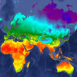
Datasets tagged precipitation in Earth Engine
Оптимизируйте свои подборки
Сохраняйте и классифицируйте контент в соответствии со своими настройками.
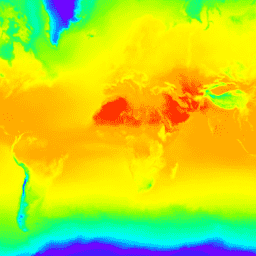
CFSR: Гармонизированный реанализ системы климатического прогнозирования
Система реанализа климатических прогнозов Национальных центров прогнозирования окружающей среды (NCEP) (CFSR) была разработана и реализована как глобальная, высокоразрешенная, взаимосвязанная система атмосфера-океан-суша-морской лед, призванная обеспечить наилучшую оценку состояния этих взаимосвязанных областей за 32-летний период наблюдений, начиная с января…
CFSV2: Система климатического прогнозирования NCEP, версия 2, гармонизированные 6-часовые продукты.
Система климатического прогнозирования (CFS) Национальных центров прогнозирования окружающей среды (NCEP) представляет собой полностью взаимосвязанную модель, описывающую взаимодействие между атмосферой Земли, океанами, сушей и морским льдом. Система CFS была разработана в Центре экологического моделирования (EMC) NCEP. Операционная версия системы CFS была модернизирована до…
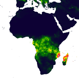
Ежедневные данные об осадках CHIRPS в режиме, близком к реальному времени: инфракрасные данные об осадках Центра климатических опасностей с использованием данных станций (версия 3.0, на основе IMERG)
Данные CHIRPS v3 (Climate Hazards Center Infrared Precipitation with Stations) представляют собой квазиглобальный набор данных об осадках с высоким разрешением, охватывающий более 40 лет. Он включает в себя данные с 60°N по 60°S и все долготы, начиная с 1981 года и до настоящего времени. CHIRPS v3 сочетает в себе спутниковые оценки количества осадков в тепловом инфракрасном диапазоне с данными наземных станций…
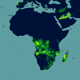
Ежедневный реанализ осадков CHIRPS: инфракрасные данные об осадках Центра климатических опасностей с учетом данных станций (версия 3.0, на основе ERA5)
Данные CHIRPS v3 (Climate Hazards Center Infrared Precipitation with Stations) представляют собой квазиглобальный набор данных об осадках с высоким разрешением, охватывающий более 40 лет. Он включает в себя данные с 60°N по 60°S и все долготы, начиная с 1981 года и до настоящего времени. CHIRPS v3 сочетает в себе спутниковые оценки количества осадков в тепловом инфракрасном диапазоне с данными наземных станций…
Ежедневные данные об осадках CHIRPS: инфракрасные данные об осадках Центра климатических опасностей с учетом данных станций (версия 2.0 Final)
Данные CHIRPS (Climate Hazards Center InfraRed Precipitation with Station data) представляют собой квазиглобальный набор данных об осадках за более чем 30 лет. CHIRPS объединяет спутниковые снимки с разрешением 0,05° с данными наземных станций для создания сеточных временных рядов осадков для анализа тенденций и мониторинга сезонных засух.
CHIRPS Precipitation Pentad: Данные о количестве осадков в инфракрасном диапазоне, полученные Центром изучения климатических опасностей, с учетом данных станций (версия 2.0 Final)
Данные CHIRPS (Climate Hazards Center InfraRed Precipitation with Station data) представляют собой квазиглобальный набор данных об осадках за более чем 30 лет. CHIRPS объединяет спутниковые снимки с разрешением 0,05° с данными наземных станций для создания сеточных временных рядов осадков для анализа тенденций и мониторинга сезонных засух.
CHIRPS Precipitation Pentad: Данные о количестве осадков в инфракрасном диапазоне от Центра климатических опасностей с учетом метеостанций (версия 3.0)
Данные CHIRPS v3 (Climate Hazards Center Infrared Precipitation with Stations) представляют собой квазиглобальный набор данных об осадках с высоким разрешением, охватывающий более 40 лет. Он включает в себя данные с 60°N по 60°S и все долготы, начиная с 1981 года и до настоящего времени. CHIRPS v3 сочетает в себе спутниковые оценки количества осадков в тепловом инфракрасном диапазоне с данными наземных станций…
Глобальный унифицированный анализ ежедневных осадков на основе данных геофизических измерений CPC
Набор данных CPC Unified Gauge-Based Analysis of Global Daily Precipitation (CPC) содержит ежедневные оценки количества осадков на суше с 1979 года по настоящее время. Разработанный Центром прогнозирования климата NOAA (CPC), он использует метод оптимальной интерполяции для объединения данных из глобальной сети дождемеров с…
Этот набор данных представляет собой сеточный анализ суточной температуры приземного воздуха над сушей по всему миру, включая суточные максимальные (Tmax) и минимальные (Tmin) температуры. Данные охватывают период с 1979 года по настоящее время и представлены на сетке с шагом 0,5 градуса по широте/долготе, что соответствует разрешению глобальных суточных данных CPC, полученных с помощью наземных измерительных приборов…
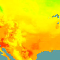
Daymet V4: Ежедневные сводки погоды и климатологические данные о состоянии поверхности Земли.
Daymet V4 предоставляет сеточные оценки ежедневных параметров погоды для континентальной Северной Америки, Гавайев и Пуэрто-Рико (данные по Пуэрто-Рико доступны начиная с 1950 года). Они основаны на данных отдельных метеорологических станций и различных вспомогательных источниках данных. По сравнению с предыдущей версией, Daymet…
Атмосферные прогнозы ECMWF в режиме, близком к реальному времени (IFS)
Этот набор данных содержит 15-дневные прогнозы переменных атмосферной модели, сгенерированные интегрированной системой прогнозирования ECMWF (IFS) с разрешением 0,25 градуса. Мы называем их прогнозами в режиме, близком к реальному времени (NRT), поскольку новые продукты выпускаются дважды в день после публикации прогноза ECMWF в режиме реального времени…
Ежедневные сводки ERA5 — последние данные климатического реанализа, подготовленные ECMWF / Службой по изменению климата Copernicus.
ERA5 — это пятое поколение атмосферного реанализа глобального климата, разработанного Европейским центром среднесрочных и международных метеорологических наблюдений (ECMWF). Реанализ объединяет данные моделей с наблюдениями со всего мира в глобально полный и согласованный набор данных. ERA5 заменяет своего предшественника, реанализ ERA-Interim. ERA5 DAILY предоставляет агрегированные значения за каждый день для…
ERA5 Почасовой анализ - Климатический реанализ ECMWF
ERA5 — это пятое поколение атмосферного реанализа глобального климата, проводимого Европейским центром метеорологии и водных ресурсов (ECMWF). Он создается Службой изменения климата Copernicus (C3S) в ECMWF. Реанализ объединяет модельные данные с наблюдениями со всего мира в глобально полный и согласованный набор данных, используя законы…
Ежемесячные сводки ERA5 — последние данные климатического реанализа, подготовленные ECMWF / Службой по изменению климата Copernicus.
ERA5 — это пятое поколение атмосферного реанализа глобального климата, разработанного Европейским центром среднесрочных и международных метеорологических наблюдений (ECMWF). Реанализ объединяет данные моделей с наблюдениями со всего мира в глобально полный и согласованный набор данных. ERA5 заменяет своего предшественника, реанализ ERA-Interim. ERA5 MONTHLY предоставляет агрегированные значения за каждый месяц для…
ERA5-Land — ежедневные агрегированные данные — климатический реанализ ECMWF
ERA5-Land — это набор данных реанализа, обеспечивающий согласованное представление об эволюции переменных, характеризующих сушу, на протяжении нескольких десятилетий с улучшенным разрешением по сравнению с ERA5. ERA5-Land был создан путем воспроизведения компонента суши климатического реанализа ECMWF ERA5. Реанализ объединяет данные модели с…
ERA5-Land — это набор данных реанализа, обеспечивающий согласованное представление об эволюции переменных, характеризующих сушу, на протяжении нескольких десятилетий с улучшенным разрешением по сравнению с ERA5. ERA5-Land был создан путем воспроизведения компонента суши климатического реанализа ECMWF ERA5. Реанализ объединяет данные модели с…
Ежемесячные сводные данные ERA5-Land - Климатический реанализ ECMWF
ERA5-Land — это набор данных реанализа, обеспечивающий согласованное представление об эволюции переменных, характеризующих сушу, на протяжении нескольких десятилетий с улучшенным разрешением по сравнению с ERA5. ERA5-Land был создан путем воспроизведения компонента суши климатического реанализа ECMWF ERA5. Реанализ объединяет данные модели с…
ERA5-Land: среднемесячные значения по часам суток - Климатический реанализ ECMWF
ERA5-Land — это набор данных реанализа, обеспечивающий согласованное представление об эволюции переменных, характеризующих сушу, на протяжении нескольких десятилетий с улучшенным разрешением по сравнению с ERA5. ERA5-Land был создан путем воспроизведения компонента суши климатического реанализа ECMWF ERA5. Реанализ объединяет данные модели с…
ERA5-Land — это набор данных реанализа, обеспечивающий согласованное представление об эволюции переменных, характеризующих сушу, на протяжении нескольких десятилетий с улучшенным разрешением по сравнению с ERA5. ERA5-Land был создан путем воспроизведения компонента суши климатического реанализа ECMWF ERA5. Реанализ объединяет данные модели с…
FLDAS: Сеть систем раннего предупреждения о голоде (FEWS NET) Система ассимиляции данных о земле
Набор данных FLDAS (McNally et al. 2017) был разработан для оказания помощи в оценке продовольственной безопасности в условиях дефицита данных в развивающихся странах. Он включает информацию о многих климатических переменных, включая содержание влаги, влажность воздуха, испарение, среднюю температуру почвы, общее количество осадков и т. д. Существует несколько различных наборов данных FLDAS; …
GFS: Глобальная система прогнозирования атмосферных условий, прогнозируемые на 384 часа.
Глобальная система прогнозирования (GFS) — это модель прогнозирования погоды, разработанная Национальными центрами прогнозирования окружающей среды (NCEP). Набор данных GFS состоит из выбранных выходных данных модели (описанных ниже) в виде сеточных переменных прогноза. Прогнозы на 384 часа, с интервалами в 1 час (до 120 часов) и 3 часа (после…
GLDAS-2.1: Глобальная система ассимиляции данных о суше
Система глобальной ассимиляции данных о суше НАСА, версия 2 (GLDAS-2), состоит из трех компонентов: GLDAS-2.0, GLDAS-2.1 и GLDAS-2.2. GLDAS-2.0 полностью использует входные данные метеорологического воздействия Принстонского университета и предоставляет согласованный по времени ряд данных с 1948 по 2014 год. GLDAS-2.1 использует комбинацию модельных данных…
GLDAS-2.2: Глобальная система ассимиляции данных о суше
Система глобальной ассимиляции данных о суше НАСА, версия 2 (GLDAS-2), состоит из трех компонентов: GLDAS-2.0, GLDAS-2.1 и GLDAS-2.2. GLDAS-2.0 полностью использует входные данные метеорологического воздействия Принстонского университета и предоставляет согласованный по времени ряд данных с 1948 по 2014 год. GLDAS-2.1 использует комбинацию модельных данных…
GPM: Глобальная система измерения осадков (GPM), выпуск 07
Глобальная система измерения осадков (GPM) — это международная спутниковая миссия, призванная каждые три часа предоставлять данные нового поколения о дожде и снеге по всему миру. Интегрированный алгоритм IMERG (Integrated Multi-satellitE Retrievals for GPM) — это унифицированный алгоритм, который позволяет оценивать количество осадков, объединяя данные со всех пассивных микроволновых приборов, входящих в состав GPM…
GPM: Ежемесячные глобальные измерения осадков (GPM), версия 6
Выпуск финальной версии IMERG "06" был прекращен в сентябре 2021 года. Выпуск версии "07" ожидается в сентябре 2022 года. Глобальная система измерения осадков (GPM) — это международная спутниковая миссия, предоставляющая данные наблюдений за осадками и снегом нового поколения по всему миру каждые три часа. Интегрированные многоспутниковые данные для…
GPM: Ежемесячные глобальные измерения осадков (GPM), версия 07
Глобальная система измерения осадков (GPM) — это международная спутниковая миссия, призванная каждые три часа предоставлять данные нового поколения о дожде и снеге по всему миру. Интегрированный алгоритм IMERG (Integrated Multi-satellitE Retrievals for GPM) — это унифицированный алгоритм, который позволяет оценивать количество осадков, объединяя данные со всех пассивных микроволновых приборов, входящих в состав GPM…
GRIDMET ЗАСУХА: Индексы засухи на территории континентальной части США
Этот набор данных содержит индексы засухи, полученные на основе ежедневных метеорологических данных GRIDMET с разрешением 4 км. Представленные индексы засухи включают стандартизированный индекс осадков (SPI), индекс испарительной засухи (EDDI), стандартизированный индекс осадков и испарения (SPEI), индекс засушливости Палмера (PDSI) и индекс Палмера…
GRIDMET: Набор сеточных метеорологических данных по поверхности земли Университета Айдахо
Набор данных Gridded Surface Meteorological предоставляет ежедневные данные о температуре, осадках, ветре, влажности и радиации на поверхности континентальной части Соединенных Штатов с 1979 года с высоким пространственным разрешением (~4 км). Этот набор данных объединяет пространственные данные высокого разрешения из PRISM с данными высокого временного разрешения из…
GSMaP Operational: Глобальное спутниковое картирование осадков - V6
Глобальное спутниковое картирование осадков (GSMaP) предоставляет глобальные почасовые данные об интенсивности осадков с разрешением 0,1 x 0,1 градуса. GSMaP — это продукт миссии Global Precipitation Measurement (GPM), которая предоставляет глобальные данные об осадках с трехчасовыми интервалами. Значения оцениваются с использованием многодиапазонных пассивных…
GSMaP Operational: Глобальное спутниковое картирование осадков - V7
Глобальное спутниковое картирование осадков (GSMaP) предоставляет глобальные почасовые данные об интенсивности осадков с разрешением 0,1 x 0,1 градуса. GSMaP — это продукт миссии Global Precipitation Measurement (GPM), которая предоставляет глобальные данные об осадках с трехчасовыми интервалами. Значения оцениваются с использованием многодиапазонных пассивных…
GSMaP Operational: Глобальное спутниковое картирование осадков - V8
Глобальное спутниковое картирование осадков (GSMaP) предоставляет глобальные почасовые данные об интенсивности осадков с разрешением 0,1 x 0,1 градуса. GSMaP — это продукт миссии Global Precipitation Measurement (GPM), которая предоставляет глобальные данные об осадках с трехчасовыми интервалами. Значения оцениваются с использованием многодиапазонных пассивных…
Реанализ GSMaP: Глобальное спутниковое картирование осадков
Глобальное спутниковое картирование осадков (GSMaP) предоставляет глобальные почасовые данные об интенсивности осадков с разрешением 0,1 x 0,1 градуса. GSMaP — это продукт миссии Global Precipitation Measurement (GPM), которая предоставляет глобальные данные об осадках с трехчасовыми интервалами. Значения оцениваются с использованием многодиапазонных пассивных…
M2T1NXFLX (или tavg1_2d_flx_Nx) — это почасовой набор усредненных по времени данных в рамках программы Modern-Era Retrospective analysis for Research and Applications версии 2 (MERRA-2). Этот набор данных включает в себя ассимилированные диагностические данные о приземных потоках, такие как общее количество осадков, скорректированное по смещению общее количество осадков, температура воздуха на поверхности, удельная влажность на поверхности, скорость ветра на поверхности и т. д.
MERRA-2 M2T1NXLND: Диагностика поверхности суши, версия 5.12.4
M2T1NXLND (или tavg1_2d_lnd_Nx) — это почасовой усредненный набор данных в рамках программы Modern-Era Retrospective analysis for Research and Applications версии 2 (MERRA-2). Этот набор данных включает в себя диагностику поверхности земли, такую как базовый сток, поверхностный сток, влажность поверхностного слоя почвы, влажность корневой зоны почвы, содержание воды в поверхностном слое, содержание воды в…
NEX-DCP30: Ансамблевая статистика для детализированных климатических прогнозов NASA Earth Exchange
Набор данных NASA NEX-DCP30 состоит из детализированных климатических сценариев для континентальной части Соединенных Штатов, полученных на основе расчетов с использованием моделей общей циркуляции атмосферы (GCM), проведенных в рамках проекта сравнения связанных моделей, фаза 5 (CMIP5, см. Taylor et al. 2012), и охватывает четыре парниковых газа…
NEX-DCP30: Упрощенные климатические прогнозы NASA Earth Exchange
Набор данных NASA NEX-DCP30 состоит из детализированных климатических сценариев для континентальной части Соединенных Штатов, полученных на основе расчетов с использованием моделей общей циркуляции атмосферы (GCM), проведенных в рамках проекта сравнения связанных моделей, фаза 5 (CMIP5, см. Taylor et al. 2012), и охватывает четыре парниковых газа…
NEX-GDDP-CMIP6: Глобальные ежедневные детализированные климатические прогнозы NASA Earth Exchange.
Набор данных NEX-GDDP-CMIP6 включает глобальные детализированные климатические сценарии, полученные на основе расчетов с использованием моделей общей циркуляции атмосферы (GCM), проведенных в рамках шестого этапа проекта сравнения связанных моделей (CMIP6, см. Thrasher et al. 2022), а также по двум из четырех сценариев выбросов парниковых газов «первого уровня»…
NEX-GDDP: Глобальные ежедневные детализированные климатические прогнозы NASA Earth Exchange.
Набор данных NASA NEX-GDDP состоит из детализированных климатических сценариев для планеты, полученных на основе расчетов с использованием моделей общей циркуляции атмосферы (GCM), проведенных в рамках проекта сравнения связанных моделей, фаза 5 (CMIP5, см. Taylor et al. 2012), и охватывает два из четырех парниковых газов…
NLDAS-2: Поля воздействия Североамериканской системы ассимиляции данных о суше
Система ассимиляции данных о суше (LDAS) объединяет несколько источников наблюдений (таких как данные с метеорологических постов, спутниковые данные и радиолокационные измерения осадков) для получения оценок климатологических свойств на поверхности Земли или вблизи нее. Этот набор данных является основным (по умолчанию) файлом входных данных (файл A) для фазы…
Ежемесячные осадки в мм с разрешением 1 км на основе данных SM2RAIN-ASCAT 2007-2018, IMERG, CHELSA Climate и WorldClim. Масштабирование до разрешения 1 км выполнено с использованием gdalwarp (кубические сплайны) и усреднения ежемесячных данных WorldClim, CHELSA Climate и IMERG (см., например, "3B-MO-L.GIS.IMERG.20180601.V05B.tif"). Присвоен в 3 раза больший вес…
Ойя: квазиглобальные оценки количества осадков на расстоянии 5 км
Oya — это квазиглобальный набор данных для оценки количества осадков с высоким разрешением, полученный на основе наблюдений с геостационарных (GEO) спутников. Модель Oya использует весь спектр видимых и инфракрасных (VIS-IR) каналов созвездия геостационарных спутников, включая GOES-16/18, Meteosat-9/10 и Himawari-8/9, для генерации оценок количества осадков, охватывающих…
PERSIANN-CDR: Оценка количества осадков на основе данных дистанционного зондирования с использованием искусственных нейронных сетей — Климатический архив данных
PERSIANN-CDR — это ежедневный квазиглобальный продукт данных об осадках, охватывающий период с 1 января 1983 года по настоящее время. Данные предоставляются ежеквартально с типичной задержкой в три месяца. Продукт разработан Центром гидрометеорологии и дистанционного зондирования Калифорнийского университета в Ирвайне…
Ежедневный пространственный климатический набор данных PRISM
Ежедневные и ежемесячные наборы данных PRISM представляют собой сеточные климатические данные для континентальной части Соединенных Штатов, созданные группой PRISM Climate Group в Университете штата Орегон. Эта коллекция содержит данные AN81 и AN91, что указывается свойством 'dataset_type'. Сетки разрабатываются с использованием PRISM (Parameter-elevation Regressions…).
Набор данных PRISM о долгосрочных средних климатических показателях Norm91m
Ежедневные и ежемесячные наборы данных PRISM представляют собой сеточные климатические данные для континентальной части Соединенных Штатов, созданные группой PRISM Climate Group в Университете штата Орегон. Сетки разрабатываются с использованием PRISM (Parameter-elevation Regressions on Independent Slopes Model). Процедуры интерполяции PRISM имитируют изменения погоды и климата…
Ежемесячный пространственный климатический набор данных PRISM ANm
Ежедневные и ежемесячные наборы данных PRISM представляют собой сеточные климатические данные для континентальной части Соединенных Штатов, созданные группой PRISM Climate Group в Университете штата Орегон. Эта коллекция содержит данные AN81 и AN91, как указано в свойстве 'dataset_type'. Сетки разрабатываются с использованием PRISM (Parameter-elevation…).
RTMA: Анализ мезомасштабных процессов в реальном времени
Анализ мезомасштабных данных в реальном времени (RTMA) — это анализ приземных погодных условий с высоким пространственным и временным разрешением. Данный набор данных включает почасовые анализы с разрешением 2,5 км для континентальной части США.
Переработанные данные GLDAS-2.0: Глобальная система ассимиляции данных о суше.
Система глобальной ассимиляции данных о суше НАСА, версия 2 (GLDAS-2), состоит из трех компонентов: GLDAS-2.0, GLDAS-2.1 и GLDAS-2.2. GLDAS-2.0 полностью использует входные данные метеорологического воздействия Принстонского университета и предоставляет согласованный по времени ряд данных с 1948 по 2014 год. GLDAS-2.1 использует комбинацию модельных данных…
SPEIbase: База данных стандартизированного индекса осадков и испарения, версия 2.11
Глобальная база данных SPEI (SPEIbase) предоставляет надежную информацию о засушливых условиях в глобальном масштабе за длительный период, с размером пикселя 0,5 градуса и ежемесячной периодичностью. Она содержит данные по индексу SPEI за период от 1 до 48 месяцев. Стандартизированный индекс осадков и испарения (SPEI) выражает в виде стандартизированной переменной…
Миссия по измерению тропических осадков (TRMM) — это совместная миссия НАСА и Японского агентства аэрокосмических исследований (JAXA), предназначенная для мониторинга и изучения тропических осадков. Продукт 34B2 содержит сеточные, скорректированные по данным TRMM, объединенные данные об осадках в инфракрасном диапазоне (мм/час) и среднеквадратичной ошибке осадков, с временным интервалом в 3 часа…
Данная коллекция больше не обновляется. См. ежемесячный отчет IMERG. Этот набор данных алгоритмически объединяет микроволновые данные с нескольких спутников, включая SSMI, SSMIS, MHS, AMSU-B и AMSR-E, каждый из которых откалиброван относительно объединенного прибора TRMM. Алгоритм 3B43 выполняется один раз в календарный месяц для получения единого…
TerraClimate: Ежемесячный климатический и водный баланс для наземных поверхностей по всему миру, Университет Айдахо.
TerraClimate — это набор данных о ежемесячном климате и климатическом водном балансе для глобальных наземных поверхностей. Он использует интерполяцию с учетом климатических факторов, объединяя климатологические нормы с высоким пространственным разрешением из набора данных WorldClim с данными с более низким пространственным разрешением, но изменяющимися во времени, из CRU Ts4.0 и японского 55-летнего реанализа (JRA55). …
Проект сравнения связанных моделей Центра по изучению климатических опасностей (CHC), фаза 6 (CHC-CMIP6)
CHC-CMIP6 был специально разработан для поддержки анализа климатических опасностей в недавнем прошлом и в ближайшем будущем. Этот набор данных климатических прогнозов содержит глобальные ежедневные данные в виде сетки за период наблюдений (1983–2016 гг.) и прогнозов (2030 и 2050 гг.), которые будут использоваться для идентификации и…
Карта «Монитор засухи США» публикуется каждый четверг и показывает регионы США, находящиеся в состоянии засухи. Карта использует пять классификаций: аномально засушливые районы (D0), показывающие территории, которые могут находиться в состоянии засухи или уже выходят из нее, и четыре уровня засухи: …
WeatherNext 2 — это экспериментальный набор данных глобальных среднесрочных ансамблевых прогнозов погоды, созданный рабочей версией генеративной модели погоды на основе функциональной сети Google DeepMind. Экспериментальный набор данных включает данные в реальном времени и исторические данные. Данные в реальном времени — это любые данные, относящиеся ко времени, которое…
WeatherNext 2 Mean — это среднее значение 64 ансамблей экспериментального набора данных глобальных среднесрочных ансамблевых прогнозов погоды, созданных рабочей версией генеративной модели погоды на основе функциональной сети Google DeepMind. Для получения набора данных, содержащего все члены ансамбля, см. (не среднее) значение WeatherNext 2…
Набор данных WeatherNext 3 (0,05°) — это экспериментальный набор данных глобальных среднесрочных ансамблевых прогнозов погоды от Google DeepMind и Google Research, созданный на основе рабочей версии модели, описанной в статье: WeatherNext 3: Повышение разрешения и производительности глобальных моделей погоды с использованием необработанных данных наблюдений. Доступ к данным…
Набор данных WeatherNext 3 (0,1°) — это экспериментальный набор данных глобальных среднесрочных ансамблевых прогнозов погоды от Google DeepMind и Google Research, созданный на основе рабочей версии модели, описанной в статье: WeatherNext 3: Повышение разрешения и производительности глобальных моделей погоды с использованием необработанных данных наблюдений. Доступ к данным…
WorldClim V1 Bioclim предоставляет биоклиматические переменные, полученные на основе ежемесячных данных о температуре и количестве осадков, для генерации более биологически значимых значений. Биоклиматические переменные отражают годовые тенденции (например, среднегодовая температура, годовое количество осадков), сезонность (например, годовой диапазон температуры и осадков) и экстремальные значения…
В первой версии WorldClim представлены усредненные ежемесячные глобальные климатические данные по минимальной, средней и максимальной температуре, а также по количеству осадков. Первая версия WorldClim была разработана Робертом Дж. Хиймансом, Сьюзан Кэмерон и Хуаном Парра в Музее позвоночной зоологии Калифорнийского университета в Беркли в сотрудничестве с…
CFSR: Гармонизированный реанализ системы климатического прогнозирования
Система реанализа климатических прогнозов Национальных центров прогнозирования окружающей среды (NCEP) (CFSR) была разработана и реализована как глобальная, высокоразрешенная, взаимосвязанная система атмосфера-океан-суша-морской лед, призванная обеспечить наилучшую оценку состояния этих взаимосвязанных областей за 32-летний период наблюдений, начиная с января…
CFSV2: Система климатического прогнозирования NCEP, версия 2, гармонизированные 6-часовые продукты.
Система климатического прогнозирования (CFS) Национальных центров прогнозирования окружающей среды (NCEP) представляет собой полностью взаимосвязанную модель, описывающую взаимодействие между атмосферой Земли, океанами, сушей и морским льдом. Система CFS была разработана в Центре экологического моделирования (EMC) NCEP. Операционная версия системы CFS была модернизирована до…
Ежедневные данные об осадках CHIRPS в режиме, близком к реальному времени: инфракрасные данные об осадках Центра климатических опасностей с использованием данных станций (версия 3.0, на основе IMERG)
Данные CHIRPS v3 (Climate Hazards Center Infrared Precipitation with Stations) представляют собой квазиглобальный набор данных об осадках с высоким разрешением, охватывающий более 40 лет. Он включает в себя данные с 60°N по 60°S и все долготы, начиная с 1981 года и до настоящего времени. CHIRPS v3 сочетает в себе спутниковые оценки количества осадков в тепловом инфракрасном диапазоне с данными наземных станций…
Ежедневный реанализ осадков CHIRPS: инфракрасные данные об осадках Центра климатических опасностей с учетом данных станций (версия 3.0, на основе ERA5)
Данные CHIRPS v3 (Climate Hazards Center Infrared Precipitation with Stations) представляют собой квазиглобальный набор данных об осадках с высоким разрешением, охватывающий более 40 лет. Он включает в себя данные с 60°N по 60°S и все долготы, начиная с 1981 года и до настоящего времени. CHIRPS v3 сочетает в себе спутниковые оценки количества осадков в тепловом инфракрасном диапазоне с данными наземных станций…
Ежедневные данные об осадках CHIRPS: инфракрасные данные об осадках Центра климатических опасностей с учетом данных станций (версия 2.0 Final)
Данные CHIRPS (Climate Hazards Center InfraRed Precipitation with Station data) представляют собой квазиглобальный набор данных об осадках за более чем 30 лет. CHIRPS объединяет спутниковые снимки с разрешением 0,05° с данными наземных станций для создания сеточных временных рядов осадков для анализа тенденций и мониторинга сезонных засух.
CHIRPS Precipitation Pentad: Данные о количестве осадков в инфракрасном диапазоне, полученные Центром изучения климатических опасностей, с учетом данных станций (версия 2.0 Final)
Данные CHIRPS (Climate Hazards Center InfraRed Precipitation with Station data) представляют собой квазиглобальный набор данных об осадках за более чем 30 лет. CHIRPS объединяет спутниковые снимки с разрешением 0,05° с данными наземных станций для создания сеточных временных рядов осадков для анализа тенденций и мониторинга сезонных засух.
CHIRPS Precipitation Pentad: Данные о количестве осадков в инфракрасном диапазоне от Центра климатических опасностей с учетом метеостанций (версия 3.0)
Данные CHIRPS v3 (Climate Hazards Center Infrared Precipitation with Stations) представляют собой квазиглобальный набор данных об осадках с высоким разрешением, охватывающий более 40 лет. Он включает в себя данные с 60°N по 60°S и все долготы, начиная с 1981 года и до настоящего времени. CHIRPS v3 сочетает в себе спутниковые оценки количества осадков в тепловом инфракрасном диапазоне с данными наземных станций…
Глобальный унифицированный анализ ежедневных осадков на основе данных геофизических измерений CPC
Набор данных CPC Unified Gauge-Based Analysis of Global Daily Precipitation (CPC) содержит ежедневные оценки количества осадков на суше с 1979 года по настоящее время. Разработанный Центром прогнозирования климата NOAA (CPC), он использует метод оптимальной интерполяции для объединения данных из глобальной сети дождемеров с…
Этот набор данных представляет собой сеточный анализ суточной температуры приземного воздуха над сушей по всему миру, включая суточные максимальные (Tmax) и минимальные (Tmin) температуры. Данные охватывают период с 1979 года по настоящее время и представлены на сетке с шагом 0,5 градуса по широте/долготе, что соответствует разрешению глобальных суточных данных CPC, полученных с помощью наземных измерительных приборов…
Daymet V4: Ежедневные сводки погоды и климатологические данные о состоянии поверхности Земли.
Daymet V4 предоставляет сеточные оценки ежедневных параметров погоды для континентальной Северной Америки, Гавайев и Пуэрто-Рико (данные по Пуэрто-Рико доступны начиная с 1950 года). Они основаны на данных отдельных метеорологических станций и различных вспомогательных источниках данных. По сравнению с предыдущей версией, Daymet…
Атмосферные прогнозы ECMWF в режиме, близком к реальному времени (IFS)
Этот набор данных содержит 15-дневные прогнозы переменных атмосферной модели, сгенерированные интегрированной системой прогнозирования ECMWF (IFS) с разрешением 0,25 градуса. Мы называем их прогнозами в режиме, близком к реальному времени (NRT), поскольку новые продукты выпускаются дважды в день после публикации прогноза ECMWF в режиме реального времени…
Ежедневные сводки ERA5 — последние данные климатического реанализа, подготовленные ECMWF / Службой по изменению климата Copernicus.
ERA5 — это пятое поколение атмосферного реанализа глобального климата, разработанного Европейским центром среднесрочных и международных метеорологических наблюдений (ECMWF). Реанализ объединяет данные моделей с наблюдениями со всего мира в глобально полный и согласованный набор данных. ERA5 заменяет своего предшественника, реанализ ERA-Interim. ERA5 DAILY предоставляет агрегированные значения за каждый день для…
ERA5 Почасовой анализ - Климатический реанализ ECMWF
ERA5 is the fifth generation ECMWF atmospheric reanalysis of the global climate. It is produced by the Copernicus Climate Change Service (C3S) at ECMWF. Reanalysis combines model data with observations from across the world into a globally complete and consistent dataset using the laws of …
ERA5 Monthly Aggregates - Latest Climate Reanalysis Produced by ECMWF / Copernicus Climate Change Service
ERA5 is the fifth generation ECMWF atmospheric reanalysis of the global climate. Reanalysis combines model data with observations from across the world into a globally complete and consistent dataset. ERA5 replaces its predecessor, the ERA-Interim reanalysis. ERA5 MONTHLY provides aggregated values for each month for …
ERA5-Land — ежедневные агрегированные данные — климатический реанализ ECMWF
ERA5-Land is a reanalysis dataset providing a consistent view of the evolution of land variables over several decades at an enhanced resolution compared to ERA5. ERA5-Land has been produced by replaying the land component of the ECMWF ERA5 climate reanalysis. Reanalysis combines model data with …
ERA5-Land is a reanalysis dataset providing a consistent view of the evolution of land variables over several decades at an enhanced resolution compared to ERA5. ERA5-Land has been produced by replaying the land component of the ECMWF ERA5 climate reanalysis. Reanalysis combines model data with …
ERA5-Land is a reanalysis dataset providing a consistent view of the evolution of land variables over several decades at an enhanced resolution compared to ERA5. ERA5-Land has been produced by replaying the land component of the ECMWF ERA5 climate reanalysis. Reanalysis combines model data with …
ERA5-Land Monthly Averaged by Hour of Day - ECMWF Climate Reanalysis
ERA5-Land is a reanalysis dataset providing a consistent view of the evolution of land variables over several decades at an enhanced resolution compared to ERA5. ERA5-Land has been produced by replaying the land component of the ECMWF ERA5 climate reanalysis. Reanalysis combines model data with …
ERA5-Land is a reanalysis dataset providing a consistent view of the evolution of land variables over several decades at an enhanced resolution compared to ERA5. ERA5-Land has been produced by replaying the land component of the ECMWF ERA5 climate reanalysis. Reanalysis combines model data with …
FLDAS: Famine Early Warning Systems Network (FEWS NET) Land Data Assimilation System
The FLDAS dataset (McNally et al. 2017), was designed to assist with food security assessments in data-sparse, developing country settings. It includes information on many climate-related variables including moisture content, humidity, evapotranspiration, average soil temperature, total precipitation rate, etc. There are multiple different FLDAS datasets; …
GFS: Global Forecast System 384-Hour Predicted Atmosphere Data
The Global Forecast System (GFS) is a weather forecast model produced by the National Centers for Environmental Prediction (NCEP). The GFS dataset consists of selected model outputs (described below) as gridded forecast variables. The 384-hour forecasts, with 1-hour (up to 120 hours) and 3-hour (after …
NASA Global Land Data Assimilation System Version 2 (GLDAS-2) has three components: GLDAS-2.0, GLDAS-2.1, and GLDAS-2.2. GLDAS-2.0 is forced entirely with the Princeton meteorological forcing input data and provides a temporally consistent series from 1948 through 2014. GLDAS-2.1 is forced with a combination of model …
NASA Global Land Data Assimilation System Version 2 (GLDAS-2) has three components: GLDAS-2.0, GLDAS-2.1, and GLDAS-2.2. GLDAS-2.0 is forced entirely with the Princeton meteorological forcing input data and provides a temporally consistent series from 1948 through 2014. GLDAS-2.1 is forced with a combination of model …
GPM: Global Precipitation Measurement (GPM) Release 07
Global Precipitation Measurement (GPM) is an international satellite mission to provide next-generation observations of rain and snow worldwide every three hours. The Integrated Multi-satellitE Retrievals for GPM (IMERG) is the unified algorithm that provides rainfall estimates combining data from all passive-microwave instruments in the GPM …
GPM: Monthly Global Precipitation Measurement (GPM) v6
IMERG-Final version "06" stopped being produced in September, 2021. Version "07" is expected to be released in September 2022 Global Precipitation Measurement (GPM) is an international satellite mission to provide next-generation observations of rain and snow worldwide every three hours. The Integrated Multi-satellitE Retrievals for …
GPM: Monthly Global Precipitation Measurement (GPM) vRelease 07
Global Precipitation Measurement (GPM) is an international satellite mission to provide next-generation observations of rain and snow worldwide every three hours. The Integrated Multi-satellitE Retrievals for GPM (IMERG) is the unified algorithm that provides rainfall estimates combining data from all passive-microwave instruments in the GPM …
This dataset contains drought indices derived from the 4-km daily Gridded Surface Meteorological (GRIDMET) dataset. The drought indices provided include the standardized precipitation index (SPI), the evaporative drought demand index (EDDI), the standardized precipitation evapotranspiration index (SPEI), the Palmer Drought Severity Index (PDSI) and Palmer …
GRIDMET: University of Idaho Gridded Surface Meteorological Dataset
The Gridded Surface Meteorological dataset provides high spatial resolution (~4-km) daily surface fields of temperature, precipitation, winds, humidity and radiation across the contiguous United States from 1979. The dataset blends the high resolution spatial data from PRISM with the high temporal resolution data from the …
GSMaP Operational: Global Satellite Mapping of Precipitation - V6
Global Satellite Mapping of Precipitation (GSMaP) provides a global hourly rain rate with a 0.1 x 0.1 degree resolution. GSMaP is a product of the Global Precipitation Measurement (GPM) mission, which provides global precipitation observations at three hour intervals. Values are estimated using multi-band passive …
GSMaP Operational: Global Satellite Mapping of Precipitation - V7
Global Satellite Mapping of Precipitation (GSMaP) provides a global hourly rain rate with a 0.1 x 0.1 degree resolution. GSMaP is a product of the Global Precipitation Measurement (GPM) mission, which provides global precipitation observations at three hour intervals. Values are estimated using multi-band passive …
GSMaP Operational: Global Satellite Mapping of Precipitation - V8
Global Satellite Mapping of Precipitation (GSMaP) provides a global hourly rain rate with a 0.1 x 0.1 degree resolution. GSMaP is a product of the Global Precipitation Measurement (GPM) mission, which provides global precipitation observations at three hour intervals. Values are estimated using multi-band passive …
GSMaP Reanalysis: Global Satellite Mapping of Precipitation
Global Satellite Mapping of Precipitation (GSMaP) provides a global hourly rain rate with a 0.1 x 0.1 degree resolution. GSMaP is a product of the Global Precipitation Measurement (GPM) mission, which provides global precipitation observations at three hour intervals. Values are estimated using multi-band passive …
M2T1NXFLX (or tavg1_2d_flx_Nx) is an hourly time-averaged data collection in Modern-Era Retrospective analysis for Research and Applications version 2 (MERRA-2). This collection consists of assimilated surface flux diagnostics, such as total precipitation, bias corrected total precipitation, surface air temperature, surface specific humidity, surface wind speed, …
MERRA-2 M2T1NXLND: Land Surface Diagnostics V5.12.4
M2T1NXLND (or tavg1_2d_lnd_Nx) is an hourly time-averaged data collection in Modern-Era Retrospective analysis for Research and Applications version 2 (MERRA-2). This collection consists of land surface diagnostics, such a baseflow flux, runoff, surface soil wetness, root zone soil wetness, water at surface layer, water at …
NEX-DCP30: Ensemble Stats for NASA Earth Exchange Downscaled Climate Projections
The NASA NEX-DCP30 dataset is comprised of downscaled climate scenarios for the conterminous United States that are derived from the General Circulation Model (GCM) runs conducted under the Coupled Model Intercomparison Project Phase 5 (CMIP5, see Taylor et al. 2012) and across the four greenhouse …
NEX-DCP30: NASA Earth Exchange Downscaled Climate Projections
The NASA NEX-DCP30 dataset is comprised of downscaled climate scenarios for the conterminous United States that are derived from the General Circulation Model (GCM) runs conducted under the Coupled Model Intercomparison Project Phase 5 (CMIP5, see Taylor et al. 2012) and across the four greenhouse …
NEX-GDDP-CMIP6: NASA Earth Exchange Global Daily Downscaled Climate Projections
The NEX-GDDP-CMIP6 dataset is comprised of global downscaled climate scenarios derived from the General Circulation Model (GCM) runs conducted under the Coupled Model Intercomparison Project Phase 6 (CMIP6, see Thrasher et al. 2022) and across two of the four "Tier 1" greenhouse gas emissions scenarios …
NEX-GDDP: NASA Earth Exchange Global Daily Downscaled Climate Projections
The NASA NEX-GDDP dataset is comprised of downscaled climate scenarios for the globe that are derived from the General Circulation Model (GCM) runs conducted under the Coupled Model Intercomparison Project Phase 5 (CMIP5, see Taylor et al. 2012) and across two of the four greenhouse …
NLDAS-2: North American Land Data Assimilation System Forcing Fields
Land Data Assimilation System (LDAS) combines multiple sources of observations (such as precipitation gauge data, satellite data, and radar precipitation measurements) to produce estimates of climatological properties at or near the Earth''s surface. This dataset is the primary (default) forcing file (File A) for Phase …
Monthly precipitation in mm at 1 km resolution based on SM2RAIN-ASCAT 2007-2018, IMERG, CHELSA Climate, and WorldClim. Downscaled to 1 km resolution using gdalwarp (cubic splines) and an average between WorldClim, CHELSA Climate, and IMERG monthly product (see, eg, "3B-MO-L.GIS.IMERG.20180601.V05B.tif"). 3x higher weight is given …
Oya is a quasi-global, high-resolution precipitation estimation dataset derived from geostationary (GEO) satellite observations. The Oya model utilizes the full spectrum of visible and infrared (VIS-IR) channels from a constellation of GEO satellites — including GOES-16/18, Meteosat-9/10, and Himawari-8/9 — to generate precipitation estimates covering …
PERSIANN-CDR: Precipitation Estimation From Remotely Sensed Information Using Artificial Neural Networks-Climate Data Record
PERSIANN-CDR is a daily quasi-global precipitation product that spans the period from 1983-01-01 to present. The data is produced quarterly, with a typical lag of three months. The product is developed by the Center for Hydrometeorology and Remote Sensing at the University of California, Irvine …
The PRISM daily and monthly datasets are gridded climate datasets for the conterminous United States, produced by the PRISM Climate Group at Oregon State University. This collection contains both AN81 and AN91 data, indicated by the 'dataset_type' property. Grids are developed using PRISM (Parameter-elevation Regressions …
The PRISM daily and monthly datasets are gridded climate datasets for the conterminous United States, produced by the PRISM Climate Group at Oregon State University. Grids are developed using PRISM (Parameter-elevation Regressions on Independent Slopes Model). PRISM interpolation routines simulate how weather and climate vary …
The PRISM daily and monthly datasets are gridded climate datasets for the conterminous United States, produced by the PRISM Climate Group at Oregon State University. This collection contains both AN81 and AN91 data, as indicated by the 'dataset_type' property. Grids are developed using PRISM (Parameter-elevation …
The Real-Time Mesoscale Analysis (RTMA) is a high-spatial and temporal resolution analysis for near-surface weather conditions. This dataset includes hourly analyses at 2.5 km for CONUS.
Reprocessed GLDAS-2.0: Global Land Data Assimilation System
NASA Global Land Data Assimilation System Version 2 (GLDAS-2) has three components: GLDAS-2.0, GLDAS-2.1, and GLDAS-2.2. GLDAS-2.0 is forced entirely with the Princeton meteorological forcing input data and provides a temporally consistent series from 1948 through 2014. GLDAS-2.1 is forced with a combination of model …
SPEIbase: Standardised Precipitation-Evapotranspiration Index database, Version 2.11
The Global SPEI database (SPEIbase) offers long-time robust information about drought conditions at the global scale, with a 0.5 degree pixel size and monthly cadence. It provides SPEI time scales from 1 to 48 months. The Standardized Precipitation-Evapotranspiration Index (SPEI) expresses, as a standardized variate …
The Tropical Rainfall Measuring Mission (TRMM) is a joint mission between NASA and the Japan Aerospace Exploration Agency (JAXA) designed to monitor and study tropical rainfall. The 34B2 product contains a gridded, TRMM-adjusted, merged infrared precipitation (mm/hr) and RMS precipitation-error estimate, with a 3-hour temporal …
This collection is no longer being updated. See IMERG monthly This dataset algorithmically merges microwave data from multiple satellites, including SSMI, SSMIS, MHS, AMSU-B and AMSR-E, each inter-calibrated to the TRMM Combined Instrument. Algorithm 3B43 is executed once per calendar month to produce the single, …
TerraClimate: Monthly Climate and Climatic Water Balance for Global Terrestrial Surfaces, University of Idaho
TerraClimate is a dataset of monthly climate and climatic water balance for global terrestrial surfaces. It uses climatically aided interpolation, combining high-spatial resolution climatological normals from the WorldClim dataset, with coarser spatial resolution, but time-varying data from CRU Ts4.0 and the Japanese 55-year Reanalysis (JRA55). …
The Climate Hazards Center (CHC) Coupled Model Intercomparison Project Phase 6 (CHC-CMIP6)
CHC-CMIP6 was explicitly developed to support the analysis of climate-related hazards over the recent past and in the near-future. This climate projection dataset contains global, daily gridded data for the observational (1983-2016) and projection (2030 and 2050) periods to be used in the identification and …
The US Drought Monitor is a map released every Thursday, showing parts of the US that are in drought. The map uses five classifications: abnormally dry (D0), showing areas that may be going into or are coming out of drought, and four levels of drought: …
WeatherNext 2 is an experimental dataset of global medium-range ensemble weather forecasts produced by an operational version of Google DeepMind's Functional Network Generative weather model. The experimental dataset includes real-time and historic data. Real-time data is any data that relates to a time that is …
WeatherNext 2 Mean is the mean of 64 ensembles of an experimental dataset of global medium-range ensemble weather forecasts produced by an operational version of Google DeepMind's Functional Network Generative weather model. For a dataset containing all ensemble members, please see the (non-mean) WeatherNext 2 …
WeatherNext 3 (0.05°) dataset is an experimental dataset of global medium-range ensemble weather forecasts by Google DeepMind and Google Research, produced by an operational version of the model described in: WeatherNext 3: Increasing resolution and performance of global weather models with raw observations. Data Access …
WeatherNext 3 (0.1°) dataset is an experimental dataset of global medium-range ensemble weather forecasts by Google DeepMind and Google Research, produced by an operational version of the model described in: WeatherNext 3: Increasing resolution and performance of global weather models with raw observations. Data Access …
WorldClim V1 Bioclim provides bioclimatic variables that are derived from the monthly temperature and rainfall in order to generate more biologically meaningful values. The bioclimatic variables represent annual trends (eg, mean annual temperature, annual precipitation), seasonality (eg, annual range in temperature and precipitation), and extreme …
WorldClim version 1 has average monthly global climate data for minimum, mean, and maximum temperature and for precipitation. WorldClim version 1 was developed by Robert J. Hijmans, Susan Cameron, and Juan Parra, at the Museum of Vertebrate Zoology, University of California, Berkeley, in collaboration with …
CFSR: Climate Forecast System Reanalysis Harmonized
The National Centers for Environmental Prediction (NCEP) Climate Forecast System Reanalysis (CFSR) was designed and executed as a global, high-resolution, coupled atmosphere-ocean-land surface-sea ice system to provide the best estimate of the state of these coupled domains over the 32-year period of record from January …
CFSV2: NCEP Climate Forecast System Version 2, 6-Hourly Products Harmonized
The National Centers for Environmental Prediction (NCEP) Climate Forecast System (CFS) is a fully coupled model representing the interaction between the Earth's atmosphere, oceans, land, and sea ice. CFS was developed at the Environmental Modeling Center (EMC) at NCEP. The operational CFS was upgraded to …
CHIRPS Precipitation Daily Near-Real-Time: Climate Hazards Center InfraRed Precipitation With Station Data (Version 3.0, IMERG-based)
The Climate Hazards Center Infrared Precipitation with Stations (CHIRPS v3) is a 40+ year, high-resolution quasi-global rainfall dataset. It spans 60°N to 60°S and covers all longitudes, providing data from 1981 to near-present. CHIRPS v3 combines satellite-based thermal infrared rainfall estimates with in-situ station observations …
CHIRPS Precipitation Daily Reanalysis: Climate Hazards Center InfraRed Precipitation With Station Data (Version 3.0, ERA5-based)
The Climate Hazards Center Infrared Precipitation with Stations (CHIRPS v3) is a 40+ year, high-resolution quasi-global rainfall dataset. It spans 60°N to 60°S and covers all longitudes, providing data from 1981 to near-present. CHIRPS v3 combines satellite-based thermal infrared rainfall estimates with in-situ station observations …
CHIRPS Precipitation Daily: Climate Hazards Center InfraRed Precipitation With Station Data (Version 2.0 Final)
Climate Hazards Center InfraRed Precipitation with Station data (CHIRPS) is a 30+ year quasi-global rainfall dataset. CHIRPS incorporates 0.05° resolution satellite imagery with in-situ station data to create gridded rainfall time series for trend analysis and seasonal drought monitoring.
CHIRPS Precipitation Pentad: Climate Hazards Center InfraRed Precipitation With Station Data (Version 2.0 Final)
Climate Hazards Center InfraRed Precipitation with Station data (CHIRPS) is a 30+ year quasi-global rainfall dataset. CHIRPS incorporates 0.05° resolution satellite imagery with in-situ station data to create gridded rainfall time series for trend analysis and seasonal drought monitoring.
CHIRPS Precipitation Pentad: Climate Hazards Center InfraRed Precipitation With Station Data (Version 3.0)
The Climate Hazards Center Infrared Precipitation with Stations (CHIRPS v3) is a 40+ year, high-resolution quasi-global rainfall dataset. It spans 60°N to 60°S and covers all longitudes, providing data from 1981 to near-present. CHIRPS v3 combines satellite-based thermal infrared rainfall estimates with in-situ station observations …
CPC Global Unified Gauge-Based Analysis of Daily Precipitation
The CPC Unified Gauge-Based Analysis of Global Daily Precipitation dataset offers daily precipitation estimates over land from 1979 to the present. Developed by NOAA's Climate Prediction Center (CPC), it leverages an optimal interpolation technique to combine data from a global network of rain gauges, with …
This dataset provides a gridded analysis of daily surface air temperature over global land areas, including daily maximum (Tmax), minimum (Tmin) temperatures. Spanning from 1979 to the present, the data is presented on 0.5-degree latitude/longitude grids, aligning with the resolution of CPC's gauge-based global daily …
Daymet V4: Daily Surface Weather and Climatological Summaries
Daymet V4 provides gridded estimates of daily weather parameters for Continental North America, Hawaii, and Puerto Rico (Data for Puerto Rico is available starting in 1950). It is derived from selected meteorological station data and various supporting data sources. Compared to the previous version, Daymet …
This dataset contains 15-day forecasts of the atmospheric model variables generated by the ECMWF Integrated Forecasting System (IFS) at 0.25 degree resolution. We refer to these as Near-Realtime (NRT) because new products are released twice a day after the release of the ECMWF realtime forecast …
ERA5 Daily Aggregates - Latest Climate Reanalysis Produced by ECMWF / Copernicus Climate Change Service
ERA5 is the fifth generation ECMWF atmospheric reanalysis of the global climate. Reanalysis combines model data with observations from across the world into a globally complete and consistent dataset. ERA5 replaces its predecessor, the ERA-Interim reanalysis. ERA5 DAILY provides aggregated values for each day for …
ERA5 is the fifth generation ECMWF atmospheric reanalysis of the global climate. It is produced by the Copernicus Climate Change Service (C3S) at ECMWF. Reanalysis combines model data with observations from across the world into a globally complete and consistent dataset using the laws of …
ERA5 Monthly Aggregates - Latest Climate Reanalysis Produced by ECMWF / Copernicus Climate Change Service
ERA5 is the fifth generation ECMWF atmospheric reanalysis of the global climate. Reanalysis combines model data with observations from across the world into a globally complete and consistent dataset. ERA5 replaces its predecessor, the ERA-Interim reanalysis. ERA5 MONTHLY provides aggregated values for each month for …
ERA5-Land — ежедневные агрегированные данные — климатический реанализ ECMWF
ERA5-Land is a reanalysis dataset providing a consistent view of the evolution of land variables over several decades at an enhanced resolution compared to ERA5. ERA5-Land has been produced by replaying the land component of the ECMWF ERA5 climate reanalysis. Reanalysis combines model data with …
ERA5-Land is a reanalysis dataset providing a consistent view of the evolution of land variables over several decades at an enhanced resolution compared to ERA5. ERA5-Land has been produced by replaying the land component of the ECMWF ERA5 climate reanalysis. Reanalysis combines model data with …
ERA5-Land is a reanalysis dataset providing a consistent view of the evolution of land variables over several decades at an enhanced resolution compared to ERA5. ERA5-Land has been produced by replaying the land component of the ECMWF ERA5 climate reanalysis. Reanalysis combines model data with …
ERA5-Land Monthly Averaged by Hour of Day - ECMWF Climate Reanalysis
ERA5-Land is a reanalysis dataset providing a consistent view of the evolution of land variables over several decades at an enhanced resolution compared to ERA5. ERA5-Land has been produced by replaying the land component of the ECMWF ERA5 climate reanalysis. Reanalysis combines model data with …
ERA5-Land is a reanalysis dataset providing a consistent view of the evolution of land variables over several decades at an enhanced resolution compared to ERA5. ERA5-Land has been produced by replaying the land component of the ECMWF ERA5 climate reanalysis. Reanalysis combines model data with …
FLDAS: Famine Early Warning Systems Network (FEWS NET) Land Data Assimilation System
The FLDAS dataset (McNally et al. 2017), was designed to assist with food security assessments in data-sparse, developing country settings. It includes information on many climate-related variables including moisture content, humidity, evapotranspiration, average soil temperature, total precipitation rate, etc. There are multiple different FLDAS datasets; …
GFS: Global Forecast System 384-Hour Predicted Atmosphere Data
The Global Forecast System (GFS) is a weather forecast model produced by the National Centers for Environmental Prediction (NCEP). The GFS dataset consists of selected model outputs (described below) as gridded forecast variables. The 384-hour forecasts, with 1-hour (up to 120 hours) and 3-hour (after …
NASA Global Land Data Assimilation System Version 2 (GLDAS-2) has three components: GLDAS-2.0, GLDAS-2.1, and GLDAS-2.2. GLDAS-2.0 is forced entirely with the Princeton meteorological forcing input data and provides a temporally consistent series from 1948 through 2014. GLDAS-2.1 is forced with a combination of model …
NASA Global Land Data Assimilation System Version 2 (GLDAS-2) has three components: GLDAS-2.0, GLDAS-2.1, and GLDAS-2.2. GLDAS-2.0 is forced entirely with the Princeton meteorological forcing input data and provides a temporally consistent series from 1948 through 2014. GLDAS-2.1 is forced with a combination of model …
GPM: Global Precipitation Measurement (GPM) Release 07
Global Precipitation Measurement (GPM) is an international satellite mission to provide next-generation observations of rain and snow worldwide every three hours. The Integrated Multi-satellitE Retrievals for GPM (IMERG) is the unified algorithm that provides rainfall estimates combining data from all passive-microwave instruments in the GPM …
GPM: Monthly Global Precipitation Measurement (GPM) v6
IMERG-Final version "06" stopped being produced in September, 2021. Version "07" is expected to be released in September 2022 Global Precipitation Measurement (GPM) is an international satellite mission to provide next-generation observations of rain and snow worldwide every three hours. The Integrated Multi-satellitE Retrievals for …
GPM: Monthly Global Precipitation Measurement (GPM) vRelease 07
Global Precipitation Measurement (GPM) is an international satellite mission to provide next-generation observations of rain and snow worldwide every three hours. The Integrated Multi-satellitE Retrievals for GPM (IMERG) is the unified algorithm that provides rainfall estimates combining data from all passive-microwave instruments in the GPM …
This dataset contains drought indices derived from the 4-km daily Gridded Surface Meteorological (GRIDMET) dataset. The drought indices provided include the standardized precipitation index (SPI), the evaporative drought demand index (EDDI), the standardized precipitation evapotranspiration index (SPEI), the Palmer Drought Severity Index (PDSI) and Palmer …
GRIDMET: University of Idaho Gridded Surface Meteorological Dataset
The Gridded Surface Meteorological dataset provides high spatial resolution (~4-km) daily surface fields of temperature, precipitation, winds, humidity and radiation across the contiguous United States from 1979. The dataset blends the high resolution spatial data from PRISM with the high temporal resolution data from the …
GSMaP Operational: Global Satellite Mapping of Precipitation - V6
Global Satellite Mapping of Precipitation (GSMaP) provides a global hourly rain rate with a 0.1 x 0.1 degree resolution. GSMaP is a product of the Global Precipitation Measurement (GPM) mission, which provides global precipitation observations at three hour intervals. Values are estimated using multi-band passive …
GSMaP Operational: Global Satellite Mapping of Precipitation - V7
Global Satellite Mapping of Precipitation (GSMaP) provides a global hourly rain rate with a 0.1 x 0.1 degree resolution. GSMaP is a product of the Global Precipitation Measurement (GPM) mission, which provides global precipitation observations at three hour intervals. Values are estimated using multi-band passive …
GSMaP Operational: Global Satellite Mapping of Precipitation - V8
Global Satellite Mapping of Precipitation (GSMaP) provides a global hourly rain rate with a 0.1 x 0.1 degree resolution. GSMaP is a product of the Global Precipitation Measurement (GPM) mission, which provides global precipitation observations at three hour intervals. Values are estimated using multi-band passive …
GSMaP Reanalysis: Global Satellite Mapping of Precipitation
Global Satellite Mapping of Precipitation (GSMaP) provides a global hourly rain rate with a 0.1 x 0.1 degree resolution. GSMaP is a product of the Global Precipitation Measurement (GPM) mission, which provides global precipitation observations at three hour intervals. Values are estimated using multi-band passive …
M2T1NXFLX (or tavg1_2d_flx_Nx) is an hourly time-averaged data collection in Modern-Era Retrospective analysis for Research and Applications version 2 (MERRA-2). This collection consists of assimilated surface flux diagnostics, such as total precipitation, bias corrected total precipitation, surface air temperature, surface specific humidity, surface wind speed, …
MERRA-2 M2T1NXLND: Land Surface Diagnostics V5.12.4
M2T1NXLND (or tavg1_2d_lnd_Nx) is an hourly time-averaged data collection in Modern-Era Retrospective analysis for Research and Applications version 2 (MERRA-2). This collection consists of land surface diagnostics, such a baseflow flux, runoff, surface soil wetness, root zone soil wetness, water at surface layer, water at …
NEX-DCP30: Ensemble Stats for NASA Earth Exchange Downscaled Climate Projections
The NASA NEX-DCP30 dataset is comprised of downscaled climate scenarios for the conterminous United States that are derived from the General Circulation Model (GCM) runs conducted under the Coupled Model Intercomparison Project Phase 5 (CMIP5, see Taylor et al. 2012) and across the four greenhouse …
NEX-DCP30: NASA Earth Exchange Downscaled Climate Projections
The NASA NEX-DCP30 dataset is comprised of downscaled climate scenarios for the conterminous United States that are derived from the General Circulation Model (GCM) runs conducted under the Coupled Model Intercomparison Project Phase 5 (CMIP5, see Taylor et al. 2012) and across the four greenhouse …
NEX-GDDP-CMIP6: NASA Earth Exchange Global Daily Downscaled Climate Projections
The NEX-GDDP-CMIP6 dataset is comprised of global downscaled climate scenarios derived from the General Circulation Model (GCM) runs conducted under the Coupled Model Intercomparison Project Phase 6 (CMIP6, see Thrasher et al. 2022) and across two of the four "Tier 1" greenhouse gas emissions scenarios …
NEX-GDDP: NASA Earth Exchange Global Daily Downscaled Climate Projections
The NASA NEX-GDDP dataset is comprised of downscaled climate scenarios for the globe that are derived from the General Circulation Model (GCM) runs conducted under the Coupled Model Intercomparison Project Phase 5 (CMIP5, see Taylor et al. 2012) and across two of the four greenhouse …
NLDAS-2: North American Land Data Assimilation System Forcing Fields
Land Data Assimilation System (LDAS) combines multiple sources of observations (such as precipitation gauge data, satellite data, and radar precipitation measurements) to produce estimates of climatological properties at or near the Earth''s surface. This dataset is the primary (default) forcing file (File A) for Phase …
Monthly precipitation in mm at 1 km resolution based on SM2RAIN-ASCAT 2007-2018, IMERG, CHELSA Climate, and WorldClim. Downscaled to 1 km resolution using gdalwarp (cubic splines) and an average between WorldClim, CHELSA Climate, and IMERG monthly product (see, eg, "3B-MO-L.GIS.IMERG.20180601.V05B.tif"). 3x higher weight is given …
Oya is a quasi-global, high-resolution precipitation estimation dataset derived from geostationary (GEO) satellite observations. The Oya model utilizes the full spectrum of visible and infrared (VIS-IR) channels from a constellation of GEO satellites — including GOES-16/18, Meteosat-9/10, and Himawari-8/9 — to generate precipitation estimates covering …
PERSIANN-CDR: Precipitation Estimation From Remotely Sensed Information Using Artificial Neural Networks-Climate Data Record
PERSIANN-CDR is a daily quasi-global precipitation product that spans the period from 1983-01-01 to present. The data is produced quarterly, with a typical lag of three months. The product is developed by the Center for Hydrometeorology and Remote Sensing at the University of California, Irvine …
The PRISM daily and monthly datasets are gridded climate datasets for the conterminous United States, produced by the PRISM Climate Group at Oregon State University. This collection contains both AN81 and AN91 data, indicated by the 'dataset_type' property. Grids are developed using PRISM (Parameter-elevation Regressions …
The PRISM daily and monthly datasets are gridded climate datasets for the conterminous United States, produced by the PRISM Climate Group at Oregon State University. Grids are developed using PRISM (Parameter-elevation Regressions on Independent Slopes Model). PRISM interpolation routines simulate how weather and climate vary …
The PRISM daily and monthly datasets are gridded climate datasets for the conterminous United States, produced by the PRISM Climate Group at Oregon State University. This collection contains both AN81 and AN91 data, as indicated by the 'dataset_type' property. Grids are developed using PRISM (Parameter-elevation …
The Real-Time Mesoscale Analysis (RTMA) is a high-spatial and temporal resolution analysis for near-surface weather conditions. This dataset includes hourly analyses at 2.5 km for CONUS.
Reprocessed GLDAS-2.0: Global Land Data Assimilation System
NASA Global Land Data Assimilation System Version 2 (GLDAS-2) has three components: GLDAS-2.0, GLDAS-2.1, and GLDAS-2.2. GLDAS-2.0 is forced entirely with the Princeton meteorological forcing input data and provides a temporally consistent series from 1948 through 2014. GLDAS-2.1 is forced with a combination of model …
SPEIbase: Standardised Precipitation-Evapotranspiration Index database, Version 2.11
The Global SPEI database (SPEIbase) offers long-time robust information about drought conditions at the global scale, with a 0.5 degree pixel size and monthly cadence. It provides SPEI time scales from 1 to 48 months. The Standardized Precipitation-Evapotranspiration Index (SPEI) expresses, as a standardized variate …
The Tropical Rainfall Measuring Mission (TRMM) is a joint mission between NASA and the Japan Aerospace Exploration Agency (JAXA) designed to monitor and study tropical rainfall. The 34B2 product contains a gridded, TRMM-adjusted, merged infrared precipitation (mm/hr) and RMS precipitation-error estimate, with a 3-hour temporal …
This collection is no longer being updated. See IMERG monthly This dataset algorithmically merges microwave data from multiple satellites, including SSMI, SSMIS, MHS, AMSU-B and AMSR-E, each inter-calibrated to the TRMM Combined Instrument. Algorithm 3B43 is executed once per calendar month to produce the single, …
TerraClimate: Monthly Climate and Climatic Water Balance for Global Terrestrial Surfaces, University of Idaho
TerraClimate is a dataset of monthly climate and climatic water balance for global terrestrial surfaces. It uses climatically aided interpolation, combining high-spatial resolution climatological normals from the WorldClim dataset, with coarser spatial resolution, but time-varying data from CRU Ts4.0 and the Japanese 55-year Reanalysis (JRA55). …
The Climate Hazards Center (CHC) Coupled Model Intercomparison Project Phase 6 (CHC-CMIP6)
CHC-CMIP6 was explicitly developed to support the analysis of climate-related hazards over the recent past and in the near-future. This climate projection dataset contains global, daily gridded data for the observational (1983-2016) and projection (2030 and 2050) periods to be used in the identification and …
The US Drought Monitor is a map released every Thursday, showing parts of the US that are in drought. The map uses five classifications: abnormally dry (D0), showing areas that may be going into or are coming out of drought, and four levels of drought: …
WeatherNext 2 is an experimental dataset of global medium-range ensemble weather forecasts produced by an operational version of Google DeepMind's Functional Network Generative weather model. The experimental dataset includes real-time and historic data. Real-time data is any data that relates to a time that is …
WeatherNext 2 Mean is the mean of 64 ensembles of an experimental dataset of global medium-range ensemble weather forecasts produced by an operational version of Google DeepMind's Functional Network Generative weather model. For a dataset containing all ensemble members, please see the (non-mean) WeatherNext 2 …
WeatherNext 3 (0.05°) dataset is an experimental dataset of global medium-range ensemble weather forecasts by Google DeepMind and Google Research, produced by an operational version of the model described in: WeatherNext 3: Increasing resolution and performance of global weather models with raw observations. Data Access …
WeatherNext 3 (0.1°) dataset is an experimental dataset of global medium-range ensemble weather forecasts by Google DeepMind and Google Research, produced by an operational version of the model described in: WeatherNext 3: Increasing resolution and performance of global weather models with raw observations. Data Access …
WorldClim V1 Bioclim provides bioclimatic variables that are derived from the monthly temperature and rainfall in order to generate more biologically meaningful values. The bioclimatic variables represent annual trends (eg, mean annual temperature, annual precipitation), seasonality (eg, annual range in temperature and precipitation), and extreme …
WorldClim version 1 has average monthly global climate data for minimum, mean, and maximum temperature and for precipitation. WorldClim version 1 was developed by Robert J. Hijmans, Susan Cameron, and Juan Parra, at the Museum of Vertebrate Zoology, University of California, Berkeley, in collaboration with …
CFSR: Climate Forecast System Reanalysis Harmonized
The National Centers for Environmental Prediction (NCEP) Climate Forecast System Reanalysis (CFSR) was designed and executed as a global, high-resolution, coupled atmosphere-ocean-land surface-sea ice system to provide the best estimate of the state of these coupled domains over the 32-year period of record from January …
CFSV2: NCEP Climate Forecast System Version 2, 6-Hourly Products Harmonized
The National Centers for Environmental Prediction (NCEP) Climate Forecast System (CFS) is a fully coupled model representing the interaction between the Earth's atmosphere, oceans, land, and sea ice. CFS was developed at the Environmental Modeling Center (EMC) at NCEP. The operational CFS was upgraded to …
CHIRPS Precipitation Daily Near-Real-Time: Climate Hazards Center InfraRed Precipitation With Station Data (Version 3.0, IMERG-based)
The Climate Hazards Center Infrared Precipitation with Stations (CHIRPS v3) is a 40+ year, high-resolution quasi-global rainfall dataset. It spans 60°N to 60°S and covers all longitudes, providing data from 1981 to near-present. CHIRPS v3 combines satellite-based thermal infrared rainfall estimates with in-situ station observations …
CHIRPS Precipitation Daily Reanalysis: Climate Hazards Center InfraRed Precipitation With Station Data (Version 3.0, ERA5-based)
The Climate Hazards Center Infrared Precipitation with Stations (CHIRPS v3) is a 40+ year, high-resolution quasi-global rainfall dataset. It spans 60°N to 60°S and covers all longitudes, providing data from 1981 to near-present. CHIRPS v3 combines satellite-based thermal infrared rainfall estimates with in-situ station observations …
CHIRPS Precipitation Daily: Climate Hazards Center InfraRed Precipitation With Station Data (Version 2.0 Final)
Climate Hazards Center InfraRed Precipitation with Station data (CHIRPS) is a 30+ year quasi-global rainfall dataset. CHIRPS incorporates 0.05° resolution satellite imagery with in-situ station data to create gridded rainfall time series for trend analysis and seasonal drought monitoring.
CHIRPS Precipitation Pentad: Climate Hazards Center InfraRed Precipitation With Station Data (Version 2.0 Final)
Climate Hazards Center InfraRed Precipitation with Station data (CHIRPS) is a 30+ year quasi-global rainfall dataset. CHIRPS incorporates 0.05° resolution satellite imagery with in-situ station data to create gridded rainfall time series for trend analysis and seasonal drought monitoring.
CHIRPS Precipitation Pentad: Climate Hazards Center InfraRed Precipitation With Station Data (Version 3.0)
The Climate Hazards Center Infrared Precipitation with Stations (CHIRPS v3) is a 40+ year, high-resolution quasi-global rainfall dataset. It spans 60°N to 60°S and covers all longitudes, providing data from 1981 to near-present. CHIRPS v3 combines satellite-based thermal infrared rainfall estimates with in-situ station observations …
CPC Global Unified Gauge-Based Analysis of Daily Precipitation
The CPC Unified Gauge-Based Analysis of Global Daily Precipitation dataset offers daily precipitation estimates over land from 1979 to the present. Developed by NOAA's Climate Prediction Center (CPC), it leverages an optimal interpolation technique to combine data from a global network of rain gauges, with …
This dataset provides a gridded analysis of daily surface air temperature over global land areas, including daily maximum (Tmax), minimum (Tmin) temperatures. Spanning from 1979 to the present, the data is presented on 0.5-degree latitude/longitude grids, aligning with the resolution of CPC's gauge-based global daily …
Daymet V4: Daily Surface Weather and Climatological Summaries
Daymet V4 provides gridded estimates of daily weather parameters for Continental North America, Hawaii, and Puerto Rico (Data for Puerto Rico is available starting in 1950). It is derived from selected meteorological station data and various supporting data sources. Compared to the previous version, Daymet …
This dataset contains 15-day forecasts of the atmospheric model variables generated by the ECMWF Integrated Forecasting System (IFS) at 0.25 degree resolution. We refer to these as Near-Realtime (NRT) because new products are released twice a day after the release of the ECMWF realtime forecast …
ERA5 Daily Aggregates - Latest Climate Reanalysis Produced by ECMWF / Copernicus Climate Change Service
ERA5 is the fifth generation ECMWF atmospheric reanalysis of the global climate. Reanalysis combines model data with observations from across the world into a globally complete and consistent dataset. ERA5 replaces its predecessor, the ERA-Interim reanalysis. ERA5 DAILY provides aggregated values for each day for …
ERA5 is the fifth generation ECMWF atmospheric reanalysis of the global climate. It is produced by the Copernicus Climate Change Service (C3S) at ECMWF. Reanalysis combines model data with observations from across the world into a globally complete and consistent dataset using the laws of …
ERA5 Monthly Aggregates - Latest Climate Reanalysis Produced by ECMWF / Copernicus Climate Change Service
ERA5 is the fifth generation ECMWF atmospheric reanalysis of the global climate. Reanalysis combines model data with observations from across the world into a globally complete and consistent dataset. ERA5 replaces its predecessor, the ERA-Interim reanalysis. ERA5 MONTHLY provides aggregated values for each month for …
ERA5-Land — ежедневные агрегированные данные — климатический реанализ ECMWF
ERA5-Land is a reanalysis dataset providing a consistent view of the evolution of land variables over several decades at an enhanced resolution compared to ERA5. ERA5-Land has been produced by replaying the land component of the ECMWF ERA5 climate reanalysis. Reanalysis combines model data with …
ERA5-Land is a reanalysis dataset providing a consistent view of the evolution of land variables over several decades at an enhanced resolution compared to ERA5. ERA5-Land has been produced by replaying the land component of the ECMWF ERA5 climate reanalysis. Reanalysis combines model data with …
ERA5-Land is a reanalysis dataset providing a consistent view of the evolution of land variables over several decades at an enhanced resolution compared to ERA5. ERA5-Land has been produced by replaying the land component of the ECMWF ERA5 climate reanalysis. Reanalysis combines model data with …
ERA5-Land Monthly Averaged by Hour of Day - ECMWF Climate Reanalysis
ERA5-Land is a reanalysis dataset providing a consistent view of the evolution of land variables over several decades at an enhanced resolution compared to ERA5. ERA5-Land has been produced by replaying the land component of the ECMWF ERA5 climate reanalysis. Reanalysis combines model data with …
ERA5-Land is a reanalysis dataset providing a consistent view of the evolution of land variables over several decades at an enhanced resolution compared to ERA5. ERA5-Land has been produced by replaying the land component of the ECMWF ERA5 climate reanalysis. Reanalysis combines model data with …
FLDAS: Famine Early Warning Systems Network (FEWS NET) Land Data Assimilation System
The FLDAS dataset (McNally et al. 2017), was designed to assist with food security assessments in data-sparse, developing country settings. It includes information on many climate-related variables including moisture content, humidity, evapotranspiration, average soil temperature, total precipitation rate, etc. There are multiple different FLDAS datasets; …
GFS: Global Forecast System 384-Hour Predicted Atmosphere Data
The Global Forecast System (GFS) is a weather forecast model produced by the National Centers for Environmental Prediction (NCEP). The GFS dataset consists of selected model outputs (described below) as gridded forecast variables. The 384-hour forecasts, with 1-hour (up to 120 hours) and 3-hour (after …
NASA Global Land Data Assimilation System Version 2 (GLDAS-2) has three components: GLDAS-2.0, GLDAS-2.1, and GLDAS-2.2. GLDAS-2.0 is forced entirely with the Princeton meteorological forcing input data and provides a temporally consistent series from 1948 through 2014. GLDAS-2.1 is forced with a combination of model …
NASA Global Land Data Assimilation System Version 2 (GLDAS-2) has three components: GLDAS-2.0, GLDAS-2.1, and GLDAS-2.2. GLDAS-2.0 is forced entirely with the Princeton meteorological forcing input data and provides a temporally consistent series from 1948 through 2014. GLDAS-2.1 is forced with a combination of model …
GPM: Global Precipitation Measurement (GPM) Release 07
Global Precipitation Measurement (GPM) is an international satellite mission to provide next-generation observations of rain and snow worldwide every three hours. The Integrated Multi-satellitE Retrievals for GPM (IMERG) is the unified algorithm that provides rainfall estimates combining data from all passive-microwave instruments in the GPM …
GPM: Monthly Global Precipitation Measurement (GPM) v6
IMERG-Final version "06" stopped being produced in September, 2021. Version "07" is expected to be released in September 2022 Global Precipitation Measurement (GPM) is an international satellite mission to provide next-generation observations of rain and snow worldwide every three hours. The Integrated Multi-satellitE Retrievals for …
GPM: Monthly Global Precipitation Measurement (GPM) vRelease 07
Global Precipitation Measurement (GPM) is an international satellite mission to provide next-generation observations of rain and snow worldwide every three hours. The Integrated Multi-satellitE Retrievals for GPM (IMERG) is the unified algorithm that provides rainfall estimates combining data from all passive-microwave instruments in the GPM …
This dataset contains drought indices derived from the 4-km daily Gridded Surface Meteorological (GRIDMET) dataset. The drought indices provided include the standardized precipitation index (SPI), the evaporative drought demand index (EDDI), the standardized precipitation evapotranspiration index (SPEI), the Palmer Drought Severity Index (PDSI) and Palmer …
GRIDMET: University of Idaho Gridded Surface Meteorological Dataset
The Gridded Surface Meteorological dataset provides high spatial resolution (~4-km) daily surface fields of temperature, precipitation, winds, humidity and radiation across the contiguous United States from 1979. The dataset blends the high resolution spatial data from PRISM with the high temporal resolution data from the …
GSMaP Operational: Global Satellite Mapping of Precipitation - V6
Global Satellite Mapping of Precipitation (GSMaP) provides a global hourly rain rate with a 0.1 x 0.1 degree resolution. GSMaP is a product of the Global Precipitation Measurement (GPM) mission, which provides global precipitation observations at three hour intervals. Values are estimated using multi-band passive …
GSMaP Operational: Global Satellite Mapping of Precipitation - V7
Global Satellite Mapping of Precipitation (GSMaP) provides a global hourly rain rate with a 0.1 x 0.1 degree resolution. GSMaP is a product of the Global Precipitation Measurement (GPM) mission, which provides global precipitation observations at three hour intervals. Values are estimated using multi-band passive …
GSMaP Operational: Global Satellite Mapping of Precipitation - V8
Global Satellite Mapping of Precipitation (GSMaP) provides a global hourly rain rate with a 0.1 x 0.1 degree resolution. GSMaP is a product of the Global Precipitation Measurement (GPM) mission, which provides global precipitation observations at three hour intervals. Values are estimated using multi-band passive …
GSMaP Reanalysis: Global Satellite Mapping of Precipitation
Global Satellite Mapping of Precipitation (GSMaP) provides a global hourly rain rate with a 0.1 x 0.1 degree resolution. GSMaP is a product of the Global Precipitation Measurement (GPM) mission, which provides global precipitation observations at three hour intervals. Values are estimated using multi-band passive …
M2T1NXFLX (or tavg1_2d_flx_Nx) is an hourly time-averaged data collection in Modern-Era Retrospective analysis for Research and Applications version 2 (MERRA-2). This collection consists of assimilated surface flux diagnostics, such as total precipitation, bias corrected total precipitation, surface air temperature, surface specific humidity, surface wind speed, …
MERRA-2 M2T1NXLND: Land Surface Diagnostics V5.12.4
M2T1NXLND (or tavg1_2d_lnd_Nx) is an hourly time-averaged data collection in Modern-Era Retrospective analysis for Research and Applications version 2 (MERRA-2). This collection consists of land surface diagnostics, such a baseflow flux, runoff, surface soil wetness, root zone soil wetness, water at surface layer, water at …
NEX-DCP30: Ensemble Stats for NASA Earth Exchange Downscaled Climate Projections
The NASA NEX-DCP30 dataset is comprised of downscaled climate scenarios for the conterminous United States that are derived from the General Circulation Model (GCM) runs conducted under the Coupled Model Intercomparison Project Phase 5 (CMIP5, see Taylor et al. 2012) and across the four greenhouse …
NEX-DCP30: NASA Earth Exchange Downscaled Climate Projections
The NASA NEX-DCP30 dataset is comprised of downscaled climate scenarios for the conterminous United States that are derived from the General Circulation Model (GCM) runs conducted under the Coupled Model Intercomparison Project Phase 5 (CMIP5, see Taylor et al. 2012) and across the four greenhouse …
NEX-GDDP-CMIP6: NASA Earth Exchange Global Daily Downscaled Climate Projections
The NEX-GDDP-CMIP6 dataset is comprised of global downscaled climate scenarios derived from the General Circulation Model (GCM) runs conducted under the Coupled Model Intercomparison Project Phase 6 (CMIP6, see Thrasher et al. 2022) and across two of the four "Tier 1" greenhouse gas emissions scenarios …
NEX-GDDP: NASA Earth Exchange Global Daily Downscaled Climate Projections
The NASA NEX-GDDP dataset is comprised of downscaled climate scenarios for the globe that are derived from the General Circulation Model (GCM) runs conducted under the Coupled Model Intercomparison Project Phase 5 (CMIP5, see Taylor et al. 2012) and across two of the four greenhouse …
NLDAS-2: North American Land Data Assimilation System Forcing Fields
Land Data Assimilation System (LDAS) combines multiple sources of observations (such as precipitation gauge data, satellite data, and radar precipitation measurements) to produce estimates of climatological properties at or near the Earth''s surface. This dataset is the primary (default) forcing file (File A) for Phase …
Monthly precipitation in mm at 1 km resolution based on SM2RAIN-ASCAT 2007-2018, IMERG, CHELSA Climate, and WorldClim. Downscaled to 1 km resolution using gdalwarp (cubic splines) and an average between WorldClim, CHELSA Climate, and IMERG monthly product (see, eg, "3B-MO-L.GIS.IMERG.20180601.V05B.tif"). 3x higher weight is given …
Oya is a quasi-global, high-resolution precipitation estimation dataset derived from geostationary (GEO) satellite observations. The Oya model utilizes the full spectrum of visible and infrared (VIS-IR) channels from a constellation of GEO satellites — including GOES-16/18, Meteosat-9/10, and Himawari-8/9 — to generate precipitation estimates covering …
PERSIANN-CDR: Precipitation Estimation From Remotely Sensed Information Using Artificial Neural Networks-Climate Data Record
PERSIANN-CDR is a daily quasi-global precipitation product that spans the period from 1983-01-01 to present. The data is produced quarterly, with a typical lag of three months. The product is developed by the Center for Hydrometeorology and Remote Sensing at the University of California, Irvine …
The PRISM daily and monthly datasets are gridded climate datasets for the conterminous United States, produced by the PRISM Climate Group at Oregon State University. This collection contains both AN81 and AN91 data, indicated by the 'dataset_type' property. Grids are developed using PRISM (Parameter-elevation Regressions …
The PRISM daily and monthly datasets are gridded climate datasets for the conterminous United States, produced by the PRISM Climate Group at Oregon State University. Grids are developed using PRISM (Parameter-elevation Regressions on Independent Slopes Model). PRISM interpolation routines simulate how weather and climate vary …
The PRISM daily and monthly datasets are gridded climate datasets for the conterminous United States, produced by the PRISM Climate Group at Oregon State University. This collection contains both AN81 and AN91 data, as indicated by the 'dataset_type' property. Grids are developed using PRISM (Parameter-elevation …
The Real-Time Mesoscale Analysis (RTMA) is a high-spatial and temporal resolution analysis for near-surface weather conditions. This dataset includes hourly analyses at 2.5 km for CONUS.
Reprocessed GLDAS-2.0: Global Land Data Assimilation System
NASA Global Land Data Assimilation System Version 2 (GLDAS-2) has three components: GLDAS-2.0, GLDAS-2.1, and GLDAS-2.2. GLDAS-2.0 is forced entirely with the Princeton meteorological forcing input data and provides a temporally consistent series from 1948 through 2014. GLDAS-2.1 is forced with a combination of model …
SPEIbase: Standardised Precipitation-Evapotranspiration Index database, Version 2.11
The Global SPEI database (SPEIbase) offers long-time robust information about drought conditions at the global scale, with a 0.5 degree pixel size and monthly cadence. It provides SPEI time scales from 1 to 48 months. The Standardized Precipitation-Evapotranspiration Index (SPEI) expresses, as a standardized variate …
The Tropical Rainfall Measuring Mission (TRMM) is a joint mission between NASA and the Japan Aerospace Exploration Agency (JAXA) designed to monitor and study tropical rainfall. The 34B2 product contains a gridded, TRMM-adjusted, merged infrared precipitation (mm/hr) and RMS precipitation-error estimate, with a 3-hour temporal …
This collection is no longer being updated. See IMERG monthly This dataset algorithmically merges microwave data from multiple satellites, including SSMI, SSMIS, MHS, AMSU-B and AMSR-E, each inter-calibrated to the TRMM Combined Instrument. Algorithm 3B43 is executed once per calendar month to produce the single, …
TerraClimate: Monthly Climate and Climatic Water Balance for Global Terrestrial Surfaces, University of Idaho
TerraClimate is a dataset of monthly climate and climatic water balance for global terrestrial surfaces. It uses climatically aided interpolation, combining high-spatial resolution climatological normals from the WorldClim dataset, with coarser spatial resolution, but time-varying data from CRU Ts4.0 and the Japanese 55-year Reanalysis (JRA55). …
The Climate Hazards Center (CHC) Coupled Model Intercomparison Project Phase 6 (CHC-CMIP6)
CHC-CMIP6 was explicitly developed to support the analysis of climate-related hazards over the recent past and in the near-future. This climate projection dataset contains global, daily gridded data for the observational (1983-2016) and projection (2030 and 2050) periods to be used in the identification and …
The US Drought Monitor is a map released every Thursday, showing parts of the US that are in drought. The map uses five classifications: abnormally dry (D0), showing areas that may be going into or are coming out of drought, and four levels of drought: …
WeatherNext 2 is an experimental dataset of global medium-range ensemble weather forecasts produced by an operational version of Google DeepMind's Functional Network Generative weather model. The experimental dataset includes real-time and historic data. Real-time data is any data that relates to a time that is …
WeatherNext 2 Mean is the mean of 64 ensembles of an experimental dataset of global medium-range ensemble weather forecasts produced by an operational version of Google DeepMind's Functional Network Generative weather model. For a dataset containing all ensemble members, please see the (non-mean) WeatherNext 2 …
WeatherNext 3 (0.05°) dataset is an experimental dataset of global medium-range ensemble weather forecasts by Google DeepMind and Google Research, produced by an operational version of the model described in: WeatherNext 3: Increasing resolution and performance of global weather models with raw observations. Data Access …
WeatherNext 3 (0.1°) dataset is an experimental dataset of global medium-range ensemble weather forecasts by Google DeepMind and Google Research, produced by an operational version of the model described in: WeatherNext 3: Increasing resolution and performance of global weather models with raw observations. Data Access …
WorldClim V1 Bioclim provides bioclimatic variables that are derived from the monthly temperature and rainfall in order to generate more biologically meaningful values. The bioclimatic variables represent annual trends (eg, mean annual temperature, annual precipitation), seasonality (eg, annual range in temperature and precipitation), and extreme …
WorldClim version 1 has average monthly global climate data for minimum, mean, and maximum temperature and for precipitation. WorldClim version 1 was developed by Robert J. Hijmans, Susan Cameron, and Juan Parra, at the Museum of Vertebrate Zoology, University of California, Berkeley, in collaboration with …
[[["Прост для понимания","easyToUnderstand","thumb-up"],["Помог мне решить мою проблему","solvedMyProblem","thumb-up"],["Другое","otherUp","thumb-up"]],[["Отсутствует нужная мне информация","missingTheInformationINeed","thumb-down"],["Слишком сложен/слишком много шагов","tooComplicatedTooManySteps","thumb-down"],["Устарел","outOfDate","thumb-down"],["Проблема с переводом текста","translationIssue","thumb-down"],["Проблемы образцов/кода","samplesCodeIssue","thumb-down"],["Другое","otherDown","thumb-down"]],[],[],[]]