Datasets tagged nasa in Earth Engine
Оптимизируйте свои подборки
Сохраняйте и классифицируйте контент в соответствии со своими настройками.
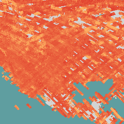
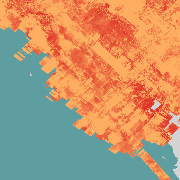
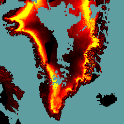
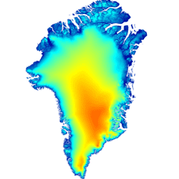
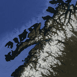
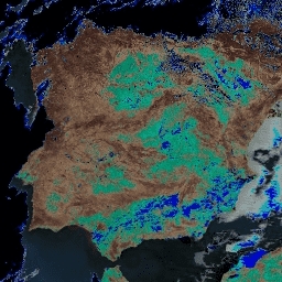
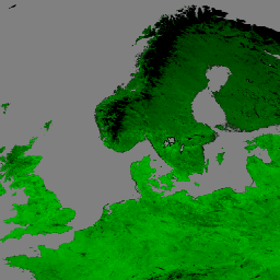
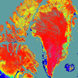
Мозаика Гренландии 2000 года - Проект картирования льда Гренландии (GIMP)
Этот набор данных представляет собой полную мозаику изображений ледяного щита Гренландии с разрешением 15 м, полученную на основе радиолокационных снимков Landsat 7 ETM+ и RADARSAT-1 за период с 1999 по 2002 год. Использованные методы включают в себя комбинацию маскирования облаков изображения, повышения резкости панорамирования, выборки и изменения размера изображения…
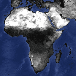
AG100: Глобальный набор данных по излучательной способности ASTER, 100 метров, V003
База данных глобальной излучательной способности усовершенствованного космического теплового эмиссионного и отражательного радиометра (ASTER-GED) была разработана Лабораторией реактивного движения (JPL) Национального управления по аэронавтике и исследованию космического пространства (НАСА) при Калифорнийском технологическом институте. Этот продукт включает среднюю излучательную способность и стандартное отклонение для всех 5 тепловых инфракрасных измерений ASTER…
Примечание: В период с 28 ноября 2024 года по 16 января 2025 года сбор данных прерван из-за технических проблем с прибором ASTER. Дополнительную информацию см. в сообщении Геологической службы США (USGS). Усовершенствованный космический тепловой эмиссионный и отражательный радиометр (ASTER) — это многоспектральный прибор, который…
Daymet V4: Ежедневные сводки погоды и климатологические данные о состоянии поверхности Земли.
Daymet V4 предоставляет сеточные оценки ежедневных параметров погоды для континентальной Северной Америки, Гавайев и Пуэрто-Рико (данные по Пуэрто-Рико доступны начиная с 1950 года). Они основаны на данных отдельных метеорологических станций и различных вспомогательных источниках данных. По сравнению с предыдущей версией, Daymet…
Динамическая оценка площади поверхностных вод по данным гармонизированного спутника Landsat Sentinel-2 (DSWx-HLS) V1
Этот набор данных содержит динамический продукт OPERA уровня 3, версия 1, демонстрирующий площадь поверхностных вод. Данные представляют собой проверенные наблюдения за площадью поверхностных вод, начиная с апреля 2023 года. Известные проблемы и ограничения по использованию описаны в документации к продукту. Входным набором данных для генерации каждого продукта является гармонизированный…
Динамическая оценка площади поверхностных вод по данным спутника Sentinel-1 (DSWx-S1) V1
Этот набор данных содержит динамические данные OPERA уровня 3 по площади поверхностных вод со спутника Sentinel-1 (DSWX-S1). DSWx-S1 обеспечивает практически глобальное географическое картирование площади поверхностных вод над сушей с пространственным разрешением 30 метров в соответствии с системой координат военной сетки (MGRS) с частотой повторного облета в период между…
Откалиброванные на датчике данные об излучении и геолокации EMIT L1B на расстоянии 60 м
Проект EMIT является частью программы Earth Venture-Instrument (EV-I), руководимой директором программы Отдела наук о Земле НАСА (ESD). EMIT представляет собой спектрометр Дайсона в ближнем инфракрасном диапазоне (VSWIR), адаптированный для установки на Международной космической станции (МКС). EMIT измеряет излучение…
Расчетная отражательная способность поверхности EMIT L2A, погрешность и маски 60 м
Проект EMIT является частью программы Earth Venture-Instrument (EV-I), руководимой директором программы Отдела наук о Земле НАСА (ESD). EMIT представляет собой спектрометр Дайсона в ближнем инфракрасном диапазоне (VSWIR), адаптированный для установки на Международной космической станции (МКС). EMIT измеряет излучение…
Исследование источников минеральной пыли на поверхности Земли – повышение концентрации метана.
Проект EMIT является частью программы Earth Venture-Instrument (EV-I), руководимой директором программы Отдела наук о Земле НАСА (ESD). EMIT представляет собой спектрометр Дайсона в ближнем инфракрасном диапазоне (VSWIR), адаптированный для установки на Международной космической станции (МКС). EMIT измеряет излучение…
Исследование источников минеральной пыли на поверхности Земли: комплексы метановых выбросов.
Проект EMIT является частью программы Earth Venture-Instrument (EV-I), руководимой директором программы Отдела наук о Земле НАСА (ESD). EMIT представляет собой спектрометр Дайсона в ближнем инфракрасном диапазоне (VSWIR), адаптированный для установки на Международной космической станции (МКС). EMIT измеряет излучение…
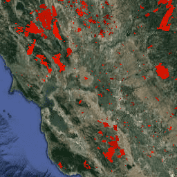
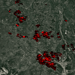
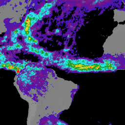
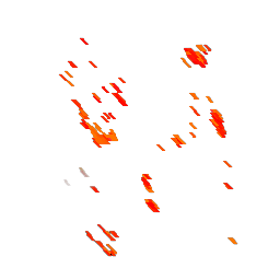
ФИРМЫ: Система управления ресурсами по вопросам пожарной безопасности
Версия набора данных FIRMS (Fire Information for Resource Management System) для Earth Engine содержит продукт обнаружения пожаров LANCE в растровом виде. Обнаружение активных очагов пожаров в режиме, близком к реальному времени (NRT), обрабатывается LANCE с использованием стандартного продукта MODIS MOD14/MYD14 «Пожары и тепловые аномалии». Каждый…
FLDAS: Сеть систем раннего предупреждения о голоде (FEWS NET) Система ассимиляции данных о земле
Набор данных FLDAS (McNally et al. 2017) был разработан для оказания помощи в оценке продовольственной безопасности в условиях дефицита данных в развивающихся странах. Он включает информацию о многих климатических переменных, включая содержание влаги, влажность воздуха, испарение, среднюю температуру почвы, общее количество осадков и т. д. Существует несколько различных наборов данных FLDAS; …
Высота верхней части навеса GEDI L2A Raster (версия 2)
Продукт GEDI уровня 2A с геолокационными данными о высоте (GEDI02_A) в основном состоит из 100 показателей относительной высоты (RH), которые в совокупности описывают форму сигнала, собранного GEDI. Исходный продукт GEDI02_A представляет собой таблицу точек с пространственным разрешением (средняя площадь охвата) 25 метров. …
Высота верхней части навеса GEDI L2A Vector (версия 2)
Продукт GEDI уровня 2A с геолокационными данными о высоте (GEDI02_A) в основном состоит из 100 показателей относительной высоты (RH), которые в совокупности описывают форму сигнала, собранного GEDI. Исходный продукт GEDI02_A представляет собой таблицу точек с пространственным разрешением (средняя площадь охвата) 25 метров. …
Это набор объектов, созданный на основе геометрических данных таблиц L2A в LARSE/GEDI/GEDI02_A_002. Каждый объект представляет собой полигональный контур исходной таблицы с ее идентификатором актива и метками времени начала/окончания. Дополнительную информацию см. в Руководстве пользователя. Миссия GEDI (Global Ecosystem Dynamics Investigation)…
Продукт GEDI Level 2B Canopy Cover and Vertical Profile Metrics (GEDI02_B) извлекает биофизические показатели из каждой осциллограммы GEDI. Эти показатели основаны на профиле вероятности образования просветов в направлении, полученном из осциллограммы L1B. Вертикальный шаг между измерениями профиля листвы (известный как dZ в GEDI…)
Характеристики вертикального профиля защитного покрытия для навеса GEDI L2B Vector (версия 2)
Продукт GEDI Level 2B Canopy Cover and Vertical Profile Metrics (GEDI02_B) извлекает биофизические показатели из каждой осциллограммы GEDI. Эти показатели основаны на профиле вероятности образования просветов в направлении, полученном из осциллограммы L1B. Вертикальный шаг между измерениями профиля листвы (известный как dZ в GEDI…)
Это набор объектов, созданный на основе геометрических данных таблиц L2B в LARSE/GEDI/GEDI02_B_002. Каждый объект представляет собой полигональный контур исходной таблицы с ее идентификатором актива и метками времени начала/окончания. Дополнительную информацию см. в Руководстве пользователя. Миссия GEDI (Global Ecosystem Dynamics Investigation)…
Этот набор данных содержит прогнозы плотности надземной биомассы (AGBD; в Мг/га) и оценки стандартной ошибки прогноза в пределах каждой геолокационной зоны лазерного сканирования, полученные в рамках Глобального исследования динамики экосистем (GEDI) уровня 4A (L4A), версия 2. В этой версии гранулы представлены в суборбитах. Высотные метрики…
Растровая карта плотности надземной биомассы GEDI L4A, версия 2.1
Этот набор данных содержит прогнозы плотности надземной биомассы (AGBD; в Мг/га) и оценки стандартной ошибки прогноза в пределах каждой геолокационной зоны лазерного сканирования, полученные в рамках Глобального исследования динамики экосистем (GEDI) уровня 4A (L4A), версия 2. В этой версии гранулы представлены в суборбитах. Высотные метрики…
Это набор объектов, созданный на основе геометрических данных таблиц L4A в LARSE/GEDI/GEDI04_A_002. Каждый объект представляет собой полигональный контур исходной таблицы с ее идентификатором актива и метками времени начала/окончания. Дополнительную информацию см. в Руководстве пользователя. Миссия GEDI (Global Ecosystem Dynamics Investigation)…
GEDI L4B Сетчатая плотность надземной биомассы (версия 2)
Данный продукт Global Ecosystem Dynamics Investigation (GEDI) L4B предоставляет оценки средней плотности надземной биомассы (AGBD) в масштабе 1 км x 1 км на основе наблюдений, проводившихся с 19-й недели миссии, начавшейся 18 апреля 2019 года, по 138-ю неделю миссии, завершившуюся 4 августа 2021 года. Продукт GEDI L4A Footprint Biomass преобразует…
GEOS-CF fcst htf v1: Прогноз состава Земли по данным системы наблюдения Годдарда
Этот набор данных содержит метеорологический прогноз (fcst) на основе данных с высокой временной частотой (htf). Используйте свойства 'creation_time' и 'forecast_time' для выбора интересующих вас данных. Система прогнозирования состава атмосферы Goddard Earth Observing System Composition Forecast (GEOS-CF) — это глобальная система прогнозирования состава атмосферы от Управления глобального моделирования и ассимиляции НАСА (GMAO). …
GEOS-CF fcst tavg1hr v1: Прогноз состава Земли по данным системы наблюдения Годдарда
Этот набор данных содержит метеорологический прогноз (fcst) на основе усредненных по времени частотных данных (tavg1hr). Используйте свойства 'creation_time' и 'forecast_time' для выбора интересующих вас данных. Система прогнозирования состава атмосферы Goddard Earth Observing System Composition Forecast (GEOS-CF) — это глобальная система прогнозирования состава атмосферы от Управления глобального моделирования и ассимиляции НАСА (GMAO). …
GEOS-CF rpl htf v1: Прогноз состава Земли по данным системы наблюдения Годдарда
Этот набор данных содержит метеорологические данные, воспроизведенные в режиме реального времени (rpl) с высокой частотой временных интервалов (htf). Система прогнозирования состава атмосферы Goddard Earth Observing System Composition Forecast (GEOS-CF) — это глобальная система прогнозирования состава атмосферы от Управления глобального моделирования и ассимиляции НАСА (GMAO). GEOS-CF предлагает новый инструмент для исследований в области химии атмосферы, включающий в себя…
GEOS-CF rpl tavg1hr v1: Прогноз состава Земли по данным системы наблюдения за Землей Годдарда
Этот набор данных содержит метеорологические данные, полученные путем воспроизведения (rpl) усредненных по времени одночасовых данных (tavg1hr). Он создан путем объединения исходных коллекций GEOS-CF: chm_tavg_1hr_g1440x721_v1, met_tavg_1hr_g1440x721_x1 и xgc_tavg_1hr_g1440x721_x1. Система прогнозирования состава Земли Goddard Earth Observing System Composition Forecast (GEOS-CF) — это глобальная система прогнозирования состава, разработанная НАСА в рамках программы глобального моделирования и…
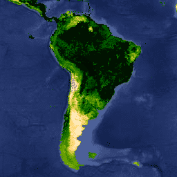
Индекс GIMMS NDVI генерируется на основе данных нескольких датчиков AVHRR NOAA для глобальной сетки координат с точностью до 1/12 градуса (широта/долгота). Последняя версия набора данных GIMMS NDVI называется NDVI3g (индекс GIMMS NDVI третьего поколения, полученный с помощью датчиков AVHRR).
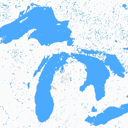
Глобальный набор данных о внутренних водных объектах содержит информацию о внутренних поверхностных водоемах, включая пресные и соленые озера, реки и водохранилища. Начиная с эпохи GLS 2000, было выявлено 3 650 723 км² внутренних водных объектов, около трех четвертей из которых находятся в Северной Америке и Азии. Бореальные леса и тундра…
GLDAS-2.1: Глобальная система ассимиляции данных о суше
Система глобальной ассимиляции данных о суше НАСА, версия 2 (GLDAS-2), состоит из трех компонентов: GLDAS-2.0, GLDAS-2.1 и GLDAS-2.2. GLDAS-2.0 полностью использует входные данные метеорологического воздействия Принстонского университета и предоставляет согласованный по времени ряд данных с 1948 по 2014 год. GLDAS-2.1 использует комбинацию модельных данных…
GLDAS-2.2: Глобальная система ассимиляции данных о суше
Система глобальной ассимиляции данных о суше НАСА, версия 2 (GLDAS-2), состоит из трех компонентов: GLDAS-2.0, GLDAS-2.1 и GLDAS-2.2. GLDAS-2.0 полностью использует входные данные метеорологического воздействия Принстонского университета и предоставляет согласованный по времени ряд данных с 1948 по 2014 год. GLDAS-2.1 использует комбинацию модельных данных…
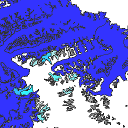
GLIMS 2023: Глобальные измерения наземного льда из космоса
Глобальные измерения наземного льда из космоса (GLIMS) — это международная инициатива, целью которой является многократное обследование примерно 200 000 ледников мира. Проект направлен на создание всеобъемлющего глобального каталога наземного льда, включая измерения площади ледников, их геометрии, скорости движения по поверхности и линии снега…
GLIMS Current: Глобальные измерения наземного льда из космоса
Глобальные измерения наземного льда из космоса (GLIMS) — это международная инициатива, целью которой является многократное обследование примерно 200 000 ледников мира. Проект направлен на создание всеобъемлющего глобального каталога наземного льда, включая измерения площади ледников, их геометрии, скорости движения по поверхности и линии снега…
GPM: Глобальная система измерения осадков (GPM), выпуск 07
Глобальная система измерения осадков (GPM) — это международная спутниковая миссия, призванная каждые три часа предоставлять данные нового поколения о дожде и снеге по всему миру. Интегрированный алгоритм IMERG (Integrated Multi-satellitE Retrievals for GPM) — это унифицированный алгоритм, который позволяет оценивать количество осадков, объединяя данные со всех пассивных микроволновых приборов, входящих в состав GPM…
GPM: Ежемесячные глобальные измерения осадков (GPM), версия 6
Выпуск финальной версии IMERG "06" был прекращен в сентябре 2021 года. Выпуск версии "07" ожидается в сентябре 2022 года. Глобальная система измерения осадков (GPM) — это международная спутниковая миссия, предоставляющая данные наблюдений за осадками и снегом нового поколения по всему миру каждые три часа. Интегрированные многоспутниковые данные для…
GPM: Ежемесячные глобальные измерения осадков (GPM), версия 07
Глобальная система измерения осадков (GPM) — это международная спутниковая миссия, призванная каждые три часа предоставлять данные нового поколения о дожде и снеге по всему миру. Интегрированный алгоритм IMERG (Integrated Multi-satellitE Retrievals for GPM) — это унифицированный алгоритм, который позволяет оценивать количество осадков, объединяя данные со всех пассивных микроволновых приборов, входящих в состав GPM…
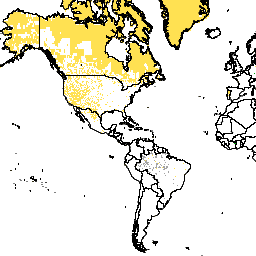
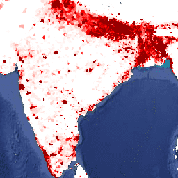
GPWv411: Скорректировано в соответствии с пересмотренными в 2015 году данными ООН по общему населению стран (сетчатая модель населения мира, версия 4.11).
Этот набор данных содержит оценки количества людей на ячейку сетки размером 30 угловых секунд, соответствующие данным национальных переписей населения и регистров населения в отношении относительного пространственного распределения, но скорректированные в соответствии с общенациональными данными пересмотра прогнозов ООН по численности населения мира 2015 года. Имеется одно изображение…
GPWv411: Основные демографические характеристики (сетчатая модель населения мира, версия 4.11)
Этот набор данных содержит оценки численности населения по возрасту и полу для каждой ячейки сетки размером 30 угловых секунд, соответствующие национальным переписям населения и регистрам населения. Для каждой моделируемой возрастной и половой категории представлено одно изображение, основанное на данных переписи 2010 года. Общая документация. Сетка данных о населении…
GPWv411: Контекст данных (Сеточная карта населения мира, версия 4.11)
Этот набор данных классифицирует пиксели с предполагаемой нулевой численностью населения на основе информации, предоставленной в документах переписи населения. Общая документация. Модель «Сеточная модель населения мира, версия 4 (GPWv4), редакция 11» моделирует распределение мирового населения за 2000, 2005, 2010, 2015 и 2020 годы…
GPWv411: Площадь суши (сетчатая карта населения мира, версия 4.11)
Этот набор данных содержит оценку площади суши в квадратных километрах на пиксель, за исключением постоянного льда и воды, в пределах каждого пикселя, и использовался для расчета наборов данных плотности населения GPW v4.11. Общая документация. Сетка данных о населении мира, версия 4 (GPWv4), …
GPWv411: Средняя площадь административной единицы (сетчатая карта населения мира, версия 4.11)
Этот набор данных содержит среднюю площадь входной единицы (единиц), на основе которой создаются сетки численности населения и плотности. Общая документация. Модель «Сеточная модель населения мира, версия 4 (GPWv4), редакция 11» моделирует распределение мирового населения за 2000, 2005, 2010, 2015 годы и т. д.
GPWv411: Национальная идентификационная сетка (Сетка населения мира, версия 4.11)
Этот набор данных представляет собой источник данных переписи населения, использованный для создания оценок численности населения GPW v4.11. Пиксели с одинаковым значением отражают один и тот же источник данных, чаще всего страну или территорию. Общая документация. Модель «Сеточная модель численности населения мира, версия 4 (GPWv4), редакция 11»…
GPWv411: Численность населения (сетчатая карта населения мира, версия 4.11)
Этот набор данных содержит оценки количества людей на ячейку сетки размером 30 угловых секунд, соответствующие данным национальных переписей населения и регистров населения. Для каждого моделируемого года имеется одно изображение. Общее примечание к документации: Поскольку в этой коллекции применяется политика пирамидального распределения по среднему значению, уменьшение масштаба приводит к…
GPWv411: Плотность населения (сетчатая модель населения мира, версия 4.11)
Этот набор данных содержит оценки количества людей на квадратный километр, соответствующие данным национальных переписей населения и регистров населения. Для каждого моделируемого года имеется одно изображение. Общая документация. Модель «Сеточная модель населения мира, версия 4 (GPWv4), редакция 11» моделирует распределение мирового населения…
GPWv411: Плотность населения, скорректированная ООН (сетчатая модель населения мира, версия 4.11)
Этот набор данных содержит оценки количества людей на ячейку сетки размером 30 угловых секунд, соответствующие данным национальных переписей населения и регистров населения в отношении относительного пространственного распределения, но скорректированные в соответствии с общенациональными данными пересмотра прогнозов ООН по численности населения мира 2015 года. Имеется одно изображение…
GPWv411: Площадь водной поверхности (сетчатая карта населения мира, версия 4.11)
Этот набор данных содержит оценки площади водной поверхности (постоянного льда и воды) в каждом пикселе и использовался для расчета плотности населения в наборах данных GPW v4.11. Общая документация. Модель «Сеточная модель населения мира, версия 4 (GPWv4), редакция 11» моделирует распределение глобального населения Земли…
GPWv411: Маска воды (Сеточная модель населения мира, версия 4.11)
Этот набор данных идентифицирует пиксели, содержащие воду; пиксели, не содержащие воду, замаскированы. Маска воды использовалась для исключения областей воды и вечного льда из распределения населения. Общая документация. Модель «Сеточная модель населения мира, версия 4 (GPWv4), редакция 11» моделирует распределение глобального населения Земли…
Ежемесячные данные о гравитационных аномалиях GRACE Tellus Monthly Mass Grids предоставляются относительно базового среднего значения за период 2004-2010 годов. Данные в этом наборе данных представлены в единицах «эквивалентной толщины воды», которые отражают отклонения массы в вертикальном направлении в сантиметрах. См. информацию у поставщика…
GRACE Monthly Mass Grids Release 06 Version 04 - Land
Ежемесячные сетки данных о площади суши содержат аномалии водных масс, представленные в виде эквивалентной толщины водного слоя, рассчитанной на основе наблюдений за гравитацией с использованием приборов GRACE и GRACE-FO в течение указанного периода времени и относительно указанного среднего эталонного периода. Эквивалентная толщина водного слоя представляет собой общую аномалию запасов наземных вод…
GRACE Monthly Mass Grids Release 06 Version 04 - Ocean
Ежемесячные данные о гравитационных аномалиях GRACE Tellus Monthly Mass Grids предоставляются относительно базового среднего значения за период 2004-2010 годов. Данные в этом наборе данных представлены в единицах «эквивалентной толщины воды», которые отражают отклонения массы в вертикальном направлении в сантиметрах. См. информацию у поставщика…
GRACE Monthly Mass Grids Release 6.3 Version 4 - Global Masscons
Этот набор данных содержит сеточные ежемесячные глобальные аномалии запасов/высоты воды относительно среднего значения за определенный период времени, полученные из данных GRACE и GRACE-FO и обработанные в JPL с использованием подхода Mascon (RL06.3Mv04). Эти данные представлены в одном файле в формате netCDF и могут быть использованы для анализа…
Ежемесячные сетки массового сбора данных GRACE, версия 04 - Global Mascon (с фильтрацией CRI)
Этот набор данных содержит сеточные ежемесячные глобальные аномалии запасов/высоты воды относительно среднего значения за определенный период времени, полученные из данных GRACE и GRACE-FO и обработанные в JPL с использованием подхода Mascon (RL06.3Mv04). Эти данные представлены в одном файле в формате netCDF и могут быть использованы для анализа…
GTOPO30: Глобальная топографическая карта с шагом 30 угловых секунд.
GTOPO30 — это глобальная цифровая модель рельефа (ЦМР) с горизонтальным шагом сетки 30 угловых секунд (приблизительно 1 километр). ЦМР была получена из нескольких растровых и векторных источников топографической информации. Разработка GTOPO30, завершенная в конце 1996 года, заняла три года…
Глобальная классификация лесов 2020 года для оценок надземной биомассы первого уровня МГЭИК, версия 1.
Этот набор данных содержит классы глобальных лесов, разграниченные по состоянию/статусу в 2020 году с разрешением приблизительно 30 м. Данные используются для формирования оценок первого уровня плотности надземной сухой древесной биомассы (AGBD) в естественных лесах в рамках уточнения 2019 года Руководящих принципов МГЭИК 2006 года по национальным парниковым газам…
Глобальные карты плотности углерода надземной и подземной биомассы
Этот набор данных предоставляет согласованные по времени и гармонизированные глобальные карты плотности углерода надземной и подземной биомассы за 2010 год с пространственным разрешением 300 м. Карта надземной биомассы объединяет карты древесной, луговой, сельскохозяйственной и тундровой биомассы, полученные с помощью дистанционного зондирования и специфичные для каждого типа землепользования. Исходные карты были…
Этот набор данных представляет собой глобальную высоту деревьев, основанную на объединении данных космического лидара (2005 г.) из системы геофизического лазерного высотомера (GLAS) и вспомогательных геопространственных данных. Подробности см. в работе Simard et al. (2011).
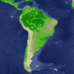
Глобальные изменения лесного покрова (GFCC) Многолетние глобальные 30-метровые данные по древесному покрову
Слои данных о древесном покрове Landsat Vegetation Continuous Fields (VCF) содержат оценки процента горизонтальной поверхности земли в каждом 30-метровом пикселе, покрытой древесной растительностью высотой более 5 метров. Набор данных доступен для четырех эпох, центрированных на 2000, 2005, 2010 годах…
Глобальное распространение мангровых лесов, т. 1 (2000)
База данных была подготовлена с использованием спутниковых данных Landsat за 2000 год. Более 1000 снимков Landsat, полученных из Центра наблюдения и изучения земных ресурсов Геологической службы США (EROS), были классифицированы с использованием гибридных методов цифровой классификации изображений с обучением и без обучения. Эта база данных является первой и наиболее…
Этот набор данных представляет собой первое в своем роде пространственное представление многосезонных глобальных интерферометрических данных когерентности и обратного рассеяния, полученных с помощью радиолокатора с синтезированной апертурой (SAR) в C-диапазоне. Охват включает в себя материки и ледяные щиты от 82 градусов северной широты до 79 градусов южной широты. Набор данных получен из многовременных…
Глобальная сезонная интерферометрическая когерентность и обратное рассеяние Sentinel-1 V2019 Когерентность
Этот набор данных представляет собой первое в своем роде пространственное представление многосезонных глобальных интерферометрических данных когерентности и обратного рассеяния, полученных с помощью радиолокатора с синтезированной апертурой (SAR) в C-диапазоне. Охват включает в себя материки и ледяные щиты от 82 градусов северной широты до 79 градусов южной широты. Набор данных получен из многовременных…
Параметры модели распада глобальной сезонной интерферометрической когерентности и обратного рассеяния Sentinel-1 V2019
Этот набор данных представляет собой первое в своем роде пространственное представление многосезонных глобальных интерферометрических данных когерентности и обратного рассеяния, полученных с помощью радиолокатора с синтезированной апертурой (SAR) в C-диапазоне. Охват включает в себя материки и ледяные щиты от 82 градусов северной широты до 79 градусов южной широты. Набор данных получен из многовременных…
Глобальная сезонная интерферометрическая когерентность и обратное рассеяние Sentinel-1 V2019, тень от точки падения
Этот набор данных представляет собой первое в своем роде пространственное представление многосезонных глобальных интерферометрических данных когерентности и обратного рассеяния, полученных с помощью радиолокатора с синтезированной апертурой (SAR) в C-диапазоне. Охват включает в себя материки и ледяные щиты от 82 градусов северной широты до 79 градусов южной широты. Набор данных получен из многовременных…
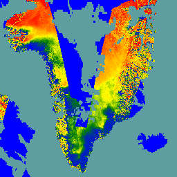
Данная цифровая модель рельефа (ЦМР) построена на основе комбинации ЦМР ASTER и SPOT-5 для периферии и края ледяного щита (т.е. ниже линии равновесия) к югу от приблизительно 82,5° с.ш. и фотоклинометрических данных AVHRR во внутренней части ледяного щита и на крайнем севере (Скамбос и…).
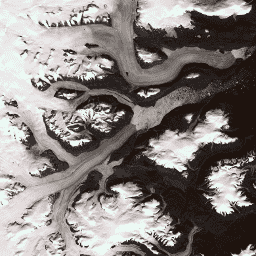
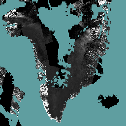
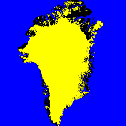
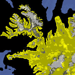
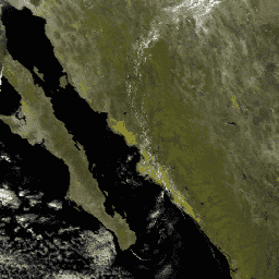
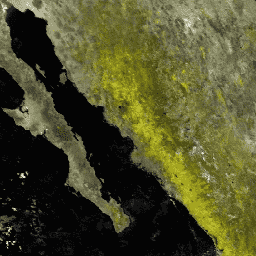
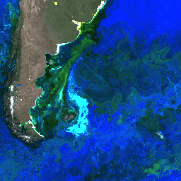
Маска «Лед и океан Гренландии» — Проект картографирования Гренландии (GIMP)
Этот набор данных содержит полные маски классификации наземного льда и океана с разрешением 15 м для ледяного щита Гренландии. Ледяной покров был нанесен на карту с использованием комбинации ортокорректированных панхроматических (диапазон 8) изображений из набора данных Landsat 7 Enhanced Thematic Mapper Plus (ETM+), распространяемого Геологической службой США, и…
Сетчатые показатели структуры растительности и плотности биомассы GEDI с использованием метрик COUNTS, размер пикселя 12 км.
Этот набор данных состоит из практически глобальных, готовых к анализу, многоуровневых сеточных метрик структуры растительности, полученных из продуктов NASA Global Ecosystem Dynamics Investigation (GEDI) уровней 2 и 4A, связанных с зонами охвата лидара диаметром 25 м. Этот набор данных обеспечивает всестороннее представление структуры растительности практически в глобальном масштабе, включая…
Сетчатые показатели структуры растительности и плотности биомассы GEDI с использованием метрик COUNTS, размер пикселя 1 км.
Этот набор данных состоит из практически глобальных, готовых к анализу, многоуровневых сеточных метрик структуры растительности, полученных из продуктов NASA Global Ecosystem Dynamics Investigation (GEDI) уровней 2 и 4A, связанных с зонами охвата лидара диаметром 25 м. Этот набор данных обеспечивает всестороннее представление структуры растительности практически в глобальном масштабе, включая…
Сетчатые показатели структуры растительности и плотности биомассы GEDI с использованием метрик COUNTS, размер пикселя 6 км.
Этот набор данных состоит из практически глобальных, готовых к анализу, многоуровневых сеточных метрик структуры растительности, полученных из продуктов NASA Global Ecosystem Dynamics Investigation (GEDI) уровней 2 и 4A, связанных с зонами охвата лидара диаметром 25 м. Этот набор данных обеспечивает всестороннее представление структуры растительности практически в глобальном масштабе, включая…
Сетчатые показатели структуры растительности и плотности биомассы GEDI, размер пикселя 12 км.
Этот набор данных состоит из практически глобальных, готовых к анализу, многоуровневых сеточных метрик структуры растительности, полученных из продуктов NASA Global Ecosystem Dynamics Investigation (GEDI) уровней 2 и 4A, связанных с зонами охвата лидара диаметром 25 м. Этот набор данных обеспечивает всестороннее представление структуры растительности практически в глобальном масштабе, включая…
Сетчатые показатели структуры растительности и плотности биомассы GEDI, размер пикселя 1 км.
Этот набор данных состоит из практически глобальных, готовых к анализу, многоуровневых сеточных метрик структуры растительности, полученных из продуктов NASA Global Ecosystem Dynamics Investigation (GEDI) уровней 2 и 4A, связанных с зонами охвата лидара диаметром 25 м. Этот набор данных обеспечивает всестороннее представление структуры растительности практически в глобальном масштабе, включая…
Сетчатые показатели структуры растительности и плотности биомассы GEDI, размер пикселя 6 км.
Этот набор данных состоит из практически глобальных, готовых к анализу, многоуровневых сеточных метрик структуры растительности, полученных из продуктов NASA Global Ecosystem Dynamics Investigation (GEDI) уровней 2 и 4A, связанных с зонами охвата лидара диаметром 25 м. Этот набор данных обеспечивает всестороннее представление структуры растительности практически в глобальном масштабе, включая…
HLSL30: HLS-2 Landsat Operational Land Imager Surface Reflectance and TOA Brightness Daily Global 30m
Проект Harmonized Landsat Sentinel-2 (HLS) предоставляет согласованные данные об отражательной способности поверхности (SR) и яркости на верхней границе атмосферы (TOA) от виртуальной группировки спутниковых датчиков. Оперативный наземный имиджер (OLI) размещен на борту совместных спутников NASA/USGS Landsat 8 и Landsat 9, а многоспектральный…
HLSS30: Многоспектральный прибор HLS Sentinel-2, измерение отражения поверхности, ежедневные глобальные данные с разрешением 30 м.
Проект Harmonized Landsat Sentinel-2 (HLS) предоставляет согласованные данные об отражательной способности поверхности, полученные с помощью оперативного прибора для получения изображений поверхности суши (OLI) на борту совместного спутника NASA/USGS Landsat 8 и многоспектрального прибора (MSI) на борту европейских спутников Copernicus Sentinel-2A. Совместные измерения позволяют проводить глобальные наблюдения за сушей каждые 2-3…
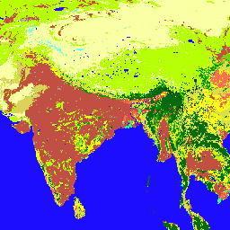
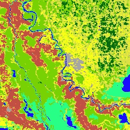
MCD12C1.061 MODIS Тип землепользования Годовые глобальные 0,05° CMG
Совместный продукт данных Terra и Aqua, полученный с помощью спектрорадиометра среднего разрешения (MODIS) и сетки моделирования климата землепользования (CMG) (MCD12C1) версии 6.1, представляет собой пространственно агрегированную и перепроецированную версию фрагментированного продукта данных MCD12Q1 версии 6.1. Карты Международной программы по геосфере и биосфере (IGBP), Университет…
MCD12Q1.061 MODIS Типы землепользования Ежегодные глобальные 500 м
Совместный продукт данных MODIS (Moderate Resolution Imaging Spectroradiometer) версии 6.1 (MCD12Q1) от Terra и Aqua предоставляет информацию о типах землепользования в глобальном масштабе с годовой периодичностью. Продукт данных MCD12Q1 версии 6.1 создан с использованием контролируемой классификации данных отражательной способности MODIS Terra и Aqua. Земля…
MCD15A3H.061 Индекс листовой поверхности MODIS/FPAR, 4-дневный глобальный диапазон 500 м
Продукт MCD15A3H версии 6.1 Moderate Resolution Imaging Spectroradiometer (MODIS) Level 4, Combined Fraction of Photosynthetically Active Radiation (FPAR) and Leaf Area Index (LAI), представляет собой 4-дневный композитный набор данных с размером пикселя 500 метров. Алгоритм выбирает лучший доступный пиксель из всех…
MCD19A1.061: Наземная поверхность BRF, ежедневные данные L2G, глобальные расстояния 500 м и 1 км.
Данные MCD19A1 версии 6.1 представляют собой сеточный продукт уровня 2, полученный с помощью спектрорадиометра среднего разрешения MODIS Terra и спутника Aqua, с двунаправленным коэффициентом отражения (BRF) поверхности суши, и выпускаются ежедневно с разрешением 500 метров и 1 километр. Более подробную информацию см. в руководстве пользователя MAIAC.
MCD19A2.061: Наземная оптическая глубина аэрозоля Terra & Aqua MAIAC, ежедневные измерения на 1 км.
Продукт данных MCD19A2 V6.1 представляет собой сеточный продукт уровня 2, полученный с помощью многоугловой реализации атмосферной коррекции (MAIAC) наземных аэрозолей, представленный данными MODIS Terra и Aqua и выпускаемый ежедневно с разрешением 1 км. Для получения дополнительной информации см. руководство пользователя MAIAC. ПРИМЕЧАНИЕ: Этот продукт имеет…
MCD43A1.061 Параметры модели MODIS BRDF-альбедо, ежедневные данные на глубине 500 м
Набор данных MCD43A1 V6.1 «Функция двунаправленного распределения отражательной способности и параметры модели альбедо (BRDF/Albedo)» представляет собой 16-дневный продукт с шагом 500 метров в сутки. Юлианская дата соответствует 9-му дню 16-дневного периода обработки данных, и, следовательно, наблюдения взвешиваются для оценки BRDF/Albedo для этого дня. …
MCD43A2.061 MODIS BRDF-Качество альбедо, ежедневные измерения 500 м
Набор данных MCD43A2 V6.1, содержащий информацию о качестве двунаправленной функции распределения отражательной способности и альбедо (BRDF/Albedo), представляет собой 16-дневный продукт с шагом сканирования 500 метров. Он включает в себя всю информацию о качестве для соответствующих 16-дневных продуктов MCD43A3 Albedo и MCD43A4 Nadir-BRDF (NBAR). MCD43A2 содержит информацию о качестве отдельных полос и наблюдениях…
The MCD43A3 V6.1 Albedo Model dataset is a daily 16-day product. It provides both directional hemispherical reflectance (black sky albedo) and bihemispherical reflectance (white sky albedo) for each of the MODIS surface reflectance bands (band 1 through band 7) as well as 3 broad spectrum …
MCD43A4.061 MODIS Nadir BRDF-Adjusted Reflectance Daily 500m
The MCD43A4 V6.1 Nadir Bidirectional Reflectance Distribution Function Adjusted Reflectance (NBAR) product provides 500 meter reflectance data of the MODIS "land" bands 1-7. These are adjusted using a bidirectional reflectance distribution function to model the values as if they were collected from a nadir view. …
The MCD43C3 Version 6.1 Bidirectional Reflectance Distribution Function and Albedo (BRDF/Albedo) Albedo dataset is produced daily using 16 days of Terra and Aqua MODIS data in a 0.05 degree (5,600 meters at the equator) Climate Modeling Grid (CMG). Data are temporally weighted to the ninth …
The Terra and Aqua combined MCD64A1 Version 6.1 Burned Area data product is a monthly, global gridded 500m product containing per-pixel burned-area and quality information. The MCD64A1 burned-area mapping approach employs 500m MODIS Surface Reflectance imagery coupled with 1km MODIS active fire observations. The algorithm …
M2I3NVAER (or inst3_3d_aer_Nv) is an instantaneous 3-dimensional 3-hourly data collection in Modern-Era Retrospective analysis for Research and Applications version 2 (MERRA-2). This collection consists of assimilations of aerosol mixing ratio parameters at 72 model layers, such as dust, sulphur dioxide, sea salt, black carbon, and …
M2T1NXAER (or tavg1_2d_aer_Nx) is an hourly time-averaged 2-dimensional data collection in Modern-Era Retrospective analysis for Research and Applications version 2 (MERRA-2). This collection consists of assimilated aerosol diagnostics, such as column mass density of aerosol components (black carbon, dust, sea-salt, sulfate, and organic carbon), surface …
M2T1NXSLV (or tavg1_2d_slv_Nx) is an hourly time-averaged 2-dimensional data collection in Modern-Era Retrospective analysis for Research and Applications version 2 (MERRA-2). This collection consists of meteorology diagnostics at popularly used vertical levels, such as air temperature at 2-meter (or at 10-meter, 850hPa, 500 hPa, 250hPa), …
MEaSUREs Greenland Ice Velocity: Selected Glacier Site Velocity Maps from Optical Images Version 2
This dataset, part of the NASA Making Earth System Data Records for Use in Research Environments (MEaSUREs) program, consists of mean monthly velocity maps for selected glacier outlet areas. The maps are generated by tracking visible features between optical image pairs acquired by the Landsat …
MOD08_M3.061 Terra Atmosphere Monthly Global Product
MOD08_M3 V6.1 is an atmosphere global product that contains monthly 1 x 1 degree grid average values of atmospheric parameters. These parameters are related to atmospheric aerosol particle properties, total ozone burden, atmospheric water vapor, cloud optical and physical properties, and atmospheric stability indices. The …
MOD09A1.061 Terra Surface Reflectance 8-Day Global 500m
The MOD09A1 V6.1 product provides an estimate of the surface spectral reflectance of Terra MODIS bands 1-7 at 500m resolution and corrected for atmospheric conditions such as gasses, aerosols, and Rayleigh scattering. Along with the seven reflectance bands is a quality layer and four observation …
MOD09GA.061 Terra Surface Reflectance Daily Global 1km and 500m
The MODIS Surface Reflectance products provide an estimate of the surface spectral reflectance as it would be measured at ground level in the absence of atmospheric scattering or absorption. Low-level data are corrected for atmospheric gases and aerosols. MOD09GA version 6.1 provides bands 1-7 in …
MOD09GQ.061 Terra Surface Reflectance Daily Global 250m
The MODIS Surface Reflectance products provide an estimate of the surface spectral reflectance as it would be measured at ground level in the absence of atmospheric scattering or absorption. Low-level data are corrected for atmospheric gases and aerosols. MOD09GQ version 6.1 provides bands 1 and …
MOD09Q1.061 Terra Surface Reflectance 8-Day Global 250m
The MOD09Q1 product provides an estimate of the surface spectral reflectance of bands 1 and 2 at 250m resolution and corrected for atmospheric conditions such as gasses, aerosols, and Rayleigh scattering. Along with the two reflectance bands, a quality layer is also included. For each …
The MOD10A1 V6.1 Snow Cover Daily Global 500m product contains snow cover, snow albedo, fractional snow cover, and quality assessment (QA) data. Snow cover data are based on a snow mapping algorithm that employs a Normalized Difference Snow Index (NDSI) and other criteria tests. General …
MOD10A2 is a snow cover dataset from the MODIS on the Terra satellite. The dataset reports the maximum snow cover extent during an eight-day period at the resolution of 500 m. An eight-day compositing period was chosen because that is the exact ground track repeat …
MOD11A1.061 Температура и коэффициент излучения поверхности суши Terra, ежедневные глобальные данные на расстоянии 1 км
The MOD11A1 V6.1 product provides daily land surface temperature (LST) and emissivity values in a 1200 x 1200 kilometer grid. The temperature value is derived from the MOD11_L2 swath product. Above 30 degrees latitude, some pixels may have multiple observations where the criteria for clear-sky …
MOD11A2.061 Terra Land Surface Temperature and Emissivity 8-Day Global 1km
The MOD11A2 V6.1 product provides an average 8-day land surface temperature (LST) in a 1200 x 1200 kilometer grid. Each pixel value in MOD11A2 is a simple average of all the corresponding MOD11A1 LST pixels collected within that 8 day period. The MOD11A2 does a …
MOD13A1.061 Terra Vegetation Indices 16-Day Global 500m
The MOD13A1 V6.1 product provides a Vegetation Index (VI) value at a per pixel basis. There are two primary vegetation layers. The first is the Normalized Difference Vegetation Index (NDVI) which is referred to as the continuity index to the existing National Oceanic and Atmospheric …
MOD13A2.061 Terra Vegetation Indices 16-Day Global 1km
The MOD13A2 V6.1 product provides two Vegetation Indices (VI): the Normalized Difference Vegetation Index (NDVI) and the Enhanced Vegetation Index (EVI). The NDVI is referred to as the continuity index to the existing National Oceanic and Atmospheric Administration-Advanced Very High Resolution Radiometer (NOAA-AVHRR) derived NDVI. …
MOD13A3.061 Vegetation Indices Monthly L3 Global 1 km SIN Grid
The MOD13A3 V6.1 product data is provided monthly at 1 kilometer (km) spatial resolution. In generating this monthly product, the algorithm ingests all the MOD13A2 products that overlap the month and employs a weighted temporal average. Vegetation indices are used for global monitoring of vegetation …
MOD13C1.061: Terra Vegetation Indices 16-Day L3 Global 0.05 Deg Climate Modeling Grid
The Terra Moderate Resolution Imaging Spectroradiometer (MODIS) Vegetation Indices 16-Day (MOD13C1) Version 6.1 product provides a Vegetation Index (VI) value at a per pixel basis. There are two primary vegetation layers. The first is the Normalized Difference Vegetation Index (NDVI), which maintains continuity with the …
MOD13Q1.061 Terra Vegetation Indices 16-Day Global 250m
The MOD13Q1 V6.1 product provides a Vegetation Index (VI) value at a per pixel basis. There are two primary vegetation layers. The first is the Normalized Difference Vegetation Index (NDVI) which is referred to as the continuity index to the existing National Oceanic and Atmospheric …
MOD14A1.061: Terra Thermal Anomalies & Fire Daily Global 1km
The MOD14A1 V6.1 dataset provides daily fire mask composites at 1km resolution derived from the MODIS 4- and 11-micrometer radiances. The fire detection strategy is based on absolute detection of a fire (when the fire strength is sufficient to detect), and on detection relative to …
MOD14A2.061: Terra Thermal Anomalies & Fire 8-Day Global 1km
The MOD14A2 V6.1 dataset provides 8-day fire mask composites at 1km resolution. It contains the maximum value of the individual pixel classes over the compositing period. Along with the fire mask, an associated quality information layer is also provided. Documentation: User's Guide Algorithm Theoretical Basis …
MOD15A2H.061: Terra Leaf Area Index/FPAR 8-Day Global 500m
The MOD15A2H V6.1 MODIS combined Leaf Area Index (LAI) and Fraction of Photosynthetically Active Radiation (FPAR) product is an 8-day composite dataset at 500m resolution. The algorithm chooses the "best" pixel available from all the acquisitions of the Terra sensor from within the 8-day period. …
MOD16A2.061: Terra Net Evapotranspiration 8-Day Global 500m
The MOD16A2 Version 6.1 Evapotranspiration/Latent Heat Flux product is an 8-day composite product produced at 500 meter pixel resolution. The algorithm used for the MOD16 data product collection is based on the logic of the Penman-Monteith equation, which includes inputs of daily meteorological reanalysis data …
MOD16A2GF.061: Terra Net Evapotranspiration Gap-Filled 8-Day Global 500m
The Terra Moderate Resolution Imaging Spectroradiometer (MODIS) MOD16A2GF Version 6.1 Evapotranspiration/Latent Heat Flux (ET/LE) product is a year-end gap-filled 8-day composite dataset produced at 500 meter (m) pixel resolution. The algorithm used for the MOD16 data product collection is based on the logic of the …
MOD17A2H.061: Terra Gross Primary Productivity 8-Day Global 500m
The MOD17A2H V6.1 Gross Primary Productivity (GPP) product is a cumulative 8-day composite with a 500m pixel size. The product is based on the radiation-use efficiency concept and can be potentially used as inputs to data models to calculate terrestrial energy, carbon, water cycle processes, …
MOD17A2HGF.061: Terra Gross Primary Productivity 8-Day Global 500m
The MOD17A2HGF Version 6.1 Gross Primary Productivity (GPP) product is a cumulative 8-day composite of values with 500 meter (m) pixel size based on the radiation use efficiency concept that can be potentially used as inputs to data models to calculate terrestrial energy, carbon, water …
MOD17A3HGF.061: Terra Net Primary Production Gap-Filled Yearly Global 500m
The MOD17A3HGF V6.1 product provides information about annual Gross and Net Primary Productivity (GPP and NPP) at 500m pixel resolution. Annual NPP is derived from the sum of all 8-day Net Photosynthesis(PSN) products (MOD17A2H) from the given year. The PSN value is the difference of …
MOD21A1D.061 Terra Land Surface Temperature and 3-Band Emissivity Daily Global 1km
The MOD21A1D dataset is produced daily from daytime Level 2 Gridded (L2G) intermediate LST products at a spatial resolution of 1,000 meters. The L2G process maps the daily MOD21 swath granules onto a sinusoidal MODIS grid and stores all observations falling over a gridded cell …
MOD21A1N.061 Terra Температура поверхности суши и трехдиапазонная излучательная способность, ежедневные глобальные данные с разрешением 1 км
The MOD21A1N dataset is produced daily from nighttime Level 2 Gridded (L2G) intermediate LST products at a spatial resolution of 1,000 meters. The L2G process maps the daily MOD21 swath granules onto a sinusoidal MODIS grid and stores all observations falling over a gridded cell …
MOD21C1.061 Terra Land Surface Temperature and 3-Band Emissivity Daily L3 Global 0.05 Deg CMG
The MOD21C1 dataset is produced daily in a 0.05 degree (5,600 meters at the equator) Climate Modeling Grid (CMG) from daytime Level 2 Gridded (L2G) intermediate LST products. The L2G process maps the daily MOD21 swath granules onto a sinusoidal MODIS grid and stores all …
MOD21C2.061 Terra Land Surface Temperature and 3-Band Emissivity 8-Day L3 Global 0.05 Deg CMG
The MOD21C2 dataset is an 8-day composite LST product that uses an algorithm based on a simple averaging method. The algorithm calculates the average from all the cloud free MOD21A1D and MOD21A1N daily acquisitions from the 8-day period. Unlike the MOD21A1 data sets where the …
MOD21C3.061 Terra Land Surface Temperature and 3-Band Emissivity Monthly L3 Global 0.05 Deg CMG
The MOD21C3 dataset is a monthly composite LST product that uses an algorithm based on a simple averaging method. The algorithm calculates the average from all the cloud free MOD21A1D and MOD21A1N daily acquisitions from the 8-day period. Unlike the MOD21A1 data sets where the …
MOD44B.061 Terra Vegetation Continuous Fields Yearly Global 250m
The Terra MODIS Vegetation Continuous Fields (VCF) product is a sub-pixel-level representation of surface vegetation cover estimates globally. Designed to continuously represent Earth's terrestrial surface as a proportion of basic vegetation traits, it provides a gradation of three surface cover components: percent tree cover, percent …
MOD44W.006 Terra Land Water Mask Derived From MODIS and SRTM Yearly Global 250m
The MOD44W V6 land/water mask 250m product is derived using a decision tree classifier trained with MODIS data and validated with the MOD44W V5 product. A series of masks are applied to address known issues caused by terrain shadow, burn scars, cloudiness, or ice cover …
MODOCGA.006 Terra Ocean Reflectance Daily Global 1km
The MODOCGA V6 ocean reflectance product consists of 1 kilometer reflectance data from Terra MODIS bands 8-16. The product is referred to as ocean reflectance, because bands 8-16 are used primarily to produce ocean products, but this is not an ocean product as the tiles …
MYD08_M3.061 Aqua Atmosphere Monthly Global Product
MYD08_M3 V6.1 is an atmosphere global product that contains monthly 1 x 1 degree grid average values of atmospheric parameters. These parameters are related to atmospheric aerosol particle properties, total ozone burden, atmospheric water vapor, cloud optical and physical properties, and atmospheric stability indices. The …
MYD09A1.061 Aqua Surface Reflectance 8-Day Global 500m
The MYD09A1 V6.1 product provides an estimate of the surface spectral reflectance of Aqua MODIS bands 1-7 at 500m resolution and corrected for atmospheric conditions such as gasses, aerosols, and Rayleigh scattering. Along with the seven reflectance bands is a quality layer and four observation …
MYD09GA.061 Aqua Surface Reflectance Daily Global 1km and 500m
The MODIS Surface Reflectance products provide an estimate of the surface spectral reflectance as it would be measured at ground level in the absence of atmospheric scattering or absorption. Low-level data are corrected for atmospheric gases and aerosols. MYD09GA version 6.1 provides bands 1-7 in …
MYD09GQ.061 Aqua Surface Reflectance Daily Global 250m
The MODIS Surface Reflectance products provide an estimate of the surface spectral reflectance as it would be measured at ground level in the absence of atmospheric scattering or absorption. Low-level data are corrected for atmospheric gases and aerosols. MYD09GQ version 6.1 provides bands 1 and …
MYD09Q1.061 Aqua Surface Reflectance 8-Day Global 250m
The MYD09Q1 product provides an estimate of the surface spectral reflectance of bands 1 and 2 at 250m resolution and corrected for atmospheric conditions such as gasses, aerosols, and Rayleigh scattering. Along with the two reflectance bands, a quality layer is also included. For each …
The MYD10A1 V6 Snow Cover Daily Global 500m product contains snow cover, snow albedo, fractional snow cover, and quality assessment (QA) data. Snow cover data are based on a snow mapping algorithm that employs a Normalized Difference Snow Index (NDSI) and other criteria tests. General …
MYD11A1.061 Aqua Land Surface Temperature and Emissivity Daily Global 1km
The MYD11A1 V6.1 product provides daily land surface temperature (LST) and emissivity values in a 1200 x 1200 kilometer grid. The temperature value is derived from the MYD11_L2 swath product. Above 30 degrees latitude, some pixels may have multiple observations where the criteria for clear-sky …
MYD11A2.061 Aqua Land Surface Temperature and Emissivity 8-Day Global 1km
The MYD11A2 V6.1 product provides an average 8-day land surface temperature (LST) in a 1200 x 1200 kilometer grid. Each pixel value in MYD11A2 is a simple average of all the corresponding MYD11A1 LST pixels collected within that 8 day period. The MYD11A2 does a …
MYD13A1.061 Aqua Vegetation Indices 16-Day Global 500m
The MYD13A1 V6.1 product provides a Vegetation Index (VI) value at a per pixel basis. There are two primary vegetation layers. The first is the Normalized Difference Vegetation Index (NDVI) which is referred to as the continuity index to the existing National Oceanic and Atmospheric …
MYD13A2.061 Aqua Vegetation Indices 16-Day Global 1km
The MYD13A2 V6.1 product provides two Vegetation Indices (VI): the Normalized Difference Vegetation Index (NDVI) and the Enhanced Vegetation Index (EVI). The NDVI is referred to as the continuity index to the existing National Oceanic and Atmospheric Administration-Advanced Very High Resolution Radiometer (NOAA-AVHRR) derived NDVI. …
MYD13A3.061 Aqua Vegetation Indices Monthly L3 Global 1 km SIN Grid
The Aqua Moderate Resolution Imaging Spectroradiometer (MODIS) Vegetation Indices (MYD13A3) Version 6.1 data are provided monthly at 1 kilometer (km) spatial resolution as a gridded Level 3 product in the sinusoidal projection. In generating this monthly product, the algorithm ingests all the MYD13A2 products that …
MYD13C1.061: Aqua Vegetation Indices 16-Day L3 Global 0.05 Deg CMG
The Aqua Moderate Resolution Imaging Spectroradiometer (MODIS) Vegetation Indices 16-Day (MYD13C1) Version 6.1 product provides a Vegetation Index (VI) value at a per pixel basis. There are two primary vegetation layers. The first is the Normalized Difference Vegetation Index (NDVI), which maintains continuity with the …
MYD13Q1.061 Aqua Vegetation Indices 16-Day Global 250m
The MYD13Q1 V6.1 product provides a Vegetation Index (VI) value at a per pixel basis. There are two primary vegetation layers. The first is the Normalized Difference Vegetation Index (NDVI) which is referred to as the continuity index to the existing National Oceanic and Atmospheric …
MYD14A1.061: Aqua Thermal Anomalies & Fire Daily Global 1km
The MYD14A1 V6.1 dataset provides daily fire mask composites at 1km resolution derived from the MODIS 4- and 11-micrometer radiances. The fire detection strategy is based on absolute detection of a fire (when the fire strength is sufficient to detect), and on detection relative to …
MYD14A2.061: Aqua Thermal Anomalies & Fire 8-Day Global 1km
The MYD14A2 V6.1 dataset provides 8-day fire mask composites at 1km resolution. It contains the maximum value of the individual pixel classes over the compositing period. Along with the fire mask, an associated quality information layer is also provided. Documentation: User's Guide Algorithm Theoretical Basis …
MYD15A2H.061: Aqua Leaf Area Index/FPAR 8-Day Global 500m
The MYD15A2H V6.1 MODIS combined Leaf Area Index (LAI) and Fraction of Photosynthetically Active Radiation (FPAR) product is an 8-day composite dataset at 500m resolution. The algorithm chooses the "best" pixel available from all the acquisitions of the Aqua sensor from within the 8-day period. …
MYD16A2.061: Aqua Net Evapotranspiration 8-Day L4 Global 500m SIN Grid V061
The MYD16A2 Version 6.1 Evapotranspiration/Latent Heat Flux product is an 8-day composite product at 500 meter pixel resolution. The algorithm used for the MOD16 data product collection is based on the logic of the Penman-Monteith equation, which includes inputs of daily meteorological reanalysis data along …
MYD17A2H.061: Aqua Gross Primary Productivity 8-Day Global 500m
The MYD17A2H V6.1 Gross Primary Productivity (GPP) product is a cumulative 8-day composite with a 500m resolution. The product is based on the radiation-use efficiency concept and can be potentially used as inputs to data models to calculate terrestrial energy, carbon, water cycle processes, and …
MYD17A3HGF.061: Aqua Net Primary Production Gap-Filled Yearly Global 500m
The MYD17A3HGF V6.1 product provides information about annual Gross and Net Primary Productivity (GPP and NPP) at 500m pixel resolution. Annual NPP is derived from the sum of all 8-day Net Photosynthesis(PSN) products (MYD17A2H) from the given year. The PSN value is the difference of …
MYD21A1D.061 Aqua Land Surface Temperature and 3-Band Emissivity Daily Global 1km
The MYD21A1D dataset is produced daily from daytime Level 2 Gridded (L2G) intermediate LST products at a spatial resolution of 1,000 meters. The L2G process maps the daily MOD21 swath granules onto a sinusoidal MODIS grid and stores all observations falling over a gridded cell …
MYD21A1N.061 Aqua Land Surface Temperature and 3-Band Emissivity Daily Global 1km
The MYD21A1N dataset is produced daily from nighttime Level 2 Gridded (L2G) intermediate LST products at a spatial resolution of 1,000 meters. The L2G process maps the daily MOD21 swath granules onto a sinusoidal MODIS grid and stores all observations falling over a gridded cell …
MYD21C1.061 Aqua Land Surface Temperature and 3-Band Emissivity Daily L3 Global 0.05 Deg CMG
The MYD21C1 dataset is produced daily in a 0.05 degree (5,600 meters at the equator) Climate Modeling Grid (CMG) from daytime Level 2 Gridded (L2G) intermediate LST products. The L2G process maps the daily MYD21 swath granules onto a sinusoidal MODIS grid and stores all …
MYD21C2.061 Aqua Land Surface Temperature and 3-Band Emissivity 8-Day L3 Global 0.05 Deg CMG
The MYD21C2 dataset is an 8-day composite LST product that uses an algorithm based on a simple averaging method. The algorithm calculates the average from all the cloud free MYD21A1D and MYD21A1N daily acquisitions from the 8-day period. Unlike the MYD21A1 data sets where the …
MYD21C3.061 Aqua Land Surface Temperature and 3-Band Emissivity Monthly L3 Global 0.05 Deg CMG
The MYD21C3 dataset is a monthly composite LST product that uses an algorithm based on a simple averaging method. The algorithm calculates the average from all the cloud free MYD21A1D and MYD21A1N daily acquisitions from the 8-day period. Unlike the MYD21A1 data sets where the …
MYDOCGA.006 Aqua Ocean Reflectance Daily Global 1km
The MYDOCGA V6 ocean reflectance product consists of 1 kilometer reflectance data from Aqua MODIS bands 8-16. The product is referred to as ocean reflectance, because bands 8-16 are used primarily to produce ocean products, but this is not an ocean product as the tiles …
The Shuttle Radar Topography Mission (SRTM, see Farr et al. 2007) digital elevation data is an international research effort that obtained digital elevation models on a near-global scale. This SRTM V3 product (SRTM Plus) is provided by NASA JPL at a resolution of 1 arc-second …
NASADEM is a reprocessing of SRTM data, with improved accuracy by incorporating auxiliary data from ASTER GDEM, ICESat GLAS, and PRISM datasets. The most significant processing improvements involve void reduction through improved phase unwrapping and using ICESat GLAS data for control. Documentation: User's Guide
NEX-DCP30: Ensemble Stats for NASA Earth Exchange Downscaled Climate Projections
The NASA NEX-DCP30 dataset is comprised of downscaled climate scenarios for the conterminous United States that are derived from the General Circulation Model (GCM) runs conducted under the Coupled Model Intercomparison Project Phase 5 (CMIP5, see Taylor et al. 2012) and across the four greenhouse …
NEX-DCP30: NASA Earth Exchange Downscaled Climate Projections
The NASA NEX-DCP30 dataset is comprised of downscaled climate scenarios for the conterminous United States that are derived from the General Circulation Model (GCM) runs conducted under the Coupled Model Intercomparison Project Phase 5 (CMIP5, see Taylor et al. 2012) and across the four greenhouse …
NEX-GDDP-CMIP6: NASA Earth Exchange Global Daily Downscaled Climate Projections
The NEX-GDDP-CMIP6 dataset is comprised of global downscaled climate scenarios derived from the General Circulation Model (GCM) runs conducted under the Coupled Model Intercomparison Project Phase 6 (CMIP6, see Thrasher et al. 2022) and across two of the four "Tier 1" greenhouse gas emissions scenarios …
NEX-GDDP: NASA Earth Exchange Global Daily Downscaled Climate Projections
The NASA NEX-GDDP dataset is comprised of downscaled climate scenarios for the globe that are derived from the General Circulation Model (GCM) runs conducted under the Coupled Model Intercomparison Project Phase 5 (CMIP5, see Taylor et al. 2012) and across two of the four greenhouse …
NLDAS-2: Поля воздействия Североамериканской системы ассимиляции данных о суше
Land Data Assimilation System (LDAS) combines multiple sources of observations (such as precipitation gauge data, satellite data, and radar precipitation measurements) to produce estimates of climatological properties at or near the Earth''s surface. This dataset is the primary (default) forcing file (File A) for Phase …
OPERA Radiometric Terrain-Corrected SAR Backscatter from Sentinel-1 Static Layers V1.0
This product contains static radar geometry layers associated with the OPERA Radiometric Terrain Corrected SAR Backscatter from Sentinel-1 dataset. Due to the S1 mission's narrow orbital tube, radar-geometry layers such as incidence angle, local incidence angle, number of looks, and RTC Area Normalization Factor (ANF) …
OPERA Radiometric Terrain-Corrected SAR Backscatter from Sentinel-1 V1.0
This product consists of radar backscatter normalized with respect to the topography. It maps signals related to the physical properties of ground scattering objects, such as surface roughness and soil moisture and/or vegetation. The OPERA RTC-S1 product is derived from Copernicus Sentinel-1 Interferometric Wide (IW) …
Ocean Color SMI: Standard Mapped Image MODIS Aqua Data
This level 3 product includes ocean color and satellite ocean biology data produced or collected under EOSDIS. This dataset may be used for studying the biology and hydrology of coastal zones, changes in the diversity and geographical distribution of coastal marine habitats, biogeochemical fluxes and …
Ocean Color SMI: Standard Mapped Image MODIS Terra Data
This level 3 product includes ocean color and satellite ocean biology data produced or collected under EOSDIS. This dataset may be used for studying the biology and hydrology of coastal zones, changes in the diversity and geographical distribution of coastal marine habitats, biogeochemical fluxes and …
Ocean Color SMI: Standard Mapped Image SeaWiFS Data
This level 3 product includes ocean color and satellite ocean biology data produced or collected under EOSDIS. This dataset may be used for studying the biology and hydrology of coastal zones, changes in the diversity and geographical distribution of coastal marine habitats, biogeochemical fluxes and …
Reprocessed GLDAS-2.0: Global Land Data Assimilation System
NASA Global Land Data Assimilation System Version 2 (GLDAS-2) has three components: GLDAS-2.0, GLDAS-2.1, and GLDAS-2.2. GLDAS-2.0 is forced entirely with the Princeton meteorological forcing input data and provides a temporally consistent series from 1948 through 2014. GLDAS-2.1 is forced with a combination of model …
SPL3SMP_E.005 SMAP L3 Radiometer Global Daily 9 km Soil Moisture
Data starting from 2023-12-04 are available in the NASA/SMAP/SPL3SMP_E/006 collection. This Level-3 (L3) soil moisture product provides a daily composite of global land surface conditions retrieved by the Soil Moisture Active Passive (SMAP) L-Band radiometer. The daily data here were collected from the descending (local …
SPL3SMP_E.006 SMAP L3 Radiometer Global Daily 9 km Soil Moisture
Data prior from 2023-12-04 are available in the older NASA/SMAP/SPL3SMP_E/005 collection. They will eventually be reprocessed and added to this collection. This Level-3 (L3) soil moisture product provides a daily composite of global land surface conditions retrieved by the Soil Moisture Active Passive (SMAP) L-Band …
SPL4SMGP.008 SMAP L4 Глобальные трехчасовые измерения влажности почвы на глубине 9 км в поверхностном слое и корневой зоне
The SMAP Level-4 (L4) Soil Moisture product includes surface soil moisture (0-5 cm vertical average), root-zone soil moisture (0-100 cm vertical average), and additional research products (not validated), including surface meteorological forcing variables, soil temperature, evapotranspiration, and net radiation. This dataset, formally known as the …
TEMPO gridded HCHO (QA filtered) vertical columns V03
Formaldehyde Level 3 collection provides trace gas information on a regular grid covering the TEMPO field of regard for nominal TEMPO observations. Level 3 files are derived by combining information from all Level 2 files constituting a TEMPO East-West scan cycle. The rasters contain information …
Formaldehyde Level 3 collection provides trace gas information on a regular grid covering the TEMPO field of regard for nominal TEMPO observations. Level 3 files are derived by combining information from all Level 2 files constituting a TEMPO East-West scan cycle. The rasters contain information …
TEMPO gridded NO2 (QA filtered) tropospheric and stratospheric columns V03
Nitrogen dioxide Level 3 files provide trace gas information on a regular grid covering the TEMPO field of regard for nominal TEMPO observations. Level 3 files are derived by combining information from all Level 2 files constituting a TEMPO East-West scan cycle. The rasters contain …
TEMPO gridded NO2 tropospheric and stratospheric columns V03
Nitrogen dioxide Level 3 files provide trace gas information on a regular grid covering the TEMPO field of regard for nominal TEMPO observations. Level 3 files are derived by combining information from all Level 2 files constituting a TEMPO East-West scan cycle. The rasters contain …
TEMPO gridded ozone total column V03 (PROVISIONAL)
The TEMPO gridded ozone total column V03 (PROVISIONAL) is a Level 3 dataset providing essential total column ozone information on a regular grid across North America. Generated from the TEMPO instrument on the IS-40e platform, the data is created by combining and re-gridding Level 2 …
Объединенные данные по озону TOMS и OMI, версия 4.
The Total Ozone Mapping Spectrometer (TOMS) data represent the primary long-term, continuous record of satellite-based observations available for use in monitoring global and regional trends in total ozone over the past 25 years. The data are produced by the Laboratory for Atmospheres at NASA's Goddard …
The Tropical Rainfall Measuring Mission (TRMM) is a joint mission between NASA and the Japan Aerospace Exploration Agency (JAXA) designed to monitor and study tropical rainfall. The 34B2 product contains a gridded, TRMM-adjusted, merged infrared precipitation (mm/hr) and RMS precipitation-error estimate, with a 3-hour temporal …
This collection is no longer being updated. See IMERG monthly This dataset algorithmically merges microwave data from multiple satellites, including SSMI, SSMIS, MHS, AMSU-B and AMSR-E, each inter-calibrated to the TRMM Combined Instrument. Algorithm 3B43 is executed once per calendar month to produce the single, …
VJ114IMGTDL_NRT Daily Raster: VIIRS (NOAA-20) Band 375m Active Fire
NOAA-20 (JPSS-1) Visible Infrared Imaging Radiometer Suite (VIIRS) Active Fire detection product is based on the instrument's 375m nominal resolution data. Compared to other coarser resolution (≥ 1km) satellite fire detection products, the improved 375 m data provide greater response over fires of relatively small …
VNP09GA: VIIRS Surface Reflectance Daily 500m and 1km
The Visible Infrared Imaging Radiometer Suite (VIIRS) daily surface reflectance (VNP09GA) product provides an estimate of land surface reflectance from the Suomi National Polar-Orbiting Partnership (S-NPP) VIIRS sensor. Data are provided for three imagery bands (I1, I2, I3) at nominal 500 meter resolution (~463 meter) …
VNP09H1: VIIRS Surface Reflectance 8-Day L3 Global 500m
The 8-day Visible Infrared Imaging Radiometer Suite (VIIRS) Surface Reflectance (VNP09H1) Version 1 composite product provides an estimate of land surface reflectance from the Suomi National Polar-orbiting Partnership (Suomi NPP) VIIRS sensor for three imagery bands (I1, I2, I3) at nominal 500m resolution (~463m). The …
The Suomi National Polar-Orbiting Partnership (S-NPP) NASA Visible Infrared Imaging Radiometer Suite (VIIRS) Vegetation Indices (VNP13A1) data product provides vegetation indices by a process of selecting the best available pixel over a 16-day acquisition period at 500 meter resolution. The VNP13 data products are designed …
VNP14A1.002: Thermal Anomalies/Fire Daily L3 Global 1km SIN Grid
The daily Suomi National Polar-Orbiting Partnership NASA Visible Infrared Imaging Radiometer Suite (VIIRS) Thermal Anomalies/Fire (VNP14A1) Version 1 data product provides daily information about active fires and other thermal anomalies. The VNP14A1 data product is a global, 1km gridded composite of fire pixels detected from …
VNP14IMGTDL_NRT Daily Raster: VIIRS (S-NPP) Band 375m Active Fire
Suomi NPP Visible Infrared Imaging Radiometer Suite (VIIRS) Active Fire detection product is based on the instrument's 375m nominal resolution data. Compared to other coarser resolution (≥ 1km) satellite fire detection products, the improved 375 m data provide greater response over fires of relatively small …
The Visible Infrared Imaging Radiometer Suite (VIIRS) Leaf Area Index (LAI) and Fraction of Photosynthetically Active Radiation (FPAR) Version 1 data product provides information about the vegetative canopy layer at 500 meter resolution (VNP15A2H). The VIIRS sensor is located onboard the NOAA/NASA joint Suomi National …
VNP21A1D.002: Day Land Surface Temperature and Emissivity Daily 1km
The NASA Suomi National Polar-Orbiting Partnership (Suomi NPP) Visible Infrared Imaging Radiometer Suite (VIIRS) Land Surface Temperature and Emissivity (LST&E) Day Version 1 product (VNP21A1D) is compiled daily from daytime Level 2 Gridded (L2G) intermediate products. The L2G process maps the daily VNP21 swath granules …
VNP21A1N.002: Ночная температура поверхности земли и коэффициент излучения, ежедневные измерения на расстоянии 1 км.
The NASA Suomi National Polar-Orbiting Partnership (Suomi NPP) Visible Infrared Imaging Radiometer Suite (VIIRS) Land Surface Temperature and Emissivity (LST&E) Night Version 1 product (VNP21A1N) is compiled daily from nighttime Level 2 Gridded (L2G) intermediate products. The L2G process maps the daily VNP21 swath granules …
VNP22Q2.002: Land Surface Phenology Yearly L3 Global 500m SIN Grid
The Suomi National Polar-Orbiting Partnership (Suomi NPP) NASA Visible Infrared Imaging Radiometer Suite (VIIRS) Land Surface Phenology Yearly (VNP22Q2) Version 2 data product provides global land surface phenology (GLSP) metrics at yearly intervals. The VNP22Q2 data product is derived from time series of the two-band …
VNP43IA1: BRDF/Albedo Model Parameters Daily L3 Global 500m SIN Grid
The Suomi National Polar-Orbiting Partnership (Suomi NPP) NASA Visible Infrared Imaging Radiometer Suite (VIIRS) Bidirectional Reflectance Distribution Function (BRDF) and Albedo Model Parameters (VNP43IA1) Version 1 product provides kernel weights (parameters) at 500 resolution. The VNP43IA1 product is produced daily using 16 days of VIIRS …
VNP43IA2: BRDF/Albedo Quality Daily L3 Global 500m SIN Grid
The Suomi National Polar-Orbiting Partnership (Suomi NPP) NASA Visible Infrared Imaging Radiometer Suite (VIIRS) Bidirectional Reflectance Distribution Function (BRDF) and Albedo Quality (VNP43IA2) Version 1 product provides BRDF and Albedo quality at 500m resolution. The VNP43IA2 product is produced daily using 16 days of VIIRS …
VNP43IA4: BRDF/Albedo Quality Daily L3 Global 500m SIN Grid
The NASA/NOAA Suomi National Polar-orbiting Partnership (Suomi NPP) Visible Infrared Imaging Radiometer Suite (VIIRS) Nadir Bidirectional Reflectance Distribution Function (BRDF) Adjusted Reflectance (NBAR) Version 2 product provides NBAR estimates at 500 meter resolution. The VNP43IA4 product is produced daily using 16 days of VIIRS data …
VNP46A1: VIIRS Daily Gridded Day Night Band 500m Linear Lat Lon Grid Night
The Suomi National Polar-orbiting Partnership (SNPP) Visible Infrared Imaging Radiometer Suite (VIIRS) supports a Day-Night Band (DNB) sensor that provides global daily measurements of nocturnal visible and near-infrared (NIR) light that are suitable for Earth system science and applications. The VIIRS DNB's ultra-sensitivity in lowlight …
The Suomi National Polar-orbiting Partnership (SNPP) Visible Infrared Imaging Radiometer Suite (VIIRS) supports a Day-Night Band (DNB) sensor that provides global daily measurements of nocturnal visible and near-infrared(NIR) light that are suitable for Earth system science and applications. The VIIRS DNB's ultra-sensitivity in lowlight conditions …
VNP64A1.002: Burned Area Monthly L4 Global 500m SIN Grid
The daily Suomi National Polar-Orbiting Partnership (Suomi NPP) NASA Visible Infrared Imaging Radiometer Suite (VIIRS) Burned Area (VNP64A1) Version 2 data product is a monthly, global gridded 500m product containing per-pixel burned area and quality information. The VNP64 burned area mapping approach employs 750m VIIRS …
[[["Прост для понимания","easyToUnderstand","thumb-up"],["Помог мне решить мою проблему","solvedMyProblem","thumb-up"],["Другое","otherUp","thumb-up"]],[["Отсутствует нужная мне информация","missingTheInformationINeed","thumb-down"],["Слишком сложен/слишком много шагов","tooComplicatedTooManySteps","thumb-down"],["Устарел","outOfDate","thumb-down"],["Проблема с переводом текста","translationIssue","thumb-down"],["Проблемы образцов/кода","samplesCodeIssue","thumb-down"],["Другое","otherDown","thumb-down"]],[],[],["ASTER L1T Radiance data collection stopped due to technical issues. GPWv411 datasets provide population estimates, density, land area, and water area per grid cell, based on census data. FIRMS offers real-time fire locations. GLIMS inventories land ice. GEDI datasets contain elevation, height, and biomass metrics in various formats. Other datasets include mangrove forest distribution and vegetation metrics in different pixel sizes and resolutions. MODIS and VIIRS products measure reflectance, land surface temperature, vegetation, fire, and atmospheric conditions. Additionally, data on soil moisture, ozone, precipitation, elevation, and ice are detailed.\n"]]