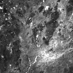
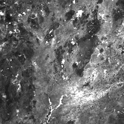
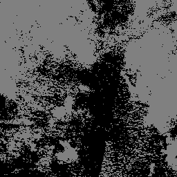
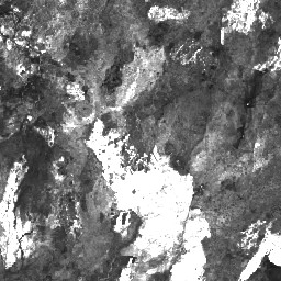
Datasets tagged fire in Earth Engine
Оптимизируйте свои подборки
Сохраняйте и классифицируйте контент в соответствии со своими настройками.
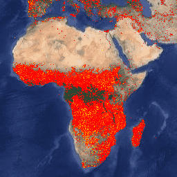
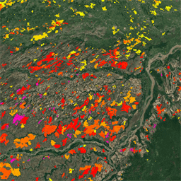
ФИРМЫ: Система управления ресурсами по вопросам пожарной безопасности
Версия набора данных FIRMS (Fire Information for Resource Management System) для Earth Engine содержит продукт обнаружения пожаров LANCE в растровом виде. Обнаружение активных очагов пожаров в режиме, близком к реальному времени (NRT), обрабатывается LANCE с использованием стандартного продукта MODIS MOD14/MYD14 «Пожары и тепловые аномалии». Каждый…
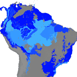
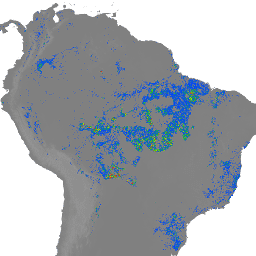
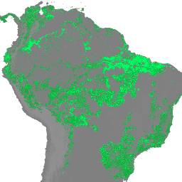
Примечание от WRI: WRI приняла решение прекратить обновление оповещений FORMA. Цель заключалась в упрощении пользовательского интерфейса Global Forest Watch и уменьшении избыточности. Мы обнаружили, что Terra-i и GLAD использовались чаще. Более того, используя GLAD в качестве стандарта, мы обнаружили, что Terra-i превосходит FORMA…
Примечание от WRI: WRI приняла решение прекратить обновление оповещений FORMA. Цель заключалась в упрощении пользовательского интерфейса Global Forest Watch и уменьшении избыточности. Мы обнаружили, что Terra-i и GLAD использовались чаще. Более того, используя GLAD в качестве стандарта, мы обнаружили, что Terra-i превосходит FORMA…
Примечание от WRI: WRI приняла решение прекратить обновление оповещений FORMA. Цель заключалась в упрощении пользовательского интерфейса Global Forest Watch и уменьшении избыточности. Мы обнаружили, что Terra-i и GLAD использовались чаще. Более того, используя GLAD в качестве стандарта, мы обнаружили, что Terra-i превосходит FORMA…
FireCCI51: Пиксельный продукт MODIS Fire_cci для выгоревших областей, версия 5.1
Пиксельный продукт MODIS Fire_cci Burned Area версии 5.1 (FireCCI51) представляет собой ежемесячный глобальный набор данных с пространственным разрешением около 250 м, содержащий информацию о выгоревших территориях, а также вспомогательные данные. Он основан на отражательной способности поверхности в ближнем инфракрасном (ИК) диапазоне, полученной с помощью бортового прибора MODIS…
GOES-16 FDCC Series ABI Level 2 Fire/Hot Spot Characterization CONUS
Продукт Fire (HSC) содержит четыре изображения: одно в виде маски пожара, а три других содержат значения пикселей, определяющие температуру пожара, площадь пожара и мощность излучения пожара. Метаданные маски ABI L2+ FHS присваивают флаг каждому пикселю, полученному с помощью навигации по Земле, который…
Полнодисковая характеристика очагов возгорания/горячих точек серии GOES-16 FDCF с уровнем ABI 2 ABI.
Продукт Fire (HSC) содержит четыре изображения: одно в виде маски пожара, а три других содержат значения пикселей, определяющие температуру пожара, площадь пожара и мощность излучения пожара. Метаданные маски ABI L2+ FHS присваивают флаг каждому пикселю, полученному с помощью навигации по Земле, который…
GOES-17 FDCC Series ABI Level 2 Fire/Hot Spot Characterization CONUS
Продукт Fire (HSC) содержит четыре изображения: одно в виде маски пожара, а три других содержат значения пикселей, определяющие температуру пожара, площадь пожара и мощность излучения пожара. Метаданные маски ABI L2+ FHS присваивают флаг каждому пикселю, полученному с помощью навигации по Земле, который…
Полнодисковая характеристика очагов возгорания/горячих точек серии GOES-17 FDCF с уровнем ABI 2 ABI.
Продукт Fire (HSC) содержит четыре изображения: одно в виде маски пожара, а три других содержат значения пикселей, определяющие температуру пожара, площадь пожара и мощность излучения пожара. Метаданные маски ABI L2+ FHS присваивают флаг каждому пикселю, полученному с помощью навигации по Земле, который…
GOES-18 FDCC Series ABI Level 2 Fire/Hot Spot Characterization CONUS
Продукт Fire (HSC) содержит четыре изображения: одно в виде маски пожара, а три других содержат значения пикселей, определяющие температуру пожара, площадь пожара и мощность излучения пожара. Метаданные маски ABI L2+ FHS присваивают флаг каждому пикселю, полученному с помощью навигации по Земле, который…
Полнодисковая характеристика очагов возгорания/горячих точек серии GOES-18 FDCF с уровнем ABI 2 ABI.
Продукт Fire (HSC) содержит четыре изображения: одно в виде маски пожара, а три других содержат значения пикселей, определяющие температуру пожара, площадь пожара и мощность излучения пожара. Метаданные маски ABI L2+ FHS присваивают флаг каждому пикселю, полученному с помощью навигации по Земле, который…
GOES-19 FDCC Series ABI Level 2 Fire/Hot Spot Characterization CONUS
Спутники GOES — это геостационарные метеорологические спутники, управляемые NOAA. Продукт Fire (HSC) содержит четыре изображения: одно в виде маски пожара, а три других — с пиксельными значениями, определяющими температуру пожара, площадь пожара и мощность излучения пожара. Метаданные ABI L2+ FHS…
Полнодисковая характеристика очагов возгорания/горячих точек серии GOES-19 FDCF с уровнем ABI 2 ABI.
Продукт Fire (HSC) содержит четыре изображения: одно в виде маски пожара, а три других содержат значения пикселей, определяющие температуру пожара, площадь пожара и мощность излучения пожара. Метаданные маски ABI L2+ FHS присваивают флаг каждому пикселю, полученному с помощью навигации по Земле, который…
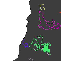
Система обнаружения пожаров GlobFire Daily Fire Event Detection на основе MCD64A1
Границы пожаров определены на основе набора данных MODIS MCD64A1. Данные были рассчитаны с использованием алгоритма, основанного на кодировании в графовой структуре пространственно-временной взаимосвязи между участками выгоревшей территории. Каждому пожару присвоен уникальный номер, идентифицирующий событие.
Система обнаружения пожара GlobFire Final на основе MCD64A1
Границы пожаров определены на основе набора данных MODIS MCD64A1. Данные были рассчитаны с использованием алгоритма, основанного на кодировании в графовой структуре пространственно-временной взаимосвязи между участками выгоревшей территории. Каждому пожару присвоен уникальный номер, идентифицирующий событие.
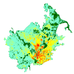
Индекс засухи Китча-Байрама (KBDI) — это непрерывная эталонная шкала для оценки сухости почвенного и подстилочного слоев. Индекс увеличивается с каждым днем без дождя (величина увеличения зависит от суточной максимальной температуры) и уменьшается при дожде. Эта система…
LANDFIRE (LF), Инструменты планирования управления лесными пожарами и ресурсами, — это совместная программа программ управления лесными пожарами Лесной службы Министерства сельского хозяйства США, Геологической службы Министерства внутренних дел США и организации The Nature Conservancy. Слои LANDFIRE (LF) создаются с использованием прогнозных…
LANDFIRE ESP AK (Environmental Site Potential) v1.2.0
LANDFIRE (LF), Инструменты планирования управления лесными пожарами и ресурсами, — это совместная программа программ управления лесными пожарами Лесной службы Министерства сельского хозяйства США, Геологической службы Министерства внутренних дел США и организации The Nature Conservancy. Слои LANDFIRE (LF) создаются с использованием прогнозных…
LANDFIRE ESP CONUS (Environmental Site Potential) v1.2.0
LANDFIRE (LF), Инструменты планирования управления лесными пожарами и ресурсами, — это совместная программа программ управления лесными пожарами Лесной службы Министерства сельского хозяйства США, Геологической службы Министерства внутренних дел США и организации The Nature Conservancy. Слои LANDFIRE (LF) создаются с использованием прогнозных…
LANDFIRE ESP HI (Environmental Site Potential) v1.2.0
LANDFIRE (LF), Инструменты планирования управления лесными пожарами и ресурсами, — это совместная программа программ управления лесными пожарами Лесной службы Министерства сельского хозяйства США, Геологической службы Министерства внутренних дел США и организации The Nature Conservancy. Слои LANDFIRE (LF) создаются с использованием прогнозных…
LANDFIRE (LF), Инструменты планирования управления лесными пожарами и ресурсами, — это совместная программа программ управления лесными пожарами Лесной службы Министерства сельского хозяйства США, Геологической службы Министерства внутренних дел США и организации The Nature Conservancy. Слои LANDFIRE (LF) создаются с использованием прогнозных…
LANDFIRE (LF), Инструменты планирования управления лесными пожарами и ресурсами, — это совместная программа программ управления лесными пожарами Лесной службы Министерства сельского хозяйства США, Геологической службы Министерства внутренних дел США и организации The Nature Conservancy. Слои LANDFIRE (LF) создаются с использованием прогнозных…
LANDFIRE (LF), Инструменты планирования управления лесными пожарами и ресурсами, — это совместная программа программ управления лесными пожарами Лесной службы Министерства сельского хозяйства США, Геологической службы Министерства внутренних дел США и организации The Nature Conservancy. Слои LANDFIRE (LF) создаются с использованием прогнозных…
LANDFIRE (LF), Инструменты планирования управления лесными пожарами и ресурсами, — это совместная программа программ управления лесными пожарами Лесной службы Министерства сельского хозяйства США, Геологической службы Министерства внутренних дел США и организации The Nature Conservancy. Landfire (LF) Исторические режимы пожаров, интервалы и…
LANDFIRE (LF), Инструменты планирования управления лесными пожарами и ресурсами, — это совместная программа программ управления лесными пожарами Лесной службы Министерства сельского хозяйства США, Геологической службы Министерства внутренних дел США и организации The Nature Conservancy. Landfire (LF) Исторические режимы пожаров, интервалы и…
LANDFIRE PLS (Процент пожаров низкой интенсивности) v1.2.0
LANDFIRE (LF), Инструменты планирования управления лесными пожарами и ресурсами, — это совместная программа программ управления лесными пожарами Лесной службы Министерства сельского хозяйства США, Геологической службы Министерства внутренних дел США и организации The Nature Conservancy. Landfire (LF) Исторические режимы пожаров, интервалы и…
LANDFIRE (LF), Инструменты планирования управления лесными пожарами и ресурсами, — это совместная программа программ управления лесными пожарами Лесной службы Министерства сельского хозяйства США, Геологической службы Министерства внутренних дел США и организации The Nature Conservancy. Landfire (LF) Исторические режимы пожаров, интервалы и…
LANDFIRE PRS (Процент восстановления от интенсивности пожара) v1.2.0
LANDFIRE (LF), Инструменты планирования управления лесными пожарами и ресурсами, — это совместная программа программ управления лесными пожарами Лесной службы Министерства сельского хозяйства США, Геологической службы Министерства внутренних дел США и организации The Nature Conservancy. Landfire (LF) Исторические режимы пожаров, интервалы и…
LANDFIRE (LF), Инструменты планирования управления лесными пожарами и ресурсами, — это совместная программа программ управления лесными пожарами Лесной службы Министерства сельского хозяйства США, Геологической службы Министерства внутренних дел США и организации The Nature Conservancy. Landfire (LF) Исторические режимы пожаров, интервалы и…
LANDFIRE VCC (Класс состояния растительности) v1.4.0
LANDFIRE (LF), Инструменты планирования управления лесными пожарами и ресурсами, — это совместная программа программ управления лесными пожарами Лесной службы Министерства сельского хозяйства США, Геологической службы Министерства внутренних дел США и организации The Nature Conservancy. Landfire (LF) Исторические режимы пожаров, интервалы и…
LANDFIRE (LF), Инструменты планирования управления лесными пожарами и ресурсами, — это совместная программа программ управления лесными пожарами Лесной службы Министерства сельского хозяйства США, Геологической службы Министерства внутренних дел США и организации The Nature Conservancy. Landfire (LF) Исторические режимы пожаров, интервалы и…
Landsat Collection 2 Уровень 1 Уровень 2 32-дневный композитный снимок BAI
Эти композитные изображения Landsat Collection 2 Tier 1 Level 2 созданы из ортокорректированных сцен Tier 1 Level 2. Индекс выгорания (BAI) рассчитывается на основе красного и ближнего ИК-диапазонов и измеряет спектральное расстояние каждого пикселя от эталонной спектральной точки (…
Эти композитные изображения Landsat Collection 2 уровня 1 (Level 2) созданы на основе ортокорректированных сцен уровня 1 (Level 2). Индекс нормализованного коэффициента выгорания в тепловом диапазоне (NBRT) рассчитывается на основе ближнего ИК-диапазона, среднего ИК-диапазона (2215 нм) и теплового диапазона и имеет диапазон от -1,0 до 1,0. См.…
Landsat Collection 2 Уровень 1 Уровень 2 8-дневный композитный снимок BAI
Эти композитные изображения Landsat Collection 2 Tier 1 Level 2 созданы из ортокорректированных сцен Tier 1 Level 2. Индекс выгорания (BAI) рассчитывается на основе красного и ближнего ИК-диапазонов и измеряет спектральное расстояние каждого пикселя от эталонной спектральной точки (…
Эти композитные изображения Landsat Collection 2 уровня 1 (Level 2) созданы на основе ортокорректированных сцен уровня 1 (Level 2). Индекс нормализованного коэффициента выгорания в тепловом диапазоне (NBRT) рассчитывается на основе ближнего ИК-диапазона, среднего ИК-диапазона (2215 нм) и теплового диапазона и имеет диапазон от -1,0 до 1,0. См.…
Landsat Collection 2 Уровень 1 Уровень 2 Ежегодный композитный снимок BAI
Эти композитные изображения Landsat Collection 2 Tier 1 Level 2 созданы из ортокорректированных сцен Tier 1 Level 2. Индекс выгорания (BAI) рассчитывается на основе красного и ближнего ИК-диапазонов и измеряет спектральное расстояние каждого пикселя от эталонной спектральной точки (…
Landsat Collection 2 Уровень 1 Уровень 2 Ежегодный композитный снимок NBR
Эти композитные изображения Landsat Collection 2 уровня 1 (Level 2) созданы на основе ортокорректированных сцен уровня 1 (Level 2). Индекс нормализованного коэффициента выгорания в тепловом диапазоне (NBRT) рассчитывается на основе ближнего ИК-диапазона, среднего ИК-диапазона (2215 нм) и теплового диапазона и имеет диапазон от -1,0 до 1,0. См.…
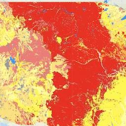
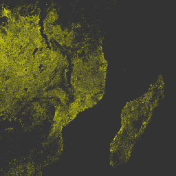
MCD64A1.061 MODIS Площадь выгоревших территорий, ежемесячные данные по всему миру, 500 м
Совместный продукт Terra и Aqua MCD64A1 версии 6.1 «Выгоревшие территории» представляет собой ежемесячный глобальный сетчатый продукт с разрешением 500 м, содержащий информацию о выгоревших территориях и качестве каждого пикселя. В методе картирования выгоревших территорий MCD64A1 используются изображения поверхностного отражения MODIS с разрешением 500 м в сочетании с данными наблюдений за активными пожарами MODIS с разрешением 1 км. Алгоритм…
MOD14A1.061: Терра Термальные аномалии и пожары. Ежедневные глобальные данные (1 км).
Набор данных MOD14A1 V6.1 предоставляет ежедневные композитные изображения зон пожаров с разрешением 1 км, полученные на основе данных MODIS с излучением на длинах волн 4 и 11 микрометров. Стратегия обнаружения пожаров основана на абсолютном обнаружении пожара (когда интенсивность пожара достаточна для обнаружения) и на обнаружении относительно…
MOD14A2.061: Терра Термальные аномалии и пожары, 8-дневный глобальный обзор на 1 км.
Набор данных MOD14A2 V6.1 содержит 8-дневные композитные изображения с маской пожара с разрешением 1 км. Он включает максимальные значения отдельных классов пикселей за период композитинга. Вместе с маской пожара предоставляется также связанный с ней слой информации о качестве. Документация: Руководство пользователя, Теоретические основы алгоритма…
Набор данных о границах выгоревших территорий в рамках проекта «Мониторинг тенденций интенсивности выгорания» (MTBS) содержит полигоны, отображающие границы выгоревших территорий всех завершенных на данный момент пожаров MTBS на территории континентальной части США, Аляски, Гавайев и Пуэрто-Рико. Ниже NBR означает «нормализованный коэффициент выгорания», а dNBR означает…
MYD14A1.061: Аномалии акватермальных источников и пожары. Ежедневные глобальные данные (1 км).
Набор данных MYD14A1 V6.1 предоставляет ежедневные композитные изображения маскировки пожаров с разрешением 1 км, полученные на основе данных MODIS с излучением на длинах волн 4 и 11 микрометров. Стратегия обнаружения пожаров основана на абсолютном обнаружении пожара (когда интенсивность пожара достаточна для обнаружения) и на обнаружении относительно…
MYD14A2.061: Аномалии акватермального излучения и пожары, глобальный диапазон 1 км, 8 дней.
Набор данных MYD14A2 V6.1 содержит 8-дневные композитные изображения с маской пожара с разрешением 1 км. Он включает максимальные значения отдельных классов пикселей за период композитинга. Вместе с маской пожара предоставляется также связанный с ней слой информации о качестве. Документация: Руководство пользователя, Теоретические основы алгоритма…
Мониторинг тенденций изменения степени тяжести ожогов (MTBS) Изображения степени тяжести ожогов
Мозаичные изображения степени выгорания представляют собой тематические растровые изображения классов степени выгорания по классификации MTBS для всех завершенных на данный момент пожаров MTBS на территории континентальной части Соединенных Штатов, Аляски, Гавайев и Пуэрто-Рико. Мозаичные изображения степени выгорания составляются ежегодно штатом США и…
VJ114IMGTDL_NRT Ежедневный растр: VIIRS (NOAA-20) Диапазон 375 м Активный огонь
Продукт обнаружения активных пожаров на спутнике NOAA-20 (JPSS-1) Visible Infrared Imaging Radiometer Suite (VIIRS) основан на данных с номинальным разрешением 375 м. По сравнению с другими спутниковыми продуктами обнаружения пожаров с более низким разрешением (≥ 1 км), улучшенные данные с разрешением 375 м обеспечивают более высокую эффективность при обнаружении пожаров относительно небольшой площади…
VNP14A1.002: Тепловые аномалии/Пожары. Ежедневная глобальная сетка SIN L3 с шагом 1 км.
Ежедневный продукт данных Suomi National Polar-Orbiting Partnership NASA Visible Infrared Imaging Radiometer Suite (VIIRS) Thermal Anomalies/Fire (VNP14A1) Version 1 предоставляет информацию об активных пожарах и других тепловых аномалиях. Продукт данных VNP14A1 представляет собой глобальное композитное изображение пикселей пожаров с разрешением 1 км, обнаруженных на…
Продукт обнаружения активных пожаров Suomi NPP Visible Infrared Imaging Radiometer Suite (VIIRS) основан на данных с номинальным разрешением прибора 375 м. По сравнению с другими спутниковыми продуктами обнаружения пожаров с более низким разрешением (≥ 1 км), улучшенные данные с разрешением 375 м обеспечивают более высокую эффективность при обнаружении пожаров относительно небольшой площади…
VNP64A1.002: Площадь выгоревшей территории, ежемесячный объем, глобальная сетка SIN L4 500 м
Ежедневный продукт данных Suomi National Polar-Orbiting Partnership (Suomi NPP) NASA Visible Infrared Imaging Radiometer Suite (VIIRS) Burned Area (VNP64A1) Version 2 представляет собой глобальный сеточный продукт с разрешением 500 м, содержащий информацию о площади выгоревших участков и качестве каждого пикселя. В методе картирования выгоревших участков VNP64 используется разрешение VIIRS 750 м…
VNP64A1: Площадь выгоревшей территории, ежемесячный объем, глобальная сетка SIN L4 500 м
Ежедневный продукт данных Suomi National Polar-Orbiting Partnership (Suomi NPP) NASA Visible Infrared Imaging Radiometer Suite (VIIRS) Burned Area (VNP64A1) Version 1 представляет собой глобальный сеточный продукт с разрешением 500 м, содержащий информацию о площади выгоревших участков и качестве каждого пикселя. В методе картирования выгоревших участков VNP64 используется разрешение VIIRS 750 м…
Этот набор данных отображает компоненты риска лесных пожаров для всех территорий Соединенных Штатов, которые: 1) охватывают весь ландшафт (т.е. измеримы в каждом пикселе ландшафта); и 2) представляют собой риск на месте – риск в точке, где происходят неблагоприятные последствия для…
[[["Прост для понимания","easyToUnderstand","thumb-up"],["Помог мне решить мою проблему","solvedMyProblem","thumb-up"],["Другое","otherUp","thumb-up"]],[["Отсутствует нужная мне информация","missingTheInformationINeed","thumb-down"],["Слишком сложен/слишком много шагов","tooComplicatedTooManySteps","thumb-down"],["Устарел","outOfDate","thumb-down"],["Проблема с переводом текста","translationIssue","thumb-down"],["Проблемы образцов/кода","samplesCodeIssue","thumb-down"],["Другое","otherDown","thumb-down"]],[],[],[]]