Datasets tagged esa in Earth Engine
Оптимизируйте свои подборки
Сохраняйте и классифицируйте контент в соответствии со своими настройками.
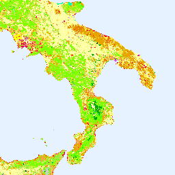
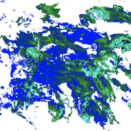
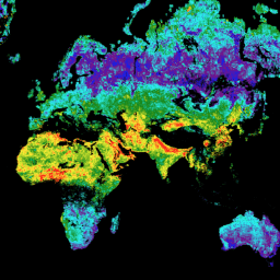
Коперник Коринн Земельный покров
Инвентаризация земельного покрова CORINE (координация информации об окружающей среде) была начата в 1985 году с целью стандартизации сбора данных о земельных ресурсах в Европе для поддержки разработки экологической политики. Проект координируется Европейским агентством по окружающей среде (ЕЭЗ) в рамках ЕС…
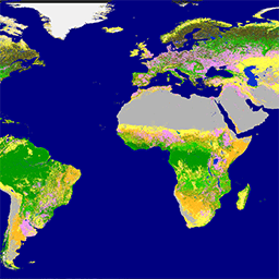
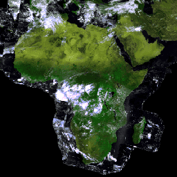
Глобальная служба по изучению земель Copernicus (CGLS) определена как компонент Службы по изучению земель и предназначена для предоставления многоцелевого сервисного компонента, обеспечивающего ряд биогеофизических продуктов о состоянии и эволюции земной поверхности в глобальном масштабе. Динамическая карта земельного покрова на…
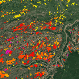
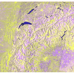
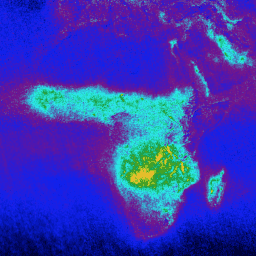
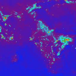
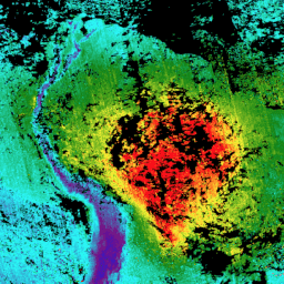
Надземная биомасса ESA CCI за 2007, 2010, 2015-2022 годы (версия 6.0)
Этот набор данных, обновленный до версии 6.0, содержит оценки надземной биомассы лесов за 2007, 2010, 2015, 2016, 2017, 2018, 2019, 2020, 2021 и 2022 годы. Эти оценки получены на основе комбинации данных дистанционного зондирования Земли, в зависимости от года, полученных со спутника Copernicus Sentinel-1…
Пакет продуктов Европейского космического агентства (ESA) WorldCereal 10 m 2021 включает в себя глобальные карты годовых и сезонных урожаев, а также данные об уровне достоверности этих карт. Они были созданы в рамках проекта ESA-WorldCereal. Более подробная информация о содержании этих продуктов и используемой методологии…
Классификационная система WorldCereal Европейского космического агентства (ESA) направлена на определение продукции, произведенной в течение одного месяца после окончания конкретного вегетационного периода. Ввиду динамичного характера этих вегетационных периодов по всему миру, была проведена глобальная стратификация на агроэкологические зоны (АЭЗ) на основе…
Пакет продуктов Европейского космического агентства (ESA) WorldCereal Active Cropland 10 m 2021 содержит глобальные сезонные маркеры активных сельскохозяйственных угодий. Они были созданы в рамках проекта ESA-WorldCereal. Продукты, отображающие активные сельскохозяйственные угодья, показывают, активно ли обрабатывался пиксель, идентифицированный как временный сельскохозяйственный участок…
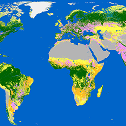
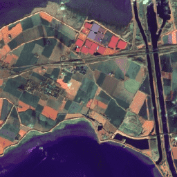
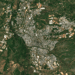
Продукт WorldCover 10 m 2020 Европейского космического агентства (ESA) представляет собой глобальную карту землепользования на 2020 год с разрешением 10 м, основанную на данных Sentinel-1 и Sentinel-2. Продукт WorldCover включает 11 классов землепользования и был создан в рамках…
Продукт WorldCover 10 m 2021 Европейского космического агентства (ESA) представляет собой глобальную карту землепользования на 2021 год с разрешением 10 м, основанную на данных Sentinel-1 и Sentinel-2. Продукт WorldCover включает 11 классов землепользования и был создан в рамках…
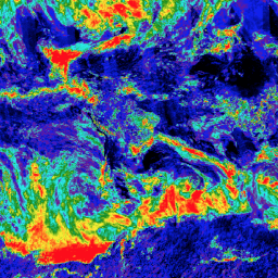
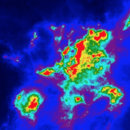
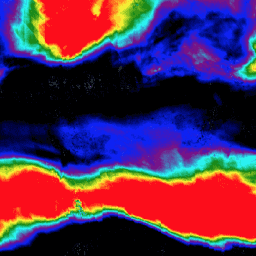
FireCCI51: Пиксельный продукт MODIS Fire_cci для выгоревших областей, версия 5.1
Пиксельный продукт MODIS Fire_cci Burned Area версии 5.1 (FireCCI51) представляет собой ежемесячный глобальный набор данных с пространственным разрешением около 250 м, содержащий информацию о выгоревших территориях, а также вспомогательные данные. Он основан на отражательной способности поверхности в ближнем инфракрасном (ИК) диапазоне, полученной с помощью бортового прибора MODIS…
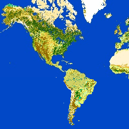
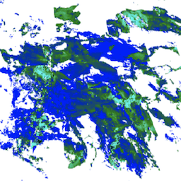
GlobCover 2009 — это глобальная карта растительного покрова, созданная на основе данных уровня 1B спектрометра среднего разрешения (MERIS) спутника ENVISAT, полученных в режиме полного разрешения с пространственным разрешением приблизительно 300 метров.
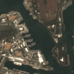
Гармонизированный многоспектральный прибор Sentinel-2 MSI: уровень 1C (TOA)
После 25.01.2022 диапазон значений DN (значения) для снимков Sentinel-2 с параметром PROCESSING_BASELINE '04.00' и выше сдвигается на 1000. Сбор данных HARMONIZED сдвигает данные в более новых снимках таким образом, чтобы они находились в том же диапазоне, что и в более старых снимках. Sentinel-2 — это широкополосная миссия по получению многоспектральных изображений высокого разрешения, поддерживающая программу Copernicus…
Гармонизированный многоспектральный прибор Sentinel-2 MSI: уровень 2A (SR)
После 25.01.2022 диапазон значений DN (значения) для снимков Sentinel-2 с параметром PROCESSING_BASELINE '04.00' и выше сдвигается на 1000. Сбор данных HARMONIZED сдвигает данные в более новых снимках таким образом, чтобы они находились в том же диапазоне, что и в более старых снимках. Sentinel-2 — это широкополосная миссия по получению многоспектральных изображений высокого разрешения, поддерживающая программу Copernicus…
PROBA-V C1 Суточный синтез данных с вершины растительного покрова на расстоянии 100 м
Proba-V — это спутниковая миссия, задача которой — картирование растительного покрова и роста растительности. Она была разработана для обеспечения преемственности с оптическим прибором VGT, использовавшимся в миссиях SPOT-4 и SPOT-5. Датчик собирает данные в трех диапазонах VNIR (видимый и ближний инфракрасный) и одном диапазоне SWIR (коротковолновый…).
PROBA-V C1 Суточный синтез данных с вершины растительного покрова 333 м
Proba-V — это спутниковая миссия, задача которой — картирование растительного покрова и роста растительности. Она была разработана для обеспечения преемственности с оптическим прибором VGT, использовавшимся в миссиях SPOT-4 и SPOT-5. Датчик собирает данные в трех диапазонах VNIR (видимый и ближний инфракрасный) и одном диапазоне SWIR (коротковолновый…).
Sentinel-1 SAR GRD: Обнаружено расстояние до поверхности земли с помощью синтезированной апертурной радиолокации C-диапазона, логарифмическое масштабирование.
Миссия Sentinel-1 предоставляет данные с двухполяризационного радиолокатора с синтезированной апертурой (SAR) C-диапазона на частоте 5,405 ГГц (C-диапазон). Эта коллекция включает в себя снимки S1 Ground Range Detected (GRD), обработанные с помощью Sentinel-1 Toolbox для создания калиброванного ортокорректированного продукта. Коллекция обновляется ежедневно. Новое…
Вероятность образования облаков S2 создается с помощью библиотеки sentinel2-cloud-detector (используя LightGBM). Все полосы дискретизируются с помощью билинейной интерполяции до разрешения 10 м перед применением базового алгоритма градиентного бустинга. Полученная вероятность с плавающей запятой 0–1 масштабируется до 0–100 и сохраняется как UINT8. …
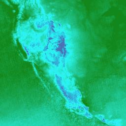
Sentinel-3 OLCI EFR: прибор для наблюдения за цветом океана и суши (Ocean and Land Color Instrument) — изображение Земли в полном разрешении.
Набор данных дистанционного зондирования Земли с полным разрешением (EFR) прибора Ocean and Land Color Instrument (OLCI) содержит данные об уровне излучения на верхней границе атмосферы в 21 спектральном диапазоне с центральными длинами волн от 0,4 мкм до 1,02 мкм, пространственным разрешением 300 м и глобальным охватом примерно каждые 2 дня. OLCI является одним из…
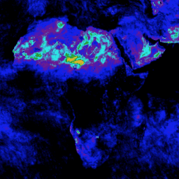
Sentinel-5P NRTI AER AI: Индекс аэрозольного излучения в УФ-диапазоне, измеряемый практически в реальном времени.
NRTI/L3_AER_AI Этот набор данных предоставляет изображения высокого разрешения, полученные практически в реальном времени, индекса УФ-аэрозолей (UVAI), также называемого индексом поглощающих аэрозолей (AAI). Индекс AAI основан на зависящих от длины волны изменениях рэлеевского рассеяния в УФ-спектральном диапазоне для пары длин волн. Разница между наблюдаемыми…
Sentinel-5P NRTI AER LH: Высота слоя УФ-аэрозоля в режиме, близком к реальному времени.
NRTI/L3_AER_LH Этот набор данных предоставляет офлайн-изображения высокого разрешения индекса УФ-аэрозолей (UVAI), также называемого высотой поглощающего слоя (ALH). ALH очень чувствителен к загрязнению облаками. Однако аэрозоли и облака трудно различить, и ALH рассчитывается для всех эффективных значений FRESCO…
Sentinel-5P NRTI CLOUD: Свойства облака в режиме, близком к реальному времени
NRTI/L3_CLOUD Этот набор данных предоставляет изображения параметров облаков с высоким разрешением, полученные практически в реальном времени. Получение свойств облаков с помощью TROPOMI/S5P основано на алгоритмах OCRA и ROCINN, используемых в настоящее время в оперативных продуктах GOME и GOME-2. OCRA определяет долю облачности, используя измерения в УФ/видимом спектральном диапазоне…
Sentinel-5P NRTI CO: Монооксид углерода в режиме, близком к реальному времени.
NRTI/L3_CO Этот набор данных предоставляет изображения высокого разрешения, полученные практически в реальном времени, о концентрации CO. Оксид углерода (CO) является важным атмосферным микроэлементом, необходимым для понимания химии тропосферы. В некоторых городских районах он является основным загрязнителем атмосферы. Основными источниками CO являются сжигание ископаемого топлива, сжигание биомассы и т. д.
Sentinel-5P NRTI HCHO: Определение формальдегида в режиме, близком к реальному времени.
NRTI/L3_HCHO Этот набор данных предоставляет изображения высокого разрешения, полученные практически в режиме реального времени, о концентрации формальдегида (HCHO) в атмосфере. Формальдегид является промежуточным газом почти во всех цепочках окисления неметановых летучих органических соединений (НМЛОС), в конечном итоге приводящих к образованию CO2. Неметановые летучие органические соединения (НМЛОС) — это, наряду с NOx, CO и CH4, …
Sentinel-5P NRTI NO2: Измерение диоксида азота в режиме, близком к реальному времени.
NRTI/L3_NO2 Этот набор данных предоставляет изображения высокого разрешения, полученные практически в реальном времени, с данными о концентрации NO2. Оксиды азота (NO2 и NO) являются важными микроэлементами в атмосфере Земли, присутствующими как в тропосфере, так и в стратосфере. Они попадают в атмосферу в результате антропогенной деятельности (в частности, в результате использования ископаемого топлива…).
Sentinel-5P NRTI O3: Озон в режиме, близком к реальному времени
NRTI/L3_O3 Этот набор данных предоставляет изображения высокого разрешения, полученные практически в реальном времени, о концентрации озона в столбе атмосферы. См. также COPERNICUS/S5P/OFFL/L3_O3_TCL для данных о концентрации озона в тропосфере. В стратосфере озоновый слой защищает биосферу от опасного солнечного ультрафиолетового излучения. В тропосфере он действует как эффективное очищающее средство, но…
Sentinel-5P NRTI SO2: Измерение диоксида серы в режиме, близком к реальному времени.
NRTI/L3_SO2 Этот набор данных предоставляет изображения высокого разрешения, полученные практически в реальном времени, о концентрации диоксида серы (SO2) в атмосфере. Диоксид серы (SO2) попадает в атмосферу Земли как в результате природных, так и антропогенных процессов. Он играет роль в химических процессах на местном и глобальном уровнях, и его воздействие варьируется от краткосрочного…
Sentinel-5P OFFL AER AI: Автономный индекс аэрозольного излучения в УФ-диапазоне
OFFL/L3_AER_AI Этот набор данных предоставляет офлайн-изображения высокого разрешения УФ-аэрозольного индекса (УФАИ), также называемого индексом поглощающих аэрозолей (ААИ). ААИ основан на зависящих от длины волны изменениях рэлеевского рассеяния в УФ-спектральном диапазоне для пары длин волн. Разница между наблюдаемыми и…
Sentinel-5P OFFL AER LH: Высота слоя аэрозоля УФ-излучения в автономном режиме
OFFL/L3_AER_LH Этот набор данных предоставляет офлайн-изображения высокого разрешения индекса УФ-аэрозолей (UVAI), также называемого высотой поглощающего слоя (ALH). ALH очень чувствителен к загрязнению облаками. Однако аэрозоли и облака трудно различить, и ALH рассчитывается для всех эффективных значений FRESCO…
OFFL/L3_CH4 Этот набор данных предоставляет офлайн-изображения высокого разрешения концентрации метана. Метан (CH4) после углекислого газа (CO2) является наиболее важным фактором, способствующим усилению парникового эффекта, вызванного антропогенными факторами. Примерно три четверти выбросов метана имеют антропогенное происхождение, и поэтому важно продолжать сбор данных…
OFFL/L3_CLOUD Этот набор данных предоставляет офлайн-изображения высокого разрешения параметров облаков. Получение свойств облаков с помощью TROPOMI/S5P основано на алгоритмах OCRA и ROCINN, используемых в настоящее время в оперативных продуктах GOME и GOME-2. OCRA определяет долю облачности, используя измерения в УФ/видимом спектральном диапазоне…
Sentinel-5P OFFL CO: Автономный датчик угарного газа
OFFL/L3_CO Этот набор данных предоставляет офлайн-изображения высокого разрешения концентраций CO. Оксид углерода (CO) является важным атмосферным микроэлементом, необходимым для понимания химии тропосферы. В некоторых городских районах он является основным загрязнителем атмосферы. Основными источниками CO являются сжигание ископаемого топлива, сжигание биомассы и…
OFFL/L3_HCHO Этот набор данных предоставляет офлайн-изображения высокого разрешения концентраций формальдегида (HCHO) в атмосфере. Формальдегид является промежуточным газом почти во всех цепочках окисления неметановых летучих органических соединений (НМЛОС), в конечном итоге приводящих к образованию CO2. Неметановые летучие органические соединения (НМЛОС) наряду с NOx, CO и CH4 относятся к…
OFFL/L3_NO2 Этот набор данных предоставляет офлайн-изображения высокого разрешения концентраций NO2. Оксиды азота (NO2 и NO) являются важными микроэлементами в атмосфере Земли, присутствующими как в тропосфере, так и в стратосфере. Они попадают в атмосферу в результате антропогенной деятельности (в частности, сжигания ископаемого топлива…).
OFFL/L3_O3_TCL Этот набор данных предоставляет офлайн-изображения высокого разрешения тропосферы с концентрацией озона между 20°N и 20°S. См. также COPERNICUS/S5P/OFFL/L3_O3 и COPERNICUS/S5P/NRTI/L3_O3 для данных о суммарной концентрации озона в атмосфере. В стратосфере озоновый слой защищает биосферу от опасного солнечного ультрафиолетового излучения. В тропосфере он действует как…
OFFL/L3_O3 Этот набор данных предоставляет офлайн-изображения высокого разрешения общей концентрации озона в столбе атмосферы. См. также COPERNICUS/S5P/OFFL/L3_O3_TCL для данных о концентрации озона в тропосфере. В стратосфере озоновый слой защищает биосферу от опасного солнечного ультрафиолетового излучения. В тропосфере он действует как эффективное очищающее средство, но…
Sentinel-5P OFFL SO2: Диоксид серы в автономном режиме
OFFL/L3_SO2 Этот набор данных предоставляет офлайн-изображения высокого разрешения концентрации диоксида серы (SO2) в атмосфере. Диоксид серы (SO2) попадает в атмосферу Земли как в результате природных, так и антропогенных процессов. Он играет роль в химических процессах на местном и глобальном уровнях, и его воздействие варьируется от краткосрочного загрязнения…
[[["Прост для понимания","easyToUnderstand","thumb-up"],["Помог мне решить мою проблему","solvedMyProblem","thumb-up"],["Другое","otherUp","thumb-up"]],[["Отсутствует нужная мне информация","missingTheInformationINeed","thumb-down"],["Слишком сложен/слишком много шагов","tooComplicatedTooManySteps","thumb-down"],["Устарел","outOfDate","thumb-down"],["Проблема с переводом текста","translationIssue","thumb-down"],["Проблемы образцов/кода","samplesCodeIssue","thumb-down"],["Другое","otherDown","thumb-down"]],[],[],["The content describes numerous datasets, primarily from the Copernicus and ESA initiatives, focusing on Earth observation. Key actions include providing land cover inventories, global land surface monitoring, and high-resolution multi-spectral imaging. Datasets also offer cloud probability data, radar data, and near real-time monitoring of atmospheric parameters like aerosols, carbon monoxide, nitrogen dioxide, and ozone. Additionally, there are data products related to agriculture, active cropland, and burned areas. These data provide both offline and real time information.\n"]]