Климат и погода
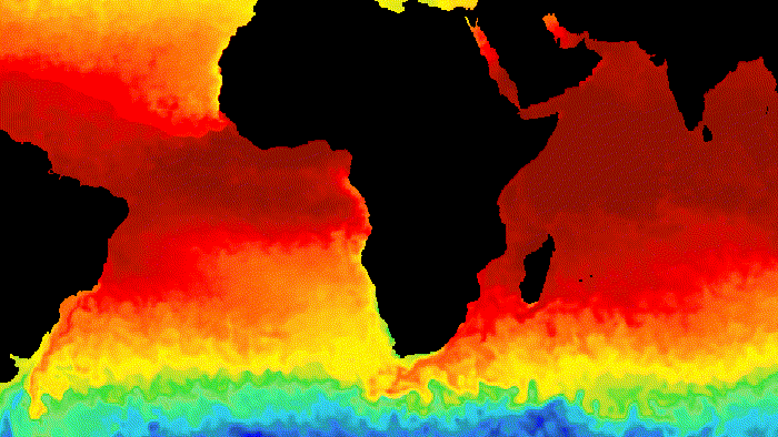
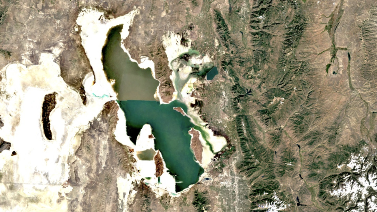
Температура поверхности
Тепловые спутниковые датчики могут предоставить информацию о температуре поверхности и излучательной способности. Каталог данных Earth Engine включает в себя продукты о температуре поверхности суши и моря, полученные от нескольких датчиков космических аппаратов, включая MODIS, ASTER и AVHRR, в дополнение к необработанным тепловым данным Landsat.
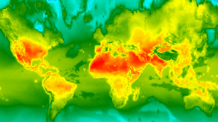
Климат
Климатические модели позволяют генерировать как долгосрочные прогнозы климата, так и исторические интерполяции приземных переменных. Каталог Earth Engine включает исторические данные реанализа из NCEP/NCAR, наборы метеорологических данных с координатной сеткой, такие как NLDAS-2 и GridMET, а также результаты климатических моделей, такие как MACAv2-METDATA Университета Айдахо и уменьшенные климатические прогнозы NASA Earth Exchange.
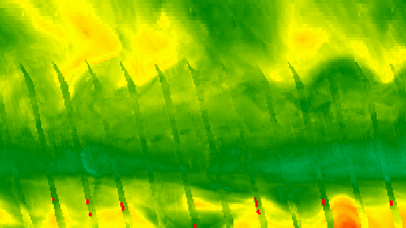
Атмосферный
Вы можете использовать данные об атмосфере, чтобы корректировать данные изображений, полученные от других датчиков, или изучать их самостоятельно. Каталог Earth Engine включает в себя наборы атмосферных данных, такие как данные об озоне от инструментов НАСА TOMS и OMI, а также ежемесячный сеточный атмосферный продукт MODIS.
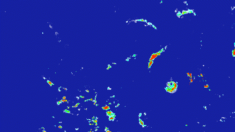
Погода
Наборы метеорологических данных описывают прогнозируемые и измеренные условия за короткие периоды времени, включая осадки, температуру, влажность, ветер и другие переменные. Earth Engine включает в себя прогнозные данные из Глобальной системы прогнозирования NOAA (GFS) и Системы климатического прогнозирования NCEP (CFSv2), а также данные датчиков из таких источников, как Миссия по измерению тропических осадков (TRMM).
Образы
Ландсат
Landsat, совместная программа Геологической службы США и НАСА, непрерывно наблюдает за Землей с 1972 года по сегодняшний день. Сегодня спутники Landsat фотографируют всю поверхность Земли с разрешением 30 метров примерно раз в две недели, включая мультиспектральные и тепловые данные.
Страж
Программа «Коперник» — амбициозная инициатива, возглавляемая Европейской комиссией в партнерстве с Европейским космическим агентством (ЕКА). Sentinels включает всепогодные радиолокационные изображения с Sentinel-1A и -1B, оптические изображения высокого разрешения с Sentinel 2A и 2B, а также данные об океане и суше, подходящие для мониторинга окружающей среды и климата с Sentinel 3.
МОДИС
Датчики спектрорадиометра среднего разрешения (MODIS) на спутниках НАСА Terra и Aqua ежедневно собирают изображения Земли с 1999 года, включая ежедневные изображения, 16-дневную отражательную способность поверхности с поправкой на BRDF и производные продукты, такие как индексы растительности и снежный покров.
Изображения высокого разрешения
Изображения высокого разрешения передают мельчайшие детали пейзажей и городской среды. Национальная программа изображений сельского хозяйства США (NAIP) предлагает данные аэрофотоснимков США с разрешением в один метр, включая почти полное покрытие каждые несколько лет, начиная с 2003 года.
геофизический
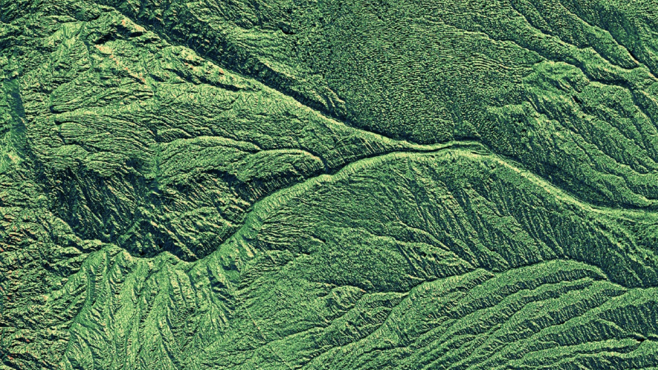
Местность
Цифровые модели рельефа (DEM) описывают форму рельефа Земли. Каталог данных Earth Engine содержит несколько глобальных ЦМР, таких как данные Shuttle Radar Topography Mission (SRTM) с разрешением 30 метров, региональные ЦМР с более высоким разрешением, а также производные продукты, такие как гидрологическая база данных HydroSHEDS WWF.
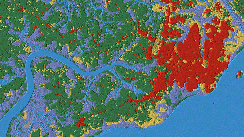
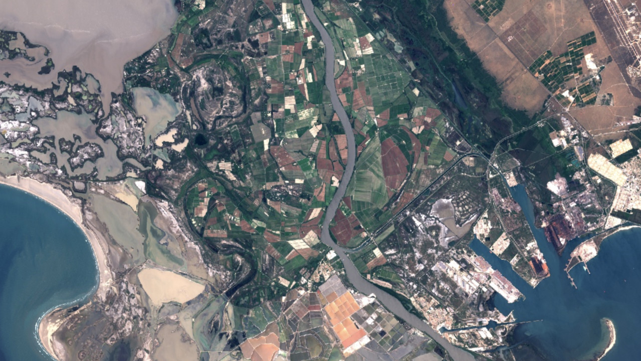
Земельный покров
Карты земного покрова описывают физический ландшафт с точки зрения классов земного покрова, таких как лес, луга и вода. Earth Engine включает в себя широкий спектр наборов данных о земном покрове: от Dynamic World, работающего практически в реальном времени, до глобальных продуктов, таких как ESA World Cover.
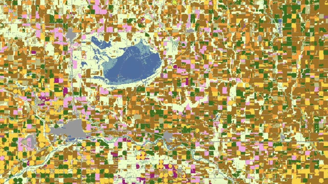
Сельское хозяйство
Данные о сельском хозяйстве являются ключом к пониманию глобального потребления воды и производства продуктов питания. Earth Engine включает в себя ряд продуктов сельскохозяйственных данных, таких как уровни данных о пахотных землях NASS Министерства сельского хозяйства США, а также слои из данных анализа поддержки глобальной продовольственной безопасности (GFSAD), включая площадь пахотных земель, преобладание сельскохозяйственных культур и источники полива.
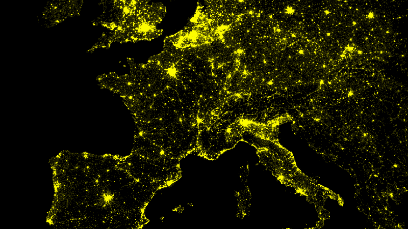
Другие геофизические данные
Данные от других датчиков спутниковых изображений также доступны в Earth Engine, включая ночные изображения из оперативной системы линейного сканирования оборонной метеорологической спутниковой программы (DMSP-OLS), которая с 1992 года непрерывно собирает изображения ночных огней с разрешением примерно 1 километр.