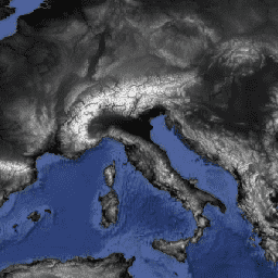
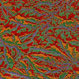
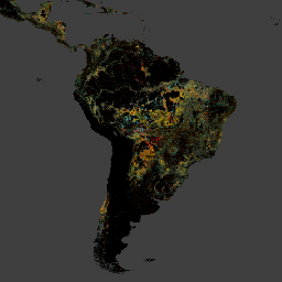
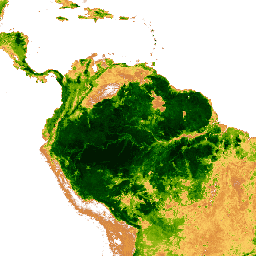
Datasets tagged geophysical in Earth Engine
Оптимизируйте свои подборки
Сохраняйте и классифицируйте контент в соответствии со своими настройками.
AG100: Глобальный набор данных по излучательной способности ASTER, 100 метров, V003
База данных глобальной излучательной способности усовершенствованного космического теплового эмиссионного и отражательного радиометра (ASTER-GED) была разработана Лабораторией реактивного движения (JPL) Национального управления по аэронавтике и исследованию космического пространства (НАСА) при Калифорнийском технологическом институте. Этот продукт включает среднюю излучательную способность и стандартное отклонение для всех 5 тепловых инфракрасных измерений ASTER…
AHN Нидерланды, цифровая модель рельефа 0,5 м, интерполированная.
Цифровая модель рельефа AHN (DEM) — это модель рельефа с разрешением 0,5 м, охватывающая территорию Нидерландов. Она была создана на основе данных LIDAR, полученных весной 2007-2012 годов. Модель содержит данные об уровне земли, из которых удалены все остальные объекты над землей (такие как здания, мосты, деревья и т. д.). Эта версия…
AHN Нидерланды, цифровая модель рельефа 0,5 м, без интерполяции
Цифровая модель рельефа AHN (DEM) — это модель рельефа с разрешением 0,5 м, охватывающая территорию Нидерландов. Она была создана на основе данных LIDAR, полученных весной 2007-2012 годов. Модель содержит данные об уровне земли, из которых удалены все остальные объекты над землей (такие как здания, мосты, деревья и т. д.). Эта версия…
AHN Нидерланды, цифровая модель рельефа 0,5 м, необработанные образцы.
Цифровая модель рельефа AHN (цифровая модель рельефа) — это модель рельефа с разрешением 0,5 м, охватывающая территорию Нидерландов. Она была создана на основе данных LIDAR, полученных весной 2007-2012 годов. Эта версия содержит как данные с уровня земли, так и данные об объектах, расположенных выше уровня земли (таких как здания, мосты, деревья и т. д.). Облако точек…
Actueel Hoogtebestand Nederland (AHN) — это набор данных с подробными и точными данными о высоте местности на всей территории Нидерландов. Информация о высоте была собрана с вертолетов и самолетов с использованием лазерной технологии с вертикальной точностью 5 см. Набор данных AHN3 содержит цифровую модель рельефа Нидерландов AHN с разрешением 0,5 м…
Actueel Hoogtebestand Nederland (AHN) — это набор данных с подробными и точными данными о высоте местности на всей территории Нидерландов. Информация о высоте была собрана с вертолетов и самолетов с использованием лазерной технологии с вертикальной точностью 5 см. Набор данных AHN4 содержит цифровую модель рельефа Нидерландов AHN с разрешением 0,5 м…
ALOS World 3D - 30m (AW3D30) — это глобальный набор данных цифровой модели поверхности (ЦМП) с горизонтальным разрешением приблизительно 30 метров (сетка 1 угловая секунда). Набор данных основан на наборе данных ЦМП (версия с сеткой 5 метров) World 3D Topographic Data. Более подробная информация…
ArcticDEM — это государственно-частная инициатива Национального агентства геопространственной разведки (NGA) и Национального научного фонда (NSF), направленная на автоматическое создание высококачественной цифровой модели поверхности (ЦМП) Арктики с использованием оптических стереоизображений, высокопроизводительных вычислений и программного обеспечения для фотограмметрии с открытым исходным кодом. Модель включает растительность, древесный покров, здания и…
ArcticDEM — это государственно-частная инициатива Национального агентства геопространственной разведки (NGA) и Национального научного фонда (NSF), направленная на автоматическое создание высококачественной цифровой модели поверхности (ЦМП) Арктики с использованием оптических стереоизображений, высокопроизводительных вычислений и программного обеспечения для фотограмметрии с открытым исходным кодом. Модель включает растительность, древесный покров, здания и…
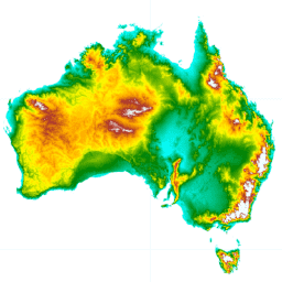
Цифровая модель рельефа (ЦМР) Австралии с шагом 5 метров, полученная на основе модели LiDAR, представляет собой национальную ЦМР с шагом 5 метров (без учета рельефа местности), созданную на основе 236 отдельных съемок LiDAR, проведенных в период с 2001 по 2015 год и охватывающих территорию площадью более 245 000 квадратных километров.
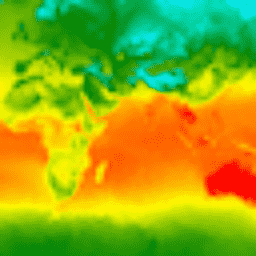
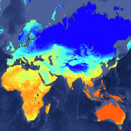
CFSR: Реанализ системы климатического прогнозирования
Система реанализа климатических прогнозов Национальных центров прогнозирования окружающей среды (NCEP) (CFSR) была разработана и реализована как глобальная, высокоразрешенная, взаимосвязанная система атмосфера-океан-суша-морской лед, призванная обеспечить наилучшую оценку состояния этих взаимосвязанных областей за 32-летний период наблюдений, начиная с января…
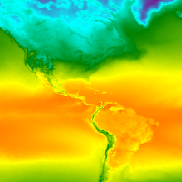
CFSV2: Система климатического прогнозирования NCEP, версия 2, гармонизированные 6-часовые продукты.
Система климатического прогнозирования (CFS) Национальных центров прогнозирования окружающей среды (NCEP) представляет собой полностью взаимосвязанную модель, описывающую взаимодействие между атмосферой Земли, океанами, сушей и морским льдом. Система CFS была разработана в Центре экологического моделирования (EMC) NCEP. Операционная версия системы CFS была модернизирована до…
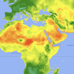
Ежедневные данные об осадках CHIRPS в режиме, близком к реальному времени: инфракрасные данные об осадках Центра климатических опасностей с использованием данных станций (версия 3.0, на основе IMERG)
Данные CHIRPS v3 (Climate Hazards Center Infrared Precipitation with Stations) представляют собой квазиглобальный набор данных об осадках с высоким разрешением, охватывающий более 40 лет. Он включает в себя данные с 60°N по 60°S и все долготы, начиная с 1981 года и до настоящего времени. CHIRPS v3 сочетает в себе спутниковые оценки количества осадков в тепловом инфракрасном диапазоне с данными наземных станций…
Ежедневный реанализ осадков CHIRPS: инфракрасные данные об осадках Центра климатических опасностей с учетом данных станций (версия 3.0, на основе ERA5)
Данные CHIRPS v3 (Climate Hazards Center Infrared Precipitation with Stations) представляют собой квазиглобальный набор данных об осадках с высоким разрешением, охватывающий более 40 лет. Он включает в себя данные с 60°N по 60°S и все долготы, начиная с 1981 года и до настоящего времени. CHIRPS v3 сочетает в себе спутниковые оценки количества осадков в тепловом инфракрасном диапазоне с данными наземных станций…
Ежедневные данные об осадках CHIRPS: инфракрасные данные об осадках Центра климатических опасностей с учетом данных станций (версия 2.0 Final)
Данные CHIRPS (Climate Hazards Center InfraRed Precipitation with Station data) представляют собой квазиглобальный набор данных об осадках за более чем 30 лет. CHIRPS объединяет спутниковые снимки с разрешением 0,05° с данными наземных станций для создания сеточных временных рядов осадков для анализа тенденций и мониторинга сезонных засух.
CHIRPS Precipitation Pentad: Данные о количестве осадков в инфракрасном диапазоне, полученные Центром изучения климатических опасностей, с учетом данных станций (версия 2.0 Final)
Данные CHIRPS (Climate Hazards Center InfraRed Precipitation with Station data) представляют собой квазиглобальный набор данных об осадках за более чем 30 лет. CHIRPS объединяет спутниковые снимки с разрешением 0,05° с данными наземных станций для создания сеточных временных рядов осадков для анализа тенденций и мониторинга сезонных засух.
CHIRPS Precipitation Pentad: Данные о количестве осадков в инфракрасном диапазоне от Центра климатических опасностей с учетом метеостанций (версия 3.0)
Данные CHIRPS v3 (Climate Hazards Center Infrared Precipitation with Stations) представляют собой квазиглобальный набор данных об осадках с высоким разрешением, охватывающий более 40 лет. Он включает в себя данные с 60°N по 60°S и все долготы, начиная с 1981 года и до настоящего времени. CHIRPS v3 сочетает в себе спутниковые оценки количества осадков в тепловом инфракрасном диапазоне с данными наземных станций…
Ежедневные данные о температуре CHIRTS: Инфракрасные данные о температуре от станций мониторинга. Центр климатических опасностей.
Ежедневные данные о температуре, полученные с помощью инфракрасного датчика температуры на станциях (CHIRTS-daily; Verdin et al. 2020) Центра по изучению климатических опасностей, представляют собой квазиглобальный набор данных с высоким разрешением (0,05° × 0,05°, 60°S - 70°N), который предоставляет ежедневные минимальные (Tmin) и максимальные температуры на высоте 2 метра (Tmax), а также четыре производные переменные: насыщенный пар…
Канадская цифровая модель рельефа (CDEM) является частью системы альтиметрии Министерства природных ресурсов Канады (NRCan) и основана на существующих канадских цифровых данных о рельефе (CDED). В этих данных высоты могут быть как наземными, так и отражающими поверхностными высотами. CDEM состоит из нескольких цифровых моделей рельефа с…
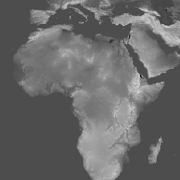
Copernicus DEM GLO-30: Глобальная цифровая модель рельефа с разрешением 30 м.
Цифровая модель поверхности Земли (ЦМР) Copernicus представляет собой изображение поверхности Земли, включая здания, инфраструктуру и растительность. Эта ЦМР получена из отредактированной ЦМР под названием WorldDEM™, то есть в нее включены выравнивание водных объектов и равномерное течение рек. Редактирование…
DEM-H: Австралийская цифровая модель рельефа, созданная с учетом гидрологических требований (SRTM).
Цифровая модель рельефа с учетом гидрологических условий (DEM-H) была создана на основе данных SRTM, полученных НАСА в феврале 2000 года. Модель была оптимизирована с учетом гидрологических условий и дренажа. DEM-H фиксирует пути течения на основе высот SRTM и нанесенных на карту линий водотоков, а также поддерживает определение…
DEM-S: Австралийская сглаженная цифровая модель рельефа
Сглаженная цифровая модель рельефа (DEM-S) была получена на основе данных SRTM, собранных НАСА в феврале 2000 года. DEM-S представляет собой топографию поверхности земли (за исключением растительности) и была сглажена для уменьшения шума и улучшения отображения формы поверхности. Для этого был применен адаптивный процесс…
Daymet V4: Ежедневные сводки погоды и климатологические данные о состоянии поверхности Земли.
Daymet V4 предоставляет сеточные оценки ежедневных параметров погоды для континентальной Северной Америки, Гавайев и Пуэрто-Рико (данные по Пуэрто-Рико доступны начиная с 1950 года). Они основаны на данных отдельных метеорологических станций и различных вспомогательных источниках данных. По сравнению с предыдущей версией, Daymet…
Динамическая оценка площади поверхностных вод по данным гармонизированного спутника Landsat Sentinel-2 (DSWx-HLS) V1
Этот набор данных содержит динамический продукт OPERA уровня 3, версия 1, демонстрирующий площадь поверхностных вод. Данные представляют собой проверенные наблюдения за площадью поверхностных вод, начиная с апреля 2023 года. Известные проблемы и ограничения по использованию описаны в документации к продукту. Входным набором данных для генерации каждого продукта является гармонизированный…
Динамическая оценка площади поверхностных вод по данным спутника Sentinel-1 (DSWx-S1) V1
Этот набор данных содержит динамические данные OPERA уровня 3 по площади поверхностных вод со спутника Sentinel-1 (DSWX-S1). DSWx-S1 обеспечивает практически глобальное географическое картирование площади поверхностных вод над сушей с пространственным разрешением 30 метров в соответствии с системой координат военной сетки (MGRS) с частотой повторного облета в период между…
ETOPO1: Глобальная угловая высота 1 угловая минута
ETOPO1 — это глобальная модель рельефа земной поверхности с разрешением 1 угловая минута, которая объединяет топографию суши и батиметрию океана. Она была построена на основе многочисленных глобальных и региональных наборов данных. Она содержит два диапазона высот: поверхность льда и коренная порода.
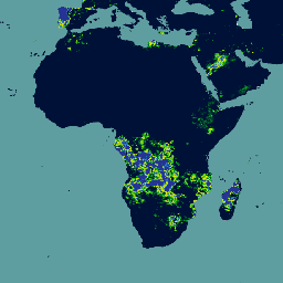
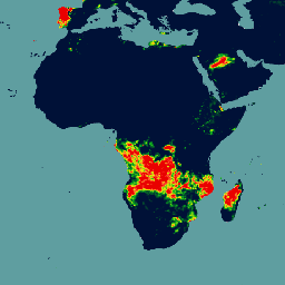
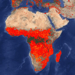
ФИРМЫ: Система управления ресурсами по вопросам пожарной безопасности
Версия набора данных FIRMS (Fire Information for Resource Management System) для Earth Engine содержит продукт обнаружения пожаров LANCE в растровом виде. Обнаружение активных очагов пожаров в режиме, близком к реальному времени (NRT), обрабатывается LANCE с использованием стандартного продукта MODIS MOD14/MYD14 «Пожары и тепловые аномалии». Каждый…
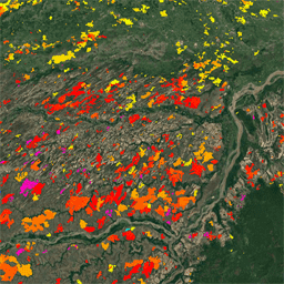
FireCCI51: Пиксельный продукт MODIS Fire_cci для выгоревших областей, версия 5.1
Пиксельный продукт MODIS Fire_cci Burned Area версии 5.1 (FireCCI51) представляет собой ежемесячный глобальный набор данных с пространственным разрешением около 250 м, содержащий информацию о выгоревших территориях, а также вспомогательные данные. Он основан на отражательной способности поверхности в ближнем инфракрасном (ИК) диапазоне, полученной с помощью бортового прибора MODIS…
GFS: Глобальная система прогнозирования атмосферных условий, прогнозируемые на 384 часа.
Глобальная система прогнозирования (GFS) — это модель прогнозирования погоды, разработанная Национальными центрами прогнозирования окружающей среды (NCEP). Набор данных GFS состоит из выбранных выходных данных модели (описанных ниже) в виде сеточных переменных прогноза. Прогнозы на 384 часа, с интервалами в 1 час (до 120 часов) и 3 часа (после…
GLDAS-2.1: Глобальная система ассимиляции данных о суше
Система глобальной ассимиляции данных о суше НАСА, версия 2 (GLDAS-2), состоит из трех компонентов: GLDAS-2.0, GLDAS-2.1 и GLDAS-2.2. GLDAS-2.0 полностью использует входные данные метеорологического воздействия Принстонского университета и предоставляет согласованный по времени ряд данных с 1948 по 2014 год. GLDAS-2.1 использует комбинацию модельных данных…
GLDAS-2.2: Глобальная система ассимиляции данных о суше
Система глобальной ассимиляции данных о суше НАСА, версия 2 (GLDAS-2), состоит из трех компонентов: GLDAS-2.0, GLDAS-2.1 и GLDAS-2.2. GLDAS-2.0 полностью использует входные данные метеорологического воздействия Принстонского университета и предоставляет согласованный по времени ряд данных с 1948 по 2014 год. GLDAS-2.1 использует комбинацию модельных данных…
GMTED2010: Глобальные многоуровневые данные о высоте местности 2010 года
Глобальный многоразрешенный набор данных о высоте рельефа 2010 года (GMTED2010) содержит данные о высоте земного шара, собранные из различных источников с разрешением 7,5 угловых секунд. Более подробная информация доступна в отчете по набору данных. Основным источником данных для GMTED2010 являются цифровые данные о высоте рельефа SRTM (DTED®) Национального агентства геофизики (NGA).
GPM: Глобальная система измерения осадков (GPM), выпуск 07
Глобальная система измерения осадков (GPM) — это международная спутниковая миссия, призванная каждые три часа предоставлять данные нового поколения о дожде и снеге по всему миру. Интегрированный алгоритм IMERG (Integrated Multi-satellitE Retrievals for GPM) — это унифицированный алгоритм, который позволяет оценивать количество осадков, объединяя данные со всех пассивных микроволновых приборов, входящих в состав GPM…
GPM: Ежемесячные глобальные измерения осадков (GPM), версия 6
Выпуск финальной версии IMERG "06" был прекращен в сентябре 2021 года. Выпуск версии "07" ожидается в сентябре 2022 года. Глобальная система измерения осадков (GPM) — это международная спутниковая миссия, предоставляющая данные наблюдений за осадками и снегом нового поколения по всему миру каждые три часа. Интегрированные многоспутниковые данные для…
GPM: Ежемесячные глобальные измерения осадков (GPM), версия 07
Глобальная система измерения осадков (GPM) — это международная спутниковая миссия, призванная каждые три часа предоставлять данные нового поколения о дожде и снеге по всему миру. Интегрированный алгоритм IMERG (Integrated Multi-satellitE Retrievals for GPM) — это унифицированный алгоритм, который позволяет оценивать количество осадков, объединяя данные со всех пассивных микроволновых приборов, входящих в состав GPM…
GRIDMET ЗАСУХА: Индексы засухи на территории континентальной части США
Этот набор данных содержит индексы засухи, полученные на основе ежедневных метеорологических данных GRIDMET с разрешением 4 км. Представленные индексы засухи включают стандартизированный индекс осадков (SPI), индекс испарительной засухи (EDDI), стандартизированный индекс осадков и испарения (SPEI), индекс засушливости Палмера (PDSI) и индекс Палмера…
GSMaP Operational: Глобальное спутниковое картирование осадков - V6
Глобальное спутниковое картирование осадков (GSMaP) предоставляет глобальные почасовые данные об интенсивности осадков с разрешением 0,1 x 0,1 градуса. GSMaP — это продукт миссии Global Precipitation Measurement (GPM), которая предоставляет глобальные данные об осадках с трехчасовыми интервалами. Значения оцениваются с использованием многодиапазонных пассивных…
GSMaP Operational: Глобальное спутниковое картирование осадков - V7
Глобальное спутниковое картирование осадков (GSMaP) предоставляет глобальные почасовые данные об интенсивности осадков с разрешением 0,1 x 0,1 градуса. GSMaP — это продукт миссии Global Precipitation Measurement (GPM), которая предоставляет глобальные данные об осадках с трехчасовыми интервалами. Значения оцениваются с использованием многодиапазонных пассивных…
GSMaP Operational: Глобальное спутниковое картирование осадков - V8
Глобальное спутниковое картирование осадков (GSMaP) предоставляет глобальные почасовые данные об интенсивности осадков с разрешением 0,1 x 0,1 градуса. GSMaP — это продукт миссии Global Precipitation Measurement (GPM), которая предоставляет глобальные данные об осадках с трехчасовыми интервалами. Значения оцениваются с использованием многодиапазонных пассивных…
Реанализ GSMaP: Глобальное спутниковое картирование осадков
Глобальное спутниковое картирование осадков (GSMaP) предоставляет глобальные почасовые данные об интенсивности осадков с разрешением 0,1 x 0,1 градуса. GSMaP — это продукт миссии Global Precipitation Measurement (GPM), которая предоставляет глобальные данные об осадках с трехчасовыми интервалами. Значения оцениваются с использованием многодиапазонных пассивных…
GTOPO30: Глобальная топографическая карта с шагом 30 угловых секунд.
GTOPO30 — это глобальная цифровая модель рельефа (ЦМР) с горизонтальным шагом сетки 30 угловых секунд (приблизительно 1 километр). ЦМР была получена из нескольких растровых и векторных источников топографической информации. Разработка GTOPO30, завершенная в конце 1996 года, заняла три года…
Глобальный индекс тепловой и солнечной нагрузки ALOS CHILI (непрерывный индекс)
CHILI — это модель, заменяющая влияние инсоляции и топографического затенения на эвапотранспирацию, которая рассчитывается путем вычисления инсоляции в начале дня, на высоте солнца, эквивалентной равноденствию. Она основана на 30-метровом диапазоне «AVE» цифровой модели рельефа ALOS JAXA (доступна в Европе как JAXA/ALOS/AW3D30_V1_1). Conservation Science…
Набор данных ALOS Landform содержит классы форм рельефа, созданные путем объединения данных непрерывного индекса тепловой и инсоляционной нагрузки (ALOS CHILI) и многомасштабного топографического индекса положения (ALOS mTPI). Он основан на 30-метровом диапазоне «AVE» цифровой модели рельефа ALOS JAXA (доступна в Европе как JAXA/ALOS/AW3D30_V1_1). Консервация…
Топографическое разнообразие (D) — это косвенная переменная, отражающая разнообразие температурных и влажностных условий, доступных видам в качестве локальных местообитаний. Она выражает логику, согласно которой большее разнообразие топографических и климатических ниш должно поддерживать большее разнообразие (особенно растений) и способствовать выживанию видов при заданных климатических условиях…
Глобальный индекс топографического положения ALOS mTPI (Multi-Scale Topographic Position Index)
Индекс mTPI различает хребты и долины. Он рассчитывается с использованием данных о высоте для каждого местоположения, из которых вычитается средняя высота в пределах района. В индексе mTPI используются скользящие окна радиусом (км): 115,8, 89,9, 35,5, 13,1, 5,6, 2,8 и 1,2. Он основан на 30-метровом…
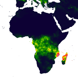
Этот набор данных представляет собой глобальную высоту деревьев, основанную на объединении данных космического лидара (2005 г.) из системы геофизического лазерного высотомера (GLAS) и вспомогательных геопространственных данных. Подробности см. в работе Simard et al. (2011).
Глобальный индекс тепловой и солнечной нагрузки SRTM CHILI (непрерывный).
CHILI — это модель, заменяющая влияние инсоляции и топографического затенения на эвапотранспирацию, которая рассчитывается путем вычисления инсоляции в начале дня, при высоте солнца, эквивалентной равноденствию. Она основана на цифровой модели рельефа SRTM с разрешением 30 м (доступна в Европе как USGS/SRTMGL1_003). Программа Conservation Science Partners (CSP) Ecologically Relevant…
Набор данных SRTM Landform содержит классы форм рельефа, созданные путем объединения данных непрерывного индекса тепловой и инсоляционной нагрузки (SRTM CHILI) и многомасштабного топографического индекса положения (SRTM mTPI). Он основан на цифровой модели рельефа SRTM с разрешением 30 м (доступна в Европе как USGS/SRTMGL1_003). Программа Conservation Science Partners (CSP) Ecologically…
Топографическое разнообразие (D) — это косвенная переменная, отражающая разнообразие температурных и влажностных условий, доступных видам в качестве локальных местообитаний. Она выражает логику, согласно которой большее разнообразие топографических и климатических ниш должно поддерживать большее разнообразие (особенно растений) и способствовать выживанию видов при заданных климатических условиях…
Глобальный SRTM mTPI (многомасштабный топографический индекс положения)
Индекс mTPI различает хребты и долины. Он рассчитывается с использованием данных о высоте для каждого местоположения, из которых вычитается средняя высота в пределах района. В индексе mTPI используются скользящие окна радиусом (км): 115,8, 89,9, 35,5, 13,1, 5,6, 2,8 и 1,2. Он основан на 30-метровом…
Результаты анализа временных рядов изображений Landsat для характеристики глобального распространения и изменений лесов. «Первый» и «последний» диапазоны представляют собой эталонные мультиспектральные изображения за первый и последний доступные годы для спектральных диапазонов Landsat, соответствующих красному, ближнему инфракрасному (NIR), коротковолновому инфракрасному (SWIR1) и коротковолновому инфракрасному (SWIR2) диапазонам. Эталонное композитное изображение представляет собой…
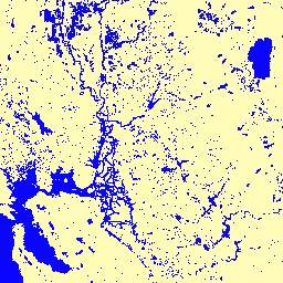
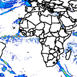
Глобальные слои картирования поверхностных вод JRC, версия 1.2 [устарело]
Этот набор данных содержит карты расположения и временного распределения поверхностных вод с 1984 по 2019 год, а также статистические данные о масштабах и изменениях этих водных поверхностей. Более подробную информацию можно найти в соответствующей журнальной статье: Высокоточное картирование глобальных поверхностных вод и их…
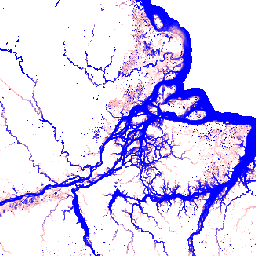
Глобальные слои картирования поверхностных вод JRC, версия 1.4
Этот набор данных содержит карты расположения и временного распределения поверхностных вод с 1984 по 2021 год, а также статистические данные о масштабах и изменениях этих водных поверхностей. Более подробную информацию можно найти в соответствующей журнальной статье: Высокоточное картирование глобальных поверхностных вод и их…
Этот набор данных содержит карты расположения и временного распределения поверхностных вод с 1984 по 2021 год, а также статистические данные о масштабах и изменениях этих водных поверхностей. Более подробную информацию можно найти в соответствующей журнальной статье: Высокоточное картирование глобальных поверхностных вод и их…
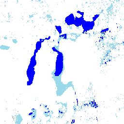
Ежемесячная история водопотребления JRC, версия 1.4
Этот набор данных содержит карты расположения и временного распределения поверхностных вод с 1984 по 2021 год, а также статистические данные о масштабах и изменениях этих водных поверхностей. Более подробную информацию можно найти в соответствующей журнальной статье: Высокоточное картирование глобальных поверхностных вод и их…
JRC Ежемесячный график потребления воды, версия 1.4
Этот набор данных содержит карты расположения и временного распределения поверхностных вод с 1984 по 2021 год, а также статистические данные о масштабах и изменениях этих водных поверхностей. Более подробную информацию можно найти в соответствующей журнальной статье: Высокоточное картирование глобальных поверхностных вод и их…
История классификации водных ресурсов JRC за год, версия 1.4
Этот набор данных содержит карты расположения и временного распределения поверхностных вод с 1984 по 2021 год, а также статистические данные о масштабах и изменениях этих водных поверхностей. Более подробную информацию можно найти в соответствующей журнальной статье: Высокоточное картирование глобальных поверхностных вод и их…
Ежемесячные обзоры MACAv2-METDATA: Университет Айдахо, Многомерные адаптивные сконструированные аналоги, применяемые к глобальным климатическим моделям.
Набор данных MACAv2-METDATA представляет собой коллекцию из 20 глобальных климатических моделей, охватывающих территорию континентальной части США. Метод многомерных адаптивных конструированных аналогов (MACA) — это статистический метод уменьшения масштаба, который использует обучающий набор данных (т.е. набор данных метеорологических наблюдений) для устранения исторических искажений и сопоставления пространственных закономерностей…
MACAv2-METDATA: Университет Айдахо, Многомерные адаптивные сконструированные аналоги, применяемые к глобальным климатическим моделям.
Набор данных MACAv2-METDATA представляет собой коллекцию из 20 глобальных климатических моделей, охватывающих территорию континентальной части США. Метод многомерных адаптивных конструированных аналогов (MACA) — это статистический метод уменьшения масштаба, который использует обучающий набор данных (т.е. набор данных метеорологических наблюдений) для устранения исторических искажений и сопоставления пространственных закономерностей…
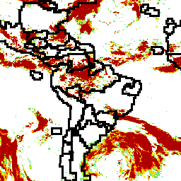
MCD64A1.061 MODIS Площадь выгоревших территорий, ежемесячные данные по всему миру, 500 м
Совместный продукт Terra и Aqua MCD64A1 версии 6.1 «Выгоревшие территории» представляет собой ежемесячный глобальный сетчатый продукт с разрешением 500 м, содержащий информацию о выгоревших территориях и качестве каждого пикселя. В методе картирования выгоревших территорий MCD64A1 используются изображения поверхностного отражения MODIS с разрешением 500 м в сочетании с данными наблюдений за активными пожарами MODIS с разрешением 1 км. Алгоритм…
MOD08_M3.061 Terra Atmosphere Ежемесячный глобальный продукт
MOD08_M3 V6.1 — это глобальный продукт для анализа атмосферы, содержащий усредненные по сетке 1 x 1 градус ежемесячные значения атмосферных параметров. Эти параметры связаны со свойствами атмосферных аэрозольных частиц, общим содержанием озона, атмосферным водяным паром, оптическими и физическими свойствами облаков, а также индексами атмосферной стабильности. …
Продукт MOD10A1 V6.1 Snow Cover Daily Global 500m содержит данные о снежном покрове, альбедо снега, доле снежного покрова и оценке качества (QA). Данные о снежном покрове основаны на алгоритме картирования снега, использующем нормализованный разностный снежный индекс (NDSI) и другие критерии оценки. Общие сведения…
MOD10A2 — это набор данных о снежном покрове, полученный с помощью прибора MODIS на спутнике Terra. В наборе данных представлены данные о максимальной площади снежного покрова за восьмидневный период с разрешением 500 м. Восьмидневный период композитинга был выбран потому, что это точное время повторения траектории движения Земли…
MOD44B.061 Терра Растительность Непрерывные Поля Ежегодно Глобальный 250 м
Продукт Terra MODIS Vegetation Continuous Fields (VCF) представляет собой субпиксельное отображение оценок растительного покрова поверхности Земли в глобальном масштабе. Разработанный для непрерывного представления земной поверхности в виде доли основных характеристик растительности, он обеспечивает градацию трех компонентов растительного покрова: процент древесного покрова, процент…
Маска для съемки суши и воды MOD44W.005, созданная на основе данных MODIS и SRTM.
Глобальная маска водных ресурсов использует данные о водных объектах (SRTM Water Body Data) в сочетании с данными MODIS с разрешением 250 м для создания полной глобальной карты поверхностных вод с пространственным разрешением 250 м, приблизительно за 2000-2002 годы. Этот набор данных предназначен для использования при обработке растровых данных и для…
Водонепроницаемая маска MOD44W.006 Terra Land, созданная на основе ежегодных глобальных измерений MODIS и SRTM на глубине до 250 м.
Продукт MOD44W V6 «маска суши/воды 250 м» создан с использованием классификатора на основе дерева решений, обученного на данных MODIS и проверенного с помощью продукта MOD44W V5. Для устранения известных проблем, вызванных тенями от рельефа, следами пожаров, облачностью или ледяным покровом, применяется ряд масок…
MYD08_M3.061 Aqua Atmosphere Ежемесячный глобальный продукт
MYD08_M3 V6.1 — это глобальный продукт атмосферных данных, содержащий усредненные по сетке 1 x 1 градус ежемесячные значения атмосферных параметров. Эти параметры связаны со свойствами атмосферных аэрозольных частиц, общим содержанием озона, атмосферным водяным паром, оптическими и физическими свойствами облаков, а также индексами атмосферной стабильности. …
Продукт MYD10A1 V6 Snow Cover Daily Global 500m содержит данные о снежном покрове, альбедо снега, доле снежного покрова и оценке качества (QA). Данные о снежном покрове основаны на алгоритме картирования снега, использующем нормализованный разностный индекс снежного покрова (NDSI) и другие критерии оценки. Общие…
Цифровые данные о рельефе, полученные в рамках миссии Shuttle Radar Topography Mission (SRTM, см. Farr et al. 2007), представляют собой международный исследовательский проект, в результате которого были получены цифровые модели рельефа в масштабе, близком к глобальному. Этот продукт SRTM V3 (SRTM Plus) предоставляется Лабораторией реактивного движения НАСА с разрешением 1 угловая секунда…
NASADEM — это переобработка данных SRTM с улучшенной точностью за счет включения вспомогательных данных из наборов данных ASTER GDEM, ICESat GLAS и PRISM. Наиболее значительные улучшения обработки связаны с уменьшением пустот за счет улучшенного развертывания фазы и использованием данных ICESat GLAS для контроля. Документация: Руководство пользователя
Реанализ NCEP-DOE 2 (гауссова сетка), полное облачное покрытие
Данная коллекция больше не обновляется. Модель больше не обновляется в источнике. Проект NCEP-DOE Reanalysis 2 использует современную систему анализа/прогнозирования для ассимиляции данных с использованием данных за период с 1979 года по предыдущий год.
Данные реанализа NCEP/NCAR, атмосферное давление на уровне моря [устарело]
Проект реанализа NCEP/NCAR — это совместный проект Национальных центров прогнозирования окружающей среды (NCEP, ранее «NMC») и Национального центра атмосферных исследований (NCAR). Цель этой совместной работы — создание новых атмосферных анализов с использованием исторических данных, а также…
Данные реанализа NCEP/NCAR, температура поверхности [устарело]
Проект реанализа NCEP/NCAR — это совместный проект Национальных центров прогнозирования окружающей среды (NCEP, ранее «NMC») и Национального центра атмосферных исследований (NCAR). Цель этой совместной работы — создание новых атмосферных анализов с использованием исторических данных, а также…
Данные реанализа NCEP/NCAR, водяной пар [устарело]
Проект реанализа NCEP/NCAR — это совместный проект Национальных центров прогнозирования окружающей среды (NCEP, ранее «NMC») и Национального центра атмосферных исследований (NCAR). Цель этой совместной работы — создание новых атмосферных анализов с использованием исторических данных, а также…
NEX-DCP30: Ансамблевая статистика для детализированных климатических прогнозов NASA Earth Exchange
Набор данных NASA NEX-DCP30 состоит из детализированных климатических сценариев для континентальной части Соединенных Штатов, полученных на основе расчетов с использованием моделей общей циркуляции атмосферы (GCM), проведенных в рамках проекта сравнения связанных моделей, фаза 5 (CMIP5, см. Taylor et al. 2012), и охватывает четыре парниковых газа…
NEX-DCP30: Упрощенные климатические прогнозы NASA Earth Exchange
Набор данных NASA NEX-DCP30 состоит из детализированных климатических сценариев для континентальной части Соединенных Штатов, полученных на основе расчетов с использованием моделей общей циркуляции атмосферы (GCM), проведенных в рамках проекта сравнения связанных моделей, фаза 5 (CMIP5, см. Taylor et al. 2012), и охватывает четыре парниковых газа…
NEX-GDDP-CMIP6: Глобальные ежедневные детализированные климатические прогнозы NASA Earth Exchange.
Набор данных NEX-GDDP-CMIP6 включает глобальные детализированные климатические сценарии, полученные на основе расчетов с использованием моделей общей циркуляции атмосферы (GCM), проведенных в рамках шестого этапа проекта сравнения связанных моделей (CMIP6, см. Thrasher et al. 2022), а также по двум из четырех сценариев выбросов парниковых газов «первого уровня»…
NEX-GDDP: Глобальные ежедневные детализированные климатические прогнозы NASA Earth Exchange.
Набор данных NASA NEX-GDDP состоит из детализированных климатических сценариев для планеты, полученных на основе расчетов с использованием моделей общей циркуляции атмосферы (GCM), проведенных в рамках проекта сравнения связанных моделей, фаза 5 (CMIP5, см. Taylor et al. 2012), и охватывает два из четырех парниковых газов…
NLDAS-2: Поля воздействия Североамериканской системы ассимиляции данных о суше
Система ассимиляции данных о суше (LDAS) объединяет несколько источников наблюдений (таких как данные с метеорологических постов, спутниковые данные и радиолокационные измерения осадков) для получения оценок климатологических свойств на поверхности Земли или вблизи нее. Этот набор данных является основным (по умолчанию) файлом входных данных (файл A) для фазы…
Ойя: квазиглобальные оценки количества осадков на расстоянии 5 км
Oya — это квазиглобальный набор данных для оценки количества осадков с высоким разрешением, полученный на основе наблюдений с геостационарных (GEO) спутников. Модель Oya использует весь спектр видимых и инфракрасных (VIS-IR) каналов созвездия геостационарных спутников, включая GOES-16/18, Meteosat-9/10 и Himawari-8/9, для генерации оценок количества осадков, охватывающих…
PERSIANN-CDR: Оценка количества осадков на основе данных дистанционного зондирования с использованием искусственных нейронных сетей — Климатический архив данных
PERSIANN-CDR — это ежедневный квазиглобальный продукт данных об осадках, охватывающий период с 1 января 1983 года по настоящее время. Данные предоставляются ежеквартально с типичной задержкой в три месяца. Продукт разработан Центром гидрометеорологии и дистанционного зондирования Калифорнийского университета в Ирвайне…
Ежедневный пространственный климатический набор данных PRISM
Ежедневные и ежемесячные наборы данных PRISM представляют собой сеточные климатические данные для континентальной части Соединенных Штатов, созданные группой PRISM Climate Group в Университете штата Орегон. Эта коллекция содержит данные AN81 и AN91, что указывается свойством 'dataset_type'. Сетки разрабатываются с использованием PRISM (Parameter-elevation Regressions…).
Набор данных PRISM о долгосрочных средних климатических показателях Norm91m
Ежедневные и ежемесячные наборы данных PRISM представляют собой сеточные климатические данные для континентальной части Соединенных Штатов, созданные группой PRISM Climate Group в Университете штата Орегон. Сетки разрабатываются с использованием PRISM (Parameter-elevation Regressions on Independent Slopes Model). Процедуры интерполяции PRISM имитируют изменения погоды и климата…
Ежемесячный пространственный климатический набор данных PRISM ANm
Ежедневные и ежемесячные наборы данных PRISM представляют собой сеточные климатические данные для континентальной части Соединенных Штатов, созданные группой PRISM Climate Group в Университете штата Орегон. Эта коллекция содержит данные AN81 и AN91, как указано в свойстве 'dataset_type'. Сетки разрабатываются с использованием PRISM (Parameter-elevation…).
Эталонная модель рельефа Антарктиды (REMA) — это цифровая модель поверхности Антарктиды высокого разрешения с временными метками, имеющая пространственное разрешение 2 и 8 метров. Мозаичные файлы ЦМР составлены из нескольких полос, которые были совмещены, смешаны и сглажены для уменьшения артефактов, связанных с совпадением краев.
Эталонная модель рельефа Антарктиды (REMA) — это цифровая модель поверхности (DSM) Антарктиды с высоким разрешением и временными метками, имеющая пространственное разрешение 2 и 8 метров. Файлы DEM в виде полос соответствуют области перекрытия входных пар стереоскопических изображений, собранных компанией DigitalGlobe…
Эталонная модель рельефа Антарктиды (REMA) — это цифровая модель поверхности (DSM) Антарктиды с высоким разрешением и временными метками, имеющая пространственное разрешение 2 и 8 метров. Файлы DEM в виде полос соответствуют области перекрытия входных пар стереоскопических изображений, собранных компанией DigitalGlobe…
Набор данных RGE ALTI описывает цифровую модель рельефа (ЦМР) Франции с размером пикселя 1 м. Она была создана на основе данных аэрофотосъемки с использованием лидара или путем корреляции аэрофотоснимков. Лидар применялся в районах, подверженных наводнениям, прибрежных зонах и крупных лесных массивах. Вертикальная…
RTMA: Анализ мезомасштабных процессов в реальном времени
Анализ мезомасштабных данных в реальном времени (RTMA) — это анализ приземных погодных условий с высоким пространственным и временным разрешением. Данный набор данных включает почасовые анализы с разрешением 2,5 км для континентальной части США.
Переработанные данные GLDAS-2.0: Глобальная система ассимиляции данных о суше.
Система глобальной ассимиляции данных о суше НАСА, версия 2 (GLDAS-2), состоит из трех компонентов: GLDAS-2.0, GLDAS-2.1 и GLDAS-2.2. GLDAS-2.0 полностью использует входные данные метеорологического воздействия Принстонского университета и предоставляет согласованный по времени ряд данных с 1948 по 2014 год. GLDAS-2.1 использует комбинацию модельных данных…
Цифровые данные о рельефе местности, полученные в рамках миссии Shuttle Radar Topography Mission (SRTM), изначально были созданы для обеспечения согласованных и высококачественных данных о рельефе местности в масштабах, близких к глобальному. Данная версия цифровых данных о рельефе местности SRTM была обработана для заполнения пробелов в данных и упрощения их использования.
Объединенные данные по озону TOMS и OMI, версия 4.
Данные спектрометра для картирования общего содержания озона (TOMS) представляют собой основную долгосрочную непрерывную запись спутниковых наблюдений, доступную для мониторинга глобальных и региональных тенденций изменения общего содержания озона за последние 25 лет. Данные создаются Лабораторией атмосферы в Центре Годдарда НАСА…
Миссия по измерению тропических осадков (TRMM) — это совместная миссия НАСА и Японского агентства аэрокосмических исследований (JAXA), предназначенная для мониторинга и изучения тропических осадков. Продукт 34B2 содержит сеточные, скорректированные по данным TRMM, объединенные данные об осадках в инфракрасном диапазоне (мм/час) и среднеквадратичной ошибке осадков, с временным интервалом в 3 часа…
Данная коллекция больше не обновляется. См. ежемесячный отчет IMERG. Этот набор данных алгоритмически объединяет микроволновые данные с нескольких спутников, включая SSMI, SSMIS, MHS, AMSU-B и AMSR-E, каждый из которых откалиброван относительно объединенного прибора TRMM. Алгоритм 3B43 выполняется один раз в календарный месяц для получения единого…
TerraClimate: Ежемесячный климатический и водный баланс для наземных поверхностей по всему миру, Университет Айдахо.
TerraClimate — это набор данных о ежемесячном климате и климатическом водном балансе для глобальных наземных поверхностей. Он использует интерполяцию с учетом климатических факторов, объединяя климатологические нормы с высоким пространственным разрешением из набора данных WorldClim с данными с более низким пространственным разрешением, но изменяющимися во времени, из CRU Ts4.0 и японского 55-летнего реанализа (JRA55). …
Проект сравнения связанных моделей Центра по изучению климатических опасностей (CHC), фаза 6 (CHC-CMIP6)
CHC-CMIP6 был специально разработан для поддержки анализа климатических опасностей в недавнем прошлом и в ближайшем будущем. Этот набор данных климатических прогнозов содержит глобальные ежедневные данные в виде сетки за период наблюдений (1983–2016 гг.) и прогнозов (2030 и 2050 гг.), которые будут использоваться для идентификации и…
Набор данных «Литология» содержит классы общих типов материнской породы почвы на поверхности. Он не основан ни на одной цифровой модели рельефа (ЦМР). Наборы данных «Экологически значимая геоморфология» (ERGo) организации Conservation Science Partners (CSP), «Формы рельефа и физиография», содержат подробные многомасштабные данные о формах рельефа и физиографических особенностях…
US NED CHILI (Непрерывный индекс тепловой и солнечной нагрузки)
CHILI — это модель, заменяющая влияние инсоляции и топографического затенения на эвапотранспирацию, которая рассчитывается путем вычисления инсоляции в начале дня, на высоте солнца, эквивалентной равноденствию. Она основана на цифровой модели рельефа NED с разрешением 10 м, предоставленной Геологической службой США (доступна в Европе как USGS/NED). Программа Conservation Science Partners (CSP) Ecologically…
Набор данных ALOS Landform содержит классы форм рельефа, созданные путем объединения данных непрерывного индекса тепловой и инсоляционной нагрузки (CHILI) и многомасштабного топографического индекса положения (mTPI). Он основан на 10-метровой цифровой модели рельефа NED Геологической службы США (доступна в Европе как USGS/NED). Программа Conservation Science Partners (CSP) Ecologically Relevant…
Набор данных «Физиографическое разнообразие» содержит индекс разнообразия физиографических типов. Он был рассчитан с использованием индекса разнообразия Шеннона в нескольких масштабах (км): 115,8, 89,9, 35,5, 13,1, 5,6, 2,8 и 1,2. Он основан на цифровой модели рельефа США (NED) с разрешением 10 м, предоставленной Геологической службой США (доступна в EE…).
Топографическое разнообразие (D) — это косвенная переменная, отражающая разнообразие температурных и влажностных условий, доступных видам в качестве локальных местообитаний. Она выражает логику, согласно которой большее разнообразие топографических и климатических ниш должно поддерживать большее разнообразие (особенно растений) и способствовать выживанию видов при заданных климатических условиях…
Индекс топографического положения США NED mTPI (Multi-Scale Topographic Position Index)
Индекс mTPI различает хребты и долины. Он рассчитывается с использованием данных о высоте для каждого местоположения, из которых вычитается средняя высота в пределах района. В индексе mTPI используются скользящие окна радиусом (км): 115,8, 89,9, 35,5, 13,1, 5,6, 2,8 и 1,2. Он основан на данных Геологической службы США (USGS)…
Набор данных «Физиография» представляет собой пространственное пересечение слоев данных о формах рельефа (доступен в EE как ERGo/1_0/US/landforms) и литологии (доступен в EE как ERGo/1_0/US/lithology). Он предоставляет 247 уникальных комбинаций из 270 возможных. Значения для каждого типа формируются путем конкатенации данных о формах рельефа и…
3D-карта США (USGS) масштабом 10 м, бесшовная (1/3 угловой секунды).
Это цельный набор данных 3DEP DEM для США с полным покрытием 48 смежных штатов, Гавайев и территорий США. Покрытие Аляски частично доступно уже сейчас и расширяется до охвата всего штата в рамках Инициативы по картографированию Аляски. Расстояние между точками на местности…
Это набор фрагментированных изображений с размером пикселя 1 м из программы 3D-моделирования рельефа (3DEP). Данные 3DEP служат слоем рельефа для Национальной карты и предоставляют базовую информацию о высоте для исследований в области наук о Земле и картографических приложений в Соединенных Штатах…
VJ114IMGTDL_NRT Ежедневный растр: VIIRS (NOAA-20) Диапазон 375 м Активный огонь
Продукт обнаружения активных пожаров на спутнике NOAA-20 (JPSS-1) Visible Infrared Imaging Radiometer Suite (VIIRS) основан на данных с номинальным разрешением 375 м. По сравнению с другими спутниковыми продуктами обнаружения пожаров с более низким разрешением (≥ 1 км), улучшенные данные с разрешением 375 м обеспечивают более высокую эффективность при обнаружении пожаров относительно небольшой площади…
Продукт обнаружения активных пожаров Suomi NPP Visible Infrared Imaging Radiometer Suite (VIIRS) основан на данных с номинальным разрешением прибора 375 м. По сравнению с другими спутниковыми продуктами обнаружения пожаров с более низким разрешением (≥ 1 км), улучшенные данные с разрешением 375 м обеспечивают более высокую эффективность при обнаружении пожаров относительно небольшой площади…
Набор данных о запасах углерода в пантропических регионах на национальном уровне, подготовленный WHRC
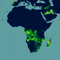
Карта плотности надземной живой древесной биомассы тропических стран на уровне страны с разрешением 500 м. Этот набор данных был составлен на основе комбинации полевых измерений в одном месте, наблюдений с помощью лидара и изображений, полученных с помощью спектрорадиометра среднего разрешения (MODIS).
BasinATLAS — это компонент базы данных HydroATLAS, которая, в свою очередь, является компонентом HydroSHEDS. BasinATLAS предоставляет стандартизированный сборник гидроэкологических характеристик для всех водосборных бассейнов мира с высоким пространственным разрешением. Этот набор данных включает данные по 56 переменным, разделенным на 281 атрибут и…
BasinATLAS — это компонент базы данных HydroATLAS, которая, в свою очередь, является компонентом HydroSHEDS. BasinATLAS предоставляет стандартизированный сборник гидроэкологических характеристик для всех водосборных бассейнов мира с высоким пространственным разрешением. Этот набор данных включает данные по 56 переменным, разделенным на 281 атрибут и…
BasinATLAS — это компонент базы данных HydroATLAS, которая, в свою очередь, является компонентом HydroSHEDS. BasinATLAS предоставляет стандартизированный сборник гидроэкологических характеристик для всех водосборных бассейнов мира с высоким пространственным разрешением. Этот набор данных включает данные по 56 переменным, разделенным на 281 атрибут и…
BasinATLAS — это компонент базы данных HydroATLAS, которая, в свою очередь, является компонентом HydroSHEDS. BasinATLAS предоставляет стандартизированный сборник гидроэкологических характеристик для всех водосборных бассейнов мира с высоким пространственным разрешением. Этот набор данных включает данные по 56 переменным, разделенным на 281 атрибут и…
BasinATLAS — это компонент базы данных HydroATLAS, которая, в свою очередь, является компонентом HydroSHEDS. BasinATLAS предоставляет стандартизированный сборник гидроэкологических характеристик для всех водосборных бассейнов мира с высоким пространственным разрешением. Этот набор данных включает данные по 56 переменным, разделенным на 281 атрибут и…
BasinATLAS — это компонент базы данных HydroATLAS, которая, в свою очередь, является компонентом HydroSHEDS. BasinATLAS предоставляет стандартизированный сборник гидроэкологических характеристик для всех водосборных бассейнов мира с высоким пространственным разрешением. Этот набор данных включает данные по 56 переменным, разделенным на 281 атрибут и…
BasinATLAS — это компонент базы данных HydroATLAS, которая, в свою очередь, является компонентом HydroSHEDS. BasinATLAS предоставляет стандартизированный сборник гидроэкологических характеристик для всех водосборных бассейнов мира с высоким пространственным разрешением. Этот набор данных включает данные по 56 переменным, разделенным на 281 атрибут и…
BasinATLAS — это компонент базы данных HydroATLAS, которая, в свою очередь, является компонентом HydroSHEDS. BasinATLAS предоставляет стандартизированный сборник гидроэкологических характеристик для всех водосборных бассейнов мира с высоким пространственным разрешением. Этот набор данных включает данные по 56 переменным, разделенным на 281 атрибут и…
BasinATLAS — это компонент базы данных HydroATLAS, которая, в свою очередь, является компонентом HydroSHEDS. BasinATLAS предоставляет стандартизированный сборник гидроэкологических характеристик для всех водосборных бассейнов мира с высоким пространственным разрешением. Этот набор данных включает данные по 56 переменным, разделенным на 281 атрибут и…
BasinATLAS — это компонент базы данных HydroATLAS, которая, в свою очередь, является компонентом HydroSHEDS. BasinATLAS предоставляет стандартизированный сборник гидроэкологических характеристик для всех водосборных бассейнов мира с высоким пространственным разрешением. Этот набор данных включает данные по 56 переменным, разделенным на 281 атрибут и…
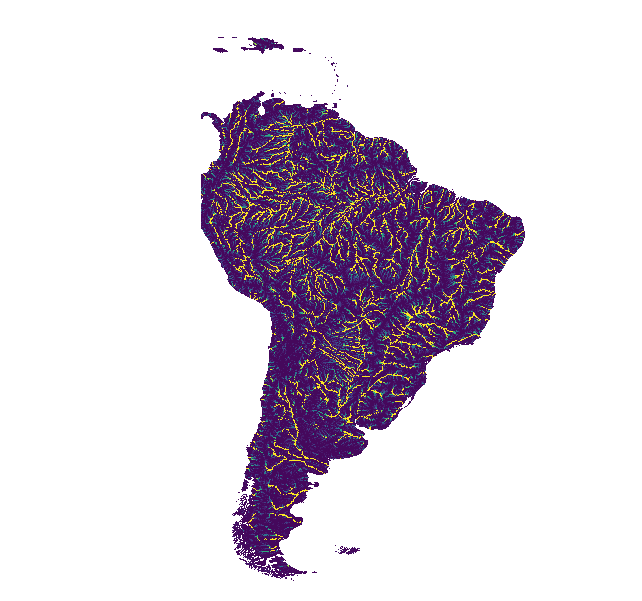
HydroSHEDS — это картографический продукт, предоставляющий гидрографическую информацию для региональных и глобальных приложений в согласованном формате. Он предлагает набор геопривязанных наборов данных (векторных и растровых) в различных масштабах, включая речные сети, границы водосборных бассейнов, направления стока и накопление воды. HydroSHEDS основан на…
Бассейны гидротехнического обслуживания WWF, уровень 10
HydroSHEDS — это картографический продукт, предоставляющий гидрографическую информацию для региональных и глобальных приложений в согласованном формате. Он предлагает набор геопривязанных наборов данных (векторных и растровых) в различных масштабах, включая речные сети, границы водосборных бассейнов, направления стока и накопление воды. HydroSHEDS основан на…
Бассейны гидротехнического обслуживания WWF, уровень 11
HydroSHEDS — это картографический продукт, предоставляющий гидрографическую информацию для региональных и глобальных приложений в согласованном формате. Он предлагает набор геопривязанных наборов данных (векторных и растровых) в различных масштабах, включая речные сети, границы водосборных бассейнов, направления стока и накопление воды. HydroSHEDS основан на…
Бассейны гидротехнического обслуживания WWF, уровень 12
HydroSHEDS — это картографический продукт, предоставляющий гидрографическую информацию для региональных и глобальных приложений в согласованном формате. Он предлагает набор геопривязанных наборов данных (векторных и растровых) в различных масштабах, включая речные сети, границы водосборных бассейнов, направления стока и накопление воды. HydroSHEDS основан на…
HydroSHEDS — это картографический продукт, предоставляющий гидрографическую информацию для региональных и глобальных приложений в согласованном формате. Он предлагает набор геопривязанных наборов данных (векторных и растровых) в различных масштабах, включая речные сети, границы водосборных бассейнов, направления стока и накопление воды. HydroSHEDS основан на…
HydroSHEDS — это картографический продукт, предоставляющий гидрографическую информацию для региональных и глобальных приложений в согласованном формате. Он предлагает набор геопривязанных наборов данных (векторных и растровых) в различных масштабах, включая речные сети, границы водосборных бассейнов, направления стока и накопление воды. HydroSHEDS основан на…
HydroSHEDS — это картографический продукт, предоставляющий гидрографическую информацию для региональных и глобальных приложений в согласованном формате. Он предлагает набор геопривязанных наборов данных (векторных и растровых) в различных масштабах, включая речные сети, границы водосборных бассейнов, направления стока и накопление воды. HydroSHEDS основан на…
HydroSHEDS — это картографический продукт, предоставляющий гидрографическую информацию для региональных и глобальных приложений в согласованном формате. Он предлагает набор геопривязанных наборов данных (векторных и растровых) в различных масштабах, включая речные сети, границы водосборных бассейнов, направления стока и накопление воды. HydroSHEDS основан на…
HydroSHEDS — это картографический продукт, предоставляющий гидрографическую информацию для региональных и глобальных приложений в согласованном формате. Он предлагает набор геопривязанных наборов данных (векторных и растровых) в различных масштабах, включая речные сети, границы водосборных бассейнов, направления стока и накопление воды. HydroSHEDS основан на…
HydroSHEDS — это картографический продукт, предоставляющий гидрографическую информацию для региональных и глобальных приложений в согласованном формате. Он предлагает набор геопривязанных наборов данных (векторных и растровых) в различных масштабах, включая речные сети, границы водосборных бассейнов, направления стока и накопление воды. HydroSHEDS основан на…
HydroSHEDS — это картографический продукт, предоставляющий гидрографическую информацию для региональных и глобальных приложений в согласованном формате. Он предлагает набор геопривязанных наборов данных (векторных и растровых) в различных масштабах, включая речные сети, границы водосборных бассейнов, направления стока и накопление воды. HydroSHEDS основан на…
Бассейны гидротехнического обслуживания WWF, уровень 9
HydroSHEDS — это картографический продукт, предоставляющий гидрографическую информацию для региональных и глобальных приложений в согласованном формате. Он предлагает набор геопривязанных наборов данных (векторных и растровых) в различных масштабах, включая речные сети, границы водосборных бассейнов, направления стока и накопление воды. HydroSHEDS основан на…
Направление дренажа согласно данным WWF HydroSHEDS, 15 угловых секунд
HydroSHEDS — это картографический продукт, предоставляющий гидрографическую информацию для региональных и глобальных приложений в согласованном формате. Он предлагает набор геопривязанных наборов данных (векторных и растровых) в различных масштабах, включая речные сети, границы водосборных бассейнов, направления стока и накопление воды. HydroSHEDS основан на…
Направление дренажа WWF HydroSHEDS, 3 угловые секунды
HydroSHEDS — это картографический продукт, предоставляющий гидрографическую информацию для региональных и глобальных приложений в согласованном формате. Он предлагает набор геопривязанных наборов данных (векторных и растровых) в различных масштабах, включая речные сети, границы водосборных бассейнов, направления стока и накопление воды. HydroSHEDS основан на…
Направление дренажа согласно данным WWF HydroSHEDS, 30 угловых секунд
HydroSHEDS — это картографический продукт, предоставляющий гидрографическую информацию для региональных и глобальных приложений в согласованном формате. Он предлагает набор геопривязанных наборов данных (векторных и растровых) в различных масштабах, включая речные сети, границы водосборных бассейнов, направления стока и накопление воды. HydroSHEDS основан на…
Накопление стока по данным WWF HydroSHEDS, 15 угловых секунд.
HydroSHEDS — это картографический продукт, предоставляющий гидрографическую информацию для региональных и глобальных приложений в согласованном формате. Он предлагает набор геопривязанных наборов данных (векторных и растровых) в различных масштабах, включая речные сети, границы водосборных бассейнов, направления стока и накопление воды. HydroSHEDS основан на…
Накопление стока по данным WWF HydroSHEDS, 30 угловых секунд.
HydroSHEDS — это картографический продукт, предоставляющий гидрографическую информацию для региональных и глобальных приложений в согласованном формате. Он предлагает набор геопривязанных наборов данных (векторных и растровых) в различных масштабах, включая речные сети, границы водосборных бассейнов, направления стока и накопление воды. HydroSHEDS основан на…
Сеть свободно текущих рек WWF HydroSHEDS, версия 1
HydroSHEDS — это картографический продукт, предоставляющий гидрографическую информацию для региональных и глобальных приложений в согласованном формате. Он предлагает набор геопривязанных наборов данных (векторных и растровых) в различных масштабах, включая речные сети, границы водосборных бассейнов, направления стока и накопление воды. HydroSHEDS основан на…
WWF HydroSHEDS Гидрологически обоснованная цифровая модель рельефа, 15 угловых секунд
HydroSHEDS — это картографический продукт, предоставляющий гидрографическую информацию для региональных и глобальных приложений в согласованном формате. Он предлагает набор геопривязанных наборов данных (векторных и растровых) в различных масштабах, включая речные сети, границы водосборных бассейнов, направления стока и накопление воды. HydroSHEDS основан на…
WWF HydroSHEDS Гидрологически обоснованная цифровая модель рельефа, 3 угловые секунды
HydroSHEDS — это картографический продукт, предоставляющий гидрографическую информацию для региональных и глобальных приложений в согласованном формате. Он предлагает набор геопривязанных наборов данных (векторных и растровых) в различных масштабах, включая речные сети, границы водосборных бассейнов, направления стока и накопление воды. HydroSHEDS основан на…
WWF HydroSHEDS Гидрологически обоснованная цифровая модель рельефа, 30 угловых секунд
HydroSHEDS — это картографический продукт, предоставляющий гидрографическую информацию для региональных и глобальных приложений в согласованном формате. Он предлагает набор геопривязанных наборов данных (векторных и растровых) в различных масштабах, включая речные сети, границы водосборных бассейнов, направления стока и накопление воды. HydroSHEDS основан на…
WWF HydroSHEDS Цифровая модель рельефа с заполнением пустот, 3 угловые секунды
HydroSHEDS — это картографический продукт, предоставляющий гидрографическую информацию для региональных и глобальных приложений в согласованном формате. Он предлагает набор геопривязанных наборов данных (векторных и растровых) в различных масштабах, включая речные сети, границы водосборных бассейнов, направления стока и накопление воды. HydroSHEDS основан на…
[[["Прост для понимания","easyToUnderstand","thumb-up"],["Помог мне решить мою проблему","solvedMyProblem","thumb-up"],["Другое","otherUp","thumb-up"]],[["Отсутствует нужная мне информация","missingTheInformationINeed","thumb-down"],["Слишком сложен/слишком много шагов","tooComplicatedTooManySteps","thumb-down"],["Устарел","outOfDate","thumb-down"],["Проблема с переводом текста","translationIssue","thumb-down"],["Проблемы образцов/кода","samplesCodeIssue","thumb-down"],["Другое","otherDown","thumb-down"]],[],[],[]]