Datasets tagged hourly in Earth Engine
Оптимизируйте свои подборки
Сохраняйте и классифицируйте контент в соответствии со своими настройками.
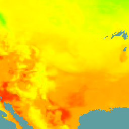
ERA5 Почасовой анализ - Климатический реанализ ECMWF
ERA5 — это пятое поколение атмосферного реанализа глобального климата, проводимого Европейским центром метеорологии и водных ресурсов (ECMWF). Он создается Службой изменения климата Copernicus (C3S) в ECMWF. Реанализ объединяет модельные данные с наблюдениями со всего мира в глобально полный и согласованный набор данных, используя законы…
GSMaP Operational: Глобальное спутниковое картирование осадков - V6
Глобальное спутниковое картирование осадков (GSMaP) предоставляет глобальные почасовые данные об интенсивности осадков с разрешением 0,1 x 0,1 градуса. GSMaP — это продукт миссии Global Precipitation Measurement (GPM), которая предоставляет глобальные данные об осадках с трехчасовыми интервалами. Значения оцениваются с использованием многодиапазонных пассивных…
GSMaP Operational: Глобальное спутниковое картирование осадков - V7
Глобальное спутниковое картирование осадков (GSMaP) предоставляет глобальные почасовые данные об интенсивности осадков с разрешением 0,1 x 0,1 градуса. GSMaP — это продукт миссии Global Precipitation Measurement (GPM), которая предоставляет глобальные данные об осадках с трехчасовыми интервалами. Значения оцениваются с использованием многодиапазонных пассивных…
GSMaP Operational: Глобальное спутниковое картирование осадков - V8
Глобальное спутниковое картирование осадков (GSMaP) предоставляет глобальные почасовые данные об интенсивности осадков с разрешением 0,1 x 0,1 градуса. GSMaP — это продукт миссии Global Precipitation Measurement (GPM), которая предоставляет глобальные данные об осадках с трехчасовыми интервалами. Значения оцениваются с использованием многодиапазонных пассивных…
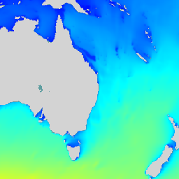
Реанализ GSMaP: Глобальное спутниковое картирование осадков
Глобальное спутниковое картирование осадков (GSMaP) предоставляет глобальные почасовые данные об интенсивности осадков с разрешением 0,1 x 0,1 градуса. GSMaP — это продукт миссии Global Precipitation Measurement (GPM), которая предоставляет глобальные данные об осадках с трехчасовыми интервалами. Значения оцениваются с использованием многодиапазонных пассивных…
Оперативная глобальная система анализа и прогнозирования океана Meteo-France с разрешением 1/12 градуса предоставляет ежедневный анализ и 10-дневные прогнозы для поверхностных волн мирового океана. Этот продукт включает в себя мгновенные поля интегрированных параметров волн с интервалом в 3 часа из всего спектра…
NLDAS-2: Поля воздействия Североамериканской системы ассимиляции данных о суше
Система ассимиляции данных о суше (LDAS) объединяет несколько источников наблюдений (таких как данные с метеорологических постов, спутниковые данные и радиолокационные измерения осадков) для получения оценок климатологических свойств на поверхности Земли или вблизи нее. Этот набор данных является основным (по умолчанию) файлом входных данных (файл A) для фазы…
NOAA CDR WHOI: Температура поверхности моря, версия 2
Данные о температуре поверхности моря (WHOI) являются частью пакета данных NOAA Ocean Surface Bundle (OSB) и представляют собой высококачественную запись климатических данных (CDR) о температуре поверхности моря над свободными ото льда океанами. Значения температуры поверхности моря определяются путем моделирования суточной изменчивости в сочетании с…
Набор данных «Потоки тепла в океане» является частью пакета данных NOAA Ocean Surface Bundle (OSB) и представляет собой высококачественную запись климатических данных (CDR) о потоках тепла между воздухом и океаном над свободными ото льда океанами. Этот набор данных рассчитывается на основе параметров CDR OSB для приповерхностных атмосферных и морских...
NOAA CDR: Приповерхностные атмосферные свойства океана, версия 2
Набор данных «Приповерхностные атмосферные свойства океана» является частью пакета данных NOAA Ocean Surface Bundle (OSB) и представляет собой высококачественную запись климатических данных (CDR) о температуре воздуха, скорости ветра и удельной влажности над свободными ото льда поверхностями океана. Эти атмосферные свойства рассчитываются на основе яркостной температуры…
[[["Прост для понимания","easyToUnderstand","thumb-up"],["Помог мне решить мою проблему","solvedMyProblem","thumb-up"],["Другое","otherUp","thumb-up"]],[["Отсутствует нужная мне информация","missingTheInformationINeed","thumb-down"],["Слишком сложен/слишком много шагов","tooComplicatedTooManySteps","thumb-down"],["Устарел","outOfDate","thumb-down"],["Проблема с переводом текста","translationIssue","thumb-down"],["Проблемы образцов/кода","samplesCodeIssue","thumb-down"],["Другое","otherDown","thumb-down"]],[],[],[]]