Datasets tagged monthly in Earth Engine
Оптимизируйте свои подборки
Сохраняйте и классифицируйте контент в соответствии со своими настройками.
FLDAS: Сеть систем раннего предупреждения о голоде (FEWS NET) Система ассимиляции данных о земле
Набор данных FLDAS (McNally et al. 2017) был разработан для оказания помощи в оценке продовольственной безопасности в условиях дефицита данных в развивающихся странах. Он включает информацию о многих климатических переменных, включая содержание влаги, влажность воздуха, испарение, среднюю температуру почвы, общее количество осадков и т. д. Существует несколько различных наборов данных FLDAS; …
FireCCI51: Пиксельный продукт MODIS Fire_cci для выгоревших областей, версия 5.1
Пиксельный продукт MODIS Fire_cci Burned Area версии 5.1 (FireCCI51) представляет собой ежемесячный глобальный набор данных с пространственным разрешением около 250 м, содержащий информацию о выгоревших территориях, а также вспомогательные данные. Он основан на отражательной способности поверхности в ближнем инфракрасном (ИК) диапазоне, полученной с помощью бортового прибора MODIS…
GFW (Global Fishing Watch) — Ежедневное расписание работы рыболовных площадок.
Рыболовные усилия измеряются в часах предполагаемой рыболовной деятельности. Каждый ресурс представляет собой усилия для данного государства флага и дня, с отдельной категорией для рыболовной деятельности каждого типа орудий лова. См. примеры скриптов Earth Engine. Также см. основной сайт GFW для получения информации о программе…
GFW (Global Fishing Watch) Ежедневное расписание работы судов
Присутствие рыболовных судов, измеряемое в часах на квадратный километр. Каждый показатель отражает присутствие судна для данного государства флага и дня, при этом для каждого типа орудий лова используется отдельная полоса. См. примеры скриптов Earth Engine. Также см. основной сайт GFW для получения информации о программе…
GPM: Ежемесячные глобальные измерения осадков (GPM), версия 6
Выпуск финальной версии IMERG "06" был прекращен в сентябре 2021 года. Выпуск версии "07" ожидается в сентябре 2022 года. Глобальная система измерения осадков (GPM) — это международная спутниковая миссия, предоставляющая данные наблюдений за осадками и снегом нового поколения по всему миру каждые три часа. Интегрированные многоспутниковые данные для…
GPM: Ежемесячные глобальные измерения осадков (GPM), версия 07
Глобальная система измерения осадков (GPM) — это международная спутниковая миссия, призванная каждые три часа предоставлять данные нового поколения о дожде и снеге по всему миру. Интегрированный алгоритм IMERG (Integrated Multi-satellitE Retrievals for GPM) — это унифицированный алгоритм, который позволяет оценивать количество осадков, объединяя данные со всех пассивных микроволновых приборов, входящих в состав GPM…
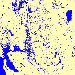
Ежемесячная история водопотребления JRC, версия 1.4
Этот набор данных содержит карты расположения и временного распределения поверхностных вод с 1984 по 2021 год, а также статистические данные о масштабах и изменениях этих водных поверхностей. Более подробную информацию можно найти в соответствующей журнальной статье: Высокоточное картирование глобальных поверхностных вод и их…
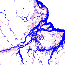
JRC Ежемесячный график потребления воды, версия 1.4
Этот набор данных содержит карты расположения и временного распределения поверхностных вод с 1984 по 2021 год, а также статистические данные о масштабах и изменениях этих водных поверхностей. Более подробную информацию можно найти в соответствующей журнальной статье: Высокоточное картирование глобальных поверхностных вод и их…
Ежемесячные обзоры MACAv2-METDATA: Университет Айдахо, Многомерные адаптивные сконструированные аналоги, применяемые к глобальным климатическим моделям.
Набор данных MACAv2-METDATA представляет собой коллекцию из 20 глобальных климатических моделей, охватывающих территорию континентальной части США. Метод многомерных адаптивных конструированных аналогов (MACA) — это статистический метод уменьшения масштаба, который использует обучающий набор данных (т.е. набор данных метеорологических наблюдений) для устранения исторических искажений и сопоставления пространственных закономерностей…
MACAv2-METDATA: Университет Айдахо, Многомерные адаптивные сконструированные аналоги, применяемые к глобальным климатическим моделям.
Набор данных MACAv2-METDATA представляет собой коллекцию из 20 глобальных климатических моделей, охватывающих территорию континентальной части США. Метод многомерных адаптивных конструированных аналогов (MACA) — это статистический метод уменьшения масштаба, который использует обучающий набор данных (т.е. набор данных метеорологических наблюдений) для устранения исторических искажений и сопоставления пространственных закономерностей…
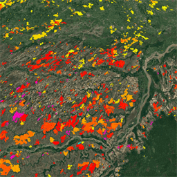
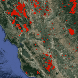
MCD64A1.061 MODIS Площадь выгоревших территорий, ежемесячные данные по всему миру, 500 м
Совместный продукт Terra и Aqua MCD64A1 версии 6.1 «Выгоревшие территории» представляет собой ежемесячный глобальный сетчатый продукт с разрешением 500 м, содержащий информацию о выгоревших территориях и качестве каждого пикселя. В методе картирования выгоревших территорий MCD64A1 используются изображения поверхностного отражения MODIS с разрешением 500 м в сочетании с данными наблюдений за активными пожарами MODIS с разрешением 1 км. Алгоритм…
MOD08_M3.061 Terra Atmosphere Ежемесячный глобальный продукт
MOD08_M3 V6.1 — это глобальный продукт для анализа атмосферы, содержащий усредненные по сетке 1 x 1 градус ежемесячные значения атмосферных параметров. Эти параметры связаны со свойствами атмосферных аэрозольных частиц, общим содержанием озона, атмосферным водяным паром, оптическими и физическими свойствами облаков, а также индексами атмосферной стабильности. …
MOD13A3.061 Индексы растительности, ежемесячные, L3, глобальная сетка SIN 1 км
Данные продукта MOD13A3 V6.1 предоставляются ежемесячно с пространственным разрешением 1 километр (км). При создании этого ежемесячного продукта алгоритм учитывает все продукты MOD13A2, которые перекрываются с данным месяцем, и использует взвешенное временное среднее. Индексы растительности используются для глобального мониторинга растительности…
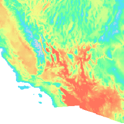
MOD21C3.061 Температура поверхности суши и трехдиапазонная излучательная способность Terra, ежемесячные данные L3 Global 0,05°CMG
Набор данных MOD21C3 представляет собой ежемесячный составной продукт температуры поверхности моря (LST), использующий алгоритм, основанный на простом методе усреднения. Алгоритм вычисляет среднее значение по всем безоблачным ежедневным данным MOD21A1D и MOD21A1N за 8-дневный период. В отличие от наборов данных MOD21A1, где…
MYD08_M3.061 Aqua Atmosphere Ежемесячный глобальный продукт
MYD08_M3 V6.1 — это глобальный продукт атмосферных данных, содержащий усредненные по сетке 1 x 1 градус ежемесячные значения атмосферных параметров. Эти параметры связаны со свойствами атмосферных аэрозольных частиц, общим содержанием озона, атмосферным водяным паром, оптическими и физическими свойствами облаков, а также индексами атмосферной стабильности. …
MYD13A3.061 Индексы водной растительности, ежемесячные, L3, глобальная сетка SIN 1 км
Данные индексов растительности MODIS (MYD13A3) версии 6.1 предоставляются ежемесячно с пространственным разрешением 1 километр (км) в виде сетки уровня 3 в синусоидальной проекции. При создании этого ежемесячного продукта алгоритм использует все продукты MYD13A2, которые…
MYD21C3.061 Температура поверхности суши и трехдиапазонная излучательная способность Aqua, ежемесячные данные L3, глобальный диапазон 0,05°C.
Набор данных MYD21C3 представляет собой ежемесячный составной продукт температуры поверхности моря (LST), использующий алгоритм, основанный на простом методе усреднения. Алгоритм вычисляет среднее значение по всем безоблачным ежедневным данным MYD21A1D и MYD21A1N за 8-дневный период. В отличие от наборов данных MYD21A1, где…
Обратная модель обмена между атмосферой и сушей / Дезагрегация обратной модели обмена между атмосферой и сушей (ALEXI/DisALEXI). Модель DisALEXI была портирована в Google Earth Engine как часть фреймворка OpenET. Базовая структура модели ALEXI/DisALEXI описана Андерсоном и др. (2012, 2018). Модель эвапотранспирации (ET) ALEXI использует временные параметры…
Обратная модель обмена между атмосферой и сушей / Дезагрегация обратной модели обмена между атмосферой и сушей (ALEXI/DisALEXI). Модель DisALEXI была портирована в Google Earth Engine как часть фреймворка OpenET. Базовая структура модели ALEXI/DisALEXI описана Андерсоном и др. (2012, 2018). Модель эвапотранспирации (ET) ALEXI использует временные параметры…
Ежемесячный отчет OpenET Ensemble об эвапотранспирации, версия 2.0
Набор данных OpenET включает спутниковые данные об общем количестве воды, переносимой с поверхности земли в атмосферу в процессе эвапотранспирации (ЭТ). OpenET предоставляет данные об ЭТ из множества моделей, основанных на спутниковых данных, а также вычисляет единое «ансамблевое значение» на основе…
Набор данных OpenET включает спутниковые данные об общем количестве воды, переносимой с поверхности земли в атмосферу в процессе эвапотранспирации (ЭТ). OpenET предоставляет данные об ЭТ из множества моделей, основанных на спутниковых данных, а также вычисляет единое «ансамблевое значение» на основе…
Лаборатория реактивного движения Пристли-Тейлора (PT-JPL). Основная формулировка модели PT-JPL в рамках OpenET не изменилась по сравнению с первоначальной формулировкой, подробно описанной в работе Фишера и др. (2008). Однако были внесены улучшения и обновления в входные данные модели и интеграцию по времени для PT-JPL, чтобы учесть…
Лаборатория реактивного движения Пристли-Тейлора (PT-JPL). Основная формулировка модели PT-JPL в рамках OpenET не изменилась по сравнению с первоначальной формулировкой, подробно описанной в работе Фишера и др. (2008). Однако были внесены улучшения и обновления в входные данные модели и интеграцию по времени для PT-JPL, чтобы учесть…
Спутниковая система поддержки управления орошением (SIMS). Модель спутниковой поддержки управления орошением (SIMS) НАСА изначально была разработана для поддержки спутникового картирования коэффициентов урожайности и эвапотранспирации (ET) на орошаемых землях, а также для расширения доступа к этим данным для использования в планировании орошения и региональной оценке…
Спутниковая система поддержки управления орошением (SIMS). Модель спутниковой поддержки управления орошением (SIMS) НАСА изначально была разработана для поддержки спутникового картирования коэффициентов урожайности и эвапотранспирации (ET) на орошаемых землях, а также для расширения доступа к этим данным для использования в планировании орошения и региональной оценке…
Оперативная упрощенная модель баланса поверхностной энергии (SSEBop). Модель оперативной упрощенной модели баланса поверхностной энергии (SSEBop), разработанная Сенаем и др. (2013, 2017), представляет собой упрощенную модель поверхностной энергии, основанную на тепловом эффекте, для оценки фактического испарения на основе принципов спутниковой психрометрии (Сенай, 2018). В реализации OpenET SSEBop используется…
Оперативная упрощенная модель баланса поверхностной энергии (SSEBop). Модель оперативного упрощенного баланса поверхностной энергии (SSEBop) (Senay et al., 2013; 2023) представляет собой термический подход к оценке фактического испарения (ET) с использованием принципов спутниковой психрометрии (Senay, 2018). Как одна из основных моделей в…
Реализация в Google Earth Engine модели картирования испарения с высоким разрешением с внутренней калибровкой (eeMETRIC). eeMETRIC использует усовершенствованные алгоритмы и процесс METRIC, описанные Алленом и др. (2007; 2015) и Алленом и др. (2013b), где наблюдается особая взаимосвязь между температурой воздуха у поверхности земли…
Реализация в Google Earth Engine модели картирования испарения с высоким разрешением с внутренней калибровкой (eeMETRIC). eeMETRIC использует усовершенствованные алгоритмы и процесс METRIC, описанные Алленом и др. (2007; 2015) и Алленом и др. (2013b), где наблюдается особая взаимосвязь между температурой воздуха у поверхности земли…
Реализация модели алгоритма баланса поверхностной энергии для суши (SEBAL) в Google Earth Engine. Обзор текущей версии geeSEBAL можно найти в работе Laipelt et al. (2021), которая основана на оригинальных алгоритмах, разработанных Bastiaanssen et al. (1998). OpenET geeSEBAL…
Реализация модели алгоритма баланса поверхностной энергии для суши (SEBAL) в Google Earth Engine. Обзор текущей версии geeSEBAL можно найти в работе Laipelt et al. (2021), которая основана на оригинальных алгоритмах, разработанных Bastiaanssen et al. (1998). OpenET geeSEBAL…
OpenLandMap Долгосрочные данные о температуре поверхности земли в дневное время Месячные значения
Среднемесячные значения температуры поверхности суши в дневное время за 2000-2017 годы. Получено с использованием пакета data.table и функции quantile в R. Для получения дополнительной информации о продукте MODIS LST см. эту страницу. Антарктида не включена. Для доступа и визуализации карт вне Earth Engine используйте эту страницу. …
OpenLandMap Долгосрочные данные о температуре поверхности земли в дневное и месячное время Стандартное отклонение
Долгосрочное стандартное отклонение дневной и ночной температуры MODIS LST на высоте 1 км, основанное на временном ряду 2000-2017 годов. Получено с использованием пакета data.table и функции quantile в R. Для получения дополнительной информации о продукте MODIS LST см. эту страницу. Антарктида не включена. Для доступа…
OpenLandMap Долгосрочные данные о температуре поверхности земли: разница между дневными и ночными значениями за месяц
Долгосрочные дневные и ночные различия температуры поверхности моря по данным MODIS на уровне 1 км, основанные на временном ряду 2000-2017 гг., получены с использованием пакета data.table и функции quantile в R. Более подробную информацию о продукте MODIS LST см. на этой странице. Антарктида не включена. Для доступа и визуализации…
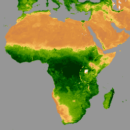
Потенциальный ежемесячный отчет FAPAR от OpenLandMap
Потенциальная естественная растительность FAPAR, прогнозируемая среднемесячная (на основе данных PROB-V FAPAR 2014-2017). Описание. Для доступа к картам и их визуализации вне Earth Engine используйте эту страницу. Если вы обнаружили ошибку, артефакт или несоответствие на картах LandGIS или у вас есть вопрос, пожалуйста, используйте…
Ежемесячные осадки в мм с разрешением 1 км на основе данных SM2RAIN-ASCAT 2007-2018, IMERG, CHELSA Climate и WorldClim. Масштабирование до разрешения 1 км выполнено с использованием gdalwarp (кубические сплайны) и усреднения ежемесячных данных WorldClim, CHELSA Climate и IMERG (см., например, "3B-MO-L.GIS.IMERG.20180601.V05B.tif"). Присвоен в 3 раза больший вес…
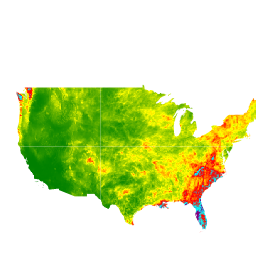
Ежемесячный пространственный климатический набор данных PRISM ANm
Ежедневные и ежемесячные наборы данных PRISM представляют собой сеточные климатические данные для континентальной части Соединенных Штатов, созданные группой PRISM Climate Group в Университете штата Орегон. Эта коллекция содержит данные AN81 и AN91, как указано в свойстве 'dataset_type'. Сетки разрабатываются с использованием PRISM (Parameter-elevation…).
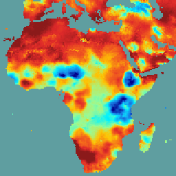
SPEIbase: База данных стандартизированного индекса осадков и испарения, версия 2.11
Глобальная база данных SPEI (SPEIbase) предоставляет надежную информацию о засушливых условиях в глобальном масштабе за длительный период, с размером пикселя 0,5 градуса и ежемесячной периодичностью. Она содержит данные по индексу SPEI за период от 1 до 48 месяцев. Стандартизированный индекс осадков и испарения (SPEI) выражает в виде стандартизированной переменной…
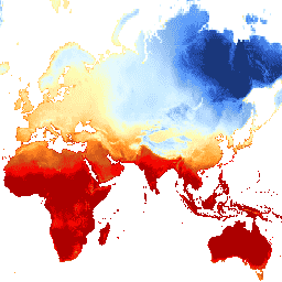
TerraClimate: Ежемесячный климатический и водный баланс для наземных поверхностей по всему миру, Университет Айдахо.
TerraClimate — это набор данных о ежемесячном климате и климатическом водном балансе для глобальных наземных поверхностей. Он использует интерполяцию с учетом климатических факторов, объединяя климатологические нормы с высоким пространственным разрешением из набора данных WorldClim с данными с более низким пространственным разрешением, но изменяющимися во времени, из CRU Ts4.0 и японского 55-летнего реанализа (JRA55). …
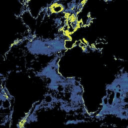
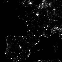
VIIRS Ночное время Дневное/Ночное время Композитные изображения, версия 1
Усредненные за месяц композитные изображения яркости, полученные с использованием ночных данных с прибора Visible Infrared Imaging Radiometer Suite (VIIRS) в дневном/ночном диапазоне (DNB). Поскольку эти данные формируются ежемесячно, во многих регионах мира невозможно получить качественные данные за конкретный месяц.
VIIRS Композитные изображения ночного и дневного/ночного диапазонов с коррекцией рассеянного света, версия 1.
Усредненные за месяц композитные изображения яркости, полученные с использованием ночных данных с прибора Visible Infrared Imaging Radiometer Suite (VIIRS) в дневном/ночном диапазоне (DNB). Поскольку эти данные формируются ежемесячно, во многих регионах мира невозможно получить качественные данные за конкретный месяц.
WorldClim V1 Bioclim предоставляет биоклиматические переменные, полученные на основе ежемесячных данных о температуре и количестве осадков, для генерации более биологически значимых значений. Биоклиматические переменные отражают годовые тенденции (например, среднегодовая температура, годовое количество осадков), сезонность (например, годовой диапазон температуры и осадков) и экстремальные значения…
В первой версии WorldClim представлены усредненные ежемесячные глобальные климатические данные по минимальной, средней и максимальной температуре, а также по количеству осадков. Первая версия WorldClim была разработана Робертом Дж. Хиймансом, Сьюзан Кэмерон и Хуаном Парра в Музее позвоночной зоологии Калифорнийского университета в Беркли в сотрудничестве с…
[[["Прост для понимания","easyToUnderstand","thumb-up"],["Помог мне решить мою проблему","solvedMyProblem","thumb-up"],["Другое","otherUp","thumb-up"]],[["Отсутствует нужная мне информация","missingTheInformationINeed","thumb-down"],["Слишком сложен/слишком много шагов","tooComplicatedTooManySteps","thumb-down"],["Устарел","outOfDate","thumb-down"],["Проблема с переводом текста","translationIssue","thumb-down"],["Проблемы образцов/кода","samplesCodeIssue","thumb-down"],["Другое","otherDown","thumb-down"]],[],[],[]]