Datasets tagged lidar in Earth Engine
Оптимизируйте свои подборки
Сохраняйте и классифицируйте контент в соответствии со своими настройками.
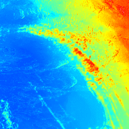
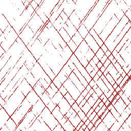
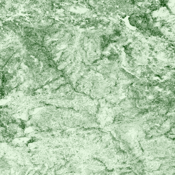
AHN Нидерланды, цифровая модель рельефа 0,5 м, интерполированная.
Цифровая модель рельефа AHN (DEM) — это модель рельефа с разрешением 0,5 м, охватывающая территорию Нидерландов. Она была создана на основе данных LIDAR, полученных весной 2007-2012 годов. Модель содержит данные об уровне земли, из которых удалены все остальные объекты над землей (такие как здания, мосты, деревья и т. д.). Эта версия…
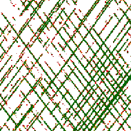
AHN Нидерланды, цифровая модель рельефа 0,5 м, без интерполяции
Цифровая модель рельефа AHN (DEM) — это модель рельефа с разрешением 0,5 м, охватывающая территорию Нидерландов. Она была создана на основе данных LIDAR, полученных весной 2007-2012 годов. Модель содержит данные об уровне земли, из которых удалены все остальные объекты над землей (такие как здания, мосты, деревья и т. д.). Эта версия…
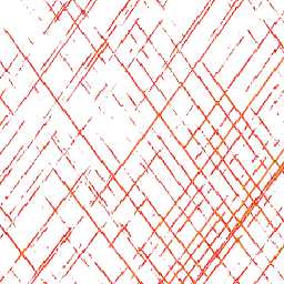
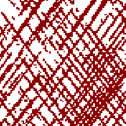
AHN Нидерланды, цифровая модель рельефа 0,5 м, необработанные образцы.
Цифровая модель рельефа AHN (цифровая модель рельефа) — это модель рельефа с разрешением 0,5 м, охватывающая территорию Нидерландов. Она была создана на основе данных LIDAR, полученных весной 2007-2012 годов. Эта версия содержит как данные с уровня земли, так и данные об объектах, расположенных выше уровня земли (таких как здания, мосты, деревья и т. д.). Облако точек…
Actueel Hoogtebestand Nederland (AHN) — это набор данных с подробными и точными данными о высоте местности на всей территории Нидерландов. Информация о высоте была собрана с вертолетов и самолетов с использованием лазерной технологии с вертикальной точностью 5 см. Набор данных AHN3 содержит цифровую модель рельефа Нидерландов AHN с разрешением 0,5 м…
Actueel Hoogtebestand Nederland (AHN) — это набор данных с подробными и точными данными о высоте местности на всей территории Нидерландов. Информация о высоте была собрана с вертолетов и самолетов с использованием лазерной технологии с вертикальной точностью 5 см. Набор данных AHN4 содержит цифровую модель рельефа Нидерландов AHN с разрешением 0,5 м…
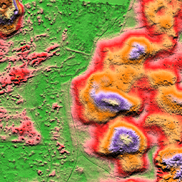
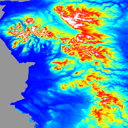
Цифровая модель рельефа (ЦМР) Австралии с шагом 5 метров, полученная на основе модели LiDAR, представляет собой национальную ЦМР с шагом 5 метров (без учета рельефа местности), созданную на основе 236 отдельных съемок LiDAR, проведенных в период с 2001 по 2015 год и охватывающих территорию площадью более 245 000 квадратных километров.
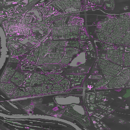
Англия, 1-метровая сводная цифровая модель рельефа/цифровая модель поверхности (Агентство по охране окружающей среды)
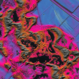
Композитная цифровая модель рельефа (ЦМР) на основе данных LIDAR представляет собой растровую модель местности, охватывающую около 99% территории Англии с пространственным разрешением 1 м, созданную Агентством по охране окружающей среды Великобритании в 2022 году. Модель содержит 3 канала данных о рельефе: цифровую модель рельефа (ЦМР), цифровую модель поверхности (ЦМП) первого поколения, …
Сетчатые показатели структуры растительности и плотности биомассы GEDI с использованием метрик COUNTS, размер пикселя 12 км.
Этот набор данных состоит из практически глобальных, готовых к анализу, многоуровневых сеточных метрик структуры растительности, полученных из продуктов NASA Global Ecosystem Dynamics Investigation (GEDI) уровней 2 и 4A, связанных с зонами охвата лидара диаметром 25 м. Этот набор данных обеспечивает всестороннее представление структуры растительности практически в глобальном масштабе, включая…
Сетчатые показатели структуры растительности и плотности биомассы GEDI с использованием метрик COUNTS, размер пикселя 1 км.
Этот набор данных состоит из практически глобальных, готовых к анализу, многоуровневых сеточных метрик структуры растительности, полученных из продуктов NASA Global Ecosystem Dynamics Investigation (GEDI) уровней 2 и 4A, связанных с зонами охвата лидара диаметром 25 м. Этот набор данных обеспечивает всестороннее представление структуры растительности практически в глобальном масштабе, включая…
Сетчатые показатели структуры растительности и плотности биомассы GEDI с использованием метрик COUNTS, размер пикселя 6 км.
Этот набор данных состоит из практически глобальных, готовых к анализу, многоуровневых сеточных метрик структуры растительности, полученных из продуктов NASA Global Ecosystem Dynamics Investigation (GEDI) уровней 2 и 4A, связанных с зонами охвата лидара диаметром 25 м. Этот набор данных обеспечивает всестороннее представление структуры растительности практически в глобальном масштабе, включая…
Сетчатые показатели структуры растительности и плотности биомассы GEDI, размер пикселя 12 км.
Этот набор данных состоит из практически глобальных, готовых к анализу, многоуровневых сеточных метрик структуры растительности, полученных из продуктов NASA Global Ecosystem Dynamics Investigation (GEDI) уровней 2 и 4A, связанных с зонами охвата лидара диаметром 25 м. Этот набор данных обеспечивает всестороннее представление структуры растительности практически в глобальном масштабе, включая…
Сетчатые показатели структуры растительности и плотности биомассы GEDI, размер пикселя 1 км.
Этот набор данных состоит из практически глобальных, готовых к анализу, многоуровневых сеточных метрик структуры растительности, полученных из продуктов NASA Global Ecosystem Dynamics Investigation (GEDI) уровней 2 и 4A, связанных с зонами охвата лидара диаметром 25 м. Этот набор данных обеспечивает всестороннее представление структуры растительности практически в глобальном масштабе, включая…
Сетчатые показатели структуры растительности и плотности биомассы GEDI, размер пикселя 6 км.
Этот набор данных состоит из практически глобальных, готовых к анализу, многоуровневых сеточных метрик структуры растительности, полученных из продуктов NASA Global Ecosystem Dynamics Investigation (GEDI) уровней 2 и 4A, связанных с зонами охвата лидара диаметром 25 м. Этот набор данных обеспечивает всестороннее представление структуры растительности практически в глобальном масштабе, включая…
Высота верхней части растительного покрова над голой землей (модель высоты растительного покрова; CHM). Модель CHM получается из облака точек NEON LiDAR и генерируется путем создания непрерывной поверхности оценок высоты растительного покрова по всей пространственной области съемки LiDAR. …
Цифровые модели поверхности (ЦМП) и рельефа (ЦМР), полученные на основе данных лидара NEON. ЦМП: Характеристики поверхности (топографическая информация с учетом растительности и искусственных сооружений). ЦМР: Высота над уровнем моря (топографическая информация без учета растительности и искусственных сооружений). Изображения представлены в метрах над уровнем моря…
[[["Прост для понимания","easyToUnderstand","thumb-up"],["Помог мне решить мою проблему","solvedMyProblem","thumb-up"],["Другое","otherUp","thumb-up"]],[["Отсутствует нужная мне информация","missingTheInformationINeed","thumb-down"],["Слишком сложен/слишком много шагов","tooComplicatedTooManySteps","thumb-down"],["Устарел","outOfDate","thumb-down"],["Проблема с переводом текста","translationIssue","thumb-down"],["Проблемы образцов/кода","samplesCodeIssue","thumb-down"],["Другое","otherDown","thumb-down"]],[],[],[]]