Datasets tagged landsat in Earth Engine
Оптимизируйте свои подборки
Сохраняйте и классифицируйте контент в соответствии со своими настройками.
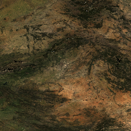
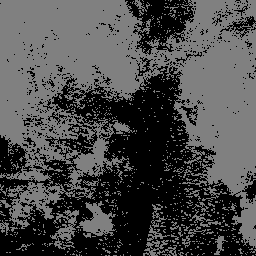
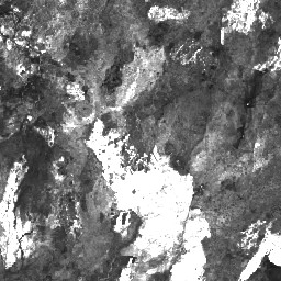
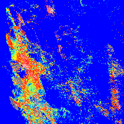
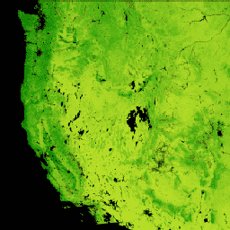
ESA WorldCereal 10 m v100
Пакет продуктов Европейского космического агентства (ESA) WorldCereal 10 m 2021 включает в себя глобальные карты годовых и сезонных урожаев, а также данные об уровне достоверности этих карт. Они были созданы в рамках проекта ESA-WorldCereal. Более подробная информация о содержании этих продуктов и используемой методологии…
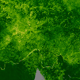
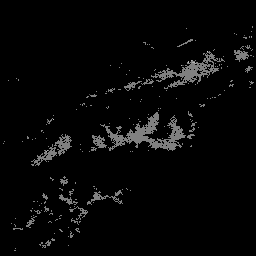
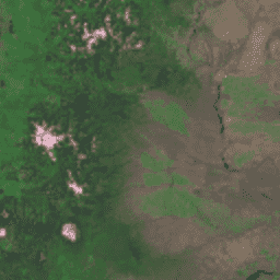
Пакет продуктов Европейского космического агентства (ESA) WorldCereal Active Cropland 10 m 2021 содержит глобальные сезонные маркеры активных сельскохозяйственных угодий. Они были созданы в рамках проекта ESA-WorldCereal. Продукты, отображающие активные сельскохозяйственные угодья, показывают, активно ли обрабатывался пиксель, идентифицированный как временный сельскохозяйственный участок…
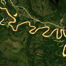
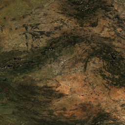
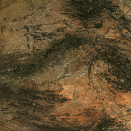
HLSL30: HLS-2 Landsat Operational Land Imager Surface Reflectance and TOA Brightness Daily Global 30m
Проект Harmonized Landsat Sentinel-2 (HLS) предоставляет согласованные данные об отражательной способности поверхности (SR) и яркости на верхней границе атмосферы (TOA) от виртуальной группировки спутниковых датчиков. Оперативный наземный имиджер (OLI) размещен на борту совместных спутников NASA/USGS Landsat 8 и Landsat 9, а многоспектральный…
HLSS30: Многоспектральный прибор HLS Sentinel-2, измерение отражения поверхности, ежедневные глобальные данные с разрешением 30 м.
Проект Harmonized Landsat Sentinel-2 (HLS) предоставляет согласованные данные об отражательной способности поверхности, полученные с помощью оперативного прибора для получения изображений поверхности суши (OLI) на борту совместного спутника NASA/USGS Landsat 8 и многоспектрального прибора (MSI) на борту европейских спутников Copernicus Sentinel-2A. Совместные измерения позволяют проводить глобальные наблюдения за сушей каждые 2-3…
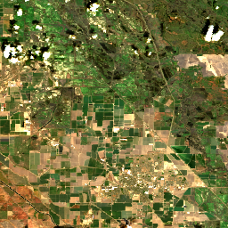
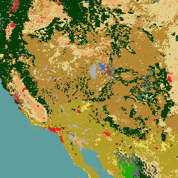
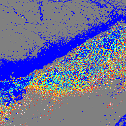
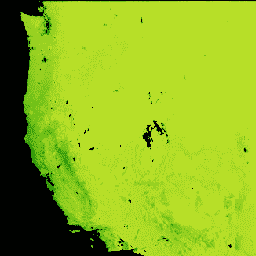
Земной покров Северной Америки на расстоянии 30 метров, 2020 год.
Набор данных о земельном покрове Северной Америки за 2020 год с разрешением 30 метров был создан в рамках Североамериканской системы мониторинга изменений земель (NALCMS), трехстороннего проекта Министерства природных ресурсов Канады, Геологической службы США и трех мексиканских организаций, включая Национальный институт статистики и географии…
Landsat Collection 2 Уровень 1 Уровень 2 32-дневный композитный снимок BAI
Эти композитные изображения Landsat Collection 2 Tier 1 Level 2 созданы из ортокорректированных сцен Tier 1 Level 2. Индекс выгорания (BAI) рассчитывается на основе красного и ближнего ИК-диапазонов и измеряет спектральное расстояние каждого пикселя от эталонной спектральной точки (…
Landsat Collection 2 Уровень 1, Уровень 2, 32-дневный композитный снимок
Эти композитные изображения Landsat Collection 2 Tier 1 Level 2 созданы из ортокорректированных снимков Tier 1 Level 2 и включают в себя следующие полосы SR: синий, зеленый, красный, ближний инфракрасный, swir1, swir2 и тепловой. Эти композиты создаются из всех снимков за каждый 32-дневный период, начиная с…
Эти композитные изображения Landsat Collection 2 уровня 1 (Level 2) созданы на основе ортокорректированных сцен уровня 1 (Level 2). Индекс нормализованного коэффициента выгорания в тепловом диапазоне (NBRT) рассчитывается на основе ближнего ИК-диапазона, среднего ИК-диапазона (2215 нм) и теплового диапазона и имеет диапазон от -1,0 до 1,0. См.…
Landsat Collection 2 Уровень 1, Уровень 2, 32-дневный композитный NDVI
Эти композитные изображения Landsat Collection 2 Tier 1 Level 2 созданы из ортокорректированных сцен Tier 1 Level 2. Нормализованный разностный индекс растительности рассчитывается из ближнего ИК- и красного диапазонов каждой сцены как (NIR - Red) / (NIR + Red) и варьируется в…
Landsat Collection 2 Уровень 1, Уровень 2, 32-дневный композитный снимок NDWI
Эти композитные изображения Landsat Collection 2 Tier 1 Level 2 созданы из ортокорректированных сцен Tier 1 Level 2. Нормализованный разностный водный индекс (NDWI) предназначен для выделения открытых водных объектов и повышения их видимости на изображениях при одновременном исключении почвенных и наземных растительных элементов. Он…
Landsat Collection 2 Уровень 1 Уровень 2 8-дневный композитный снимок BAI
Эти композитные изображения Landsat Collection 2 Tier 1 Level 2 созданы из ортокорректированных сцен Tier 1 Level 2. Индекс выгорания (BAI) рассчитывается на основе красного и ближнего ИК-диапазонов и измеряет спектральное расстояние каждого пикселя от эталонной спектральной точки (…
Landsat Collection 2 Уровень 1 Уровень 2 8-дневный композитный снимок
Эти композитные изображения Landsat Collection 2 Tier 1 Level 2 созданы из ортокорректированных снимков Tier 1 Level 2 и включают в себя следующие полосы SR: синий, зеленый, красный, ближний инфракрасный, swir1, swir2 и тепловой. Эти композиты создаются из всех снимков за каждый 8-дневный период, начиная с…
Композитный снимок Landsat Collection 2 уровня 1, 8-дневный уровень 2 (EVI).
Эти композитные изображения Landsat Collection 2 Tier 1 Level 2 созданы на основе ортокорректированных сцен Tier 1 Level 2. Улучшенный индекс растительности (EVI) рассчитывается на основе ближнего ИК, красного и синего диапазонов каждого изображения и принимает значения от -1,0 до 1,0. См. Huete…
Эти композитные изображения Landsat Collection 2 уровня 1 (Level 2) созданы на основе ортокорректированных сцен уровня 1 (Level 2). Индекс нормализованного коэффициента выгорания в тепловом диапазоне (NBRT) рассчитывается на основе ближнего ИК-диапазона, среднего ИК-диапазона (2215 нм) и теплового диапазона и имеет диапазон от -1,0 до 1,0. См.…
Эти композитные изображения Landsat Collection 2 Tier 1 Level 2 созданы из ортокорректированных сцен Tier 1 Level 2. Нормализованный разностный индекс растительности рассчитывается из ближнего ИК- и красного диапазонов каждой сцены как (NIR - Red) / (NIR + Red) и варьируется в…
Эти композитные изображения Landsat Collection 2 Tier 1 Level 2 созданы из ортокорректированных сцен Tier 1 Level 2. Нормализованный разностный водный индекс (NDWI) предназначен для выделения открытых водных объектов и повышения их видимости на изображениях при одновременном исключении почвенных и наземных растительных элементов. Он…
Landsat Collection 2 Уровень 1 Уровень 2 Ежегодный композитный снимок BAI
Эти композитные изображения Landsat Collection 2 Tier 1 Level 2 созданы из ортокорректированных сцен Tier 1 Level 2. Индекс выгорания (BAI) рассчитывается на основе красного и ближнего ИК-диапазонов и измеряет спектральное расстояние каждого пикселя от эталонной спектральной точки (…
Landsat Collection 2 Уровень 1 Уровень 2 Ежегодное композитное изображение
Эти композитные изображения Landsat Collection 2 Tier 1 Level 2 созданы из ортокорректированных снимков Tier 1 Level 2 и включают в себя следующие полосы SR: синий, зеленый, красный, ближний инфракрасный, swir1, swir2 и тепловой. Эти композиты созданы из всех снимков за каждый годовой период, начиная с…
Landsat Collection 2 Уровень 1 Уровень 2 Ежегодный композитный снимок EVI
Эти композитные изображения Landsat Collection 2 Tier 1 Level 2 созданы на основе ортокорректированных сцен Tier 1 Level 2. Улучшенный индекс растительности (EVI) рассчитывается на основе ближнего ИК, красного и синего диапазонов каждого изображения и принимает значения от -1,0 до 1,0. См. Huete…
Landsat Collection 2 Уровень 1 Уровень 2 Ежегодный композитный снимок NBR
Эти композитные изображения Landsat Collection 2 уровня 1 (Level 2) созданы на основе ортокорректированных сцен уровня 1 (Level 2). Индекс нормализованного коэффициента выгорания в тепловом диапазоне (NBRT) рассчитывается на основе ближнего ИК-диапазона, среднего ИК-диапазона (2215 нм) и теплового диапазона и имеет диапазон от -1,0 до 1,0. См.…
Landsat Collection 2 Уровень 1, Ежегодный композитный снимок NDVI уровня 2
Эти композитные изображения Landsat Collection 2 Tier 1 Level 2 созданы из ортокорректированных сцен Tier 1 Level 2. Нормализованный разностный индекс растительности рассчитывается из ближнего ИК- и красного диапазонов каждой сцены как (NIR - Red) / (NIR + Red) и варьируется в…
Коллекция Landsat 2, уровень 1, ежегодный композитный снимок NDWI уровня 2.
Эти композитные изображения Landsat Collection 2 Tier 1 Level 2 созданы из ортокорректированных сцен Tier 1 Level 2. Нормализованный разностный водный индекс (NDWI) предназначен для выделения открытых водных объектов и повышения их видимости на изображениях при одновременном исключении почвенных и наземных растительных элементов. Он…
Глобальная наземная съемка (GLS) 1975 года — это глобальная коллекция изображений, полученных с помощью мультиспектрального сканера Landsat (MSS). Большинство снимков были сделаны спутниками Landsat 1-3 в 1972-1983 годах. Несколько пробелов в данных Landsat 1-3 были заполнены снимками, полученными спутниками Landsat 4-5 в течение…
Глобальное исследование земель Landsat 2005, снимки Landsat 5
Набор данных GLS2005 представляет собой коллекцию из 9500 ортокорректированных спутниковых снимков среднего разрешения, полученных в период с 2004 по 2007 год и охватывающих земную поверхность. В GLS2005 используются в основном данные Landsat 5 и данные Landsat 7 с заполненными пробелами, а данные EO-1 ALI и Terra ASTER заполняют любые…
Набор данных GLS2005 представляет собой коллекцию из 9500 ортокорректированных спутниковых снимков среднего разрешения, полученных в период с 2004 по 2007 год и охватывающих земную поверхность. В GLS2005 используются в основном данные Landsat 5 и данные Landsat 7 с заполненными пробелами, а данные EO-1 ALI и Terra ASTER заполняют любые…
Глобальное исследование земель Landsat 2005, снимки Landsat 7
Набор данных GLS2005 представляет собой коллекцию из 9500 ортокорректированных спутниковых снимков среднего разрешения, полученных в период с 2004 по 2007 год и охватывающих земную поверхность. В GLS2005 используются в основном данные Landsat 5 и данные Landsat 7 с заполненными пробелами, а данные EO-1 ALI и Terra ASTER заполняют любые…
Данные Landsat о валовом первичном производстве на территории континентальной части США
В наборе данных Landsat Gross Primary Production (GPP) CONUS оценка GPP производится с использованием данных Landsat Surface Reflectance для континентальной части США. GPP — это количество углерода, поглощенного растениями в экосистеме, и является важным компонентом в расчетах чистой первичной продукции (NPP). GPP рассчитывается с использованием…
Первичное производство Landsat Net на территории континентальной части США
Набор данных Landsat Net Primary Production (NPP) CONUS оценивает первичную продуктивность (NPP) с использованием данных Landsat Surface Reflectance для континентальной части США. NPP — это количество углерода, поглощенного растениями в экосистеме, после учета потерь из-за дыхания. NPP рассчитывается с использованием алгоритма MOD17 (см. MOD17 User…).
Необработанные изображения из коллекции USGS Landsat 1 MSS Collection 2 Tier 1
Значения DN уровня 1 из коллекции MSS Landsat 1, представляющие собой масштабированную, откалиброванную яркость на датчике. Сцены Landsat с наивысшим доступным качеством данных помещаются в уровень 1 и считаются пригодными для анализа временных рядов. Уровень 1 включает данные, обработанные с помощью технологии Level-1 Precision Terrain (L1TP), которые…
Необработанные изображения из коллекции USGS Landsat 1 MSS Collection 2 Tier 2.
Значения DN уровня 2 из коллекции MSS Landsat 1 представляют собой масштабированную, откалиброванную яркость, измеренную непосредственно на датчике. Сцены, не соответствующие критериям уровня 1 во время обработки, относятся к уровню 2. Это включает в себя сцены, обработанные с помощью систематической обработки рельефа (L1GT) и систематической обработки (L1GS), а также любые сцены L1TP, которые…
Необработанные изображения из коллекции USGS Landsat 2 MSS Collection 2 Tier 1.
Значения DN уровня 1 коллекции MSS Landsat 2 представляют собой масштабированную, откалиброванную яркость, измеренную непосредственно на датчике. Сцены Landsat с наивысшим доступным качеством данных помещаются в уровень 1 и считаются пригодными для анализа временных рядов. Уровень 1 включает данные, обработанные с помощью технологии Level-1 Precision Terrain (L1TP), которые…
Необработанные изображения из коллекции USGS Landsat 2 MSS Collection 2 Tier 2.
Значения DN уровня 2 коллекции MSS Landsat 2 представляют собой масштабированную, откалиброванную яркость, измеренную непосредственно на датчике. Сцены, не соответствующие критериям уровня 1 во время обработки, относятся к уровню 2. Это включает в себя сцены, обработанные с помощью систематической обработки рельефа (L1GT) и систематической обработки (L1GS), а также любые сцены L1TP, которые…
Необработанные изображения из коллекции USGS Landsat 3 MSS Collection 2 Tier 1.
Значения DN уровня 1 из коллекции MSS Landsat 3, представляющие собой масштабированную, откалиброванную яркость на датчике. Сцены Landsat с наивысшим доступным качеством данных помещаются в уровень 1 и считаются пригодными для анализа временных рядов. Уровень 1 включает данные, обработанные с помощью технологии Level-1 Precision Terrain (L1TP), которые…
Необработанные изображения из коллекции USGS Landsat 3 MSS Collection 2 Tier 2.
Значения DN уровня 2 коллекции MSS Landsat 3 представляют собой масштабированную, откалиброванную яркость, измеренную непосредственно на датчике. Сцены, не соответствующие критериям уровня 1 во время обработки, относятся к уровню 2. Это включает в себя сцены, обработанные с помощью систематической обработки рельефа (L1GT) и систематической обработки (L1GS), а также любые сцены L1TP, которые…
Геологическая служба США, спутник Landsat 4, уровень 2, коллекция 2, категория 1.
Этот набор данных содержит атмосферно скорректированные значения отражательной способности поверхности и температуры поверхности земли, полученные на основе данных, собранных датчиком Landsat™. Изображения включают 4 полосы видимого и ближнего инфракрасного диапазона (VNIR) и 2 полосы коротковолнового инфракрасного диапазона (SWIR), обработанные для получения ортокорректированной отражательной способности поверхности, а также одно изображение в тепловом инфракрасном диапазоне…
Геологическая служба США, спутник Landsat 4, уровень 2, коллекция 2, категория 2.
Этот набор данных содержит атмосферно скорректированные значения отражательной способности поверхности и температуры поверхности земли, полученные на основе данных, собранных датчиком Landsat™. Изображения включают 4 полосы видимого и ближнего инфракрасного диапазона (VNIR) и 2 полосы коротковолнового инфракрасного диапазона (SWIR), обработанные для получения ортокорректированной отражательной способности поверхности, а также одно изображение в тепловом инфракрасном диапазоне…
Необработанные изображения из коллекции USGS Landsat 4 MSS Collection 2 Tier 1.
Значения DN уровня 1 из коллекции MSS Landsat 4, представляющие собой масштабированную, откалиброванную яркость на датчике. Сцены Landsat с наивысшим доступным качеством данных помещаются в уровень 1 и считаются пригодными для анализа временных рядов. Уровень 1 включает данные, обработанные с помощью технологии Level-1 Precision Terrain (L1TP), которые…
Необработанные изображения из коллекции USGS Landsat 4 MSS Collection 2 Tier 2.
Значения DN уровня 2 коллекции MSS Landsat 4 представляют собой масштабированную, откалиброванную яркость, измеренную непосредственно на датчике. Сцены, не соответствующие критериям уровня 1 во время обработки, относятся к уровню 2. Это включает в себя сцены, обработанные с помощью систематической обработки рельефа (L1GT) и систематической обработки (L1GS), а также любые сцены L1TP, которые…
Необработанные изображения из коллекции USGS Landsat 4™ Collection 2 Tier 1.
Значения DN уровня 1 коллекции Landsat 4™ представляют собой масштабированную, откалиброванную яркость, измеренную непосредственно на датчике. Сцены Landsat с наивысшим доступным качеством данных помещаются в уровень 1 и считаются пригодными для анализа временных рядов. Уровень 1 включает данные, обработанные с помощью технологии Level-1 Precision Terrain (L1TP), которые…
Отражательная способность TOA, коллекция 2, уровень 1, USGS Landsat 4™
Откалиброванная отражательная способность верхней границы атмосферы (TOA) из коллекции Landsat 4™ Collection 2 Tier 1. Коэффициенты калибровки извлекаются из метаданных изображения. Подробности о вычислении TOA см. в работе Chander et al. (2009).
Необработанные изображения из коллекции USGS Landsat 4™ Collection 2 Tier 2.
Значения DN уровня 2 для Landsat 4™ Collection 2 представляют собой масштабированную, откалиброванную яркость, измеренную непосредственно на датчике. Сцены, не соответствующие критериям уровня 1 во время обработки, относятся к уровню 2. Это включает в себя сцены, обработанные с помощью систематической обработки рельефа (L1GT) и систематической обработки (L1GS), а также любые сцены L1TP, которые…
Отражательная способность TOA, USGS Landsat 4™ Collection 2 Tier 2
Откалиброванная по уровню 2 отражательная способность верхней границы атмосферы (TOA) данных Landsat 4 TM Collection 2. Коэффициенты калибровки извлекаются из метаданных изображения. Подробности о вычислении TOA см. в работе Chander et al. (2009).
Геологическая служба США, спутник Landsat 5, уровень 2, коллекция 2, категория 1.
Этот набор данных содержит атмосферно скорректированные значения отражательной способности поверхности и температуры поверхности земли, полученные на основе данных, собранных датчиком Landsat™. Изображения включают 4 полосы видимого и ближнего инфракрасного диапазона (VNIR) и 2 полосы коротковолнового инфракрасного диапазона (SWIR), обработанные для получения ортокорректированной отражательной способности поверхности, а также одно изображение в тепловом инфракрасном диапазоне…
Геологическая служба США, спутник Landsat 5, уровень 2, коллекция 2, категория 2.
Этот набор данных содержит атмосферно скорректированные значения отражательной способности поверхности и температуры поверхности земли, полученные на основе данных, собранных датчиком Landsat™. Изображения включают 4 полосы видимого и ближнего инфракрасного диапазона (VNIR) и 2 полосы коротковолнового инфракрасного диапазона (SWIR), обработанные для получения ортокорректированной отражательной способности поверхности, а также одно изображение в тепловом инфракрасном диапазоне…
Необработанные изображения из коллекции USGS Landsat 5 MSS Collection 2 Tier 1.
Значения DN уровня 1 из коллекции MSS Landsat 5, представляющие собой масштабированную, откалиброванную яркость на датчике. Сцены Landsat с наивысшим доступным качеством данных помещаются в уровень 1 и считаются пригодными для анализа временных рядов. Уровень 1 включает данные, обработанные с помощью технологии Level-1 Precision Terrain (L1TP), которые…
Необработанные изображения из коллекции USGS Landsat 5 MSS Collection 2 Tier 2.
Значения DN уровня 2 из коллекции MSS Landsat 5 представляют собой масштабированную, откалиброванную яркость, измеренную непосредственно на датчике. Сцены, не соответствующие критериям уровня 1 во время обработки, относятся к уровню 2. Это включает в себя сцены, обработанные с помощью систематической обработки рельефа (L1GT) и систематической обработки (L1GS), а также любые сцены L1TP, которые не соответствуют…
Необработанные изображения из коллекции USGS Landsat 5™ 2, уровень 1.
Значения DN уровня 1 коллекции Landsat 5™ представляют собой масштабированную, откалиброванную яркость, измеренную непосредственно на датчике. Сцены Landsat с наивысшим доступным качеством данных помещаются в уровень 1 и считаются пригодными для анализа временных рядов. Уровень 1 включает данные, обработанные с помощью технологии Level-1 Precision Terrain (L1TP), которые…
Отражательная способность верхней границы атмосферы (TOA) по данным USGS Landsat 5™ Collection 2 Tier 1.
Откалиброванная отражательная способность верхней границы атмосферы (TOA) из коллекции Landsat 5 TM Collection 2 Tier 1. Коэффициенты калибровки извлекаются из метаданных изображения. Подробности о вычислении TOA см. в работе Chander et al. (2009).
Необработанные изображения из коллекции USGS Landsat 5™ Collection 2 Tier 2.
Значения DN уровня 2 для Landsat 5™ Collection 2 представляют собой масштабированную, откалиброванную яркость, измеренную непосредственно на датчике. Сцены, не соответствующие критериям уровня 1 во время обработки, относятся к уровню 2. Это включает в себя сцены, обработанные с помощью систематической обработки рельефа (L1GT) и систематической обработки (L1GS), а также любые сцены L1TP, которые не соответствуют…
Отражательная способность TOA, USGS Landsat 5™ Collection 2 Tier 2
Откалиброванная по уровню 2 отражательная способность верхней границы атмосферы (TOA) данных Landsat 5 TM Collection 2. Коэффициенты калибровки извлекаются из метаданных изображения. Подробности вычисления TOA см. в работе Chander et al. (2009).
Необработанные изображения из коллекции USGS Landsat 7, уровень 2, категория 1.
Значения DN уровня 1 коллекции Landsat 7, представляющие собой масштабированную, откалиброванную яркость на датчике. Сцены Landsat с наивысшим доступным качеством данных помещаются в уровень 1 и считаются пригодными для анализа временных рядов. Уровень 1 включает данные, обработанные с помощью технологии Level-1 Precision Terrain (L1TP), которые имеют…
Отражательная способность верхней границы атмосферы (TOA), коллекция 2, уровень 1, USGS Landsat 7.
Откалиброванная отражательная способность верхней границы атмосферы (TOA) для коллекции Landsat 7 2 уровня 1. Коэффициенты калибровки извлекаются из метаданных изображения. Подробности о вычислении TOA см. в работе Chander et al. (2009). Следует отметить, что орбита Landsat 7 с 2017 года смещается в сторону более раннего времени получения данных.
Данные USGS Landsat 7 Collection 2 Tier 1 и данные в реальном времени (необработанные изображения).
Значения DN для данных Landsat 7 Collection 2 Tier 1 и данных в реальном времени, представляющие собой масштабированную, откалиброванную яркость на датчике. Сцены Landsat с наивысшим доступным качеством данных помещаются в Tier 1 и считаются пригодными для анализа временных рядов. Tier 1 включает в себя обработанные данные Level-1 Precision Terrain (L1TP)…
Данные USGS Landsat 7 Collection 2 Tier 1 и данные в реальном времени TOA Reflectance
Данные Landsat 7 Collection 2 Tier 1 и данные в реальном времени, калиброванные по отражательной способности верхней границы атмосферы (TOA). Коэффициенты калибровки извлекаются из метаданных изображения. Подробности о вычислении TOA см. в работе Chander et al. (2009). Следует отметить, что орбита Landsat 7 смещается в сторону более раннего времени получения данных…
Необработанные изображения из коллекции USGS Landsat 7, уровень 2, коллекция 2.
Значения DN уровня 2 коллекции Landsat 7 представляют собой масштабированную, откалиброванную яркость, измеренную непосредственно на датчике. Сцены, не соответствующие критериям уровня 1 во время обработки, относятся к уровню 2. Это включает в себя сцены, обработанные с помощью систематической обработки рельефа (L1GT) и систематической обработки (L1GS), а также любые сцены L1TP, которые не соответствуют…
Отражательная способность верхней границы атмосферы (TOA) по данным USGS Landsat 7 Collection 2 Tier 2.
Откалиброванная отражательная способность верхней границы атмосферы (TOA) для коллекции Landsat 7, уровень 2. Коэффициенты калибровки извлекаются из метаданных изображения. Подробности о вычислении TOA см. в работе Chander et al. (2009). Следует отметить, что орбита Landsat 7 с 2017 года смещается в сторону более раннего времени получения данных.
Геологическая служба США, спутник Landsat 7, уровень 2, коллекция 2, категория 1.
Этот набор данных содержит атмосферно скорректированные значения отражательной способности поверхности и температуры поверхности земли, полученные на основе данных, собранных датчиком Landsat 7 ETM+. Изображения включают 4 полосы видимого и ближнего инфракрасного диапазона (VNIR) и 2 полосы коротковолнового инфракрасного диапазона (SWIR), обработанные для получения ортокорректированной отражательной способности поверхности, а также одно тепловое изображение…
Геологическая служба США, спутник Landsat 7, уровень 2, коллекция 2, категория 2.
Этот набор данных содержит атмосферно скорректированные значения отражательной способности поверхности и температуры поверхности земли, полученные на основе данных, собранных датчиком Landsat 7 ETM+. Изображения включают 4 полосы видимого и ближнего инфракрасного диапазона (VNIR) и 2 полосы коротковолнового инфракрасного диапазона (SWIR), обработанные для получения ортокорректированной отражательной способности поверхности, а также одно тепловое изображение…
Необработанные изображения из коллекции USGS Landsat 8, уровень 2, категория 1.
Значения DN уровня 1 коллекции Landsat 8 представляют собой масштабированную, откалиброванную яркость, измеренную непосредственно на датчике. Сцены Landsat с наивысшим доступным качеством данных помещаются в уровень 1 и считаются пригодными для анализа временных рядов. Уровень 1 включает данные, обработанные с помощью технологии Level-1 Precision Terrain (L1TP), которые имеют…
Отражательная способность TOA, коллекция 2, уровень 1, USGS Landsat 8
Откалиброванная отражательная способность верхней границы атмосферы (TOA) для коллекции Landsat 8, уровень 2, 1. Коэффициенты калибровки извлекаются из метаданных изображения. Подробности о вычислении TOA см. в работе Chander et al. (2009). Сцены Landsat с наивысшим доступным качеством данных помещаются в уровень 1 и считаются…
Данные USGS Landsat 8 Collection 2 Tier 1 и данные в реальном времени (необработанные изображения)
Значения DN для данных Landsat 8 Collection 2 Tier 1 и данных в реальном времени, представляющие собой масштабированную, откалиброванную яркость на датчике. Сцены Landsat с наивысшим доступным качеством данных помещаются в Tier 1 и считаются пригодными для анализа временных рядов. Tier 1 включает в себя обработанные данные Level-1 Precision Terrain (L1TP)…
Данные USGS Landsat 8 Collection 2 Tier 1 и данные в реальном времени TOA Reflectance
Данные Landsat 8 Collection 2 Tier 1 и данные в реальном времени калибруются по показателю отражательной способности верхней границы атмосферы (TOA). Коэффициенты калибровки извлекаются из метаданных изображения. Подробности о вычислении TOA см. в работе Chander et al. (2009). Сцены Landsat с наивысшим доступным качеством данных помещаются в Tier 1…
Необработанные изображения из коллекции USGS Landsat 8, уровень 2, коллекция 2.
Значения DN уровня 2 коллекции Landsat 8 представляют собой масштабированную, откалиброванную яркость, измеренную непосредственно на датчике. Сцены, не соответствующие критериям уровня 1 во время обработки, относятся к уровню 2. Это включает в себя сцены, обработанные с помощью систематической обработки рельефа (L1GT) и систематической обработки (L1GS), а также любые сцены L1TP, которые не соответствуют…
Отражательная способность TOA, коллекция 2, уровень 2, USGS Landsat 8
Откалиброванная по уровню 2 отражательная способность верхней границы атмосферы (TOA) из коллекции Landsat 8. Коэффициенты калибровки извлекаются из метаданных изображения. Подробности вычисления TOA см. в работе Chander et al. (2009). Сцены, не соответствующие критериям уровня 1 во время обработки, относятся к уровню 2. Это включает в себя систематические…
Геологическая служба США, спутник Landsat 8, уровень 2, коллекция 2, категория 1.
Этот набор данных содержит атмосферно скорректированные значения отражательной способности поверхности и температуры поверхности земли, полученные на основе данных, собранных датчиками Landsat 8 OLI/TIRS. Изображения включают 5 полос видимого и ближнего инфракрасного (VNIR) диапазона и 2 полосы коротковолнового инфракрасного (SWIR) диапазона, обработанные для ортокоррекции отражательной способности поверхности, а также одно тепловое изображение…
Этот набор данных содержит атмосферно скорректированные значения отражательной способности поверхности и температуры поверхности земли, полученные на основе данных, собранных датчиками Landsat 8 OLI/TIRS. Изображения включают 5 полос видимого и ближнего инфракрасного (VNIR) диапазона и 2 полосы коротковолнового инфракрасного (SWIR) диапазона, обработанные для ортокоррекции отражательной способности поверхности, а также одно тепловое изображение…
Необработанные изображения из коллекции USGS Landsat 9, уровень 2, категория 1.
Значения DN уровня 1 коллекции Landsat 9, представляющие собой масштабированную, откалиброванную яркость на датчике. Сцены Landsat с наивысшим доступным качеством данных помещаются в уровень 1 и считаются пригодными для анализа временных рядов. Уровень 1 включает данные, обработанные с помощью технологии Level-1 Precision Terrain (L1TP), которые имеют…
Отражательная способность верхней границы атмосферы (TOA), коллекция 2, уровень 1, USGS Landsat 9.
Откалиброванная отражательная способность верхней границы атмосферы (TOA) для коллекции Landsat 9, уровень 2, 1. Коэффициенты калибровки извлекаются из метаданных изображения. Подробности о вычислении TOA см. в работе Chander et al. (2009). Сцены Landsat с наивысшим доступным качеством данных помещаются в уровень 1 и считаются…
Необработанные изображения из коллекции USGS Landsat 9, уровень 2, коллекция 2.
Значения DN уровня 2 для коллекции Landsat 9, представляющие собой масштабированную, откалиброванную яркость, измеренную непосредственно на датчике. Сцены, не соответствующие критериям уровня 1 во время обработки, относятся к уровню 2. Это включает в себя сцены, обработанные с помощью систематической обработки рельефа (L1GT) и систематической обработки (L1GS), а также любые сцены L1TP, которые не соответствуют…
Отражательная способность верхней границы атмосферы (TOA) по данным USGS Landsat 9 Collection 2 Tier 2.
Откалиброванная отражательная способность верхней границы атмосферы (TOA) для коллекции Landsat 9, уровень 2. Коэффициенты калибровки извлекаются из метаданных изображения. Подробности о вычислении TOA см. в работе Chander et al. (2009). Сцены, не соответствующие критериям уровня 1 во время обработки, относятся к уровню 2. Это включает в себя систематические…
Этот набор данных содержит атмосферно скорректированные значения отражательной способности поверхности и температуры поверхности земли, полученные на основе данных, собранных датчиками Landsat 9 OLI/TIRS. Изображения включают 5 полос видимого и ближнего инфракрасного (VNIR) диапазона и 2 полосы коротковолнового инфракрасного (SWIR) диапазона, обработанные для ортокоррекции отражательной способности поверхности, а также одно тепловое изображение…
Геологическая служба США, спутник Landsat 9, уровень 2, коллекция 2, категория 2.
Этот набор данных содержит атмосферно скорректированные значения отражательной способности поверхности и температуры поверхности земли, полученные на основе данных, собранных датчиками Landsat 9 OLI/TIRS. Изображения включают 5 полос видимого и ближнего инфракрасного (VNIR) диапазона и 2 полосы коротковолнового инфракрасного (SWIR) диапазона, обработанные для ортокоррекции отражательной способности поверхности, а также одно тепловое изображение…
[[["Прост для понимания","easyToUnderstand","thumb-up"],["Помог мне решить мою проблему","solvedMyProblem","thumb-up"],["Другое","otherUp","thumb-up"]],[["Отсутствует нужная мне информация","missingTheInformationINeed","thumb-down"],["Слишком сложен/слишком много шагов","tooComplicatedTooManySteps","thumb-down"],["Устарел","outOfDate","thumb-down"],["Проблема с переводом текста","translationIssue","thumb-down"],["Проблемы образцов/кода","samplesCodeIssue","thumb-down"],["Другое","otherDown","thumb-down"]],[],[],[]]