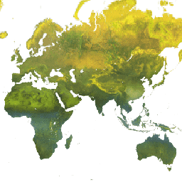
Datasets tagged sr in Earth Engine
Оптимизируйте свои подборки
Сохраняйте и классифицируйте контент в соответствии со своими настройками.
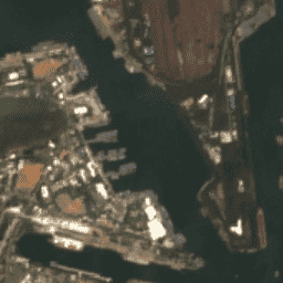
Гармонизированный многоспектральный прибор Sentinel-2 MSI: уровень 2A (SR)
После 25.01.2022 диапазон значений DN (значения) для снимков Sentinel-2 с параметром PROCESSING_BASELINE '04.00' и выше сдвигается на 1000. Сбор данных HARMONIZED сдвигает данные в более новых снимках таким образом, чтобы они находились в том же диапазоне, что и в более старых снимках. Sentinel-2 — это широкополосная миссия по получению многоспектральных изображений высокого разрешения, поддерживающая программу Copernicus…
Landsat Collection 2 Уровень 1, Уровень 2, 32-дневный композитный снимок
Эти композитные изображения Landsat Collection 2 Tier 1 Level 2 созданы из ортокорректированных снимков Tier 1 Level 2 и включают в себя следующие полосы SR: синий, зеленый, красный, ближний инфракрасный, swir1, swir2 и тепловой. Эти композиты создаются из всех снимков за каждый 32-дневный период, начиная с…
Landsat Collection 2 Уровень 1 Уровень 2 8-дневный композитный снимок
Эти композитные изображения Landsat Collection 2 Tier 1 Level 2 созданы из ортокорректированных снимков Tier 1 Level 2 и включают в себя следующие полосы SR: синий, зеленый, красный, ближний инфракрасный, swir1, swir2 и тепловой. Эти композиты создаются из всех снимков за каждый 8-дневный период, начиная с…
Landsat Collection 2 Уровень 1 Уровень 2 Ежегодное композитное изображение
Эти композитные изображения Landsat Collection 2 Tier 1 Level 2 созданы из ортокорректированных снимков Tier 1 Level 2 и включают в себя следующие полосы SR: синий, зеленый, красный, ближний инфракрасный, swir1, swir2 и тепловой. Эти композиты созданы из всех снимков за каждый годовой период, начиная с…
Обработанные снимки Антарктиды, полученные с помощью спутника Landsat (LIMA) (16 бит)
Мозаика изображений Антарктиды, полученная с помощью спутника Landsat (LIMA), представляет собой бесшовную и практически безоблачную мозаику, созданную из обработанных снимков Landsat 7 ETM+. Обработанные снимки Landsat (16 бит) — это снимки NLAPS уровня 1Gt, преобразованные в 16 бит, обработанные с коррекцией угла наклона солнца и преобразованные в значения отражательной способности (Bindschadler…).
Мозаика изображений Антарктиды, полученная с помощью спутника Landsat (LIMA), представляет собой бесшовную и практически безоблачную мозаику, созданную из обработанных снимков Landsat 7 ETM+. Обработанные снимки Landsat (16 бит) — это снимки NLAPS уровня 1Gt, преобразованные в 16 бит, обработанные с коррекцией угла наклона солнца и преобразованные в значения отражательной способности (Bindschadler…).
Мозаика изображений Антарктиды, полученная с помощью спутника Landsat (LIMA), 16-битная, с улучшенной резкостью.
Мозаика изображений Антарктиды, полученная со спутника Landsat (LIMA), представляет собой бесшовную и практически безоблачную мозаику, созданную из обработанных снимков Landsat 7 ETM+. Этот набор данных LIMA — 16-битный промежуточный набор LIMA. Мозаика состоит из улучшенных по резкости нормализованных изображений поверхностного отражения (полосы Landsat ETM+ 1, 2, 3 и…).
MOD09A1.061 Terra Surface Reflectance 8Day Global 500m
Продукт MOD09A1 V6.1 предоставляет оценку спектральной отражательной способности поверхности по полосам 1-7 спутника Terra MODIS с разрешением 500 м, скорректированную с учетом атмосферных условий, таких как газы, аэрозоли и рэлеевское рассеяние. Наряду с семью полосами отражательной способности имеется слой качества и четыре слоя наблюдений…
MOD09GA.061 Ежедневная глобальная отражательная способность поверхности Terra на расстоянии 1 км и 500 м
Продукты MODIS Surface Reflectance предоставляют оценку спектральной отражательной способности поверхности, измеренной на уровне земли в отсутствие атмосферного рассеяния или поглощения. Данные для нижних уровней скорректированы с учетом атмосферных газов и аэрозолей. Версия MOD09GA 6.1 предоставляет полосы 1-7 в…
MOD09GQ.061 Terra Surface Reflectance Daily Global 250m
Продукты MODIS Surface Reflectance предоставляют оценку спектральной отражательной способности поверхности, измеренной на уровне земли в отсутствие атмосферного рассеяния или поглощения. Данные для нижних уровней скорректированы с учетом атмосферных газов и аэрозолей. Версия MOD09GQ 6.1 предоставляет данные для полос 1 и…
MOD09Q1.061 Terra Surface Reflectance 8-Day Global 250m
Продукт MOD09Q1 предоставляет оценку спектрального коэффициента отражения поверхности в полосах 1 и 2 с разрешением 250 м, скорректированную с учетом атмосферных условий, таких как газы, аэрозоли и рэлеевское рассеяние. Наряду с двумя полосами отражения, также включен слой качества. Для каждой…
MODOCGA.006 Terra Ocean Reflectance Daily Global 1km
Продукт MODOCGA V6 по отражательной способности океана состоит из данных об отражательной способности с разрешением 1 километр, полученных с помощью спутников Terra MODIS в диапазонах 8-16. Этот продукт называется «отражательная способность океана», поскольку диапазоны 8-16 используются в основном для создания океанографических продуктов, но данный продукт не является океанографическим, так как фрагменты данных…
MYD09A1.061 Aqua Surface Reflectance 8-Day Global 500m
Продукт MYD09A1 V6.1 предоставляет оценку спектральной отражательной способности поверхности в полосах 1-7 спутника Aqua MODIS с разрешением 500 м, скорректированную с учетом атмосферных условий, таких как газы, аэрозоли и рэлеевское рассеяние. Наряду с семью полосами отражательной способности имеется слой качества и четыре слоя наблюдений…
MYD09GA.061 Ежедневная глобальная отражательная способность поверхности воды на расстоянии 1 км и 500 м
Продукты MODIS Surface Reflectance предоставляют оценку спектральной отражательной способности поверхности, измеренной на уровне земли в отсутствие атмосферного рассеяния или поглощения. Данные для нижних уровней скорректированы с учетом атмосферных газов и аэрозолей. Версия MYD09GA 6.1 предоставляет полосы 1-7 в…
MYD09GQ.061 Aqua Surface Reflectance Daily Global 250m
Продукты MODIS Surface Reflectance предоставляют оценку спектральной отражательной способности поверхности, измеренной на уровне земли в отсутствие атмосферного рассеяния или поглощения. Данные для нижних уровней скорректированы с учетом атмосферных газов и аэрозолей. Версия MYD09GQ 6.1 предоставляет данные для полос 1 и…
MYD09Q1.061 Aqua Surface Reflectance 8-Day Global 250m
Продукт MYD09Q1 предоставляет оценку спектральной отражательной способности поверхности в полосах 1 и 2 с разрешением 250 м, скорректированную с учетом атмосферных условий, таких как газы, аэрозоли и рэлеевское рассеяние. Наряду с двумя полосами отражательной способности, также включен слой качества. Для каждой…
MYDOCGA.006 Aqua Ocean Reflectance Daily Global 1km
Продукт MYDOCGA V6 по отражательной способности океана состоит из данных об отражательной способности с разрешением 1 километр, полученных с помощью полос 8-16 спутника Aqua MODIS. Этот продукт называется «отражательная способность океана», поскольку полосы 8-16 используются в основном для создания океанографических продуктов, но данный продукт не является океанографическим, так как фрагменты данных…
Базовые карты программы спутниковых данных NICFI для мониторинга тропических лесов – Африка
Эта коллекция изображений предоставляет доступ к спутниковым данным высокого разрешения, полученным в ходе мониторинга тропиков, с основной целью сокращения и обращения вспять утраты тропических лесов, содействия борьбе с изменением климата, сохранения биоразнообразия, содействия восстановлению и улучшению лесных массивов, а также содействия устойчивому развитию…
Базовые карты программы спутниковых данных NICFI для мониторинга тропических лесов — Северная и Южная Америка
Эта коллекция изображений предоставляет доступ к спутниковым данным высокого разрешения, полученным в ходе мониторинга тропиков, с основной целью сокращения и обращения вспять утраты тропических лесов, содействия борьбе с изменением климата, сохранения биоразнообразия, содействия восстановлению и улучшению лесных массивов, а также содействия устойчивому развитию…
Базовые карты программы спутниковых данных NICFI для мониторинга тропических лесов — Азия
Эта коллекция изображений предоставляет доступ к спутниковым данным высокого разрешения, полученным в ходе мониторинга тропиков, с основной целью сокращения и обращения вспять утраты тропических лесов, содействия борьбе с изменением климата, сохранения биоразнообразия, содействия восстановлению и улучшению лесных массивов, а также содействия устойчивому развитию…
NOAA CDR AVHRR: Поверхностная отражательная способность, версия 5
В базе данных климатических данных NOAA (CDR) по поверхностной отражательной способности AVHRR содержатся ежедневные данные о поверхностной отражательной способности и яркостной температуре, полученные с помощью датчиков усовершенствованного радиометра очень высокого разрешения (AVHRR), установленных на борту семи полярных орбитальных спутников NOAA. Данные представлены в виде сетки с разрешением 0,05° и вычислены…
NOAA CDR GRIDSAT-B1: Яркостная температура ИК-канала геостационарной станции.
Примечание: Данный набор данных не обновлялся поставщиком с 31 марта 2024 года в связи с текущими обновлениями инфраструктуры. Сроки возобновления обновлений набора данных пока неизвестны. Этот набор данных представляет собой высококачественный климатический регистр (CDR), содержащий глобальные инфракрасные измерения с геостационарных спутников.
Геологическая служба США, спутник Landsat 4, уровень 2, коллекция 2, категория 1.
Этот набор данных содержит атмосферно скорректированные значения отражательной способности поверхности и температуры поверхности земли, полученные на основе данных, собранных датчиком Landsat™. Изображения включают 4 полосы видимого и ближнего инфракрасного диапазона (VNIR) и 2 полосы коротковолнового инфракрасного диапазона (SWIR), обработанные для получения ортокорректированной отражательной способности поверхности, а также одно изображение в тепловом инфракрасном диапазоне…
Геологическая служба США, спутник Landsat 4, уровень 2, коллекция 2, категория 2.
Этот набор данных содержит атмосферно скорректированные значения отражательной способности поверхности и температуры поверхности земли, полученные на основе данных, собранных датчиком Landsat™. Изображения включают 4 полосы видимого и ближнего инфракрасного диапазона (VNIR) и 2 полосы коротковолнового инфракрасного диапазона (SWIR), обработанные для получения ортокорректированной отражательной способности поверхности, а также одно изображение в тепловом инфракрасном диапазоне…
Геологическая служба США, спутник Landsat 5, уровень 2, коллекция 2, категория 1.
Этот набор данных содержит атмосферно скорректированные значения отражательной способности поверхности и температуры поверхности земли, полученные на основе данных, собранных датчиком Landsat™. Изображения включают 4 полосы видимого и ближнего инфракрасного диапазона (VNIR) и 2 полосы коротковолнового инфракрасного диапазона (SWIR), обработанные для получения ортокорректированной отражательной способности поверхности, а также одно изображение в тепловом инфракрасном диапазоне…
Геологическая служба США, спутник Landsat 5, уровень 2, коллекция 2, категория 2.
Этот набор данных содержит атмосферно скорректированные значения отражательной способности поверхности и температуры поверхности земли, полученные на основе данных, собранных датчиком Landsat™. Изображения включают 4 полосы видимого и ближнего инфракрасного диапазона (VNIR) и 2 полосы коротковолнового инфракрасного диапазона (SWIR), обработанные для получения ортокорректированной отражательной способности поверхности, а также одно изображение в тепловом инфракрасном диапазоне…
Геологическая служба США, спутник Landsat 7, уровень 2, коллекция 2, категория 1.
Этот набор данных содержит атмосферно скорректированные значения отражательной способности поверхности и температуры поверхности земли, полученные на основе данных, собранных датчиком Landsat 7 ETM+. Изображения включают 4 полосы видимого и ближнего инфракрасного диапазона (VNIR) и 2 полосы коротковолнового инфракрасного диапазона (SWIR), обработанные для получения ортокорректированной отражательной способности поверхности, а также одно тепловое изображение…
Геологическая служба США, спутник Landsat 7, уровень 2, коллекция 2, категория 2.
Этот набор данных содержит атмосферно скорректированные значения отражательной способности поверхности и температуры поверхности земли, полученные на основе данных, собранных датчиком Landsat 7 ETM+. Изображения включают 4 полосы видимого и ближнего инфракрасного диапазона (VNIR) и 2 полосы коротковолнового инфракрасного диапазона (SWIR), обработанные для получения ортокорректированной отражательной способности поверхности, а также одно тепловое изображение…
Этот набор данных содержит атмосферно скорректированные значения отражательной способности поверхности и температуры поверхности земли, полученные на основе данных, собранных датчиками Landsat 8 OLI/TIRS. Изображения включают 5 полос видимого и ближнего инфракрасного (VNIR) диапазона и 2 полосы коротковолнового инфракрасного (SWIR) диапазона, обработанные для ортокоррекции отражательной способности поверхности, а также одно тепловое изображение…
Этот набор данных содержит атмосферно скорректированные значения отражательной способности поверхности и температуры поверхности земли, полученные на основе данных, собранных датчиками Landsat 8 OLI/TIRS. Изображения включают 5 полос видимого и ближнего инфракрасного (VNIR) диапазона и 2 полосы коротковолнового инфракрасного (SWIR) диапазона, обработанные для ортокоррекции отражательной способности поверхности, а также одно тепловое изображение…
Этот набор данных содержит атмосферно скорректированные значения отражательной способности поверхности и температуры поверхности земли, полученные на основе данных, собранных датчиками Landsat 9 OLI/TIRS. Изображения включают 5 полос видимого и ближнего инфракрасного (VNIR) диапазона и 2 полосы коротковолнового инфракрасного (SWIR) диапазона, обработанные для ортокоррекции отражательной способности поверхности, а также одно тепловое изображение…
Геологическая служба США, спутник Landsat 9, уровень 2, коллекция 2, категория 2.
Этот набор данных содержит атмосферно скорректированные значения отражательной способности поверхности и температуры поверхности земли, полученные на основе данных, собранных датчиками Landsat 9 OLI/TIRS. Изображения включают 5 полос видимого и ближнего инфракрасного (VNIR) диапазона и 2 полосы коротковолнового инфракрасного (SWIR) диапазона, обработанные для ортокоррекции отражательной способности поверхности, а также одно тепловое изображение…
VNP09GA: Ежедневные измерения отражательной способности поверхности с помощью прибора VIIRS на расстояниях 500 м и 1 км.
Ежедневный продукт Visible Infrared Imaging Radiometer Suite (VIIRS) по оценке отражательной способности поверхности суши (VNP09GA) предоставляет данные с датчика VIIRS, установленного в рамках программы Suomi National Polar-Orbiting Partnership (S-NPP). Данные представлены для трех диапазонов изображения (I1, I2, I3) с номинальным разрешением 500 метров (~463 метра)…
VNP09H1: VIIRS Поверхностная отражательная способность 8-дневный L3 Глобальный диапазон 500 м
8-дневный композитный продукт Visible Infrared Imaging Radiometer Suite (VIIRS) Surface Reflectance (VNP09H1) Version 1 предоставляет оценку отражательной способности поверхности суши, полученную с помощью датчика VIIRS Suomi National Polar-orbiting Partnership (Suomi NPP) для трех диапазонов изображения (I1, I2, I3) с номинальным разрешением 500 м (~463 м). …
[[["Прост для понимания","easyToUnderstand","thumb-up"],["Помог мне решить мою проблему","solvedMyProblem","thumb-up"],["Другое","otherUp","thumb-up"]],[["Отсутствует нужная мне информация","missingTheInformationINeed","thumb-down"],["Слишком сложен/слишком много шагов","tooComplicatedTooManySteps","thumb-down"],["Устарел","outOfDate","thumb-down"],["Проблема с переводом текста","translationIssue","thumb-down"],["Проблемы образцов/кода","samplesCodeIssue","thumb-down"],["Другое","otherDown","thumb-down"]],[],[],[]]