Datasets tagged land in Earth Engine
Оптимизируйте свои подборки
Сохраняйте и классифицируйте контент в соответствии со своими настройками.
ECOSTRESS Tiled Ancillary NDVI and Albedo L2 Global 70 m V002
Набор данных ECOSTRESS Tiled Ancillary NDVI and Albedo (ECO_L2T_STARS) V002 предоставляет данные о нормализованном разностном индексе растительности (NDVI) и альбедо с пространственным разрешением 70 м. Этот вспомогательный продукт, необходимый для понимания потребностей растений в воде и уровня стресса, создается посредством процесса слияния данных, который объединяет видимый спектр…
Этот продукт представляет собой температуру поверхности суши. Для этого набора данных также доступна более новая версия JAXA/GCOM-C/L3/LAND/LST/V3, использующая этот алгоритм обработки. GCOM-C проводит долгосрочные и непрерывные глобальные наблюдения и сбор данных для выяснения механизма колебаний радиационного баланса и…
Данный продукт представляет собой данные о температуре поверхности суши. Данные после 28.11.2021 см. в наборе данных V3. GCOM-C проводит долгосрочные и непрерывные глобальные наблюдения и сбор данных для выяснения механизма колебаний радиационного баланса и углеродного цикла, необходимых для составления точных прогнозов относительно…
Этот продукт представляет собой данные о температуре поверхности суши. Это постоянно обновляемый набор данных с задержкой в 3-4 дня. GCOM-C проводит долгосрочные и непрерывные глобальные наблюдения и сбор данных для выяснения механизма колебаний радиационного баланса и углеродного цикла, необходимых для…
Этот продукт представляет собой сумму площади односторонних зеленых листьев на единицу площади поверхности земли. Для этого набора данных также доступна более новая версия JAXA/GCOM-C/L3/LAND/LAI/V3, использующая этот алгоритм обработки. GCOM-C проводит долгосрочные и непрерывные глобальные наблюдения и сбор данных для выяснения механизма…
Этот продукт представляет собой сумму площади односторонней зеленой листвы на единицу площади земли. Данные после 28.11.2021 см. в наборе данных V3. GCOM-C проводит долгосрочные и непрерывные глобальные наблюдения и сбор данных для выяснения механизма колебаний радиационного баланса и углеродного цикла…
Этот продукт представляет собой сумму площади односторонней зеленой листвы на единицу площади земли. Это постоянно обновляемый набор данных с задержкой в 3-4 дня. GCOM-C проводит долгосрочные и непрерывные глобальные наблюдения и сбор данных для выяснения механизма колебаний радиационного баланса…
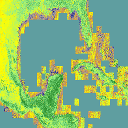
Этот набор данных содержит глобальные ежегодные карты преобладающих классов пастбищных угодий (возделываемых и естественных/полуестественных) за период с 2000 по 2022 год с пространственным разрешением 30 м. Созданный в рамках инициативы Land & Carbon Lab Global Pasture Watch, набор данных охватывает все типы землепользования, содержащие не менее…
GPW Ежегодные вероятности развития культивируемых пастбищ v1
Этот набор данных содержит глобальные ежегодные карты вероятности площади обрабатываемых пастбищ с 2000 по 2022 год с пространственным разрешением 30 м. Созданный в рамках инициативы Land & Carbon Lab Global Pasture Watch, набор данных охватывает все типы землепользования, содержащие не менее 30% засушливых земель…
GPW Ежегодные вероятности существования естественных/полуестественных лугов, версия 1
Этот набор данных содержит глобальные ежегодные карты вероятности наличия естественных/полуестественных пастбищ с 2000 по 2022 год с пространственным разрешением 30 м. Созданный в рамках инициативы Land & Carbon Lab Global Pasture Watch, набор данных охватывает любые типы землепользования, содержащие не менее 30% засушливых земель…
Этот набор данных содержит глобальные медианные значения высоты растительности с 2000 года с пространственным разрешением 30 м. Созданный в рамках инициативы Global Pasture Watch лаборатории Land & Carbon Lab, этот набор данных предоставляет медианные значения высоты растительности (50-й процентиль) в глобальном масштабе с пространственным разрешением 30 м, начиная с 2000 года. Набор данных основан на…
Этот набор данных содержит глобальные некалиброванные данные о валовой первичной продуктивности (ВПП) на основе дистанционного зондирования Земли с 2000 года с пространственным разрешением 30 м. Созданный в рамках инициативы Land & Carbon Lab Global Pasture Watch, текущий набор данных предоставляет значения ВПП (валовой первичной продуктивности) в глобальном масштабе с пространственным разрешением 30 м, начиная с 2000 года. Значения ВПП…
GRACE Monthly Mass Grids Release 06 Version 04 - Land
Ежемесячные сетки данных о площади суши содержат аномалии водных масс, представленные в виде эквивалентной толщины водного слоя, рассчитанной на основе наблюдений за гравитацией с использованием приборов GRACE и GRACE-FO в течение указанного периода времени и относительно указанного среднего эталонного периода. Эквивалентная толщина водного слоя представляет собой общую аномалию запасов наземных вод…
NOAA CDR AVHRR LAI FAPAR: Индекс листовой поверхности и доля поглощенного фотосинтетически активного излучения, версия 5
В наборе данных NOAA Climate Data Record (CDR), содержащем индекс листовой поверхности (LAI) и долю поглощенного фотосинтетически активного излучения (FAPAR) из AVHRR, представлены производные значения, характеризующие растительный покров и фотосинтетическую активность растений. Этот набор данных получен из продукта NOAA AVHRR Surface Reflectance и…
NOAA CDR AVHRR NDVI: Нормализованный разностный индекс растительности, версия 5
В базе данных климатических данных NOAA (CDR) по нормализованному разностному индексу растительности AVHRR (NDVI) содержится сеточная сетка значений NDVI, полученная на основе продукта поверхностного отражения NOAA AVHRR. Она обеспечивает измерение активности растительного покрова на поверхности, представленное в виде сетки с разрешением 0,05° и рассчитанное в глобальном масштабе над сушей…
NOAA CDR AVHRR: Поверхностная отражательная способность, версия 5
В базе данных климатических данных NOAA (CDR) по поверхностной отражательной способности AVHRR содержатся ежедневные данные о поверхностной отражательной способности и яркостной температуре, полученные с помощью датчиков усовершенствованного радиометра очень высокого разрешения (AVHRR), установленных на борту семи полярных орбитальных спутников NOAA. Данные представлены в виде сетки с разрешением 0,05° и вычислены…
NOAA CDR VIIRS LAI FAPAR: Индекс листовой поверхности и доля поглощенного фотосинтетически активного излучения, версия 1
Данный сборник климатических данных (CDR) объединяет наборы данных по индексу листовой поверхности (LAI) и доле поглощенной фотосинтетически активной радиации (FAPAR) — двум биофизическим переменным, которые можно использовать для оценки стресса растительности, прогнозирования урожайности сельскохозяйственных культур и других задач моделирования и управления ресурсами. LAI отслеживает одностороннее…
NOAA CDR VIIRS NDVI: Нормализованный разностный индекс растительности, версия 1
Этот набор данных содержит сеточные значения нормализованного разностного индекса растительности (NDVI), полученные из климатических данных NOAA (CDR) по отражательной способности поверхности, измеренной с помощью прибора Visible Infrared Imaging Radiometer Suite (VIIRS). Данные охватывают период с 2014 года и получены с полярных орбитальных спутников NOAA. Данные являются прогнозируемыми…
VNP14A1.002: Тепловые аномалии/Пожары. Ежедневная глобальная сетка SIN L3 с шагом 1 км.
Ежедневный продукт данных Suomi National Polar-Orbiting Partnership NASA Visible Infrared Imaging Radiometer Suite (VIIRS) Thermal Anomalies/Fire (VNP14A1) Version 1 предоставляет информацию об активных пожарах и других тепловых аномалиях. Продукт данных VNP14A1 представляет собой глобальное композитное изображение пикселей пожаров с разрешением 1 км, обнаруженных на…
VNP15A2H: 8-дневная глобальная сетка SIN L4 L4 с шагом 500 м по L1.
Данные VIIRS (Visible Infrared Imaging Radiometer Suite) по индексу листовой поверхности (LAI) и доле фотосинтетически активного излучения (FPAR), версия 1, предоставляют информацию о растительном покрове с разрешением 500 метров (VNP15A2H). Датчик VIIRS расположен на борту совместного космического аппарата NOAA/NASA Suomi National…
VNP21A1D.002: Суточная температура поверхности земли и коэффициент излучения, 1 км
Ежедневные данные о температуре и излучательной способности поверхности суши (LST&E) версии 1 (VNP21A1D) из комплекта видимых и инфракрасных изображений радиометра VIIRS (Suomi National Polar-Orbiting Partnership) собираются на основе промежуточных данных уровня 2 (L2G), полученных в дневное время. Процесс L2G отображает ежедневные данные VNP21…
VNP21A1N.002: Ночная температура поверхности земли и коэффициент излучения, ежедневные измерения на расстоянии 1 км.
Продукт VNP21A1N (Visible Infrared Imaging Radiometer Suite, VIIRS) от NASA Suomi National Polar-Orbiting Partnership (Suomi NPP) ежедневно компилируется из промежуточных продуктов уровня 2 (L2G), полученных в ночное время. Процесс L2G отображает ежедневные данные VNP21…
VNP22Q2: Фенология поверхности суши. Ежегодные данные L3. Глобальная сетка SIN 500 м.
Данные о динамике растительного покрова, полученные в рамках программы Suomi National Polar-Orbiting Partnership (Suomi NPP) NASA Visible Infrared Imaging Radiometer Suite (VIIRS), предоставляют глобальные показатели фенологии поверхности суши (GLSP) с годовыми интервалами. Данные VNP22Q2 получены из временных рядов двухдиапазонного улучшенного индекса растительности (EVI2)…
VNP43IA1: Параметры модели BRDF/альбедо. Ежедневная глобальная сетка SIN L3 с шагом 500 м.
Продукт Suomi National Polar-Orbiting Partnership (Suomi NPP) NASA Visible Infrared Imaging Radiometer Suite (VIIRS) Bidirectional Reflectance Distribution Function (BRDF) and Albedo Model Parameters (VNP43IA1) Version 1 предоставляет весовые коэффициенты ядра (параметры) с разрешением 500. Продукт VNP43IA1 создается ежедневно на основе данных VIIRS за 16 дней…
VNP43IA2: BRDF/Albedo Quality Daily L3 Global 500m SIN Grid
Продукт Suomi National Polar-Orbiting Partnership (Suomi NPP) NASA Visible Infrared Imaging Radiometer Suite (VIIRS) Bidirectional Reflectance Distribution Function (BRDF) and Albedo Quality (VNP43IA2) Version 1 обеспечивает определение BRDF и качества альбедо с разрешением 500 м. Продукт VNP43IA2 создается ежедневно на основе данных VIIRS за 16 дней…
VNP43IA4: BRDF/Albedo Quality Daily L3 Global 500m SIN Grid
Продукт NASA/NOAA Suomi National Polar-orbiting Partnership (Suomi NPP) Visible Infrared Imaging Radiometer Suite (VIIRS) Nadir Bidirectional Reflectance Distribution Function (BRDF) Adjusted Reflectance (NBAR) Version 2 предоставляет оценки NBAR с разрешением 500 метров. Продукт VNP43IA4 создается ежедневно на основе данных VIIRS за 16 дней…
VNP64A1.002: Площадь выгоревшей территории, ежемесячный объем, глобальная сетка SIN L4 500 м
Ежедневный продукт данных Suomi National Polar-Orbiting Partnership (Suomi NPP) NASA Visible Infrared Imaging Radiometer Suite (VIIRS) Burned Area (VNP64A1) Version 2 представляет собой глобальный сеточный продукт с разрешением 500 м, содержащий информацию о площади выгоревших участков и качестве каждого пикселя. В методе картирования выгоревших участков VNP64 используется разрешение VIIRS 750 м…
VNP64A1: Площадь выгоревшей территории, ежемесячный объем, глобальная сетка SIN L4 500 м
Ежедневный продукт данных Suomi National Polar-Orbiting Partnership (Suomi NPP) NASA Visible Infrared Imaging Radiometer Suite (VIIRS) Burned Area (VNP64A1) Version 1 представляет собой глобальный сеточный продукт с разрешением 500 м, содержащий информацию о площади выгоревших участков и качестве каждого пикселя. В методе картирования выгоревших участков VNP64 используется разрешение VIIRS 750 м…
[[["Прост для понимания","easyToUnderstand","thumb-up"],["Помог мне решить мою проблему","solvedMyProblem","thumb-up"],["Другое","otherUp","thumb-up"]],[["Отсутствует нужная мне информация","missingTheInformationINeed","thumb-down"],["Слишком сложен/слишком много шагов","tooComplicatedTooManySteps","thumb-down"],["Устарел","outOfDate","thumb-down"],["Проблема с переводом текста","translationIssue","thumb-down"],["Проблемы образцов/кода","samplesCodeIssue","thumb-down"],["Другое","otherDown","thumb-down"]],[],[],["Several datasets from GCOM-C/SGLI, NASA, NOAA, and GPW track land surface and vegetation properties. GCOM-C data measures leaf area index (LAI) and land surface temperature (LST), updating to V3. NASA's VIIRS monitors thermal anomalies, fire, LAI, FPAR, LST, and surface reflectance. NOAA's CDR provides data on AVHRR and VIIRS metrics like LAI, FAPAR, and NDVI. GPW offers annual grassland probability and classification maps. These datasets provide time-series information for global observation and research.\n"]]