Datasets tagged usda in Earth Engine
Оптимизируйте свои подборки
Сохраняйте и классифицируйте контент в соответствии со своими настройками.
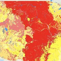
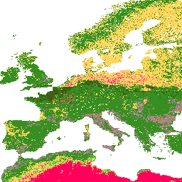
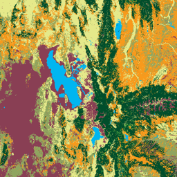
LANDFIRE BPS (Биофизические настройки) v1.4.0
LANDFIRE (LF), Инструменты планирования управления лесными пожарами и ресурсами, — это совместная программа программ управления лесными пожарами Лесной службы Министерства сельского хозяйства США, Геологической службы Министерства внутренних дел США и организации The Nature Conservancy. Слои LANDFIRE (LF) создаются с использованием прогнозных…
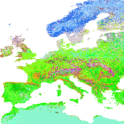
LANDFIRE ESP AK (Environmental Site Potential) v1.2.0
LANDFIRE (LF), Инструменты планирования управления лесными пожарами и ресурсами, — это совместная программа программ управления лесными пожарами Лесной службы Министерства сельского хозяйства США, Геологической службы Министерства внутренних дел США и организации The Nature Conservancy. Слои LANDFIRE (LF) создаются с использованием прогнозных…
LANDFIRE ESP CONUS (Environmental Site Potential) v1.2.0
LANDFIRE (LF), Инструменты планирования управления лесными пожарами и ресурсами, — это совместная программа программ управления лесными пожарами Лесной службы Министерства сельского хозяйства США, Геологической службы Министерства внутренних дел США и организации The Nature Conservancy. Слои LANDFIRE (LF) создаются с использованием прогнозных…
LANDFIRE ESP HI (Environmental Site Potential) v1.2.0
LANDFIRE (LF), Инструменты планирования управления лесными пожарами и ресурсами, — это совместная программа программ управления лесными пожарами Лесной службы Министерства сельского хозяйства США, Геологической службы Министерства внутренних дел США и организации The Nature Conservancy. Слои LANDFIRE (LF) создаются с использованием прогнозных…
LANDFIRE (LF), Инструменты планирования управления лесными пожарами и ресурсами, — это совместная программа программ управления лесными пожарами Лесной службы Министерства сельского хозяйства США, Геологической службы Министерства внутренних дел США и организации The Nature Conservancy. Слои LANDFIRE (LF) создаются с использованием прогнозных…
LANDFIRE (LF), Инструменты планирования управления лесными пожарами и ресурсами, — это совместная программа программ управления лесными пожарами Лесной службы Министерства сельского хозяйства США, Геологической службы Министерства внутренних дел США и организации The Nature Conservancy. Слои LANDFIRE (LF) создаются с использованием прогнозных…
LANDFIRE (LF), Инструменты планирования управления лесными пожарами и ресурсами, — это совместная программа программ управления лесными пожарами Лесной службы Министерства сельского хозяйства США, Геологической службы Министерства внутренних дел США и организации The Nature Conservancy. Слои LANDFIRE (LF) создаются с использованием прогнозных…
LANDFIRE (LF), Инструменты планирования управления лесными пожарами и ресурсами, — это совместная программа программ управления лесными пожарами Лесной службы Министерства сельского хозяйства США, Геологической службы Министерства внутренних дел США и организации The Nature Conservancy. Landfire (LF) Исторические режимы пожаров, интервалы и…
LANDFIRE (LF), Инструменты планирования управления лесными пожарами и ресурсами, — это совместная программа программ управления лесными пожарами Лесной службы Министерства сельского хозяйства США, Геологической службы Министерства внутренних дел США и организации The Nature Conservancy. Landfire (LF) Исторические режимы пожаров, интервалы и…
LANDFIRE PLS (Процент пожаров низкой интенсивности) v1.2.0
LANDFIRE (LF), Инструменты планирования управления лесными пожарами и ресурсами, — это совместная программа программ управления лесными пожарами Лесной службы Министерства сельского хозяйства США, Геологической службы Министерства внутренних дел США и организации The Nature Conservancy. Landfire (LF) Исторические режимы пожаров, интервалы и…
LANDFIRE (LF), Инструменты планирования управления лесными пожарами и ресурсами, — это совместная программа программ управления лесными пожарами Лесной службы Министерства сельского хозяйства США, Геологической службы Министерства внутренних дел США и организации The Nature Conservancy. Landfire (LF) Исторические режимы пожаров, интервалы и…
LANDFIRE PRS (Процент восстановления от интенсивности пожара) v1.2.0
LANDFIRE (LF), Инструменты планирования управления лесными пожарами и ресурсами, — это совместная программа программ управления лесными пожарами Лесной службы Министерства сельского хозяйства США, Геологической службы Министерства внутренних дел США и организации The Nature Conservancy. Landfire (LF) Исторические режимы пожаров, интервалы и…
LANDFIRE (LF), Инструменты планирования управления лесными пожарами и ресурсами, — это совместная программа программ управления лесными пожарами Лесной службы Министерства сельского хозяйства США, Геологической службы Министерства внутренних дел США и организации The Nature Conservancy. Landfire (LF) Исторические режимы пожаров, интервалы и…
LANDFIRE VCC (Класс состояния растительности) v1.4.0
LANDFIRE (LF), Инструменты планирования управления лесными пожарами и ресурсами, — это совместная программа программ управления лесными пожарами Лесной службы Министерства сельского хозяйства США, Геологической службы Министерства внутренних дел США и организации The Nature Conservancy. Landfire (LF) Исторические режимы пожаров, интервалы и…
LANDFIRE (LF), Инструменты планирования управления лесными пожарами и ресурсами, — это совместная программа программ управления лесными пожарами Лесной службы Министерства сельского хозяйства США, Геологической службы Министерства внутренних дел США и организации The Nature Conservancy. Landfire (LF) Исторические режимы пожаров, интервалы и…
Набор данных о границах выгоревших территорий в рамках проекта «Мониторинг тенденций интенсивности выгорания» (MTBS) содержит полигоны, отображающие границы выгоревших территорий всех завершенных на данный момент пожаров MTBS на территории континентальной части США, Аляски, Гавайев и Пуэрто-Рико. Ниже NBR означает «нормализованный коэффициент выгорания», а dNBR означает…
Мониторинг тенденций изменения степени тяжести ожогов (MTBS) Изображения степени тяжести ожогов
Мозаичные изображения степени выгорания представляют собой тематические растровые изображения классов степени выгорания по классификации MTBS для всех завершенных на данный момент пожаров MTBS на территории континентальной части Соединенных Штатов, Аляски, Гавайев и Пуэрто-Рико. Мозаичные изображения степени выгорания составляются ежегодно штатом США и…
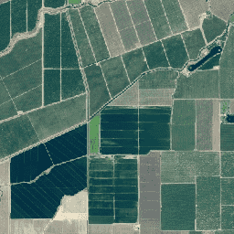
NAIP: Национальная программа аэрофотосъемки сельского хозяйства
Национальная программа аэрофотосъемки сельского хозяйства (NAIP) получает аэрофотоснимки в течение сельскохозяйственных сезонов на территории континентальной части США. Контракты на проекты NAIP заключаются ежегодно в зависимости от имеющегося финансирования и цикла получения изображений. Начиная с 2003 года, цикл NAIP составлял 5 лет. 2008 год был…
Содержание глины в % (кг/кг) на 6 стандартных глубинах (0, 10, 30, 60, 100 и 200 см) с разрешением 250 м. Основано на прогнозах машинного обучения, полученных из глобальной компиляции почвенных профилей и образцов. Этапы обработки подробно описаны здесь. Антарктида…
Содержание песка в % (кг/кг) на 6 стандартных глубинах (0, 10, 30, 60, 100 и 200 см) с разрешением 250 м. На основе прогнозов машинного обучения, полученных из глобальной компиляции почвенных профилей и образцов. Этапы обработки подробно описаны здесь. Антарктида…
Классы текстуры почвы (система USDA) для 6 глубин почвы (0, 10, 30, 60, 100 и 200 см) на глубине 250 м. Получены на основе прогнозируемых фракций текстуры почвы с использованием пакета soiltexture в R. Этапы обработки подробно описаны здесь. Антарктида не включена. Для доступа…
Прогнозируемые вероятности принадлежности почв к определенным группам USDA на глубине 250 м. Распределение групп почв USDA на основе прогнозов машинного обучения, полученных из глобальной компиляции почвенных профилей. Для получения дополнительной информации о группах почв, пожалуйста, обратитесь к Иллюстрированному руководству по таксономии почв - NRCS - …
SOLUS: Свойства почв континентальной части Соединенных Штатов с разрешением 100 м.
SOLUS (Soil Landscapes of the United States) — это национальный картографический продукт, разработанный Национальной кооперативной службой почвенных исследований, целью которого является предоставление согласованного набора пространственно непрерывных карт свойств почв для поддержки крупномасштабных почвенных исследований и принятия решений по землепользованию. Карты SOLUS…
Слои данных о сельскохозяйственных угодьях USDA NASS
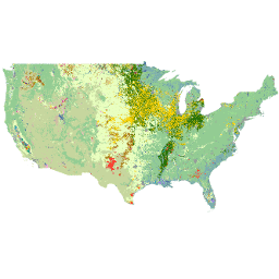
Слой данных о сельскохозяйственных угодьях (Cropland Data Layer, CDL) — это слой данных о растительном покрове, создаваемый ежегодно для континентальной части Соединенных Штатов с использованием спутниковых снимков среднего разрешения и обширных данных полевых исследований в сельском хозяйстве. Слой CDL создается Министерством сельского хозяйства США, Национальной службой сельскохозяйственной статистики (NASS), Отделом исследований и разработок…
Система мониторинга изменений ландшафта Лесной службы США, версия 2025-11 (на территории США и за рубежом)
Этот продукт является частью пакета данных Системы мониторинга изменений ландшафта (LCMS). Он отображает смоделированные в рамках LCMS изменения, землепользование и/или классы землепользования за каждый год и охватывает континентальную часть Соединенных Штатов (CONUS), а также территории за пределами CONUS (OCONUS), включая Аляску (AK), Пуэрто-Рико…
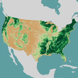
Лесная служба США (USFS) рекомендует использовать программу защиты кроны деревьев v2023-5 (для континентальной и зарубежной частей США).
Обзор. Набор данных о покрытии древесным пологом (Tree Canopy Cover, TCC), создаваемый Лесной службой Министерства сельского хозяйства США (USFS), представляет собой ежегодные карты, основанные на данных дистанционного зондирования, охватывающие период с 1985 по 2023 год. Эти данные поддерживают проект Национальной базы данных о земельном покрове (National Land Cover Database, NLCD), которым управляет Геологическая служба США…
Этот продукт является частью пакета данных TreeMap. Он предоставляет подробную пространственную информацию о характеристиках лесов, включая количество живых и мертвых деревьев, биомассу и содержание углерода на всей территории лесов Соединенных Штатов в 2020 году. TreeMap v2020 содержит 22-канальные данные размером 30 x 30 м…
Этот продукт является частью пакета данных TreeMap. Он предоставляет подробную пространственную информацию о характеристиках лесов, включая количество живых и мертвых деревьев, биомассу и содержание углерода на всей территории лесов Соединенных Штатов в 2022 году. TreeMap v2022 содержит 22-канальные данные размером 30 x 30 м…
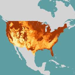
Карта «Монитор засухи США» публикуется каждый четверг и показывает регионы США, находящиеся в состоянии засухи. Карта использует пять классификаций: аномально засушливые районы (D0), показывающие территории, которые могут находиться в состоянии засухи или уже выходят из нее, и четыре уровня засухи: …
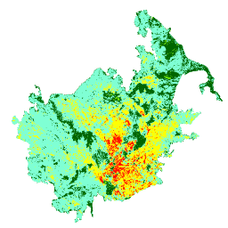
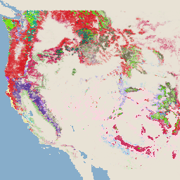
Этот набор данных отображает компоненты риска лесных пожаров для всех территорий Соединенных Штатов, которые: 1) охватывают весь ландшафт (т.е. измеримы в каждом пикселе ландшафта); и 2) представляют собой риск на месте – риск в точке, где происходят неблагоприятные последствия для…
[[["Прост для понимания","easyToUnderstand","thumb-up"],["Помог мне решить мою проблему","solvedMyProblem","thumb-up"],["Другое","otherUp","thumb-up"]],[["Отсутствует нужная мне информация","missingTheInformationINeed","thumb-down"],["Слишком сложен/слишком много шагов","tooComplicatedTooManySteps","thumb-down"],["Устарел","outOfDate","thumb-down"],["Проблема с переводом текста","translationIssue","thumb-down"],["Проблемы образцов/кода","samplesCodeIssue","thumb-down"],["Другое","otherDown","thumb-down"]],[],[],[]]