Page Summary
-
The content describes various remote sensing and geospatial datasets, primarily from NASA and USGS.
-
Datasets cover categories such as imagery and radiance, elevation and topography, forest and vegetation, protected areas, land cover, and hydrology.
-
Many datasets are available at different resolutions and processing levels, including raw scenes, TOA reflectance, and atmospherically corrected surface reflectance.
-
Specific missions and products highlighted include ASTER, EO-1 Hyperion, HLSL/HLSS, Landsat (various collections and tiers), MODIS (various products like land cover, indices, fire, and temperature), GMTED, GTOPO30, GEDI, LANDFIRE, and PAD-US.
-
Data is often provided at various temporal resolutions such as daily, 8-day, 16-day, monthly, and yearly composites.
-
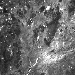
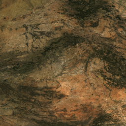
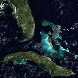
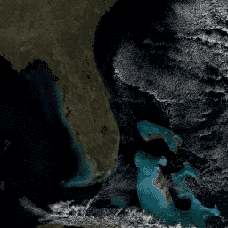
ASTER L1T Radiance
Note: There is a gap in data collection between November 28, 2024 and January 16, 2025 due to technical issues with the ASTER instrument. See the USGS announcement for more information. The Advanced Spaceborne Thermal Emission and Reflection Radiometer (ASTER) is a multispectral imager that … aster imagery nasa nir radiance satellite-imagery -
Designation: USGS GAP PAD-US v2.0
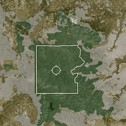
PAD-US is America's official national inventory of U.S. terrestrial and marine protected areas that are dedicated to the preservation of biological diversity and to other natural, recreation and cultural uses, managed for these purposes through legal or other effective means. This database is separated into … conservation-easements designation infrastructure-boundaries management ownership protected-areas -
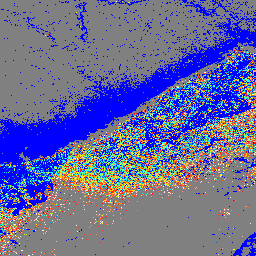
EO-1 Hyperion Hyperspectral Imager
Hyperion is a high resolution hyperspectral imager producing 220 unique spectral channels ranging from 0.357 to 2.576 micrometers with a 10-nm bandwidth. The instrument operates in a pushbroom fashion, with a spatial resolution of 30 meters for all bands and a standard scene width of … hyperspectral satellite-imagery usgs -
Easement: USGS GAP PAD-US v2.0
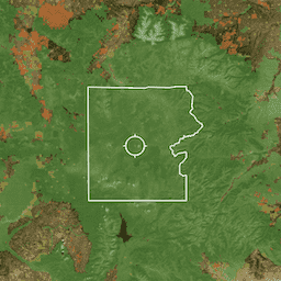
PAD-US is America's official national inventory of U.S. terrestrial and marine protected areas that are dedicated to the preservation of biological diversity and to other natural, recreation and cultural uses, managed for these purposes through legal or other effective means. This database is separated into … conservation-easements designation infrastructure-boundaries management ownership protected-areas -
Fee: USGS GAP PAD-US v2.0
PAD-US is America's official national inventory of U.S. terrestrial and marine protected areas that are dedicated to the preservation of biological diversity and to other natural, recreation and cultural uses, managed for these purposes through legal or other effective means. This database is separated into … conservation-easements designation infrastructure-boundaries management ownership protected-areas -
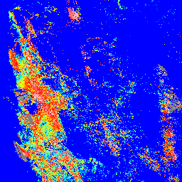
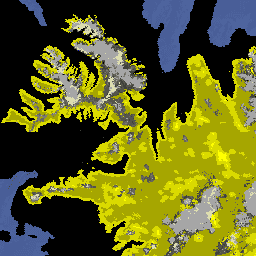
GEDI L2A Raster Canopy Top Height (Version 2)
GEDI's Level 2A Geolocated Elevation and Height Metrics Product (GEDI02_A) is primarily composed of 100 Relative Height (RH) metrics, which collectively describe the waveform collected by GEDI. The original GEDI02_A product is a table of point with a spatial resolution (average footprint) of 25 meters. … elevation forest-biomass gedi larse nasa tree-cover -
GEDI L2A Vector Canopy Top Height (Version 2)
GEDI's Level 2A Geolocated Elevation and Height Metrics Product (GEDI02_A) is primarily composed of 100 Relative Height (RH) metrics, which collectively describe the waveform collected by GEDI. The original GEDI02_A product is a table of point with a spatial resolution (average footprint) of 25 meters. … elevation forest-biomass gedi larse nasa tree-cover -
GEDI L2A table index

This is a feature collection created from the geometries of L2A tables in LARSE/GEDI/GEDI02_A_002. Each feature is a polygon footprint of a source table with its asset id and start/end timestamps. Please see User Guide for more information. The Global Ecosystem Dynamics Investigation GEDI mission … elevation forest-biomass gedi larse nasa table -
GEDI L2B Raster Canopy Cover Vertical Profile Metrics (Version 2)
GEDI Level 2B Canopy Cover and Vertical Profile Metrics product (GEDI02_B) extracts biophysical metrics from each GEDI waveform. These metrics are based on the directional gap probability profile derived from the L1B waveform. The vertical step between foliage profile measurements (known as dZ in GEDI … elevation forest-biomass gedi larse nasa tree-cover -
GEDI L2B Vector Canopy Cover Vertical Profile Metrics (Version 2)
GEDI Level 2B Canopy Cover and Vertical Profile Metrics product (GEDI02_B) extracts biophysical metrics from each GEDI waveform. These metrics are based on the directional gap probability profile derived from the L1B waveform. The vertical step between foliage profile measurements (known as dZ in GEDI … elevation forest-biomass gedi larse nasa tree-cover -
GEDI L2B table index
This is a feature collection created from the geometries of L2B tables in LARSE/GEDI/GEDI02_B_002. Each feature is a polygon footprint of a source table with its asset id and start/end timestamps. Please see User Guide for more information. The Global Ecosystem Dynamics Investigation GEDI mission … elevation forest-biomass gedi larse nasa table -
GEDI L4A Aboveground Biomass Density, Version 2.1

This dataset contains Global Ecosystem Dynamics Investigation (GEDI) Level 4A (L4A) Version 2 predictions of the aboveground biomass density (AGBD; in Mg/ha) and estimates of the prediction standard error within each sampled geolocated laser footprint. In this version, the granules are in sub-orbits. Height metrics … elevation forest-biomass gedi larse nasa tree-cover -
GEDI L4A Raster Aboveground Biomass Density, Version 2.1

This dataset contains Global Ecosystem Dynamics Investigation (GEDI) Level 4A (L4A) Version 2 predictions of the aboveground biomass density (AGBD; in Mg/ha) and estimates of the prediction standard error within each sampled geolocated laser footprint. In this version, the granules are in sub-orbits. Height metrics … elevation forest-biomass gedi larse nasa tree-cover -
GEDI L4A table index

This is a feature collection created from the geometries of L4A tables in LARSE/GEDI/GEDI04_A_002. Each feature is a polygon footprint of a source table with its asset id and start/end timestamps. Please see User Guide for more information. The Global Ecosystem Dynamics Investigation GEDI mission … elevation forest-biomass gedi larse nasa table -
GEDI L4B Gridded Aboveground Biomass Density (Version 2)
This Global Ecosystem Dynamics Investigation (GEDI) L4B product provides 1 km x 1 km estimates of mean aboveground biomass density (AGBD) based on observations from mission week 19 starting on 2019-04-18 to mission week 138 ending on 2021-08-04. The GEDI L4A Footprint Biomass product converts … elevation forest-biomass gedi larse nasa tree-cover -
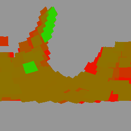
GFSAD1000: Cropland Extent 1km Multi-Study Crop Mask, Global Food-Support Analysis Data
The GFSAD is a NASA-funded project to provide high-resolution global cropland data and their water use that contributes towards global food security in the twenty-first century. The GFSAD products are derived through multi-sensor remote sensing data (e.g., Landsat, MODIS, AVHRR), secondary data, and field-plot data … agriculture crop landcover usgs -
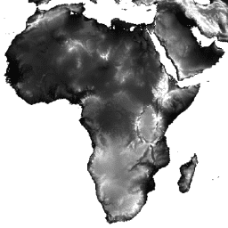
GMTED2010: Global Multi-resolution Terrain Elevation Data 2010
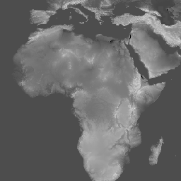
The Global Multi-resolution Terrain Elevation Data 2010 (GMTED2010) dataset contains elevation data for the globe collected from various sources at 7.5 arc-seconds resolution. More details are available in the dataset report. The primary source dataset for GMTED2010 is NGA''s SRTM Digital Terrain Elevation Data (DTED®, … dem elevation elevation-topography geophysical srtm topography -
GTOPO30: Global 30 Arc-Second Elevation
GTOPO30 is a global digital elevation model (DEM) with a horizontal grid spacing of 30 arc seconds (approximately 1 kilometer). The DEM was derived from several raster and vector sources of topographic information. Completed in late 1996, GTOPO30 was developed over a three-year period through … dem elevation elevation-topography geophysical nasa topography -
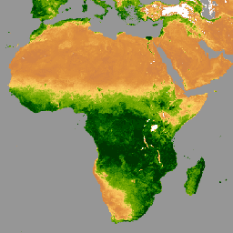
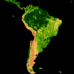
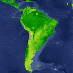
Global Mangrove Forests Distribution, v1 (2000)
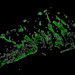
The database was prepared using Landsat satellite data from the year 2000. More than 1,000 Landsat scenes obtained from the USGS Earth Resources Observation and Science Center (EROS) were classified using hybrid supervised and unsupervised digital image classification techniques. This database is the first, most … annual ciesin forest-biomass global landsat-derived mangrove -
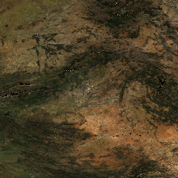
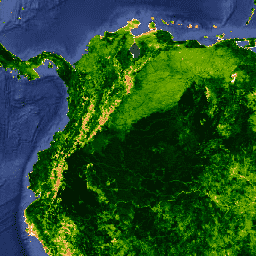
HLSL30: HLS-2 Landsat Operational Land Imager Surface Reflectance and TOA Brightness Daily Global 30m
The Harmonized Landsat Sentinel-2 (HLS) project provides consistent surface reflectance (SR) and top of atmosphere (TOA) brightness data from a virtual constellation of satellite sensors. The Operational Land Imager (OLI) is housed aboard the joint NASA/USGS Landsat 8 and Landsat 9 satellites, while the Multi-Spectral … landsat nasa satellite-imagery sentinel usgs -
HLSS30: HLS Sentinel-2 Multi-spectral Instrument Surface Reflectance Daily Global 30m

The Harmonized Landsat Sentinel-2 (HLS) project provides consistent surface reflectance data from the Operational Land Imager (OLI) aboard the joint NASA/USGS Landsat 8 satellite and the Multi-Spectral Instrument (MSI) aboard Europe's Copernicus Sentinel-2A satellites. The combined measurement enables global observations of the land every 2-3 … landsat nasa satellite-imagery sentinel usgs -
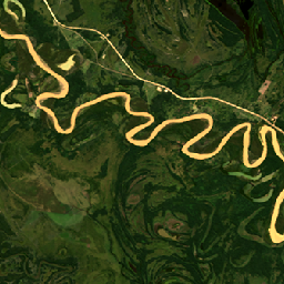
HUC02: USGS Watershed Boundary Dataset of Regions
The Watershed Boundary Dataset (WBD) is a comprehensive aggregated collection of hydrologic unit (HU) data consistent with the national criteria for delineation and resolution. It defines the areal extent of surface water drainage to a point except in coastal or lake front areas where there … hydrology surface-ground-water table usgs water watershed -
HUC04: USGS Watershed Boundary Dataset of Subregions

The Watershed Boundary Dataset (WBD) is a comprehensive aggregated collection of hydrologic unit (HU) data consistent with the national criteria for delineation and resolution. It defines the areal extent of surface water drainage to a point except in coastal or lake front areas where there … hydrology surface-ground-water table usgs water watershed -
HUC06: USGS Watershed Boundary Dataset of Basins

The Watershed Boundary Dataset (WBD) is a comprehensive aggregated collection of hydrologic unit (HU) data consistent with the national criteria for delineation and resolution. It defines the areal extent of surface water drainage to a point except in coastal or lake front areas where there … hydrology surface-ground-water table usgs water watershed -
HUC08: USGS Watershed Boundary Dataset of Subbasins

The Watershed Boundary Dataset (WBD) is a comprehensive aggregated collection of hydrologic unit (HU) data consistent with the national criteria for delineation and resolution. It defines the areal extent of surface water drainage to a point except in coastal or lake front areas where there … hydrology surface-ground-water table usgs water watershed -
HUC10: USGS Watershed Boundary Dataset of Watersheds

The Watershed Boundary Dataset (WBD) is a comprehensive aggregated collection of hydrologic unit (HU) data consistent with the national criteria for delineation and resolution. It defines the areal extent of surface water drainage to a point except in coastal or lake front areas where there … hydrology surface-ground-water table usgs water watershed -
HUC12: USGS Watershed Boundary Dataset of Subwatersheds

The Watershed Boundary Dataset (WBD) is a comprehensive aggregated collection of hydrologic unit (HU) data consistent with the national criteria for delineation and resolution. It defines the areal extent of surface water drainage to a point except in coastal or lake front areas where there … hydrology surface-ground-water table usgs water watershed -
LANDFIRE BPS (Biophysical Settings) v1.4.0

LANDFIRE (LF), Landscape Fire and Resource Management Planning Tools, is a shared program between the wildland fire management programs of the U.S. Department of Agriculture's Forest Service, U.S. Department of the Interior's Geological Survey, and The Nature Conservancy. LANDFIRE (LF) layers are created using predictive … doi fire forest-biomass landfire nature-conservancy usda -
LANDFIRE ESP AK (Environmental Site Potential) v1.2.0
LANDFIRE (LF), Landscape Fire and Resource Management Planning Tools, is a shared program between the wildland fire management programs of the U.S. Department of Agriculture's Forest Service, U.S. Department of the Interior's Geological Survey, and The Nature Conservancy. LANDFIRE (LF) layers are created using predictive … doi fire forest-biomass landfire nature-conservancy usda -
LANDFIRE ESP CONUS (Environmental Site Potential) v1.2.0

LANDFIRE (LF), Landscape Fire and Resource Management Planning Tools, is a shared program between the wildland fire management programs of the U.S. Department of Agriculture's Forest Service, U.S. Department of the Interior's Geological Survey, and The Nature Conservancy. LANDFIRE (LF) layers are created using predictive … doi fire forest-biomass landfire nature-conservancy usda -
LANDFIRE ESP HI (Environmental Site Potential) v1.2.0
LANDFIRE (LF), Landscape Fire and Resource Management Planning Tools, is a shared program between the wildland fire management programs of the U.S. Department of Agriculture's Forest Service, U.S. Department of the Interior's Geological Survey, and The Nature Conservancy. LANDFIRE (LF) layers are created using predictive … doi fire forest-biomass landfire nature-conservancy usda -
LANDFIRE EVC (Existing Vegetation Cover) v1.4.0

LANDFIRE (LF), Landscape Fire and Resource Management Planning Tools, is a shared program between the wildland fire management programs of the U.S. Department of Agriculture's Forest Service, U.S. Department of the Interior's Geological Survey, and The Nature Conservancy. LANDFIRE (LF) layers are created using predictive … doi fire forest-biomass landfire nature-conservancy usda -
LANDFIRE EVH (Existing Vegetation Height) v1.4.0
LANDFIRE (LF), Landscape Fire and Resource Management Planning Tools, is a shared program between the wildland fire management programs of the U.S. Department of Agriculture's Forest Service, U.S. Department of the Interior's Geological Survey, and The Nature Conservancy. LANDFIRE (LF) layers are created using predictive … doi fire forest-biomass landfire nature-conservancy usda -
LANDFIRE EVT (Existing Vegetation Type) v1.4.0

LANDFIRE (LF), Landscape Fire and Resource Management Planning Tools, is a shared program between the wildland fire management programs of the U.S. Department of Agriculture's Forest Service, U.S. Department of the Interior's Geological Survey, and The Nature Conservancy. LANDFIRE (LF) layers are created using predictive … doi fire forest-biomass landfire nature-conservancy usda -
LANDFIRE FRG (Fire Regime Groups) v1.2.0

LANDFIRE (LF), Landscape Fire and Resource Management Planning Tools, is a shared program between the wildland fire management programs of the U.S. Department of Agriculture's Forest Service, U.S. Department of the Interior's Geological Survey, and The Nature Conservancy. Landfire (LF) Historical fire regimes, intervals, and … doi fire landfire nature-conservancy usda usgs -
LANDFIRE MFRI (Mean Fire Return Interval) v1.2.0

LANDFIRE (LF), Landscape Fire and Resource Management Planning Tools, is a shared program between the wildland fire management programs of the U.S. Department of Agriculture's Forest Service, U.S. Department of the Interior's Geological Survey, and The Nature Conservancy. Landfire (LF) Historical fire regimes, intervals, and … doi fire landfire nature-conservancy usda usgs -
LANDFIRE PLS (Percent Low-severity Fire) v1.2.0
LANDFIRE (LF), Landscape Fire and Resource Management Planning Tools, is a shared program between the wildland fire management programs of the U.S. Department of Agriculture's Forest Service, U.S. Department of the Interior's Geological Survey, and The Nature Conservancy. Landfire (LF) Historical fire regimes, intervals, and … doi fire landfire nature-conservancy usda usgs -
LANDFIRE PMS (Percent of Mixed-severity Fire) v1.2.0

LANDFIRE (LF), Landscape Fire and Resource Management Planning Tools, is a shared program between the wildland fire management programs of the U.S. Department of Agriculture's Forest Service, U.S. Department of the Interior's Geological Survey, and The Nature Conservancy. Landfire (LF) Historical fire regimes, intervals, and … doi fire landfire nature-conservancy usda usgs -
LANDFIRE PRS (Percent of Replacement-severity Fire) v1.2.0

LANDFIRE (LF), Landscape Fire and Resource Management Planning Tools, is a shared program between the wildland fire management programs of the U.S. Department of Agriculture's Forest Service, U.S. Department of the Interior's Geological Survey, and The Nature Conservancy. Landfire (LF) Historical fire regimes, intervals, and … doi fire landfire nature-conservancy usda usgs -
LANDFIRE SClass (Succession Classes) v1.4.0
LANDFIRE (LF), Landscape Fire and Resource Management Planning Tools, is a shared program between the wildland fire management programs of the U.S. Department of Agriculture's Forest Service, U.S. Department of the Interior's Geological Survey, and The Nature Conservancy. Landfire (LF) Historical fire regimes, intervals, and … doi fire landfire nature-conservancy usda usgs -
LANDFIRE VCC (Vegetation Condition Class) v1.4.0

LANDFIRE (LF), Landscape Fire and Resource Management Planning Tools, is a shared program between the wildland fire management programs of the U.S. Department of Agriculture's Forest Service, U.S. Department of the Interior's Geological Survey, and The Nature Conservancy. Landfire (LF) Historical fire regimes, intervals, and … doi fire landfire nature-conservancy usda usgs -
LANDFIRE VDep (Vegetation Departure) v1.4.0

LANDFIRE (LF), Landscape Fire and Resource Management Planning Tools, is a shared program between the wildland fire management programs of the U.S. Department of Agriculture's Forest Service, U.S. Department of the Interior's Geological Survey, and The Nature Conservancy. Landfire (LF) Historical fire regimes, intervals, and … doi fire landfire nature-conservancy usda usgs -
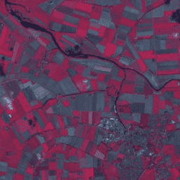
Landsat Collection 2 Tier 1 Level 2 32-Day BAI Composite
These Landsat Collection 2 Tier 1 Level 2 composites are made from Tier 1 Level 2 orthorectified scenes. The Burn Area Index (BAI) is generated from the Red and Near-IR bands, and measures the spectral distance of each pixel from a reference spectral point (the … bai fire landsat landsat-composite usgs vegetation-indices -
Landsat Collection 2 Tier 1 Level 2 32-Day Composite
These Landsat Collection 2 Tier 1 Level 2 composites are made from Tier 1 Level 2 orthorectified scenes, and include the SR bands: blue, green, red, nir, swir1, swir2, and thermal. These composites are created from all the scenes in each 32-day period beginning from … landsat landsat-composite satellite-imagery sr usgs -
Landsat Collection 2 Tier 1 Level 2 32-Day NBR Composite

These Landsat Collection 2 Tier 1 Level 2 composites are made from Tier 1 Level 2 orthorectified scenes. The Normalized Burn Ratio Thermal (NBRT) index is generated from the Near-IR, Mid-IR (2215 nm), and Thermal bands, and has a range from -1.0 to 1.0. See … fire landsat landsat-composite nbrt usgs vegetation-indices -
Landsat Collection 2 Tier 1 Level 2 32-Day NDVI Composite

These Landsat Collection 2 Tier 1 Level 2 composites are made from Tier 1 Level 2 orthorectified scenes. The Normalized Difference Vegetation Index is generated from the Near-IR and Red bands of each scene as (NIR - Red) / (NIR + Red), and ranges in … landsat landsat-composite ndvi usgs vegetation vegetation-indices -
Landsat Collection 2 Tier 1 Level 2 32-Day NDWI Composite
These Landsat Collection 2 Tier 1 Level 2 composites are made from Tier 1 Level 2 orthorectified scenes. The Normalized Difference Water Index (NDWI) is designed to delineate open water features and enhance their presence in imagery while eliminating soil and terrestrial vegetation features. It … landsat landsat-composite ndwi surface-ground-water usgs -
Landsat Collection 2 Tier 1 Level 2 8-Day BAI Composite
These Landsat Collection 2 Tier 1 Level 2 composites are made from Tier 1 Level 2 orthorectified scenes. The Burn Area Index (BAI) is generated from the Red and Near-IR bands, and measures the spectral distance of each pixel from a reference spectral point (the … bai fire landsat landsat-composite usgs vegetation-indices -
Landsat Collection 2 Tier 1 Level 2 8-Day Composite
These Landsat Collection 2 Tier 1 Level 2 composites are made from Tier 1 Level 2 orthorectified scenes, and include the SR bands: blue, green, red, nir, swir1, swir2, and thermal. These composites are created from all the scenes in each 8-day period beginning from … landsat landsat-composite satellite-imagery sr usgs -
Landsat Collection 2 Tier 1 Level 2 8-Day EVI Composite
These Landsat Collection 2 Tier 1 Level 2 composites are made from Tier 1 Level 2 orthorectified scenes. The Enhanced Vegetation Index (EVI) is generated from the Near-IR, Red and Blue bands of each scene, and ranges in value from -1.0 to 1.0. See Huete … evi landsat landsat-composite usgs vegetation vegetation-indices -
Landsat Collection 2 Tier 1 Level 2 8-Day NBR Composite
These Landsat Collection 2 Tier 1 Level 2 composites are made from Tier 1 Level 2 orthorectified scenes. The Normalized Burn Ratio Thermal (NBRT) index is generated from the Near-IR, Mid-IR (2215 nm), and Thermal bands, and has a range from -1.0 to 1.0. See … fire landsat landsat-composite nbrt usgs vegetation-indices -
Landsat Collection 2 Tier 1 Level 2 8-Day NDVI Composite
These Landsat Collection 2 Tier 1 Level 2 composites are made from Tier 1 Level 2 orthorectified scenes. The Normalized Difference Vegetation Index is generated from the Near-IR and Red bands of each scene as (NIR - Red) / (NIR + Red), and ranges in … landsat landsat-composite ndvi usgs vegetation vegetation-indices -
Landsat Collection 2 Tier 1 Level 2 8-Day NDWI Composite
These Landsat Collection 2 Tier 1 Level 2 composites are made from Tier 1 Level 2 orthorectified scenes. The Normalized Difference Water Index (NDWI) is designed to delineate open water features and enhance their presence in imagery while eliminating soil and terrestrial vegetation features. It … landsat landsat-composite ndwi surface-ground-water usgs -
Landsat Collection 2 Tier 1 Level 2 Annual BAI Composite
These Landsat Collection 2 Tier 1 Level 2 composites are made from Tier 1 Level 2 orthorectified scenes. The Burn Area Index (BAI) is generated from the Red and Near-IR bands, and measures the spectral distance of each pixel from a reference spectral point (the … bai fire landsat landsat-composite usgs vegetation-indices -
Landsat Collection 2 Tier 1 Level 2 Annual Composite
These Landsat Collection 2 Tier 1 Level 2 composites are made from Tier 1 Level 2 orthorectified scenes, and include the SR bands: blue, green, red, nir, swir1, swir2, and thermal. These composites are created from all the scenes in each annual period beginning from … landsat landsat-composite satellite-imagery sr usgs -
Landsat Collection 2 Tier 1 Level 2 Annual EVI Composite
These Landsat Collection 2 Tier 1 Level 2 composites are made from Tier 1 Level 2 orthorectified scenes. The Enhanced Vegetation Index (EVI) is generated from the Near-IR, Red and Blue bands of each scene, and ranges in value from -1.0 to 1.0. See Huete … evi landsat landsat-composite usgs vegetation vegetation-indices -
Landsat Collection 2 Tier 1 Level 2 Annual NBR Composite
These Landsat Collection 2 Tier 1 Level 2 composites are made from Tier 1 Level 2 orthorectified scenes. The Normalized Burn Ratio Thermal (NBRT) index is generated from the Near-IR, Mid-IR (2215 nm), and Thermal bands, and has a range from -1.0 to 1.0. See … fire landsat landsat-composite nbrt usgs vegetation-indices -
Landsat Collection 2 Tier 1 Level 2 Annual NDVI Composite
These Landsat Collection 2 Tier 1 Level 2 composites are made from Tier 1 Level 2 orthorectified scenes. The Normalized Difference Vegetation Index is generated from the Near-IR and Red bands of each scene as (NIR - Red) / (NIR + Red), and ranges in … landsat landsat-composite ndvi usgs vegetation vegetation-indices -
Landsat Collection 2 Tier 1 Level 2 Annual NDWI Composite
These Landsat Collection 2 Tier 1 Level 2 composites are made from Tier 1 Level 2 orthorectified scenes. The Normalized Difference Water Index (NDWI) is designed to delineate open water features and enhance their presence in imagery while eliminating soil and terrestrial vegetation features. It … landsat landsat-composite ndwi surface-ground-water usgs -
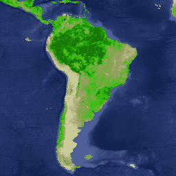
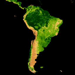
Landsat Global Land Survey 1975
The Global Land Survey (GLS) 1975 is a global collection of imagery from the Landsat Multispectral Scanner (MSS). Most scenes were acquired by Landsat 1-3 in 1972-1983. A few gaps in the Landsat 1-3 data have been filled with scenes acquired by Landsat 4-5 during … global gls landsat radiance satellite-imagery usgs -
Landsat Global Land Survey 2005, Landsat 5 scenes

The GLS2005 data set is a collection of 9500 orthorectified leaf-on medium-resolution satellite images collected between 2004 and 2007 and covering the Earth's land masses. GLS2005 uses mainly Landsat 5 and gap-filled Landsat 7 data with EO-1 ALI and Terra ASTER data filling in any … etm gls l5 landsat radiance satellite-imagery -
Landsat Global Land Survey 2005, Landsat 5+7 scenes

The GLS2005 data set is a collection of 9500 orthorectified leaf-on medium-resolution satellite images collected between 2004 and 2007 and covering the Earth's land masses. GLS2005 uses mainly Landsat 5 and gap-filled Landsat 7 data with EO-1 ALI and Terra ASTER data filling in any … gls landsat radiance satellite-imagery usgs -
Landsat Global Land Survey 2005, Landsat 7 scenes
The GLS2005 data set is a collection of 9500 orthorectified leaf-on medium-resolution satellite images collected between 2004 and 2007 and covering the Earth's land masses. GLS2005 uses mainly Landsat 5 and gap-filled Landsat 7 data with EO-1 ALI and Terra ASTER data filling in any … etm gls l7 landsat radiance satellite-imagery -
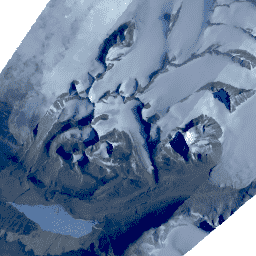
Landsat Image Mosaic of Antarctica (LIMA) - Processed Landsat Scenes (16 bit)
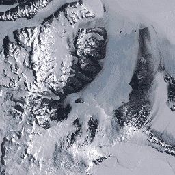
The Landsat Image Mosaic of Antarctica (LIMA) is a seamless and virtually cloudless mosaic created from processed Landsat 7 ETM+ scenes. Processed Landsat Scenes (16 bit) are Level 1Gt NLAPS scenes converted to 16 bit, processed with sun-angle correction, and converted to reflectance values (Bindschadler … antarctica ice landsat-derived lima mosaic satellite-imagery -
Landsat Image Mosaic of Antarctica (LIMA) - Processed Landsat Scenes (16 bit) Metadata
The Landsat Image Mosaic of Antarctica (LIMA) is a seamless and virtually cloudless mosaic created from processed Landsat 7 ETM+ scenes. Processed Landsat Scenes (16 bit) are Level 1Gt NLAPS scenes converted to 16 bit, processed with sun-angle correction, and converted to reflectance values (Bindschadler … antarctica ice landsat-derived lima mosaic satellite-imagery -
Landsat Image Mosaic of Antarctica (LIMA) 16-Bit Pan-Sharpened Mosaic

The Landsat Image Mosaic of Antarctica (LIMA) is a seamless and virtually cloudless mosaic created from processed Landsat 7 ETM+ scenes. This LIMA dataset is the 16-bit Intermediate LIMA. The mosaic consists of pan-sharpened normalized surface reflectance scenes (Landsat ETM+ bands 1, 2, 3, and … antarctica ice landsat-derived lima mosaic satellite-imagery -
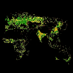
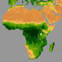
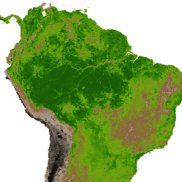
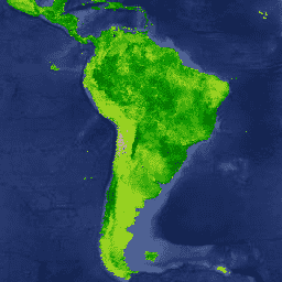
MCD12C1.061 MODIS Land Cover Type Yearly Global 0.05 Deg CMG
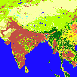
The Terra and Aqua combined Moderate Resolution Imaging Spectroradiometer (MODIS) Land Cover Climate Modeling Grid (CMG) (MCD12C1) Version 6.1 data product provides a spatially aggregated and reprojected version of the tiled MCD12Q1 Version 6.1 data product. Maps of the International Geosphere-Biosphere Programme (IGBP), University of … landcover landuse-landcover modis nasa usgs yearly -
MCD12Q1.061 MODIS Land Cover Type Yearly Global 500m
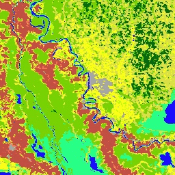
The Terra and Aqua combined Moderate Resolution Imaging Spectroradiometer (MODIS) Land Cover Type (MCD12Q1) Version 6.1 data product provides global land cover types at yearly intervals. The MCD12Q1 Version 6.1 data product is derived using supervised classifications of MODIS Terra and Aqua reflectance data. Land … landcover landuse-landcover modis nasa usgs yearly -
MCD12Q2.006 Land Cover Dynamics Yearly Global 500m
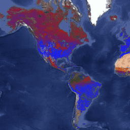
The Terra and Aqua combined Moderate Resolution Imaging Spectroradiometer (MODIS) Land Cover Dynamics (MCD12Q2) Version 6.1 data product provides global land surface phenology metrics at yearly intervals. The MCD12Q2 Version 6.1 data product is derived from time series of the 2-band Enhanced Vegetation Index (EVI2) … evi global landuse-landcover modis onset-greenness phenology -
MCD15A3H.061 MODIS Leaf Area Index/FPAR 4-Day Global 500m
The MCD15A3H Version 6.1 Moderate Resolution Imaging Spectroradiometer (MODIS) Level 4, Combined Fraction of Photosynthetically Active Radiation (FPAR), and Leaf Area Index (LAI) product is a 4-day composite data set with 500 meter pixel size. The algorithm chooses the best pixel available from all the … fpar global lai modis nasa plant-productivity -
MCD19A1.061: Land Surface BRF Daily L2G Global 500m and 1km
The MCD19A1 Version 6.1 data product is a Moderate Resolution Imaging Spectroradiometer (MODIS) Terra and Aqua combined Land Surface Bidirectional Reflectance Factor (BRF) gridded Level 2 product produced daily at 500 meter and 1 kilometer resolution. For more information see the MAIAC user guide. aerosol aod aqua daily global maiac -
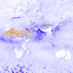
MCD19A2.061: Terra & Aqua MAIAC Land Aerosol Optical Depth Daily 1km
The MCD19A2 V6.1 data product is a MODIS Terra and Aqua combined Multi-angle Implementation of Atmospheric Correction (MAIAC) Land Aerosol Optical Depth (AOD) gridded Level 2 product produced daily at 1 km resolution. For more information see the MAIAC user guide. NOTE: This product has … aerosol aod aqua atmosphere daily global -
MCD43A1.061 MODIS BRDF-Albedo Model Parameters Daily 500m
The MCD43A1 V6.1 Bidirectional Reflectance Distribution Function and Albedo (BRDF/Albedo) Model Parameters dataset is a 500 meter daily 16-day product. The Julian date represents the 9th day of the 16-day retrieval period, and consequently the observations are weighted to estimate the BRDF/Albedo for that day. … albedo brdf daily global modis nasa -
MCD43A2.061 MODIS BRDF-Albedo Quality Daily 500m
The MCD43A2 V6.1 Bidirectional Reflectance Distribution Function and Albedo (BRDF/Albedo) Quality dataset is a 500 meter daily 16-day product. It contains all the quality information for the corresponding 16-day MCD43A3 Albedo and the MCD43A4 Nadir-BRDF (NBAR) products. The MCD43A2 contains individual band quality and observation … albedo brdf daily global modis nasa -
MCD43A3.061 MODIS Albedo Daily 500m
The MCD43A3 V6.1 Albedo Model dataset is a daily 16-day product. It provides both directional hemispherical reflectance (black sky albedo) and bihemispherical reflectance (white sky albedo) for each of the MODIS surface reflectance bands (band 1 through band 7) as well as 3 broad spectrum … albedo black-sky daily global modis nasa -
MCD43A4.061 MODIS Nadir BRDF-Adjusted Reflectance Daily 500m
The MCD43A4 V6.1 Nadir Bidirectional Reflectance Distribution Function Adjusted Reflectance (NBAR) product provides 500 meter reflectance data of the MODIS "land" bands 1-7. These are adjusted using a bidirectional reflectance distribution function to model the values as if they were collected from a nadir view. … albedo brdf daily global modis nasa -
MCD43C3.061 BRDF/Albedo Daily L3 0.05 Deg CMG
The MCD43C3 Version 6.1 Bidirectional Reflectance Distribution Function and Albedo (BRDF/Albedo) Albedo dataset is produced daily using 16 days of Terra and Aqua MODIS data in a 0.05 degree (5,600 meters at the equator) Climate Modeling Grid (CMG). Data are temporally weighted to the ninth … albedo black-sky brdf daily global modis -
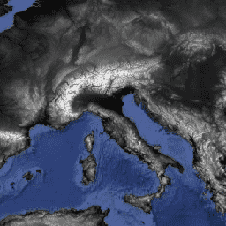
MCD64A1.061 MODIS Burned Area Monthly Global 500m
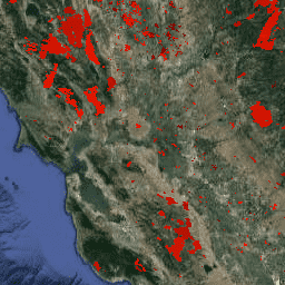
The Terra and Aqua combined MCD64A1 Version 6.1 Burned Area data product is a monthly, global gridded 500m product containing per-pixel burned-area and quality information. The MCD64A1 burned-area mapping approach employs 500m MODIS Surface Reflectance imagery coupled with 1km MODIS active fire observations. The algorithm … burn change-detection fire geophysical global mcd64a1 -
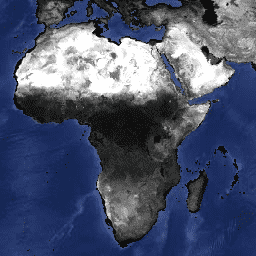
MOD08_M3.061 Terra Atmosphere Monthly Global Product
MOD08_M3 V6.1 is an atmosphere global product that contains monthly 1 x 1 degree grid average values of atmospheric parameters. These parameters are related to atmospheric aerosol particle properties, total ozone burden, atmospheric water vapor, cloud optical and physical properties, and atmospheric stability indices. The … atmosphere climate geophysical global modis monthly -
MOD09A1.061 Terra Surface Reflectance 8-Day Global 500m

The MOD09A1 V6.1 product provides an estimate of the surface spectral reflectance of Terra MODIS bands 1-7 at 500m resolution and corrected for atmospheric conditions such as gasses, aerosols, and Rayleigh scattering. Along with the seven reflectance bands is a quality layer and four observation … 8-day global modis nasa satellite-imagery sr -
MOD09GA.061 Terra Surface Reflectance Daily Global 1km and 500m

The MODIS Surface Reflectance products provide an estimate of the surface spectral reflectance as it would be measured at ground level in the absence of atmospheric scattering or absorption. Low-level data are corrected for atmospheric gases and aerosols. MOD09GA version 6.1 provides bands 1-7 in … daily global modis nasa satellite-imagery sr -
MOD09GQ.061 Terra Surface Reflectance Daily Global 250m

The MODIS Surface Reflectance products provide an estimate of the surface spectral reflectance as it would be measured at ground level in the absence of atmospheric scattering or absorption. Low-level data are corrected for atmospheric gases and aerosols. MOD09GQ version 6.1 provides bands 1 and … daily global modis nasa satellite-imagery sr -
MOD09Q1.061 Terra Surface Reflectance 8-Day Global 250m

The MOD09Q1 product provides an estimate of the surface spectral reflectance of bands 1 and 2 at 250m resolution and corrected for atmospheric conditions such as gasses, aerosols, and Rayleigh scattering. Along with the two reflectance bands, a quality layer is also included. For each … 8-day global mod09q1 modis nasa satellite-imagery -
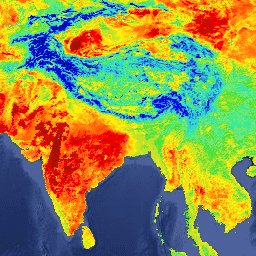
MOD11A1.061 Terra Land Surface Temperature and Emissivity Daily Global 1km

The MOD11A1 V6.1 product provides daily land surface temperature (LST) and emissivity values in a 1200 x 1200 kilometer grid. The temperature value is derived from the MOD11_L2 swath product. Above 30 degrees latitude, some pixels may have multiple observations where the criteria for clear-sky … climate daily emissivity global lst modis -
MOD11A2.061 Terra Land Surface Temperature and Emissivity 8-Day Global 1km
The MOD11A2 V6.1 product provides an average 8-day land surface temperature (LST) in a 1200 x 1200 kilometer grid. Each pixel value in MOD11A2 is a simple average of all the corresponding MOD11A1 LST pixels collected within that 8 day period. The MOD11A2 does a … 8-day climate emissivity global lst mod11a2 -
MOD13A1.061 Terra Vegetation Indices 16-Day Global 500m

The MOD13A1 V6.1 product provides a Vegetation Index (VI) value at a per pixel basis. There are two primary vegetation layers. The first is the Normalized Difference Vegetation Index (NDVI) which is referred to as the continuity index to the existing National Oceanic and Atmospheric … 16-day evi global modis nasa ndvi -
MOD13A2.061 Terra Vegetation Indices 16-Day Global 1km

The MOD13A2 V6.1 product provides two Vegetation Indices (VI): the Normalized Difference Vegetation Index (NDVI) and the Enhanced Vegetation Index (EVI). The NDVI is referred to as the continuity index to the existing National Oceanic and Atmospheric Administration-Advanced Very High Resolution Radiometer (NOAA-AVHRR) derived NDVI. … 16-day evi global modis nasa ndvi -
MOD13A3.061 Vegetation Indices Monthly L3 Global 1 km SIN Grid
The MOD13A3 V6.1 product data is provided monthly at 1 kilometer (km) spatial resolution. In generating this monthly product, the algorithm ingests all the MOD13A2 products that overlap the month and employs a weighted temporal average. Vegetation indices are used for global monitoring of vegetation … evi global modis monthly nasa ndvi -
MOD13C1.061: Terra Vegetation Indices 16-Day L3 Global 0.05 Deg Climate Modeling Grid
The Terra Moderate Resolution Imaging Spectroradiometer (MODIS) Vegetation Indices 16-Day (MOD13C1) Version 6.1 product provides a Vegetation Index (VI) value at a per pixel basis. There are two primary vegetation layers. The first is the Normalized Difference Vegetation Index (NDVI), which maintains continuity with the … 16-day global nasa terra usgs vegetation -
MOD13Q1.061 Terra Vegetation Indices 16-Day Global 250m

The MOD13Q1 V6.1 product provides a Vegetation Index (VI) value at a per pixel basis. There are two primary vegetation layers. The first is the Normalized Difference Vegetation Index (NDVI) which is referred to as the continuity index to the existing National Oceanic and Atmospheric … 16-day evi global modis nasa ndvi -
MOD14A1.061: Terra Thermal Anomalies & Fire Daily Global 1km

The MOD14A1 V6.1 dataset provides daily fire mask composites at 1km resolution derived from the MODIS 4- and 11-micrometer radiances. The fire detection strategy is based on absolute detection of a fire (when the fire strength is sufficient to detect), and on detection relative to … daily fire global modis nasa terra -
MOD14A2.061: Terra Thermal Anomalies & Fire 8-Day Global 1km
The MOD14A2 V6.1 dataset provides 8-day fire mask composites at 1km resolution. It contains the maximum value of the individual pixel classes over the compositing period. Along with the fire mask, an associated quality information layer is also provided. Documentation: User's Guide Algorithm Theoretical Basis … 8-day fire global modis nasa terra -
MOD15A2H.061: Terra Leaf Area Index/FPAR 8-Day Global 500m
The MOD15A2H V6.1 MODIS combined Leaf Area Index (LAI) and Fraction of Photosynthetically Active Radiation (FPAR) product is an 8-day composite dataset at 500m resolution. The algorithm chooses the "best" pixel available from all the acquisitions of the Terra sensor from within the 8-day period. … 8-day fpar global lai modis nasa -
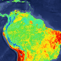
MOD17A2H.061: Terra Gross Primary Productivity 8-Day Global 500m

The MOD17A2H V6.1 Gross Primary Productivity (GPP) product is a cumulative 8-day composite with a 500m pixel size. The product is based on the radiation-use efficiency concept and can be potentially used as inputs to data models to calculate terrestrial energy, carbon, water cycle processes, … 8-day global gpp modis nasa photosynthesis -
MOD17A2HGF.061: Terra Gross Primary Productivity 8-Day Global 500m
The MOD17A2HGF Version 6.1 Gross Primary Productivity (GPP) product is a cumulative 8-day composite of values with 500 meter (m) pixel size based on the radiation use efficiency concept that can be potentially used as inputs to data models to calculate terrestrial energy, carbon, water … 8-day global gpp modis nasa photosynthesis -
MOD17A3HGF.061: Terra Net Primary Production Gap-Filled Yearly Global 500m

The MOD17A3HGF V6.1 product provides information about annual Gross and Net Primary Productivity (GPP and NPP) at 500m pixel resolution. Annual NPP is derived from the sum of all 8-day Net Photosynthesis(PSN) products (MOD17A2H) from the given year. The PSN value is the difference of … global gpp nasa npp photosynthesis plant-productivity -
MOD21A1D.061 Terra Land Surface Temperature and 3-Band Emissivity Daily Global 1km

The MOD21A1D dataset is produced daily from daytime Level 2 Gridded (L2G) intermediate LST products at a spatial resolution of 1,000 meters. The L2G process maps the daily MOD21 swath granules onto a sinusoidal MODIS grid and stores all observations falling over a gridded cell … climate daily emissivity global lst nasa -
MOD21A1N.061 Terra Land Surface Temperature and 3-Band Emissivity Daily Global 1km

The MOD21A1N dataset is produced daily from nighttime Level 2 Gridded (L2G) intermediate LST products at a spatial resolution of 1,000 meters. The L2G process maps the daily MOD21 swath granules onto a sinusoidal MODIS grid and stores all observations falling over a gridded cell … climate daily emissivity global lst nasa -
MOD21C1.061 Terra Land Surface Temperature and 3-Band Emissivity Daily L3 Global 0.05 Deg CMG

The MOD21C1 dataset is produced daily in a 0.05 degree (5,600 meters at the equator) Climate Modeling Grid (CMG) from daytime Level 2 Gridded (L2G) intermediate LST products. The L2G process maps the daily MOD21 swath granules onto a sinusoidal MODIS grid and stores all … climate daily emissivity global lst nasa -
MOD21C2.061 Terra Land Surface Temperature and 3-Band Emissivity 8-Day L3 Global 0.05 Deg CMG
The MOD21C2 dataset is an 8-day composite LST product that uses an algorithm based on a simple averaging method. The algorithm calculates the average from all the cloud free MOD21A1D and MOD21A1N daily acquisitions from the 8-day period. Unlike the MOD21A1 data sets where the … climate emissivity global lst nasa surface-temperature -
MOD21C3.061 Terra Land Surface Temperature and 3-Band Emissivity Monthly L3 Global 0.05 Deg CMG
The MOD21C3 dataset is a monthly composite LST product that uses an algorithm based on a simple averaging method. The algorithm calculates the average from all the cloud free MOD21A1D and MOD21A1N daily acquisitions from the 8-day period. Unlike the MOD21A1 data sets where the … climate emissivity global lst monthly nasa -
MOD44W.006 Terra Land Water Mask Derived From MODIS and SRTM Yearly Global 250m
The MOD44W V6 land/water mask 250m product is derived using a decision tree classifier trained with MODIS data and validated with the MOD44W V5 product. A series of masks are applied to address known issues caused by terrain shadow, burn scars, cloudiness, or ice cover … geophysical mod44w modis nasa srtm surface-ground-water -
MODOCGA.006 Terra Ocean Reflectance Daily Global 1km

The MODOCGA V6 ocean reflectance product consists of 1 kilometer reflectance data from Terra MODIS bands 8-16. The product is referred to as ocean reflectance, because bands 8-16 are used primarily to produce ocean products, but this is not an ocean product as the tiles … daily global modis nasa oceans reflectance -
MTBS Burned Area Boundaries
The Monitoring Trends in Burn Severity (MTBS) burned area boundaries dataset contains the extent polygons of the burned areas of all currently completed MTBS fires for the continental United States, Alaska, Hawaii, and Puerto Rico. Below NBR stands for "Normalized Burn Ratio", while dNBR stands … eros fire gtac mtbs table usda -
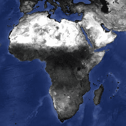
MYD08_M3.061 Aqua Atmosphere Monthly Global Product

MYD08_M3 V6.1 is an atmosphere global product that contains monthly 1 x 1 degree grid average values of atmospheric parameters. These parameters are related to atmospheric aerosol particle properties, total ozone burden, atmospheric water vapor, cloud optical and physical properties, and atmospheric stability indices. The … aqua atmosphere climate geophysical global modis -
MYD09A1.061 Aqua Surface Reflectance 8-Day Global 500m
The MYD09A1 V6.1 product provides an estimate of the surface spectral reflectance of Aqua MODIS bands 1-7 at 500m resolution and corrected for atmospheric conditions such as gasses, aerosols, and Rayleigh scattering. Along with the seven reflectance bands is a quality layer and four observation … 8-day aqua global modis nasa satellite-imagery -
MYD09GA.061 Aqua Surface Reflectance Daily Global 1km and 500m
The MODIS Surface Reflectance products provide an estimate of the surface spectral reflectance as it would be measured at ground level in the absence of atmospheric scattering or absorption. Low-level data are corrected for atmospheric gases and aerosols. MYD09GA version 6.1 provides bands 1-7 in … aqua daily global modis nasa satellite-imagery -
MYD09GQ.061 Aqua Surface Reflectance Daily Global 250m
The MODIS Surface Reflectance products provide an estimate of the surface spectral reflectance as it would be measured at ground level in the absence of atmospheric scattering or absorption. Low-level data are corrected for atmospheric gases and aerosols. MYD09GQ version 6.1 provides bands 1 and … aqua daily global modis nasa satellite-imagery -
MYD09Q1.061 Aqua Surface Reflectance 8-Day Global 250m
The MYD09Q1 product provides an estimate of the surface spectral reflectance of bands 1 and 2 at 250m resolution and corrected for atmospheric conditions such as gasses, aerosols, and Rayleigh scattering. Along with the two reflectance bands, a quality layer is also included. For each … 8-day aqua global modis nasa satellite-imagery -
MYD11A1.061 Aqua Land Surface Temperature and Emissivity Daily Global 1km

The MYD11A1 V6.1 product provides daily land surface temperature (LST) and emissivity values in a 1200 x 1200 kilometer grid. The temperature value is derived from the MYD11_L2 swath product. Above 30 degrees latitude, some pixels may have multiple observations where the criteria for clear-sky … aqua climate daily emissivity global lst -
MYD11A2.061 Aqua Land Surface Temperature and Emissivity 8-Day Global 1km

The MYD11A2 V6.1 product provides an average 8-day land surface temperature (LST) in a 1200 x 1200 kilometer grid. Each pixel value in MYD11A2 is a simple average of all the corresponding MYD11A1 LST pixels collected within that 8 day period. The MYD11A2 does a … 8-day aqua climate emissivity global lst -
MYD13A1.061 Aqua Vegetation Indices 16-Day Global 500m
The MYD13A1 V6.1 product provides a Vegetation Index (VI) value at a per pixel basis. There are two primary vegetation layers. The first is the Normalized Difference Vegetation Index (NDVI) which is referred to as the continuity index to the existing National Oceanic and Atmospheric … 16-day aqua evi global modis nasa -
MYD13A2.061 Aqua Vegetation Indices 16-Day Global 1km
The MYD13A2 V6.1 product provides two Vegetation Indices (VI): the Normalized Difference Vegetation Index (NDVI) and the Enhanced Vegetation Index (EVI). The NDVI is referred to as the continuity index to the existing National Oceanic and Atmospheric Administration-Advanced Very High Resolution Radiometer (NOAA-AVHRR) derived NDVI. … 16-day aqua evi global modis nasa -
MYD13A3.061 Aqua Vegetation Indices Monthly L3 Global 1 km SIN Grid
The Aqua Moderate Resolution Imaging Spectroradiometer (MODIS) Vegetation Indices (MYD13A3) Version 6.1 data are provided monthly at 1 kilometer (km) spatial resolution as a gridded Level 3 product in the sinusoidal projection. In generating this monthly product, the algorithm ingests all the MYD13A2 products that … aqua evi global modis monthly nasa -
MYD13C1.061: Aqua Vegetation Indices 16-Day L3 Global 0.05 Deg CMG
The Aqua Moderate Resolution Imaging Spectroradiometer (MODIS) Vegetation Indices 16-Day (MYD13C1) Version 6.1 product provides a Vegetation Index (VI) value at a per pixel basis. There are two primary vegetation layers. The first is the Normalized Difference Vegetation Index (NDVI), which maintains continuity with the … 16-day aqua global nasa usgs vegetation -
MYD13Q1.061 Aqua Vegetation Indices 16-Day Global 250m
The MYD13Q1 V6.1 product provides a Vegetation Index (VI) value at a per pixel basis. There are two primary vegetation layers. The first is the Normalized Difference Vegetation Index (NDVI) which is referred to as the continuity index to the existing National Oceanic and Atmospheric … 16-day aqua evi global modis nasa -
MYD14A1.061: Aqua Thermal Anomalies & Fire Daily Global 1km
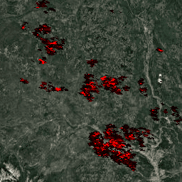
The MYD14A1 V6.1 dataset provides daily fire mask composites at 1km resolution derived from the MODIS 4- and 11-micrometer radiances. The fire detection strategy is based on absolute detection of a fire (when the fire strength is sufficient to detect), and on detection relative to … aqua daily fire global modis nasa -
MYD14A2.061: Aqua Thermal Anomalies & Fire 8-Day Global 1km

The MYD14A2 V6.1 dataset provides 8-day fire mask composites at 1km resolution. It contains the maximum value of the individual pixel classes over the compositing period. Along with the fire mask, an associated quality information layer is also provided. Documentation: User's Guide Algorithm Theoretical Basis … 8-day aqua fire global modis nasa -
MYD15A2H.061: Aqua Leaf Area Index/FPAR 8-Day Global 500m
The MYD15A2H V6.1 MODIS combined Leaf Area Index (LAI) and Fraction of Photosynthetically Active Radiation (FPAR) product is an 8-day composite dataset at 500m resolution. The algorithm chooses the "best" pixel available from all the acquisitions of the Aqua sensor from within the 8-day period. … 8-day aqua fpar global lai modis -
MYD17A2H.061: Aqua Gross Primary Productivity 8-Day Global 500m
The MYD17A2H V6.1 Gross Primary Productivity (GPP) product is a cumulative 8-day composite with a 500m resolution. The product is based on the radiation-use efficiency concept and can be potentially used as inputs to data models to calculate terrestrial energy, carbon, water cycle processes, and … 8-day aqua global gpp modis nasa -
MYD17A3HGF.061: Aqua Net Primary Production Gap-Filled Yearly Global 500m
The MYD17A3HGF V6.1 product provides information about annual Gross and Net Primary Productivity (GPP and NPP) at 500m pixel resolution. Annual NPP is derived from the sum of all 8-day Net Photosynthesis(PSN) products (MYD17A2H) from the given year. The PSN value is the difference of … aqua global gpp nasa npp photosynthesis -
MYD21A1D.061 Aqua Land Surface Temperature and 3-Band Emissivity Daily Global 1km

The MYD21A1D dataset is produced daily from daytime Level 2 Gridded (L2G) intermediate LST products at a spatial resolution of 1,000 meters. The L2G process maps the daily MOD21 swath granules onto a sinusoidal MODIS grid and stores all observations falling over a gridded cell … aqua climate daily emissivity global lst -
MYD21A1N.061 Aqua Land Surface Temperature and 3-Band Emissivity Daily Global 1km

The MYD21A1N dataset is produced daily from nighttime Level 2 Gridded (L2G) intermediate LST products at a spatial resolution of 1,000 meters. The L2G process maps the daily MOD21 swath granules onto a sinusoidal MODIS grid and stores all observations falling over a gridded cell … aqua climate daily emissivity global lst -
MYD21C1.061 Aqua Land Surface Temperature and 3-Band Emissivity Daily L3 Global 0.05 Deg CMG

The MYD21C1 dataset is produced daily in a 0.05 degree (5,600 meters at the equator) Climate Modeling Grid (CMG) from daytime Level 2 Gridded (L2G) intermediate LST products. The L2G process maps the daily MYD21 swath granules onto a sinusoidal MODIS grid and stores all … aqua climate daily emissivity global lst -
MYD21C2.061 Aqua Land Surface Temperature and 3-Band Emissivity 8-Day L3 Global 0.05 Deg CMG

The MYD21C2 dataset is an 8-day composite LST product that uses an algorithm based on a simple averaging method. The algorithm calculates the average from all the cloud free MYD21A1D and MYD21A1N daily acquisitions from the 8-day period. Unlike the MYD21A1 data sets where the … aqua climate emissivity global lst nasa -
MYD21C3.061 Aqua Land Surface Temperature and 3-Band Emissivity Monthly L3 Global 0.05 Deg CMG

The MYD21C3 dataset is a monthly composite LST product that uses an algorithm based on a simple averaging method. The algorithm calculates the average from all the cloud free MYD21A1D and MYD21A1N daily acquisitions from the 8-day period. Unlike the MYD21A1 data sets where the … aqua climate emissivity global lst monthly -
MYDOCGA.006 Aqua Ocean Reflectance Daily Global 1km
The MYDOCGA V6 ocean reflectance product consists of 1 kilometer reflectance data from Aqua MODIS bands 8-16. The product is referred to as ocean reflectance, because bands 8-16 are used primarily to produce ocean products, but this is not an ocean product as the tiles … aqua daily global modis nasa oceans -
Monitoring Trends in Burn Severity (MTBS) Burn Severity Images
The burn severity mosaics consist of thematic raster images of MTBS burn severity classes for all currently completed MTBS fires for the continental United States, Alaska, Hawaii and Puerto Rico. Mosaicked burn severity images are compiled annually for each year by US State and the … eros fire forest gtac landcover landsat-derived -
NASA SRTM Digital Elevation 30m
The Shuttle Radar Topography Mission (SRTM, see Farr et al. 2007) digital elevation data is an international research effort that obtained digital elevation models on a near-global scale. This SRTM V3 product (SRTM Plus) is provided by NASA JPL at a resolution of 1 arc-second … dem elevation elevation-topography geophysical nasa srtm -
NASADEM: NASA 30m Digital Elevation Model
NASADEM is a reprocessing of SRTM data, with improved accuracy by incorporating auxiliary data from ASTER GDEM, ICESat GLAS, and PRISM datasets. The most significant processing improvements involve void reduction through improved phase unwrapping and using ICESat GLAS data for control. Documentation: User's Guide dem elevation elevation-topography geophysical nasa srtm -
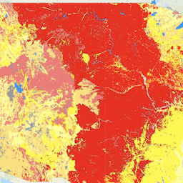
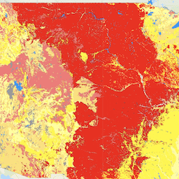
NLCD 2019: USGS National Land Cover Database, 2019 release
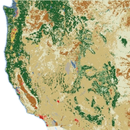
NLCD (the National Land Cover Database) is a 30-m Landsat-based land cover database spanning 8 epochs (2001, 2004, 2006, 2008, 2011, 2013, 2016, and 2019). A ninth epoch for 2021 is also available here. The images rely on the imperviousness data layer for the urban … blm landcover landuse-landcover mrlc nlcd usgs -
NLCD 2021: USGS National Land Cover Database, 2021 release
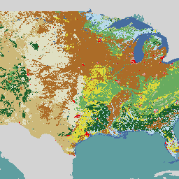
The U.S. Geological Survey (USGS), in partnership with several federal agencies, has now developed and released seven National Land Cover Database (NLCD) products: NLCD 1992, 2001, 2006, 2011, 2016, 2019, and 2021. Beginning with the 2016 release, land cover products were created for two-to-three-year intervals … blm landcover landuse-landcover mrlc nlcd usgs -
Proclamation: USGS GAP PAD-US v2.0
PAD-US is America's official national inventory of U.S. terrestrial and marine protected areas that are dedicated to the preservation of biological diversity and to other natural, recreation and cultural uses, managed for these purposes through legal or other effective means. This database is separated into … conservation-easements designation infrastructure-boundaries management ownership protected-areas -
USFS Tree Canopy Cover v2025-6 (CONUS and OCONUS)
The Tree Canopy Cover (TCC) data suite, produced by the United States Department of Agriculture, Forest Service (USFS), are annual remote sensing-based map outputs spanning from 1985-2025. These data support the National Land Cover Database (NLCD) project, which is managed by the US Geological Survey … forest gtac gtac-data-publish landuse-landcover publisher-dataset redcastle-resources -
USGS 3DEP 10m National Map Seamless (1/3 Arc-Second)
This is the seamless 3DEP DEM dataset for the U.S. with full coverage of the 48 conterminous states, Hawaii, and U.S. territories. Alaska coverage is partially available now and is being expanded to statewide coverage as part of the Alaska Mapping Initiative. Ground spacing is … 3dep dem elevation elevation-topography geophysical topography -
USGS 3DEP 1m National Map
This is a tiled collection of images with 1m pixel size from the 3D Elevation Program (3DEP). The 3DEP data holdings serve as the elevation layer of The National Map and provide foundational elevation information for earth science studies and mapping applications in the United … 3dep dem elevation elevation-topography geophysical topography -
USGS 3DEP National Map Spatial Metadata 1/3 Arc-Second (10m)
This is a table with metadata for the 3DEP 10m DEM asset. The Work unit Extent Spatial Metadata (WESM) contains current lidar data availability and basic information about lidar projects, including lidar quality level, data acquisition dates, and links to project-level metadata. See more details … 3dep elevation-topography table usgs -
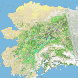
USGS GAP Alaska 2001
The GAP/LANDFIRE National Terrestrial Ecosystems data represents a detailed vegetation and land cover classification for the Conterminous U.S., Alaska, Hawaii, and Puerto Rico.GAP/LF 2011 Ecosystems for the Conterminous U.S. is an update of the National Gap Analysis Program Land Cover Data - Version 2.2. Alaska … ecosystems gap landcover landfire usgs vegetation -
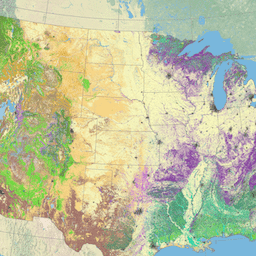
USGS GAP CONUS 2011
The GAP/LANDFIRE National Terrestrial Ecosystems data represents a detailed vegetation and land cover classification for the Conterminous U.S., Alaska, Hawaii, and Puerto Rico.GAP/LF 2011 Ecosystems for the Conterminous U.S. is an update of the National Gap Analysis Program Land Cover Data - Version 2.2. Alaska … ecosystems gap landcover landfire usgs vegetation -
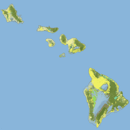
USGS GAP Hawaii 2001
The GAP/LANDFIRE National Terrestrial Ecosystems data represents a detailed vegetation and land cover classification for the Conterminous U.S., Alaska, Hawaii, and Puerto Rico.GAP/LF 2011 Ecosystems for the Conterminous U.S. is an update of the National Gap Analysis Program Land Cover Data - Version 2.2. Alaska … ecosystems gap landcover landfire usgs vegetation -
USGS GAP Puerto Rico 2001
The GAP/LANDFIRE National Terrestrial Ecosystems data represents a detailed vegetation and land cover classification for the Conterminous U.S., Alaska, Hawaii, and Puerto Rico.GAP/LF 2011 Ecosystems for the Conterminous U.S. is an update of the National Gap Analysis Program Land Cover Data - Version 2.2. Alaska … ecosystems gap landcover landfire usgs vegetation -
USGS Landsat 1 MSS Collection 2 Tier 1 Raw Scenes

Landsat 1 MSS Collection 2 Tier 1 DN values, representing scaled, calibrated at-sensor radiance. Landsat scenes with the highest available data quality are placed into Tier 1 and are considered suitable for time-series processing analysis. Tier 1 includes Level-1 Precision Terrain (L1TP) processed data that … c2 global l1 landsat lm1 mss -
USGS Landsat 1 MSS Collection 2 Tier 2 Raw Scenes

Landsat 1 MSS Collection 2 Tier 2 DN values, representing scaled, calibrated at-sensor radiance. Scenes not meeting Tier 1 criteria during processing are assigned to Tier 2. This includes Systematic terrain (L1GT) and Systematic (L1GS) processed scenes, as well as any L1TP scenes that do … c2 global l1 landsat lm1 mss -
USGS Landsat 2 MSS Collection 2 Tier 1 Raw Scenes

Landsat 2 MSS Collection 2 Tier 1 DN values, representing scaled, calibrated at-sensor radiance. Landsat scenes with the highest available data quality are placed into Tier 1 and are considered suitable for time-series processing analysis. Tier 1 includes Level-1 Precision Terrain (L1TP) processed data that … c2 global l2 landsat lm2 mss -
USGS Landsat 2 MSS Collection 2 Tier 2 Raw Scenes

Landsat 2 MSS Collection 2 Tier 2 DN values, representing scaled, calibrated at-sensor radiance. Scenes not meeting Tier 1 criteria during processing are assigned to Tier 2. This includes Systematic terrain (L1GT) and Systematic (L1GS) processed scenes, as well as any L1TP scenes that do … c2 global l2 landsat lm2 mss -
USGS Landsat 3 MSS Collection 2 Tier 1 Raw Scenes

Landsat 3 MSS Collection 2 Tier 1 DN values, representing scaled, calibrated at-sensor radiance. Landsat scenes with the highest available data quality are placed into Tier 1 and are considered suitable for time-series processing analysis. Tier 1 includes Level-1 Precision Terrain (L1TP) processed data that … c2 global l3 landsat lm3 mss -
USGS Landsat 3 MSS Collection 2 Tier 2 Raw Scenes

Landsat 3 MSS Collection 2 Tier 2 DN values, representing scaled, calibrated at-sensor radiance. Scenes not meeting Tier 1 criteria during processing are assigned to Tier 2. This includes Systematic terrain (L1GT) and Systematic (L1GS) processed scenes, as well as any L1TP scenes that do … c2 global l3 landsat lm3 mss -
USGS Landsat 4 Level 2, Collection 2, Tier 1

This dataset contains atmospherically corrected surface reflectance and land surface temperature derived from the data produced by the Landsat TM sensor. These images contain 4 visible and near-infrared (VNIR) bands and 2 short-wave infrared (SWIR) bands processed to orthorectified surface reflectance, and one thermal infrared … cfmask cloud fmask global landsat lasrc -
USGS Landsat 4 Level 2, Collection 2, Tier 2

This dataset contains atmospherically corrected surface reflectance and land surface temperature derived from the data produced by the Landsat TM sensor. These images contain 4 visible and near-infrared (VNIR) bands and 2 short-wave infrared (SWIR) bands processed to orthorectified surface reflectance, and one thermal infrared … cfmask cloud fmask global landsat lasrc -
USGS Landsat 4 MSS Collection 2 Tier 1 Raw Scenes

Landsat 4 MSS Collection 2 Tier 1 DN values, representing scaled, calibrated at-sensor radiance. Landsat scenes with the highest available data quality are placed into Tier 1 and are considered suitable for time-series processing analysis. Tier 1 includes Level-1 Precision Terrain (L1TP) processed data that … c2 global l4 landsat lm4 mss -
USGS Landsat 4 MSS Collection 2 Tier 2 Raw Scenes

Landsat 4 MSS Collection 2 Tier 2 DN values, representing scaled, calibrated at-sensor radiance. Scenes not meeting Tier 1 criteria during processing are assigned to Tier 2. This includes Systematic terrain (L1GT) and Systematic (L1GS) processed scenes, as well as any L1TP scenes that do … c2 global l4 landsat lm4 mss -
USGS Landsat 4 TM Collection 2 Tier 1 Raw Scenes

Landsat 4 TM Collection 2 Tier 1 DN values, representing scaled, calibrated at-sensor radiance. Landsat scenes with the highest available data quality are placed into Tier 1 and are considered suitable for time-series processing analysis. Tier 1 includes Level-1 Precision Terrain (L1TP) processed data that … c2 global l4 landsat lt4 radiance -
USGS Landsat 4 TM Collection 2 Tier 1 TOA Reflectance

Landsat 4 TM Collection 2 Tier 1 calibrated top-of-atmosphere (TOA) reflectance. Calibration coefficients are extracted from the image metadata. See Chander et al. (2009) for details on the TOA computation. global landsat satellite-imagery toa usgs -
USGS Landsat 4 TM Collection 2 Tier 2 Raw Scenes

Landsat 4 TM Collection 2 Tier 2 DN values, representing scaled, calibrated at-sensor radiance. Scenes not meeting Tier 1 criteria during processing are assigned to Tier 2. This includes Systematic terrain (L1GT) and Systematic (L1GS) processed scenes, as well as any L1TP scenes that do … c2 global l4 landsat lt4 radiance -
USGS Landsat 4 TM Collection 2 Tier 2 TOA Reflectance
Landsat 4 TM Collection 2 Tier 2 calibrated top-of-atmosphere (TOA) reflectance. Calibration coefficients are extracted from the image metadata. See Chander et al. (2009) for details on the TOA computation. global landsat satellite-imagery toa usgs -
USGS Landsat 5 Level 2, Collection 2, Tier 1

This dataset contains atmospherically corrected surface reflectance and land surface temperature derived from the data produced by the Landsat TM sensor. These images contain 4 visible and near-infrared (VNIR) bands and 2 short-wave infrared (SWIR) bands processed to orthorectified surface reflectance, and one thermal infrared … cfmask cloud fmask global landsat lasrc -
USGS Landsat 5 Level 2, Collection 2, Tier 2

This dataset contains atmospherically corrected surface reflectance and land surface temperature derived from the data produced by the Landsat TM sensor. These images contain 4 visible and near-infrared (VNIR) bands and 2 short-wave infrared (SWIR) bands processed to orthorectified surface reflectance, and one thermal infrared … cfmask cloud fmask global landsat lasrc -
USGS Landsat 5 MSS Collection 2 Tier 1 Raw Scenes

Landsat 5 MSS Collection 2 Tier 1 DN values, representing scaled, calibrated at-sensor radiance. Landsat scenes with the highest available data quality are placed into Tier 1 and are considered suitable for time-series processing analysis. Tier 1 includes Level-1 Precision Terrain (L1TP) processed data that … c2 global l5 landsat lm5 mss -
USGS Landsat 5 MSS Collection 2 Tier 2 Raw Scenes

Landsat 5 MSS Collection 2 Tier 2 DN values, representing scaled, calibrated at-sensor radiance. Scenes not meeting Tier 1 criteria during processing are assigned to Tier 2. This includes Systematic terrain (L1GT) and Systematic (L1GS) processed scenes, as well as any L1TP scenes that do … c2 global l5 landsat lm5 mss -
USGS Landsat 5 TM Collection 2 Tier 1 Raw Scenes

Landsat 5 TM Collection 2 Tier 1 DN values, representing scaled, calibrated at-sensor radiance. Landsat scenes with the highest available data quality are placed into Tier 1 and are considered suitable for time-series processing analysis. Tier 1 includes Level-1 Precision Terrain (L1TP) processed data that … c2 global l5 landsat lt5 radiance -
USGS Landsat 5 TM Collection 2 Tier 1 TOA Reflectance

Landsat 5 TM Collection 2 Tier 1 calibrated top-of-atmosphere (TOA) reflectance. Calibration coefficients are extracted from the image metadata. See Chander et al. (2009) for details on the TOA computation. global landsat satellite-imagery toa usgs -
USGS Landsat 5 TM Collection 2 Tier 2 Raw Scenes

Landsat 5 TM Collection 2 Tier 2 DN values, representing scaled, calibrated at-sensor radiance. Scenes not meeting Tier 1 criteria during processing are assigned to Tier 2. This includes Systematic terrain (L1GT) and Systematic (L1GS) processed scenes, as well as any L1TP scenes that do … c2 global l5 landsat lt5 radiance -
USGS Landsat 5 TM Collection 2 Tier 2 TOA Reflectance

Landsat 5 TM Collection 2 Tier 2 calibrated top-of-atmosphere (TOA) reflectance. Calibration coefficients are extracted from the image metadata. See Chander et al. (2009) for details on the TOA computation. global landsat satellite-imagery toa usgs -
USGS Landsat 7 Collection 2 Tier 1 Raw Scenes

Landsat 7 Collection 2 Tier 1 DN values, representing scaled, calibrated at-sensor radiance. Landsat scenes with the highest available data quality are placed into Tier 1 and are considered suitable for time-series processing analysis. Tier 1 includes Level-1 Precision Terrain (L1TP) processed data that have … c2 etm global l7 landsat le7 -
USGS Landsat 7 Collection 2 Tier 1 TOA Reflectance

Landsat 7 Collection 2 Tier 1 calibrated top-of-atmosphere (TOA) reflectance. Calibration coefficients are extracted from the image metadata. See Chander et al. (2009) for details on the TOA computation. Note that Landsat 7's orbit has been drifting to an earlier acquisition time since 2017. c2 global landsat satellite-imagery toa usgs -
USGS Landsat 7 Collection 2 Tier 1 and Real-Time data Raw Scenes

Landsat 7 Collection 2 Tier 1 and Real-Time data DN values, representing scaled, calibrated at-sensor radiance. Landsat scenes with the highest available data quality are placed into Tier 1 and are considered suitable for time-series processing analysis. Tier 1 includes Level-1 Precision Terrain (L1TP) processed … c2 etm global l7 landsat le7 -
USGS Landsat 7 Collection 2 Tier 1 and Real-Time data TOA Reflectance

Landsat 7 Collection 2 Tier 1 and Real-Time data calibrated top-of-atmosphere (TOA) reflectance. Calibration coefficients are extracted from the image metadata. See Chander et al. (2009) for details on the TOA computation. Note that Landsat 7's orbit has been drifting to an earlier acquisition time … c2 global landsat satellite-imagery toa usgs -
USGS Landsat 7 Collection 2 Tier 2 Raw Scenes

Landsat 7 Collection 2 Tier 2 DN values, representing scaled, calibrated at-sensor radiance. Scenes not meeting Tier 1 criteria during processing are assigned to Tier 2. This includes Systematic terrain (L1GT) and Systematic (L1GS) processed scenes, as well as any L1TP scenes that do not … c2 etm global l7 landsat le7 -
USGS Landsat 7 Collection 2 Tier 2 TOA Reflectance

Landsat 7 Collection 2 Tier 2 calibrated top-of-atmosphere (TOA) reflectance. Calibration coefficients are extracted from the image metadata. See Chander et al. (2009) for details on the TOA computation. Note that Landsat 7's orbit has been drifting to an earlier acquisition time since 2017. c2 global landsat satellite-imagery toa usgs -
USGS Landsat 7 Level 2, Collection 2, Tier 1

This dataset contains atmospherically corrected surface reflectance and land surface temperature derived from the data produced by the Landsat 7 ETM+ sensor. These images contain 4 visible and near-infrared (VNIR) bands and 2 short-wave infrared (SWIR) bands processed to orthorectified surface reflectance, and one thermal … cfmask cloud etm fmask global landsat -
USGS Landsat 7 Level 2, Collection 2, Tier 2
This dataset contains atmospherically corrected surface reflectance and land surface temperature derived from the data produced by the Landsat 7 ETM+ sensor. These images contain 4 visible and near-infrared (VNIR) bands and 2 short-wave infrared (SWIR) bands processed to orthorectified surface reflectance, and one thermal … cfmask cloud etm fmask global landsat -
USGS Landsat 8 Collection 2 Tier 1 Raw Scenes
Landsat 8 Collection 2 Tier 1 DN values, representing scaled, calibrated at-sensor radiance. Landsat scenes with the highest available data quality are placed into Tier 1 and are considered suitable for time-series processing analysis. Tier 1 includes Level-1 Precision Terrain (L1TP) processed data that have … c2 global l8 landsat lc8 oli-tirs -
USGS Landsat 8 Collection 2 Tier 1 TOA Reflectance

Landsat 8 Collection 2 Tier 1 calibrated top-of-atmosphere (TOA) reflectance. Calibration coefficients are extracted from the image metadata. See Chander et al. (2009) for details on the TOA computation. Landsat scenes with the highest available data quality are placed into Tier 1 and are considered … c2 global landsat satellite-imagery toa usgs -
USGS Landsat 8 Collection 2 Tier 1 and Real-Time data Raw Scenes

Landsat 8 Collection 2 Tier 1 and Real-Time data DN values, representing scaled, calibrated at-sensor radiance. Landsat scenes with the highest available data quality are placed into Tier 1 and are considered suitable for time-series processing analysis. Tier 1 includes Level-1 Precision Terrain (L1TP) processed … c2 global l8 landsat lc8 nrt -
USGS Landsat 8 Collection 2 Tier 1 and Real-Time data TOA Reflectance

Landsat 8 Collection 2 Tier 1 and Real-Time data calibrated top-of-atmosphere (TOA) reflectance. Calibration coefficients are extracted from the image metadata. See Chander et al. (2009) for details on the TOA computation. Landsat scenes with the highest available data quality are placed into Tier 1 … c2 global l8 landsat lc8 satellite-imagery -
USGS Landsat 8 Collection 2 Tier 2 Raw Scenes

Landsat 8 Collection 2 Tier 2 DN values, representing scaled, calibrated at-sensor radiance. Scenes not meeting Tier 1 criteria during processing are assigned to Tier 2. This includes Systematic terrain (L1GT) and Systematic (L1GS) processed scenes, as well as any L1TP scenes that do not … c2 global l8 landsat lc8 oli-tirs -
USGS Landsat 8 Collection 2 Tier 2 TOA Reflectance

Landsat 8 Collection 2 Tier 2 calibrated top-of-atmosphere (TOA) reflectance. Calibration coefficients are extracted from the image metadata. See Chander et al. (2009) for details on the TOA computation. Scenes not meeting Tier 1 criteria during processing are assigned to Tier 2. This includes Systematic … c2 global landsat satellite-imagery toa usgs -
USGS Landsat 8 Level 2, Collection 2, Tier 1

This dataset contains atmospherically corrected surface reflectance and land surface temperature derived from the data produced by the Landsat 8 OLI/TIRS sensors. These images contain 5 visible and near-infrared (VNIR) bands and 2 short-wave infrared (SWIR) bands processed to orthorectified surface reflectance, and one thermal … cfmask cloud fmask global l8sr landsat -
USGS Landsat 8 Level 2, Collection 2, Tier 2

This dataset contains atmospherically corrected surface reflectance and land surface temperature derived from the data produced by the Landsat 8 OLI/TIRS sensors. These images contain 5 visible and near-infrared (VNIR) bands and 2 short-wave infrared (SWIR) bands processed to orthorectified surface reflectance, and one thermal … cfmask cloud fmask global l8sr landsat -
USGS Landsat 9 Collection 2 Tier 1 Raw Scenes

Landsat 9 Collection 2 Tier 1 DN values, representing scaled, calibrated at-sensor radiance. Landsat scenes with the highest available data quality are placed into Tier 1 and are considered suitable for time-series processing analysis. Tier 1 includes Level-1 Precision Terrain (L1TP) processed data that have … c2 global l9 landsat lc9 oli-tirs -
USGS Landsat 9 Collection 2 Tier 1 TOA Reflectance
Landsat 9 Collection 2 Tier 1 calibrated top-of-atmosphere (TOA) reflectance. Calibration coefficients are extracted from the image metadata. See Chander et al. (2009) for details on the TOA computation. Landsat scenes with the highest available data quality are placed into Tier 1 and are considered … c2 global landsat satellite-imagery toa usgs -
USGS Landsat 9 Collection 2 Tier 2 Raw Scenes

Landsat 9 Collection 2 Tier 2 DN values, representing scaled, calibrated at-sensor radiance. Scenes not meeting Tier 1 criteria during processing are assigned to Tier 2. This includes Systematic terrain (L1GT) and Systematic (L1GS) processed scenes, as well as any L1TP scenes that do not … c2 global l9 landsat lc9 oli-tirs -
USGS Landsat 9 Collection 2 Tier 2 TOA Reflectance

Landsat 9 Collection 2 Tier 2 calibrated top-of-atmosphere (TOA) reflectance. Calibration coefficients are extracted from the image metadata. See Chander et al. (2009) for details on the TOA computation. Scenes not meeting Tier 1 criteria during processing are assigned to Tier 2. This includes Systematic … c2 global l9 landsat lc9 satellite-imagery -
USGS Landsat 9 Level 2, Collection 2, Tier 1

This dataset contains atmospherically corrected surface reflectance and land surface temperature derived from the data produced by the Landsat 9 OLI/TIRS sensors. These images contain 5 visible and near-infrared (VNIR) bands and 2 short-wave infrared (SWIR) bands processed to orthorectified surface reflectance, and one thermal … cfmask cloud fmask global l9sr landsat -
USGS Landsat 9 Level 2, Collection 2, Tier 2

This dataset contains atmospherically corrected surface reflectance and land surface temperature derived from the data produced by the Landsat 9 OLI/TIRS sensors. These images contain 5 visible and near-infrared (VNIR) bands and 2 short-wave infrared (SWIR) bands processed to orthorectified surface reflectance, and one thermal … cfmask cloud fmask global l9sr landsat