Landsat 9 Collection 2 Tier 1 DN values, representing scaled, calibrated at-sensor radiance. Landsat scenes with the highest available data quality are placed into Tier 1 and are considered suitable for time-series processing analysis. Tier 1 includes Level-1 Precision Terrain (L1TP) processed data that have …
Landsat 9 Collection 2 Tier 2 DN values, representing scaled, calibrated at-sensor radiance. Scenes not meeting Tier 1 criteria during processing are assigned to Tier 2. This includes Systematic terrain (L1GT) and Systematic (L1GS) processed scenes, as well as any L1TP scenes that do not …
Landsat 9 Collection 2 Tier 2 calibrated top-of-atmosphere (TOA) reflectance. Calibration coefficients are extracted from the image metadata. See Chander et al. (2009) for details on the TOA computation. Scenes not meeting Tier 1 criteria during processing are assigned to Tier 2. This includes Systematic …
[[["Easy to understand","easyToUnderstand","thumb-up"],["Solved my problem","solvedMyProblem","thumb-up"],["Other","otherUp","thumb-up"]],[["Missing the information I need","missingTheInformationINeed","thumb-down"],["Too complicated / too many steps","tooComplicatedTooManySteps","thumb-down"],["Out of date","outOfDate","thumb-down"],["Samples / code issue","samplesCodeIssue","thumb-down"],["Other","otherDown","thumb-down"]],[],[[["\u003cp\u003eThis page provides access to USGS Landsat 9 Collection 2 data, including Tier 1 and Tier 2 raw scenes, and Tier 2 top-of-atmosphere (TOA) reflectance.\u003c/p\u003e\n"],["\u003cp\u003eLandsat 9 Collection 2 Tier 1 data represents the highest quality scenes suitable for time-series analysis, while Tier 2 includes scenes that did not meet Tier 1 criteria.\u003c/p\u003e\n"],["\u003cp\u003eBoth Tier 1 and Tier 2 raw scenes provide scaled, calibrated at-sensor radiance, represented as Digital Number (DN) values.\u003c/p\u003e\n"],["\u003cp\u003eLandsat 9 Collection 2 Tier 2 TOA reflectance data is calibrated and derived from the image metadata, offering insights into surface reflectance.\u003c/p\u003e\n"]]],["Landsat 9 Collection 2 data is categorized into Tiers 1 and 2. Tier 1 includes scenes with the highest data quality, suitable for time-series analysis, and are represented by Level-1 Precision Terrain (L1TP) processed data. Tier 2 data, including Systematic terrain (L1GT) and Systematic (L1GS) processed scenes, do not meet Tier 1 standards. Tier 2 also includes top-of-atmosphere (TOA) reflectance data with calibration coefficients extracted from image metadata.\n"],null,["-\n\n |---------------------------------------------------------------------------------------------------------------------------------------------------------------------------------------------------------------------------------------------------------------------------------------------------------------------------|\n | [
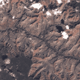
USGS Landsat 9 Collection 2 Tier 1 Raw Scenes](/earth-engine/datasets/catalog/LANDSAT_LC09_C02_T1) |\n | Landsat 9 Collection 2 Tier 1 DN values, representing scaled, calibrated at-sensor radiance. Landsat scenes with the highest available data quality are placed into Tier 1 and are considered suitable for time-series processing analysis. Tier 1 includes Level-1 Precision Terrain (L1TP) processed data that have ... |\n | [c2](/earth-engine/datasets/tags/c2) [global](/earth-engine/datasets/tags/global) [l9](/earth-engine/datasets/tags/l9) [landsat](/earth-engine/datasets/tags/landsat) [lc9](/earth-engine/datasets/tags/lc9) [oli-tirs](/earth-engine/datasets/tags/oli-tirs) |\n\n-\n\n |------------------------------------------------------------------------------------------------------------------------------------------------------------------------------------------------------------------------------------------------------------------------------------------------------|\n | [
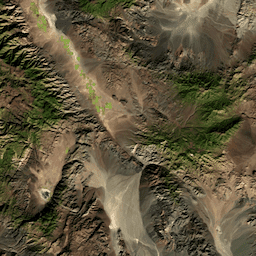
USGS Landsat 9 Collection 2 Tier 2 Raw Scenes](/earth-engine/datasets/catalog/LANDSAT_LC09_C02_T2) |\n | Landsat 9 Collection 2 Tier 2 DN values, representing scaled, calibrated at-sensor radiance. Scenes not meeting Tier 1 criteria during processing are assigned to Tier 2. This includes Systematic terrain (L1GT) and Systematic (L1GS) processed scenes, as well as any L1TP scenes that do not ... |\n | [c2](/earth-engine/datasets/tags/c2) [global](/earth-engine/datasets/tags/global) [l9](/earth-engine/datasets/tags/l9) [landsat](/earth-engine/datasets/tags/landsat) [lc9](/earth-engine/datasets/tags/lc9) [oli-tirs](/earth-engine/datasets/tags/oli-tirs) |\n\n-\n\n |-----------------------------------------------------------------------------------------------------------------------------------------------------------------------------------------------------------------------------------------------------------------------------------------------------------------------|\n | [USGS Landsat 9 Collection 2 Tier 2 TOA Reflectance](/earth-engine/datasets/catalog/LANDSAT_LC09_C02_T2_TOA) |\n | Landsat 9 Collection 2 Tier 2 calibrated top-of-atmosphere (TOA) reflectance. Calibration coefficients are extracted from the image metadata. See Chander et al. (2009) for details on the TOA computation. Scenes not meeting Tier 1 criteria during processing are assigned to Tier 2. This includes Systematic ... |\n | [c2](/earth-engine/datasets/tags/c2) [global](/earth-engine/datasets/tags/global) [l9](/earth-engine/datasets/tags/l9) [landsat](/earth-engine/datasets/tags/landsat) [lc9](/earth-engine/datasets/tags/lc9) [satellite-imagery](/earth-engine/datasets/tags/satellite-imagery) |"]]