Page Summary
-
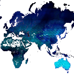
Landsat-derived datasets offer a diverse range of information including actual evapotranspiration for Australia, global built-up surfaces, inland water bodies, and various forest cover and change products.
-
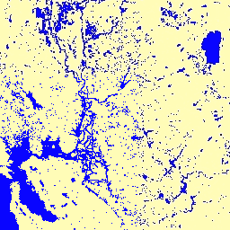
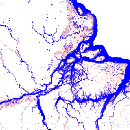
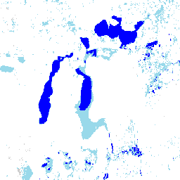
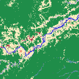
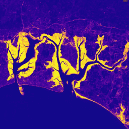
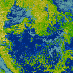
Several global datasets map water distribution and change over time, with versions available from 1984 up to 2021, providing both yearly and monthly history and recurrence.
-
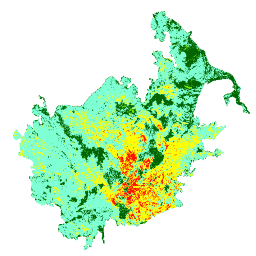
Datasets are available for specific regions or phenomena, such as irrigated lands in the Western US, monitoring burn severity in the US, and intertidal and tidal wetland changes globally.
-
Advanced algorithms like CCDC and Random Forest are used in conjunction with Landsat data for change detection and classification of land features.
-
The collection includes unique products like a seamless cloudless mosaic of Antarctica and a global dataset of learned geospatial embeddings.
-
Actual Evapotranspiration for Australia (CMRSET Landsat V2.2)
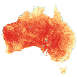
This dataset provides accurate actual evapotranspiration (AET or ETa) for Australia using the CMRSET algorithm. The AET band (named 'ETa') contains the average daily value from the CMRSET model for all cloud-free Landsat observations in that month (indicated with value 3 in the AET Data … agriculture australia csiro evaporation evapotranspiration landsat-derived -
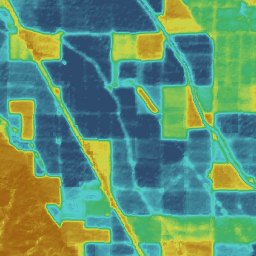
Dynamic Surface Water Extent from Harmonized Landsat Sentinel-2 (DSWx-HLS) V1
This dataset contains Level-3 Dynamic OPERA surface water extent product version 1. The data are validated surface water extent observations beginning April 2023. Known issues and caveats on usage are described in the product documentation. The input dataset for generating each product is the Harmonized … geophysical landsat-derived nasa opera sentinel2-derived surface -
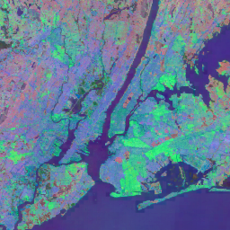
GHSL: Global built-up surface 1975-2030 (P2023A)
This raster dataset depicts the distribution of built-up surfaces, expressed in square metres per 100 m grid cell. The dataset measures: a) the total built-up surface, and b) the built-up surface allocated to grid cells of predominant non-residential (NRES) use. Data are spatially-temporally interpolated or … built built-environment builtup copernicus ghsl jrc -
GLCF: Landsat Global Inland Water
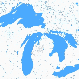
The Global Inland Water dataset shows inland surface water bodies, including fresh and saline lakes, rivers, and reservoirs. From the GLS 2000 epoch, 3,650,723 km2 of inland water were identified, around three quarters of which were in North America and Asia. Boreal forests and tundra … glcf landsat-derived nasa surface-ground-water umd water -
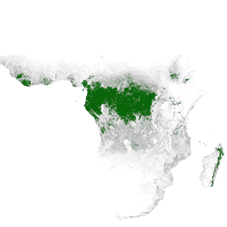
Global Annual Mangrove Extent (1984-2023)
The CGMD-Extent30 (Continuous Global Mangrove Dynamics-Annual Mangrove Extent at 30-m resolution) dataset provides global annual mangrove extent from 1984 to 2023. The dataset is distributed as a single Earth Engine FeatureCollection, with each feature representing a mapped mangrove polygon for a specific year. The dataset … annual coastal forest-biomass global landsat-derived landuse-landcover -
Global Annual Mangrove Fractional Canopy Cover (1984-2023)
This dataset provides global annual mangrove fractional canopy cover (FCC) at 30-m spatial resolution from 1984 to 2023 to support large-scale analyses of long-term mangrove dynamics, including canopy degradation and recovery, blue carbon assessment, and coastal ecosystem monitoring. FCC quantifies the proportion of each Landsat … annual coastal forest-biomass global landsat-derived mangrove -
Global Forest Cover Change (GFCC) Tree Cover Multi-Year Global 30m
The Landsat Vegetation Continuous Fields (VCF) tree cover layers contain estimates of the percentage of horizontal ground in each 30-m pixel covered by woody vegetation greater than 5 meters in height. The dataset is available for four epochs centered on the years 2000, 2005, 2010 … forest forest-biomass glcf landsat-derived nasa umd -
Global Mangrove Forests Distribution, v1 (2000)
The database was prepared using Landsat satellite data from the year 2000. More than 1,000 Landsat scenes obtained from the USGS Earth Resources Observation and Science Center (EROS) were classified using hybrid supervised and unsupervised digital image classification techniques. This database is the first, most … annual ciesin forest-biomass global landsat-derived mangrove -
Google Global Landsat-based CCDC Segments (1999-2019)
This collection contains precomputed results from running the Continuous Change Detection and Classification (CCDC) algorithm on 20 years of Landsat surface reflectance data. CCDC is a break-point finding algorithm that uses harmonic fitting with a dynamic RMSE threshold to detect breakpoints in time-series data. The … change-detection google landcover landsat-derived landuse landuse-landcover -
Hansen Global Forest Change v1.13 (2000-2025)
Results from time-series analysis of Landsat images in characterizing global forest extent and change. The 'first' and 'last' bands are reference multispectral imagery from the first and last available years for Landsat spectral bands corresponding to red, NIR, SWIR1, and SWIR2. Reference composite imagery represents … forest forest-biomass geophysical landsat-derived umd -
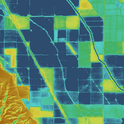
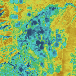
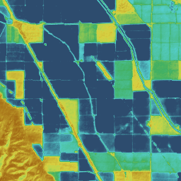
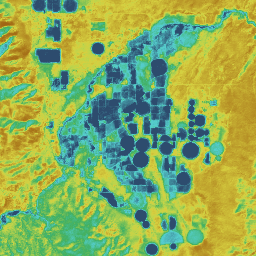
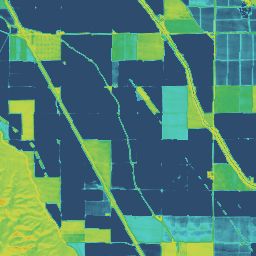
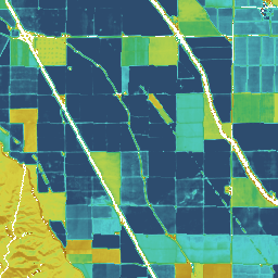
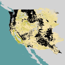
IrrMapper Irrigated Lands, Version 1.2
IrrMapper is an annual classification of irrigation status in the 11 Western United States made at Landsat scale (i.e., 30 m) using the Random Forest algorithm, covering years 1986 - present. While the IrrMapper paper describes classification of four classes (i.e., irrigated, dryland, uncultivated, wetland), … agriculture landsat-derived -
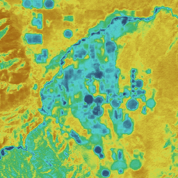
JRC Global Surface Water Mapping Layers, v1.2 [deprecated]

This dataset contains maps of the location and temporal distribution of surface water from 1984 to 2019 and provides statistics on the extent and change of those water surfaces. For more information see the associated journal article: High-resolution mapping of global surface water and its … geophysical google jrc landsat-derived surface surface-ground-water -
JRC Global Surface Water Mapping Layers, v1.4
This dataset contains maps of the location and temporal distribution of surface water from 1984 to 2021 and provides statistics on the extent and change of those water surfaces. For more information see the associated journal article: High-resolution mapping of global surface water and its … change-detection geophysical google jrc landsat-derived surface -
JRC Global Surface Water Metadata, v1.4
This dataset contains maps of the location and temporal distribution of surface water from 1984 to 2021 and provides statistics on the extent and change of those water surfaces. For more information see the associated journal article: High-resolution mapping of global surface water and its … geophysical google jrc landsat-derived surface surface-ground-water -
JRC Monthly Water History, v1.4
This dataset contains maps of the location and temporal distribution of surface water from 1984 to 2021 and provides statistics on the extent and change of those water surfaces. For more information see the associated journal article: High-resolution mapping of global surface water and its … geophysical google history jrc landsat-derived monthly -
JRC Monthly Water Recurrence, v1.4
This dataset contains maps of the location and temporal distribution of surface water from 1984 to 2021 and provides statistics on the extent and change of those water surfaces. For more information see the associated journal article: High-resolution mapping of global surface water and its … geophysical google history jrc landsat-derived monthly -
JRC Yearly Water Classification History, v1.4
This dataset contains maps of the location and temporal distribution of surface water from 1984 to 2021 and provides statistics on the extent and change of those water surfaces. For more information see the associated journal article: High-resolution mapping of global surface water and its … annual geophysical google history jrc landsat-derived -
Landsat Image Mosaic of Antarctica (LIMA) - Processed Landsat Scenes (16 bit)
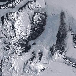
The Landsat Image Mosaic of Antarctica (LIMA) is a seamless and virtually cloudless mosaic created from processed Landsat 7 ETM+ scenes. Processed Landsat Scenes (16 bit) are Level 1Gt NLAPS scenes converted to 16 bit, processed with sun-angle correction, and converted to reflectance values (Bindschadler … antarctica ice landsat-derived lima mosaic satellite-imagery -
Landsat Image Mosaic of Antarctica (LIMA) - Processed Landsat Scenes (16 bit) Metadata
The Landsat Image Mosaic of Antarctica (LIMA) is a seamless and virtually cloudless mosaic created from processed Landsat 7 ETM+ scenes. Processed Landsat Scenes (16 bit) are Level 1Gt NLAPS scenes converted to 16 bit, processed with sun-angle correction, and converted to reflectance values (Bindschadler … antarctica ice landsat-derived lima mosaic satellite-imagery -
Landsat Image Mosaic of Antarctica (LIMA) 16-Bit Pan-Sharpened Mosaic

The Landsat Image Mosaic of Antarctica (LIMA) is a seamless and virtually cloudless mosaic created from processed Landsat 7 ETM+ scenes. This LIMA dataset is the 16-bit Intermediate LIMA. The mosaic consists of pan-sharpened normalized surface reflectance scenes (Landsat ETM+ bands 1, 2, 3, and … antarctica ice landsat-derived lima mosaic satellite-imagery -
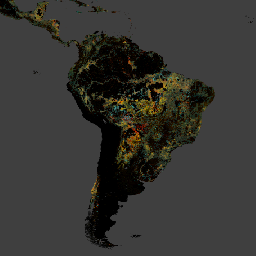
MapBiomas Land Use and Land Cover - Bolivia V1.0
MapBiomas Land Use and Land Cover (LULC) dataset for Bolivia is produced annually by the MapBiomas Project using Landsat satellite imagery and machine learning classification techniques. The dataset provides consistent annual land cover maps at 30-meter resolution covering the period from 1985 to 2024. Bolivia's … landsat-derived landuse-landcover mapbiomas-public publisher-dataset -
MapBiomas Land Use and Land Cover - Brazil V1.0
MapBiomas Land Use and Land Cover (LULC) dataset for Brazil is produced annually by the MapBiomas Project using Landsat satellite imagery and machine learning classification techniques. The dataset provides consistent, thematically detailed maps at 30-meter resolution, covering multiple decades and updated each year. Each image … landsat-derived landuse-landcover mapbiomas-public publisher-dataset -
MapBiomas Land Use and Land Cover - Ecuador V1.0
MapBiomas Land Use and Land Cover (LULC) dataset for Ecuador is produced annually by the MapBiomas Project using Landsat satellite imagery and machine learning classification techniques. The dataset provides consistent annual land cover maps at 30-meter resolution covering the period from 1985 to 2024. Ecuador's … landsat-derived landuse-landcover mapbiomas-public publisher-dataset -
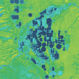
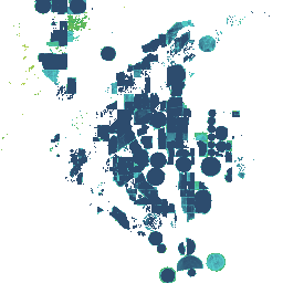
Monitoring Trends in Burn Severity (MTBS) Burn Severity Images
The burn severity mosaics consist of thematic raster images of MTBS burn severity classes for all currently completed MTBS fires for the continental United States, Alaska, Hawaii and Puerto Rico. Mosaicked burn severity images are compiled annually for each year by US State and the … eros fire forest gtac landcover landsat-derived -
Murray Global Intertidal Change Classification
The Murray Global Intertidal Change Dataset contains global maps of tidal flat ecosystems produced via a supervised classification of 707,528 Landsat Archive images. Each pixel was classified into tidal flat, permanent water or other with reference to a globally distributed set of training data. The … coastal google intertidal landsat-derived murray surface-ground-water -
Murray Global Intertidal Change Data Mask

The Murray Global Intertidal Change Dataset contains global maps of tidal flat ecosystems produced via a supervised classification of 707,528 Landsat Archive images. Each pixel was classified into tidal flat, permanent water or other with reference to a globally distributed set of training data. The … coastal google intertidal landsat-derived murray surface-ground-water -
Murray Global Intertidal Change QA Pixel Count

The Murray Global Intertidal Change Dataset contains global maps of tidal flat ecosystems produced via a supervised classification of 707,528 Landsat Archive images. Each pixel was classified into tidal flat, permanent water or other with reference to a globally distributed set of training data. The … coastal google intertidal landsat-derived murray surface-ground-water -
Murray Global Tidal Wetland Change v1.0 (1999-2019)
The Murray Global Tidal Wetland Change Dataset contains maps of the global extent of tidal wetlands and their change. The maps were developed from a three stage classification that sought to (i) estimate the global distribution of tidal wetlands (defined as either tidal marsh, tidal … coastal ecosystem intertidal landsat-derived mangrove murray -
OpenET DisALEXI Monthly Evapotranspiration v2.0
Atmosphere-Land Exchange Inverse / Disaggregation of the Atmosphere-Land Exchange Inverse (ALEXI/DisALEXI). DisALEXI was ported to Google Earth Engine as part of the OpenET framework. The baseline ALEXI/DisALEXI model structure is described by Anderson et al. (2012, 2018). The ALEXI evapotranspiration (ET) model specifically uses time … evapotranspiration landsat-derived monthly openet publisher-dataset water -
OpenET DisALEXI Monthly Evapotranspiration v2.1
Atmosphere-Land Exchange Inverse / Disaggregation of the Atmosphere-Land Exchange Inverse (ALEXI/DisALEXI). DisALEXI was ported to Google Earth Engine as part of the OpenET framework. The baseline ALEXI/DisALEXI model structure is described by Anderson et al. (2012, 2018). The ALEXI evapotranspiration (ET) model specifically uses time … evapotranspiration landsat-derived monthly openet publisher-dataset water -
OpenET Ensemble Monthly Evapotranspiration v2.0
The OpenET dataset includes satellite-based data on the total amount of water that is transferred from the land surface to the atmosphere through the process of evapotranspiration (ET). OpenET provides ET data from multiple satellite-driven models, and also calculates a single "ensemble value" from the … evapotranspiration gridmet-derived landsat-derived monthly openet publisher-dataset -
OpenET Ensemble Monthly Evapotranspiration v2.1
The OpenET dataset includes satellite-based data on the total amount of water that is transferred from the land surface to the atmosphere through the process of evapotranspiration (ET). OpenET provides ET data from multiple satellite-driven models, and also calculates a single "ensemble value" from the … evapotranspiration gridmet-derived landsat-derived monthly openet publisher-dataset -
OpenET PT-JPL Monthly Evapotranspiration v2.0
Priestley-Taylor Jet Propulsion Laboratory (PT-JPL). The core formulation of the PT-JPL model within the OpenET framework has not changed from the original formulation detailed in Fisher et al. (2008). However, enhancements and updates to model inputs and time integration for PT-JPL were made to take … evapotranspiration gridmet-derived landsat-derived monthly openet publisher-dataset -
OpenET PT-JPL Monthly Evapotranspiration v2.1
Priestley-Taylor Jet Propulsion Laboratory (PT-JPL). The core formulation of the PT-JPL model within the OpenET framework has not changed from the original formulation detailed in Fisher et al. (2008). However, enhancements and updates to model inputs and time integration for PT-JPL were made to take … evapotranspiration gridmet-derived landsat-derived monthly openet publisher-dataset -
OpenET SIMS Monthly Evapotranspiration v2.0
Satellite Irrigation Management Support (SIMS). The NASA Satellite Irrigation Management Support (SIMS) model was originally developed to support satellite mapping of crop coefficients and evapotranspiration (ET) from irrigated lands and to increase access to this data to support use in irrigation scheduling and regional assessment … evapotranspiration gridmet-derived landsat-derived monthly openet publisher-dataset -
OpenET SIMS Monthly Evapotranspiration v2.1
Satellite Irrigation Management Support (SIMS). The NASA Satellite Irrigation Management Support (SIMS) model was originally developed to support satellite mapping of crop coefficients and evapotranspiration (ET) from irrigated lands and to increase access to this data to support use in irrigation scheduling and regional assessment … evapotranspiration gridmet-derived landsat-derived monthly openet publisher-dataset -
OpenET SSEBop Monthly Evapotranspiration v2.0
Operational Simplified Surface Energy Balance (SSEBop). The Operational Simplified Surface Energy Balance (SSEBop) model by Senay et al. (2013, 2017) is a thermal-based simplified surface energy model for estimating actual ET based on the principles of satellite psychrometry (Senay 2018). The OpenET SSEBop implementation uses … evapotranspiration gridmet-derived landsat-derived monthly openet publisher-dataset -
OpenET SSEBop Monthly Evapotranspiration v2.1
Operational Simplified Surface Energy Balance (SSEBop). The Operational Simplified Surface Energy Balance (SSEBop) model (Senay et al., 2013; 2023) is a thermal based approach for estimating actual evapotranspiration (ET) using the principles of satellite psychrometry (Senay, 2018). As one of the core models in the … evapotranspiration gridmet-derived landsat-derived monthly openet publisher-dataset -
OpenET eeMETRIC Monthly Evapotranspiration v2.0
Google Earth Engine implementation of the Mapping Evapotranspiration at high Resolution with Internalized Calibration model (eeMETRIC). eeMETRIC applies the advanced METRIC algorithms and process of Allen et al. (2007; 2015) and Allen et al. (2013b), where a singular relationship between the near surface air temperature … evapotranspiration gridmet-derived landsat-derived monthly openet publisher-dataset -
OpenET eeMETRIC Monthly Evapotranspiration v2.1
Google Earth Engine implementation of the Mapping Evapotranspiration at high Resolution with Internalized Calibration model (eeMETRIC). eeMETRIC applies the advanced METRIC algorithms and process of Allen et al. (2007; 2015) and Allen et al. (2013b), where a singular relationship between the near surface air temperature … evapotranspiration gridmet-derived landsat-derived monthly openet publisher-dataset -
OpenET geeSEBAL Monthly Evapotranspiration v2.0
Google Earth Engine implementation of the Surface Energy Balance Algorithm for Land (SEBAL) model. An overview of the current geeSEBAL version can be found in Laipelt et al. (2021), which is based on the original algorithms developed by Bastiaanssen et al. (1998). The OpenET geeSEBAL … evapotranspiration gridmet-derived landsat-derived monthly openet publisher-dataset -
OpenET geeSEBAL Monthly Evapotranspiration v2.1
Google Earth Engine implementation of the Surface Energy Balance Algorithm for Land (SEBAL) model. An overview of the current geeSEBAL version can be found in Laipelt et al. (2021), which is based on the original algorithms developed by Bastiaanssen et al. (1998). The OpenET geeSEBAL … evapotranspiration gridmet-derived landsat-derived monthly openet publisher-dataset -
Primary Humid Tropical Forests
Primary humid tropical forests provide numerous global ecosystem services, but are under continuing threat of clearing from economic drivers. To facilitate national land use planning and balancing the goals of economic development and maintenance of ecosystem services, a primary humid tropical forest map was created … forest forest-biomass global landsat-derived umd -
RCMAP Rangeland Component Timeseries (1985-2023), v06
'The RCMAP (Rangeland Condition Monitoring Assessment and Projection) dataset quantifies the percent cover of rangeland components across western North America using Landsat imagery from 1985-2023. The RCMAP product suite consists of ten fractional components: annual herbaceous, bare ground, herbaceous, litter, non-sagebrush shrub, perennial herbaceous, sagebrush, … climate-change disturbance landsat-derived landuse-landcover nlcd rangeland -
RCMAP Rangeland Trends Year for Component Timeseries (1985-2023), v06
This collection includes RCMAP yearly products from 1985 through 2023. The RCMAP (Rangeland Condition Monitoring Assessment and Projection) dataset quantifies the percent cover of rangeland components across western North America using Landsat imagery from 1985-2023. The RCMAP product suite consists of ten fractional components: annual … climate-change disturbance landsat-derived landuse-landcover nlcd rangeland -
RCMAP Rangeland Trends for Component Timeseries (1985-2023), v06
The RCMAP (Rangeland Condition Monitoring Assessment and Projection) dataset quantifies the percent cover of rangeland components across western North America using Landsat imagery from 1985-2023. The RCMAP product suite consists of ten fractional components: annual herbaceous, bare ground, herbaceous, litter, non-sagebrush shrub, perennial herbaceous, sagebrush, … climate-change disturbance landsat-derived landuse-landcover nlcd rangeland -
Satellite Embedding V1
The Google Satellite Embedding dataset is a global, analysis-ready collection of learned geospatial embeddings. Each 10-meter pixel in this dataset is a 64-dimensional representation, or "embedding vector," that encodes temporal trajectories of surface conditions at and around that pixel as measured by various Earth observation … annual global google landsat-derived satellite-imagery sentinel1-derived -
World Settlement Footprint 2015
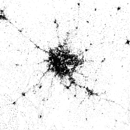
The World Settlement Footprint (WSF) 2015 is a 10m resolution binary mask outlining the extent of human settlements globally derived by means of 2014-2015 multitemporal Landsat-8 and Sentinel-1 imagery (of which ~217,000 and ~107,000 scenes have been processed, respectively). The temporal dynamics of human settlements … landcover landsat-derived population sentinel1-derived settlement urban