Page Summary
-
The Murray Global Intertidal Change Dataset provides global maps of tidal flat ecosystems created from Landsat images between 1984 and 2016.
-
The dataset classifies areas as tidal flat, permanent water, or other, covering the entire global coastline between 60° North and 60° South at 30m resolution.
-
The dataset consists of a time-series of 11 global maps representing different 3-year periods within the dataset's availability timeframe.
-
Tidal flat pixels in this dataset include various unconsolidated and consolidated sediment types but exclude vegetated intertidal ecosystems like mangroves and marshes.
- Dataset Availability
- 1984-01-01T00:00:00Z–2017-01-01T00:00:00Z
- Dataset Producer
- Murray/UQ/Google/USGS/NASA
- Cadence
- 3 Years
- Tags
Description
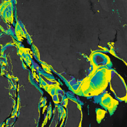
The Murray Global Intertidal Change Dataset contains global maps of tidal flat ecosystems produced via a supervised classification of 707,528 Landsat Archive images. Each pixel was classified into tidal flat, permanent water or other with reference to a globally distributed set of training data.
The classification was implemented along the entire global coastline between 60° North and 60° South from 1 January 1984 to 31 December 2016. The image collection consists consists of a time-series of 11 global maps of tidal flats at 30m pixel resolution for set time-periods (1984-1986; 1987-1989; 1990-1992; 1993-1995; 1996-1998; 1999-2001; 2002-2004; 2005-2007; 2008-2010; 2011-2013; 2014-2016)
This product depicts tidal flat ecosystems around the global coastline.
Pixels classified as tidal flat in the analysis represent several types of tidal flat ecosystems, including unconsolidated fine-grain sediments (tidal mudflats), unconsolidated coarse-grain sediments (tidal sand flats), and consolidated sediments, organic material or rocks (wide tidal rock-platforms), while excluding spectral signatures indicating the presence of vegetation dominated intertidal ecosystems such as mangroves and vegetated marshes. The analysis aimed to identify pixels that are subject to regular tidal inundation, and therefore may also include other intertidal systems where intertidal dynamics are observable.
Bands
Bands
Pixel size: 30 meters (all bands)
| Name | Units | Pixel Size | Description | ||||||||||||||||||||||||||||||||||||||||||||||||||||||||||||||||||||||||||||||||||||||||||||||||
|---|---|---|---|---|---|---|---|---|---|---|---|---|---|---|---|---|---|---|---|---|---|---|---|---|---|---|---|---|---|---|---|---|---|---|---|---|---|---|---|---|---|---|---|---|---|---|---|---|---|---|---|---|---|---|---|---|---|---|---|---|---|---|---|---|---|---|---|---|---|---|---|---|---|---|---|---|---|---|---|---|---|---|---|---|---|---|---|---|---|---|---|---|---|---|---|---|---|---|---|
classification |
occurrence | 30 meters | Intertertidal area classification for the interval. |
||||||||||||||||||||||||||||||||||||||||||||||||||||||||||||||||||||||||||||||||||||||||||||||||
Terms of Use
Terms of Use
This work is licensed under a Creative Commons Attribution 4.0 International License.
Any use of the intertidal data must include proper acknowledgement, including citing the associated journal article.
Citations
Murray, N.J., Phinn, S.R., DeWitt, M., Ferrari, R., Johnston, R., Lyons, M.B., Clinton, N., Thau, D. & Fuller, R.A. (2019) The global distribution and trajectory of tidal flats. Nature, 565, 222-225. doi:10.1038/s41586-018-0805-8,
Murray, N. J., Phinn, S. P., Fuller, R. A., DeWitt, M., Ferrari, R., Johnston, R., Clinton, N., & Lyons, M. B. (2022). High-resolution global maps of tidal flat ecosystems from 1984 to 2019. Scientific Data, 9(1). doi:10.1038/s41597-022-01635-5,
DOIs
Explore with Earth Engine
Code Editor (JavaScript)
var dataset = ee.ImageCollection('UQ/murray/Intertidal/v1_1/global_intertidal');

var visualization = {
  bands: ['classification'],
  min: 0,
  max: 1,
  palette: ['0000ff']
};

Map.setCenter(126.6339, 37.4394, 10);

Map.addLayer(dataset, visualization, 'Intertidal areas');