Page Summary
-
The Murray Global Intertidal Change Dataset provides global maps of tidal flat ecosystems derived from classifying Landsat Archive images.
-
The classification process in the Murray Global Intertidal Change Dataset categorized each pixel as tidal flat, permanent water, or other based on training data.
-
The Murray Global Tidal Wetland Change Dataset maps the global distribution and changes in tidal wetlands, including tidal marsh and other types.
-
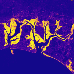
Global Annual Mangrove Extent (1984-2023)
The CGMD-Extent30 (Continuous Global Mangrove Dynamics-Annual Mangrove Extent at 30-m resolution) dataset provides global annual mangrove extent from 1984 to 2023. The dataset is distributed as a single Earth Engine FeatureCollection, with each feature representing a mapped mangrove polygon for a specific year. The dataset … annual coastal forest-biomass global landsat-derived landuse-landcover -
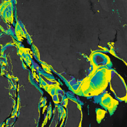
Global Annual Mangrove Fractional Canopy Cover (1984-2023)
This dataset provides global annual mangrove fractional canopy cover (FCC) at 30-m spatial resolution from 1984 to 2023 to support large-scale analyses of long-term mangrove dynamics, including canopy degradation and recovery, blue carbon assessment, and coastal ecosystem monitoring. FCC quantifies the proportion of each Landsat … annual coastal forest-biomass global landsat-derived mangrove -
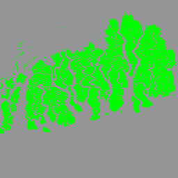
Murray Global Intertidal Change Classification
The Murray Global Intertidal Change Dataset contains global maps of tidal flat ecosystems produced via a supervised classification of 707,528 Landsat Archive images. Each pixel was classified into tidal flat, permanent water or other with reference to a globally distributed set of training data. The … coastal google intertidal landsat-derived murray surface-ground-water -
Murray Global Intertidal Change Data Mask

The Murray Global Intertidal Change Dataset contains global maps of tidal flat ecosystems produced via a supervised classification of 707,528 Landsat Archive images. Each pixel was classified into tidal flat, permanent water or other with reference to a globally distributed set of training data. The … coastal google intertidal landsat-derived murray surface-ground-water -
Murray Global Intertidal Change QA Pixel Count

The Murray Global Intertidal Change Dataset contains global maps of tidal flat ecosystems produced via a supervised classification of 707,528 Landsat Archive images. Each pixel was classified into tidal flat, permanent water or other with reference to a globally distributed set of training data. The … coastal google intertidal landsat-derived murray surface-ground-water -
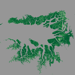
Murray Global Tidal Wetland Change v1.0 (1999-2019)
The Murray Global Tidal Wetland Change Dataset contains maps of the global extent of tidal wetlands and their change. The maps were developed from a three stage classification that sought to (i) estimate the global distribution of tidal wetlands (defined as either tidal marsh, tidal … coastal ecosystem intertidal landsat-derived mangrove murray