Page Summary
-
Cloud Score+ is a quality assessment processor for medium-to-high resolution optical satellite imagery used to identify clear pixels and remove clouds.
-
Dynamic World is a 10m near-real-time Land Use/Land Cover dataset with class probabilities and label information for nine classes, available for Sentinel-2 L1C.
-
The Google Global Landsat-based CCDC Segments collection provides precomputed results of the Continuous Change Detection and Classification algorithm on 20 years of Landsat data.
-
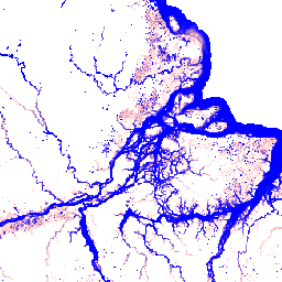
JRC Global Surface Water Mapping Layers (v1.4 and deprecated v1.2), Metadata (v1.4), Monthly History (v1.4), Monthly Recurrence (v1.4), and Yearly Classification History (v1.4) datasets contain maps and statistics on surface water location and temporal distribution.
-
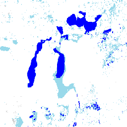
The Murray Global Intertidal Change Dataset provides global maps of tidal flat ecosystems classified from Landsat images.
-
The Google Satellite Embedding dataset is a global collection of learned geospatial embeddings representing temporal trajectories of surface conditions.
-
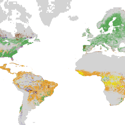
WRI/Google DeepMind Global Drivers of Forest Loss datasets (v1.0, v1.1, v1.2) map the dominant driver of tree cover loss globally at 1 km resolution.
-
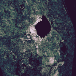
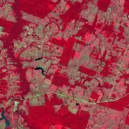
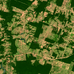
Brazil Forest Imagery Dataset 2008: Analytic Basemap
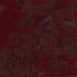
This dataset provides up to a 10-meter resolution multispectral (green, red, and near-infrared) basemap of Brazil, primarily captured in 2008, to support implementation of the Brazil Forest Code. The mosaic is synthesized from SPOT 2, 4, and 5 satellite data. It serves as a higher-resolution … brazil forest-code google imagery multispectral satellite-imagery -
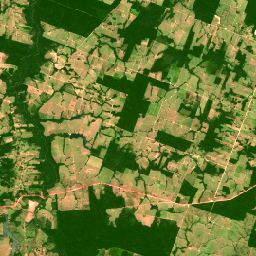
Brazil Forest Imagery Dataset 2008: Visual Basemap
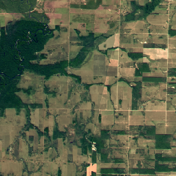
This dataset provides a visual imagery basemap of Brazil with up to 5-meter resolution, primarily captured in 2008, to support implementation of the Brazil Forest Code. The mosaic is synthesized from SPOT 2, 4, and 5 satellite data. It serves as a high-resolution alternative to … brazil deforestation forest-code google rgb satellite-imagery -
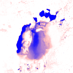
Cloud Score+ S2_HARMONIZED V1
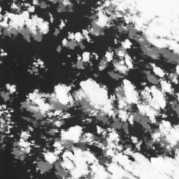
Cloud Score+ is a quality assessment (QA) processor for medium-to-high resolution optical satellite imagery. The Cloud Score+ S2_HARMONIZED dataset is being operationally produced from the harmonized Sentinel-2 L1C collection, and Cloud Score+ outputs can be used to identify relatively clear pixels and effectively remove clouds … cloud google satellite-imagery sentinel2-derived -
Dynamic World V1
Dynamic World is a 10m near-real-time (NRT) Land Use/Land Cover (LULC) dataset that includes class probabilities and label information for nine classes. Dynamic World predictions are available for the Sentinel-2 L1C collection from 2015-06-27 to present. The revisit frequency of Sentinel-2 is between 2-5 days … global google landcover landuse landuse-landcover nrt -
Google Global Landsat-based CCDC Segments (1999-2019)
This collection contains precomputed results from running the Continuous Change Detection and Classification (CCDC) algorithm on 20 years of Landsat surface reflectance data. CCDC is a break-point finding algorithm that uses harmonic fitting with a dynamic RMSE threshold to detect breakpoints in time-series data. The … change-detection google landcover landsat-derived landuse landuse-landcover -
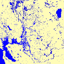
JRC Global Surface Water Mapping Layers, v1.2 [deprecated]

This dataset contains maps of the location and temporal distribution of surface water from 1984 to 2019 and provides statistics on the extent and change of those water surfaces. For more information see the associated journal article: High-resolution mapping of global surface water and its … geophysical google jrc landsat-derived surface surface-ground-water -
JRC Global Surface Water Mapping Layers, v1.4
This dataset contains maps of the location and temporal distribution of surface water from 1984 to 2021 and provides statistics on the extent and change of those water surfaces. For more information see the associated journal article: High-resolution mapping of global surface water and its … change-detection geophysical google jrc landsat-derived surface -
JRC Global Surface Water Metadata, v1.4
This dataset contains maps of the location and temporal distribution of surface water from 1984 to 2021 and provides statistics on the extent and change of those water surfaces. For more information see the associated journal article: High-resolution mapping of global surface water and its … geophysical google jrc landsat-derived surface surface-ground-water -
JRC Monthly Water History, v1.4
This dataset contains maps of the location and temporal distribution of surface water from 1984 to 2021 and provides statistics on the extent and change of those water surfaces. For more information see the associated journal article: High-resolution mapping of global surface water and its … geophysical google history jrc landsat-derived monthly -
JRC Monthly Water Recurrence, v1.4
This dataset contains maps of the location and temporal distribution of surface water from 1984 to 2021 and provides statistics on the extent and change of those water surfaces. For more information see the associated journal article: High-resolution mapping of global surface water and its … geophysical google history jrc landsat-derived monthly -
JRC Yearly Water Classification History, v1.4
This dataset contains maps of the location and temporal distribution of surface water from 1984 to 2021 and provides statistics on the extent and change of those water surfaces. For more information see the associated journal article: High-resolution mapping of global surface water and its … annual geophysical google history jrc landsat-derived -
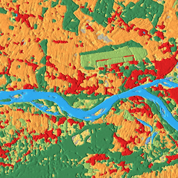
Murray Global Intertidal Change Classification
The Murray Global Intertidal Change Dataset contains global maps of tidal flat ecosystems produced via a supervised classification of 707,528 Landsat Archive images. Each pixel was classified into tidal flat, permanent water or other with reference to a globally distributed set of training data. The … coastal google intertidal landsat-derived murray surface-ground-water -
Murray Global Intertidal Change Data Mask

The Murray Global Intertidal Change Dataset contains global maps of tidal flat ecosystems produced via a supervised classification of 707,528 Landsat Archive images. Each pixel was classified into tidal flat, permanent water or other with reference to a globally distributed set of training data. The … coastal google intertidal landsat-derived murray surface-ground-water -
Murray Global Intertidal Change QA Pixel Count

The Murray Global Intertidal Change Dataset contains global maps of tidal flat ecosystems produced via a supervised classification of 707,528 Landsat Archive images. Each pixel was classified into tidal flat, permanent water or other with reference to a globally distributed set of training data. The … coastal google intertidal landsat-derived murray surface-ground-water -
SPOT Multispectral Imagery 10-20m, Brazil
This collection provides 2008-era raw multispectral imagery from the SPOT 2, 4, and 5 satellites over the country of Brazil. These missions, operated by CNES, were designed to provide high-resolution, wide-area optical imagery for managing Earth's resources. SPOT 2 and 4 utilized HRV and HRVIR … brazil forest-code google multispectral satellite-imagery spot -
SPOT Multispectral Pseudo Natural Color Imagery 10-20m, Brazil
This collection contains 2008-era "pseudo natural color" RGB images derived from the native multispectral bands of SPOT 2, 4, and 5 for Brazil. Because the HRV and HRG sensors did not include a native blue band, this product synthesizes an RGB representation to approximate a … brazil forest-code google rgb satellite-imagery spot -
SPOT Panchromatic Imagery 5-10m, Brazil
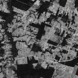
This collection contains the raw panchromatic (PAN) bands from the SPOT 2, 4, and 5 satellites for Brazil circa 2008. The panchromatic sensor provides the highest native spatial resolution of the missions, capturing light across a broad visible spectrum (0.51-0.73 µm for SPOT 2, 0.61-0.68 … brazil forest-code google imagery satellite-imagery spot -
SPOT Pansharpened Pseudo Natural Color Imagery 5-10m, Brazil
This collection provides high-resolution pansharpened pseudo-natural color SPOT imagery satellites 2, 4, and 5 for Brazil circa 2008. Where a corresponding high-resolution panchromatic image was available, it was fused with multispectral data to achieve enhanced spatial detail (up to 5m for SPOT 5 or 10m … brazil forest-code google rgb satellite-imagery spot -
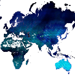
Satellite Embedding V1
The Google Satellite Embedding dataset is a global, analysis-ready collection of learned geospatial embeddings. Each 10-meter pixel in this dataset is a 64-dimensional representation, or "embedding vector," that encodes temporal trajectories of surface conditions at and around that pixel as measured by various Earth observation … annual global google landsat-derived satellite-imagery sentinel1-derived -
WRI/Google DeepMind Global Drivers of Forest Loss 2001-2022 v1.0

This dataset maps the dominant driver of tree cover loss from 2001-2022 globally at 1 km resolution. Produced by the World Resources Institute (WRI) and Google DeepMind, the data were developed using a global neural network model (ResNet) trained on a set of samples collected … agriculture deforestation forest forest-biomass google landandcarbon -
WRI/Google DeepMind Global Drivers of Forest Loss 2001-2023 v1.1

This dataset maps the dominant driver of tree cover loss from 2001-2023 globally at 1 km resolution. Produced by the World Resources Institute (WRI) and Google DeepMind, the data were developed using a global neural network model (ResNet) trained on a set of samples collected … agriculture deforestation forest forest-biomass google landandcarbon -
WRI/Google DeepMind Global Drivers of Forest Loss 2001-2024 v1.2

This dataset maps the dominant driver of tree cover loss from 2001-2024 globally at 1 km resolution. Produced by the World Resources Institute (WRI) and Google DeepMind, the data were developed using a global neural network model (ResNet) trained on a set of samples collected … agriculture deforestation forest forest-biomass google landandcarbon -
WRI/Google DeepMind Global Drivers of Forest Loss 2001-2025 v1.3
This dataset maps the dominant driver of tree cover loss from 2001-2025 globally at 1 km resolution. Produced by the World Resources Institute (WRI) and Google DeepMind, the data were developed using a global neural network model (ResNet) trained on a set of samples collected … agriculture deforestation forest forest-biomass google landandcarbon