Page Summary
-
The datasets provided offer a variety of global Earth observation data, including coral reef mapping, cloud assessment, land use/land cover classification, crop identification, building characteristics, and satellite image embeddings.
-
Several datasets are derived from Sentinel-1 and Sentinel-2 satellite imagery, offering high-resolution (10m) global coverage for different years and applications.
-
The Global Human Settlement Layer (GHSL) datasets provide detailed information on built-up areas, building height, volume, and settlement characteristics at various resolutions.
-
Google provides datasets like Cloud Score+ for image quality assessment and Satellite Embedding for learned geospatial representations of surface conditions.
-
The European Space Agency (ESA) contributes WorldCereal and WorldCover datasets focusing on agricultural and general land cover mapping.
-
Allen Coral Atlas (ACA) - Geomorphic Zonation and Benthic Habitat - v2.0
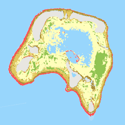
The Allen Coral Atlas dataset maps the geomorphic zonation and benthic habitat for the world's shallow coral reefs at 5 m pixel resolution. Also included is a global reef extent product that maps additional reef areas unable to be explicitly included in the geomorphic and … oceans sentinel2-derived -
Cloud Score+ S2_HARMONIZED V1
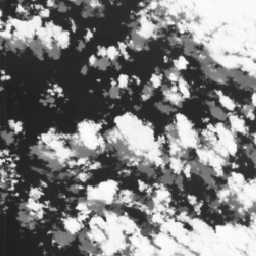
Cloud Score+ is a quality assessment (QA) processor for medium-to-high resolution optical satellite imagery. The Cloud Score+ S2_HARMONIZED dataset is being operationally produced from the harmonized Sentinel-2 L1C collection, and Cloud Score+ outputs can be used to identify relatively clear pixels and effectively remove clouds … cloud google satellite-imagery sentinel2-derived -
Dynamic Surface Water Extent from Harmonized Landsat Sentinel-2 (DSWx-HLS) V1
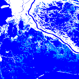
This dataset contains Level-3 Dynamic OPERA surface water extent product version 1. The data are validated surface water extent observations beginning April 2023. Known issues and caveats on usage are described in the product documentation. The input dataset for generating each product is the Harmonized … geophysical landsat-derived nasa opera sentinel2-derived surface -
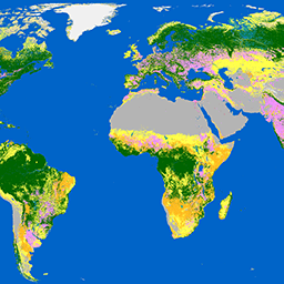
Dynamic World V1
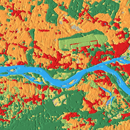
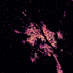
Dynamic World is a 10m near-real-time (NRT) Land Use/Land Cover (LULC) dataset that includes class probabilities and label information for nine classes. Dynamic World predictions are available for the Sentinel-2 L1C collection from 2015-06-27 to present. The revisit frequency of Sentinel-2 is between 2-5 days … global google landcover landuse landuse-landcover nrt -
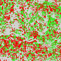
ESA WorldCereal 10 m v100
The European Space Agency (ESA) WorldCereal 10 m 2021 product suite consists of global-scale annual and seasonal crop maps and their related confidence. They were generated as part of the ESA-WorldCereal project. More information on the content of these products and the methodology used to … agriculture copernicus crop esa global landcover -
ESA WorldCereal Active Cropland 10 m v100
The European Space Agency (ESA) WorldCereal Active Cropland 10 m 2021 product suite contains global-scale seasonal active cropland markers. They were generated as part of the ESA-WorldCereal project. The active cropland products indicate whether or not a pixel identified as temporary crops has been actively … agriculture copernicus crop esa global landcover -
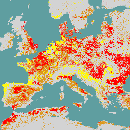
ESA WorldCover 10m v100
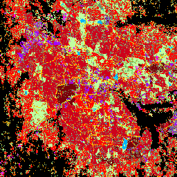
The European Space Agency (ESA) WorldCover 10 m 2020 product provides a global land cover map for 2020 at 10 m resolution based on Sentinel-1 and Sentinel-2 data. The WorldCover product comes with 11 land cover classes and has been generated in the framework of … esa landcover landuse landuse-landcover sentinel1-derived sentinel2-derived -
ESA WorldCover 10m v200

The European Space Agency (ESA) WorldCover 10 m 2021 product provides a global land cover map for 2021 at 10 m resolution based on Sentinel-1 and Sentinel-2 data. The WorldCover product comes with 11 land cover classes and has been generated in the framework of … esa landcover landuse landuse-landcover sentinel1-derived sentinel2-derived -
GHSL: Global building height 2018 (P2023A)
This spatial raster dataset depicts the global distribution of building heights at a resolution of 100 m, referred to the year 2018. The input data used to predict building heights are the ALOS Global Digital Surface Model (30 m), the NASA Shuttle Radar Topographic Mission … alos building built built-environment builtup copernicus -
GHSL: Global building volume 1975-2030 (P2023A)
This raster dataset depicts the global distribution of building volume, expressed in cubic metres per 100 m grid cell. The dataset measures the total building volume and the building volume allocated to grid cells of predominant non-residential (NRES) use. Estimates are based on the built-up … alos building built-environment copernicus dem ghsl -
GHSL: Global built-up surface 10m (P2023A)
This raster dataset depicts the distribution of built-up surfaces, expressed in square metres per 10 m grid cell, for 2018 as observed from the S2 image data. The datasets measure: a) the total built-up surface, and b) the built-up surface allocated to grid cells of … built built-environment builtup copernicus ghsl jrc -
GHSL: Global built-up surface 1975-2030 (P2023A)
This raster dataset depicts the distribution of built-up surfaces, expressed in square metres per 100 m grid cell. The dataset measures: a) the total built-up surface, and b) the built-up surface allocated to grid cells of predominant non-residential (NRES) use. Data are spatially-temporally interpolated or … built built-environment builtup copernicus ghsl jrc -
GHSL: Global settlement characteristics (10 m) 2018 (P2023A)
This spatial raster dataset delineates human settlements at 10 m resolution, and describes their inner characteristics in terms of the functional and height-related components of the built environment. More information about the GHSL data products can be found in the GHSL Data Package 2023 report … building built builtup copernicus ghsl height -
Satellite Embedding V1
The Google Satellite Embedding dataset is a global, analysis-ready collection of learned geospatial embeddings. Each 10-meter pixel in this dataset is a 64-dimensional representation, or "embedding vector," that encodes temporal trajectories of surface conditions at and around that pixel as measured by various Earth observation … annual global google landsat-derived satellite-imagery sentinel1-derived