Page Summary
-
The Allen Coral Atlas dataset provides high-resolution maps of shallow coral reef habitats and geomorphic zonation globally.
-
Copernicus offers various global ocean datasets including bio-geo-chemical and physics forecasts, satellite ocean color data, and waves analysis.
-
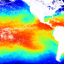
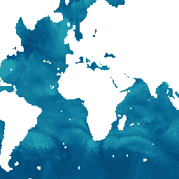
JAXA's GCOM-C/SGLI provides L3 Chlorophyll-a Concentration and Sea Surface Temperature data for long-term ocean observation.
-
Global Fishing Watch datasets track daily fishing and vessel hours based on inferred activity and presence.
-
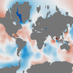
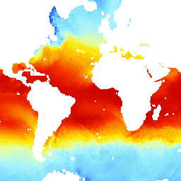
NOAA offers Climate Data Records of sea surface temperature, ocean heat fluxes, and near-surface atmospheric properties over ice-free oceans.
-
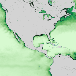
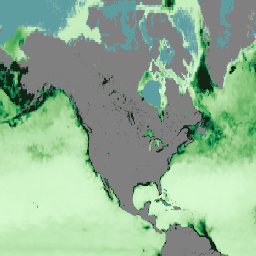
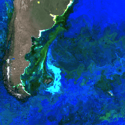
NASA's Ocean Color SMI provides ocean color and satellite ocean biology data from MODIS Aqua, MODIS Terra, and SeaWiFS.
-
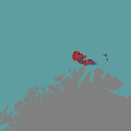
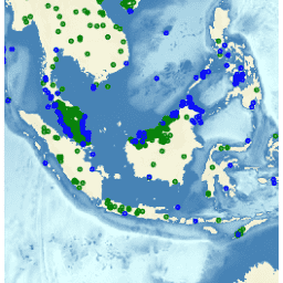
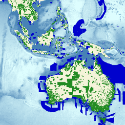
Allen Coral Atlas (ACA) - Geomorphic Zonation and Benthic Habitat - v2.0
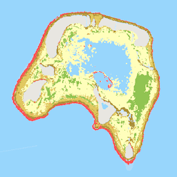
The Allen Coral Atlas dataset maps the geomorphic zonation and benthic habitat for the world's shallow coral reefs at 5 m pixel resolution. Also included is a global reef extent product that maps additional reef areas unable to be explicitly included in the geomorphic and … oceans sentinel2-derived -
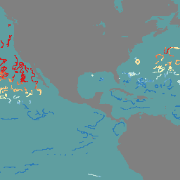
Copernicus Global In-situ Observations of Ocean Currents - Argo
The In Situ TAC is a distributed centre organized around 7 oceanographic regions: the global ocean and the 6 EUROGOOS regional alliances. It involves 14 partners from 11 countries in Europe. It doesn't deploy any observing system and relies on data, exclusively funded by other … copernicus currents insitu oceans -
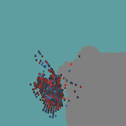
Copernicus Global In-situ Observations of Ocean Currents - Drifter
The In Situ TAC is a distributed centre organized around 7 oceanographic regions: the global ocean and the 6 EUROGOOS regional alliances. It involves 14 partners from 11 countries in Europe. It doesn't deploy any observing system and relies on data, exclusively funded by other … copernicus currents insitu oceans -
Copernicus Global In-situ Observations of Ocean Currents - Radar Radial
The In Situ TAC is a distributed centre organized around 7 oceanographic regions: the global ocean and the 6 EUROGOOS regional alliances. It involves 14 partners from 11 countries in Europe. It doesn't deploy any observing system and relies on data, exclusively funded by other … copernicus currents insitu oceans radar -
Copernicus Global In-situ Observations of Ocean Currents - Radar Total
The In Situ TAC is a distributed centre organized around 7 oceanographic regions: the global ocean and the 6 EUROGOOS regional alliances. It involves 14 partners from 11 countries in Europe. It doesn't deploy any observing system and relies on data, exclusively funded by other … copernicus currents insitu oceans radar -
Copernicus Global Ocean Bio-Geo-Chemical Forecast - BIO
The Operational Mercator Ocean biogeochemical global ocean analysis and forecast system at 1/4 degree is providing 10 days of 3D global ocean forecasts updated weekly. The time series is aggregated in time, in order to reach a two full year's time series sliding window. This … copernicus daily forecast oceans -
Copernicus Global Ocean Bio-Geo-Chemical Forecast - CAR
The Operational Mercator Ocean biogeochemical global ocean analysis and forecast system at 1/4 degree is providing 10 days of 3D global ocean forecasts updated weekly. The time series is aggregated in time, in order to reach a two full year's time series sliding window. This … copernicus daily forecast oceans -
Copernicus Global Ocean Bio-Geo-Chemical Forecast - CO2
The Operational Mercator Ocean biogeochemical global ocean analysis and forecast system at 1/4 degree is providing 10 days of 3D global ocean forecasts updated weekly. The time series is aggregated in time, in order to reach a two full year's time series sliding window. This … copernicus daily forecast oceans -
Copernicus Global Ocean Bio-Geo-Chemical Forecast - NUT
The Operational Mercator Ocean biogeochemical global ocean analysis and forecast system at 1/4 degree is providing 10 days of 3D global ocean forecasts updated weekly. The time series is aggregated in time, in order to reach a two full year's time series sliding window. This … copernicus daily forecast oceans -
Copernicus Global Ocean Bio-Geo-Chemical Forecast - OPTICS
The Operational Mercator Ocean biogeochemical global ocean analysis and forecast system at 1/4 degree is providing 10 days of 3D global ocean forecasts updated weekly. The time series is aggregated in time, in order to reach a two full year's time series sliding window. This … copernicus daily forecast oceans -
Copernicus Global Ocean Bio-Geo-Chemical Forecast - PFT
The Operational Mercator Ocean biogeochemical global ocean analysis and forecast system at 1/4 degree is providing 10 days of 3D global ocean forecasts updated weekly. The time series is aggregated in time, in order to reach a two full year's time series sliding window. This … copernicus daily forecast oceans -
Copernicus Global Ocean Bio-Geo-Chemical Forecast - PLANKTON

The Operational Mercator Ocean biogeochemical global ocean analysis and forecast system at 1/4 degree is providing 10 days of 3D global ocean forecasts updated weekly. The time series is aggregated in time, in order to reach a two full year's time series sliding window. This … copernicus daily forecast oceans -
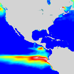
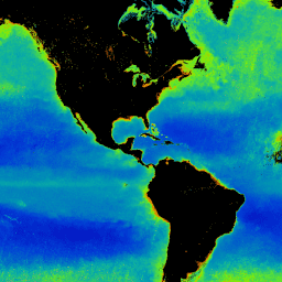
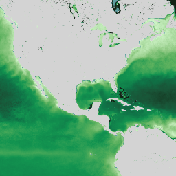
Copernicus Satellite Ocean Color Daily Data

This dataset provides global daily estimates of ocean surface chlorophyll-a concentration and remote sensing reflectance derived from multiple satellite sensors. Remote-sensing reflectance (or Rrs) is defined as the ratio of water-leaving radiance to downwelling irradiance and serves as the main input to algorithms used to … chlorophyll-a copernicus daily oceans -
ECMWF Near-Realtime IFS Wave (Short-Cutoff) Forecasts
This dataset contains 6-day forecasts of the wave model fields generated by the ECMWF Integrated Forecasting System (IFS) at 0.25 degree resolution. We refer to these as Near-Realtime (NRT) because new products are released twice a day after the release of the ECMWF realtime forecast … climate ecmwf forecast global oceans -
ECMWF Near-Realtime IFS Wave Forecasts
This dataset contains 15-day forecasts of the wave model fields generated by the ECMWF Integrated Forecasting System (IFS) at 0.25 degree resolution. We refer to these as Near-Realtime (NRT) because new products are released twice a day after the release of the ECMWF realtime forecast … climate ecmwf forecast global oceans -
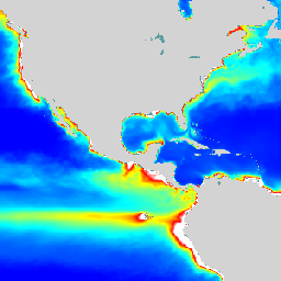
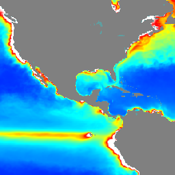
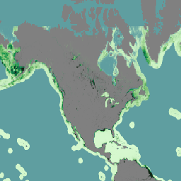
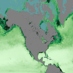
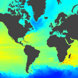
GCOM-C/SGLI L3 Chlorophyll-a Concentration (V1)
This product is the concentration of the photosynthetic pigment (chlorophyll-a) in phytoplankton in the sea surface layer. A newer version JAXA/GCOM-C/L3/OCEAN/CHLA/V3 is also available for this dataset which uses this algorithm for processing. GCOM-C conducts long-term and continuous global observation and data collection to elucidate … chla chlorophyll-a g-portal gcom gcom-c jaxa -
GCOM-C/SGLI L3 Chlorophyll-a Concentration (V2)

This product is the concentration of the photosynthetic pigment (chlorophyll-a) in phytoplankton in the sea surface layer. For data after 2021-11-28, see the V3 dataset. GCOM-C conducts long-term and continuous global observation and data collection to elucidate the mechanism behind fluctuations in radiation budget and … chla chlorophyll-a g-portal gcom gcom-c jaxa -
GCOM-C/SGLI L3 Chlorophyll-a Concentration (V3)

This product is the concentration of the photosynthetic pigment (chlorophyll-a) in phytoplankton in the sea surface layer. This is an ongoing dataset with a latency of 3-4 days. GCOM-C conducts long-term and continuous global observation and data collection to elucidate the mechanism behind fluctuations in … chla chlorophyll-a g-portal gcom gcom-c jaxa -
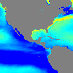
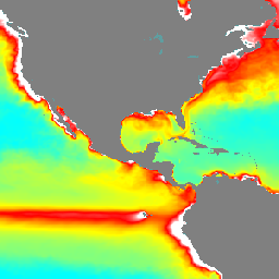
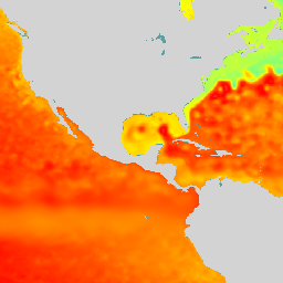
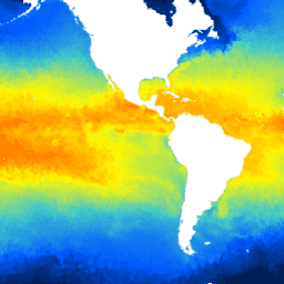
GCOM-C/SGLI L3 Sea Surface Temperature (V1)

This product is the temperature of sea surface. A newer version JAXA/GCOM-C/L3/OCEAN/SST/V3 is also available for this dataset which uses this algorithm for processing. GCOM-C conducts long-term and continuous global observation and data collection to elucidate the mechanism behind fluctuations in radiation budget and carbon … climate g-portal gcom gcom-c jaxa oceans -
GCOM-C/SGLI L3 Sea Surface Temperature (V2)
This product is the temperature of sea surface. For data after 2021-11-28, see the V3 dataset. GCOM-C conducts long-term and continuous global observation and data collection to elucidate the mechanism behind fluctuations in radiation budget and carbon cycle needed to make accurate projections regarding future … climate g-portal gcom gcom-c jaxa oceans -
GCOM-C/SGLI L3 Sea Surface Temperature (V3)

This product is the temperature of sea surface. This is an ongoing dataset with a latency of 3-4 days. GCOM-C conducts long-term and continuous global observation and data collection to elucidate the mechanism behind fluctuations in radiation budget and carbon cycle needed to make accurate … climate g-portal gcom gcom-c jaxa oceans -
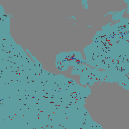
GFW (Global Fishing Watch) Daily Fishing Hours
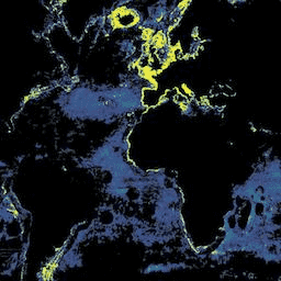
Fishing effort, measured in hours of inferred fishing activity. Each asset is the effort for a given flag state and day, with one band for the fishing activity of each gear type. See sample Earth Engine scripts. Also see the main GFW site for program … fishing gfw monthly oceans -
GFW (Global Fishing Watch) Daily Vessel Hours

Fishing vessel presence, measured in hours per square km. Each asset is the vessel presence for a given flag state and day, with one band for the presence of each gear type. See sample Earth Engine scripts. Also see the main GFW site for program … fishing gfw monthly oceans -
GRACE Monthly Mass Grids - Ocean EOFR
GRACE Tellus Monthly Mass Grids provides monthly gravitational anomalies relative to a 2004-2010 time-mean baseline. The data contained in this dataset are units of "Equivalent Water Thickness" which represent the deviations of mass in terms of vertical extent of water in centimeters. See the provider's … crs gfz grace gravity jpl mass -
GRACE Monthly Mass Grids Release 06 Version 04 - Ocean
GRACE Tellus Monthly Mass Grids provides monthly gravitational anomalies relative to a 2004-2010 time-mean baseline. The data contained in this dataset are units of "Equivalent Water Thickness" which represent the deviations of mass in terms of vertical extent of water in centimeters. See the provider's … crs gfz grace gravity jpl mass -
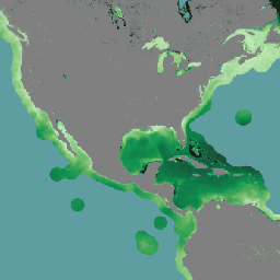
Global Ocean Colour: Bio-Geo-Chemical, L4, from Satellite Observations, Optics, Multi-Sensor 4KM
The Global Ocean Colour (Copernicus-GlobColour) dataset is a Bio-Geo-Chemical (BGC) product developed by ACRI-ST. Derived from multiple satellite sources like SeaWiFS, MODIS, and OLCI. It provides a comprehensive range of oceanographic variables, including: Chlorophyll (CHL), Phytoplankton Functional types and sizes (PFT), Primary Production (PP), Suspended … copernicus oceans -
Global Ocean Colour: Bio-Geo-Chemical, L4, from Satellite Observations, Plankton, Multi-Sensor, 4KM
The Global Ocean Colour (Copernicus-GlobColour) dataset is a Bio-Geo-Chemical (BGC) product developed by ACRI-ST. Derived from multiple satellite sources like SeaWiFS, MODIS, and OLCI. It provides a comprehensive range of oceanographic variables, including: Chlorophyll (CHL), Phytoplankton Functional types and sizes (PFT), Primary Production (PP), Suspended … copernicus oceans -
Global Ocean Colour: Bio-Geo-Chemical, L4, from Satellite Observations, Plankton, OLCI, 300M
The Global Ocean Colour (Copernicus-GlobColour) dataset is a Bio-Geo-Chemical (BGC) product developed by ACRI-ST. Derived from multiple satellite sources like SeaWiFS, MODIS, and OLCI. It provides a comprehensive range of oceanographic variables, including: Chlorophyll (CHL), Phytoplankton Functional types and sizes (PFT), Primary Production (PP), Suspended … copernicus oceans -
Global Ocean Colour: Bio-Geo-Chemical, L4, from Satellite Observations, Primary Production, Multi-Sensor 4KM

The Global Ocean Colour (Copernicus-GlobColour) dataset is a Bio-Geo-Chemical (BGC) product developed by ACRI-ST. Derived from multiple satellite sources like SeaWiFS, MODIS, and OLCI. It provides a comprehensive range of oceanographic variables, including: Chlorophyll (CHL), Phytoplankton Functional types and sizes (PFT), Primary Production (PP), Suspended … copernicus oceans -
Global Ocean Colour: Bio-Geo-Chemical, L4, from Satellite Observations, Reflectance, Multi-Sensor 4KM
The Global Ocean Colour (Copernicus-GlobColour) dataset is a Bio-Geo-Chemical (BGC) product developed by ACRI-ST. Derived from multiple satellite sources like SeaWiFS, MODIS, and OLCI. It provides a comprehensive range of oceanographic variables, including: Chlorophyll (CHL), Phytoplankton Functional types and sizes (PFT), Primary Production (PP), Suspended … copernicus oceans -
Global Ocean Colour: Bio-Geo-Chemical, L4, from Satellite Observations, Reflectance, OLCI 300M
The Global Ocean Colour (Copernicus-GlobColour) dataset is a Bio-Geo-Chemical (BGC) product developed by ACRI-ST. Derived from multiple satellite sources like SeaWiFS, MODIS, and OLCI. It provides a comprehensive range of oceanographic variables, including: Chlorophyll (CHL), Phytoplankton Functional types and sizes (PFT), Primary Production (PP), Suspended … copernicus oceans -
Global Ocean Colour: Bio-Geo-Chemical, L4, from Satellite Observations, Transparency, Multi-Sensor, 4KM
The Global Ocean Colour (Copernicus-GlobColour) dataset is a Bio-Geo-Chemical (BGC) product developed by ACRI-ST. Derived from multiple satellite sources like SeaWiFS, MODIS, and OLCI. It provides a comprehensive range of oceanographic variables, including: Chlorophyll (CHL), Phytoplankton Functional types and sizes (PFT), Primary Production (PP), Suspended … copernicus oceans -
Global Ocean Colour: Bio-Geo-Chemical, L4, from Satellite Observations, Transparency, OLCI, 4KM
The Global Ocean Colour (Copernicus-GlobColour) dataset is a Bio-Geo-Chemical (BGC) product developed by ACRI-ST. Derived from multiple satellite sources like SeaWiFS, MODIS, and OLCI. It provides a comprehensive range of oceanographic variables, including: Chlorophyll (CHL), Phytoplankton Functional types and sizes (PFT), Primary Production (PP), Suspended … copernicus oceans -
Global Ocean Physics Analysis and Forecast Daily
Copernicus Marine Physics 2D Daily Mean Fields (cmems_mod_glo_phy_anfc_0.083deg_P1D-m) deliver global daily-averaged ocean surface and bottom variables at 8km resolution. The Operational Mercator global ocean analysis and forecast system is providing 10 days of 2D global ocean forecasts updated daily. The time series is aggregated in … copernicus daily forecast oceans -
Global Ocean Waves Analysis and Forecast
The operational global ocean analysis and forecast system of Meteo-France with a resolution of 1/12 degree is providing daily analyses and 10 days forecasts for the global ocean sea surface waves. This product includes 3-hourly instantaneous fields of integrated wave parameters from the total spectrum … copernicus forecast hourly oceans -
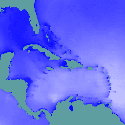
Global Ocean Waves Static Bathymetry
Static bathymetry for the Global Ocean Waves Analysis and Forecast system. This dataset provides the sea floor depth in meters. The global wave system of Meteo-France is based on the wave model MFWAM which is a third generation wave model. MFWAM uses the computing code … bathymetry copernicus oceans -
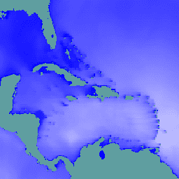
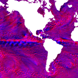
HYCOM: Hybrid Coordinate Ocean Model, Sea Surface Elevation
The Hybrid Coordinate Ocean Model (HYCOM) is a data-assimilative hybrid isopycnal-sigma-pressure (generalized) coordinate ocean model. The subset of HYCOM data hosted in EE contains the variables salinity, temperature, velocity, and elevation. They have been interpolated to a uniform 0.08 degree lat/long grid between 80.48°S and … elevation hycom nopp oceans water -
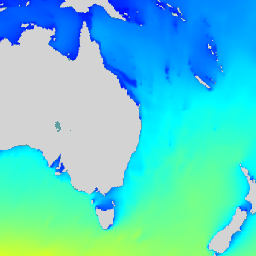
HYCOM: Hybrid Coordinate Ocean Model, Water Temperature and Salinity
The Hybrid Coordinate Ocean Model (HYCOM) is a data-assimilative hybrid isopycnal-sigma-pressure (generalized) coordinate ocean model. The subset of HYCOM data hosted in EE contains the variables salinity, temperature, velocity, and elevation. They have been interpolated to a uniform 0.08 degree lat/long grid between 80.48°S and … hycom nopp oceans sst water -
HYCOM: Hybrid Coordinate Ocean Model, Water Velocity
The Hybrid Coordinate Ocean Model (HYCOM) is a data-assimilative hybrid isopycnal-sigma-pressure (generalized) coordinate ocean model. The subset of HYCOM data hosted in EE contains the variables salinity, temperature, velocity, and elevation. They have been interpolated to a uniform 0.08 degree lat/long grid between 80.48°S and … hycom nopp oceans velocity water -
IPCC AR6 Sea Level Projections Regional (Medium Confidence)

The dataset provided by the IPCC features comprehensive global and regional sea level projections from the IPCC 6th Assessment Report (AR6). This collection contains assets for the medium confidence sea level rise projections. The dataset spans from 2020 to 2150 and includes projections for various … ipcc oceans -
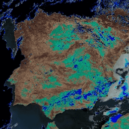
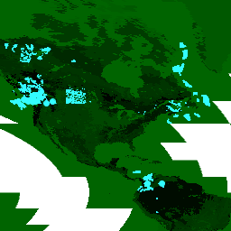
MODOCGA.006 Terra Ocean Reflectance Daily Global 1km

The MODOCGA V6 ocean reflectance product consists of 1 kilometer reflectance data from Terra MODIS bands 8-16. The product is referred to as ocean reflectance, because bands 8-16 are used primarily to produce ocean products, but this is not an ocean product as the tiles … daily global modis nasa oceans reflectance -
MYDOCGA.006 Aqua Ocean Reflectance Daily Global 1km
The MYDOCGA V6 ocean reflectance product consists of 1 kilometer reflectance data from Aqua MODIS bands 8-16. The product is referred to as ocean reflectance, because bands 8-16 are used primarily to produce ocean products, but this is not an ocean product as the tiles … aqua daily global modis nasa oceans -
Multi Observation Global Ocean Sea Surface Salinity and Sea Surface Density : Daily, Multi-Year Reprocessed

Multi Observation Global Ocean Sea Surface Salinity and Sea Surface Density is an oceanographic product that provides daily, global, and gap-free Level-4 (L4) analyses of Sea Surface Salinity (SSS) and Sea Surface Density (SSD) at a high resolution of 1/8 degree. This product is generated … copernicus oceans -
Multi Observation Global Ocean Sea Surface Salinity and Sea Surface Density : Daily, Near Real Time

Multi Observation Global Ocean Sea Surface Salinity and Sea Surface Density is an oceanographic product that provides daily, global, and gap-free Level-4 (L4) analyses of Sea Surface Salinity (SSS) and Sea Surface Density (SSD) at a high resolution of 1/8 degree. This product is generated … copernicus oceans -
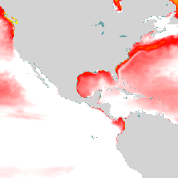
NOAA AVHRR Pathfinder Version 5.3 Collated Global 4km Sea Surface Temperature
The AVHRR Pathfinder Version 5.3 Sea Surface Temperature dataset (PFV53) is a collection of global, twice-daily 4km sea surface temperature data produced in a partnership by the NOAA National Oceanographic Data Center and the University of Miami's Rosenstiel School of Marine and Atmospheric Science. PFV53 … avhrr noaa oceans sst temperature wind -
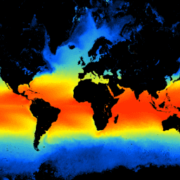
NOAA CDR OISST v02r01: Optimum Interpolation Sea Surface Temperature
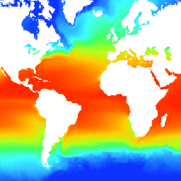
The NOAA 1/4 degree daily Optimum Interpolation Sea Surface Temperature (OISST) provides complete ocean temperature fields constructed by combining bias-adjusted observations from different platforms (satellite, ships, buoys) on a regular global grid, with gaps filled in by interpolation. Satellite data from the Advanced Very High … avhrr cdr daily ice noaa oceans -
NOAA CDR WHOI: Sea Surface Temperature, Version 2
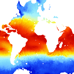
The Sea Surface Temperature - WHOI dataset is part of the NOAA Ocean Surface Bundle (OSB) and provides a high quality Climate Data Record (CDR) of sea surface temperature over ice-free oceans. The SST values are found through modeling the diurnal variability in combination with … atmospheric cdr hourly noaa oceans oisst -
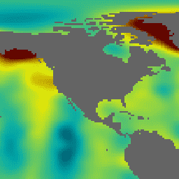
NOAA CDR: Ocean Heat Fluxes, Version 2
The Ocean Heat Fluxes dataset is part of the NOAA Ocean Surface Bundle (OSB) and provides a high quality Climate Data Record (CDR) of the air/ocean heat fluxes over ice-free oceans. This dataset is calculated from the OSB CDR parameters of near-surface atmospheric and sea … atmospheric cdr flux heat hourly noaa -
NOAA CDR: Ocean Near-Surface Atmospheric Properties, Version 2
The Ocean Near-Surface Atmospheric Properties dataset is part of the NOAA Ocean Surface Bundle (OSB) and provides a high quality Climate Data Record (CDR) of air temperature, wind speed, and specific humidity over ice-free ocean surfaces. These atmospheric properties are calculated based on brightness temperature … atmospheric cdr hourly humidity noaa oceans -
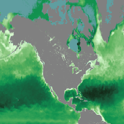
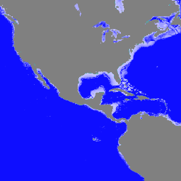
Ocean Color SMI: Standard Mapped Image MODIS Aqua Data

This level 3 product includes ocean color and satellite ocean biology data produced or collected under EOSDIS. This dataset may be used for studying the biology and hydrology of coastal zones, changes in the diversity and geographical distribution of coastal marine habitats, biogeochemical fluxes and … biology chlorophyll modis nasa oceandata oceans -
Ocean Color SMI: Standard Mapped Image MODIS Terra Data
This level 3 product includes ocean color and satellite ocean biology data produced or collected under EOSDIS. This dataset may be used for studying the biology and hydrology of coastal zones, changes in the diversity and geographical distribution of coastal marine habitats, biogeochemical fluxes and … biology chlorophyll modis nasa oceandata oceans -
Ocean Color SMI: Standard Mapped Image SeaWiFS Data

This level 3 product includes ocean color and satellite ocean biology data produced or collected under EOSDIS. This dataset may be used for studying the biology and hydrology of coastal zones, changes in the diversity and geographical distribution of coastal marine habitats, biogeochemical fluxes and … biology chlorophyll nasa oceandata oceans reflectance -
WDKBA: World Database of Key Biodiversity Areas (KBAs) - March 2026
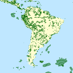
If you are interested in accessing the KBA dataset please complete the KBA data request form which will allow access directly in GEE once approved. Key Biodiversity Areas (KBAs) are 'sites contributing significantly to the global persistence of biodiversity’, in terrestrial, freshwater and marine ecosystems. … biodiversity boundaries ecosystems global iucn management -
WDOECM: Other Effective Area-based Conservation Measures (points)

A geographically defined area other than a Protected Area, which is governed and managed in ways that achieve positive and sustained long-term outcomes for the in situ conservation of biodiversity, with associated ecosystem functions and services and where applicable, cultural, spiritual, socio-economic, and other locally … boundaries ecosystems iucn mpa oceans protected -
WDOECM: Other Effective Area-based Conservation Measures (polygons)
A geographically defined area other than a Protected Area, which is governed and managed in ways that achieve positive and sustained long-term outcomes for the in situ conservation of biodiversity, with associated ecosystem functions and services and where applicable, cultural, spiritual, socio-economic, and other locally … boundaries ecosystems iucn mpa oceans protected -
WDPA: World Database on Protected Areas (points)
The World Database on Protected Areas (WDPA) is the most up-to-date and complete source of information on protected areas, updated monthly with submissions from governments, non-governmental organizations, landowners, and communities. It is managed by the United Nations Environment Programme's World Conservation Monitoring Centre (UNEP-WCMC) with … boundaries ecosystems iucn mpa oceans protected -
WDPA: World Database on Protected Areas (polygons)
The World Database on Protected Areas (WDPA) is the most up-to-date and complete source of information on protected areas, updated monthly with submissions from governments, non-governmental organizations, landowners, and communities. It is managed by the United Nations Environment Programme's World Conservation Monitoring Centre (UNEP-WCMC) with … boundaries ecosystems iucn mpa oceans protected