Page Summary
-
GLOBathy provides bathymetry data for over 1.4 million global waterbodies and is harmonized with the HydroLAKES dataset.
-
The Global Ocean Waves Static Bathymetry dataset provides sea floor depth in meters for the Global Ocean Waves Analysis and Forecast system.
-
GLOBathy Global lakes bathymetry dataset
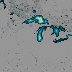
The GLObal Bathymetric (GLOBathy) dataset, comprising data on over 1.4 million waterbodies globally, has been meticulously developed to harmonize with the widely recognized HydroLAKES dataset. Utilizing a sophisticated Geographic Information System (GIS)-based framework, GLOBathy constructs detailed bathymetric maps by integrating maximum depth estimates and geometric/geophysical … bathymetry community-dataset hydrology sat-io surface-ground-water -
Global Ocean Waves Static Bathymetry
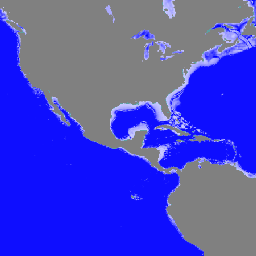
Static bathymetry for the Global Ocean Waves Analysis and Forecast system. This dataset provides the sea floor depth in meters. The global wave system of Meteo-France is based on the wave model MFWAM which is a third generation wave model. MFWAM uses the computing code … bathymetry copernicus oceans