Page Summary
-
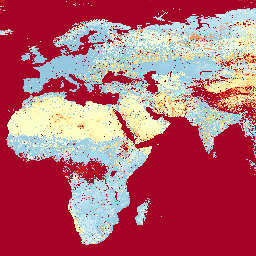
Datasets are available that enumerate land-based travel time to cities and healthcare facilities globally.
-
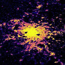
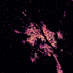
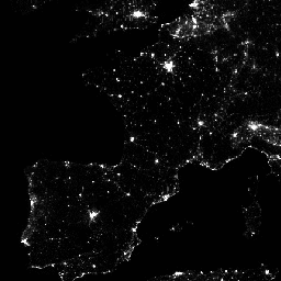
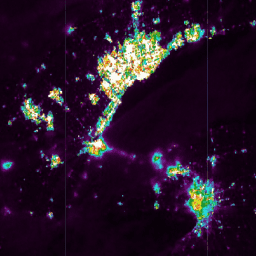
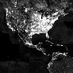
Nighttime light datasets from DMSP-OLS and VIIRS are provided, some of which are corrected or calibrated.
-
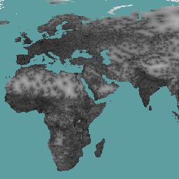
Global datasets measure human modification of land, building height and volume, and built-up surfaces at various resolutions and time periods.
-
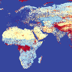
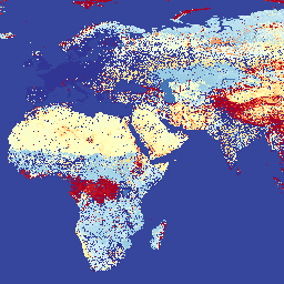
Multiple datasets offer global gridded population estimates and projections, including demographic characteristics and context such as water or land area.
-
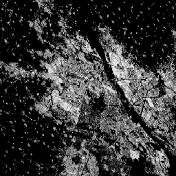
Additional datasets include information on forest and tree proximate people, impervious surface changes, and high-resolution building outlines.
-
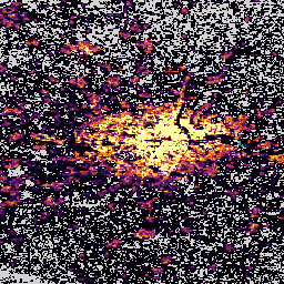
CCNL: Consistent and Corrected Nighttime Light Dataset from DMSP-OLS (1992-2013) v1
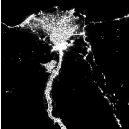
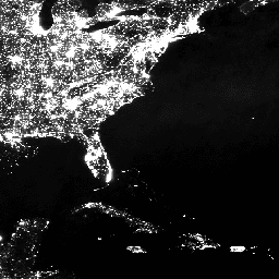
The Consistent and Corrected Nighttime Lights (CCNL) dataset is a reprocessed version of the Defense Meteorological Program (DMSP) Operational Line-Scan System (OLS) Version 4. A series of methods was used to mitigate the impact of inter-annual inconsistency, saturation, and blooming effects and to improve data … dmsp eog imagery lights nighttime ols -
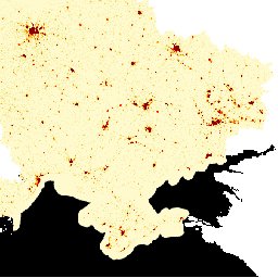
CSP gHM: Global Human Modification
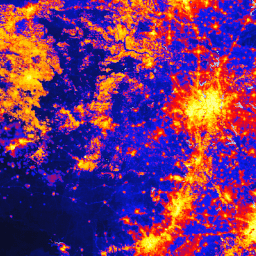
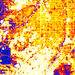
The global Human Modification dataset (gHM) provides a cumulative measure of human modification of terrestrial lands globally at 1 square-kilometer resolution. The gHM values range from 0.0-1.0 and are calculated by estimating the proportion of a given location (pixel) that is modified, the estimated intensity … csp fragmentation human-modification landcover landscape-gradient population -
DMSP OLS: Global Radiance-Calibrated Nighttime Lights Version 4, Defense Meteorological Program Operational Linescan System
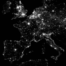
The Defense Meteorological Program (DMSP) Operational Line-Scan System (OLS) has a unique capability to detect visible and near-infrared (VNIR) emission sources at night. This collection contains global nighttime lights images with no sensor saturation. The sensor is typically operated at a high-gain setting to enable … dmsp eog imagery lights nighttime ols -
DMSP OLS: Nighttime Lights Time Series Version 4, Defense Meteorological Program Operational Linescan System

The Defense Meteorological Program (DMSP) Operational Line-Scan System (OLS) has a unique capability to detect visible and near-infrared (VNIR) emission sources at night. Version 4 of the DMSP-OLS Nighttime Lights Time Series consists of cloud-free composites made using all the available archived DMSP-OLS smooth resolution … dmsp eog imagery lights nighttime ols -
Forest proximate people (FPP) 1.0
The "Forest Proximate People" (FPP) dataset is one of the data layers contributing to the development of indicator #13, "number of forest-dependent people in extreme poverty," of the Collaborative Partnership on Forests (CPF) Global Core Set of forest-related indicators (GCS). The FPP dataset provides an … agriculture fao forest global plant-productivity population -
GHSL: Degree of Urbanization 1975-2030 V2-0 (P2023A)

This raster dataset represents a global, multitemporal rural-urban classification, applying the "Degree of Urbanisation" stage I methodology recommended by UN Statistical Commission, based on global gridded population and built-up surface data generated by the GHSL project for the epochs 1975-2030 in 5-year intervals. The Degree … ghsl jrc population sdg settlement -
GHSL: Global building height 2018 (P2023A)
This spatial raster dataset depicts the global distribution of building heights at a resolution of 100 m, referred to the year 2018. The input data used to predict building heights are the ALOS Global Digital Surface Model (30 m), the NASA Shuttle Radar Topographic Mission … alos building built built-environment builtup copernicus -
GHSL: Global building volume 1975-2030 (P2023A)
This raster dataset depicts the global distribution of building volume, expressed in cubic metres per 100 m grid cell. The dataset measures the total building volume and the building volume allocated to grid cells of predominant non-residential (NRES) use. Estimates are based on the built-up … alos building built-environment copernicus dem ghsl -
GHSL: Global built-up surface 10m (P2023A)
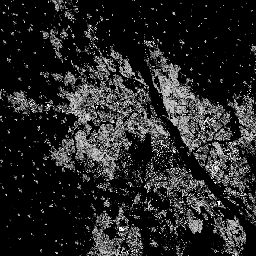
This raster dataset depicts the distribution of built-up surfaces, expressed in square metres per 10 m grid cell, for 2018 as observed from the S2 image data. The datasets measure: a) the total built-up surface, and b) the built-up surface allocated to grid cells of … built built-environment builtup copernicus ghsl jrc -
GHSL: Global built-up surface 1975-2030 (P2023A)
This raster dataset depicts the distribution of built-up surfaces, expressed in square metres per 100 m grid cell. The dataset measures: a) the total built-up surface, and b) the built-up surface allocated to grid cells of predominant non-residential (NRES) use. Data are spatially-temporally interpolated or … built built-environment builtup copernicus ghsl jrc -
GHSL: Global population surfaces 1975-2030 (P2023A)
This raster dataset depicts the spatial distribution of residential population, expressed as the absolute number of inhabitants of the cell. Residential population estimates between 1975 and 2020 in 5-year intervals and projections to 2025 and 2030 derived from CIESIN GPWv4.11 were disaggregated from census or … ghsl jrc population sdg -
GHSL: Global settlement characteristics (10 m) 2018 (P2023A)
This spatial raster dataset delineates human settlements at 10 m resolution, and describes their inner characteristics in terms of the functional and height-related components of the built environment. More information about the GHSL data products can be found in the GHSL Data Package 2023 report … building built builtup copernicus ghsl height -
GPWv411: Adjusted to Match 2015 Revision of UN WPP Country Totals (Gridded Population of the World Version 4.11)

This dataset contains estimates of the number of persons per 30 arc-second grid cell, consistent with national censuses and population registers with respect to relative spatial distribution but adjusted to match the 2015 Revision of UN World Population Prospects country totals. There is one image … ciesin gpw nasa population -
GPWv411: Basic Demographic Characteristics (Gridded Population of the World Version 4.11)

This dataset contains population estimates, by age and sex, per 30 arc-second grid cell consistent with national censuses and population registers. There is one image for each modeled age and sex category based on the 2010 round of Census. General Documentation The Gridded Population of … ciesin gpw nasa population -
GPWv411: Data Context (Gridded Population of the World Version 4.11)

This dataset categorizes pixels with estimated zero population based on information provided in the census documents. General Documentation The Gridded Population of World Version 4 (GPWv4), Revision 11 models the distribution of global human population for the years 2000, 2005, 2010, 2015, and 2020 on … ciesin gpw nasa population -
GPWv411: Land Area (Gridded Population of the World Version 4.11)

This dataset contains the estimate of the surface area of land in square kilometers per pixel, excluding permanent ice and water, within each pixel, and was used to calculate the GPW v4.11 population density datasets. General Documentation The Gridded Population of World Version 4 (GPWv4), … ciesin gpw nasa population -
GPWv411: Mean Administrative Unit Area (Gridded Population of the World Version 4.11)
This dataset contains the mean area of the input unit(s) from which population count and density grids are created. General documentation The Gridded Population of World Version 4 (GPWv4), Revision 11 models the distribution of global human population for the years 2000, 2005, 2010, 2015, … ciesin gpw nasa population -
GPWv411: National Identifier Grid (Gridded Population of the World Version 4.11)

This dataset represents the Census data source used to produce the GPW v4.11 populations estimates. Pixels that have the same value reflect the same data source, most often a country or territory. General Documentation The Gridded Population of World Version 4 (GPWv4), Revision 11 models … ciesin gpw nasa population -
GPWv411: Population Count (Gridded Population of the World Version 4.11)
This dataset contains estimates of the number of persons per 30 arc-second grid cell consistent with national censuses and population registers. There is one image for each modeled year. General Documentation Note: Because this collection has a pyramid policy of MEAN, zooming out results in … ciesin gpw nasa population -
GPWv411: Population Density (Gridded Population of the World Version 4.11)

This dataset contains estimates of the number of persons per square kilometer consistent with national censuses and population registers. There is one image for each modeled year. General Documentation The Gridded Population of World Version 4 (GPWv4), Revision 11 models the distribution of global human … ciesin gpw nasa population -
GPWv411: UN-Adjusted Population Density (Gridded Population of the World Version 4.11)

This dataset contains estimates of the number of persons per 30 arc-second grid cell, consistent with national censuses and population registers with respect to relative spatial distribution but adjusted to match the 2015 Revision of UN World Population Prospects country totals. There is one image … ciesin gpw nasa population -
GPWv411: Water Area (Gridded Population of the World Version 4.11)

This dataset contains estimates of the water area (permanent ice and water) within each pixel, and was used to calculate the GPW v4.11 population density datasets. General Documentation The Gridded Population of World Version 4 (GPWv4), Revision 11 models the distribution of global human population … ciesin gpw nasa population surface-ground-water -
GPWv411: Water Mask (Gridded Population of the World Version 4.11)

This dataset identifies water pixels; non-water pixels are masked. The water mask was used to exclude areas of water and permanent ice from the population allocation. General Documentation The Gridded Population of World Version 4 (GPWv4), Revision 11 models the distribution of global human population … ciesin gpw nasa population surface-ground-water -
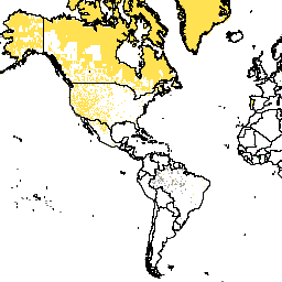
LandScan High Definition Data for Ukraine, January 2022
LandScan High Definition (HD) provides gridded population estimates at 3 arc-second (~100m) resolution. Values for each LandScan HD cell represent an ambient (i.e. 24 hour average) population count estimate. In this way, the data capture the full potential activity space of people throughout the course … landscan population -
LandScan Population Data Global 1km
The LandScan dataset, provided by the Oak Ridge National Laboratory (ORNL), offers a comprehensive and high-resolution global population distribution dataset that serves as a valuable resource for a wide range of applications. Leveraging state-of-the-art spatial modeling techniques and advanced geospatial data sources, LandScan provides detailed … community-dataset demography landscan population sat-io -
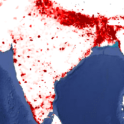
Malaria Atlas Project Accessibility to Cities 2015
This global accessibility map enumerates land-based travel time to the nearest densely-populated area for all areas between 85 degrees north and 60 degrees south for a nominal year 2015. Densely-populated areas are defined as contiguous areas with 1,500 or more inhabitants per square kilometer or … accessibility malariaatlasproject map population publisher-dataset -
Malaria Atlas Project Accessibility to Healthcare 2019
This global accessibility map enumerates land-based travel time (in minutes) to the nearest hospital or clinic for all areas between 85 degrees north and 60 degrees south for a nominal year 2019. Major data collection efforts underway by OpenStreetMap, Google Maps, and academic researchers have … accessibility malariaatlasproject map population publisher-dataset -
Malaria Atlas Project Accessibility to Healthcare 2019 (Walking Only)
This global accessibility map enumerates land-based travel time (in minutes) to the nearest hospital or clinic for all areas between 85 degrees north and 60 degrees south for a nominal year 2019. This surface is based on "walking-only" travel time, using non-motorized means of transportation … accessibility malariaatlasproject map population publisher-dataset -
Malaria Atlas Project Global Friction Surface 2015
Friction Surface 2019". This global friction surface enumerates land-based travel speed for all land pixels between 85 degrees north and 60 degrees south for a nominal year 2015. This map was produced through a collaboration between the University of Oxford Malaria Atlas Project (MAP), Google, … accessibility malariaatlasproject map population publisher-dataset -
Malaria Atlas Project Global Friction Surface 2019
This global friction surface enumerates land-based travel speed for all land pixels between 85 degrees north and 60 degrees south for a nominal year 2019. This map was produced through a collaboration between MAP (University of Oxford), Telethon Kids Institute (Perth, Australia), Google, and the … accessibility malariaatlasproject map population publisher-dataset -
Malaria Atlas Project Global Friction Surface 2019 (Walking Only)
This global friction surface enumerates land-based travel speed for all land pixels between 85 degrees north and 60 degrees south for a nominal year 2019. This surface is based on "walking-only" travel speed, using non-motorized means of transportation only. This map was produced through a … accessibility malariaatlasproject map population publisher-dataset -
Open Buildings Temporal V1
The Open Buildings 2.5D Temporal Dataset contains data about building presence, fractional building counts, and building heights at an effective1 spatial resolution of 4m (rasters are provided at 0.5m resolution) at an annual cadence from 2016-2023. It is produced from open-source, low-resolution imagery from the … africa annual asia built-up height open-buildings -
Open Buildings V3 Polygons
This large-scale open dataset consists of outlines of buildings derived from high-resolution 50 cm satellite imagery. It contains 1.8B building detections in Africa, Latin America, Caribbean, South Asia and Southeast Asia. The inference spanned an area of 58M km². For each building in this dataset … africa asia building built-up open-buildings population -
Overture Maps - Places: Place
The Overture Maps Places theme contains more than 64 million point representations of real-world entities: businesses, schools, hospitals, religious organizations, landmarks, mountain peaks, and much more. Each place record includes location coordinates, names, categories, contact information (websites, social media, emails, phones), brand information, addresses, and … global infrastructure-boundaries map population publisher-dataset urban -
TNC Global Human Modification v3 (Change-Consistent 300m)
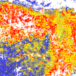
The Global Human Modification v3 dataset measures cumulative human pressures on global terrestrial ecosystems (excluding Antarctica). It tracks data from 1990 to 2022 and is intended to help quantify human impact for conservation planning, policy-making, and research. This dataset is the "Change-Consistent" Series ("c" series) … fragmentation human-modification landcover landscape-gradient population stressors -
TNC Global Human Modification v3 (Static Snapshot 90m)
The Global Human Modification v3 dataset measures cumulative human pressures on global terrestrial ecosystems (excluding Antarctica). It tracks data from 1990 to 2022 and is intended to help quantify human impact for conservation planning, policy-making, and research. This is the 2022 static snapshot ("s" series) … fragmentation human-modification landcover landscape-gradient population stressors -
Tree proximate people (TPP) 1.0
The "Tree Proximate People" (TPP) is one of the datasets contributing to the development of indicator #13, number of forest-dependent people in extreme poverty, of the Collaborative Partnership on Forests (CPF) Global Core Set of forest-related indicators (GCS). The TPP dataset provides 4 different estimates … agriculture fao forest global plant-productivity population -
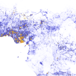
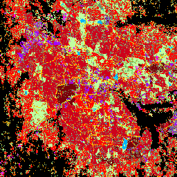
Tsinghua FROM-GLC Year of Change to Impervious Surface
This dataset contains annual change information of global impervious surface area from 1985 to 2018 at a 30m resolution. Change from pervious to impervious was determined using a combined approach of supervised classification and temporal consistency checking. Impervious pixels are defined as above 50% impervious. … built population tsinghua urban -
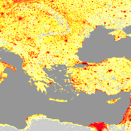
VIIRS Nighttime Day/Night Annual Band Composites V2.1
Annual global VIIRS nighttime lights dataset is a time series produced from monthly cloud-free average radiance grids spanning 2013 to 2021. Data for 2022 are available in the NOAA/VIIRS/DNB/ANNUAL_V22 dataset. An initial filtering step removed sunlit, moonlit and cloudy pixels, leading to rough composites that … annual dnb eog lights nighttime noaa -
VIIRS Nighttime Day/Night Annual Band Composites V2.2

Annual global VIIRS nighttime lights dataset is a time series produced from monthly cloud-free average radiance grids for 2022. Data for earlier years are available in the NOAA/VIIRS/DNB/ANNUAL_V21 dataset. An initial filtering step removed sunlit, moonlit and cloudy pixels, leading to rough composites that contains … annual dnb eog lights nighttime noaa -
VIIRS Nighttime Day/Night Band Composites Version 1
Monthly average radiance composite images using nighttime data from the Visible Infrared Imaging Radiometer Suite (VIIRS) Day/Night Band (DNB). As these data are composited monthly, there are many areas of the globe where it is impossible to get good quality data coverage for that month. … dnb eog lights monthly nighttime noaa -
VIIRS Stray Light Corrected Nighttime Day/Night Band Composites Version 1

Monthly average radiance composite images using nighttime data from the Visible Infrared Imaging Radiometer Suite (VIIRS) Day/Night Band (DNB). As these data are composited monthly, there are many areas of the globe where it is impossible to get good quality data coverage for that month. … dnb eog lights monthly nighttime noaa -
VNP46A1: VIIRS Daily Gridded Day Night Band 500m Linear Lat Lon Grid Night
The Suomi National Polar-orbiting Partnership (SNPP) Visible Infrared Imaging Radiometer Suite (VIIRS) supports a Day-Night Band (DNB) sensor that provides global daily measurements of nocturnal visible and near-infrared (NIR) light that are suitable for Earth system science and applications. The VIIRS DNB's ultra-sensitivity in lowlight … daily dnb nasa noaa population viirs -
VNP46A2: VIIRS Lunar Gap-Filled BRDF Nighttime Lights Daily L3 Global 500m
The Suomi National Polar-orbiting Partnership (SNPP) Visible Infrared Imaging Radiometer Suite (VIIRS) supports a Day-Night Band (DNB) sensor that provides global daily measurements of nocturnal visible and near-infrared(NIR) light that are suitable for Earth system science and applications. The VIIRS DNB's ultra-sensitivity in lowlight conditions … brdf daily nasa nighttime noaa population -
World Settlement Footprint 2015
The World Settlement Footprint (WSF) 2015 is a 10m resolution binary mask outlining the extent of human settlements globally derived by means of 2014-2015 multitemporal Landsat-8 and Sentinel-1 imagery (of which ~217,000 and ~107,000 scenes have been processed, respectively). The temporal dynamics of human settlements … landcover landsat-derived population sentinel1-derived settlement urban -
WorldPop Global Project Population Data: Constrained Estimated Age and Sex Structures of Residential Population per 100x100m Grid Square

Global high-resolution, contemporary data on human population distributions are a prerequisite for the accurate measurement of the impacts of population growth, for monitoring changes, and for planning interventions. The WorldPop project aims to meet these needs through the provision of detailed and open access population … demography population worldpop -
WorldPop Global Project Population Data: Estimated Age and Sex Structures of Residential Population per 100x100m Grid Square
Global high-resolution, contemporary data on human population distributions are a prerequisite for the accurate measurement of the impacts of population growth, for monitoring changes, and for planning interventions. The WorldPop project aims to meet these needs through the provision of detailed and open access population … demography population worldpop -
WorldPop Global Project Population Data: Estimated Residential Population per 100x100m Grid Square

Global high-resolution, contemporary data on human population distributions are a prerequisite for the accurate measurement of the impacts of population growth, for monitoring changes, and for planning interventions. The WorldPop project aims to meet these needs through the provision of detailed and open access population … demography population worldpop