Page Summary
-
The RCMAP TRENDS YEAR dataset provides yearly rangeland component cover data for western North America from 1985 to 2023, derived from Landsat imagery.
-
The dataset includes information on ten fractional rangeland components and their temporal trends.
-
Two approaches, linear trends and a breaks and stable states method, were used to assess temporal patterns in each RCMAP component.
-
The data can be utilized to study the impact of climate change and the effectiveness of management practices on rangelands.
- Dataset Availability
- 1985-01-01T00:00:00Z–2023-12-31T00:00:00Z
- Dataset Producer
- United States Geological Survey and Bureau of Land Management
- Cadence
- 1 Year
- Tags
Description
This collection includes RCMAP yearly products from 1985 through 2023. The RCMAP (Rangeland Condition Monitoring Assessment and Projection) dataset quantifies the percent cover of rangeland components across western North America using Landsat imagery from 1985-2023. The RCMAP product suite consists of ten fractional components: annual herbaceous, bare ground, herbaceous, litter, non-sagebrush shrub, perennial herbaceous, sagebrush, shrub, tree, and shrub height in addition to the temporal trends of each component. Several enhancements were made to the RCMAP process relative to prior generations. First, high-resolution training was revised using an improved neural-net classifier and modelling approach. These data serve as foundation to the RCMAP approach. The training database was further improved by incorporating additional datasets. Next, the Landsat compositing approach was improved to better capture the range of conditions from across each year and through time. These composites are based on Collection 2 Landsat data with improved geolocation accuracy and dynamic range. Finally, the Canadian portion of the sagebrush biome was included, which expanded the study area by 29,199 km2.
Processing efficiency has been increased using open-source software and USGS High-Performance Computing (HPC) resources. The mapping area included eight regions which were subsequently mosaicked. These data can be used to answer critical questions regarding the influence of climate change and the suitability of management practices. Component products can be downloaded at Multi-Resolution Land Characteristics Consortium.
The temporal patterns were assessed in each RCMAP component with two approaches, 1) linear trends and 2) a breaks and stable states method with an 8-year temporal moving window based on structural change at the pixel level. Linear trend products include slope and p-value calculated from least squares linear regression. The slope represents the average percent cover change per year over the times-series and the p-value reflects the confidence of change in each pixel. The structural change method partitions the time-series into segments of similar slope values, with statistically significant breakpoints indicating perturbations to the prior trajectory. The break point trends analysis suite relies on structural break methods, resulting in the identification of the number and timing of breaks in the time-series, and the significance of each segment. The following statistics were produced: 1) for each component, each year, the presence/absence of breaks, 2) the slope, p-value, and standard error of the segment occurring in each year, 3) the overall model R2 (quality of model fit to the temporal profile), and 4) an index, Total Change Intensity. This index reflects the total amount of change occurring across components in that pixel. The linear and structural change methods generally agreed on patterns of change, but the latter found breaks more often, with at least one break point in most pixels. The structural change model provides more robust statistics on the significant minority of pixels with non-monotonic trends, while detrending some interannual signal potentially superfluous from a long-term perspective.
Bands
Bands
Pixel size: 30 meters (all bands)
| Name | Units | Min | Max | Scale | Pixel Size | Description |
|---|---|---|---|---|---|---|
annual_herbaceous_break_point |
count | 0 | 1 | 30 meters | Annual structural breaks in each component of annual herbaceous present or absent |
|
bare_ground_break_point |
count | 0 | 1 | 30 meters | Annual structural breaks in each component of bare ground present or absent |
|
herbaceous_break_point |
count | 0 | 1 | 30 meters | Annual structural breaks in each component of herbaceous present or absent |
|
litter_break_point |
count | 0 | 1 | 30 meters | Annual structural breaks in each component of litter present or absent |
|
sagebrush_break_point |
count | 0 | 1 | 30 meters | Annual structural breaks in each component of sagebrush present or absent |
|
shrub_break_point |
count | 0 | 1 | 30 meters | Annual structural breaks in each component of shrub present or absent |
|
shrub_height_break_point |
count | 0 | 1 | 30 meters | Annual structural breaks in each component of shrub height present or absent |
|
non_sagebrush_shrub_break_point |
count | 0 | 1 | 30 meters | Annual structural breaks in each component of non sagebrush shrub present or absent |
|
perennial_herbaceous_break_point |
count | 0 | 1 | 30 meters | Annual structural breaks in each component of perennial herbaceous present or absent |
|
tree_break_point |
count | 0 | 1 | 30 meters | Annual structural breaks in each component of tree present or absent |
|
annual_herbaceous_segment_pvalue |
P-value | 0 | 100 | 0.01 | 30 meters | P-values of structural break segments within each component of annual herbaceous per year |
bare_ground_segment_pvalue |
P-value | 0 | 100 | 0.01 | 30 meters | P-values of structural break segments within each component of bare ground per year |
herbaceous_segment_pvalue |
P-value | 0 | 100 | 0.01 | 30 meters | P-values of structural break segments within each component of herbaceous per year |
litter_segment_pvalue |
P-value | 0 | 100 | 0.01 | 30 meters | P-values of structural break segments within each component of litter per year |
sagebrush_segment_pvalue |
P-value | 0 | 100 | 0.01 | 30 meters | P-values of structural break segments within each component of sagebrush per year |
shrub_segment_pvalue |
P-value | 0 | 100 | 0.01 | 30 meters | P-values of structural break segments within each component of shrub per year |
shrub_height_segment_pvalue |
P-value | 0 | 100 | 0.01 | 30 meters | P-values of structural break segments within each component of shrub height per year |
non_sagebrush_shrub_segment_pvalue |
P-value | 0 | 100 | 0.01 | 30 meters | P-values of structural break segments within each component of non sagebrush shrub per year |
perennial_herbaceous_segment_pvalue |
P-value | 0 | 100 | 0.01 | 30 meters | P-values of structural break segments within each component of perennial herbaceous per year |
tree_segment_pvalue |
P-value | 0 | 100 | 0.01 | 30 meters | P-values of structural break segments within each component of tree per year |
annual_herbaceous_segment_slope |
% change/y | -99999 | 99999 | 0.01 | 30 meters | Annual slope of structural break segments within each component of annual herbaceous |
bare_ground_segment_slope |
% change/y | -99999 | 99999 | 0.01 | 30 meters | Annual slope of structural break segments within each component of bare ground |
herbaceous_segment_slope |
% change/y | -99999 | 99999 | 0.01 | 30 meters | Annual slope of structural break segments within each component of herbaceous |
litter_segment_slope |
% change/y | -99999 | 99999 | 0.01 | 30 meters | Annual slope of structural break segments within each component of litter |
sagebrush_segment_slope |
% change/y | -99999 | 99999 | 0.01 | 30 meters | Annual slope of structural break segments within each component of sagebrush |
shrub_segment_slope |
% change/y | -99999 | 99999 | 0.01 | 30 meters | Annual slope of structural break segments within each component of shrub |
shrub_height_segment_slope |
% change/y | -99999 | 99999 | 0.01 | 30 meters | Annual slope of structural break segments within each component of shrub height |
non_sagebrush_shrub_segment_slope |
% change/y | -99999 | 99999 | 0.01 | 30 meters | Annual slope of structural break segments within each component of non sagebrush shrub |
perennial_herbaceous_segment_slope |
% change/y | -99999 | 99999 | 0.01 | 30 meters | Annual slope of structural break segments within each component of perennial herbaceous |
tree_segment_slope |
% change/y | -99999 | 99999 | 0.01 | 30 meters | Annual slope of structural break segments within each component of tree |
Terms of Use
Terms of Use
This work was authored as part of the Contributor's official duties as an Employee of the United States Government and is therefore a work of the United States Government. In accordance with 17 U.S.C. 105, no copyright protection is available for such works under U.S. Law. This is an Open Access article that has been identified as being free of known restrictions under copyright law, including all related and neighboring rights (https://creativecommons.org/publicdomain/mark/1.0/). You can copy, modify, distribute and perform the work, even for commercial purposes, all without asking permission.
Citations
Rigge, M.B., Bunde, B., Postma, K., and Shi, H., 2024, Rangeland Condition Monitoring Assessment and Projection (RCMAP) Fractional Component Time-Series Across the Western U.S. 1985-2023: U.S. Geological Survey data release, doi:10.5066/P9SJXUI1.
Rigge, M., H. Shi, C. Homer, P. Danielson, and B. Granneman. 2019. Long-term trajectories of fractional component change in the Northern Great Basin, USA. Ecosphere 10(6):e02762. doi:10.1002/ecs2.2762
Rigge, M., C. Homer, L. Cleeves, D. K. Meyer, B. Bunde, H. Shi, G. Xian, S. Schell, and M. Bobo. 2020. Quantifying western U.S. rangelands as fractional components with multi-resolution remote sensing and in situ data. Remote Sensing 12. doi:10.3390/rs12030412
Rigge, M., C. Homer, H. Shi, D. Meyer, B. Bunde, B. Granneman, K. Postma, P. Danielson, A. Case, and G. Xian. 2021. Rangeland Fractional Components Across the Western United States from 1985 to 2018. Remote Sensing 13:813. doi:10.3390/rs13040813
DOIs
Explore with Earth Engine
Code Editor (JavaScript)
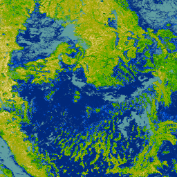
// Import the NLCD RCMAP TRENDS YEAR collection.
var image = ee.ImageCollection(
    'USGS/NLCD_RELEASES/2023_REL/RCMAP/V6/TRENDS_YEAR'
  ).select('annual_herbaceous_segment_pvalue');

  var vis = {
    min: [0],
    max: [100],
    palette: [
    '000000', 'f9e8b7', 'f7e3ac', 'f0dfa3', 'eedf9c', 'eada91', 'e8d687',
    'e0d281', 'ddd077', 'd6cc6d', 'd3c667', 'd0c55e', 'cfc555', 'c6bd4f',
    'c4ba46', 'bdb83a', 'bbb534', 'b7b02c', 'b0ad1f', 'adac17', 'aaaa0a',
    'a3a700', '9fa700', '9aa700', '92a700', '8fa700', '87a700', '85a700',
    '82aa00', '7aaa00', '77aa00', '70aa00', '6caa00', '67aa00', '5fa700',
    '57a700', '52a700', '4fa700', '4aa700', '42a700', '3ca700', '37a700',
    '37a300', '36a000', '369f00', '349d00', '339900', '339900', '2f9200',
    '2d9100', '2d8f00', '2c8a00', '2c8800', '2c8500', '2c8400', '2b8200',
    '297d00', '297a00', '297900', '277700', '247400', '247000', '29700f',
    '2c6d1c', '2d6d24', '336d2d', '366c39', '376c44', '396a4a', '396a55',
    '3a6a5f', '3a696a', '396774', '3a6782', '39668a', '376292', '34629f',
    '2f62ac', '2c5fb7', '245ec4', '1e5ed0', '115cdd', '005ae0', '0057dd',
    '0152d6', '0151d0', '014fcc', '014ac4', '0147bd', '0144b8', '0142b0',
    '0141ac', '013da7', '013aa0', '01399d', '013693', '013491', '012f8a',
    '012d85', '012c82', '01297a'
    ]
  };

  // Display the image on the map.
  Map.setCenter(-114, 38, 6);
  Map.addLayer(image, vis, 'Annual herbaceous segment pvalue');