Page Summary
-
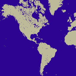
The MOD44W V6 land/water mask 250m product provides a land-water mask derived using a decision tree classifier and validated with a previous version.
-
This dataset is available from 2000-01-01 to 2015-01-01 with a yearly cadence.
-
The dataset includes a water mask band and a quality assurance band.
-
MODIS data and products, including this one, have no restrictions on subsequent use, sale, or redistribution.
-
This dataset can be explored using Google Earth Engine for scientific analysis and visualization.
- Dataset Availability
- 2000-01-01T00:00:00Z–2015-01-01T00:00:00Z
- Dataset Producer
- NASA LP DAAC at the USGS EROS Center
- Cadence
- 1 Year
- Tags
Description
The MOD44W V6 land/water mask 250m product is derived using a decision tree classifier trained with MODIS data and validated with the MOD44W V5 product. A series of masks are applied to address known issues caused by terrain shadow, burn scars, cloudiness, or ice cover in oceans.
Bands
Bands
Pixel size: 250 meters (all bands)
| Name | Pixel Size | Description | |||||||||||||||||||||||||||||||||||||||||||||||||||||||||||||||||||||||||||||||||||||||||||||||||
|---|---|---|---|---|---|---|---|---|---|---|---|---|---|---|---|---|---|---|---|---|---|---|---|---|---|---|---|---|---|---|---|---|---|---|---|---|---|---|---|---|---|---|---|---|---|---|---|---|---|---|---|---|---|---|---|---|---|---|---|---|---|---|---|---|---|---|---|---|---|---|---|---|---|---|---|---|---|---|---|---|---|---|---|---|---|---|---|---|---|---|---|---|---|---|---|---|---|---|---|
water_mask |
250 meters | Land-water mask |
|||||||||||||||||||||||||||||||||||||||||||||||||||||||||||||||||||||||||||||||||||||||||||||||||
water_mask_QA |
250 meters | Quality assurance (QA) |
|||||||||||||||||||||||||||||||||||||||||||||||||||||||||||||||||||||||||||||||||||||||||||||||||
Terms of Use
Terms of Use
MODIS data and products acquired through the LP DAAC have no restrictions on subsequent use, sale, or redistribution.
Citations
Please visit LP DAAC 'Citing Our Data' page for information on citing LP DAAC datasets.
DOIs
Explore with Earth Engine
Code Editor (JavaScript)
var dataset = ee.ImageCollection('MODIS/006/MOD44W')
                  .filter(ee.Filter.date('2015-01-01', '2015-05-01'));
var waterMask = dataset.select('water_mask');
var waterMaskVis = {
  min: 0,
  max: 1,
  palette: ['bcba99', '2d0491'],
};
Map.setCenter(6.746, 46.529, 2);
Map.addLayer(waterMask, waterMaskVis, 'Water Mask');