-
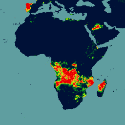
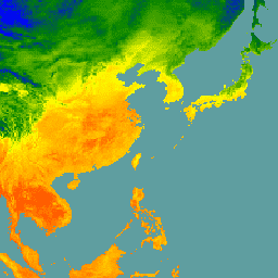
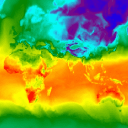
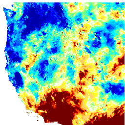
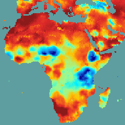
การแผ่รังสีของโปรแกรมจำลองระบบโลกที่หายใจ (BESS) เวอร์ชัน 1
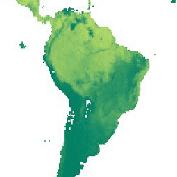
Breathing Earth System Simulator (BESS) เป็นโมเดลแบบอิงกระบวนการที่เรียบง่ายซึ่งเชื่อมโยงการแผ่รังสีในชั้นบรรยากาศและเรือนยอด การสังเคราะห์ด้วยแสงของเรือนยอด การคายน้ำ และสมดุลพลังงาน โดยจะรวมโมเดลการแผ่รังสีในชั้นบรรยากาศและโครงข่ายระบบประสาทเทียมเข้ากับแรงจากผลิตภัณฑ์ชั้นบรรยากาศของ MODIS เพื่อสร้างผลิตภัณฑ์รายวันขนาด 5 กม. … สภาพอากาศ การคายระเหย gpp modis-derived par รังสี -
CFSR: การวิเคราะห์ซ้ำของระบบพยากรณ์อากาศ
การวิเคราะห์ย้อนหลังของระบบพยากรณ์อากาศ (CFSR) ของศูนย์พยากรณ์อากาศแห่งชาติ (NCEP) ได้รับการออกแบบและดำเนินการในฐานะระบบบรรยากาศ-มหาสมุทร-พื้นผิวดิน-น้ำแข็งทะเลแบบคู่ความละเอียดสูงระดับโลก เพื่อให้ค่าประมาณที่ดีที่สุดของสถานะของโดเมนที่เชื่อมโยงเหล่านี้ในช่วงระยะเวลา 32 ปีที่บันทึกไว้ตั้งแต่เดือนมกราคม … สภาพอากาศ แสงกลางวัน ฟลักซ์ พยากรณ์ ธรณีฟิสิกส์ ncep -
CFSV2: NCEP Climate Forecast System เวอร์ชัน 2, ผลิตภัณฑ์ราย 6 ชั่วโมงที่ปรับให้สอดคล้องกัน
ระบบพยากรณ์อากาศ (CFS) ของศูนย์พยากรณ์อากาศแห่งชาติ (NCEP) เป็นโมเดลที่เชื่อมโยงกันอย่างสมบูรณ์ซึ่งแสดงถึงการโต้ตอบระหว่างชั้นบรรยากาศ มหาสมุทร แผ่นดิน และน้ำแข็งในทะเลของโลก CFS ได้รับการพัฒนาที่ศูนย์การสร้างแบบจำลองสภาพแวดล้อม (EMC) ที่ NCEP CFS ที่ใช้งานได้รับการอัปเกรดเป็น … สภาพอากาศ แสงกลางวัน ฟลักซ์ พยากรณ์ ธรณีฟิสิกส์ ncep -
หยาดน้ำฟ้าจาก CHIRPS แบบรายวันใกล้เวลาจริง: หยาดน้ำฟ้าจากรังสีอินฟราเรดของศูนย์อันตรายจากสภาพอากาศพร้อมข้อมูลสถานี (เวอร์ชัน 3.0 อิงตาม IMERG)
ศูนย์อันตรายจากสภาพอากาศ (Climate Hazards Center) ได้จัดทำชุดข้อมูลปริมาณน้ำฝนความละเอียดสูงแบบกึ่งทั่วโลก (CHIRPS v3) ซึ่งมีระยะเวลามากกว่า 40 ปี โดยครอบคลุมตั้งแต่ 60°N ถึง 60°S และครอบคลุมลองจิจูดทั้งหมด ซึ่งให้ข้อมูลตั้งแต่ปี 1981 จนถึงปัจจุบัน CHIRPS v3 ผสานรวมการประมาณปริมาณน้ำฝนจากรังสีอินฟราเรดเชิงความร้อนจากดาวเทียมกับการสังเกตการณ์จากสถานีภาคพื้นดิน … chc สภาพอากาศ ธรณีฟิสิกส์ หยาดน้ำฟ้า ucsb ภูมิอากาศ -
การวิเคราะห์ซ้ำรายวันของปริมาณน้ำฝน CHIRPS: ปริมาณน้ำฝนจากรังสีอินฟราเรดของศูนย์อันตรายจากสภาพอากาศพร้อมข้อมูลสถานี (เวอร์ชัน 3.0, อิงตาม ERA5)
ศูนย์อันตรายจากสภาพอากาศ (Climate Hazards Center) ได้จัดทำชุดข้อมูลปริมาณน้ำฝนความละเอียดสูงแบบกึ่งทั่วโลก (CHIRPS v3) ซึ่งมีระยะเวลามากกว่า 40 ปี โดยครอบคลุมตั้งแต่ 60°N ถึง 60°S และครอบคลุมลองจิจูดทั้งหมด ซึ่งให้ข้อมูลตั้งแต่ปี 1981 จนถึงปัจจุบัน CHIRPS v3 ผสานรวมการประมาณปริมาณน้ำฝนจากรังสีอินฟราเรดเชิงความร้อนจากดาวเทียมกับการสังเกตการณ์จากสถานีภาคพื้นดิน … chc สภาพอากาศ ธรณีฟิสิกส์ หยาดน้ำฟ้า ucsb ภูมิอากาศ -
ปริมาณน้ำฝนรายวันของ CHIRPS: ปริมาณน้ำฝนจากรังสีอินฟราเรดของศูนย์อันตรายจากสภาพอากาศพร้อมข้อมูลสถานี (เวอร์ชัน 2.0 สุดท้าย)
ข้อมูลปริมาณน้ำฝนทั่วโลกแบบกึ่งรายปีนานกว่า 30 ปี (CHIRPS) ของศูนย์อันตรายจากสภาพอากาศ (Climate Hazards Center) คือข้อมูลปริมาณน้ำฝนทั่วโลกแบบกึ่งรายปีนานกว่า 30 ปี CHIRPS ผสานรวมภาพจากดาวเทียมที่มีความละเอียด 0.05° กับข้อมูลสถานีในแหล่งกำเนิดเพื่อสร้างอนุกรมเวลาของปริมาณน้ำฝนแบบกริดสำหรับการวิเคราะห์แนวโน้มและการตรวจสอบภัยแล้งตามฤดูกาล chg สภาพอากาศ ธรณีฟิสิกส์ หยาดน้ำฟ้า ucsb ภูมิอากาศ -
ปริมาณน้ำฝน CHIRPS Pentad: ปริมาณน้ำฝนอินฟราเรดของศูนย์อันตรายจากสภาพอากาศพร้อมข้อมูลสถานี (เวอร์ชัน 2.0 สุดท้าย)

ข้อมูลปริมาณน้ำฝนทั่วโลกแบบกึ่งรายปีนานกว่า 30 ปี (CHIRPS) ของศูนย์อันตรายจากสภาพอากาศ (Climate Hazards Center) คือข้อมูลปริมาณน้ำฝนทั่วโลกแบบกึ่งรายปีนานกว่า 30 ปี CHIRPS ผสานรวมภาพจากดาวเทียมที่มีความละเอียด 0.05° กับข้อมูลสถานีในแหล่งกำเนิดเพื่อสร้างอนุกรมเวลาของปริมาณน้ำฝนแบบกริดสำหรับการวิเคราะห์แนวโน้มและการตรวจสอบภัยแล้งตามฤดูกาล chg สภาพอากาศ ธรณีฟิสิกส์ หยาดน้ำฟ้า ucsb ภูมิอากาศ -
ปริมาณน้ำฝน CHIRPS แบบ 5 วัน: ปริมาณน้ำฝนอินฟราเรดจากศูนย์อันตรายจากสภาพอากาศพร้อมข้อมูลสถานี (เวอร์ชัน 3.0)
ศูนย์อันตรายจากสภาพอากาศ (Climate Hazards Center) ได้จัดทำชุดข้อมูลปริมาณน้ำฝนความละเอียดสูงแบบกึ่งทั่วโลก (CHIRPS v3) ซึ่งมีระยะเวลามากกว่า 40 ปี โดยครอบคลุมตั้งแต่ 60°N ถึง 60°S และครอบคลุมลองจิจูดทั้งหมด ซึ่งให้ข้อมูลตั้งแต่ปี 1981 จนถึงปัจจุบัน CHIRPS v3 ผสานรวมการประมาณปริมาณน้ำฝนจากรังสีอินฟราเรดเชิงความร้อนจากดาวเทียมกับการสังเกตการณ์จากสถานีภาคพื้นดิน … chc chg climate geophysical precipitation ucsb -
CHIRTS Temperature Daily: ผลิตภัณฑ์ข้อมูลรายวันของอุณหภูมิอินฟราเรดจากศูนย์อันตรายจากสภาพอากาศที่มีสถานี
ผลิตภัณฑ์ข้อมูลอุณหภูมิรายวันของศูนย์อันตรายจากสภาพอากาศ (Climate Hazards Center) ที่วัดด้วยอุณหภูมิอินฟราเรดพร้อมสถานี (CHIRTS-daily; Verdin et al. 2020) เป็นชุดข้อมูลแบบกริดความละเอียดสูงระดับกึ่งโลก (ความละเอียด 0.05° × 0.05°, 60°S - 70°N) ซึ่งให้ข้อมูลอุณหภูมิต่ำสุด (Tmin) และสูงสุด (Tmax) ที่ระดับ 2 เมตรรายวัน รวมถึงตัวแปรที่ได้มา 4 รายการ ได้แก่ แรงดันไอน้ำอิ่มตัว … chg สภาพอากาศ รายวัน era5 geophysical reanalysis -
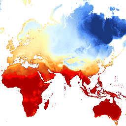
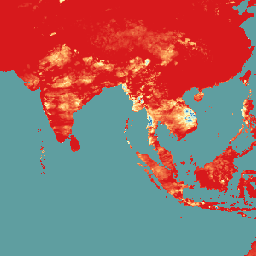
อุณหภูมิรวมทั่วโลกของ CPC
ชุดข้อมูลนี้ให้การวิเคราะห์แบบกริดของอุณหภูมิอากาศที่พื้นผิวรายวันทั่วพื้นที่บกของโลก รวมถึงอุณหภูมิสูงสุด (Tmax) และต่ำสุด (Tmin) รายวัน ข้อมูลตั้งแต่ปี 1979 จนถึงปัจจุบันจะแสดงบนกริดละติจูด/ลองจิจูด 0.5 องศา ซึ่งสอดคล้องกับความละเอียดของข้อมูลรายวันทั่วโลกที่อิงตามเกจของ CPC … สภาพอากาศ รายวัน noaa precipitation weather -
หน่วยบริการสังเกตการณ์ชั้นบรรยากาศโคเปอร์นิคัส (CAMS) แบบเรียลไทม์ทั่วโลก
หน่วยบริการสังเกตการณ์ชั้นบรรยากาศโคเปอร์นิคัสมีความสามารถในการตรวจสอบองค์ประกอบของชั้นบรรยากาศโลกอย่างต่อเนื่องในระดับโลกและระดับภูมิภาค ระบบการผลิตแบบเกือบเรียลไทม์ทั่วโลกหลักคือชุดการรวมข้อมูลและการพยากรณ์ที่ให้การพยากรณ์ 5 วัน 2 ครั้งต่อวันสำหรับละอองลอยและสารเคมี … ละอองลอย ชั้นบรรยากาศ สภาพอากาศ copernicus ecmwf การพยากรณ์ -
Daymet V4: สรุปสภาพอากาศและภูมิอากาศบนพื้นผิวรายวัน
Daymet V4 ให้ค่าประมาณแบบกริดของพารามิเตอร์สภาพอากาศรายวันสำหรับทวีปอเมริกาเหนือ ฮาวาย และเปอร์โตริโก (ข้อมูลสำหรับเปอร์โตริโกพร้อมใช้งานตั้งแต่ปี 1950) โดยได้มาจากข้อมูลสถานีอุตุนิยมวิทยาที่เลือกและแหล่งข้อมูลสนับสนุนต่างๆ เมื่อเทียบกับเวอร์ชันก่อนหน้า Daymet … สภาพอากาศ รายวัน เวลากลางวัน ฟลักซ์ geophysical nasa -
การปล่อยก๊าซจากดินอินทรีย์ที่ระบายน้ำ (รายปี) 1.0
ชุดข้อมูล FAO ที่เกี่ยวข้อง 2 ชุดเกี่ยวกับดินอินทรีย์ที่ระบายน้ำจะให้ค่าประมาณต่อไปนี้ DROSA-A: พื้นที่ของดินอินทรีย์ (เป็นเฮกตาร์) ที่ระบายน้ำสำหรับกิจกรรมทางการเกษตร (พื้นที่เพาะปลูกและทุ่งหญ้าที่ใช้เลี้ยงสัตว์) DROSE-A: ค่าประมาณคาร์บอน (C) และไนตรัสออกไซด์ (N2O) (เป็นกิกะกรัม) จากการระบายน้ำทางการเกษตรของดินอินทรีย์ภายใต้ … การเกษตร สภาพอากาศ การเปลี่ยนแปลงสภาพภูมิอากาศ การปล่อยก๊าซ fao ghg -
การพยากรณ์ชั้นบรรยากาศ IFS แบบแทบจะเรียลไทม์ของ ECMWF
ชุดข้อมูลนี้ประกอบด้วยการคาดการณ์ 15 วันของตัวแปรโมเดลชั้นบรรยากาศที่สร้างขึ้นโดยระบบการคาดการณ์แบบบูรณาการ (IFS) ของ ECMWF ที่ความละเอียด 0.25 องศา เราเรียกข้อมูลเหล่านี้ว่า "เกือบเรียลไทม์ (NRT)" เนื่องจากมีการเปิดตัวผลิตภัณฑ์ใหม่วันละ 2 ครั้งหลังจากเปิดตัวการพยากรณ์แบบเรียลไทม์ของ ECMWF … climate dewpoint ecmwf forecast global humidity -
การพยากรณ์คลื่น IFS แบบใกล้เคียงเรียลไทม์ (ระยะสั้น) ของ ECMWF
ชุดข้อมูลนี้ประกอบด้วยการคาดการณ์ 6 วันของฟิลด์โมเดลคลื่นที่สร้างขึ้นโดยระบบการคาดการณ์แบบบูรณาการ (IFS) ของ ECMWF ที่ความละเอียด 0.25 องศา เราเรียกข้อมูลเหล่านี้ว่า "เกือบเรียลไทม์ (NRT)" เนื่องจากมีการเปิดตัวผลิตภัณฑ์ใหม่วันละ 2 ครั้งหลังจากเปิดตัวการพยากรณ์แบบเรียลไทม์ของ ECMWF … สภาพอากาศ ecmwf การพยากรณ์ ทั่วโลก มหาสมุทร -
การพยากรณ์คลื่น IFS แบบแทบจะเรียลไทม์ของ ECMWF
ชุดข้อมูลนี้ประกอบด้วยการคาดการณ์ 15 วันของฟิลด์โมเดลคลื่นที่สร้างขึ้นโดยระบบการคาดการณ์แบบบูรณาการ (IFS) ของ ECMWF ที่ความละเอียด 0.25 องศา เราเรียกข้อมูลเหล่านี้ว่า "เกือบเรียลไทม์ (NRT)" เนื่องจากมีการเปิดตัวผลิตภัณฑ์ใหม่วันละ 2 ครั้งหลังจากเปิดตัวการพยากรณ์แบบเรียลไทม์ของ ECMWF … สภาพอากาศ ecmwf การพยากรณ์ ทั่วโลก มหาสมุทร -
การรวมข้อมูลรายวันของ ERA5 - การวิเคราะห์สภาพภูมิอากาศล่าสุดที่ผลิตโดย ECMWF / Copernicus Climate Change Service
ERA5 คือการวิเคราะห์ซ้ำของชั้นบรรยากาศ ECMWF รุ่นที่ 5 ของสภาพภูมิอากาศทั่วโลก การวิเคราะห์ซ้ำจะรวมข้อมูลโมเดลเข้ากับการสังเกตการณ์จากทั่วโลกเป็นชุดข้อมูลที่สมบูรณ์และสอดคล้องกันทั่วโลก ERA5 จะมาแทนที่ ERA-Interim reanalysis ซึ่งเป็นรุ่นก่อนหน้า ERA5 DAILY ให้ค่ารวมสำหรับแต่ละวันสำหรับ … สภาพอากาศ copernicus จุดน้ำค้าง ecmwf era5 หยาดน้ำฟ้า -
รายชั่วโมง ERA5 - การวิเคราะห์สภาพภูมิอากาศซ้ำของ ECMWF
ERA5 คือการวิเคราะห์ซ้ำของชั้นบรรยากาศ ECMWF รุ่นที่ 5 ของสภาพภูมิอากาศทั่วโลก โดย Copernicus Climate Change Service (C3S) ที่ ECMWF เป็นผู้จัดทำ การวิเคราะห์ซ้ำจะรวมข้อมูลโมเดลเข้ากับการสังเกตการณ์จากทั่วโลกเป็นชุดข้อมูลที่สมบูรณ์และสอดคล้องกันทั่วโลกโดยใช้กฎของ … ชั้นบรรยากาศ สภาพอากาศ copernicus ecmwf era5 รายชั่วโมง -
การรวบรวมข้อมูลรายเดือนของ ERA5 - การวิเคราะห์สภาพอากาศย้อนหลังล่าสุดที่ผลิตโดย ECMWF / Copernicus Climate Change Service

ERA5 คือการวิเคราะห์ซ้ำของชั้นบรรยากาศ ECMWF รุ่นที่ 5 ของสภาพภูมิอากาศทั่วโลก การวิเคราะห์ซ้ำจะรวมข้อมูลโมเดลเข้ากับการสังเกตการณ์จากทั่วโลกเป็นชุดข้อมูลที่สมบูรณ์และสอดคล้องกันทั่วโลก ERA5 จะมาแทนที่ ERA-Interim reanalysis ซึ่งเป็นรุ่นก่อนหน้า ERA5 MONTHLY ให้ค่ารวมสำหรับแต่ละเดือนสำหรับ … สภาพอากาศ copernicus จุดน้ำค้าง ecmwf era5 หยาดน้ำฟ้า -
ERA5-Land Daily Aggregated - การวิเคราะห์สภาพอากาศย้อนหลังของ ECMWF
ERA5-Land เป็นชุดข้อมูลการวิเคราะห์ซ้ำที่ให้มุมมองที่สอดคล้องกันเกี่ยวกับการเปลี่ยนแปลงของตัวแปรบนบกในช่วงหลายทศวรรษที่ผ่านมา โดยมีความละเอียดที่ดียิ่งขึ้นเมื่อเทียบกับ ERA5 ERA5-Land สร้างขึ้นโดยการเล่นซ้ำองค์ประกอบภาคพื้นดินของการวิเคราะห์สภาพอากาศย้อนหลัง ERA5 ของ ECMWF การวิเคราะห์ซ้ำจะรวมข้อมูลโมเดลเข้ากับ … cds climate copernicus ecmwf era5-land evaporation -
รายชั่วโมง ERA5-Land - การวิเคราะห์สภาพภูมิอากาศซ้ำของ ECMWF
ERA5-Land เป็นชุดข้อมูลการวิเคราะห์ซ้ำที่ให้มุมมองที่สอดคล้องกันเกี่ยวกับการเปลี่ยนแปลงของตัวแปรบนบกในช่วงหลายทศวรรษที่ผ่านมา โดยมีความละเอียดที่ดียิ่งขึ้นเมื่อเทียบกับ ERA5 ERA5-Land สร้างขึ้นโดยการเล่นซ้ำองค์ประกอบภาคพื้นดินของการวิเคราะห์สภาพอากาศย้อนหลัง ERA5 ของ ECMWF การวิเคราะห์ซ้ำจะรวมข้อมูลโมเดลเข้ากับ … cds climate copernicus ecmwf era5-land evaporation -
ERA5-Land Monthly Aggregated - ECMWF Climate Reanalysis

ERA5-Land เป็นชุดข้อมูลการวิเคราะห์ซ้ำที่ให้มุมมองที่สอดคล้องกันเกี่ยวกับการเปลี่ยนแปลงของตัวแปรบนบกในช่วงหลายทศวรรษที่ผ่านมา โดยมีความละเอียดที่ดียิ่งขึ้นเมื่อเทียบกับ ERA5 ERA5-Land สร้างขึ้นโดยการเล่นซ้ำองค์ประกอบภาคพื้นดินของการวิเคราะห์สภาพอากาศย้อนหลัง ERA5 ของ ECMWF การวิเคราะห์ซ้ำจะรวมข้อมูลโมเดลเข้ากับ … cds climate copernicus ecmwf era5-land evaporation -
ค่าเฉลี่ยรายเดือนของ ERA5-Land ตามชั่วโมงของวัน - การวิเคราะห์สภาพอากาศย้อนหลังของ ECMWF

ERA5-Land เป็นชุดข้อมูลการวิเคราะห์ซ้ำที่ให้มุมมองที่สอดคล้องกันเกี่ยวกับการเปลี่ยนแปลงของตัวแปรบนบกในช่วงหลายทศวรรษที่ผ่านมา โดยมีความละเอียดที่ดียิ่งขึ้นเมื่อเทียบกับ ERA5 ERA5-Land สร้างขึ้นโดยการเล่นซ้ำองค์ประกอบภาคพื้นดินของการวิเคราะห์สภาพอากาศย้อนหลัง ERA5 ของ ECMWF การวิเคราะห์ซ้ำจะรวมข้อมูลโมเดลเข้ากับ … cds climate copernicus ecmwf era5-land evaporation -
FLDAS: Famine Early Warning Systems Network (FEWS NET) Land Data Assimilation System

ชุดข้อมูล FLDAS (McNally et al. 2017) ออกแบบมาเพื่อช่วยในการประเมินความมั่นคงทางอาหารในประเทศกำลังพัฒนาที่มีข้อมูลน้อย ซึ่งมีข้อมูลเกี่ยวกับตัวแปรที่เกี่ยวข้องกับสภาพอากาศหลายอย่าง เช่น ปริมาณความชื้น ความชื้น การคายระเหย อุณหภูมิเฉลี่ยของดิน อัตราการเกิดฝนรวม เป็นต้น มีชุดข้อมูล FLDAS หลายชุดที่แตกต่างกัน … สภาพอากาศ ชั้นน้ำแข็ง การคายระเหย ความชื้น ldas รายเดือน -
Farmscapes 2020
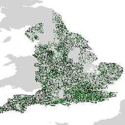
ชุดข้อมูล Farmscapes 2020 มีแผนที่ความน่าจะเป็นความละเอียดสูง (25 ซม.) สำหรับฟีเจอร์กึ่งธรรมชาติที่สำคัญ 3 อย่างในภูมิทัศน์ทางการเกษตรของอังกฤษ ได้แก่ แนวพุ่มไม้ ป่าไม้ และกำแพงหิน ชุดข้อมูลนี้ได้รับการพัฒนาโดยความร่วมมือกับ Leverhulme Centre for Nature Recovery ที่ Oxford เพื่อใช้เป็นพื้นฐานสำหรับแอปพลิเคชัน … ความหลากหลายทางชีวภาพ สภาพอากาศ การอนุรักษ์ การเชื่อมต่อเชิงนิเวศ ป่าไม้ การใช้ประโยชน์ที่ดินและสิ่งปกคลุมดิน -
Farmscapes 2020 Vectorised
นี่คือชุดข้อมูลแรสเตอร์ Farmscapes 2020 เวอร์ชันเวกเตอร์ โดยมีรูปทรงเรขาคณิตแบบรูปหลายเหลี่ยมที่แสดงถึงลักษณะภูมิทัศน์กึ่งธรรมชาติในระดับละเอียด (โดยเฉพาะแนวพุ่มไม้ ป่าไม้ และกำแพงหิน) ทั่วทั้งภูมิทัศน์ทางการเกษตรของอังกฤษ ชุดข้อมูลนี้พัฒนาขึ้นโดยความร่วมมือกับ Oxford Leverhulme Centre for Nature Recovery เพื่อ … ความหลากหลายทางชีวภาพ สภาพอากาศ การอนุรักษ์ การเชื่อมต่อเชิงนิเวศ ป่าไม้ การใช้ประโยชน์ที่ดินและสิ่งปกคลุมดิน -
การจำแนกประเภทป่า (ForTy) 2020 v1.0
ชุดข้อมูลการจำแนกประเภทป่าไม้ (ForTy) v1 ประกอบด้วยแผนที่ความน่าจะเป็นต่อชั้นทั่วโลกที่ความละเอียด 10 เมตร ซึ่งครอบคลุมพื้นที่ทั้งหมดระหว่างละติจูด 65°S ถึง 84°N สำหรับปี 2020 การแบ่งประเภท 6 คลาสสอดคล้องกับคำจำกัดความของ FAO และกฎระเบียบว่าด้วยการตัดไม้ทำลายป่าของสหภาพยุโรป (EUDR) โดยคลาส 1 … alphaearth-derived ความหลากหลายทางชีวภาพ สภาพภูมิอากาศ การอนุรักษ์สิ่งแวดล้อม การตัดไม้ทำลายป่า eudr -
อุณหภูมิพื้นผิวดินระดับ 3 ของ GCOM-C/SGLI (V1)

ผลิตภัณฑ์นี้คืออุณหภูมิของพื้นผิวดินบนบก นอกจากนี้ ยังมี JAXA/GCOM-C/L3/LAND/LST/V3 เวอร์ชันใหม่กว่าสำหรับชุดข้อมูลนี้ ซึ่งใช้อัลกอริทึมนี้ในการประมวลผล GCOM-C ดำเนินการสังเกตการณ์และรวบรวมข้อมูลทั่วโลกอย่างต่อเนื่องในระยะยาวเพื่ออธิบายกลไกที่อยู่เบื้องหลังความผันผวนของงบประมาณรังสีและ … สภาพอากาศ g-portal gcom gcom-c jaxa land -
อุณหภูมิพื้นผิวดินระดับ 3 ของ GCOM-C/SGLI (V2)
ผลิตภัณฑ์นี้คืออุณหภูมิของพื้นผิวดินบนบก สำหรับข้อมูลหลังวันที่ 28-11-2021 โปรดดูชุดข้อมูล V3 GCOM-C ดำเนินการสังเกตการณ์และรวบรวมข้อมูลทั่วโลกอย่างต่อเนื่องในระยะยาวเพื่ออธิบายกลไกเบื้องหลังความผันผวนของงบประมาณรังสีและวัฏจักรคาร์บอนที่จำเป็นต่อการคาดการณ์ที่แม่นยำเกี่ยวกับ … สภาพอากาศ g-portal gcom gcom-c jaxa land -
อุณหภูมิพื้นผิวดินระดับ 3 ของ GCOM-C/SGLI (V3)

ผลิตภัณฑ์นี้คืออุณหภูมิของพื้นผิวดินบนบก นี่คือชุดข้อมูลที่อัปเดตอย่างต่อเนื่องโดยมีความหน่วง 3-4 วัน GCOM-C ดำเนินการสังเกตการณ์และรวบรวมข้อมูลทั่วโลกอย่างต่อเนื่องในระยะยาวเพื่ออธิบายกลไกเบื้องหลังความผันผวนของงบประมาณรังสีและวัฏจักรคาร์บอนที่จำเป็นต่อการสร้าง … สภาพอากาศ g-portal gcom gcom-c jaxa land -
อุณหภูมิผิวน้ำทะเล L3 ของ GCOM-C/SGLI (V1)

ผลิตภัณฑ์นี้คืออุณหภูมิของผิวน้ำทะเล นอกจากนี้ ชุดข้อมูลนี้ยังมี JAXA/GCOM-C/L3/OCEAN/SST/V3 เวอร์ชันใหม่กว่าซึ่งใช้อัลกอริทึมนี้ในการประมวลผลด้วย GCOM-C ดำเนินการสังเกตการณ์และรวบรวมข้อมูลทั่วโลกอย่างต่อเนื่องในระยะยาวเพื่ออธิบายกลไกเบื้องหลังความผันผวนของงบประมาณรังสีและคาร์บอน … สภาพอากาศ g-portal gcom gcom-c jaxa มหาสมุทร -
อุณหภูมิผิวน้ำทะเลระดับ 3 (V2) ของ GCOM-C/SGLI
ผลิตภัณฑ์นี้คืออุณหภูมิของผิวน้ำทะเล สำหรับข้อมูลหลังวันที่ 28-11-2021 โปรดดูชุดข้อมูล V3 GCOM-C ดำเนินการสังเกตการณ์และรวบรวมข้อมูลทั่วโลกอย่างต่อเนื่องในระยะยาวเพื่ออธิบายกลไกเบื้องหลังความผันผวนของงบประมาณรังสีและวัฏจักรคาร์บอนที่จำเป็นต่อการคาดการณ์ที่แม่นยำเกี่ยวกับอนาคต … สภาพอากาศ g-portal gcom gcom-c jaxa มหาสมุทร -
อุณหภูมิผิวน้ำทะเลระดับ 3 ของ GCOM-C/SGLI (V3)

ผลิตภัณฑ์นี้คืออุณหภูมิของผิวน้ำทะเล นี่คือชุดข้อมูลที่อัปเดตอย่างต่อเนื่องโดยมีความหน่วง 3-4 วัน GCOM-C ดำเนินการสังเกตการณ์และรวบรวมข้อมูลทั่วโลกอย่างต่อเนื่องในระยะยาวเพื่ออธิบายกลไกเบื้องหลังความผันผวนของงบประมาณรังสีและวัฏจักรคาร์บอนที่จำเป็นต่อการสร้าง … ที่แม่นยำ สภาพอากาศ g-portal gcom gcom-c jaxa มหาสมุทร -
GFS: ข้อมูลชั้นบรรยากาศที่คาดการณ์ไว้ 384 ชั่วโมงของระบบพยากรณ์อากาศทั่วโลก
ระบบพยากรณ์อากาศทั่วโลก (Global Forecast System หรือ GFS) เป็นโมเดลพยากรณ์อากาศที่ผลิตโดยศูนย์พยากรณ์สิ่งแวดล้อมแห่งชาติ (National Centers for Environmental Prediction หรือ NCEP) ชุดข้อมูล GFS ประกอบด้วยเอาต์พุตของโมเดลที่เลือก (อธิบายไว้ด้านล่าง) เป็นตัวแปรพยากรณ์ที่จัดเรียงเป็นตารางกริด การพยากรณ์ 384 ชั่วโมงที่มีความละเอียด 1 ชั่วโมง (สูงสุด 120 ชั่วโมง) และ 3 ชั่วโมง (หลังจาก … สภาพอากาศ เมฆ ฟลักซ์ พยากรณ์ ธรณีฟิสิกส์ ความชื้น -
GLDAS-2.1: ระบบการดูดซึมข้อมูลภาคพื้นดินทั่วโลก

ระบบการปรับข้อมูลที่ดินทั่วโลกของ NASA เวอร์ชัน 2 (GLDAS-2) มี 3 องค์ประกอบ ได้แก่ GLDAS-2.0, GLDAS-2.1 และ GLDAS-2.2 GLDAS-2.0 บังคับใช้ข้อมูลอินพุตการบังคับทางอุตุนิยมวิทยาของพรินซ์ตันทั้งหมด และให้ชุดข้อมูลที่สอดคล้องกันตามเวลาตั้งแต่ปี 1948 ถึง 2014 GLDAS-2.1 ถูกบังคับให้ใช้ร่วมกับโมเดล … ทุก 3 ชั่วโมง สภาพอากาศ ชั้นน้ำแข็ง การระเหย การบังคับ ธรณีฟิสิกส์ -
GLDAS-2.2: ระบบการปรับข้อมูลที่ดินทั่วโลก

ระบบการปรับข้อมูลที่ดินทั่วโลกของ NASA เวอร์ชัน 2 (GLDAS-2) มี 3 องค์ประกอบ ได้แก่ GLDAS-2.0, GLDAS-2.1 และ GLDAS-2.2 GLDAS-2.0 บังคับใช้ข้อมูลอินพุตการบังคับทางอุตุนิยมวิทยาของพรินซ์ตันทั้งหมด และให้ชุดข้อมูลที่สอดคล้องกันตามเวลาตั้งแต่ปี 1948 ถึง 2014 GLDAS-2.1 ถูกบังคับให้ใช้ร่วมกับโมเดล … ทุก 3 ชั่วโมง สภาพอากาศ ชั้นน้ำแข็ง การระเหย การบังคับ ธรณีฟิสิกส์ -
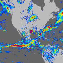
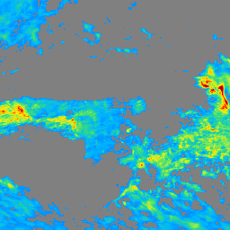
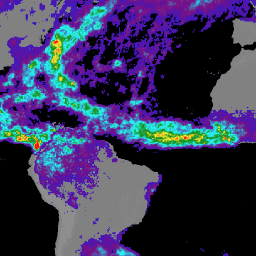
GPM: การวัดปริมาณหยาดน้ำฟ้าทั่วโลก (GPM) รุ่น 07
Global Precipitation Measurement (GPM) เป็นภารกิจดาวเทียมนานาชาติที่จัดทำขึ้นเพื่อให้การสังเกตการณ์ฝนและหิมะด้วยเทคโนโลยีรุ่นใหม่ทั่วโลกในทุกๆ 3 ชั่วโมง Integrated Multi-satellitE Retrievals for GPM (IMERG) เป็นอัลกอริทึมแบบรวมศูนย์ที่ให้ค่าประมาณปริมาณฝน โดยผสานข้อมูลจากเครื่องมือไมโครเวฟแบบพาสซีฟทั้งหมดใน GPM … สภาพอากาศ ธรณีฟิสิกส์ gpm imerg jaxa nasa -
GPM: การวัดปริมาณหยาดน้ำฟ้าทั่วโลกรายเดือน (GPM) v6
IMERG เวอร์ชันสุดท้าย "06" หยุดการผลิตในเดือนกันยายน 2021 คาดว่าจะเปิดตัวเวอร์ชัน "07" ในเดือนกันยายน 2022 Global Precipitation Measurement (GPM) เป็นภารกิจดาวเทียมนานาชาติที่จัดทำขึ้นเพื่อให้การสังเกตการณ์ฝนและหิมะด้วยเทคโนโลยีรุ่นใหม่ทั่วโลกในทุกๆ 3 ชั่วโมง The Integrated Multi-satellitE Retrievals for … สภาพอากาศ ธรณีฟิสิกส์ gpm imerg jaxa รายเดือน -
GPM: การวัดปริมาณหยาดน้ำฟ้าทั่วโลก (GPM) รายเดือน รุ่น 07
Global Precipitation Measurement (GPM) เป็นภารกิจดาวเทียมนานาชาติที่จัดทำขึ้นเพื่อให้การสังเกตการณ์ฝนและหิมะด้วยเทคโนโลยีรุ่นใหม่ทั่วโลกในทุกๆ 3 ชั่วโมง Integrated Multi-satellitE Retrievals for GPM (IMERG) เป็นอัลกอริทึมแบบรวมศูนย์ที่ให้ค่าประมาณปริมาณฝน โดยผสานข้อมูลจากเครื่องมือไมโครเวฟแบบพาสซีฟทั้งหมดใน GPM … สภาพอากาศ ธรณีฟิสิกส์ gpm imerg jaxa รายเดือน -
ภัยแล้ง GRIDMET: ดัชนีภัยแล้งของ CONUS
ชุดข้อมูลนี้มีดัชนีภัยแล้งที่ได้มาจากชุดข้อมูลอุตุนิยมวิทยาพื้นผิวแบบกริด (GRIDMET) รายวันขนาด 4 กม. ดัชนีภัยแล้งที่ระบุ ได้แก่ ดัชนีฝนมาตรฐาน (SPI), ดัชนีความต้องการภัยแล้งจากการระเหย (EDDI), ดัชนีวัดความแห้งแล้งของฝนที่ต่างจากค่าปกติ (SPEI), ดัชนีความรุนแรงด้านภัยแล้งของพาลเมอร์ (PDSI) และดัชนีพาลเมอร์ … สภาพอากาศ conus พืช ภัยแล้ง การคายระเหย geophysical -
GRIDMET: ชุดข้อมูลอุตุนิยมวิทยาพื้นผิวแบบกริดของมหาวิทยาลัยไอดาโฮ

ชุดข้อมูลอุตุนิยมวิทยาพื้นผิวแบบกริดให้ฟิลด์พื้นผิวรายวันที่มีความละเอียดเชิงพื้นที่สูง (~4 กม.) ของอุณหภูมิ ปริมาณน้ำฝน ลม ความชื้น และรังสีทั่วสหรัฐอเมริกาภาคพื้นทวีปตั้งแต่ปี 1979 ชุดข้อมูลนี้ผสมผสานข้อมูลเชิงพื้นที่ความละเอียดสูงจาก PRISM กับข้อมูลความละเอียดเชิงเวลาสูงจาก … climate gridmet humidity merced metdata precipitation -
GSMaP Operational: Global Satellite Mapping of Precipitation - V6
Global Satellite Mapping of Precipitation (GSMaP) ให้อัตราการเกิดฝนรายชั่วโมงทั่วโลกที่มีความละเอียด 0.1 x 0.1 องศา GSMaP เป็นผลิตภัณฑ์จากภารกิจ Global Precipitation Measurement (GPM) ซึ่งให้ข้อมูลการสังเกตการณ์ปริมาณหยาดน้ำฟ้าทั่วโลกทุกๆ 3 ชั่วโมง ระบบจะประมาณค่าโดยใช้แถบความถี่หลายแถบแบบพาสซีฟ … สภาพอากาศ ธรณีฟิสิกส์ gpm รายชั่วโมง jaxa หยาดน้ำฟ้า -
GSMaP Operational: Global Satellite Mapping of Precipitation - V7
Global Satellite Mapping of Precipitation (GSMaP) ให้อัตราการเกิดฝนรายชั่วโมงทั่วโลกที่มีความละเอียด 0.1 x 0.1 องศา GSMaP เป็นผลิตภัณฑ์จากภารกิจ Global Precipitation Measurement (GPM) ซึ่งให้ข้อมูลการสังเกตการณ์ปริมาณหยาดน้ำฟ้าทั่วโลกทุกๆ 3 ชั่วโมง ระบบจะประมาณค่าโดยใช้แถบความถี่หลายแถบแบบพาสซีฟ … สภาพอากาศ ธรณีฟิสิกส์ gpm รายชั่วโมง jaxa หยาดน้ำฟ้า -
GSMaP Operational: Global Satellite Mapping of Precipitation - V8

Global Satellite Mapping of Precipitation (GSMaP) ให้อัตราการเกิดฝนรายชั่วโมงทั่วโลกที่มีความละเอียด 0.1 x 0.1 องศา GSMaP เป็นผลิตภัณฑ์จากภารกิจ Global Precipitation Measurement (GPM) ซึ่งให้ข้อมูลการสังเกตการณ์ปริมาณหยาดน้ำฟ้าทั่วโลกทุกๆ 3 ชั่วโมง ระบบจะประมาณค่าโดยใช้แถบความถี่หลายแถบแบบพาสซีฟ … สภาพอากาศ ธรณีฟิสิกส์ gpm รายชั่วโมง jaxa หยาดน้ำฟ้า -
การวิเคราะห์ซ้ำของ GSMaP: การทำแผนที่ปริมาณน้ำฝนทั่วโลกจากดาวเทียม

Global Satellite Mapping of Precipitation (GSMaP) ให้อัตราการเกิดฝนรายชั่วโมงทั่วโลกที่มีความละเอียด 0.1 x 0.1 องศา GSMaP เป็นผลิตภัณฑ์จากภารกิจ Global Precipitation Measurement (GPM) ซึ่งให้ข้อมูลการสังเกตการณ์ปริมาณหยาดน้ำฟ้าทั่วโลกทุกๆ 3 ชั่วโมง ระบบจะประมาณค่าโดยใช้แถบความถี่หลายแถบแบบพาสซีฟ … สภาพอากาศ ธรณีฟิสิกส์ gpm รายชั่วโมง jaxa หยาดน้ำฟ้า -
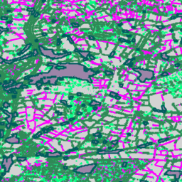
แผนที่ทั่วโลกของเขตภูมิอากาศในท้องถิ่น เวอร์ชันล่าสุด
นับตั้งแต่เปิดตัวในปี 2012 เขตภูมิอากาศท้องถิ่น (LCZ) ได้กลายเป็นมาตรฐานใหม่ในการระบุลักษณะภูมิทัศน์ในเมือง โดยมีแนวทางการจัดประเภทแบบองค์รวมที่คำนึงถึงสิ่งปกคลุมดินในระดับจุลภาคและคุณสมบัติทางกายภาพที่เกี่ยวข้อง แผนที่เขตภูมิอากาศในเมืองทั่วโลกนี้มีขนาดพิกเซล 100 เมตร และ… สภาพอากาศ สิ่งปกคลุมดิน การใช้ประโยชน์ที่ดินและสิ่งปกคลุมดิน เขตเมือง -
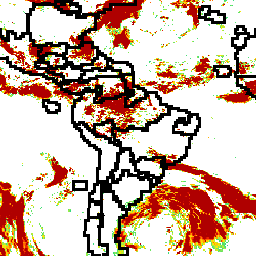
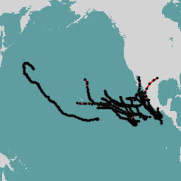
ที่เก็บถาวรของเส้นทางที่ดีที่สุดระหว่างประเทศสำหรับโครงการดูแลรักษาสภาพอากาศ
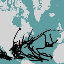
International Best Track Archive for Climate Stewardship (IBTrACS) ให้ข้อมูลตำแหน่งและความรุนแรงของพายุหมุนเขตร้อนทั่วโลก ข้อมูลครอบคลุมตั้งแต่ช่วงทศวรรษที่ 1840 จนถึงปัจจุบัน โดยทั่วไปจะให้ข้อมูลทุกๆ 3 ชั่วโมง แม้ว่าข้อมูลเส้นทางที่ดีที่สุดจะเน้นที่ตำแหน่งและความรุนแรง (ลมสูงสุดที่พัดต่อเนื่อง … สภาพอากาศ พายุเฮอริเคน noaa ตาราง สภาพอากาศ -
LST Day: Malaria Atlas Project Gap-Filled Daytime Land Surface Temperature (8-Daily 1km)

อุณหภูมิพื้นผิวดิน (LST) ในเวลากลางวันได้มาจากผลิตภัณฑ์ MOD11A2 v6.1 ของ MODIS ที่มีความละเอียดประมาณ 1 กม. ระบบจะแปลงข้อมูลผสม 8 วันเป็นองศาเซลเซียส จากนั้นจะเติมช่องว่างโดยใช้วิธีการที่ระบุไว้ใน Weiss et al (2014) เพื่อกำจัดข้อมูลที่ขาดหายไปซึ่งเกิดจากปัจจัยต่างๆ เช่น เมฆปกคลุม … climate lst malariaatlasproject map publisher-dataset surface-temperature -
LST Day: Malaria Atlas Project Gap-Filled Daytime Land Surface Temperature (Annual 1km)

อุณหภูมิพื้นผิวดิน (LST) ในเวลากลางวันได้มาจากผลิตภัณฑ์ MOD11A2 v6.1 ของ MODIS ที่มีความละเอียดประมาณ 1 กม. ระบบจะแปลงข้อมูลผสม 8 วันเป็นองศาเซลเซียส จากนั้นจะเติมช่องว่างโดยใช้วิธีการที่ระบุไว้ใน Weiss et al (2014) เพื่อกำจัดข้อมูลที่ขาดหายไปซึ่งเกิดจากปัจจัยต่างๆ เช่น เมฆปกคลุม … climate lst malariaatlasproject map publisher-dataset surface-temperature -
LST Day: Malaria Atlas Project Gap-Filled Daytime Land Surface Temperature (รายเดือน 1 กม.)

อุณหภูมิพื้นผิวดิน (LST) ในเวลากลางวันได้มาจากผลิตภัณฑ์ MOD11A2 v6.1 ของ MODIS ที่มีความละเอียดประมาณ 1 กม. ระบบจะแปลงข้อมูลผสม 8 วันเป็นองศาเซลเซียส จากนั้นจะเติมช่องว่างโดยใช้วิธีการที่ระบุไว้ใน Weiss et al (2014) เพื่อกำจัดข้อมูลที่ขาดหายไปซึ่งเกิดจากปัจจัยต่างๆ เช่น เมฆปกคลุม … climate lst malariaatlasproject map publisher-dataset surface-temperature -
LST Night: Malaria Atlas Project Gap-Filled Nighttime Land Surface Temperature (8-Daily 1km)

อุณหภูมิพื้นผิวดิน (LST) ในเวลากลางคืนได้มาจากผลิตภัณฑ์ MOD11A2 v6.1 ของ MODIS ที่มีความละเอียดประมาณ 1 กม. ระบบจะแปลงข้อมูลผสม 8 วันเป็นองศาเซลเซียส จากนั้นจะเติมช่องว่างโดยใช้วิธีการที่ระบุไว้ใน Weiss et al (2014) เพื่อกำจัดข้อมูลที่ขาดหายไปซึ่งเกิดจากปัจจัยต่างๆ เช่น เมฆปกคลุม … climate lst malariaatlasproject map publisher-dataset surface-temperature -
LST Night: Malaria Atlas Project Gap-Filled Nighttime Land Surface Temperature (Annual 1km)

อุณหภูมิพื้นผิวดิน (LST) ในเวลากลางคืนได้มาจากผลิตภัณฑ์ MOD11A2 v6.1 ของ MODIS ที่มีความละเอียดประมาณ 1 กม. ระบบจะแปลงข้อมูลผสม 8 วันเป็นองศาเซลเซียส จากนั้นจะเติมช่องว่างโดยใช้วิธีการที่ระบุไว้ใน Weiss et al (2014) เพื่อกำจัดข้อมูลที่ขาดหายไปซึ่งเกิดจากปัจจัยต่างๆ เช่น เมฆปกคลุม … climate lst malariaatlasproject map publisher-dataset surface-temperature -
LST Night: Malaria Atlas Project Gap-Filled Nighttime Land Surface Temperature (Monthly 1km)

อุณหภูมิพื้นผิวดิน (LST) ในเวลากลางคืนได้มาจากผลิตภัณฑ์ MOD11A2 v6.1 ของ MODIS ที่มีความละเอียดประมาณ 1 กม. ระบบจะแปลงข้อมูลผสม 8 วันเป็นองศาเซลเซียส จากนั้นจะเติมช่องว่างโดยใช้วิธีการที่ระบุไว้ใน Weiss et al (2014) เพื่อกำจัดข้อมูลที่ขาดหายไปซึ่งเกิดจากปัจจัยต่างๆ เช่น เมฆปกคลุม … climate lst malariaatlasproject map publisher-dataset surface-temperature -
สรุปรายเดือนของ MACAv2-METDATA: มหาวิทยาลัยไอดาโฮ, Multivariate Adaptive Constructed Analogs Applied to Global Climate Models

ชุดข้อมูล MACAv2-METDATA คือคอลเล็กชันของโมเดลสภาพอากาศทั่วโลก 20 รายการที่ครอบคลุมสหรัฐอเมริกาภาคพื้นทวีป วิธีการ Multivariate Adaptive Constructed Analogs (MACA) เป็นวิธีการลดขนาดทางสถิติซึ่งใช้ชุดข้อมูลการฝึก (เช่น ชุดข้อมูลการสังเกตการณ์ทางอุตุนิยมวิทยา) เพื่อลบอคติในอดีตและจับคู่รูปแบบเชิงพื้นที่ … สภาพอากาศ conus geophysical idaho maca รายเดือน -
MACAv2-METDATA: University of Idaho, Multivariate Adaptive Constructed Analogs Applied to Global Climate Models
ชุดข้อมูล MACAv2-METDATA คือคอลเล็กชันของโมเดลสภาพอากาศทั่วโลก 20 รายการที่ครอบคลุมสหรัฐอเมริกาภาคพื้นทวีป วิธีการ Multivariate Adaptive Constructed Analogs (MACA) เป็นวิธีการลดขนาดทางสถิติซึ่งใช้ชุดข้อมูลการฝึก (เช่น ชุดข้อมูลการสังเกตการณ์ทางอุตุนิยมวิทยา) เพื่อลบอคติในอดีตและจับคู่รูปแบบเชิงพื้นที่ … สภาพอากาศ conus geophysical idaho maca รายเดือน -
MCD18A1.062 Surface Radiation Daily/3-Hour
MCD18A1 เวอร์ชัน 6.2 เป็นผลิตภัณฑ์ระดับ 3 แบบกริดของรังสีคลื่นสั้นขาลง (DSR) ที่รวมกันของ Terra และ Aqua จาก Moderate Resolution Imaging Spectroradiometer (MODIS) ซึ่งสร้างขึ้นทุกวันที่ความละเอียดของพิกเซล 1 กิโลเมตร โดยมีค่าประมาณ DSR ทุก 3 ชั่วโมง DSR คือรังสีดวงอาทิตย์ที่ตกกระทบพื้นผิวโลก … สภาพอากาศ par รังสี -
MCD18C2.062 Photosynthetically Active Radiation Daily 3-Hour
MCD18C2 เวอร์ชัน 6.2 เป็นผลิตภัณฑ์ระดับ 3 แบบกริดของ Moderate Resolution Imaging Spectroradiometer (MODIS) Terra และ Aqua ที่รวม Photosynthetically Active Radiation (PAR) ซึ่งสร้างขึ้นทุกวันที่ความละเอียด 0.05 องศา (5,600 เมตรที่เส้นศูนย์สูตร) พร้อมค่าประมาณ PAR ทุก 3 ชั่วโมง PAR คือแสงอาทิตย์ที่ตกกระทบ … สภาพอากาศ par รังสี -
MERRA-2 M2T1NXFLX: การวินิจฉัยฟลักซ์พื้นผิว V5.12.4
M2T1NXFLX (หรือ tavg1_2d_flx_Nx) คือการรวบรวมข้อมูลที่หาค่าเฉลี่ยตามเวลาเป็นรายชั่วโมงในการวิเคราะห์ย้อนหลังยุคใหม่สำหรับงานวิจัยและการประยุกต์ใช้เวอร์ชัน 2 (MERRA-2) คอลเล็กชันนี้ประกอบด้วยการวินิจฉัยฟลักซ์พื้นผิวที่รวมกัน เช่น ปริมาณน้ำฝนทั้งหมด ปริมาณน้ำฝนทั้งหมดที่แก้ไขค่าความคลาดเคลื่อน อุณหภูมิอากาศที่พื้นผิว ความชื้นสัมพัทธ์ที่พื้นผิว ความเร็วลมที่พื้นผิว … สภาพอากาศ merra หยาดน้ำฟ้า sea-salt so2 so4 -
MERRA-2 M2T1NXLND: Land Surface Diagnostics V5.12.4
M2T1NXLND (หรือ tavg1_2d_lnd_Nx) คือการรวบรวมข้อมูลที่หาค่าเฉลี่ยตามเวลาเป็นรายชั่วโมงในการวิเคราะห์ย้อนหลังยุคปัจจุบันสำหรับงานวิจัยและการประยุกต์ใช้เวอร์ชัน 2 (MERRA-2) คอลเล็กชันนี้ประกอบด้วยการวินิจฉัยพื้นผิวดิน เช่น ฟลักซ์ฐาน การไหลบ่า ความชื้นในดินที่พื้นผิว ความชื้นในดินที่โซนราก น้ำที่ชั้นพื้นผิว น้ำที่ … สภาพอากาศ ไครโอสเฟียร์ การระเหย น้ำแข็ง merra หยาดน้ำฟ้า -
MERRA-2 M2T1NXRAD: การวินิจฉัยรังสี V5.12.4
M2T1NXRAD (หรือ tavg1_2d_rad_Nx) คือการรวบรวมข้อมูลที่หาค่าเฉลี่ยตามเวลาเป็นรายชั่วโมงในการวิเคราะห์ย้อนหลังยุคใหม่สำหรับการวิจัยและการประยุกต์ใช้เวอร์ชัน 2 (MERRA-2) คอลเล็กชันนี้ประกอบด้วยการวินิจฉัยรังสี เช่น อัตราส่วนสะท้อนของพื้นผิว เศษส่วนพื้นที่เมฆ ความหนาเชิงแสงในเมฆ ฟลักซ์คลื่นสั้นที่เข้ามายังพื้นผิว (เช่น รังสีจากดวงอาทิตย์) พื้นผิว … albedo atmosphere climate emissivity merra shortwave -
MERRA-2 M2T1NXSLV: การวินิจฉัยระดับเดียว V5.12.4
M2T1NXSLV (หรือ tavg1_2d_slv_Nx) คือการเก็บรวบรวมข้อมูล 2 มิติที่หาค่าเฉลี่ยตามเวลาเป็นรายชั่วโมงในการวิเคราะห์ย้อนหลังยุคใหม่สำหรับการวิจัยและการประยุกต์ใช้เวอร์ชัน 2 (MERRA-2) คอลเล็กชันนี้ประกอบด้วยการวินิจฉัยอุตุนิยมวิทยาที่ระดับความสูงที่ใช้กันโดยทั่วไป เช่น อุณหภูมิอากาศที่ 2 เมตร (หรือที่ 10 เมตร, 850hPa, 500 hPa, 250hPa) … ชั้นบรรยากาศ สภาพอากาศ ความชื้น merra nasa ความดัน -
MOD08_M3.061 Terra Atmosphere Monthly Global Product
MOD08_M3 V6.1 เป็นผลิตภัณฑ์ทั่วโลกเกี่ยวกับชั้นบรรยากาศซึ่งมีค่าเฉลี่ยแบบกริดรายเดือน 1 x 1 องศาของพารามิเตอร์ชั้นบรรยากาศ พารามิเตอร์เหล่านี้เกี่ยวข้องกับคุณสมบัติของอนุภาคละอองในชั้นบรรยากาศ ภาระโอโซนทั้งหมด ไอน้ำในชั้นบรรยากาศ คุณสมบัติทางแสงและทางกายภาพของเมฆ และดัชนีความเสถียรของชั้นบรรยากาศ The … atmosphere climate geophysical global modis monthly -
MOD11A1.061 Terra Land Surface Temperature and Emissivity Daily Global 1km

ผลิตภัณฑ์ MOD11A1 V6.1 ให้ค่าอุณหภูมิพื้นผิวดิน (LST) และค่าการแผ่รังสีรายวันในตารางกริดขนาด 1200 x 1200 กิโลเมตร ค่าอุณหภูมิได้มาจากผลิตภัณฑ์แถบ MOD11_L2 ที่ละติจูดสูงกว่า 30 องศา พิกเซลบางพิกเซลอาจมีการสังเกตการณ์หลายครั้งซึ่งมีเกณฑ์สำหรับท้องฟ้าแจ่มใส … สภาพอากาศ รายวัน การแผ่รังสี ทั่วโลก lst modis -
MOD11A2.061 อุณหภูมิพื้นผิวดินและความสามารถในการแผ่รังสีของ Terra 8 วันทั่วโลกที่ 1 กม.

ผลิตภัณฑ์ MOD11A2 V6.1 ให้ข้อมูลอุณหภูมิพื้นผิวดิน (LST) เฉลี่ย 8 วันในตารางกริดขนาด 1200 x 1200 กิโลเมตร ค่าพิกเซลแต่ละค่าใน MOD11A2 คือค่าเฉลี่ยอย่างง่ายของพิกเซล LST ของ MOD11A1 ที่สอดคล้องกันทั้งหมดซึ่งรวบรวมในช่วง 8 วันนั้น MOD11A2 จะทำ … 8 วัน สภาพอากาศ การแผ่รังสี ทั่วโลก lst mod11a2 -
MOD21A1D.061 อุณหภูมิพื้นผิวดินของ Terra และการแผ่รังสี 3 แถบรายวันทั่วโลกที่ 1 กม.

ชุดข้อมูล MOD21A1D สร้างขึ้นทุกวันจากผลิตภัณฑ์ LST ระดับกลางแบบกริด (L2G) ระดับ 2 ในเวลากลางวันที่มีความละเอียดเชิงพื้นที่ 1,000 เมตร กระบวนการ L2G จะแมปแกรนูลแถบ MOD21 รายวันลงในตารางกริด MODIS แบบไซน์และจัดเก็บข้อมูลการสังเกตทั้งหมดที่อยู่ในเซลล์กริด … สภาพอากาศ รายวัน การแผ่รังสี ทั่วโลก lst nasa -
MOD21A1N.061 Terra Land Surface Temperature and 3-Band Emissivity Daily Global 1km

ชุดข้อมูล MOD21A1N สร้างขึ้นทุกวันจากผลิตภัณฑ์ LST ระดับกลางแบบกริด (L2G) ระดับ 2 ในเวลากลางคืนที่มีความละเอียดเชิงพื้นที่ 1,000 เมตร กระบวนการ L2G จะแมปแกรนูลแถบ MOD21 รายวันลงในตารางกริด MODIS แบบไซน์และจัดเก็บข้อมูลการสังเกตทั้งหมดที่อยู่ในเซลล์กริด … สภาพอากาศ รายวัน การแผ่รังสี ทั่วโลก lst nasa -
MOD21C1.061 อุณหภูมิพื้นผิวดินของ Terra และการแผ่รังสี 3 แถบรายวัน L3 ทั่วโลก 0.05 Deg CMG
ชุดข้อมูล MOD21C1 สร้างขึ้นทุกวันในตารางกริดการสร้างแบบจำลองสภาพอากาศ (CMG) ขนาด 0.05 องศา (5,600 เมตรที่เส้นศูนย์สูตร) จากผลิตภัณฑ์ LST ระดับกลางแบบกริด (L2G) ระดับ 2 ในเวลากลางวัน กระบวนการ L2G จะแมปแกรนูลแถบ MOD21 รายวันลงในตารางกริด MODIS แบบไซน์และจัดเก็บข้อมูลทั้งหมด … สภาพอากาศ รายวัน การแผ่รังสี ทั่วโลก lst nasa -
MOD21C2.061 อุณหภูมิพื้นผิวดินและค่าการแผ่รังสี 3 แถบของ Terra 8 วัน L3 ทั่วโลก 0.05 Deg CMG

ชุดข้อมูล MOD21C2 เป็นผลิตภัณฑ์ LST แบบคอมโพสิต 8 วันที่ใช้อัลกอริทึมซึ่งอิงตามวิธีการหาค่าเฉลี่ยอย่างง่าย อัลกอริทึมจะคำนวณค่าเฉลี่ยจากการได้ข้อมูล MOD21A1D และ MOD21A1N ทุกวันแบบไม่มีเมฆในช่วง 8 วัน ซึ่งแตกต่างจากชุดข้อมูล MOD21A1 ที่ … climate emissivity global lst nasa surface-temperature -
MOD21C3.061 อุณหภูมิพื้นผิวดินของ Terra และการแผ่รังสี 3 แถบรายเดือน L3 ทั่วโลก 0.05 Deg CMG

ชุดข้อมูล MOD21C3 เป็นผลิตภัณฑ์ LST แบบคอมโพสิตรายเดือนที่ใช้อัลกอริทึมตามวิธีการหาค่าเฉลี่ยอย่างง่าย อัลกอริทึมจะคำนวณค่าเฉลี่ยจากการได้ข้อมูล MOD21A1D และ MOD21A1N ทุกวันแบบไม่มีเมฆในช่วง 8 วัน ซึ่งแตกต่างจากชุดข้อมูล MOD21A1 ที่ … สภาพอากาศ การแผ่รังสี ทั่วโลก lst รายเดือน nasa -
MYD08_M3.061 Aqua Atmosphere Monthly Global Product

MYD08_M3 V6.1 เป็นผลิตภัณฑ์ทั่วโลกเกี่ยวกับชั้นบรรยากาศที่มีค่าเฉลี่ยแบบตารางกริด 1 x 1 องศาของพารามิเตอร์ชั้นบรรยากาศรายเดือน พารามิเตอร์เหล่านี้เกี่ยวข้องกับคุณสมบัติของอนุภาคละอองในชั้นบรรยากาศ ภาระโอโซนทั้งหมด ไอน้ำในชั้นบรรยากาศ คุณสมบัติทางแสงและทางกายภาพของเมฆ และดัชนีความเสถียรของชั้นบรรยากาศ The … aqua ชั้นบรรยากาศ สภาพอากาศ geophysical global modis -
MYD11A1.061 อุณหภูมิพื้นผิวดินและความสามารถในการแผ่รังสีของ Aqua รายวันทั่วโลกที่ 1 กม.

ผลิตภัณฑ์ MYD11A1 V6.1 ให้ค่าอุณหภูมิพื้นผิวดิน (LST) และค่าการแผ่รังสีรายวันในตารางกริดขนาด 1200 x 1200 กิโลเมตร ค่าอุณหภูมิได้มาจากผลิตภัณฑ์แถบ MYD11_L2 ที่ละติจูดสูงกว่า 30 องศา พิกเซลบางพิกเซลอาจมีการสังเกตการณ์หลายครั้งซึ่งมีเกณฑ์สำหรับท้องฟ้าแจ่มใส … aqua climate daily emissivity global lst -
MYD11A2.061 อุณหภูมิพื้นผิวดินและความสามารถในการแผ่รังสีของ Aqua แบบ 8 วันทั่วโลกที่ 1 กม.
ผลิตภัณฑ์ MYD11A2 V6.1 แสดงอุณหภูมิพื้นผิวดิน (LST) เฉลี่ย 8 วันในตารางกริดขนาด 1200 x 1200 กิโลเมตร ค่าพิกเซลแต่ละค่าใน MYD11A2 คือค่าเฉลี่ยอย่างง่ายของพิกเซล LST ของ MYD11A1 ที่สอดคล้องกันทั้งหมดซึ่งรวบรวมในช่วง 8 วันนั้น MYD11A2 ทำ … 8 วัน aqua climate emissivity global lst -
MYD21A1D.061 อุณหภูมิพื้นผิวดินและค่าการแผ่รังสี 3 แถบของ Aqua รายวันทั่วโลกที่ 1 กม.

ชุดข้อมูล MYD21A1D สร้างขึ้นทุกวันจากผลิตภัณฑ์ LST ระดับกลางแบบกริด (L2G) ระดับ 2 ในเวลากลางวันที่มีความละเอียดเชิงพื้นที่ 1,000 เมตร กระบวนการ L2G จะแมปแกรนูลแถบ MOD21 รายวันลงในตารางกริด MODIS แบบไซน์และจัดเก็บข้อมูลการสังเกตทั้งหมดที่อยู่ในเซลล์กริด … aqua climate daily emissivity global lst -
MYD21A1N.061 อุณหภูมิพื้นผิวดินของ Aqua และการแผ่รังสี 3 แถบรายวันทั่วโลกที่ 1 กม.

ชุดข้อมูล MYD21A1N สร้างขึ้นทุกวันจากผลิตภัณฑ์ LST ระดับกลางแบบกริด (L2G) ระดับ 2 ในเวลากลางคืนที่มีความละเอียดเชิงพื้นที่ 1,000 เมตร กระบวนการ L2G จะแมปแกรนูลแถบ MOD21 รายวันลงในตารางกริด MODIS แบบไซน์และจัดเก็บข้อมูลการสังเกตทั้งหมดที่อยู่ในเซลล์กริด … aqua climate daily emissivity global lst -
MYD21C1.061 อุณหภูมิพื้นผิวดินและค่าการแผ่รังสี 3 แถบของ Aqua รายวัน L3 ทั่วโลก 0.05 Deg CMG

ชุดข้อมูล MYD21C1 สร้างขึ้นทุกวันในตารางกริดการจำลองสภาพอากาศ (CMG) ขนาด 0.05 องศา (5,600 เมตรที่เส้นศูนย์สูตร) จากผลิตภัณฑ์ LST ระดับกลางแบบกริด (L2G) ระดับ 2 ในเวลากลางวัน กระบวนการ L2G จะแมปแกรนูลแถบ MYD21 รายวันลงในตารางกริด MODIS แบบไซน์และจัดเก็บข้อมูลทั้งหมด … aqua climate daily emissivity global lst -
MYD21C2.061 อุณหภูมิพื้นผิวและค่าการแผ่รังสี 3 แถบของ Aqua 8 วัน L3 ทั่วโลก 0.05 Deg CMG

ชุดข้อมูล MYD21C2 เป็นผลิตภัณฑ์ LST แบบคอมโพสิต 8 วันที่ใช้อัลกอริทึมตามวิธีการหาค่าเฉลี่ยอย่างง่าย อัลกอริทึมจะคำนวณค่าเฉลี่ยจากการได้ข้อมูล MYD21A1D และ MYD21A1N แบบรายวันทั้งหมดที่ไม่มีเมฆในช่วง 8 วัน ซึ่งแตกต่างจากชุดข้อมูล MYD21A1 ที่ … aqua สภาพอากาศ การแผ่รังสี ทั่วโลก lst nasa -
MYD21C3.061 อุณหภูมิพื้นผิวดินและค่าการแผ่รังสี 3 แถบของ Aqua รายเดือน ระดับ 3 ทั่วโลก 0.05 Deg CMG

ชุดข้อมูล MYD21C3 เป็นผลิตภัณฑ์ LST แบบคอมโพสิตรายเดือนที่ใช้อัลกอริทึมตามวิธีการหาค่าเฉลี่ยอย่างง่าย อัลกอริทึมจะคำนวณค่าเฉลี่ยจากการได้ข้อมูล MYD21A1D และ MYD21A1N แบบรายวันทั้งหมดที่ไม่มีเมฆในช่วง 8 วัน ซึ่งแตกต่างจากชุดข้อมูล MYD21A1 ที่ … aqua climate emissivity global lst monthly -
ความเข้มข้นของมีเทนAIR L3 เวอร์ชัน 1.1.0
ชุดข้อมูลนี้ให้ข้อมูลเชิงพื้นที่สำหรับเศษส่วนโมลของอากาศแห้งทั้งหมดตลอดแนวคอลัมน์ของมีเทนในชั้นบรรยากาศ "XCH4" ตามที่สังเกตได้จากสเปกโตรมิเตอร์การถ่ายภาพ MethaneAIR XCH4 หมายถึงปริมาณคอลัมน์ทั้งหมด (จำนวนโมเลกุล) ของมีเทน ("CH4") หารด้วยปริมาณทั้งหมด … ชั้นบรรยากาศ สภาพอากาศ edf edf-methanesat-ee การปล่อยก๊าซ ghg -
ความเข้มข้นของมีเทนAIR L3 v1
ชุดข้อมูลนี้ให้ข้อมูลเชิงพื้นที่สำหรับเศษส่วนโมลของอากาศแห้งทั้งหมดตลอดแนวคอลัมน์ของมีเทนในชั้นบรรยากาศ "XCH4" ตามที่สังเกตได้จากสเปกโตรมิเตอร์การถ่ายภาพ MethaneAIR XCH4 หมายถึงปริมาณคอลัมน์ทั้งหมด (จำนวนโมเลกุล) ของมีเทน ("CH4") หารด้วยปริมาณทั้งหมด … ชั้นบรรยากาศ สภาพอากาศ edf การปล่อยก๊าซ ghg มีเทน -
แหล่งที่มาของพื้นที่ MethaneAIR L4 v1
โมเดลการปล่อยก๊าซเรือนกระจกในพื้นที่ยังอยู่ระหว่างการพัฒนาและไม่ได้แสดงถึงผลิตภัณฑ์ขั้นสุดท้าย ชุดข้อมูลนี้แสดงฟลักซ์การปล่อยก๊าซมีเทนที่แยกตามพื้นที่ (กก./ชม.) โดยใช้การวัดจากการบินของ MethaneAIR ซึ่งมุ่งเน้นไปที่ภูมิภาคที่ผลิตน้ำมันและก๊าซทั่วสหรัฐอเมริกา การปล่อยก๊าซทั้งหมดสำหรับการสำรวจ … ชั้นบรรยากาศ สภาพอากาศ edf การปล่อยก๊าซ ghg มีเทน -
แหล่งกำเนิดก๊าซมีเทน L4 V1.1.0
ชุดข้อมูลนี้ให้ข้อมูลสำหรับการตรวจหาแหล่งกำเนิดก๊าซมีเทนที่ปล่อยออกมาสูง (กก./ชม.) ในพื้นที่สกัดน้ำมันและก๊าซหรือถ่านหิน 13 แห่งตั้งแต่โคโลราโด นิวเม็กซิโก และเท็กซัสทางตะวันตก ไปจนถึงเพนซิลเวเนีย โอไฮโอ และเวสต์เวอร์จิเนียทางตะวันออก รวมถึงพื้นที่ในเมือง 3 แห่ง (นิวยอร์กซิตี้ … ชั้นบรรยากาศ สภาพอากาศ edf edf-methanesat-ee การปล่อยก๊าซ ghg -
แหล่งที่มาของก๊าซมีเทน L4 v1

ชุดข้อมูลนี้ให้ข้อมูลสำหรับการตรวจหาแหล่งกำเนิดก๊าซมีเทนที่ปล่อยออกมาสูง (กก./ชม.) ในพื้นที่สกัดน้ำมันและก๊าซหรือถ่านหิน 13 แห่งตั้งแต่โคโลราโด นิวเม็กซิโก และเท็กซัสทางตะวันตก ไปจนถึงเพนซิลเวเนีย โอไฮโอ และเวสต์เวอร์จิเนียทางตะวันออก รวมถึงพื้นที่ในเมือง 3 แห่ง (นิวยอร์กซิตี้ … ชั้นบรรยากาศ สภาพอากาศ edf การปล่อยก๊าซ ghg มีเทน -
เวอร์ชันตัวอย่างแบบสาธารณะของความเข้มข้นของมีเทนแซท L3 V1.0.0

ชุดข้อมูล "ตัวอย่างเวอร์ชันสาธารณะ" ในระยะแรกนี้ให้ข้อมูลเชิงพื้นที่สำหรับเศษส่วนโมลของมีเทนในอากาศแห้งที่เฉลี่ยตามคอลัมน์ในชั้นบรรยากาศ "XCH4" ซึ่งดึงข้อมูลจากการวัดโดยสเปกโตรมิเตอร์การถ่ายภาพ MethaneSAT XCH4 คือปริมาณคอลัมน์ทั้งหมด (จำนวนโมเลกุลเหนือพื้นที่ผิว 1 หน่วย) ของ … ชั้นบรรยากาศ สภาพอากาศ edf edf-methanesat-ee การปล่อยก๊าซ ghg -
MethaneSAT L4 Area Sources Public Preview V1.0.0

โมเดลการปล่อยก๊าซเรือนกระจกในพื้นที่กระจัดกระจายยังอยู่ระหว่างการพัฒนาและไม่ได้เป็นตัวแทนของผลิตภัณฑ์ขั้นสุดท้าย ชุดข้อมูล "ตัวอย่างเวอร์ชันสาธารณะ" ในระยะแรกนี้ให้ข้อมูลที่มีความแม่นยำสูงสำหรับการปล่อยก๊าซมีเทนจากแหล่งที่มาในพื้นที่กระจัดกระจาย ข้อมูลการปล่อยก๊าซเรือนกระจกเหล่านี้มาจากแอ่งแอปปาเลเชียน เพอร์เมียน และอูอินตาใน… ชั้นบรรยากาศ สภาพอากาศ edf edf-methanesat-ee การปล่อยก๊าซ ghg -
MethaneSAT L4 Area Sources Public Preview V2.0.0

โมเดลการปล่อยก๊าซเรือนกระจกในพื้นที่กระจัดกระจายยังอยู่ระหว่างการพัฒนาและไม่ได้เป็นตัวแทนของผลิตภัณฑ์ขั้นสุดท้าย ชุดข้อมูล "ตัวอย่างเวอร์ชันสาธารณะ" ในระยะแรกนี้ให้ข้อมูลที่มีความแม่นยำสูงสำหรับการปล่อยก๊าซมีเทนจากแหล่งที่มาในพื้นที่กระจัดกระจาย การวัดผลแบบใหม่เหล่านี้แสดงให้เห็นถึงความสำคัญของการวัดปริมาณการปล่อยก๊าซมีเทนทั้งหมดด้วยความแม่นยำสูง … ชั้นบรรยากาศ สภาพอากาศ edf edf-methanesat-ee การปล่อยก๊าซ ghg -
MethaneSAT L4 Point Sources Public Preview V1.0.0

ชุดข้อมูล "ตัวอย่างเวอร์ชันสาธารณะ" ระยะแรกนี้ให้ข้อมูลที่มีความแม่นยำสูงสำหรับการปล่อยก๊าซมีเทนจากแหล่งกำเนิดแบบจุดที่แยกกัน ฟลักซ์การปล่อยก๊าซมีเทนเหล่านี้สร้างขึ้นโดยใช้กรอบการตรวจหาแหล่งกำเนิดแบบจุดและการวัดปริมาณการปล่อยก๊าซที่ออกแบบมาเป็นพิเศษเพื่อใช้ประโยชน์จากความละเอียดเชิงพื้นที่สูง ความครอบคลุมเชิงพื้นที่กว้าง และความแม่นยำสูงของ … ชั้นบรรยากาศ สภาพอากาศ edf edf-methanesat-ee การปล่อยก๊าซ ghg -
การวิเคราะห์ซ้ำ NCEP-DOE 2 (กริดเกาส์) ความครอบคลุมของเมฆทั้งหมด
เราจะไม่อัปเดตคอลเล็กชันนี้อีกต่อไป เราไม่ได้อัปเดตโมเดลที่แหล่งข้อมูลอีกต่อไป โปรเจ็กต์ NCEP-DOE Reanalysis 2 ใช้ระบบการวิเคราะห์/การพยากรณ์ที่ทันสมัยที่สุดเพื่อทำการปรับข้อมูลโดยใช้ข้อมูลในอดีตตั้งแต่ปี 1979 จนถึงปีก่อนหน้า ชั้นบรรยากาศ สภาพอากาศ เมฆ geophysical ncep noaa -
ข้อมูลการวิเคราะห์ซ้ำของ NCEP/NCAR, ความดันระดับน้ำทะเล [เลิกใช้งานแล้ว]
โครงการวิเคราะห์ซ้ำของ NCEP/NCAR เป็นโครงการร่วมระหว่างศูนย์พยากรณ์สิ่งแวดล้อมแห่งชาติ (NCEP เดิมคือ "NMC") กับศูนย์วิจัยบรรยากาศแห่งชาติ (NCAR) เป้าหมายของความพยายามร่วมกันนี้คือการวิเคราะห์ชั้นบรรยากาศใหม่โดยใช้ข้อมูลย้อนหลัง รวมถึง… ชั้นบรรยากาศ สภาพอากาศ geophysical ncep noaa ความดัน -
ข้อมูลการวิเคราะห์ซ้ำของ NCEP/NCAR, อุณหภูมิพื้นผิว [เลิกใช้งานแล้ว]

โครงการวิเคราะห์ซ้ำของ NCEP/NCAR เป็นโครงการร่วมระหว่างศูนย์พยากรณ์สิ่งแวดล้อมแห่งชาติ (NCEP เดิมคือ "NMC") กับศูนย์วิจัยบรรยากาศแห่งชาติ (NCAR) เป้าหมายของความพยายามร่วมกันนี้คือการวิเคราะห์ชั้นบรรยากาศใหม่โดยใช้ข้อมูลย้อนหลัง รวมถึง… ชั้นบรรยากาศ สภาพอากาศ geophysical ncep noaa reanalysis -
ข้อมูลการวิเคราะห์ซ้ำของ NCEP/NCAR, ไอน้ำ [เลิกใช้งานแล้ว]
โครงการวิเคราะห์ซ้ำของ NCEP/NCAR เป็นโครงการร่วมระหว่างศูนย์พยากรณ์สิ่งแวดล้อมแห่งชาติ (NCEP เดิมคือ "NMC") กับศูนย์วิจัยบรรยากาศแห่งชาติ (NCAR) เป้าหมายของความพยายามร่วมกันนี้คือการวิเคราะห์ชั้นบรรยากาศใหม่โดยใช้ข้อมูลย้อนหลัง รวมถึง… ชั้นบรรยากาศ สภาพอากาศ geophysical ncep noaa reanalysis -
NEX-DCP30: Ensemble Stats for NASA Earth Exchange Downscaled Climate Projections

ชุดข้อมูล NASA NEX-DCP30 ประกอบด้วยสถานการณ์จำลองสภาพอากาศที่ปรับขนาดลงสำหรับสหรัฐอเมริกาภาคพื้นทวีป ซึ่งได้มาจากการรันโมเดลการหมุนเวียนทั่วไป (GCM) ที่ดำเนินการภายใต้โครงการเปรียบเทียบโมเดลแบบคู่ระยะที่ 5 (CMIP5 ดู Taylor และคณะ 2012) และทั่วทั้งเรือนกระจก 4 หลัง … cag climate cmip5 geophysical ipcc nasa -
NEX-DCP30: การคาดการณ์สภาพภูมิอากาศที่ปรับขนาดลงของ NASA Earth Exchange
ชุดข้อมูล NASA NEX-DCP30 ประกอบด้วยสถานการณ์จำลองสภาพอากาศที่ปรับขนาดลงสำหรับสหรัฐอเมริกาภาคพื้นทวีป ซึ่งได้มาจากการรันโมเดลการหมุนเวียนทั่วไป (GCM) ที่ดำเนินการภายใต้โครงการเปรียบเทียบโมเดลแบบคู่ระยะที่ 5 (CMIP5 ดู Taylor และคณะ 2012) และทั่วทั้งเรือนกระจก 4 หลัง … cag climate cmip5 geophysical ipcc nasa -
NEX-GDDP-CMIP6: การคาดการณ์สภาพภูมิอากาศแบบดาวน์สเกลรายวันทั่วโลกของ NASA Earth Exchange

ชุดข้อมูล NEX-GDDP-CMIP6 ประกอบด้วยสถานการณ์สภาพอากาศทั่วโลกที่ลดขนาดลงซึ่งได้มาจากการรันโมเดลการหมุนเวียนทั่วไป (GCM) ที่ดำเนินการภายใต้โครงการเปรียบเทียบโมเดลแบบคู่ระยะที่ 6 (CMIP6 ดู Thrasher และคณะ 2022) และใน 2 จาก 4 สถานการณ์การปล่อยก๊าซเรือนกระจก "ระดับ 1" … cag สภาพอากาศ gddp geophysical ipcc nasa -
NEX-GDDP: การคาดการณ์สภาพภูมิอากาศรายวันทั่วโลกที่ปรับขนาดลงของ NASA Earth Exchange
ชุดข้อมูล NASA NEX-GDDP ประกอบด้วยสถานการณ์สภาพอากาศที่ปรับขนาดลงสำหรับทั่วโลกซึ่งได้มาจากการรันโมเดลการหมุนเวียนทั่วไป (GCM) ที่ดำเนินการภายใต้โครงการเปรียบเทียบโมเดลแบบคู่ระยะที่ 5 (CMIP5 ดู Taylor และคณะ 2012) และใน 2 จาก 4 เรือนกระจก … cag สภาพอากาศ cmip5 gddp geophysical ipcc -
NLDAS-2: North American Land Data Assimilation System Forcing Fields
ระบบการปรับข้อมูลที่ดิน (LDAS) จะรวมแหล่งข้อมูลการสังเกตหลายแหล่ง (เช่น ข้อมูลเกจวัดปริมาณน้ำฝน ข้อมูลดาวเทียม และการวัดปริมาณน้ำฝนจากเรดาร์) เพื่อสร้างค่าประมาณคุณสมบัติทางภูมิอากาศที่หรือใกล้กับพื้นผิวโลก ชุดข้อมูลนี้เป็นไฟล์บังคับหลัก (ค่าเริ่มต้น) (ไฟล์ ก.) สำหรับระยะที่ … สภาพอากาศ การระเหย การบังคับ ธรณีฟิสิกส์ รายชั่วโมง ความชื้น -
NOAA CDR GRIDSAT-B1: อุณหภูมิความสว่างของช่อง IR แบบอยู่กับที่
หมายเหตุ: ผู้ให้บริการไม่ได้อัปเดตชุดข้อมูลนี้ตั้งแต่ปี 2024-03-31 เนื่องจากการอัปเดตโครงสร้างพื้นฐานที่ยังไม่เสร็จสิ้น ขณะนี้ยังไม่มีไทม์ไลน์ที่กำหนดว่าการอัปเดตชุดข้อมูลจะกลับมาดำเนินการได้เมื่อใด ชุดข้อมูลนี้ให้บันทึกข้อมูลสภาพอากาศ (CDR) คุณภาพสูงของการวัดค่าอินฟราเรดทั่วโลกจากดาวเทียมวงโคจรค้างฟ้า … ความสว่าง cdr สภาพอากาศ อินฟราเรด noaa ภาพสะท้อน -
NOAA CDR PATMOSX: คุณสมบัติของเมฆ การสะท้อน และอุณหภูมิความสว่าง เวอร์ชัน 5.3
ชุดข้อมูลนี้มีบันทึกข้อมูลสภาพอากาศ (CDR) คุณภาพสูงเกี่ยวกับคุณสมบัติของเมฆหลายอย่าง พร้อมด้วยอุณหภูมิความสว่างและการสะท้อนของ Advanced Very High Resolution Radiometer (AVHRR) Pathfinder Atmospheres Extended (PATMOS-x) ข้อมูลเหล่านี้ได้รับการปรับให้เข้ากับกริดมุมเท่าขนาด 0.1 x 0.1 โดยมีทั้งแบบขึ้นและ… atmospheric avhrr brightness cdr climate cloud -
แคตตาล็อกเฮอร์ริเคนแอตแลนติก HURDAT2 ของ NOAA NHC
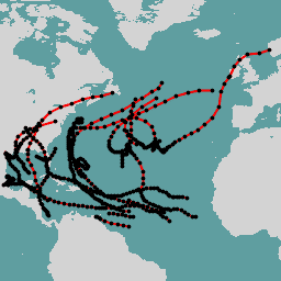
ฐานข้อมูลเส้นทางที่ดีที่สุดของเฮอร์ริเคน (HURDAT2) แอ่งแอตแลนติก ค.ศ. 1851-2018 สภาพอากาศ พายุเฮอริเคน nhc noaa ตาราง สภาพอากาศ -
แคตตาล็อกเฮอริเคนในมหาสมุทรแปซิฟิก HURDAT2 ของ NHC จาก NOAA
ฐานข้อมูลเส้นทางที่ดีที่สุดของเฮอร์ริเคน (HURDAT2) อ่างแปซิฟิก ค.ศ. 1949-2018 สภาพอากาศ พายุเฮอริเคน nhc noaa ตาราง สภาพอากาศ -
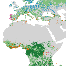
ป่าธรรมชาติของโลกปี 2020

ป่าธรรมชาติของโลกปี 2020 แสดงแผนที่ทั่วโลกเกี่ยวกับความเป็นไปได้ของป่าธรรมชาติในปี 2020 ที่ความละเอียด 10 เมตร เลเยอร์นี้ได้รับการพัฒนาขึ้นเพื่อสนับสนุนโครงการริเริ่มต่างๆ เช่น European Union's Deforestation Regulation (EUDR) และความพยายามอื่นๆ ในการอนุรักษ์และเฝ้าระวังรักษาป่า แผนที่ … ความหลากหลายทางชีวภาพ สภาพอากาศ การอนุรักษ์ การตัดไม้ทำลายป่า eudr ป่าไม้ -
ค่ามัธยฐานรายเดือนของอุณหภูมิพื้นผิวดินในระยะยาวช่วงกลางวันของ OpenLandMap

ค่าเฉลี่ยรายเดือนของอุณหภูมิพื้นผิวดินในเวลากลางวัน ปี 2000-2017 คำนวณโดยใช้แพ็กเกจ data.table และฟังก์ชันควอนไทล์ใน R ดูข้อมูลเพิ่มเติมเกี่ยวกับผลิตภัณฑ์ LST ของ MODIS ได้ที่หน้านี้ ไม่รวมทวีปแอนตาร์กติกา หากต้องการเข้าถึงและแสดงภาพแผนที่ภายนอก Earth Engine ให้ใช้หน้านี้ … สภาพอากาศ envirometrix lst mod11a2 modis รายเดือน -
ค่าเบี่ยงเบนมาตรฐานรายเดือนของอุณหภูมิพื้นผิวดินในระยะยาวช่วงกลางวันของ OpenLandMap
ค่าเบี่ยงเบนมาตรฐานของอุณหภูมิ LST ในเวลากลางวันและกลางคืนของ MODIS ในระยะยาวที่ 1 กม. โดยอิงตามอนุกรมเวลาปี 2000-2017 คำนวณโดยใช้แพ็กเกจ data.table และฟังก์ชันควอนไทล์ใน R ดูข้อมูลเพิ่มเติมเกี่ยวกับผลิตภัณฑ์ LST ของ MODIS ได้ที่หน้านี้ ไม่รวมทวีปแอนตาร์กติกา หากต้องการเข้าถึง … สภาพอากาศ envirometrix lst mod11a2 modis รายเดือน -
ความแตกต่างระหว่างกลางวันและกลางคืนของอุณหภูมิพื้นผิวดินระยะยาวรายเดือนของ OpenLandMap

ความแตกต่างของ LST ในช่วงกลางวันและกลางคืนของ MODIS ในระยะยาวที่ 1 กม.โดยอิงตามอนุกรมเวลาปี 2000-2017 ซึ่งได้มาจากการใช้แพ็กเกจ data.table และฟังก์ชันควอนไทล์ใน R ดูข้อมูลเพิ่มเติมเกี่ยวกับผลิตภัณฑ์ LST ของ MODIS ได้ที่หน้านี้ ไม่รวมทวีปแอนตาร์กติกา หากต้องการเข้าถึงและแสดงภาพ … climate day envirometrix lst mod11a2 modis -
Oya: การประมาณปริมาณน้ำฝน ลูกเห็บ หรือหิมะตกทั่วโลกแบบกึ่งหนึ่งที่ระยะ 5 กม.
Oya เป็นชุดข้อมูลการประมาณหยาดน้ำฟ้าความละเอียดสูงแบบกึ่งทั่วโลกที่ได้มาจากการสังเกตการณ์ดาวเทียมวงโคจรค้างฟ้า (GEO) โมเดล Oya ใช้ช่องสัญญาณที่มองเห็นได้และอินฟราเรด (VIS-IR) ทั้งหมดจากกลุ่มดาวเทียม GEO ซึ่งรวมถึง GOES-16/18, Meteosat-9/10 และ Himawari-8/9 เพื่อสร้างการประมาณปริมาณหยาดน้ำฟ้าครอบคลุม … สภาพอากาศ ธรณีฟิสิกส์ gpm หยาดน้ำฟ้า ชุดข้อมูลของผู้เผยแพร่ ภูมิอากาศ -
PERSIANN-CDR: การประมาณปริมาณน้ำฝนจากข้อมูลที่รับรู้จากระยะไกลโดยใช้โครงข่ายประสาทเทียม - บันทึกข้อมูลสภาพอากาศ
PERSIANN-CDR เป็นผลิตภัณฑ์ปริมาณน้ำฝนรายวันแบบกึ่งทั่วโลกซึ่งครอบคลุมช่วงเวลาตั้งแต่วันที่ 01-01-1983 จนถึงปัจจุบัน ข้อมูลนี้จัดทำขึ้นทุกไตรมาส โดยปกติแล้วจะมีการหน่วงเวลา 3 เดือน ผลิตภัณฑ์นี้พัฒนาโดย Center for Hydrometeorology and Remote Sensing ที่ University of California, Irvine … cdr สภาพอากาศ ธรณีฟิสิกส์ noaa หยาดน้ำฟ้า ภูมิอากาศ -
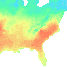
ชุดข้อมูลสภาพอากาศเชิงพื้นที่รายวันของ PRISM
ชุดข้อมูลรายวันและรายเดือนของ PRISM เป็นชุดข้อมูลสภาพอากาศแบบกริดสำหรับสหรัฐอเมริกาที่อยู่ติดกัน ซึ่งผลิตโดย PRISM Climate Group ที่ Oregon State University คอลเล็กชันนี้มีทั้งข้อมูล AN81 และ AN91 ซึ่งระบุโดยพร็อพเพอร์ตี้ "dataset_type" โดยกริดได้รับการพัฒนาโดยใช้ PRISM (Parameter-elevation Regressions … สภาพอากาศ รายวัน ธรณีฟิสิกส์ oregonstate หยาดน้ำฟ้า ความกดอากาศ -
ชุดข้อมูลสภาพอากาศระยะยาวเฉลี่ยของ PRISM Norm91m
ชุดข้อมูลรายวันและรายเดือนของ PRISM เป็นชุดข้อมูลสภาพอากาศแบบกริดสำหรับสหรัฐอเมริกาที่อยู่ติดกัน ซึ่งผลิตโดย PRISM Climate Group ที่ Oregon State University โดยกริดได้รับการพัฒนาโดยใช้ PRISM (Parameter-elevation Regressions on Independent Slopes Model) กิจวัตรการประมาณค่า PRISM จะจำลองว่าสภาพอากาศและภูมิอากาศแตกต่างกันอย่างไร … สภาพอากาศ ธรณีฟิสิกส์ oregonstate หยาดน้ำฟ้า ความดัน prism -
ชุดข้อมูลสภาพอากาศเชิงพื้นที่รายเดือนของ PRISM ANm
ชุดข้อมูลรายวันและรายเดือนของ PRISM เป็นชุดข้อมูลสภาพอากาศแบบกริดสำหรับสหรัฐอเมริกาที่อยู่ติดกัน ซึ่งผลิตโดย PRISM Climate Group ที่ Oregon State University คอลเล็กชันนี้มีทั้งข้อมูล AN81 และ AN91 ตามที่ระบุไว้ในพร็อพเพอร์ตี้ "dataset_type" โดยกริดได้รับการพัฒนาโดยใช้ PRISM (Parameter-elevation … สภาพอากาศ ธรณีฟิสิกส์ รายเดือน oregonstate หยาดน้ำฟ้า ความดัน -
RTMA: การวิเคราะห์แบบเมโซสเกลแบบเรียลไทม์
การวิเคราะห์เมโซสเกลแบบเรียลไทม์ (RTMA) คือการวิเคราะห์สภาพอากาศใกล้พื้นผิวที่มีความละเอียดเชิงพื้นที่และเวลาสูง ชุดข้อมูลนี้ประกอบด้วยการวิเคราะห์รายชั่วโมงที่ 2.5 กม. สำหรับ CONUS atmosphere climate cloud geophysical humidity noaa -
GLDAS-2.0 ที่ประมวลผลใหม่: ระบบการปรับข้อมูลที่ดินทั่วโลก

ระบบการปรับข้อมูลที่ดินทั่วโลกของ NASA เวอร์ชัน 2 (GLDAS-2) มี 3 องค์ประกอบ ได้แก่ GLDAS-2.0, GLDAS-2.1 และ GLDAS-2.2 GLDAS-2.0 บังคับใช้ข้อมูลอินพุตการบังคับทางอุตุนิยมวิทยาของพรินซ์ตันทั้งหมด และให้ชุดข้อมูลที่สอดคล้องกันตามเวลาตั้งแต่ปี 1948 ถึง 2014 GLDAS-2.1 ถูกบังคับให้ใช้ร่วมกับโมเดล … ทุก 3 ชั่วโมง สภาพอากาศ ชั้นน้ำแข็ง การระเหย การบังคับ ธรณีฟิสิกส์ -
SPEIbase: ฐานข้อมูลดัชนีวัดความแห้งแล้งของฝนที่ต่างจากค่าปกติ เวอร์ชัน 2.11
ฐานข้อมูล SPEI ทั่วโลก (SPEIbase) ให้ข้อมูลที่เชื่อถือได้ในระยะยาวเกี่ยวกับสภาวะภัยแล้งในระดับโลก โดยมีขนาดพิกเซล 0.5 องศาและรอบการอัปเดตรายเดือน โดยมีช่วงเวลา SPEI ตั้งแต่ 1 ถึง 48 เดือน ดัชนีวัดความแห้งแล้งของฝนที่ต่างจากค่าปกติ (SPEI) แสดงเป็นตัวแปรที่ได้มาตรฐาน … สภาพอากาศ การเปลี่ยนแปลงสภาพอากาศ ภัยแล้ง การคายระเหย ทั่วโลก รายเดือน -
Sentinel-5P OFFL CH4: มีเทนออฟไลน์
OFFL/L3_CH4 ชุดข้อมูลนี้แสดงภาพความละเอียดสูงแบบออฟไลน์ของความเข้มข้นของมีเทน ก๊าซมีเทน (CH4) เป็นก๊าซที่สำคัญที่สุดรองจากก๊าซคาร์บอนไดออกไซด์ (CO2) ที่ก่อให้เกิดปรากฏการณ์เรือนกระจกที่เพิ่มขึ้นจากกิจกรรมของมนุษย์ การปล่อยก๊าซมีเทนประมาณ 3 ใน 4 เกิดจากกิจกรรมของมนุษย์ ดังนั้นจึงควรบันทึก … ต่อไป ชั้นบรรยากาศ สภาพอากาศ copernicus esa eu knmi -
ข้อมูลโอโซนที่ผสานรวมของ TOMS และ OMI เวอร์ชัน 4
ข้อมูลจาก Total Ozone Mapping Spectrometer (TOMS) เป็นบันทึกข้อมูลหลักระยะยาวแบบต่อเนื่องจากการสังเกตการณ์ด้วยดาวเทียม ซึ่งใช้สำหรับติดตามแนวโน้มโอโซนรวมทั้งในระดับโลกและระดับภูมิภาค ตลอดช่วง 25 ปีที่ผ่านมา ข้อมูลนี้ผลิตโดยห้องปฏิบัติการสำหรับชั้นบรรยากาศที่ศูนย์การบินอวกาศ Goddard ของ NASA … ชั้นบรรยากาศ สภาพอากาศ geophysical nasa โอโซน -
TRMM 3B42: ค่าประมาณหยาดน้ำฟ้าทุก 3 ชั่วโมง
ภารกิจวัดปริมาณน้ำฝนเขตร้อน (TRMM) เป็นภารกิจร่วมระหว่าง NASA และองค์การสำรวจอวกาศญี่ปุ่น (JAXA) ซึ่งออกแบบมาเพื่อตรวจสอบและศึกษาปริมาณน้ำฝนเขตร้อน ผลิตภัณฑ์ 34B2 มีการรวมการตกตะกอนอินฟราเรด (มม./ชม.) แบบกริดที่ปรับ TRMM และค่าประมาณข้อผิดพลาดในการตกตะกอน RMS โดยมีช่วงเวลา 3 ชั่วโมง … ทุก 3 ชั่วโมง สภาพอากาศ ธรณีฟิสิกส์ jaxa nasa หยาดน้ำฟ้า -
TRMM 3B43: ค่าประมาณหยาดน้ำฟ้ารายเดือน
เราจะไม่อัปเดตคอลเล็กชันนี้อีกต่อไป ดูรายเดือนของ IMERG อัลกอริทึมชุดข้อมูลนี้จะผสานข้อมูลไมโครเวฟจากดาวเทียมหลายดวง ซึ่งรวมถึง SSMI, SSMIS, MHS, AMSU-B และ AMSR-E โดยแต่ละดวงจะได้รับการปรับเทียบร่วมกับเครื่องมือรวมของ TRMM อัลกอริทึม 3B43 จะทำงานเดือนละครั้งเพื่อสร้าง … สภาพอากาศ ธรณีฟิสิกส์ jaxa nasa หยาดน้ำฟ้า ปริมาณน้ำฝน -
TerraClimate: Monthly Climate and Climatic Water Balance for Global Terrestrial Surfaces, University of Idaho
TerraClimate เป็นชุดข้อมูลเกี่ยวกับสภาพอากาศรายเดือนและสมดุลน้ำตามสภาพอากาศสำหรับพื้นผิวโลกทั่วโลก โดยใช้การประมาณค่าที่ช่วยด้านสภาพภูมิอากาศ ซึ่งรวมค่าปกติทางภูมิอากาศความละเอียดเชิงพื้นที่สูงจากชุดข้อมูล WorldClim เข้ากับความละเอียดเชิงพื้นที่ที่หยาบกว่า แต่มีข้อมูลที่เปลี่ยนแปลงตามเวลาจาก CRU Ts4.0 และการวิเคราะห์ซ้ำ 55 ปีของญี่ปุ่น (JRA55) … สภาพอากาศ ภัยแล้ง การคายระเหย ธรณีฟิสิกส์ ทั่วโลก merced -
โครงการเปรียบเทียบแบบจำลองที่เชื่อมโยงระยะที่ 6 ของศูนย์อันตรายจากสภาพอากาศ (CHC) (CHC-CMIP6)
CHC-CMIP6 ได้รับการพัฒนาขึ้นโดยเฉพาะเพื่อรองรับการวิเคราะห์อันตรายที่เกี่ยวข้องกับสภาพอากาศในช่วงที่ผ่านมาและในอนาคตอันใกล้ ชุดข้อมูลการคาดการณ์สภาพอากาศนี้มีข้อมูลแบบกริดรายวันทั่วโลกสำหรับช่วงการสังเกต (1983-2016) และการคาดการณ์ (2030 และ 2050) เพื่อใช้ในการระบุและ … สภาพอากาศ ธรณีฟิสิกส์ หยาดน้ำฟ้า ucsb ภูมิอากาศ -
พื้นที่ดินอินทรีย์ที่ระบายน้ำของ FAO แห่งสหประชาชาติ (รายปี) 1.0

ชุดข้อมูล FAO ที่เกี่ยวข้อง 2 ชุดเกี่ยวกับดินอินทรีย์ที่ระบายน้ำจะให้ค่าประมาณต่อไปนี้ DROSA-A: พื้นที่ของดินอินทรีย์ (เป็นเฮกตาร์) ที่ระบายน้ำสำหรับกิจกรรมทางการเกษตร (พื้นที่เพาะปลูกและทุ่งหญ้าที่ใช้เลี้ยงสัตว์) DROSE-A: ค่าประมาณคาร์บอน (C) และไนตรัสออกไซด์ (N2O) (เป็นกิกะกรัม) จากการระบายน้ำทางการเกษตรของดินอินทรีย์ภายใต้ … การเกษตร สภาพอากาศ การเปลี่ยนแปลงสภาพภูมิอากาศ การปล่อยก๊าซ fao ghg -
VNP21A1D.002: อุณหภูมิพื้นผิวดินและค่าการแผ่รังสีในเวลากลางวันรายวัน 1 กม.

ผลิตภัณฑ์อุณหภูมิและความสามารถในการแผ่รังสี (LST&E) ของพื้นผิวดินในเวอร์ชัน 1 (VNP21A1D) ของ Visible Infrared Imaging Radiometer Suite (VIIRS) ของ NASA Suomi National Polar-Orbiting Partnership (Suomi NPP) รวบรวมขึ้นทุกวันจากผลิตภัณฑ์ระดับกลางแบบกริด (L2G) ระดับ 2 ในเวลากลางวัน กระบวนการ L2G จะแมปแกรนูลแถบ VNP21 รายวัน … สภาพอากาศ รายวัน วัน พื้นดิน nasa noaa -
VNP21A1N.002: Night Land Surface Temperature and Emissivity Daily 1km
ผลิตภัณฑ์อุณหภูมิและความสามารถในการแผ่รังสีของพื้นผิวดิน (LST&E) เวอร์ชันกลางคืน 1 (VNP21A1N) ของ Visible Infrared Imaging Radiometer Suite (VIIRS) ของ NASA Suomi National Polar-Orbiting Partnership (Suomi NPP) รวบรวมขึ้นทุกวันจากผลิตภัณฑ์ระดับกลางแบบกริด (L2G) ระดับ 2 ในเวลากลางคืน กระบวนการ L2G จะแมปแกรนูลแถบ VNP21 รายวัน … สภาพอากาศ รายวัน พื้นดิน nasa กลางคืน noaa -
WeatherNext 2

WeatherNext 2 เป็นชุดข้อมูลทดลองของการพยากรณ์อากาศแบบกลุ่มระยะปานกลางทั่วโลก ซึ่งสร้างขึ้นโดยโมเดลสภาพอากาศเชิงกำเนิดแบบเครือข่ายฟังก์ชันของ Google DeepMind เวอร์ชันที่ใช้งานได้ ชุดข้อมูลทดลองประกอบด้วยข้อมูลแบบเรียลไทม์และข้อมูลย้อนหลัง ข้อมูลเรียลไทม์คือข้อมูลใดก็ตามที่เกี่ยวข้องกับเวลาที่ … สภาพอากาศ พยากรณ์ gcp-public-data-weathernext การเกิดฝน ชุดข้อมูลของผู้เผยแพร่ อุณหภูมิ -
WeatherNext 2 Mean
WeatherNext 2 Mean คือค่าเฉลี่ยของกลุ่มการพยากรณ์อากาศแบบกลุ่มระยะปานกลางทั่วโลก 64 กลุ่มจากชุดข้อมูลทดลอง ซึ่งสร้างขึ้นโดยโมเดลพยากรณ์อากาศเชิงสร้างสรรค์แบบเครือข่ายฟังก์ชันของ Google DeepMind เวอร์ชันที่ใช้งานได้ สำหรับชุดข้อมูลที่มีสมาชิกทั้งหมดของกลุ่ม โปรดดู WeatherNext 2 (ไม่ใช่ค่าเฉลี่ย) … สภาพอากาศ พยากรณ์ gcp-public-data-weathernext การเกิดฝน ชุดข้อมูลของผู้เผยแพร่ อุณหภูมิ -
การพยากรณ์รุ่นถัดไปของ WeatherNext

ประกาศการเลิกใช้งาน: เรามีกำหนดการที่จะเลิกใช้งานชุดข้อมูลนี้ในวันที่ 15 กรกฎาคม 2026 ผู้ใช้ต้องย้ายข้อมูลเวิร์กโฟลว์ที่ใช้งานอยู่ทั้งหมดไปยัง WeatherNext 2 เพื่อให้มั่นใจว่าบริการจะทำงานได้อย่างต่อเนื่อง ดูรายละเอียดเพิ่มเติมได้ที่หน้าการเลิกใช้งาน WeatherNext Gen เป็นชุดข้อมูลทดลองของการพยากรณ์อากาศแบบรวมระยะปานกลางทั่วโลกที่ผลิตโดย … สภาพอากาศ พยากรณ์ gcp-public-data-weathernext การเกิดฝน ชุดข้อมูลของผู้เผยแพร่ อุณหภูมิ -
การคาดการณ์กราฟของ WeatherNext

ประกาศการเลิกใช้งาน: เรามีกำหนดการที่จะเลิกใช้งานชุดข้อมูลนี้ในวันที่ 15 กรกฎาคม 2026 ผู้ใช้ต้องย้ายข้อมูลเวิร์กโฟลว์ที่ใช้งานอยู่ทั้งหมดไปยัง WeatherNext 2 เพื่อให้มั่นใจว่าบริการจะทำงานได้อย่างต่อเนื่อง ดูรายละเอียดเพิ่มเติมได้ที่หน้าการเลิกใช้งาน กราฟ WeatherNext เป็นชุดข้อมูลทดลองของพยากรณ์อากาศระยะปานกลางทั่วโลกที่ผลิตโดย … สภาพอากาศ พยากรณ์ gcp-public-data-weathernext การเกิดฝน ชุดข้อมูลของผู้เผยแพร่ อุณหภูมิ -
ตัวแปร BIO ของ WorldClim V1

WorldClim V1 Bioclim มีตัวแปรทางชีวภูมิอากาศที่ได้มาจากอุณหภูมิและปริมาณน้ำฝนรายเดือนเพื่อสร้างค่าที่มีความหมายทางชีววิทยามากขึ้น ตัวแปรชีวภูมิอากาศแสดงถึงแนวโน้มรายปี (เช่น อุณหภูมิเฉลี่ยรายปี ปริมาณน้ำฝนรายปี) ฤดูกาล (เช่น ช่วงอุณหภูมิและปริมาณน้ำฝนรายปี) และค่าสุดขั้ว … berkeley สภาพอากาศ รายเดือน หยาดน้ำฟ้า อุณหภูมิ ภูมิอากาศ -
ภูมิอากาศ WorldClim V1
WorldClim เวอร์ชัน 1 มีข้อมูลสภาพภูมิอากาศเฉลี่ยรายเดือนทั่วโลกสำหรับอุณหภูมิต่ำสุด เฉลี่ย และสูงสุด รวมถึงปริมาณน้ำฝน WorldClim เวอร์ชัน 1 พัฒนาโดย Robert J. Hijmans, Susan Cameron และ Juan Parra ที่พิพิธภัณฑ์สัตววิทยาของสัตว์มีกระดูกสันหลัง มหาวิทยาลัยแคลิฟอร์เนีย เบิร์กลีย์ ร่วมกับ … berkeley สภาพอากาศ รายเดือน หยาดน้ำฟ้า อุณหภูมิ ภูมิอากาศ -
YCEO Surface Urban Heat Islands: Pixel-Level Annual Daytime and Nighttime Intensity

ชุดข้อมูลนี้ประกอบด้วยความเข้มของเกาะความร้อนในเมืองบนพื้นผิว (SUHI) ในช่วงฤดูร้อนและฤดูหนาวรายปีสำหรับกลางวันและกลางคืนสำหรับกลุ่มเมืองกว่า 10,000 กลุ่มทั่วโลก ชุดข้อมูลนี้สร้างขึ้นโดยใช้ผลิตภัณฑ์อุณหภูมิพื้นผิวดิน (LST) ของ TERRA และ AQUA แบบ 8 วันของ MODIS, ขอบเขตเมือง Landscan … สภาพอากาศ uhi urban yale -
YCEO Surface Urban Heat Islands: Pixel-Level Composites of Yearly Summertime Daytime and Nighttime Intensity

ชุดข้อมูลนี้ประกอบด้วยความเข้มของเกาะความร้อนในเมืองบนพื้นผิว (SUHI) ในช่วงฤดูร้อนและฤดูหนาวรายปีสำหรับกลางวันและกลางคืนสำหรับกลุ่มเมืองกว่า 10,000 กลุ่มทั่วโลก ชุดข้อมูลนี้สร้างขึ้นโดยใช้ผลิตภัณฑ์อุณหภูมิพื้นผิวดิน (LST) ของ TERRA และ AQUA แบบ 8 วันของ MODIS, ขอบเขตเมือง Landscan … สภาพอากาศ uhi urban yale -
YCEO Surface Urban Heat Islands: Pixel-Level Yearly Composites of Wintertime Daytime and Nighttime Intensity
ชุดข้อมูลนี้ประกอบด้วยความเข้มของเกาะความร้อนในเมืองบนพื้นผิว (SUHI) ในช่วงฤดูร้อนและฤดูหนาวรายปีสำหรับกลางวันและกลางคืนสำหรับกลุ่มเมืองกว่า 10,000 กลุ่มทั่วโลก ชุดข้อมูลนี้สร้างขึ้นโดยใช้ผลิตภัณฑ์อุณหภูมิพื้นผิวดิน (LST) ของ TERRA และ AQUA แบบ 8 วันของ MODIS, ขอบเขตเมือง Landscan … สภาพอากาศ uhi urban yale -
YCEO Surface Urban Heat Islands: Spatially-Averaged Daytime and Nighttime Intensity for Annual, Summer, and Winter

ชุดข้อมูลนี้ประกอบด้วยความเข้มของเกาะความร้อนในเมืองบนพื้นผิว (SUHI) ในช่วงฤดูร้อนและฤดูหนาวรายปีสำหรับกลางวันและกลางคืนสำหรับกลุ่มเมืองกว่า 10,000 กลุ่มทั่วโลก ชุดข้อมูลนี้สร้างขึ้นโดยใช้ผลิตภัณฑ์อุณหภูมิพื้นผิวดิน (LST) ของ TERRA และ AQUA แบบ 8 วันของ MODIS, ขอบเขตเมือง Landscan … สภาพอากาศ uhi urban yale -
YCEO Surface Urban Heat Islands: Spatially-Averaged Monthly Composites of Daytime and Nighttime Intensity

ชุดข้อมูลนี้ประกอบด้วยความเข้มของเกาะความร้อนในเมืองบนพื้นผิว (SUHI) ในช่วงฤดูร้อนและฤดูหนาวรายปีสำหรับกลางวันและกลางคืนสำหรับกลุ่มเมืองกว่า 10,000 กลุ่มทั่วโลก ชุดข้อมูลนี้สร้างขึ้นโดยใช้ผลิตภัณฑ์อุณหภูมิพื้นผิวดิน (LST) ของ TERRA และ AQUA แบบ 8 วันของ MODIS, ขอบเขตเมือง Landscan … สภาพอากาศ uhi urban yale -
YCEO Surface Urban Heat Islands: Spatially-Averaged Yearly Composites of Annual Daytime and Nighttime Intensity
ชุดข้อมูลนี้ประกอบด้วยความเข้มของเกาะความร้อนในเมืองบนพื้นผิว (SUHI) ในช่วงฤดูร้อนและฤดูหนาวรายปีสำหรับกลางวันและกลางคืนสำหรับกลุ่มเมืองกว่า 10,000 กลุ่มทั่วโลก ชุดข้อมูลนี้สร้างขึ้นโดยใช้ผลิตภัณฑ์อุณหภูมิพื้นผิวดิน (LST) ของ TERRA และ AQUA แบบ 8 วันของ MODIS, ขอบเขตเมือง Landscan … สภาพอากาศ uhi urban yale