-
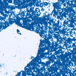
โมเดลความน่าจะเป็นของโกโก้ 2025a

**หมายเหตุ: ชุดข้อมูลนี้ยังไม่ได้รับการตรวจสอบโดยผู้เชี่ยวชาญ โปรดดูข้อมูลเพิ่มเติมใน README ของ GitHub นี้** คอลเล็กชันรูปภาพนี้แสดงความน่าจะเป็นโดยประมาณต่อพิกเซลที่พื้นที่ด้านล่างถูกครอบครองโดยสินค้าโภคภัณฑ์ การประมาณความน่าจะเป็นแสดงที่ความละเอียด 10 เมตรและสร้างขึ้นโดย … agriculture biodiversity cocoa conservation crop eudr -
โมเดลความน่าจะเป็นของโกโก้ 2025b
โปรดดูเอกสารประกอบทางเทคนิคของชุดข้อมูลนี้ใน README ของ GitHub นี้ คอลเล็กชันรูปภาพนี้แสดงความน่าจะเป็นโดยประมาณต่อพิกเซลที่พื้นที่ด้านล่างถูกครอบครองโดยสินค้าโภคภัณฑ์ การประมาณความน่าจะเป็นแสดงที่ความละเอียด 10 เมตรและสร้างขึ้นโดยโมเดลแมชชีนเลิร์นนิง … agriculture biodiversity cocoa conservation crop eudr -
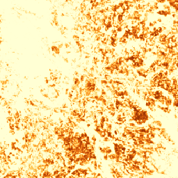
โมเดลความน่าจะเป็นของกาแฟ 2025a

**หมายเหตุ: ชุดข้อมูลนี้ยังไม่ได้รับการตรวจสอบโดยผู้เชี่ยวชาญ โปรดดูข้อมูลเพิ่มเติมใน README ของ GitHub นี้** คอลเล็กชันรูปภาพนี้แสดงความน่าจะเป็นโดยประมาณต่อพิกเซลที่พื้นที่ด้านล่างถูกครอบครองโดยสินค้าโภคภัณฑ์ การประมาณความน่าจะเป็นแสดงที่ความละเอียด 10 เมตรและสร้างขึ้นโดย … agriculture biodiversity coffee conservation crop eudr -
โมเดลความน่าจะเป็นของกาแฟ 2025b
โปรดดูเอกสารประกอบทางเทคนิคของชุดข้อมูลนี้ใน README ของ GitHub นี้ คอลเล็กชันรูปภาพนี้แสดงความน่าจะเป็นโดยประมาณต่อพิกเซลที่พื้นที่ด้านล่างถูกครอบครองโดยสินค้าโภคภัณฑ์ การประมาณความน่าจะเป็นแสดงที่ความละเอียด 10 เมตรและสร้างขึ้นโดยโมเดลแมชชีนเลิร์นนิง … agriculture biodiversity coffee conservation crop eudr -
Farmscapes 2020
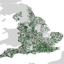
ชุดข้อมูล Farmscapes 2020 แสดงแผนที่ความน่าจะเป็นความละเอียดสูง (25 ซม.) สำหรับฟีเจอร์กึ่งธรรมชาติที่สำคัญ 3 อย่างภายในภูมิทัศน์ทางการเกษตรของอังกฤษ ได้แก่ แนวพุ่มไม้ ป่าไม้ และกำแพงหิน ชุดข้อมูลนี้ได้รับการพัฒนาขึ้นโดยความร่วมมือกับ Oxford Leverhulme Centre for Nature Recovery เพื่อใช้เป็นข้อมูลพื้นฐานสำหรับแอปพลิเคชันต่างๆ เช่น … biodiversity climate conservation forest landuse-landcover nature-trace -
Forest Persistence v0

หมายเหตุ: ชุดข้อมูลนี้ยังไม่ได้รับการตรวจสอบโดยผู้เชี่ยวชาญ โปรดดูข้อมูลเพิ่มเติมใน README ของ GitHub ที่เชื่อมโยงกับโมเดลนี้ รูปภาพนี้แสดงคะแนนต่อพิกเซล (ใน [0, 1]) ที่ระบุว่าพื้นที่พิกเซลถูกครอบครองโดยป่าที่ไม่มีการรบกวนในปี 2020 หรือไม่ คะแนนเหล่านี้คือ … biodiversity conservation deforestation eudr forest-biomass forestdatapartnership -
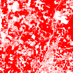
แผนที่โลกของสวนปาล์มน้ำมัน
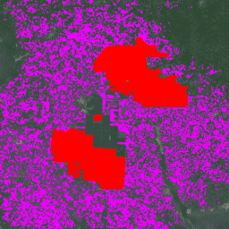
ชุดข้อมูลนี้เป็นแผนที่ปาล์มน้ำมันระดับโลกความละเอียด 10 เมตรสำหรับอุตสาหกรรมและเกษตรกรรายย่อยในปี 2019 โดยครอบคลุมพื้นที่ที่มีการตรวจพบสวนปาล์มน้ำมัน รูปภาพที่จัดประเภทเป็นเอาต์พุตของ Convolutional Neural Network ที่อิงตามคอมโพสิตครึ่งปีของ Sentinel-1 และ Sentinel-2 ดูข้อมูลเพิ่มเติมได้ที่บทความ … agriculture biodiversity conservation crop global landuse -
ป่าธรรมชาติของโลกปี 2020

ป่าธรรมชาติของโลกปี 2020 แสดงแผนที่ความน่าจะเป็นของป่าธรรมชาติทั่วโลกในปี 2020 ที่ความละเอียด 10 เมตร แผนที่นี้ได้รับการพัฒนาขึ้นเพื่อสนับสนุนโครงการริเริ่มต่างๆ เช่น European Union's Deforestation Regulation (EUDR) และความพยายามอื่นๆ ในการอนุรักษ์และเฝ้าระวังรักษาป่า แผนที่ … biodiversity climate conservation deforestation eudr forest -
โมเดลความน่าจะเป็นของปาล์ม 2025a

**หมายเหตุ: ชุดข้อมูลนี้ยังไม่ได้รับการตรวจสอบโดยผู้เชี่ยวชาญ โปรดดูข้อมูลเพิ่มเติมใน README ของ GitHub นี้** คอลเล็กชันรูปภาพนี้แสดงความน่าจะเป็นโดยประมาณต่อพิกเซลที่พื้นที่ด้านล่างถูกครอบครองโดยสินค้าโภคภัณฑ์ การประมาณความน่าจะเป็นแสดงที่ความละเอียด 10 เมตรและสร้างขึ้นโดย … agriculture biodiversity conservation crop eudr forestdatapartnership -
โมเดลความน่าจะเป็นของปาล์ม 2025b
โปรดดูเอกสารประกอบทางเทคนิคของชุดข้อมูลนี้ใน README ของ GitHub นี้ คอลเล็กชันรูปภาพนี้แสดงความน่าจะเป็นโดยประมาณต่อพิกเซลที่พื้นที่ด้านล่างถูกครอบครองโดยสินค้าโภคภัณฑ์ การประมาณความน่าจะเป็นแสดงที่ความละเอียด 10 เมตรและสร้างขึ้นโดยโมเดลแมชชีนเลิร์นนิง … agriculture biodiversity conservation crop eudr forestdatapartnership -
RESOLVE Ecoregions 2017

ชุดข้อมูล RESOLVE Ecoregions ซึ่งอัปเดตในปี 2017 แสดงภาพของเขตนิเวศทางบก 846 แห่งที่เป็นตัวแทนของโลกที่มีชีวิตของเรา ดูแผนที่ที่จัดรูปแบบได้ที่ https://ecoregions2017.appspot.com/ หรือใน Earth Engine เขตนิเวศในความหมายที่ง่ายที่สุดคือระบบนิเวศที่มีขอบเขตกว้าง โดยเฉพาะอย่างยิ่ง เขตนิเวศแสดงถึงการรวมตัวกันที่แตกต่างกัน … biodiversity conservation ecoregions ecosystems global table -
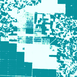
โมเดลความน่าจะเป็นของยาง 2025b
โปรดดูเอกสารประกอบทางเทคนิคของชุดข้อมูลนี้ใน README ของ GitHub นี้ คอลเล็กชันรูปภาพนี้แสดงความน่าจะเป็นโดยประมาณต่อพิกเซลที่พื้นที่ด้านล่างถูกครอบครองโดยสินค้าโภคภัณฑ์ การประมาณความน่าจะเป็นแสดงที่ความละเอียด 10 เมตรและสร้างขึ้นโดยโมเดลแมชชีนเลิร์นนิง … agriculture biodiversity conservation crop eudr forestdatapartnership -
โมเดลความน่าจะเป็นของต้นยาง 2025a

**หมายเหตุ: ชุดข้อมูลนี้ยังไม่ได้รับการตรวจสอบโดยผู้เชี่ยวชาญ โปรดดูข้อมูลเพิ่มเติมใน README ของ GitHub นี้** คอลเล็กชันรูปภาพนี้แสดงความน่าจะเป็นโดยประมาณต่อพิกเซลที่พื้นที่ด้านล่างถูกครอบครองโดยสินค้าโภคภัณฑ์ การประมาณความน่าจะเป็นแสดงที่ความละเอียด 10 เมตรและสร้างขึ้นโดย … agriculture biodiversity conservation crop eudr forestdatapartnership -
การกระจายพันธุ์ของสัตว์เลี้ยงลูกด้วยนมในออสเตรเลีย
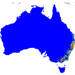
เอาต์พุตของโมเดลการกระจายพันธุ์เหล่านี้ได้รับการพัฒนาโดย Google ร่วมกับ QCIF และ EcoCommons ซึ่งแสดงถึงการประมาณความน่าจะเป็นของการเกิดพันธุ์ที่สัมพันธ์กัน (เช่น ค่าที่สูงขึ้นบ่งบอกถึงความน่าจะเป็นที่สูงขึ้นที่จะตรวจพบพันธุ์ในสถานที่หนึ่งๆ สำหรับวิธีการสำรวจที่กำหนดและการสำรวจที่กำหนด … biodiversity conservation ecosystems nature-trace publisher-dataset species