Datasets tagged usgs in Earth Engine
সেভ করা পৃষ্ঠা গুছিয়ে রাখতে 'সংগ্রহ' ব্যবহার করুন
আপনার পছন্দ অনুযায়ী কন্টেন্ট সেভ করুন ও সঠিক বিভাগে রাখুন।
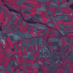
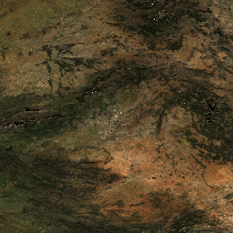
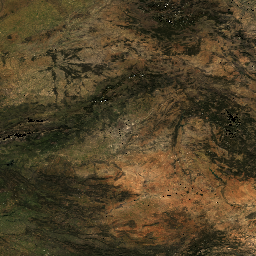
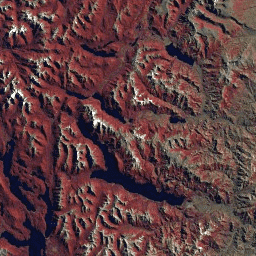
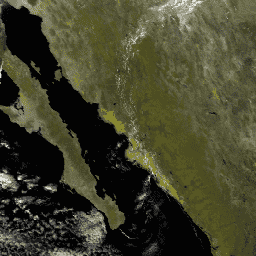
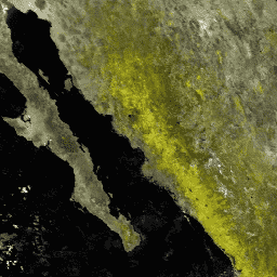
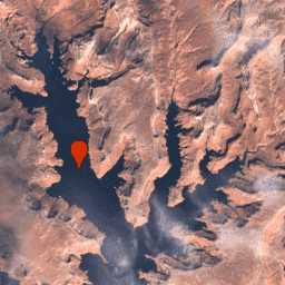
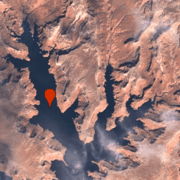
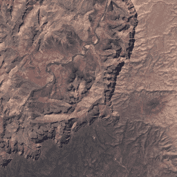
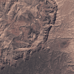
অ্যাস্টার এল১টি রেডিয়েন্স
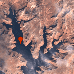
দ্রষ্টব্য: ASTER যন্ত্রের প্রযুক্তিগত সমস্যার কারণে ২৮ নভেম্বর, ২০২৪ থেকে ১৬ জানুয়ারি, ২০২৫ পর্যন্ত তথ্য সংগ্রহে একটি বিরতি রয়েছে। আরও তথ্যের জন্য USGS-এর ঘোষণা দেখুন। অ্যাডভান্সড স্পেসবোর্ন থার্মাল এমিশন অ্যান্ড রিফ্লেকশন রেডিওমিটার (ASTER) হলো একটি মাল্টিস্পেকট্রাল ইমেজার যা…
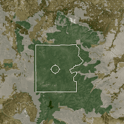
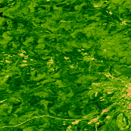
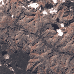
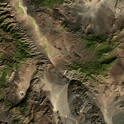
PAD-US হলো আমেরিকার স্থলজ ও সামুদ্রিক সংরক্ষিত এলাকাগুলোর সরকারি জাতীয় তালিকা, যা জীববৈচিত্র্য সংরক্ষণ এবং অন্যান্য প্রাকৃতিক, বিনোদনমূলক ও সাংস্কৃতিক ব্যবহারের জন্য নিবেদিত এবং এই উদ্দেশ্যে আইনগত বা অন্যান্য কার্যকর উপায়ে পরিচালিত হয়। এই ডেটাবেসটি বিভক্ত …
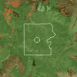
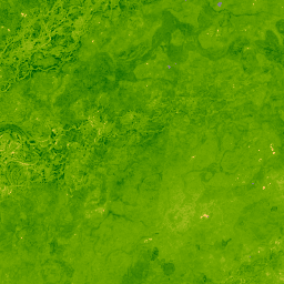
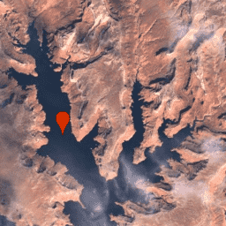
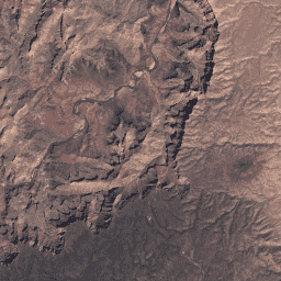
হাইপেরিয়ন হলো একটি উচ্চ রেজোলিউশনের হাইপারস্পেকট্রাল ইমেজার যা ০.৩৫৭ থেকে ২.৫৭৬ মাইক্রোমিটার পর্যন্ত ১০-ন্যানোমিটার ব্যান্ডউইথ সহ ২২০টি স্বতন্ত্র স্পেকট্রাল চ্যানেল তৈরি করে। যন্ত্রটি পুশব্রুম পদ্ধতিতে কাজ করে, যার সমস্ত ব্যান্ডের জন্য স্থানিক রেজোলিউশন ৩০ মিটার এবং একটি আদর্শ দৃশ্যের প্রস্থ …
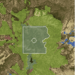
PAD-US হলো আমেরিকার স্থলজ ও সামুদ্রিক সংরক্ষিত এলাকাগুলোর সরকারি জাতীয় তালিকা, যা জীববৈচিত্র্য সংরক্ষণ এবং অন্যান্য প্রাকৃতিক, বিনোদনমূলক ও সাংস্কৃতিক ব্যবহারের জন্য নিবেদিত এবং এই উদ্দেশ্যে আইনগত বা অন্যান্য কার্যকর উপায়ে পরিচালিত হয়। এই ডেটাবেসটি বিভক্ত …
PAD-US হলো আমেরিকার স্থলজ ও সামুদ্রিক সংরক্ষিত এলাকাগুলোর সরকারি জাতীয় তালিকা, যা জীববৈচিত্র্য সংরক্ষণ এবং অন্যান্য প্রাকৃতিক, বিনোদনমূলক ও সাংস্কৃতিক ব্যবহারের জন্য নিবেদিত এবং এই উদ্দেশ্যে আইনগত বা অন্যান্য কার্যকর উপায়ে পরিচালিত হয়। এই ডেটাবেসটি বিভক্ত …
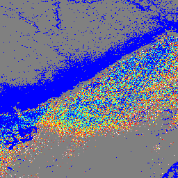
GEDI L2A রাস্টার ক্যানোপির শীর্ষ উচ্চতা (সংস্করণ ২)
GEDI-এর লেভেল 2A ভূ-অবস্থানযুক্ত উচ্চতা ও উচ্চতা মেট্রিক্স প্রোডাক্ট (GEDI02_A) প্রধানত ১০০টি আপেক্ষিক উচ্চতা (RH) মেট্রিক্স দ্বারা গঠিত, যা সম্মিলিতভাবে GEDI দ্বারা সংগৃহীত তরঙ্গরূপকে বর্ণনা করে। মূল GEDI02_A প্রোডাক্টটি হলো ২৫ মিটার স্থানিক রেজোলিউশন (গড় ফুটপ্রিন্ট) সহ একটি পয়েন্ট টেবিল। …
GEDI L2A ভেক্টর ক্যানোপির শীর্ষ উচ্চতা (সংস্করণ ২)
GEDI-এর লেভেল 2A ভূ-অবস্থানযুক্ত উচ্চতা ও উচ্চতা মেট্রিক্স প্রোডাক্ট (GEDI02_A) প্রধানত ১০০টি আপেক্ষিক উচ্চতা (RH) মেট্রিক্স দ্বারা গঠিত, যা সম্মিলিতভাবে GEDI দ্বারা সংগৃহীত তরঙ্গরূপকে বর্ণনা করে। মূল GEDI02_A প্রোডাক্টটি হলো ২৫ মিটার স্থানিক রেজোলিউশন (গড় ফুটপ্রিন্ট) সহ একটি পয়েন্ট টেবিল। …
এটি LARSE/GEDI/GEDI02_A_002-এর L2A টেবিলের জ্যামিতি থেকে তৈরি একটি ফিচার সংগ্রহ। প্রতিটি ফিচার হলো একটি উৎস টেবিলের পলিগন ফুটপ্রিন্ট, যার সাথে এর অ্যাসেট আইডি এবং শুরু/শেষের টাইমস্ট্যাম্প যুক্ত থাকে। আরও তথ্যের জন্য অনুগ্রহ করে ব্যবহারকারী নির্দেশিকা দেখুন। গ্লোবাল ইকোসিস্টেম ডাইনামিক্স ইনভেস্টিগেশন GEDI মিশন…
GEDI লেভেল 2B ক্যানোপি কভার এবং ভার্টিক্যাল প্রোফাইল মেট্রিক্স প্রোডাক্ট (GEDI02_B) প্রতিটি GEDI ওয়েভফর্ম থেকে বায়োফিজিক্যাল মেট্রিক্স নিষ্কাশন করে। এই মেট্রিক্সগুলো L1B ওয়েভফর্ম থেকে প্রাপ্ত ডিরেকশনাল গ্যাপ প্রোবাবিলিটি প্রোফাইলের উপর ভিত্তি করে তৈরি। পাতার প্রোফাইল পরিমাপের মধ্যবর্তী উল্লম্ব ধাপ (GEDI-তে যা dZ নামে পরিচিত…
GEDI লেভেল 2B ক্যানোপি কভার এবং ভার্টিক্যাল প্রোফাইল মেট্রিক্স প্রোডাক্ট (GEDI02_B) প্রতিটি GEDI ওয়েভফর্ম থেকে বায়োফিজিক্যাল মেট্রিক্স নিষ্কাশন করে। এই মেট্রিক্সগুলো L1B ওয়েভফর্ম থেকে প্রাপ্ত ডিরেকশনাল গ্যাপ প্রোবাবিলিটি প্রোফাইলের উপর ভিত্তি করে তৈরি। পাতার প্রোফাইল পরিমাপের মধ্যবর্তী উল্লম্ব ধাপ (GEDI-তে যা dZ নামে পরিচিত…
এটি LARSE/GEDI/GEDI02_B_002-এর L2B টেবিলের জ্যামিতি থেকে তৈরি একটি ফিচার সংগ্রহ। প্রতিটি ফিচার হলো একটি উৎস টেবিলের পলিগন ফুটপ্রিন্ট, যার সাথে এর অ্যাসেট আইডি এবং শুরু/শেষের টাইমস্ট্যাম্প যুক্ত থাকে। আরও তথ্যের জন্য অনুগ্রহ করে ব্যবহারকারী নির্দেশিকা দেখুন। গ্লোবাল ইকোসিস্টেম ডাইনামিক্স ইনভেস্টিগেশন GEDI মিশন…
এই ডেটাসেটে গ্লোবাল ইকোসিস্টেম ডায়নামিক্স ইনভেস্টিগেশন (GEDI) লেভেল 4A (L4A) সংস্করণ 2-এর ভূপৃষ্ঠস্থ বায়োমাস ঘনত্বের (AGBD; Mg/ha এককে) পূর্বাভাস এবং প্রতিটি নমুনাকৃত ভূ-অবস্থানযুক্ত লেজার ফুটপ্রিন্টের মধ্যে পূর্বাভাসের স্ট্যান্ডার্ড এররের অনুমান অন্তর্ভুক্ত রয়েছে। এই সংস্করণে, গ্র্যানিউলগুলি উপ-কক্ষপথে রয়েছে। উচ্চতার মেট্রিকগুলি…
এই ডেটাসেটে গ্লোবাল ইকোসিস্টেম ডায়নামিক্স ইনভেস্টিগেশন (GEDI) লেভেল 4A (L4A) সংস্করণ 2-এর ভূপৃষ্ঠস্থ বায়োমাস ঘনত্বের (AGBD; Mg/ha এককে) পূর্বাভাস এবং প্রতিটি নমুনাকৃত ভূ-অবস্থানযুক্ত লেজার ফুটপ্রিন্টের মধ্যে পূর্বাভাসের স্ট্যান্ডার্ড এররের অনুমান অন্তর্ভুক্ত রয়েছে। এই সংস্করণে, গ্র্যানিউলগুলি উপ-কক্ষপথে রয়েছে। উচ্চতার মেট্রিকগুলি…
এটি LARSE/GEDI/GEDI04_A_002-এর L4A টেবিলের জ্যামিতি থেকে তৈরি একটি ফিচার সংগ্রহ। প্রতিটি ফিচার হলো একটি উৎস টেবিলের পলিগন ফুটপ্রিন্ট, যার সাথে এর অ্যাসেট আইডি এবং শুরু/শেষের টাইমস্ট্যাম্প যুক্ত থাকে। আরও তথ্যের জন্য অনুগ্রহ করে ব্যবহারকারী নির্দেশিকা দেখুন। গ্লোবাল ইকোসিস্টেম ডাইনামিক্স ইনভেস্টিগেশন GEDI মিশন…
এই গ্লোবাল ইকোসিস্টেম ডাইনামিক্স ইনভেস্টিগেশন (GEDI) L4B প্রোডাক্টটি ২০১৯-০৪-১৮ তারিখে শুরু হওয়া ১৯তম মিশন সপ্তাহ থেকে ২০২১-০৮-০৪ তারিখে শেষ হওয়া ১৩৮তম মিশন সপ্তাহ পর্যন্ত পর্যবেক্ষণের উপর ভিত্তি করে গড় ভূপৃষ্ঠস্থ জীবভর ঘনত্বের (AGBD) ১ কিমি x ১ কিমি আকারের আনুমানিক হিসাব প্রদান করে। GEDI L4A ফুটপ্রিন্ট বায়োমাস প্রোডাক্টটি রূপান্তর করে…
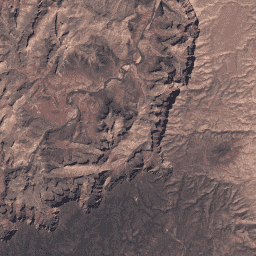
জিএফএসএডি হলো নাসা-অর্থায়িত একটি প্রকল্প, যার লক্ষ্য একবিংশ শতাব্দীতে বৈশ্বিক খাদ্য নিরাপত্তায় অবদান রাখার জন্য উচ্চ-রেজোলিউশনের বৈশ্বিক কৃষিজমি এবং সেগুলোর জল ব্যবহারের তথ্য সরবরাহ করা। জিএফএসএডি-র ফলাফলগুলো মাল্টি-সেন্সর রিমোট সেন্সিং ডেটা (যেমন, ল্যান্ডস্যাট, মোডিস, এভিএইচআরআর), সেকেন্ডারি ডেটা এবং ফিল্ড-প্লট ডেটার মাধ্যমে সংগ্রহ করা হয়…
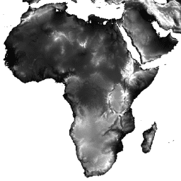
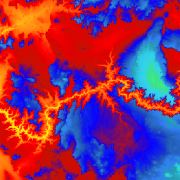
জিএমটিইডি২০১০: গ্লোবাল মাল্টি-রেজোলিউশন টেরেইন এলিভেশন ডেটা ২০১০
গ্লোবাল মাল্টি-রেজোলিউশন টেরেইন এলিভেশন ডেটা ২০১০ (GMTED2010) ডেটাসেটটিতে ৭.৫ আর্ক-সেকেন্ড রেজোলিউশনে বিভিন্ন উৎস থেকে সংগৃহীত পৃথিবীর উচ্চতার ডেটা রয়েছে। ডেটাসেট রিপোর্টে আরও বিস্তারিত তথ্য পাওয়া যাবে। GMTED2010-এর প্রাথমিক উৎস ডেটাসেটটি হলো NGA-এর SRTM ডিজিটাল টেরেইন এলিভেশন ডেটা (DTED®, …
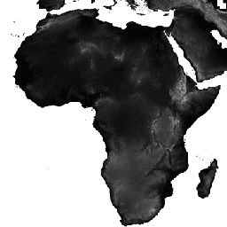
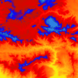
GTOPO30 হলো একটি বৈশ্বিক ডিজিটাল উচ্চতা মডেল (DEM), যার আনুভূমিক গ্রিড ব্যবধান ৩০ আর্ক সেকেন্ড (প্রায় ১ কিলোমিটার)। এই DEM-টি ভূসংস্থানিক তথ্যের বিভিন্ন রাস্টার এবং ভেক্টর উৎস থেকে উদ্ভূত হয়েছে। ১৯৯৬ সালের শেষের দিকে সম্পন্ন হওয়া GTOPO30 মডেলটি তিন বছর ধরে বিকশিত হয়েছিল…
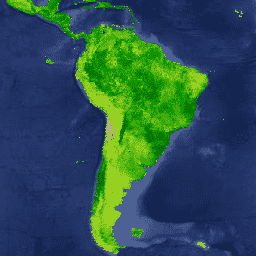
২০০০ সালের ল্যান্ডস্যাট স্যাটেলাইট ডেটা ব্যবহার করে ডেটাবেসটি প্রস্তুত করা হয়েছে। ইউএসজিএস আর্থ রিসোর্সেস অবজারভেশন অ্যান্ড সায়েন্স সেন্টার (ইআরওএস) থেকে প্রাপ্ত ১,০০০-এরও বেশি ল্যান্ডস্যাট দৃশ্যকে হাইব্রিড সুপারভাইজড এবং আনসুপারভাইজড ডিজিটাল ইমেজ ক্লাসিফিকেশন কৌশল ব্যবহার করে শ্রেণিবদ্ধ করা হয়েছে। এই ডেটাবেসটি প্রথম, সবচেয়ে...
HLSS30: HLS সেন্টিনেল-২ মাল্টি-স্পেকট্রাল ইন্সট্রুমেন্টের ভূপৃষ্ঠের প্রতিফলন দৈনিক বৈশ্বিক ৩০মি
হারমোনাইজড ল্যান্ডস্যাট সেন্টিনেল-২ (HLS) প্রকল্পটি, নাসা/ইউএসজিএস-এর যৌথ ল্যান্ডস্যাট ৮ স্যাটেলাইটে থাকা অপারেশনাল ল্যান্ড ইমেজার (OLI) এবং ইউরোপের কোপারনিকাস সেন্টিনেল-২এ স্যাটেলাইটে থাকা মাল্টি-স্পেকট্রাল ইন্সট্রুমেন্ট (MSI) থেকে ভূপৃষ্ঠের প্রতিফলনের সামঞ্জস্যপূর্ণ ডেটা সরবরাহ করে। এই সম্মিলিত পরিমাপ প্রতি ২-৩ সপ্তাহে ভূমির বৈশ্বিক পর্যবেক্ষণ সম্ভব করে তোলে…
ওয়াটারশেড বাউন্ডারি ডেটাসেট (WBD) হলো হাইড্রোলজিক ইউনিট (HU) ডেটার একটি ব্যাপক সমন্বিত সংগ্রহ, যা সীমানা নির্ধারণ এবং রেজোলিউশনের জন্য জাতীয় মানদণ্ডের সাথে সামঞ্জস্যপূর্ণ। এটি উপকূলীয় বা হ্রদ-সংলগ্ন এলাকা ব্যতীত একটি নির্দিষ্ট বিন্দু পর্যন্ত ভূপৃষ্ঠের জল নিষ্কাশনের ক্ষেত্রীয় বিস্তৃতি নির্ধারণ করে, যেখানে…
ওয়াটারশেড বাউন্ডারি ডেটাসেট (WBD) হলো হাইড্রোলজিক ইউনিট (HU) ডেটার একটি ব্যাপক সমন্বিত সংগ্রহ, যা সীমানা নির্ধারণ এবং রেজোলিউশনের জন্য জাতীয় মানদণ্ডের সাথে সামঞ্জস্যপূর্ণ। এটি উপকূলীয় বা হ্রদ-সংলগ্ন এলাকা ব্যতীত একটি নির্দিষ্ট বিন্দু পর্যন্ত ভূপৃষ্ঠের জল নিষ্কাশনের ক্ষেত্রীয় বিস্তৃতি নির্ধারণ করে, যেখানে…
ওয়াটারশেড বাউন্ডারি ডেটাসেট (WBD) হলো হাইড্রোলজিক ইউনিট (HU) ডেটার একটি ব্যাপক সমন্বিত সংগ্রহ, যা সীমানা নির্ধারণ এবং রেজোলিউশনের জন্য জাতীয় মানদণ্ডের সাথে সামঞ্জস্যপূর্ণ। এটি উপকূলীয় বা হ্রদ-সংলগ্ন এলাকা ব্যতীত একটি নির্দিষ্ট বিন্দু পর্যন্ত ভূপৃষ্ঠের জল নিষ্কাশনের ক্ষেত্রীয় বিস্তৃতি নির্ধারণ করে, যেখানে…
ওয়াটারশেড বাউন্ডারি ডেটাসেট (WBD) হলো হাইড্রোলজিক ইউনিট (HU) ডেটার একটি ব্যাপক সমন্বিত সংগ্রহ, যা সীমানা নির্ধারণ এবং রেজোলিউশনের জন্য জাতীয় মানদণ্ডের সাথে সামঞ্জস্যপূর্ণ। এটি উপকূলীয় বা হ্রদ-সংলগ্ন এলাকা ব্যতীত একটি নির্দিষ্ট বিন্দু পর্যন্ত ভূপৃষ্ঠের জল নিষ্কাশনের ক্ষেত্রীয় বিস্তৃতি নির্ধারণ করে, যেখানে…
ওয়াটারশেড বাউন্ডারি ডেটাসেট (WBD) হলো হাইড্রোলজিক ইউনিট (HU) ডেটার একটি ব্যাপক সমন্বিত সংগ্রহ, যা সীমানা নির্ধারণ এবং রেজোলিউশনের জন্য জাতীয় মানদণ্ডের সাথে সামঞ্জস্যপূর্ণ। এটি উপকূলীয় বা হ্রদ-সংলগ্ন এলাকা ব্যতীত একটি নির্দিষ্ট বিন্দু পর্যন্ত ভূপৃষ্ঠের জল নিষ্কাশনের ক্ষেত্রীয় বিস্তৃতি নির্ধারণ করে, যেখানে…
ওয়াটারশেড বাউন্ডারি ডেটাসেট (WBD) হলো হাইড্রোলজিক ইউনিট (HU) ডেটার একটি ব্যাপক সমন্বিত সংগ্রহ, যা সীমানা নির্ধারণ এবং রেজোলিউশনের জন্য জাতীয় মানদণ্ডের সাথে সামঞ্জস্যপূর্ণ। এটি উপকূলীয় বা হ্রদ-সংলগ্ন এলাকা ব্যতীত একটি নির্দিষ্ট বিন্দু পর্যন্ত ভূপৃষ্ঠের জল নিষ্কাশনের ক্ষেত্রীয় বিস্তৃতি নির্ধারণ করে, যেখানে…
ল্যান্ডফায়ার (LF), অর্থাৎ ল্যান্ডস্কেপ ফায়ার অ্যান্ড রিসোর্স ম্যানেজমেন্ট প্ল্যানিং টুলস, হলো মার্কিন কৃষি বিভাগের ফরেস্ট সার্ভিস, মার্কিন স্বরাষ্ট্র বিভাগের জিওলজিক্যাল সার্ভে এবং দ্য নেচার কনজারভেন্সি-এর বন্যভূমি অগ্নিনির্বাপণ কার্যক্রমগুলোর একটি যৌথ কর্মসূচি। ল্যান্ডফায়ার (LF) লেয়ারগুলো ভবিষ্যদ্বাণীমূলক পদ্ধতি ব্যবহার করে তৈরি করা হয়…
ল্যান্ডফায়ার ইএসপি একে (পরিবেশগত স্থান সম্ভাবনা) ভি১.২.০
ল্যান্ডফায়ার (LF), অর্থাৎ ল্যান্ডস্কেপ ফায়ার অ্যান্ড রিসোর্স ম্যানেজমেন্ট প্ল্যানিং টুলস, হলো মার্কিন কৃষি বিভাগের ফরেস্ট সার্ভিস, মার্কিন স্বরাষ্ট্র বিভাগের জিওলজিক্যাল সার্ভে এবং দ্য নেচার কনজারভেন্সি-এর বন্যভূমি অগ্নিনির্বাপণ কার্যক্রমগুলোর একটি যৌথ কর্মসূচি। ল্যান্ডফায়ার (LF) লেয়ারগুলো ভবিষ্যদ্বাণীমূলক পদ্ধতি ব্যবহার করে তৈরি করা হয়…
ল্যান্ডফায়ার ইএসপি কোনাস (পরিবেশগত স্থান সম্ভাবনা) ভি১.২.০
ল্যান্ডফায়ার (LF), অর্থাৎ ল্যান্ডস্কেপ ফায়ার অ্যান্ড রিসোর্স ম্যানেজমেন্ট প্ল্যানিং টুলস, হলো মার্কিন কৃষি বিভাগের ফরেস্ট সার্ভিস, মার্কিন স্বরাষ্ট্র বিভাগের জিওলজিক্যাল সার্ভে এবং দ্য নেচার কনজারভেন্সি-এর বন্যভূমি অগ্নিনির্বাপণ কার্যক্রমগুলোর একটি যৌথ কর্মসূচি। ল্যান্ডফায়ার (LF) লেয়ারগুলো ভবিষ্যদ্বাণীমূলক পদ্ধতি ব্যবহার করে তৈরি করা হয়…
ল্যান্ডফায়ার ইএসপি এইচআই (পরিবেশগত স্থান সম্ভাবনা) ভি১.২.০
ল্যান্ডফায়ার (LF), অর্থাৎ ল্যান্ডস্কেপ ফায়ার অ্যান্ড রিসোর্স ম্যানেজমেন্ট প্ল্যানিং টুলস, হলো মার্কিন কৃষি বিভাগের ফরেস্ট সার্ভিস, মার্কিন স্বরাষ্ট্র বিভাগের জিওলজিক্যাল সার্ভে এবং দ্য নেচার কনজারভেন্সি-এর বন্যভূমি অগ্নিনির্বাপণ কার্যক্রমগুলোর একটি যৌথ কর্মসূচি। ল্যান্ডফায়ার (LF) লেয়ারগুলো ভবিষ্যদ্বাণীমূলক পদ্ধতি ব্যবহার করে তৈরি করা হয়…
ল্যান্ডফায়ার (LF), অর্থাৎ ল্যান্ডস্কেপ ফায়ার অ্যান্ড রিসোর্স ম্যানেজমেন্ট প্ল্যানিং টুলস, হলো মার্কিন কৃষি বিভাগের ফরেস্ট সার্ভিস, মার্কিন স্বরাষ্ট্র বিভাগের জিওলজিক্যাল সার্ভে এবং দ্য নেচার কনজারভেন্সি-এর বন্যভূমি অগ্নিনির্বাপণ কার্যক্রমগুলোর একটি যৌথ কর্মসূচি। ল্যান্ডফায়ার (LF) লেয়ারগুলো ভবিষ্যদ্বাণীমূলক পদ্ধতি ব্যবহার করে তৈরি করা হয়…
ল্যান্ডফায়ার (LF), অর্থাৎ ল্যান্ডস্কেপ ফায়ার অ্যান্ড রিসোর্স ম্যানেজমেন্ট প্ল্যানিং টুলস, হলো মার্কিন কৃষি বিভাগের ফরেস্ট সার্ভিস, মার্কিন স্বরাষ্ট্র বিভাগের জিওলজিক্যাল সার্ভে এবং দ্য নেচার কনজারভেন্সি-এর বন্যভূমি অগ্নিনির্বাপণ কার্যক্রমগুলোর একটি যৌথ কর্মসূচি। ল্যান্ডফায়ার (LF) লেয়ারগুলো ভবিষ্যদ্বাণীমূলক পদ্ধতি ব্যবহার করে তৈরি করা হয়…
ল্যান্ডফায়ার (LF), অর্থাৎ ল্যান্ডস্কেপ ফায়ার অ্যান্ড রিসোর্স ম্যানেজমেন্ট প্ল্যানিং টুলস, হলো মার্কিন কৃষি বিভাগের ফরেস্ট সার্ভিস, মার্কিন স্বরাষ্ট্র বিভাগের জিওলজিক্যাল সার্ভে এবং দ্য নেচার কনজারভেন্সি-এর বন্যভূমি অগ্নিনির্বাপণ কার্যক্রমগুলোর একটি যৌথ কর্মসূচি। ল্যান্ডফায়ার (LF) লেয়ারগুলো ভবিষ্যদ্বাণীমূলক পদ্ধতি ব্যবহার করে তৈরি করা হয়…
ল্যান্ডফায়ার (LF), অর্থাৎ ল্যান্ডস্কেপ ফায়ার অ্যান্ড রিসোর্স ম্যানেজমেন্ট প্ল্যানিং টুলস, হলো মার্কিন কৃষি বিভাগের ফরেস্ট সার্ভিস, মার্কিন স্বরাষ্ট্র বিভাগের জিওলজিক্যাল সার্ভে এবং দ্য নেচার কনজারভেন্সি-র বন্যভূমি অগ্নিনির্বাপণ কার্যক্রমগুলোর একটি যৌথ কর্মসূচি। ল্যান্ডফায়ার (LF)-এর ঐতিহাসিক অগ্নিকাণ্ডের ধরন, সময়কাল এবং…
ল্যান্ডফায়ার (LF), অর্থাৎ ল্যান্ডস্কেপ ফায়ার অ্যান্ড রিসোর্স ম্যানেজমেন্ট প্ল্যানিং টুলস, হলো মার্কিন কৃষি বিভাগের ফরেস্ট সার্ভিস, মার্কিন স্বরাষ্ট্র বিভাগের জিওলজিক্যাল সার্ভে এবং দ্য নেচার কনজারভেন্সি-র বন্যভূমি অগ্নিনির্বাপণ কার্যক্রমগুলোর একটি যৌথ কর্মসূচি। ল্যান্ডফায়ার (LF)-এর ঐতিহাসিক অগ্নিকাণ্ডের ধরন, সময়কাল এবং…
ল্যান্ডফায়ার (LF), অর্থাৎ ল্যান্ডস্কেপ ফায়ার অ্যান্ড রিসোর্স ম্যানেজমেন্ট প্ল্যানিং টুলস, হলো মার্কিন কৃষি বিভাগের ফরেস্ট সার্ভিস, মার্কিন স্বরাষ্ট্র বিভাগের জিওলজিক্যাল সার্ভে এবং দ্য নেচার কনজারভেন্সি-র বন্যভূমি অগ্নিনির্বাপণ কার্যক্রমগুলোর একটি যৌথ কর্মসূচি। ল্যান্ডফায়ার (LF)-এর ঐতিহাসিক অগ্নিকাণ্ডের ধরন, সময়কাল এবং…
ল্যান্ডফায়ার (LF), অর্থাৎ ল্যান্ডস্কেপ ফায়ার অ্যান্ড রিসোর্স ম্যানেজমেন্ট প্ল্যানিং টুলস, হলো মার্কিন কৃষি বিভাগের ফরেস্ট সার্ভিস, মার্কিন স্বরাষ্ট্র বিভাগের জিওলজিক্যাল সার্ভে এবং দ্য নেচার কনজারভেন্সি-র বন্যভূমি অগ্নিনির্বাপণ কার্যক্রমগুলোর একটি যৌথ কর্মসূচি। ল্যান্ডফায়ার (LF)-এর ঐতিহাসিক অগ্নিকাণ্ডের ধরন, সময়কাল এবং…
ল্যান্ডফায়ার (LF), অর্থাৎ ল্যান্ডস্কেপ ফায়ার অ্যান্ড রিসোর্স ম্যানেজমেন্ট প্ল্যানিং টুলস, হলো মার্কিন কৃষি বিভাগের ফরেস্ট সার্ভিস, মার্কিন স্বরাষ্ট্র বিভাগের জিওলজিক্যাল সার্ভে এবং দ্য নেচার কনজারভেন্সি-র বন্যভূমি অগ্নিনির্বাপণ কার্যক্রমগুলোর একটি যৌথ কর্মসূচি। ল্যান্ডফায়ার (LF)-এর ঐতিহাসিক অগ্নিকাণ্ডের ধরন, সময়কাল এবং…
ল্যান্ডফায়ার (LF), অর্থাৎ ল্যান্ডস্কেপ ফায়ার অ্যান্ড রিসোর্স ম্যানেজমেন্ট প্ল্যানিং টুলস, হলো মার্কিন কৃষি বিভাগের ফরেস্ট সার্ভিস, মার্কিন স্বরাষ্ট্র বিভাগের জিওলজিক্যাল সার্ভে এবং দ্য নেচার কনজারভেন্সি-র বন্যভূমি অগ্নিনির্বাপণ কার্যক্রমগুলোর একটি যৌথ কর্মসূচি। ল্যান্ডফায়ার (LF)-এর ঐতিহাসিক অগ্নিকাণ্ডের ধরন, সময়কাল এবং…
ল্যান্ডফায়ার (LF), অর্থাৎ ল্যান্ডস্কেপ ফায়ার অ্যান্ড রিসোর্স ম্যানেজমেন্ট প্ল্যানিং টুলস, হলো মার্কিন কৃষি বিভাগের ফরেস্ট সার্ভিস, মার্কিন স্বরাষ্ট্র বিভাগের জিওলজিক্যাল সার্ভে এবং দ্য নেচার কনজারভেন্সি-র বন্যভূমি অগ্নিনির্বাপণ কার্যক্রমগুলোর একটি যৌথ কর্মসূচি। ল্যান্ডফায়ার (LF)-এর ঐতিহাসিক অগ্নিকাণ্ডের ধরন, সময়কাল এবং…
ল্যান্ডফায়ার (LF), অর্থাৎ ল্যান্ডস্কেপ ফায়ার অ্যান্ড রিসোর্স ম্যানেজমেন্ট প্ল্যানিং টুলস, হলো মার্কিন কৃষি বিভাগের ফরেস্ট সার্ভিস, মার্কিন স্বরাষ্ট্র বিভাগের জিওলজিক্যাল সার্ভে এবং দ্য নেচার কনজারভেন্সি-র বন্যভূমি অগ্নিনির্বাপণ কার্যক্রমগুলোর একটি যৌথ কর্মসূচি। ল্যান্ডফায়ার (LF)-এর ঐতিহাসিক অগ্নিকাণ্ডের ধরন, সময়কাল এবং…
ল্যান্ডস্যাট কালেকশন ২ টিয়ার ১ লেভেল ২ ৩২-দিনের বিএআই কম্পোজিট
এই ল্যান্ডস্যাট কালেকশন ২ টিয়ার ১ লেভেল ২ কম্পোজিটগুলো টিয়ার ১ লেভেল ২ অর্থোরেটিফাইড দৃশ্য থেকে তৈরি করা হয়েছে। বার্ন এরিয়া ইনডেক্স (BAI) রেড এবং নিয়ার-আইআর ব্যান্ড থেকে তৈরি করা হয় এবং এটি একটি রেফারেন্স স্পেকট্রাল পয়েন্ট থেকে প্রতিটি পিক্সেলের স্পেকট্রাল দূরত্ব পরিমাপ করে (…
ল্যান্ডস্যাট কালেকশন ২ টিয়ার ১ লেভেল ২ ৩২-দিনের কম্পোজিট
এই ল্যান্ডস্যাট কালেকশন ২ টিয়ার ১ লেভেল ২ কম্পোজিটগুলো টিয়ার ১ লেভেল ২ অর্থোরেটিফাইড দৃশ্য থেকে তৈরি করা হয়েছে এবং এতে এসআর ব্যান্ডগুলো অন্তর্ভুক্ত রয়েছে: নীল, সবুজ, লাল, এনআইআর, এসডব্লিউআইআর১, এসডব্লিউআইআর২ এবং থার্মাল। এই কম্পোজিটগুলো … থেকে শুরু করে প্রতিটি ৩২-দিনের সময়কালের সমস্ত দৃশ্য থেকে তৈরি করা হয়।
ল্যান্ডস্যাট কালেকশন ২ টিয়ার ১ লেভেল ২ ৩২-দিনের এনবিআর কম্পোজিট
এই ল্যান্ডস্যাট কালেকশন ২ টিয়ার ১ লেভেল ২ কম্পোজিটগুলো টিয়ার ১ লেভেল ২ অর্থোরেটিফাইড দৃশ্য থেকে তৈরি করা হয়েছে। নর্মালাইজড বার্ন রেশিও থার্মাল (NBRT) সূচকটি নিয়ার-আইআর, মিড-আইআর (২২১৫ এনএম), এবং থার্মাল ব্যান্ড থেকে উৎপন্ন করা হয় এবং এর পরিসর -১.০ থেকে ১.০ পর্যন্ত। দেখুন…
ল্যান্ডস্যাট কালেকশন ২ টিয়ার ১ লেভেল ২ ৩২-দিনের এনডিভিআই কম্পোজিট
এই ল্যান্ডস্যাট কালেকশন ২ টিয়ার ১ লেভেল ২ কম্পোজিটগুলো টিয়ার ১ লেভেল ২ অর্থোরেটিফাইড দৃশ্য থেকে তৈরি করা হয়েছে। নর্মালাইজড ডিফারেন্স ভেজিটেশন ইনডেক্স প্রতিটি দৃশ্যের নিয়ার-আইআর এবং রেড ব্যান্ড থেকে (NIR - Red) / (NIR + Red) হিসাবে তৈরি করা হয়, এবং এর পরিসর হলো …
ল্যান্ডস্যাট কালেকশন ২ টিয়ার ১ লেভেল ২ ৩২-দিনের এনডিডব্লিউআই কম্পোজিট
এই ল্যান্ডস্যাট কালেকশন ২ টিয়ার ১ লেভেল ২ কম্পোজিটগুলো টিয়ার ১ লেভেল ২ অর্থোরেটিফাইড দৃশ্য থেকে তৈরি করা হয়েছে। নর্মালাইজড ডিফারেন্স ওয়াটার ইনডেক্স (NDWI) উন্মুক্ত জলাশয়গুলোকে চিহ্নিত করতে এবং চিত্র থেকে মাটি ও স্থলজ উদ্ভিদের বৈশিষ্ট্যগুলো বাদ দিয়ে সেগুলোর উপস্থিতি আরও স্পষ্ট করার জন্য ডিজাইন করা হয়েছে। এটি…
ল্যান্ডস্যাট কালেকশন ২ টিয়ার ১ লেভেল ২ ৮-দিনের বিএআই কম্পোজিট
এই ল্যান্ডস্যাট কালেকশন ২ টিয়ার ১ লেভেল ২ কম্পোজিটগুলো টিয়ার ১ লেভেল ২ অর্থোরেটিফাইড দৃশ্য থেকে তৈরি করা হয়েছে। বার্ন এরিয়া ইনডেক্স (BAI) রেড এবং নিয়ার-আইআর ব্যান্ড থেকে তৈরি করা হয় এবং এটি একটি রেফারেন্স স্পেকট্রাল পয়েন্ট থেকে প্রতিটি পিক্সেলের স্পেকট্রাল দূরত্ব পরিমাপ করে (…
ল্যান্ডস্যাট কালেকশন ২ টিয়ার ১ লেভেল ২ ৮-দিনের কম্পোজিট
এই ল্যান্ডস্যাট কালেকশন ২ টিয়ার ১ লেভেল ২ কম্পোজিটগুলো টিয়ার ১ লেভেল ২ অর্থোরেটিফাইড দৃশ্য থেকে তৈরি করা হয়েছে এবং এতে এসআর ব্যান্ডগুলো অন্তর্ভুক্ত রয়েছে: নীল, সবুজ, লাল, এনআইআর, এসডব্লিউআইআর১, এসডব্লিউআইআর২ এবং থার্মাল। এই কম্পোজিটগুলো … থেকে শুরু করে প্রতিটি ৮-দিনের সময়কালের সমস্ত দৃশ্য থেকে তৈরি করা হয়।
ল্যান্ডস্যাট কালেকশন ২ টিয়ার ১ লেভেল ২ ৮-দিনের EVI কম্পোজিট
এই ল্যান্ডস্যাট কালেকশন ২ টিয়ার ১ লেভেল ২ কম্পোজিটগুলো টিয়ার ১ লেভেল ২ অর্থোরেটিফাইড দৃশ্য থেকে তৈরি করা হয়েছে। এনহ্যান্সড ভেজিটেশন ইনডেক্স (EVI) প্রতিটি দৃশ্যের নিয়ার-আইআর, রেড এবং ব্লু ব্যান্ড থেকে তৈরি করা হয় এবং এর মান -১.০ থেকে ১.০ পর্যন্ত হয়ে থাকে। দেখুন হুয়েতে…
ল্যান্ডস্যাট কালেকশন ২ টিয়ার ১ লেভেল ২ ৮-দিনের এনবিআর কম্পোজিট
এই ল্যান্ডস্যাট কালেকশন ২ টিয়ার ১ লেভেল ২ কম্পোজিটগুলো টিয়ার ১ লেভেল ২ অর্থোরেটিফাইড দৃশ্য থেকে তৈরি করা হয়েছে। নর্মালাইজড বার্ন রেশিও থার্মাল (NBRT) সূচকটি নিয়ার-আইআর, মিড-আইআর (২২১৫ এনএম), এবং থার্মাল ব্যান্ড থেকে উৎপন্ন করা হয় এবং এর পরিসর -১.০ থেকে ১.০ পর্যন্ত। দেখুন…
ল্যান্ডস্যাট কালেকশন ২ টিয়ার ১ লেভেল ২ ৮-দিনের এনডিভিআই কম্পোজিট
এই ল্যান্ডস্যাট কালেকশন ২ টিয়ার ১ লেভেল ২ কম্পোজিটগুলো টিয়ার ১ লেভেল ২ অর্থোরেটিফাইড দৃশ্য থেকে তৈরি করা হয়েছে। নর্মালাইজড ডিফারেন্স ভেজিটেশন ইনডেক্স প্রতিটি দৃশ্যের নিয়ার-আইআর এবং রেড ব্যান্ড থেকে (NIR - Red) / (NIR + Red) হিসাবে তৈরি করা হয়, এবং এর পরিসর হলো …
ল্যান্ডস্যাট কালেকশন ২ টিয়ার ১ লেভেল ২ ৮-দিনের এনডিডব্লিউআই কম্পোজিট
এই ল্যান্ডস্যাট কালেকশন ২ টিয়ার ১ লেভেল ২ কম্পোজিটগুলো টিয়ার ১ লেভেল ২ অর্থোরেটিফাইড দৃশ্য থেকে তৈরি করা হয়েছে। নর্মালাইজড ডিফারেন্স ওয়াটার ইনডেক্স (NDWI) উন্মুক্ত জলাশয়গুলোকে চিহ্নিত করতে এবং চিত্র থেকে মাটি ও স্থলজ উদ্ভিদের বৈশিষ্ট্যগুলো বাদ দিয়ে সেগুলোর উপস্থিতি আরও স্পষ্ট করার জন্য ডিজাইন করা হয়েছে। এটি…
ল্যান্ডস্যাট কালেকশন ২ টিয়ার ১ লেভেল ২ বার্ষিক বিএআই কম্পোজিট
এই ল্যান্ডস্যাট কালেকশন ২ টিয়ার ১ লেভেল ২ কম্পোজিটগুলো টিয়ার ১ লেভেল ২ অর্থোরেটিফাইড দৃশ্য থেকে তৈরি করা হয়েছে। বার্ন এরিয়া ইনডেক্স (BAI) রেড এবং নিয়ার-আইআর ব্যান্ড থেকে তৈরি করা হয় এবং এটি একটি রেফারেন্স স্পেকট্রাল পয়েন্ট থেকে প্রতিটি পিক্সেলের স্পেকট্রাল দূরত্ব পরিমাপ করে (…
ল্যান্ডস্যাট কালেকশন ২ টিয়ার ১ লেভেল ২ বার্ষিক কম্পোজিট
এই ল্যান্ডস্যাট কালেকশন ২ টিয়ার ১ লেভেল ২ কম্পোজিটগুলো টিয়ার ১ লেভেল ২ অর্থোরেটিফাইড দৃশ্য থেকে তৈরি করা হয়েছে এবং এতে এসআর ব্যান্ডগুলো অন্তর্ভুক্ত রয়েছে: নীল, সবুজ, লাল, এনআইআর, এসডব্লিউআইআর১, এসডব্লিউআইআর২ এবং থার্মাল। এই কম্পোজিটগুলো … থেকে শুরু করে প্রতিটি বার্ষিক সময়ের সমস্ত দৃশ্য থেকে তৈরি করা হয়।
ল্যান্ডস্যাট কালেকশন ২ টিয়ার ১ লেভেল ২ বার্ষিক EVI কম্পোজিট
এই ল্যান্ডস্যাট কালেকশন ২ টিয়ার ১ লেভেল ২ কম্পোজিটগুলো টিয়ার ১ লেভেল ২ অর্থোরেটিফাইড দৃশ্য থেকে তৈরি করা হয়েছে। এনহ্যান্সড ভেজিটেশন ইনডেক্স (EVI) প্রতিটি দৃশ্যের নিয়ার-আইআর, রেড এবং ব্লু ব্যান্ড থেকে তৈরি করা হয় এবং এর মান -১.০ থেকে ১.০ পর্যন্ত হয়ে থাকে। দেখুন হুয়েতে…
ল্যান্ডস্যাট কালেকশন ২ টিয়ার ১ লেভেল ২ বার্ষিক এনবিআর কম্পোজিট
এই ল্যান্ডস্যাট কালেকশন ২ টিয়ার ১ লেভেল ২ কম্পোজিটগুলো টিয়ার ১ লেভেল ২ অর্থোরেটিফাইড দৃশ্য থেকে তৈরি করা হয়েছে। নর্মালাইজড বার্ন রেশিও থার্মাল (NBRT) সূচকটি নিয়ার-আইআর, মিড-আইআর (২২১৫ এনএম), এবং থার্মাল ব্যান্ড থেকে উৎপন্ন করা হয় এবং এর পরিসর -১.০ থেকে ১.০ পর্যন্ত। দেখুন…
ল্যান্ডস্যাট কালেকশন ২ টিয়ার ১ লেভেল ২ বার্ষিক এনডিভিআই কম্পোজিট
এই ল্যান্ডস্যাট কালেকশন ২ টিয়ার ১ লেভেল ২ কম্পোজিটগুলো টিয়ার ১ লেভেল ২ অর্থোরেটিফাইড দৃশ্য থেকে তৈরি করা হয়েছে। নর্মালাইজড ডিফারেন্স ভেজিটেশন ইনডেক্স প্রতিটি দৃশ্যের নিয়ার-আইআর এবং রেড ব্যান্ড থেকে (NIR - Red) / (NIR + Red) হিসাবে তৈরি করা হয়, এবং এর পরিসর হলো …
ল্যান্ডস্যাট কালেকশন ২ টিয়ার ১ লেভেল ২ বার্ষিক এনডিডব্লিউআই কম্পোজিট
এই ল্যান্ডস্যাট কালেকশন ২ টিয়ার ১ লেভেল ২ কম্পোজিটগুলো টিয়ার ১ লেভেল ২ অর্থোরেটিফাইড দৃশ্য থেকে তৈরি করা হয়েছে। নর্মালাইজড ডিফারেন্স ওয়াটার ইনডেক্স (NDWI) উন্মুক্ত জলাশয়গুলোকে চিহ্নিত করতে এবং চিত্র থেকে মাটি ও স্থলজ উদ্ভিদের বৈশিষ্ট্যগুলো বাদ দিয়ে সেগুলোর উপস্থিতি আরও স্পষ্ট করার জন্য ডিজাইন করা হয়েছে। এটি…
গ্লোবাল ল্যান্ড সার্ভে (জিএলএস) ১৯৭৫ হলো ল্যান্ডস্যাট মাল্টিস্পেকট্রাল স্ক্যানার (এমএসএস) থেকে প্রাপ্ত চিত্রাবলীর একটি বৈশ্বিক সংগ্রহ। বেশিরভাগ দৃশ্য ১৯৭২-১৯৮৩ সালে ল্যান্ডস্যাট ১-৩ দ্বারা ধারণ করা হয়েছিল। ল্যান্ডস্যাট ১-৩ ডেটার কিছু ফাঁক ল্যান্ডস্যাট ৪-৫ দ্বারা ধারণ করা দৃশ্য দিয়ে পূরণ করা হয়েছে…
ল্যান্ডস্যাট গ্লোবাল ল্যান্ড সার্ভে ২০০৫, ল্যান্ডস্যাট ৫ দৃশ্যসমূহ
GLS2005 ডেটা সেট হলো ২০০৪ থেকে ২০০৭ সালের মধ্যে সংগৃহীত ৯৫০০টি অর্থোরেটিফাইড, পাতাযুক্ত মাঝারি-রেজোলিউশনের স্যাটেলাইট চিত্রের একটি সংগ্রহ, যা পৃথিবীর স্থলভাগকে আবৃত করে। GLS2005 প্রধানত ল্যান্ডস্যাট ৫ এবং ফাঁক পূরণ করা ল্যান্ডস্যাট ৭ ডেটা ব্যবহার করে, এবং যেকোনো শূন্যস্থান পূরণের জন্য EO-1 ALI ও টেরা অ্যাস্টার ডেটা ব্যবহার করা হয়…
GLS2005 ডেটা সেট হলো ২০০৪ থেকে ২০০৭ সালের মধ্যে সংগৃহীত ৯৫০০টি অর্থোরেটিফাইড, পাতাযুক্ত মাঝারি-রেজোলিউশনের স্যাটেলাইট চিত্রের একটি সংগ্রহ, যা পৃথিবীর স্থলভাগকে আবৃত করে। GLS2005 প্রধানত ল্যান্ডস্যাট ৫ এবং ফাঁক পূরণ করা ল্যান্ডস্যাট ৭ ডেটা ব্যবহার করে, এবং যেকোনো শূন্যস্থান পূরণের জন্য EO-1 ALI ও টেরা অ্যাস্টার ডেটা ব্যবহার করা হয়…
ল্যান্ডস্যাট গ্লোবাল ল্যান্ড সার্ভে ২০০৫, ল্যান্ডস্যাট ৭ দৃশ্যসমূহ
GLS2005 ডেটা সেট হলো ২০০৪ থেকে ২০০৭ সালের মধ্যে সংগৃহীত ৯৫০০টি অর্থোরেটিফাইড, পাতাযুক্ত মাঝারি-রেজোলিউশনের স্যাটেলাইট চিত্রের একটি সংগ্রহ, যা পৃথিবীর স্থলভাগকে আবৃত করে। GLS2005 প্রধানত ল্যান্ডস্যাট ৫ এবং ফাঁক পূরণ করা ল্যান্ডস্যাট ৭ ডেটা ব্যবহার করে, এবং যেকোনো শূন্যস্থান পূরণের জন্য EO-1 ALI ও টেরা অ্যাস্টার ডেটা ব্যবহার করা হয়…
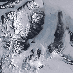
অ্যান্টার্কটিকার ল্যান্ডস্যাট চিত্র মোজাইক (LIMA) হলো প্রক্রিয়াজাত ল্যান্ডস্যাট ৭ ETM+ দৃশ্য থেকে তৈরি একটি নির্বিঘ্ন এবং কার্যত মেঘমুক্ত মোজাইক। প্রক্রিয়াজাত ল্যান্ডস্যাট দৃশ্য (১৬ বিট) হলো লেভেল ১জিটি এনএলএপিএস (Level 1Gt NLAPS) দৃশ্য যা ১৬ বিটে রূপান্তরিত, সূর্য-কোণ সংশোধনের মাধ্যমে প্রক্রিয়াজাত এবং প্রতিফলন মানে (বিন্ডশ্যাডলার...) রূপান্তরিত করা হয়েছে।
অ্যান্টার্কটিকার ল্যান্ডস্যাট চিত্র মোজাইক (LIMA) হলো প্রক্রিয়াজাত ল্যান্ডস্যাট ৭ ETM+ দৃশ্য থেকে তৈরি একটি নির্বিঘ্ন এবং কার্যত মেঘমুক্ত মোজাইক। প্রক্রিয়াজাত ল্যান্ডস্যাট দৃশ্য (১৬ বিট) হলো লেভেল ১জিটি এনএলএপিএস (Level 1Gt NLAPS) দৃশ্য যা ১৬ বিটে রূপান্তরিত, সূর্য-কোণ সংশোধনের মাধ্যমে প্রক্রিয়াজাত এবং প্রতিফলন মানে (বিন্ডশ্যাডলার...) রূপান্তরিত করা হয়েছে।
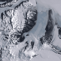
অ্যান্টার্কটিকার ল্যান্ডস্যাট ইমেজ মোজাইক (LIMA) হলো প্রক্রিয়াজাত ল্যান্ডস্যাট ৭ ETM+ দৃশ্য থেকে তৈরি একটি নির্বিঘ্ন এবং কার্যত মেঘমুক্ত মোজাইক। এই LIMA ডেটাসেটটি হলো ১৬-বিট ইন্টারমিডিয়েট LIMA। মোজাইকটি প্যান-শার্পেনড নর্মালাইজড সারফেস রিফ্লেক্টেন্স দৃশ্য নিয়ে গঠিত (ল্যান্ডস্যাট ETM+ ব্যান্ড ১, ২, ৩, এবং …
MCD12Q1.061 MODIS ভূমি আচ্ছাদন প্রকার বার্ষিক বৈশ্বিক ৫০০মি
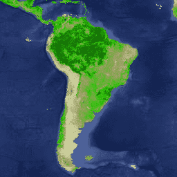
টেরা এবং অ্যাকুয়া সম্মিলিত মডারেট রেজোলিউশন ইমেজিং স্পেকট্রোরেডিওমিটার (MODIS) ল্যান্ড কভার টাইপ (MCD12Q1) সংস্করণ ৬.১ ডেটা প্রোডাক্টটি বার্ষিক বিরতিতে বৈশ্বিক ভূমি আচ্ছাদনের প্রকারভেদ সরবরাহ করে। MCD12Q1 সংস্করণ ৬.১ ডেটা প্রোডাক্টটি MODIS টেরা এবং অ্যাকুয়া রিফ্লেক্টেন্স ডেটার সুপারভাইজড ক্লাসিফিকেশন ব্যবহার করে তৈরি করা হয়েছে। ভূমি…
MCD19A1.061: ভূমি পৃষ্ঠের BRF দৈনিক L2G বৈশ্বিক ৫০০মি এবং ১কিমি
MCD19A1 ভার্সন 6.1 ডেটা প্রোডাক্টটি হলো একটি মডারেট রেজোলিউশন ইমেজিং স্পেকট্রোরেডিওমিটার (MODIS) টেরা এবং অ্যাকুয়া-র সম্মিলিত ল্যান্ড সারফেস বাইডিরেকশনাল রিফ্লেক্টেন্স ফ্যাক্টর (BRF) গ্রিডেড লেভেল ২ প্রোডাক্ট, যা প্রতিদিন ৫০০ মিটার এবং ১ কিলোমিটার রেজোলিউশনে উৎপাদিত হয়। আরও তথ্যের জন্য MAIAC ইউজার গাইড দেখুন।
MCD19A2.061: টেরা ও অ্যাকুয়া MAIAC ল্যান্ড অ্যারোসল অপটিক্যাল ডেপথ দৈনিক ১ কিমি
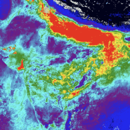
MCD19A2 V6.1 ডেটা প্রোডাক্টটি হলো একটি MODIS Terra এবং Aqua-এর সম্মিলিত মাল্টি-অ্যাঙ্গেল ইমপ্লিমেন্টেশন অফ অ্যাটমোস্ফেরিক কারেকশন (MAIAC) ল্যান্ড এরোসল অপটিক্যাল ডেপথ (AOD) গ্রিডেড লেভেল ২ প্রোডাক্ট, যা প্রতিদিন ১ কিমি রেজোলিউশনে উৎপাদিত হয়। আরও তথ্যের জন্য MAIAC ইউজার গাইড দেখুন। দ্রষ্টব্য: এই প্রোডাক্টটিতে রয়েছে…
MCD43A1.061 মোডিস বিআরডিএফ-অ্যালবেডো মডেল প্যারামিটার দৈনিক ৫০০মি
MCD43A1 V6.1 দ্বিমুখী প্রতিফলন বণ্টন ফাংশন এবং অ্যালবেডো (BRDF/Albedo) মডেল প্যারামিটার ডেটাসেটটি একটি ৫০০ মিটার দৈনিক ১৬-দিনের প্রোডাক্ট। জুলিয়ান তারিখটি ১৬-দিনের ডেটা সংগ্রহের সময়কালের নবম দিনকে নির্দেশ করে, এবং ফলস্বরূপ সেই দিনের BRDF/Albedo অনুমান করার জন্য পর্যবেক্ষণগুলোকে ওয়েট দেওয়া হয়। …
MCD43A2.061 MODIS BRDF-অ্যালবেডো কোয়ালিটি ডেইলি ৫০০মি
MCD43A2 V6.1 দ্বি-দিকনির্ভর প্রতিফলন বণ্টন ফাংশন এবং অ্যালবেডো (BRDF/Albedo) কোয়ালিটি ডেটাসেটটি একটি ৫০০ মিটার দৈনিক ১৬-দিনের প্রোডাক্ট। এতে সংশ্লিষ্ট ১৬-দিনের MCD43A3 অ্যালবেডো এবং MCD43A4 নাদির-BRDF (NBAR) প্রোডাক্টের সমস্ত কোয়ালিটি তথ্য রয়েছে। MCD43A2-তে প্রতিটি ব্যান্ডের কোয়ালিটি এবং পর্যবেক্ষণের তথ্য রয়েছে…
MCD43A3 V6.1 অ্যালবেডো মডেল ডেটাসেটটি একটি দৈনিক ১৬-দিনের প্রোডাক্ট। এটি MODIS সারফেস রিফ্লেক্টেন্স ব্যান্ডের (ব্যান্ড ১ থেকে ব্যান্ড ৭) প্রতিটির জন্য ডিরেকশনাল হেমিস্ফেরিকাল রিফ্লেক্টেন্স (ব্ল্যাক স্কাই অ্যালবেডো) এবং বাইহেমিস্ফেরিকাল রিফ্লেক্টেন্স (হোয়াইট স্কাই অ্যালবেডো) উভয়ই প্রদান করে, সেইসাথে ৩টি ব্রড স্পেকট্রাম…
MCD43A4.061 মোডিস নাদির BRDF-সমন্বিত প্রতিফলন দৈনিক ৫০০মি
MCD43A4 V6.1 নাদির দ্বি-দিকনির্ভর প্রতিফলন বণ্টন ফাংশন দ্বারা সমন্বয়কৃত প্রতিফলন (NBAR) পণ্যটি MODIS "ল্যান্ড" ব্যান্ড ১-৭ এর ৫০০ মিটার প্রতিফলন ডেটা প্রদান করে। এই ডেটাগুলোকে একটি দ্বি-দিকনির্ভর প্রতিফলন বণ্টন ফাংশন ব্যবহার করে এমনভাবে সমন্বয় করা হয়, যেন মানগুলো একটি নাদির ভিউ থেকে সংগ্রহ করা হয়েছে। …
MCD43C3.061 BRDF/অ্যালবেডো দৈনিক L3 0.05 ডিগ্রি CMG
The MCD43C3 Version 6.1 Bidirectional Reflectance Distribution Function and Albedo (BRDF/Albedo) Albedo dataset is produced daily using 16 days of Terra and Aqua MODIS data in a 0.05 degree (5,600 meters at the equator) Climate Modeling Grid (CMG). Data are temporally weighted to the ninth …
টেরা এবং অ্যাকুয়ার সম্মিলিত MCD64A1 ভার্সন 6.1 দগ্ধ এলাকা ডেটা প্রোডাক্টটি হলো একটি মাসিক, বৈশ্বিক গ্রিডযুক্ত ৫০০ মিটার প্রোডাক্ট, যাতে প্রতি-পিক্সেল দগ্ধ এলাকা এবং গুণমানের তথ্য থাকে। MCD64A1 দগ্ধ এলাকা ম্যাপিং পদ্ধতিতে ৫০০ মিটার MODIS সারফেস রিফ্লেক্টেন্স ইমেজারির সাথে ১ কিমি MODIS সক্রিয় অগ্নিকাণ্ড পর্যবেক্ষণকে সংযুক্ত করে ব্যবহার করা হয়। অ্যালগরিদমটি…
MOD08_M3.061 Terra Atmosphere Monthly Global Product
MOD08_M3 V6.1 is an atmosphere global product that contains monthly 1 x 1 degree grid average values of atmospheric parameters. These parameters are related to atmospheric aerosol particle properties, total ozone burden, atmospheric water vapor, cloud optical and physical properties, and atmospheric stability indices. The …
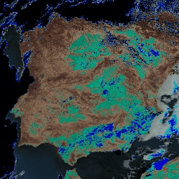
MOD09A1.061 Terra Surface Reflectance 8-Day Global 500m
The MOD09A1 V6.1 product provides an estimate of the surface spectral reflectance of Terra MODIS bands 1-7 at 500m resolution and corrected for atmospheric conditions such as gasses, aerosols, and Rayleigh scattering. Along with the seven reflectance bands is a quality layer and four observation …
MOD09GA.061 Terra Surface Reflectance Daily Global 1km and 500m
The MODIS Surface Reflectance products provide an estimate of the surface spectral reflectance as it would be measured at ground level in the absence of atmospheric scattering or absorption. Low-level data are corrected for atmospheric gases and aerosols. MOD09GA version 6.1 provides bands 1-7 in …
MOD09GQ.061 টেরা ভূপৃষ্ঠের প্রতিফলন দৈনিক বৈশ্বিক ২৫০মি
The MODIS Surface Reflectance products provide an estimate of the surface spectral reflectance as it would be measured at ground level in the absence of atmospheric scattering or absorption. Low-level data are corrected for atmospheric gases and aerosols. MOD09GQ version 6.1 provides bands 1 and …
MOD09Q1.061 Terra Surface Reflectance 8-Day Global 250m
The MOD09Q1 product provides an estimate of the surface spectral reflectance of bands 1 and 2 at 250m resolution and corrected for atmospheric conditions such as gasses, aerosols, and Rayleigh scattering. Along with the two reflectance bands, a quality layer is also included. For each …
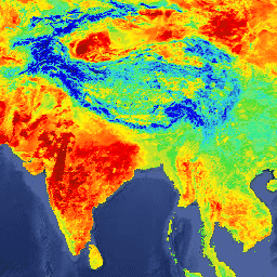
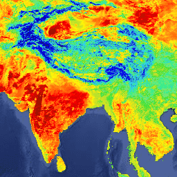
MOD11A1.061 Terra Land Surface Temperature and Emissivity Daily Global 1km
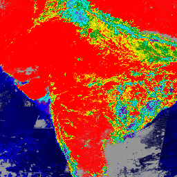
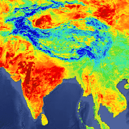
The MOD11A1 V6.1 product provides daily land surface temperature (LST) and emissivity values in a 1200 x 1200 kilometer grid. The temperature value is derived from the MOD11_L2 swath product. Above 30 degrees latitude, some pixels may have multiple observations where the criteria for clear-sky …
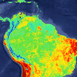
MOD11A2.061 Terra Land Surface Temperature and Emissivity 8-Day Global 1km
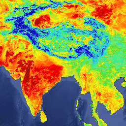
The MOD11A2 V6.1 product provides an average 8-day land surface temperature (LST) in a 1200 x 1200 kilometer grid. Each pixel value in MOD11A2 is a simple average of all the corresponding MOD11A1 LST pixels collected within that 8 day period. The MOD11A2 does a …
MOD13A1.061 Terra Vegetation Indices 16-Day Global 500m
The MOD13A1 V6.1 product provides a Vegetation Index (VI) value at a per pixel basis. There are two primary vegetation layers. The first is the Normalized Difference Vegetation Index (NDVI) which is referred to as the continuity index to the existing National Oceanic and Atmospheric …
MOD13A2.061 Terra Vegetation Indices 16-Day Global 1km
The MOD13A2 V6.1 product provides two Vegetation Indices (VI): the Normalized Difference Vegetation Index (NDVI) and the Enhanced Vegetation Index (EVI). The NDVI is referred to as the continuity index to the existing National Oceanic and Atmospheric Administration-Advanced Very High Resolution Radiometer (NOAA-AVHRR) derived NDVI. …
MOD13A3.061 Vegetation Indices Monthly L3 Global 1 km SIN Grid
The MOD13A3 V6.1 product data is provided monthly at 1 kilometer (km) spatial resolution. In generating this monthly product, the algorithm ingests all the MOD13A2 products that overlap the month and employs a weighted temporal average. Vegetation indices are used for global monitoring of vegetation …
MOD13C1.061: Terra Vegetation Indices 16-Day L3 Global 0.05 Deg Climate Modeling Grid
The Terra Moderate Resolution Imaging Spectroradiometer (MODIS) Vegetation Indices 16-Day (MOD13C1) Version 6.1 product provides a Vegetation Index (VI) value at a per pixel basis. There are two primary vegetation layers. The first is the Normalized Difference Vegetation Index (NDVI), which maintains continuity with the …
MOD13Q1.061 Terra Vegetation Indices 16-Day Global 250m
The MOD13Q1 V6.1 product provides a Vegetation Index (VI) value at a per pixel basis. There are two primary vegetation layers. The first is the Normalized Difference Vegetation Index (NDVI) which is referred to as the continuity index to the existing National Oceanic and Atmospheric …
MOD14A1.061: Terra Thermal Anomalies & Fire Daily Global 1km
The MOD14A1 V6.1 dataset provides daily fire mask composites at 1km resolution derived from the MODIS 4- and 11-micrometer radiances. The fire detection strategy is based on absolute detection of a fire (when the fire strength is sufficient to detect), and on detection relative to …
MOD14A2.061: Terra Thermal Anomalies & Fire 8-Day Global 1km
The MOD14A2 V6.1 dataset provides 8-day fire mask composites at 1km resolution. It contains the maximum value of the individual pixel classes over the compositing period. Along with the fire mask, an associated quality information layer is also provided. Documentation: User's Guide Algorithm Theoretical Basis …
MOD15A2H.061: Terra Leaf Area Index/FPAR 8-Day Global 500m
The MOD15A2H V6.1 MODIS combined Leaf Area Index (LAI) and Fraction of Photosynthetically Active Radiation (FPAR) product is an 8-day composite dataset at 500m resolution. The algorithm chooses the "best" pixel available from all the acquisitions of the Terra sensor from within the 8-day period. …
MOD17A2H.061: Terra Gross Primary Productivity 8-Day Global 500m
The MOD17A2H V6.1 Gross Primary Productivity (GPP) product is a cumulative 8-day composite with a 500m pixel size. The product is based on the radiation-use efficiency concept and can be potentially used as inputs to data models to calculate terrestrial energy, carbon, water cycle processes, …
MOD17A2HGF.061: Terra Gross Primary Productivity 8-Day Global 500m
The MOD17A2HGF Version 6.1 Gross Primary Productivity (GPP) product is a cumulative 8-day composite of values with 500 meter (m) pixel size based on the radiation use efficiency concept that can be potentially used as inputs to data models to calculate terrestrial energy, carbon, water …
MOD17A3HGF.061: Terra Net Primary Production Gap-Filled Yearly Global 500m
The MOD17A3HGF V6.1 product provides information about annual Gross and Net Primary Productivity (GPP and NPP) at 500m pixel resolution. Annual NPP is derived from the sum of all 8-day Net Photosynthesis(PSN) products (MOD17A2H) from the given year. The PSN value is the difference of …
MOD21A1D.061 Terra Land Surface Temperature and 3-Band Emissivity Daily Global 1km
The MOD21A1D dataset is produced daily from daytime Level 2 Gridded (L2G) intermediate LST products at a spatial resolution of 1,000 meters. The L2G process maps the daily MOD21 swath granules onto a sinusoidal MODIS grid and stores all observations falling over a gridded cell …
MOD21A1N.061 Terra Land Surface Temperature and 3-Band Emissivity Daily Global 1km
The MOD21A1N dataset is produced daily from nighttime Level 2 Gridded (L2G) intermediate LST products at a spatial resolution of 1,000 meters. The L2G process maps the daily MOD21 swath granules onto a sinusoidal MODIS grid and stores all observations falling over a gridded cell …
MOD21C1.061 Terra Land Surface Temperature and 3-Band Emissivity Daily L3 Global 0.05 Deg CMG
The MOD21C1 dataset is produced daily in a 0.05 degree (5,600 meters at the equator) Climate Modeling Grid (CMG) from daytime Level 2 Gridded (L2G) intermediate LST products. The L2G process maps the daily MOD21 swath granules onto a sinusoidal MODIS grid and stores all …
MOD21C2.061 Terra Land Surface Temperature and 3-Band Emissivity 8-Day L3 Global 0.05 Deg CMG
The MOD21C2 dataset is an 8-day composite LST product that uses an algorithm based on a simple averaging method. The algorithm calculates the average from all the cloud free MOD21A1D and MOD21A1N daily acquisitions from the 8-day period. Unlike the MOD21A1 data sets where the …
MOD21C3.061 Terra Land Surface Temperature and 3-Band Emissivity Monthly L3 Global 0.05 Deg CMG
The MOD21C3 dataset is a monthly composite LST product that uses an algorithm based on a simple averaging method. The algorithm calculates the average from all the cloud free MOD21A1D and MOD21A1N daily acquisitions from the 8-day period. Unlike the MOD21A1 data sets where the …
MOD44W.006 Terra Land Water Mask Derived From MODIS and SRTM Yearly Global 250m
The MOD44W V6 land/water mask 250m product is derived using a decision tree classifier trained with MODIS data and validated with the MOD44W V5 product. A series of masks are applied to address known issues caused by terrain shadow, burn scars, cloudiness, or ice cover …
MODOCGA.006 Terra Ocean Reflectance Daily Global 1km
The MODOCGA V6 ocean reflectance product consists of 1 kilometer reflectance data from Terra MODIS bands 8-16. The product is referred to as ocean reflectance, because bands 8-16 are used primarily to produce ocean products, but this is not an ocean product as the tiles …
The Monitoring Trends in Burn Severity (MTBS) burned area boundaries dataset contains the extent polygons of the burned areas of all currently completed MTBS fires for the continental United States, Alaska, Hawaii, and Puerto Rico. Below NBR stands for "Normalized Burn Ratio", while dNBR stands …
MYD08_M3.061 Aqua Atmosphere Monthly Global Product
MYD08_M3 V6.1 is an atmosphere global product that contains monthly 1 x 1 degree grid average values of atmospheric parameters. These parameters are related to atmospheric aerosol particle properties, total ozone burden, atmospheric water vapor, cloud optical and physical properties, and atmospheric stability indices. The …
MYD09A1.061 Aqua Surface Reflectance 8-Day Global 500m
The MYD09A1 V6.1 product provides an estimate of the surface spectral reflectance of Aqua MODIS bands 1-7 at 500m resolution and corrected for atmospheric conditions such as gasses, aerosols, and Rayleigh scattering. Along with the seven reflectance bands is a quality layer and four observation …
MYD09GA.061 Aqua Surface Reflectance Daily Global 1km and 500m
The MODIS Surface Reflectance products provide an estimate of the surface spectral reflectance as it would be measured at ground level in the absence of atmospheric scattering or absorption. Low-level data are corrected for atmospheric gases and aerosols. MYD09GA version 6.1 provides bands 1-7 in …
MYD09GQ.061 Aqua Surface Reflectance Daily Global 250m
The MODIS Surface Reflectance products provide an estimate of the surface spectral reflectance as it would be measured at ground level in the absence of atmospheric scattering or absorption. Low-level data are corrected for atmospheric gases and aerosols. MYD09GQ version 6.1 provides bands 1 and …
MYD09Q1.061 Aqua Surface Reflectance 8-Day Global 250m
The MYD09Q1 product provides an estimate of the surface spectral reflectance of bands 1 and 2 at 250m resolution and corrected for atmospheric conditions such as gasses, aerosols, and Rayleigh scattering. Along with the two reflectance bands, a quality layer is also included. For each …
MYD11A1.061 Aqua Land Surface Temperature and Emissivity Daily Global 1km
The MYD11A1 V6.1 product provides daily land surface temperature (LST) and emissivity values in a 1200 x 1200 kilometer grid. The temperature value is derived from the MYD11_L2 swath product. Above 30 degrees latitude, some pixels may have multiple observations where the criteria for clear-sky …
MYD11A2.061 Aqua Land Surface Temperature and Emissivity 8-Day Global 1km
The MYD11A2 V6.1 product provides an average 8-day land surface temperature (LST) in a 1200 x 1200 kilometer grid. Each pixel value in MYD11A2 is a simple average of all the corresponding MYD11A1 LST pixels collected within that 8 day period. The MYD11A2 does a …
MYD13A1.061 Aqua Vegetation Indices 16-Day Global 500m
The MYD13A1 V6.1 product provides a Vegetation Index (VI) value at a per pixel basis. There are two primary vegetation layers. The first is the Normalized Difference Vegetation Index (NDVI) which is referred to as the continuity index to the existing National Oceanic and Atmospheric …
MYD13A2.061 Aqua Vegetation Indices 16-Day Global 1km
The MYD13A2 V6.1 product provides two Vegetation Indices (VI): the Normalized Difference Vegetation Index (NDVI) and the Enhanced Vegetation Index (EVI). The NDVI is referred to as the continuity index to the existing National Oceanic and Atmospheric Administration-Advanced Very High Resolution Radiometer (NOAA-AVHRR) derived NDVI. …
MYD13A3.061 Aqua Vegetation Indices Monthly L3 Global 1 km SIN Grid
The Aqua Moderate Resolution Imaging Spectroradiometer (MODIS) Vegetation Indices (MYD13A3) Version 6.1 data are provided monthly at 1 kilometer (km) spatial resolution as a gridded Level 3 product in the sinusoidal projection. In generating this monthly product, the algorithm ingests all the MYD13A2 products that …
MYD13C1.061: Aqua Vegetation Indices 16-Day L3 Global 0.05 Deg CMG
The Aqua Moderate Resolution Imaging Spectroradiometer (MODIS) Vegetation Indices 16-Day (MYD13C1) Version 6.1 product provides a Vegetation Index (VI) value at a per pixel basis. There are two primary vegetation layers. The first is the Normalized Difference Vegetation Index (NDVI), which maintains continuity with the …
MYD13Q1.061 Aqua Vegetation Indices 16-Day Global 250m
The MYD13Q1 V6.1 product provides a Vegetation Index (VI) value at a per pixel basis. There are two primary vegetation layers. The first is the Normalized Difference Vegetation Index (NDVI) which is referred to as the continuity index to the existing National Oceanic and Atmospheric …
MYD14A1.061: Aqua Thermal Anomalies & Fire Daily Global 1km
The MYD14A1 V6.1 dataset provides daily fire mask composites at 1km resolution derived from the MODIS 4- and 11-micrometer radiances. The fire detection strategy is based on absolute detection of a fire (when the fire strength is sufficient to detect), and on detection relative to …
MYD14A2.061: Aqua Thermal Anomalies & Fire 8-Day Global 1km
The MYD14A2 V6.1 dataset provides 8-day fire mask composites at 1km resolution. It contains the maximum value of the individual pixel classes over the compositing period. Along with the fire mask, an associated quality information layer is also provided. Documentation: User's Guide Algorithm Theoretical Basis …
MYD15A2H.061: Aqua Leaf Area Index/FPAR 8-Day Global 500m
The MYD15A2H V6.1 MODIS combined Leaf Area Index (LAI) and Fraction of Photosynthetically Active Radiation (FPAR) product is an 8-day composite dataset at 500m resolution. The algorithm chooses the "best" pixel available from all the acquisitions of the Aqua sensor from within the 8-day period. …
MYD17A2H.061: Aqua Gross Primary Productivity 8-Day Global 500m
The MYD17A2H V6.1 Gross Primary Productivity (GPP) product is a cumulative 8-day composite with a 500m resolution. The product is based on the radiation-use efficiency concept and can be potentially used as inputs to data models to calculate terrestrial energy, carbon, water cycle processes, and …
MYD17A3HGF.061: Aqua Net Primary Production Gap-Filled Yearly Global 500m
The MYD17A3HGF V6.1 product provides information about annual Gross and Net Primary Productivity (GPP and NPP) at 500m pixel resolution. Annual NPP is derived from the sum of all 8-day Net Photosynthesis(PSN) products (MYD17A2H) from the given year. The PSN value is the difference of …
MYD21A1D.061 Aqua Land Surface Temperature and 3-Band Emissivity Daily Global 1km
The MYD21A1D dataset is produced daily from daytime Level 2 Gridded (L2G) intermediate LST products at a spatial resolution of 1,000 meters. The L2G process maps the daily MOD21 swath granules onto a sinusoidal MODIS grid and stores all observations falling over a gridded cell …
MYD21A1N.061 Aqua Land Surface Temperature and 3-Band Emissivity Daily Global 1km
The MYD21A1N dataset is produced daily from nighttime Level 2 Gridded (L2G) intermediate LST products at a spatial resolution of 1,000 meters. The L2G process maps the daily MOD21 swath granules onto a sinusoidal MODIS grid and stores all observations falling over a gridded cell …
MYD21C1.061 Aqua Land Surface Temperature and 3-Band Emissivity Daily L3 Global 0.05 Deg CMG
The MYD21C1 dataset is produced daily in a 0.05 degree (5,600 meters at the equator) Climate Modeling Grid (CMG) from daytime Level 2 Gridded (L2G) intermediate LST products. The L2G process maps the daily MYD21 swath granules onto a sinusoidal MODIS grid and stores all …
MYD21C2.061 Aqua Land Surface Temperature and 3-Band Emissivity 8-Day L3 Global 0.05 Deg CMG
The MYD21C2 dataset is an 8-day composite LST product that uses an algorithm based on a simple averaging method. The algorithm calculates the average from all the cloud free MYD21A1D and MYD21A1N daily acquisitions from the 8-day period. Unlike the MYD21A1 data sets where the …
MYD21C3.061 Aqua Land Surface Temperature and 3-Band Emissivity Monthly L3 Global 0.05 Deg CMG
The MYD21C3 dataset is a monthly composite LST product that uses an algorithm based on a simple averaging method. The algorithm calculates the average from all the cloud free MYD21A1D and MYD21A1N daily acquisitions from the 8-day period. Unlike the MYD21A1 data sets where the …
MYDOCGA.006 Aqua Ocean Reflectance Daily Global 1km
The MYDOCGA V6 ocean reflectance product consists of 1 kilometer reflectance data from Aqua MODIS bands 8-16. The product is referred to as ocean reflectance, because bands 8-16 are used primarily to produce ocean products, but this is not an ocean product as the tiles …
Monitoring Trends in Burn Severity (MTBS) Burn Severity Images
The burn severity mosaics consist of thematic raster images of MTBS burn severity classes for all currently completed MTBS fires for the continental United States, Alaska, Hawaii and Puerto Rico. Mosaicked burn severity images are compiled annually for each year by US State and the …
The Shuttle Radar Topography Mission (SRTM, see Farr et al. 2007) digital elevation data is an international research effort that obtained digital elevation models on a near-global scale. This SRTM V3 product (SRTM Plus) is provided by NASA JPL at a resolution of 1 arc-second …
NASADEM is a reprocessing of SRTM data, with improved accuracy by incorporating auxiliary data from ASTER GDEM, ICESat GLAS, and PRISM datasets. The most significant processing improvements involve void reduction through improved phase unwrapping and using ICESat GLAS data for control. Documentation: User's Guide
NLCD 2019: USGS National Land Cover Database, 2019 release
NLCD (the National Land Cover Database) is a 30-m Landsat-based land cover database spanning 8 epochs (2001, 2004, 2006, 2008, 2011, 2013, 2016, and 2019). A ninth epoch for 2021 is also available here. The images rely on the imperviousness data layer for the urban …
NLCD 2021: USGS National Land Cover Database, 2021 release
The US Geological Survey (USGS), in partnership with several federal agencies, has now developed and released seven National Land Cover Database (NLCD) products: NLCD 1992, 2001, 2006, 2011, 2016, 2019, and 2021. Beginning with the 2016 release, land cover products were created for two-to-three-year intervals …
PAD-US is America's official national inventory of US terrestrial and marine protected areas that are dedicated to the preservation of biological diversity and to other natural, recreation and cultural uses, managed for these purposes through legal or other effective means. This database is separated into …
The Tree Canopy Cover (TCC) data suite, produced by the United States Department of Agriculture, Forest Service (USFS), are annual remote sensing-based map outputs spanning from 1985-2025. These data support the National Land Cover Database (NLCD) project, which is managed by the US Geological Survey …
USGS 3DEP 10m National Map Seamless (1/3 Arc-Second)
This is the seamless 3DEP DEM dataset for the US with full coverage of the 48 conterminous states, Hawaii, and US territories. Alaska coverage is partially available now and is being expanded to statewide coverage as part of the Alaska Mapping Initiative. Ground spacing is …
This is a tiled collection of images with 1m pixel size from the 3D Elevation Program (3DEP). The 3DEP data holdings serve as the elevation layer of The National Map and provide foundational elevation information for earth science studies and mapping applications in the United …
USGS 3DEP National Map Spatial Metadata 1/3 Arc-Second (10m)
This is a table with metadata for the 3DEP 10m DEM asset. The Work unit Extent Spatial Metadata (WESM) contains current lidar data availability and basic information about lidar projects, including lidar quality level, data acquisition dates, and links to project-level metadata. See more details …
The GAP/LANDFIRE National Terrestrial Ecosystems data represents a detailed vegetation and land cover classification for the Conterminous US, Alaska, Hawaii, and Puerto Rico.GAP/LF 2011 Ecosystems for the Conterminous US is an update of the National Gap Analysis Program Land Cover Data - Version 2.2. Alaska …
The GAP/LANDFIRE National Terrestrial Ecosystems data represents a detailed vegetation and land cover classification for the Conterminous US, Alaska, Hawaii, and Puerto Rico.GAP/LF 2011 Ecosystems for the Conterminous US is an update of the National Gap Analysis Program Land Cover Data - Version 2.2. Alaska …
The GAP/LANDFIRE National Terrestrial Ecosystems data represents a detailed vegetation and land cover classification for the Conterminous US, Alaska, Hawaii, and Puerto Rico.GAP/LF 2011 Ecosystems for the Conterminous US is an update of the National Gap Analysis Program Land Cover Data - Version 2.2. Alaska …
The GAP/LANDFIRE National Terrestrial Ecosystems data represents a detailed vegetation and land cover classification for the Conterminous US, Alaska, Hawaii, and Puerto Rico.GAP/LF 2011 Ecosystems for the Conterminous US is an update of the National Gap Analysis Program Land Cover Data - Version 2.2. Alaska …
Landsat 1 MSS Collection 2 Tier 1 DN values, representing scaled, calibrated at-sensor radiance. Landsat scenes with the highest available data quality are placed into Tier 1 and are considered suitable for time-series processing analysis. Tier 1 includes Level-1 Precision Terrain (L1TP) processed data that …
Landsat 1 MSS Collection 2 Tier 2 DN values, representing scaled, calibrated at-sensor radiance. Scenes not meeting Tier 1 criteria during processing are assigned to Tier 2. This includes Systematic terrain (L1GT) and Systematic (L1GS) processed scenes, as well as any L1TP scenes that do …
Landsat 2 MSS Collection 2 Tier 1 DN values, representing scaled, calibrated at-sensor radiance. Landsat scenes with the highest available data quality are placed into Tier 1 and are considered suitable for time-series processing analysis. Tier 1 includes Level-1 Precision Terrain (L1TP) processed data that …
Landsat 2 MSS Collection 2 Tier 2 DN values, representing scaled, calibrated at-sensor radiance. Scenes not meeting Tier 1 criteria during processing are assigned to Tier 2. This includes Systematic terrain (L1GT) and Systematic (L1GS) processed scenes, as well as any L1TP scenes that do …
Landsat 3 MSS Collection 2 Tier 1 DN values, representing scaled, calibrated at-sensor radiance. Landsat scenes with the highest available data quality are placed into Tier 1 and are considered suitable for time-series processing analysis. Tier 1 includes Level-1 Precision Terrain (L1TP) processed data that …
Landsat 3 MSS Collection 2 Tier 2 DN values, representing scaled, calibrated at-sensor radiance. Scenes not meeting Tier 1 criteria during processing are assigned to Tier 2. This includes Systematic terrain (L1GT) and Systematic (L1GS) processed scenes, as well as any L1TP scenes that do …
This dataset contains atmospherically corrected surface reflectance and land surface temperature derived from the data produced by the Landsat TM sensor. These images contain 4 visible and near-infrared (VNIR) bands and 2 short-wave infrared (SWIR) bands processed to orthorectified surface reflectance, and one thermal infrared …
This dataset contains atmospherically corrected surface reflectance and land surface temperature derived from the data produced by the Landsat TM sensor. These images contain 4 visible and near-infrared (VNIR) bands and 2 short-wave infrared (SWIR) bands processed to orthorectified surface reflectance, and one thermal infrared …
Landsat 4 MSS Collection 2 Tier 1 DN values, representing scaled, calibrated at-sensor radiance. Landsat scenes with the highest available data quality are placed into Tier 1 and are considered suitable for time-series processing analysis. Tier 1 includes Level-1 Precision Terrain (L1TP) processed data that …
Landsat 4 MSS Collection 2 Tier 2 DN values, representing scaled, calibrated at-sensor radiance. Scenes not meeting Tier 1 criteria during processing are assigned to Tier 2. This includes Systematic terrain (L1GT) and Systematic (L1GS) processed scenes, as well as any L1TP scenes that do …
Landsat 4 TM Collection 2 Tier 1 DN values, representing scaled, calibrated at-sensor radiance. Landsat scenes with the highest available data quality are placed into Tier 1 and are considered suitable for time-series processing analysis. Tier 1 includes Level-1 Precision Terrain (L1TP) processed data that …
USGS Landsat 4 TM Collection 2 Tier 1 TOA Reflectance
Landsat 4 TM Collection 2 Tier 1 calibrated top-of-atmosphere (TOA) reflectance. Calibration coefficients are extracted from the image metadata. See Chander et al. (2009) for details on the TOA computation.
Landsat 4 TM Collection 2 Tier 2 DN values, representing scaled, calibrated at-sensor radiance. Scenes not meeting Tier 1 criteria during processing are assigned to Tier 2. This includes Systematic terrain (L1GT) and Systematic (L1GS) processed scenes, as well as any L1TP scenes that do …
USGS Landsat 4 TM Collection 2 Tier 2 TOA Reflectance
Landsat 4 TM Collection 2 Tier 2 calibrated top-of-atmosphere (TOA) reflectance. Calibration coefficients are extracted from the image metadata. See Chander et al. (2009) for details on the TOA computation.
This dataset contains atmospherically corrected surface reflectance and land surface temperature derived from the data produced by the Landsat TM sensor. These images contain 4 visible and near-infrared (VNIR) bands and 2 short-wave infrared (SWIR) bands processed to orthorectified surface reflectance, and one thermal infrared …
This dataset contains atmospherically corrected surface reflectance and land surface temperature derived from the data produced by the Landsat TM sensor. These images contain 4 visible and near-infrared (VNIR) bands and 2 short-wave infrared (SWIR) bands processed to orthorectified surface reflectance, and one thermal infrared …
Landsat 5 MSS Collection 2 Tier 1 DN values, representing scaled, calibrated at-sensor radiance. Landsat scenes with the highest available data quality are placed into Tier 1 and are considered suitable for time-series processing analysis. Tier 1 includes Level-1 Precision Terrain (L1TP) processed data that …
Landsat 5 MSS Collection 2 Tier 2 DN values, representing scaled, calibrated at-sensor radiance. Scenes not meeting Tier 1 criteria during processing are assigned to Tier 2. This includes Systematic terrain (L1GT) and Systematic (L1GS) processed scenes, as well as any L1TP scenes that do …
Landsat 5 TM Collection 2 Tier 1 DN values, representing scaled, calibrated at-sensor radiance. Landsat scenes with the highest available data quality are placed into Tier 1 and are considered suitable for time-series processing analysis. Tier 1 includes Level-1 Precision Terrain (L1TP) processed data that …
USGS Landsat 5 TM Collection 2 Tier 1 TOA Reflectance
Landsat 5 TM Collection 2 Tier 1 calibrated top-of-atmosphere (TOA) reflectance. Calibration coefficients are extracted from the image metadata. See Chander et al. (2009) for details on the TOA computation.
Landsat 5 TM Collection 2 Tier 2 DN values, representing scaled, calibrated at-sensor radiance. Scenes not meeting Tier 1 criteria during processing are assigned to Tier 2. This includes Systematic terrain (L1GT) and Systematic (L1GS) processed scenes, as well as any L1TP scenes that do …
USGS Landsat 5 TM Collection 2 Tier 2 TOA Reflectance
Landsat 5 TM Collection 2 Tier 2 calibrated top-of-atmosphere (TOA) reflectance. Calibration coefficients are extracted from the image metadata. See Chander et al. (2009) for details on the TOA computation.
Landsat 7 Collection 2 Tier 1 DN values, representing scaled, calibrated at-sensor radiance. Landsat scenes with the highest available data quality are placed into Tier 1 and are considered suitable for time-series processing analysis. Tier 1 includes Level-1 Precision Terrain (L1TP) processed data that have …
USGS Landsat 7 Collection 2 Tier 1 TOA Reflectance
Landsat 7 Collection 2 Tier 1 calibrated top-of-atmosphere (TOA) reflectance. Calibration coefficients are extracted from the image metadata. See Chander et al. (2009) for details on the TOA computation. Note that Landsat 7's orbit has been drifting to an earlier acquisition time since 2017.
USGS Landsat 7 Collection 2 Tier 1 and Real-Time data Raw Scenes
Landsat 7 Collection 2 Tier 1 and Real-Time data DN values, representing scaled, calibrated at-sensor radiance. Landsat scenes with the highest available data quality are placed into Tier 1 and are considered suitable for time-series processing analysis. Tier 1 includes Level-1 Precision Terrain (L1TP) processed …
USGS Landsat 7 Collection 2 Tier 1 and Real-Time data TOA Reflectance
Landsat 7 Collection 2 Tier 1 and Real-Time data calibrated top-of-atmosphere (TOA) reflectance. Calibration coefficients are extracted from the image metadata. See Chander et al. (2009) for details on the TOA computation. Note that Landsat 7's orbit has been drifting to an earlier acquisition time …
Landsat 7 Collection 2 Tier 2 DN values, representing scaled, calibrated at-sensor radiance. Scenes not meeting Tier 1 criteria during processing are assigned to Tier 2. This includes Systematic terrain (L1GT) and Systematic (L1GS) processed scenes, as well as any L1TP scenes that do not …
USGS Landsat 7 Collection 2 Tier 2 TOA Reflectance
Landsat 7 Collection 2 Tier 2 calibrated top-of-atmosphere (TOA) reflectance. Calibration coefficients are extracted from the image metadata. See Chander et al. (2009) for details on the TOA computation. Note that Landsat 7's orbit has been drifting to an earlier acquisition time since 2017.
This dataset contains atmospherically corrected surface reflectance and land surface temperature derived from the data produced by the Landsat 7 ETM+ sensor. These images contain 4 visible and near-infrared (VNIR) bands and 2 short-wave infrared (SWIR) bands processed to orthorectified surface reflectance, and one thermal …
This dataset contains atmospherically corrected surface reflectance and land surface temperature derived from the data produced by the Landsat 7 ETM+ sensor. These images contain 4 visible and near-infrared (VNIR) bands and 2 short-wave infrared (SWIR) bands processed to orthorectified surface reflectance, and one thermal …
Landsat 8 Collection 2 Tier 1 DN values, representing scaled, calibrated at-sensor radiance. Landsat scenes with the highest available data quality are placed into Tier 1 and are considered suitable for time-series processing analysis. Tier 1 includes Level-1 Precision Terrain (L1TP) processed data that have …
USGS Landsat 8 Collection 2 Tier 1 TOA Reflectance
Landsat 8 Collection 2 Tier 1 calibrated top-of-atmosphere (TOA) reflectance. Calibration coefficients are extracted from the image metadata. See Chander et al. (2009) for details on the TOA computation. Landsat scenes with the highest available data quality are placed into Tier 1 and are considered …
USGS Landsat 8 Collection 2 Tier 1 and Real-Time data Raw Scenes
Landsat 8 Collection 2 Tier 1 and Real-Time data DN values, representing scaled, calibrated at-sensor radiance. Landsat scenes with the highest available data quality are placed into Tier 1 and are considered suitable for time-series processing analysis. Tier 1 includes Level-1 Precision Terrain (L1TP) processed …
USGS Landsat 8 Collection 2 Tier 1 and Real-Time data TOA Reflectance
Landsat 8 Collection 2 Tier 1 and Real-Time data calibrated top-of-atmosphere (TOA) reflectance. Calibration coefficients are extracted from the image metadata. See Chander et al. (2009) for details on the TOA computation. Landsat scenes with the highest available data quality are placed into Tier 1 …
Landsat 8 Collection 2 Tier 2 DN values, representing scaled, calibrated at-sensor radiance. Scenes not meeting Tier 1 criteria during processing are assigned to Tier 2. This includes Systematic terrain (L1GT) and Systematic (L1GS) processed scenes, as well as any L1TP scenes that do not …
USGS Landsat 8 Collection 2 Tier 2 TOA Reflectance
Landsat 8 Collection 2 Tier 2 calibrated top-of-atmosphere (TOA) reflectance. Calibration coefficients are extracted from the image metadata. See Chander et al. (2009) for details on the TOA computation. Scenes not meeting Tier 1 criteria during processing are assigned to Tier 2. This includes Systematic …
This dataset contains atmospherically corrected surface reflectance and land surface temperature derived from the data produced by the Landsat 8 OLI/TIRS sensors. These images contain 5 visible and near-infrared (VNIR) bands and 2 short-wave infrared (SWIR) bands processed to orthorectified surface reflectance, and one thermal …
This dataset contains atmospherically corrected surface reflectance and land surface temperature derived from the data produced by the Landsat 8 OLI/TIRS sensors. These images contain 5 visible and near-infrared (VNIR) bands and 2 short-wave infrared (SWIR) bands processed to orthorectified surface reflectance, and one thermal …
Landsat 9 Collection 2 Tier 1 DN values, representing scaled, calibrated at-sensor radiance. Landsat scenes with the highest available data quality are placed into Tier 1 and are considered suitable for time-series processing analysis. Tier 1 includes Level-1 Precision Terrain (L1TP) processed data that have …
USGS Landsat 9 Collection 2 Tier 1 TOA Reflectance
Landsat 9 Collection 2 Tier 1 calibrated top-of-atmosphere (TOA) reflectance. Calibration coefficients are extracted from the image metadata. See Chander et al. (2009) for details on the TOA computation. Landsat scenes with the highest available data quality are placed into Tier 1 and are considered …
Landsat 9 Collection 2 Tier 2 DN values, representing scaled, calibrated at-sensor radiance. Scenes not meeting Tier 1 criteria during processing are assigned to Tier 2. This includes Systematic terrain (L1GT) and Systematic (L1GS) processed scenes, as well as any L1TP scenes that do not …
USGS Landsat 9 Collection 2 Tier 2 TOA Reflectance
Landsat 9 Collection 2 Tier 2 calibrated top-of-atmosphere (TOA) reflectance. Calibration coefficients are extracted from the image metadata. See Chander et al. (2009) for details on the TOA computation. Scenes not meeting Tier 1 criteria during processing are assigned to Tier 2. This includes Systematic …
This dataset contains atmospherically corrected surface reflectance and land surface temperature derived from the data produced by the Landsat 9 OLI/TIRS sensors. These images contain 5 visible and near-infrared (VNIR) bands and 2 short-wave infrared (SWIR) bands processed to orthorectified surface reflectance, and one thermal …
This dataset contains atmospherically corrected surface reflectance and land surface temperature derived from the data produced by the Landsat 9 OLI/TIRS sensors. These images contain 5 visible and near-infrared (VNIR) bands and 2 short-wave infrared (SWIR) bands processed to orthorectified surface reflectance, and one thermal …
[[["সহজে বোঝা যায়","easyToUnderstand","thumb-up"],["আমার সমস্যার সমাধান হয়েছে","solvedMyProblem","thumb-up"],["অন্যান্য","otherUp","thumb-up"]],[["এতে আমার প্রয়োজনীয় তথ্য নেই","missingTheInformationINeed","thumb-down"],["খুব জটিল / অনেক ধাপ","tooComplicatedTooManySteps","thumb-down"],["পুরনো","outOfDate","thumb-down"],["অনুবাদ সংক্রান্ত সমস্যা","translationIssue","thumb-down"],["নমুনা / কোড সংক্রান্ত সমস্যা","samplesCodeIssue","thumb-down"],["অন্যান্য","otherDown","thumb-down"]],[],[],[]]