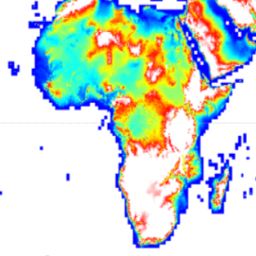
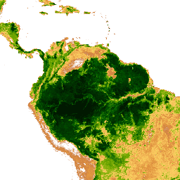
Datasets tagged geophysical in Earth Engine
সেভ করা পৃষ্ঠা গুছিয়ে রাখতে 'সংগ্রহ' ব্যবহার করুন
আপনার পছন্দ অনুযায়ী কন্টেন্ট সেভ করুন ও সঠিক বিভাগে রাখুন।
অ্যাডভান্সড স্পেসবোর্ন থার্মাল এমিশন অ্যান্ড রিফ্লেকশন রেডিওমিটার গ্লোবাল এমিসিভিটি ডেটাবেস (ASTER-GED) ন্যাশনাল অ্যারোনটিক্স অ্যান্ড স্পেস অ্যাডমিনিস্ট্রেশন (NASA)-এর জেট প্রোপালশন ল্যাবরেটরি (JPL), ক্যালিফোর্নিয়া ইনস্টিটিউট অফ টেকনোলজি দ্বারা তৈরি করা হয়েছিল। এই পণ্যটিতে সমস্ত ৫টি ASTER থার্মাল ইনফ্রারেডের গড় এমিসিভিটি এবং স্ট্যান্ডার্ড ডেভিয়েশন অন্তর্ভুক্ত রয়েছে…
AHN DEM হলো নেদারল্যান্ডসকে আবৃতকারী একটি ০.৫ মিটার DEM। এটি ২০০৭ থেকে ২০১২ সালের মধ্যে বসন্তকালে সংগৃহীত LIDAR ডেটা থেকে তৈরি করা হয়েছিল। এতে ভূপৃষ্ঠের নমুনা রয়েছে এবং মাটির উপরের অন্যান্য সমস্ত বস্তু (যেমন ভবন, সেতু, গাছ ইত্যাদি) সরিয়ে ফেলা হয়েছে। এই সংস্করণটি হলো…
AHN DEM হলো নেদারল্যান্ডসকে আবৃতকারী একটি ০.৫ মিটার DEM। এটি ২০০৭ থেকে ২০১২ সালের মধ্যে বসন্তকালে সংগৃহীত LIDAR ডেটা থেকে তৈরি করা হয়েছিল। এতে ভূপৃষ্ঠের নমুনা রয়েছে এবং মাটির উপরের অন্যান্য সমস্ত বস্তু (যেমন ভবন, সেতু, গাছ ইত্যাদি) সরিয়ে ফেলা হয়েছে। এই সংস্করণটি হলো…
AHN DEM হলো নেদারল্যান্ডসকে আবৃতকারী একটি ০.৫ মিটার DEM। এটি ২০০৭ থেকে ২০১২ সালের মধ্যে বসন্তকালে সংগৃহীত LIDAR ডেটা থেকে তৈরি করা হয়েছিল। এই সংস্করণে ভূপৃষ্ঠের নমুনা এবং ভূপৃষ্ঠের উপরের বস্তুসমূহ (যেমন ভবন, সেতু, গাছ ইত্যাদি) উভয়ই রয়েছে। পয়েন্ট ক্লাউড…
Actueel Hoogtebestand Nederland (AHN) হলো সমগ্র নেদারল্যান্ডসের জন্য বিস্তারিত এবং নির্ভুল উচ্চতার তথ্য সম্বলিত একটি ডেটাসেট। হেলিকপ্টার এবং বিমান থেকে লেজার প্রযুক্তি ব্যবহার করে ৫ সেমি উল্লম্ব নির্ভুলতায় উচ্চতার তথ্য সংগ্রহ করা হয়েছিল। AHN3 ডেটাসেটে নেদারল্যান্ডসের AHN ০.৫মি DSM অন্তর্ভুক্ত রয়েছে…
Actueel Hoogtebestand Nederland (AHN) হলো সমগ্র নেদারল্যান্ডসের জন্য বিস্তারিত এবং নির্ভুল উচ্চতার তথ্য সম্বলিত একটি ডেটাসেট। হেলিকপ্টার এবং বিমান থেকে লেজার প্রযুক্তি ব্যবহার করে ৫ সেমি উল্লম্ব নির্ভুলতায় উচ্চতার তথ্য সংগ্রহ করা হয়েছিল। AHN4 ডেটাসেটে নেদারল্যান্ডসের AHN ০.৫মি DSM অন্তর্ভুক্ত রয়েছে…
ALOS World 3D - 30m (AW3D30) হলো একটি গ্লোবাল ডিজিটাল সারফেস মডেল (DSM) ডেটাসেট, যার আনুভূমিক রেজোলিউশন প্রায় ৩০ মিটার (১ আর্কসেক মেশ)। এই ডেটাসেটটি World 3D Topographic Data-এর DSM ডেটাসেটের (৫-মিটার মেশ সংস্করণ) উপর ভিত্তি করে তৈরি। আরও বিস্তারিত নিচে দেওয়া হলো…
আর্কটিকডিইএম হলো ন্যাশনাল জিওস্পেশিয়াল-ইন্টেলিজেন্স এজেন্সি (এনজিএ) এবং ন্যাশনাল সায়েন্স ফাউন্ডেশন (এনএসএফ)-এর একটি সরকারি-বেসরকারি উদ্যোগ, যা অপটিক্যাল স্টেরিও চিত্র, উচ্চ-ক্ষমতাসম্পন্ন কম্পিউটিং এবং ওপেন সোর্স ফটোগ্রামেট্রি সফটওয়্যার ব্যবহার করে স্বয়ংক্রিয়ভাবে আর্কটিকের একটি উচ্চ-রেজোলিউশন ও উচ্চ-মানের ডিজিটাল সারফেস মডেল (ডিএসএম) তৈরি করে। এতে গাছপালা, বৃক্ষরাজির আচ্ছাদন, ভবন এবং আরও অনেক কিছু অন্তর্ভুক্ত রয়েছে।
আর্কটিকডিইএম হলো ন্যাশনাল জিওস্পেশিয়াল-ইন্টেলিজেন্স এজেন্সি (এনজিএ) এবং ন্যাশনাল সায়েন্স ফাউন্ডেশন (এনএসএফ)-এর একটি সরকারি-বেসরকারি উদ্যোগ, যা অপটিক্যাল স্টেরিও চিত্র, উচ্চ-ক্ষমতাসম্পন্ন কম্পিউটিং এবং ওপেন সোর্স ফটোগ্রামেট্রি সফটওয়্যার ব্যবহার করে স্বয়ংক্রিয়ভাবে আর্কটিকের একটি উচ্চ-রেজোলিউশন ও উচ্চ-মানের ডিজিটাল সারফেস মডেল (ডিএসএম) তৈরি করে। এতে গাছপালা, বৃক্ষরাজির আচ্ছাদন, ভবন এবং আরও অনেক কিছু অন্তর্ভুক্ত রয়েছে।
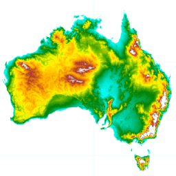
লাইডার মডেল থেকে প্রাপ্ত অস্ট্রেলিয়ার ডিজিটাল এলিভেশন মডেল (ডিইএম) ৫ মিটার গ্রিড হলো একটি জাতীয় ৫ মিটার (অনাবৃত ভূমি) ডিইএম, যা ২০০১ থেকে ২০১৫ সালের মধ্যে প্রায় ২৩৬টি স্বতন্ত্র লাইডার জরিপের মাধ্যমে ২,৪৫,০০০ বর্গ কিলোমিটারেরও বেশি এলাকা জুড়ে তৈরি করা হয়েছে। …
ন্যাশনাল সেন্টারস ফর এনভায়রনমেন্টাল প্রেডিকশন (NCEP)-এর ক্লাইমেট ফোরকাস্ট সিস্টেম রিঅ্যানালাইসিস (CFSR)-কে একটি বৈশ্বিক, উচ্চ-রেজোলিউশনের, সংযুক্ত বায়ুমণ্ডল-মহাসাগর-স্থলভাগ-সমুদ্রের বরফ ব্যবস্থা হিসেবে নকশা ও পরিচালনা করা হয়েছিল, যা জানুয়ারি থেকে শুরু করে ৩২ বছরের নথিভুক্ত সময়কালে এই সংযুক্ত ক্ষেত্রগুলোর অবস্থার সর্বোত্তম অনুমান প্রদান করে…
ন্যাশনাল সেন্টারস ফর এনভায়রনমেন্টাল প্রেডিকশন (NCEP) ক্লাইমেট ফোরকাস্ট সিস্টেম (CFS) হলো একটি সম্পূর্ণ সংযুক্ত মডেল যা পৃথিবীর বায়ুমণ্ডল, মহাসাগর, স্থলভাগ এবং সামুদ্রিক বরফের মধ্যকার মিথস্ক্রিয়াকে উপস্থাপন করে। CFS মডেলটি NCEP-এর এনভায়রনমেন্টাল মডেলিং সেন্টার (EMC)-এ তৈরি করা হয়েছিল। কার্যক্ষম CFS-টিকে আপগ্রেড করা হয়েছিল…
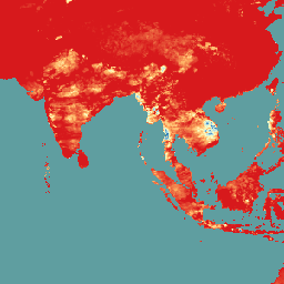
ক্লাইমেট হ্যাজার্ডস সেন্টার ইনফ্রারেড প্রেসিপিটেশন উইথ স্টেশনস (CHIRPS v3) হলো ৪০ বছরেরও বেশি সময় ধরে বিস্তৃত একটি উচ্চ-রেজোলিউশনের প্রায়-বৈশ্বিক বৃষ্টিপাতের ডেটাসেট। এটি ৬০° উত্তর থেকে ৬০° দক্ষিণ অক্ষাংশ পর্যন্ত বিস্তৃত এবং সমস্ত দ্রাঘিমাংশকে অন্তর্ভুক্ত করে, যা ১৯৮১ সাল থেকে প্রায় বর্তমান পর্যন্ত তথ্য সরবরাহ করে। CHIRPS v3 স্যাটেলাইট-ভিত্তিক থার্মাল ইনফ্রারেড বৃষ্টিপাতের অনুমানের সাথে স্টেশনগুলোর নিজস্ব পর্যবেক্ষণকে একত্রিত করে…
ক্লাইমেট হ্যাজার্ডস সেন্টার ইনফ্রারেড প্রেসিপিটেশন উইথ স্টেশনস (CHIRPS v3) হলো ৪০ বছরেরও বেশি সময় ধরে বিস্তৃত একটি উচ্চ-রেজোলিউশনের প্রায়-বৈশ্বিক বৃষ্টিপাতের ডেটাসেট। এটি ৬০° উত্তর থেকে ৬০° দক্ষিণ অক্ষাংশ পর্যন্ত বিস্তৃত এবং সমস্ত দ্রাঘিমাংশকে অন্তর্ভুক্ত করে, যা ১৯৮১ সাল থেকে প্রায় বর্তমান পর্যন্ত তথ্য সরবরাহ করে। CHIRPS v3 স্যাটেলাইট-ভিত্তিক থার্মাল ইনফ্রারেড বৃষ্টিপাতের অনুমানের সাথে স্টেশনগুলোর নিজস্ব পর্যবেক্ষণকে একত্রিত করে…
ক্লাইমেট হ্যাজার্ডস সেন্টার ইনফ্রারেড প্রেসিপিটেশন উইথ স্টেশন ডেটা (CHIRPS) হলো ৩০ বছরেরও বেশি সময় ধরে সংগৃহীত একটি প্রায়-বৈশ্বিক বৃষ্টিপাতের ডেটাসেট। CHIRPS, প্রবণতা বিশ্লেষণ এবং মৌসুমী খরা পর্যবেক্ষণের জন্য গ্রিডভিত্তিক বৃষ্টিপাতের সময়-শৃঙ্খল তৈরি করতে ০.০৫° রেজোলিউশনের স্যাটেলাইট চিত্রের সাথে স্টেশন থেকে সংগৃহীত ডেটা একত্রিত করে।
ক্লাইমেট হ্যাজার্ডস সেন্টার ইনফ্রারেড প্রেসিপিটেশন উইথ স্টেশন ডেটা (CHIRPS) হলো ৩০ বছরেরও বেশি সময় ধরে সংগৃহীত একটি প্রায়-বৈশ্বিক বৃষ্টিপাতের ডেটাসেট। CHIRPS, প্রবণতা বিশ্লেষণ এবং মৌসুমী খরা পর্যবেক্ষণের জন্য গ্রিডভিত্তিক বৃষ্টিপাতের সময়-শৃঙ্খল তৈরি করতে ০.০৫° রেজোলিউশনের স্যাটেলাইট চিত্রের সাথে স্টেশন থেকে সংগৃহীত ডেটা একত্রিত করে।
ক্লাইমেট হ্যাজার্ডস সেন্টার ইনফ্রারেড প্রেসিপিটেশন উইথ স্টেশনস (CHIRPS v3) হলো ৪০ বছরেরও বেশি সময় ধরে বিস্তৃত একটি উচ্চ-রেজোলিউশনের প্রায়-বৈশ্বিক বৃষ্টিপাতের ডেটাসেট। এটি ৬০° উত্তর থেকে ৬০° দক্ষিণ অক্ষাংশ পর্যন্ত বিস্তৃত এবং সমস্ত দ্রাঘিমাংশকে অন্তর্ভুক্ত করে, যা ১৯৮১ সাল থেকে প্রায় বর্তমান পর্যন্ত তথ্য সরবরাহ করে। CHIRPS v3 স্যাটেলাইট-ভিত্তিক থার্মাল ইনফ্রারেড বৃষ্টিপাতের অনুমানের সাথে স্টেশনগুলোর নিজস্ব পর্যবেক্ষণকে একত্রিত করে…
CHIRTS দৈনিক তাপমাত্রা: ক্লাইমেট হ্যাজার্ডস সেন্টারের স্টেশন-ভিত্তিক ইনফ্রারেড তাপমাত্রার দৈনিক ডেটা প্রোডাক্ট
ক্লাইমেট হ্যাজার্ডস সেন্টার ইনফ্রারেড টেম্পারেচার উইথ স্টেশনস দৈনিক তাপমাত্রা ডেটা প্রোডাক্ট (CHIRTS-daily; Verdin et al. 2020) হলো একটি প্রায়-বৈশ্বিক, উচ্চ-রেজোলিউশনের গ্রিডেড ডেটাসেট (০.০৫° × ০.০৫° রেজোলিউশন, ৬০°দ - ৭০°উ) যা দৈনিক সর্বনিম্ন (Tmin) ও সর্বোচ্চ ২-মিটার তাপমাত্রা (Tmax) এবং চারটি উদ্ভূত চলক প্রদান করে: সম্পৃক্ত বাষ্প…
কানাডিয়ান ডিজিটাল এলিভেশন মডেল (CDEM) হলো ন্যাচারাল রিসোর্সেস কানাডা (NRCan)-এর অল্টিমেট্রি সিস্টেমের একটি অংশ এবং এটি বিদ্যমান কানাডিয়ান ডিজিটাল এলিভেশন ডেটা (CDED) থেকে উদ্ভূত। এই ডেটাতে, উচ্চতা ভূপৃষ্ঠের অথবা প্রতিফলক পৃষ্ঠের উচ্চতা হতে পারে। CDEM একাধিক DEM দ্বারা গঠিত, যার মধ্যে রয়েছে…
কোপারনিকাস ডিইএম জিএলও-৩০: গ্লোবাল ৩০ মিটার ডিজিটাল এলিভেশন মডেল
কোপারনিকাস ডিইএম হলো একটি ডিজিটাল সারফেস মডেল (ডিএসএম) যা ভবন, অবকাঠামো এবং গাছপালা সহ পৃথিবীর পৃষ্ঠকে উপস্থাপন করে। এই ডিইএমটি ওয়ার্ল্ডডিইএম™ নামক একটি সম্পাদিত ডিএসএম থেকে উদ্ভূত, অর্থাৎ, এতে জলাশয়গুলোকে সমতল করা এবং নদীগুলোর ধারাবাহিক প্রবাহ অন্তর্ভুক্ত করা হয়েছে। সম্পাদনা…
হাইড্রোলজিক্যালি এনফোর্সড ডিজিটাল এলিভেশন মডেল (DEM-H) ২০০০ সালের ফেব্রুয়ারিতে নাসা কর্তৃক সংগৃহীত SRTM ডেটা থেকে উদ্ভূত হয়েছে। মডেলটিকে হাইড্রোলজিক্যালি কন্ডিশনড এবং ড্রেনেজ এনফোর্সড করা হয়েছে। DEM-H, SRTM এলিভেশন এবং ম্যাপ করা স্ট্রিম লাইনের উপর ভিত্তি করে প্রবাহ পথগুলো ধারণ করে এবং সীমানা নির্ধারণে সহায়তা করে…
স্মুথড ডিজিটাল এলিভেশন মডেল (DEM-S) ২০০০ সালের ফেব্রুয়ারিতে নাসা কর্তৃক সংগৃহীত SRTM ডেটা থেকে উদ্ভূত হয়েছে। DEM-S ভূপৃষ্ঠের ভূসংস্থানকে (উদ্ভিদ বৈশিষ্ট্য ব্যতীত) উপস্থাপন করে এবং নয়েজ কমাতে ও ভূপৃষ্ঠের আকৃতির উপস্থাপনা উন্নত করতে এটিকে মসৃণ করা হয়েছে। একটি অভিযোজিত প্রক্রিয়া প্রয়োগ করা হয়েছে আরও…
Daymet V4: দৈনিক ভূপৃষ্ঠের আবহাওয়া ও জলবায়ু সংক্রান্ত সারসংক্ষেপ
Daymet V4 মহাদেশীয় উত্তর আমেরিকা, হাওয়াই এবং পুয়ের্তো রিকোর জন্য দৈনিক আবহাওয়ার প্যারামিটারগুলির গ্রিডভিত্তিক আনুমানিক হিসাব প্রদান করে (পুয়ের্তো রিকোর ডেটা ১৯৫০ সাল থেকে পাওয়া যায়)। এটি নির্বাচিত আবহাওয়া স্টেশনের ডেটা এবং বিভিন্ন সহায়ক ডেটা উৎস থেকে প্রাপ্ত। পূর্ববর্তী সংস্করণের তুলনায়, Daymet …
সমন্বিত ল্যান্ডস্যাট সেন্টিনেল-২ (DSWx-HLS) V1 থেকে প্রাপ্ত গতিশীল ভূপৃষ্ঠের জলের বিস্তৃতি
এই ডেটাসেটটিতে লেভেল-৩ ডাইনামিক OPERA ভূপৃষ্ঠের জলসীমা প্রোডাক্টের সংস্করণ ১ রয়েছে। ডেটাগুলো হলো এপ্রিল ২০২৩ থেকে শুরু হওয়া যাচাইকৃত ভূপৃষ্ঠের জলসীমার পর্যবেক্ষণ। ব্যবহারের ক্ষেত্রে জ্ঞাত সমস্যা এবং সতর্কতাগুলো প্রোডাক্টের ডকুমেন্টেশনে বর্ণনা করা হয়েছে। প্রতিটি প্রোডাক্ট তৈরির জন্য ইনপুট ডেটাসেট হলো হারমোনাইজড …
সেন্টিনেল-১ থেকে গতিশীল ভূপৃষ্ঠের জলের বিস্তৃতি (DSWx-S1) V1
এই ডেটাসেটটিতে সেন্টিনেল-১ (DSWX-S1) থেকে প্রাপ্ত লেভেল-৩ ডাইনামিক OPERA ভূপৃষ্ঠের জলসীমার তথ্য রয়েছে। DSWx-S1 মিলিটারি গ্রিড রেফারেন্স সিস্টেম (MGRS) গ্রিড সিস্টেমের উপর ৩০ মিটার স্থানিক রেজোলিউশনে ভূমির উপরিভাগের জলসীমার প্রায়-বৈশ্বিক ভৌগোলিক মানচিত্র প্রদান করে, যার একটি নির্দিষ্ট সময় অন্তর পুনরাগমন হার রয়েছে…
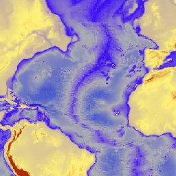
ETOPO1 হলো পৃথিবীর পৃষ্ঠের একটি ১ আর্ক-মিনিট বৈশ্বিক ভূ-উচ্চতা মডেল, যা ভূমির ভূ-সংস্থান এবং সমুদ্রের গভীরতাকে সমন্বিত করে। এটি অসংখ্য বৈশ্বিক ও আঞ্চলিক ডেটা সেট থেকে তৈরি করা হয়েছে। এতে দুটি উচ্চতা স্তর রয়েছে: বরফ-পৃষ্ঠ এবং শিলাস্তর।
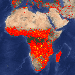
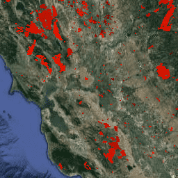
ফার্মস: সম্পদ ব্যবস্থাপনা সিস্টেমের জন্য অগ্নি তথ্য
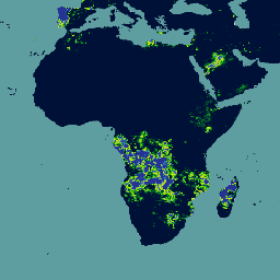
ফায়ার ইনফরমেশন ফর রিসোর্স ম্যানেজমেন্ট সিস্টেম (FIRMS) ডেটাসেটের আর্থ ইঞ্জিন সংস্করণে LANCE অগ্নি শনাক্তকরণ প্রোডাক্টটি র্যাস্টারাইজড আকারে রয়েছে। প্রায় রিয়েল-টাইম (NRT) সক্রিয় অগ্নিকাণ্ডের অবস্থানগুলো LANCE দ্বারা স্ট্যান্ডার্ড MODIS MOD14/MYD14 ফায়ার অ্যান্ড থার্মাল অ্যানোমালিজ প্রোডাক্ট ব্যবহার করে প্রক্রিয়াজাত করা হয়। প্রতিটি…
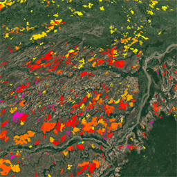
FireCCI51: MODIS Fire_cci দগ্ধ এলাকা পিক্সেল পণ্য, সংস্করণ 5.1
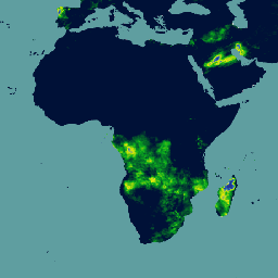
MODIS Fire_cci Burned Area পিক্সেল প্রোডাক্ট সংস্করণ 5.1 (FireCCI51) হলো একটি মাসিক বৈশ্বিক ~250m স্থানিক রেজোলিউশনের ডেটাসেট, যাতে দগ্ধ এলাকা সম্পর্কিত তথ্যের পাশাপাশি আনুষঙ্গিক ডেটাও রয়েছে। এটি MODIS যন্ত্রে থাকা নিয়ার ইনফ্রারেড (NIR) ব্যান্ডের ভূপৃষ্ঠের প্রতিফলনের উপর ভিত্তি করে তৈরি…
গ্লোবাল ফোরকাস্ট সিস্টেম (GFS) হলো ন্যাশনাল সেন্টারস ফর এনভায়রনমেন্টাল প্রেডিকশন (NCEP) দ্বারা উৎপাদিত একটি আবহাওয়ার পূর্বাভাস মডেল। GFS ডেটাসেটটি গ্রিডেড পূর্বাভাস ভেরিয়েবল হিসেবে নির্বাচিত মডেল আউটপুট (যা নিচে বর্ণনা করা হয়েছে) নিয়ে গঠিত। এর ৩৮৪-ঘণ্টার পূর্বাভাসের সাথে ১-ঘণ্টা (১২০ ঘণ্টা পর্যন্ত) এবং ৩-ঘণ্টার (এরপরে…) পূর্বাভাসও অন্তর্ভুক্ত।
নাসা গ্লোবাল ল্যান্ড ডেটা অ্যাসিমিলেশন সিস্টেম ভার্সন ২ (জিএলডিএএস-২)-এর তিনটি উপাদান রয়েছে: জিএলডিএএস-২.০, জিএলডিএএস-২.১, এবং জিএলডিএএস-২.২। জিএলডিএএস-২.০ সম্পূর্ণরূপে প্রিন্সটন আবহাওয়া সংক্রান্ত ফোর্সিং ইনপুট ডেটা দ্বারা চালিত হয় এবং ১৯৪৮ থেকে ২০১৪ সাল পর্যন্ত একটি সময়গতভাবে সামঞ্জস্যপূর্ণ সিরিজ প্রদান করে। জিএলডিএএস-২.১ বিভিন্ন মডেলের সংমিশ্রণে চালিত হয়…
নাসা গ্লোবাল ল্যান্ড ডেটা অ্যাসিমিলেশন সিস্টেম ভার্সন ২ (জিএলডিএএস-২)-এর তিনটি উপাদান রয়েছে: জিএলডিএএস-২.০, জিএলডিএএস-২.১, এবং জিএলডিএএস-২.২। জিএলডিএএস-২.০ সম্পূর্ণরূপে প্রিন্সটন আবহাওয়া সংক্রান্ত ফোর্সিং ইনপুট ডেটা দ্বারা চালিত হয় এবং ১৯৪৮ থেকে ২০১৪ সাল পর্যন্ত একটি সময়গতভাবে সামঞ্জস্যপূর্ণ সিরিজ প্রদান করে। জিএলডিএএস-২.১ বিভিন্ন মডেলের সংমিশ্রণে চালিত হয়…
জিএমটিইডি২০১০: গ্লোবাল মাল্টি-রেজোলিউশন টেরেইন এলিভেশন ডেটা ২০১০
গ্লোবাল মাল্টি-রেজোলিউশন টেরেইন এলিভেশন ডেটা ২০১০ (GMTED2010) ডেটাসেটটিতে ৭.৫ আর্ক-সেকেন্ড রেজোলিউশনে বিভিন্ন উৎস থেকে সংগৃহীত পৃথিবীর উচ্চতার ডেটা রয়েছে। ডেটাসেট রিপোর্টে আরও বিস্তারিত তথ্য পাওয়া যাবে। GMTED2010-এর প্রাথমিক উৎস ডেটাসেটটি হলো NGA-এর SRTM ডিজিটাল টেরেইন এলিভেশন ডেটা (DTED®, …
গ্লোবাল প্রিসিপিটেশন মেজারমেন্ট (GPM) হলো একটি আন্তর্জাতিক স্যাটেলাইট মিশন, যা প্রতি তিন ঘণ্টা অন্তর বিশ্বব্যাপী বৃষ্টি ও তুষারপাতের পরবর্তী প্রজন্মের পর্যবেক্ষণ প্রদান করে। ইন্টিগ্রেটেড মাল্টি-স্যাটেলাইট রিট্রিভালস ফর GPM (IMERG) হলো একটি সমন্বিত অ্যালগরিদম, যা GPM-এর সমস্ত প্যাসিভ-মাইক্রোওয়েভ যন্ত্র থেকে প্রাপ্ত ডেটা একত্রিত করে বৃষ্টিপাতের আনুমানিক হিসাব প্রদান করে…
আইএমইআরজি-এর চূড়ান্ত সংস্করণ "০৬"-এর উৎপাদন ২০২১ সালের সেপ্টেম্বরে বন্ধ হয়ে গেছে। সংস্করণ "০৭" ২০২২ সালের সেপ্টেম্বরে প্রকাশিত হবে বলে আশা করা হচ্ছে। গ্লোবাল প্রিসিপিটেশন মেজারমেন্ট (জিপিএম) হলো একটি আন্তর্জাতিক স্যাটেলাইট মিশন, যা প্রতি তিন ঘণ্টা অন্তর বিশ্বব্যাপী বৃষ্টি ও তুষারপাতের পরবর্তী প্রজন্মের পর্যবেক্ষণ প্রদান করে। ইন্টিগ্রেটেড মাল্টি-স্যাটেলাইট রিট্রিভালস ফর...
গ্লোবাল প্রিসিপিটেশন মেজারমেন্ট (GPM) হলো একটি আন্তর্জাতিক স্যাটেলাইট মিশন, যা প্রতি তিন ঘণ্টা অন্তর বিশ্বব্যাপী বৃষ্টি ও তুষারপাতের পরবর্তী প্রজন্মের পর্যবেক্ষণ প্রদান করে। ইন্টিগ্রেটেড মাল্টি-স্যাটেলাইট রিট্রিভালস ফর GPM (IMERG) হলো একটি সমন্বিত অ্যালগরিদম, যা GPM-এর সমস্ত প্যাসিভ-মাইক্রোওয়েভ যন্ত্র থেকে প্রাপ্ত ডেটা একত্রিত করে বৃষ্টিপাতের আনুমানিক হিসাব প্রদান করে…
এই ডেটাসেটটিতে ৪-কিমি দৈনিক গ্রিডেড সারফেস মেটিওরোলজিক্যাল (GRIDMET) ডেটাসেট থেকে প্রাপ্ত খরা সূচকসমূহ রয়েছে। প্রদত্ত খরা সূচকগুলোর মধ্যে রয়েছে স্ট্যান্ডার্ডাইজড প্রেসিপিটেশন ইনডেক্স (SPI), ইভাপোরেটিভ ড্রট ডিমান্ড ইনডেক্স (EDDI), স্ট্যান্ডার্ডাইজড প্রেসিপিটেশন ইভাপোট্রান্সপিরেশন ইনডেক্স (SPEI), পামার ড্রট সিভিয়ারিটি ইনডেক্স (PDSI) এবং পামার…
জিএসএমএপি অপারেশনাল: গ্লোবাল স্যাটেলাইট ম্যাপিং অফ প্রেসিপিটেশন - ভি৬
গ্লোবাল স্যাটেলাইট ম্যাপিং অফ প্রেসিপিটেশন (GSMaP) ০.১ x ০.১ ডিগ্রি রেজোলিউশনে বিশ্বব্যাপী প্রতি ঘণ্টার বৃষ্টিপাতের হার সরবরাহ করে। GSMaP হলো গ্লোবাল প্রেসিপিটেশন মেজারমেন্ট (GPM) মিশনের একটি পণ্য, যা প্রতি তিন ঘণ্টা অন্তর বিশ্বব্যাপী বৃষ্টিপাতের পর্যবেক্ষণ প্রদান করে। মাল্টি-ব্যান্ড প্যাসিভ ব্যবহার করে মানগুলি অনুমান করা হয়…
জিএসএমএপি অপারেশনাল: গ্লোবাল স্যাটেলাইট ম্যাপিং অফ প্রেসিপিটেশন - ভি৭
গ্লোবাল স্যাটেলাইট ম্যাপিং অফ প্রেসিপিটেশন (GSMaP) ০.১ x ০.১ ডিগ্রি রেজোলিউশনে বিশ্বব্যাপী প্রতি ঘণ্টার বৃষ্টিপাতের হার সরবরাহ করে। GSMaP হলো গ্লোবাল প্রেসিপিটেশন মেজারমেন্ট (GPM) মিশনের একটি পণ্য, যা প্রতি তিন ঘণ্টা অন্তর বিশ্বব্যাপী বৃষ্টিপাতের পর্যবেক্ষণ প্রদান করে। মাল্টি-ব্যান্ড প্যাসিভ ব্যবহার করে মানগুলি অনুমান করা হয়…
জিএসএমএপি অপারেশনাল: গ্লোবাল স্যাটেলাইট ম্যাপিং অফ প্রেসিপিটেশন - ভি৮
গ্লোবাল স্যাটেলাইট ম্যাপিং অফ প্রেসিপিটেশন (GSMaP) ০.১ x ০.১ ডিগ্রি রেজোলিউশনে বিশ্বব্যাপী প্রতি ঘণ্টার বৃষ্টিপাতের হার সরবরাহ করে। GSMaP হলো গ্লোবাল প্রেসিপিটেশন মেজারমেন্ট (GPM) মিশনের একটি পণ্য, যা প্রতি তিন ঘণ্টা অন্তর বিশ্বব্যাপী বৃষ্টিপাতের পর্যবেক্ষণ প্রদান করে। মাল্টি-ব্যান্ড প্যাসিভ ব্যবহার করে মানগুলি অনুমান করা হয়…
গ্লোবাল স্যাটেলাইট ম্যাপিং অফ প্রেসিপিটেশন (GSMaP) ০.১ x ০.১ ডিগ্রি রেজোলিউশনে বিশ্বব্যাপী প্রতি ঘণ্টার বৃষ্টিপাতের হার সরবরাহ করে। GSMaP হলো গ্লোবাল প্রেসিপিটেশন মেজারমেন্ট (GPM) মিশনের একটি পণ্য, যা প্রতি তিন ঘণ্টা অন্তর বিশ্বব্যাপী বৃষ্টিপাতের পর্যবেক্ষণ প্রদান করে। মাল্টি-ব্যান্ড প্যাসিভ ব্যবহার করে মানগুলি অনুমান করা হয়…
GTOPO30 হলো একটি বৈশ্বিক ডিজিটাল উচ্চতা মডেল (DEM), যার আনুভূমিক গ্রিড ব্যবধান ৩০ আর্ক সেকেন্ড (প্রায় ১ কিলোমিটার)। এই DEM-টি ভূসংস্থানিক তথ্যের বিভিন্ন রাস্টার এবং ভেক্টর উৎস থেকে উদ্ভূত হয়েছে। ১৯৯৬ সালের শেষের দিকে সম্পন্ন হওয়া GTOPO30 মডেলটি তিন বছর ধরে বিকশিত হয়েছিল…
গ্লোবাল ALOS CHILI (ধারাবাহিক তাপ-সূর্যালোক লোড সূচক)
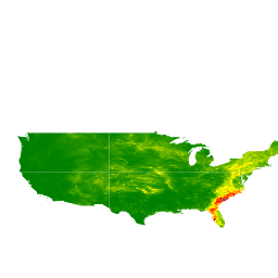
CHILI হলো বাষ্পীভবনের উপর সৌর বিকিরণ এবং ভূ-প্রাকৃতিক ছায়ার প্রভাবের একটি বিকল্প পরিমাপক, যা বিষুব সংক্রান্তির সমতুল্য সূর্য উচ্চতায়, অর্থাৎ পশ্চাদপসরণের প্রথম ভাগে সৌর বিকিরণ গণনা করে উপস্থাপন করা হয়। এটি JAXA-এর ALOS DEM-এর ৩০ মিটার "AVE" ব্যান্ডের উপর ভিত্তি করে নির্মিত (যা EE-তে JAXA/ALOS/AW3D30_V1_1 হিসেবে উপলব্ধ)। সংরক্ষণ বিজ্ঞান…
ALOS ল্যান্ডফর্ম ডেটাসেটটি কন্টিনিউয়াস হিট-ইনসোলেশন লোড ইনডেক্স (ALOS CHILI) এবং মাল্টি-স্কেল টপোগ্রাফিক পজিশন ইনডেক্স (ALOS mTPI) ডেটাসেট দুটিকে একত্রিত করে তৈরি করা ভূমিরূপ শ্রেণি প্রদান করে। এটি JAXA-এর ALOS DEM-এর ৩০ মিটার "AVE" ব্যান্ডের উপর ভিত্তি করে তৈরি (যা EE-তে JAXA/ALOS/AW3D30_V1_1 হিসেবে উপলব্ধ)। সংরক্ষণ…
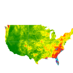
ভূ-প্রাকৃতিক বৈচিত্র্য (D) একটি বিকল্প চলক যা প্রজাতিদের স্থানীয় বাসস্থান হিসেবে উপলব্ধ তাপমাত্রা এবং আর্দ্রতার বিভিন্ন অবস্থাকে উপস্থাপন করে। এটি এই যুক্তি প্রকাশ করে যে, ভূ-জলবায়ুগত পরিবেশের অধিক বৈচিত্র্য উচ্চতর জীববৈচিত্র্যকে (বিশেষত উদ্ভিদের) সমর্থন করবে এবং জলবায়ুগত পরিস্থিতিতে প্রজাতির টিকে থাকাকে সহায়তা করবে…
mTPI শৈলশিরা এবং উপত্যকার আকৃতির মধ্যে পার্থক্য নির্ণয় করে। এটি প্রতিটি অবস্থানের উচ্চতার ডেটা থেকে একটি প্রতিবেশের গড় উচ্চতা বিয়োগ করে গণনা করা হয়। mTPI ১১৫.৮, ৮৯.৯, ৩৫.৫, ১৩.১, ৫.৬, ২.৮, এবং ১.২ কিমি ব্যাসার্ধের চলমান উইন্ডো ব্যবহার করে। এটি ৩০ মিটারের উপর ভিত্তি করে তৈরি…
এই ডেটাসেটটি জিওসায়েন্স লেজার অল্টিমিটার সিস্টেম (GLAS) থেকে প্রাপ্ত মহাকাশ-লাইডার ডেটা (২০০৫) এবং আনুষঙ্গিক ভূ-স্থানিক ডেটার সংমিশ্রণের উপর ভিত্তি করে বিশ্বব্যাপী গাছের উচ্চতা উপস্থাপন করে। বিস্তারিত জানার জন্য সিমার্ড এট আল. (২০১১) দেখুন।
CHILI হলো বাষ্পীভবনের উপর সৌর বিকিরণ এবং ভূ-প্রাকৃতিক ছায়ার প্রভাবের একটি বিকল্প পরিমাপ, যা বিষুব সংক্রান্তির সমতুল্য সূর্য উচ্চতায়, অর্থাৎ পশ্চাদপসরণের প্রথম ভাগে সৌর বিকিরণ গণনা করে উপস্থাপন করা হয়। এটি ৩০ মিটার SRTM DEM-এর উপর ভিত্তি করে তৈরি (যা EE-তে USGS/SRTMGL1_003 হিসেবে উপলব্ধ)। কনজারভেশন সায়েন্স পার্টনার্স (CSP)-এর পরিবেশগতভাবে প্রাসঙ্গিক…
এসআরটিএম ল্যান্ডফর্ম ডেটাসেটটি কন্টিনিউয়াস হিট-ইনসোলেশন লোড ইনডেক্স (এসআরটিএম চিলি) এবং মাল্টি-স্কেল টপোগ্রাফিক পজিশন ইনডেক্স (এসআরটিএম এমটিপিআই) ডেটাসেট দুটিকে একত্রিত করে তৈরি করা ভূমিরূপ শ্রেণি প্রদান করে। এটি ৩০ মিটার এসআরটিএম ডিইএম-এর উপর ভিত্তি করে তৈরি (যা ইই-তে USGS/SRTMGL1_003 হিসেবে উপলব্ধ)। কনজারভেশন সায়েন্স পার্টনার্স (সিএসপি) ইকোলজিক্যালি…
ভূ-প্রাকৃতিক বৈচিত্র্য (D) একটি বিকল্প চলক যা প্রজাতিদের স্থানীয় বাসস্থান হিসেবে উপলব্ধ তাপমাত্রা এবং আর্দ্রতার বিভিন্ন অবস্থাকে উপস্থাপন করে। এটি এই যুক্তি প্রকাশ করে যে, ভূ-জলবায়ুগত পরিবেশের অধিক বৈচিত্র্য উচ্চতর জীববৈচিত্র্যকে (বিশেষত উদ্ভিদের) সমর্থন করবে এবং জলবায়ুগত পরিস্থিতিতে প্রজাতির টিকে থাকাকে সহায়তা করবে…
mTPI শৈলশিরা এবং উপত্যকার আকৃতির মধ্যে পার্থক্য নির্ণয় করে। এটি প্রতিটি অবস্থানের উচ্চতার ডেটা থেকে একটি প্রতিবেশের গড় উচ্চতা বিয়োগ করে গণনা করা হয়। mTPI ১১৫.৮, ৮৯.৯, ৩৫.৫, ১৩.১, ৫.৬, ২.৮, এবং ১.২ কিমি ব্যাসার্ধের চলমান উইন্ডো ব্যবহার করে। এটি ৩০ মিটারের উপর ভিত্তি করে তৈরি…
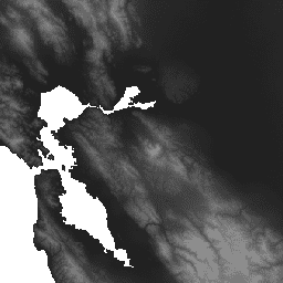
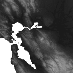
বৈশ্বিক বনের বিস্তৃতি ও পরিবর্তন নিরূপণে ল্যান্ডস্যাট চিত্রের সময়-ধারা বিশ্লেষণের ফলাফল। 'প্রথম' এবং 'শেষ' ব্যান্ডগুলো হলো যথাক্রমে লাল, NIR, SWIR1, এবং SWIR2-এর সাথে সম্পর্কিত ল্যান্ডস্যাট বর্ণালী ব্যান্ডের জন্য উপলব্ধ প্রথম এবং শেষ বছরের রেফারেন্স মাল্টিস্পেকট্রাল চিত্র। রেফারেন্স কম্পোজিট চিত্রটি প্রতিনিধিত্ব করে…
এই ডেটাসেটটিতে ১৯৮৪ থেকে ২০১৯ সাল পর্যন্ত ভূপৃষ্ঠের জলের অবস্থান ও সময়ভিত্তিক বণ্টনের মানচিত্র রয়েছে এবং এটি ঐ জলাশয়গুলোর বিস্তৃতি ও পরিবর্তন সংক্রান্ত পরিসংখ্যান প্রদান করে। আরও তথ্যের জন্য সংশ্লিষ্ট জার্নাল নিবন্ধটি দেখুন: High-resolution mapping of global surface water and its …
এই ডেটাসেটটিতে ১৯৮৪ থেকে ২০২১ সাল পর্যন্ত ভূপৃষ্ঠের জলের অবস্থান ও সময়ভিত্তিক বণ্টনের মানচিত্র রয়েছে এবং এটি ঐ জলাশয়গুলোর বিস্তৃতি ও পরিবর্তন সংক্রান্ত পরিসংখ্যান প্রদান করে। আরও তথ্যের জন্য সংশ্লিষ্ট জার্নাল নিবন্ধটি দেখুন: High-resolution mapping of global surface water and its …
এই ডেটাসেটটিতে ১৯৮৪ থেকে ২০২১ সাল পর্যন্ত ভূপৃষ্ঠের জলের অবস্থান ও সময়ভিত্তিক বণ্টনের মানচিত্র রয়েছে এবং এটি ঐ জলাশয়গুলোর বিস্তৃতি ও পরিবর্তন সংক্রান্ত পরিসংখ্যান প্রদান করে। আরও তথ্যের জন্য সংশ্লিষ্ট জার্নাল নিবন্ধটি দেখুন: High-resolution mapping of global surface water and its …
এই ডেটাসেটটিতে ১৯৮৪ থেকে ২০২১ সাল পর্যন্ত ভূপৃষ্ঠের জলের অবস্থান ও সময়ভিত্তিক বণ্টনের মানচিত্র রয়েছে এবং এটি ঐ জলাশয়গুলোর বিস্তৃতি ও পরিবর্তন সংক্রান্ত পরিসংখ্যান প্রদান করে। আরও তথ্যের জন্য সংশ্লিষ্ট জার্নাল নিবন্ধটি দেখুন: High-resolution mapping of global surface water and its …
এই ডেটাসেটটিতে ১৯৮৪ থেকে ২০২১ সাল পর্যন্ত ভূপৃষ্ঠের জলের অবস্থান ও সময়ভিত্তিক বণ্টনের মানচিত্র রয়েছে এবং এটি ঐ জলাশয়গুলোর বিস্তৃতি ও পরিবর্তন সংক্রান্ত পরিসংখ্যান প্রদান করে। আরও তথ্যের জন্য সংশ্লিষ্ট জার্নাল নিবন্ধটি দেখুন: High-resolution mapping of global surface water and its …
জেআরসি বার্ষিক পানি শ্রেণিবিন্যাসের ইতিহাস, সংস্করণ ১.৪
এই ডেটাসেটটিতে ১৯৮৪ থেকে ২০২১ সাল পর্যন্ত ভূপৃষ্ঠের জলের অবস্থান ও সময়ভিত্তিক বণ্টনের মানচিত্র রয়েছে এবং এটি ঐ জলাশয়গুলোর বিস্তৃতি ও পরিবর্তন সংক্রান্ত পরিসংখ্যান প্রদান করে। আরও তথ্যের জন্য সংশ্লিষ্ট জার্নাল নিবন্ধটি দেখুন: High-resolution mapping of global surface water and its …
MACAv2-METDATA মাসিক সারসংক্ষেপ: আইডাহো বিশ্ববিদ্যালয়, বৈশ্বিক জলবায়ু মডেলে বহুচলকীয় অভিযোজিত নির্মিত সাদৃশ্যের প্রয়োগ
MACAv2-METDATA ডেটাসেটটি হলো মার্কিন যুক্তরাষ্ট্রের সংলগ্ন অঞ্চলকে অন্তর্ভুক্তকারী ২০টি বৈশ্বিক জলবায়ু মডেলের একটি সংগ্রহ। মাল্টিভেরিয়েট অ্যাডাপটিভ কনস্ট্রাকটেড অ্যানালগস (MACA) পদ্ধতি হলো একটি পরিসংখ্যানগত ডাউনস্কেলিং পদ্ধতি যা ঐতিহাসিক পক্ষপাত দূর করতে এবং স্থানিক বিন্যাস মেলানোর জন্য একটি প্রশিক্ষণ ডেটাসেট (অর্থাৎ একটি আবহাওয়া পর্যবেক্ষণ ডেটাসেট) ব্যবহার করে…
MACAv2-METDATA ডেটাসেটটি হলো মার্কিন যুক্তরাষ্ট্রের সংলগ্ন অঞ্চলকে অন্তর্ভুক্তকারী ২০টি বৈশ্বিক জলবায়ু মডেলের একটি সংগ্রহ। মাল্টিভেরিয়েট অ্যাডাপটিভ কনস্ট্রাকটেড অ্যানালগস (MACA) পদ্ধতি হলো একটি পরিসংখ্যানগত ডাউনস্কেলিং পদ্ধতি যা ঐতিহাসিক পক্ষপাত দূর করতে এবং স্থানিক বিন্যাস মেলানোর জন্য একটি প্রশিক্ষণ ডেটাসেট (অর্থাৎ একটি আবহাওয়া পর্যবেক্ষণ ডেটাসেট) ব্যবহার করে…
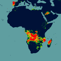
টেরা এবং অ্যাকুয়ার সম্মিলিত MCD64A1 ভার্সন 6.1 দগ্ধ এলাকা ডেটা প্রোডাক্টটি হলো একটি মাসিক, বৈশ্বিক গ্রিডযুক্ত ৫০০ মিটার প্রোডাক্ট, যাতে প্রতি-পিক্সেল দগ্ধ এলাকা এবং গুণমানের তথ্য থাকে। MCD64A1 দগ্ধ এলাকা ম্যাপিং পদ্ধতিতে ৫০০ মিটার MODIS সারফেস রিফ্লেক্টেন্স ইমেজারির সাথে ১ কিমি MODIS সক্রিয় অগ্নিকাণ্ড পর্যবেক্ষণকে সংযুক্ত করে ব্যবহার করা হয়। অ্যালগরিদমটি…
MOD08_M3 V6.1 হলো একটি বৈশ্বিক বায়ুমণ্ডলীয় পণ্য, যাতে বায়ুমণ্ডলীয় প্যারামিটারগুলোর মাসিক ১ x ১ ডিগ্রি গ্রিড গড় মান থাকে। এই প্যারামিটারগুলো বায়ুমণ্ডলীয় অ্যারোসল কণার বৈশিষ্ট্য, মোট ওজোন স্তর, বায়ুমণ্ডলীয় জলীয় বাষ্প, মেঘের আলোকীয় ও ভৌত বৈশিষ্ট্য এবং বায়ুমণ্ডলীয় স্থিতিশীলতা সূচকের সাথে সম্পর্কিত। …
MOD10A1.061 টেরা তুষার আচ্ছাদন দৈনিক বৈশ্বিক ৫০০মি
MOD10A1 V6.1 Snow Cover Daily Global 500m প্রোডাক্টটিতে তুষার আচ্ছাদন, তুষার অ্যালবেডো, ভগ্নাংশীয় তুষার আচ্ছাদন এবং গুণমান মূল্যায়ন (QA) ডেটা রয়েছে। তুষার আচ্ছাদনের ডেটা একটি স্নো ম্যাপিং অ্যালগরিদমের উপর ভিত্তি করে তৈরি, যা একটি নর্মালাইজড ডিফারেন্স স্নো ইনডেক্স (NDSI) এবং অন্যান্য মানদণ্ড পরীক্ষা ব্যবহার করে। সাধারণ…
MOD10A2 হলো টেরা স্যাটেলাইটের MODIS থেকে প্রাপ্ত একটি তুষার আচ্ছাদন ডেটাসেট। এই ডেটাসেটটি ৫০০ মিটার রেজোলিউশনে আট দিনের একটি সময়কালে সর্বোচ্চ তুষার আচ্ছাদনের বিস্তৃতি প্রকাশ করে। আট দিনের কম্পোজিটিং সময়কাল বেছে নেওয়া হয়েছে কারণ এটিই হলো গ্রাউন্ড ট্র্যাকের সঠিক পুনরাবৃত্তি…
টেরা মোডিস ভেজিটেশন কন্টিনিউয়াস ফিল্ডস (ভিসিএফ) প্রোডাক্টটি হলো বিশ্বব্যাপী ভূপৃষ্ঠের উদ্ভিদ আচ্ছাদনের অনুমানের একটি সাব-পিক্সেল-স্তরের উপস্থাপনা। পৃথিবীর স্থলভাগকে উদ্ভিদের মৌলিক বৈশিষ্ট্যগুলোর অনুপাতে অবিচ্ছিন্নভাবে উপস্থাপন করার জন্য ডিজাইন করা এই টুলটি ভূপৃষ্ঠের তিনটি আচ্ছাদন উপাদানের একটি ক্রমবিন্যাস প্রদান করে: বৃক্ষ আচ্ছাদনের শতাংশ, শতাংশ…
MODIS এবং SRTM থেকে উদ্ভূত MOD44W.005 স্থল-জল মাস্ক
গ্লোবাল ওয়াটার মাস্ক, আনুমানিক ২০০০-২০০২ সালের জন্য ২৫০ মিটার স্থানিক রেজোলিউশনে ভূপৃষ্ঠের জলের একটি সম্পূর্ণ বৈশ্বিক মানচিত্র তৈরি করতে SWBD (SRTM ওয়াটার বডি ডেটা) এবং MODIS 250m ডেটা একত্রে ব্যবহার করে। এই ডেটাসেটটি রাস্টার ডেটা প্রক্রিয়াকরণে এবং … এর জন্য ব্যবহারের উদ্দেশ্যে তৈরি।
MOD44W.006 টেরা ল্যান্ড ওয়াটার মাস্ক, যা MODIS এবং SRTM থেকে প্রাপ্ত, বার্ষিক বৈশ্বিক ২৫০মি।
MOD44W V6 স্থল/জল মাস্ক ২৫০মি প্রোডাক্টটি MODIS ডেটা দিয়ে প্রশিক্ষিত এবং MOD44W V5 প্রোডাক্ট দিয়ে যাচাইকৃত একটি ডিসিশন ট্রি ক্লাসিফায়ার ব্যবহার করে তৈরি করা হয়েছে। ভূখণ্ডের ছায়া, অগ্নিদগ্ধ ক্ষতচিহ্ন, মেঘাচ্ছন্নতা বা বরফের আচ্ছাদনের মতো পরিচিত সমস্যাগুলো সমাধানের জন্য একাধিক মাস্ক প্রয়োগ করা হয়…
MYD08_M3 V6.1 হলো একটি বৈশ্বিক বায়ুমণ্ডলীয় পণ্য, যাতে বায়ুমণ্ডলীয় প্যারামিটারগুলোর মাসিক ১ x ১ ডিগ্রি গ্রিড গড় মান থাকে। এই প্যারামিটারগুলো বায়ুমণ্ডলীয় অ্যারোসল কণার বৈশিষ্ট্য, মোট ওজোন স্তর, বায়ুমণ্ডলীয় জলীয় বাষ্প, মেঘের আলোকীয় ও ভৌত বৈশিষ্ট্য এবং বায়ুমণ্ডলীয় স্থিতিশীলতা সূচকের সাথে সম্পর্কিত। …
MYD10A1.061 জলীয় তুষার আচ্ছাদন দৈনিক বৈশ্বিক ৫০০মি
MYD10A1 V6 Snow Cover Daily Global 500m প্রোডাক্টটিতে তুষার আচ্ছাদন, তুষার অ্যালবেডো, ভগ্নাংশীয় তুষার আচ্ছাদন এবং গুণমান মূল্যায়ন (QA) ডেটা রয়েছে। তুষার আচ্ছাদনের ডেটা একটি স্নো ম্যাপিং অ্যালগরিদমের উপর ভিত্তি করে তৈরি, যা একটি নর্মালাইজড ডিফারেন্স স্নো ইনডেক্স (NDSI) এবং অন্যান্য মানদণ্ড পরীক্ষা ব্যবহার করে। সাধারণ…
শাটল রাডার টপোগ্রাফি মিশন (এসআরটিএম, দেখুন ফার এট আল. ২০০৭) ডিজিটাল উচ্চতা ডেটা হলো একটি আন্তর্জাতিক গবেষণা প্রচেষ্টা যা প্রায়-বৈশ্বিক স্কেলে ডিজিটাল উচ্চতা মডেল সংগ্রহ করেছে। এই এসআরটিএম ভি৩ প্রোডাক্টটি (এসআরটিএম প্লাস) নাসা জেপিএল কর্তৃক ১ আর্ক-সেকেন্ড রেজোলিউশনে সরবরাহ করা হয়…
NASADEM হলো SRTM ডেটার একটি পুনঃপ্রক্রিয়াকরণ, যা ASTER GDEM, ICESat GLAS, এবং PRISM ডেটাসেট থেকে সহায়ক ডেটা অন্তর্ভুক্ত করার মাধ্যমে উন্নত নির্ভুলতা প্রদান করে। সবচেয়ে উল্লেখযোগ্য প্রক্রিয়াকরণ উন্নতিগুলোর মধ্যে রয়েছে উন্নত ফেজ আনর্যাপিংয়ের মাধ্যমে ভয়েড হ্রাস এবং নিয়ন্ত্রণের জন্য ICESat GLAS ডেটা ব্যবহার করা। ডকুমেন্টেশন: ব্যবহারকারী নির্দেশিকা
এনসিইপি-ডিওই পুনঃবিশ্লেষণ ২ (গাউসিয়ান গ্রিড), মোট মেঘাচ্ছন্নতা
এই সংকলনটি আর হালনাগাদ করা হচ্ছে না। উৎসস্থলে মডেলটি আর হালনাগাদ করা হচ্ছে না। এনসিইপি-ডিওই রিঅ্যানালাইসিস ২ প্রকল্পটি ১৯৭৯ সাল থেকে পূর্ববর্তী বছর পর্যন্ত অতীতের তথ্য ব্যবহার করে ডেটা অ্যাসিমিলেশন সম্পাদনের জন্য একটি অত্যাধুনিক বিশ্লেষণ/পূর্বাভাস সিস্টেম ব্যবহার করছে।
এনসিইপি/এনসিএআর রিঅ্যানালাইসিস প্রজেক্ট হলো ন্যাশনাল সেন্টারস ফর এনভায়রনমেন্টাল প্রেডিকশন (এনসিইপি, পূর্বে "এনএমসি") এবং ন্যাশনাল সেন্টার ফর অ্যাটমোস্ফেরিক রিসার্চ (এনসিএআর)-এর একটি যৌথ প্রকল্প। এই যৌথ প্রচেষ্টার লক্ষ্য হলো ঐতিহাসিক তথ্য ব্যবহার করে নতুন বায়ুমণ্ডলীয় বিশ্লেষণ তৈরি করা এবং সেইসাথে…
এনসিইপি/এনসিএআর পুনঃবিশ্লেষণ ডেটা, ভূপৃষ্ঠের তাপমাত্রা [অপ্রচলিত]
এনসিইপি/এনসিএআর রিঅ্যানালাইসিস প্রজেক্ট হলো ন্যাশনাল সেন্টারস ফর এনভায়রনমেন্টাল প্রেডিকশন (এনসিইপি, পূর্বে "এনএমসি") এবং ন্যাশনাল সেন্টার ফর অ্যাটমোস্ফেরিক রিসার্চ (এনসিএআর)-এর একটি যৌথ প্রকল্প। এই যৌথ প্রচেষ্টার লক্ষ্য হলো ঐতিহাসিক তথ্য ব্যবহার করে নতুন বায়ুমণ্ডলীয় বিশ্লেষণ তৈরি করা এবং সেইসাথে…
এনসিইপি/এনসিএআর রিঅ্যানালাইসিস প্রজেক্ট হলো ন্যাশনাল সেন্টারস ফর এনভায়রনমেন্টাল প্রেডিকশন (এনসিইপি, পূর্বে "এনএমসি") এবং ন্যাশনাল সেন্টার ফর অ্যাটমোস্ফেরিক রিসার্চ (এনসিএআর)-এর একটি যৌথ প্রকল্প। এই যৌথ প্রচেষ্টার লক্ষ্য হলো ঐতিহাসিক তথ্য ব্যবহার করে নতুন বায়ুমণ্ডলীয় বিশ্লেষণ তৈরি করা এবং সেইসাথে…
নাসা NEX-DCP30 ডেটাসেটটি সংলগ্ন মার্কিন যুক্তরাষ্ট্রের জন্য ডাউনস্কেল করা জলবায়ু পরিস্থিতি নিয়ে গঠিত, যা কাপলড মডেল ইন্টারকম্প্যারিসন প্রজেক্ট ফেজ ৫ (CMIP5, দেখুন টেলর এট আল. ২০১২)-এর অধীনে পরিচালিত জেনারেল সার্কুলেশন মডেল (GCM) রান থেকে এবং চারটি গ্রিনহাউস গ্যাস পর্যায় জুড়ে উদ্ভূত হয়েছে…
NEX-DCP30: নাসা আর্থ এক্সচেঞ্জের ডাউনস্কেল করা জলবায়ু পূর্বাভাস
নাসা NEX-DCP30 ডেটাসেটটি সংলগ্ন মার্কিন যুক্তরাষ্ট্রের জন্য ডাউনস্কেল করা জলবায়ু পরিস্থিতি নিয়ে গঠিত, যা কাপলড মডেল ইন্টারকম্প্যারিসন প্রজেক্ট ফেজ ৫ (CMIP5, দেখুন টেলর এট আল. ২০১২)-এর অধীনে পরিচালিত জেনারেল সার্কুলেশন মডেল (GCM) রান থেকে এবং চারটি গ্রিনহাউস গ্যাস পর্যায় জুড়ে উদ্ভূত হয়েছে…
NEX-GDDP-CMIP6: নাসা আর্থ এক্সচেঞ্জের বৈশ্বিক দৈনিক ডাউনস্কেল করা জলবায়ু পূর্বাভাস
NEX-GDDP-CMIP6 ডেটাসেটটি কাপলড মডেল ইন্টারকম্প্যারিসন প্রজেক্ট ফেজ ৬ (CMIP6, দেখুন Thrasher et al. 2022)-এর অধীনে পরিচালিত জেনারেল সার্কুলেশন মডেল (GCM) রান থেকে প্রাপ্ত বৈশ্বিক ডাউনস্কেলড জলবায়ু পরিস্থিতি এবং চারটি "টিয়ার ১" গ্রিনহাউস গ্যাস নির্গমন পরিস্থিতির মধ্যে দুটি থেকে উদ্ভূত পরিস্থিতি নিয়ে গঠিত…
নাসা NEX-GDDP ডেটাসেটটি সমগ্র বিশ্বের জন্য ডাউনস্কেল করা জলবায়ু পরিস্থিতি নিয়ে গঠিত, যা কাপলড মডেল ইন্টারকম্প্যারিসন প্রজেক্ট ফেজ ৫ (CMIP5, দেখুন টেলর এট আল. ২০১২)-এর অধীনে পরিচালিত জেনারেল সার্কুলেশন মডেল (GCM) রান থেকে উদ্ভূত এবং চারটি গ্রিনহাউস গ্যাসের মধ্যে দুটির ওপর ভিত্তি করে তৈরি।
NLDAS-2: উত্তর আমেরিকান ভূমি তথ্য আত্তীকরণ সিস্টেম ফোর্সিং ফিল্ড
ল্যান্ড ডেটা অ্যাসিমিলেশন সিস্টেম (LDAS) পৃথিবীর পৃষ্ঠে বা তার কাছাকাছি জলবায়ুগত বৈশিষ্ট্যের অনুমান তৈরি করতে একাধিক পর্যবেক্ষণের উৎস (যেমন বৃষ্টিপাত গেজ ডেটা, স্যাটেলাইট ডেটা এবং রাডার বৃষ্টিপাত পরিমাপ) একত্রিত করে। এই ডেটাসেটটি ফেজ … এর জন্য প্রাথমিক (ডিফল্ট) ফোর্সিং ফাইল (ফাইল A)।
ওয়া হলো ভূস্থির (GEO) স্যাটেলাইট পর্যবেক্ষণ থেকে প্রাপ্ত একটি প্রায়-বৈশ্বিক, উচ্চ-রেজোলিউশনের বৃষ্টিপাত অনুমানের ডেটাসেট। ওয়া মডেলটি GOES-16/18, Meteosat-9/10, এবং Himawari-8/9 সহ GEO স্যাটেলাইটের একটি নক্ষত্রপুঞ্জ থেকে দৃশ্যমান এবং অবলোহিত (VIS-IR) চ্যানেলের সম্পূর্ণ পরিসর ব্যবহার করে বৃষ্টিপাতের অনুমান তৈরি করে, যা …
PERSIANN-CDR: কৃত্রিম নিউরাল নেটওয়ার্ক ব্যবহার করে দূরসংবেদী তথ্য থেকে বৃষ্টিপাতের অনুমান-জলবায়ু ডেটা রেকর্ড
PERSIANN-CDR হলো একটি দৈনিক প্রায়-বৈশ্বিক বৃষ্টিপাতের ডেটা প্রোডাক্ট যা ১৯৮৩ সালের ১লা জানুয়ারি থেকে বর্তমান পর্যন্ত সময়কালকে অন্তর্ভুক্ত করে। এই ডেটা সাধারণত তিন মাসের ব্যবধানে ত্রৈমাসিকভাবে তৈরি করা হয়। এই প্রোডাক্টটি ক্যালিফোর্নিয়া বিশ্ববিদ্যালয়, আরভাইন-এর সেন্টার ফর হাইড্রোমেটিওরোলজি অ্যান্ড রিমোট সেন্সিং দ্বারা তৈরি করা হয়েছে…
PRISM দৈনিক এবং মাসিক ডেটাসেটগুলি হল মার্কিন যুক্তরাষ্ট্রের সংলগ্ন অঞ্চলের জন্য গ্রিডযুক্ত জলবায়ু ডেটাসেট, যা ওরেগন স্টেট ইউনিভার্সিটির PRISM ক্লাইমেট গ্রুপ দ্বারা তৈরি। এই সংগ্রহটিতে AN81 এবং AN91 উভয় ডেটা রয়েছে, যা 'dataset_type' প্রপার্টি দ্বারা নির্দেশিত। PRISM (প্যারামিটার-এলিভেশন রিগ্রেশনস...) ব্যবহার করে গ্রিডগুলি তৈরি করা হয়।
PRISM দৈনিক এবং মাসিক ডেটাসেটগুলো হলো মার্কিন যুক্তরাষ্ট্রের সংলগ্ন অঞ্চলের জন্য গ্রিডভিত্তিক জলবায়ু ডেটাসেট, যা ওরেগন স্টেট ইউনিভার্সিটির PRISM ক্লাইমেট গ্রুপ দ্বারা প্রস্তুত করা হয়েছে। PRISM (Parameter-elevation Regressions on Independent Slopes Model) ব্যবহার করে গ্রিডগুলো তৈরি করা হয়। PRISM ইন্টারপোলেশন রুটিনগুলো আবহাওয়া এবং জলবায়ু কীভাবে পরিবর্তিত হয় তা অনুকরণ করে…
PRISM দৈনিক এবং মাসিক ডেটাসেটগুলি হল মার্কিন যুক্তরাষ্ট্রের সংলগ্ন অঞ্চলের জন্য গ্রিডযুক্ত জলবায়ু ডেটাসেট, যা ওরেগন স্টেট ইউনিভার্সিটির PRISM ক্লাইমেট গ্রুপ দ্বারা তৈরি। 'dataset_type' প্রপার্টি দ্বারা নির্দেশিত হিসাবে, এই সংগ্রহটিতে AN81 এবং AN91 উভয় ডেটা রয়েছে। PRISM (প্যারামিটার-এলিভেশন …) ব্যবহার করে গ্রিডগুলি তৈরি করা হয়।
অ্যান্টার্কটিকার রেফারেন্স এলিভেশন মডেল (REMA) হলো অ্যান্টার্কটিকার একটি উচ্চ রেজোলিউশন ও সময়-চিহ্নিত ডিজিটাল সারফেস মডেল (DSM), যা ২-মিটার এবং ৮-মিটার স্থানিক রেজোলিউশনে তৈরি। মোজাইক করা DEM ফাইলগুলো একাধিক স্ট্রিপ থেকে সংকলিত হয়, যেগুলোকে প্রান্ত-সমন্বয়জনিত ত্রুটি (edge-matching artifacts) কমানোর জন্য সহ-নিবন্ধিত (co-registered), মিশ্রিত (blended) এবং পালকের মতো (fethered) করা হয়েছে।
অ্যান্টার্কটিকার রেফারেন্স এলিভেশন মডেল (REMA) হলো অ্যান্টার্কটিকার একটি উচ্চ রেজোলিউশন, সময়-চিহ্নিত ডিজিটাল সারফেস মডেল (DSM), যা ২-মিটার এবং ৮-মিটার স্থানিক রেজোলিউশনে তৈরি। স্ট্রিপ DEM ফাইলগুলো ইনপুট স্টিরিওস্কোপিক চিত্রজোড়া স্ট্রিপগুলোর ওভারল্যাপিং এলাকার সাথে সঙ্গতিপূর্ণ, যা DigitalGlobe দ্বারা সংগৃহীত হয়…
অ্যান্টার্কটিকার রেফারেন্স এলিভেশন মডেল (REMA) হলো অ্যান্টার্কটিকার একটি উচ্চ রেজোলিউশন, সময়-চিহ্নিত ডিজিটাল সারফেস মডেল (DSM), যা ২-মিটার এবং ৮-মিটার স্থানিক রেজোলিউশনে তৈরি। স্ট্রিপ DEM ফাইলগুলো ইনপুট স্টিরিওস্কোপিক চিত্রজোড়া স্ট্রিপগুলোর ওভারল্যাপিং এলাকার সাথে সঙ্গতিপূর্ণ, যা DigitalGlobe দ্বারা সংগৃহীত হয়…
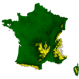
RGE ALTI ডেটাসেটটি ফ্রান্সের ১ মিটার পিক্সেল আকারের ডিজিটাল এলিভেশন মডেল (DEM) বর্ণনা করে। এটি আকাশ থেকে পরিচালিত লিডার দ্বারা প্রাপ্ত জরিপ অথবা আকাশ থেকে তোলা ছবির পারস্পরিক সম্পর্ক স্থাপনের মাধ্যমে তৈরি করা হয়েছে। বন্যাপ্রবণ, উপকূলীয় এবং বৃহৎ বনভূমি এলাকায় লিডার ব্যবহার করা হয়েছিল। উল্লম্ব…
রিয়েল-টাইম মেসোস্কেল অ্যানালাইসিস (RTMA) হলো ভূপৃষ্ঠের নিকটবর্তী আবহাওয়ার পরিস্থিতি বিশ্লেষণের জন্য একটি উচ্চ স্থানিক ও কালিক রেজোলিউশনের পদ্ধতি। এই ডেটাসেটে CONUS-এর জন্য ২.৫ কিমি উচ্চতায় ঘণ্টাভিত্তিক বিশ্লেষণ অন্তর্ভুক্ত রয়েছে।
নাসা গ্লোবাল ল্যান্ড ডেটা অ্যাসিমিলেশন সিস্টেম ভার্সন ২ (জিএলডিএএস-২)-এর তিনটি উপাদান রয়েছে: জিএলডিএএস-২.০, জিএলডিএএস-২.১, এবং জিএলডিএএস-২.২। জিএলডিএএস-২.০ সম্পূর্ণরূপে প্রিন্সটন আবহাওয়া সংক্রান্ত ফোর্সিং ইনপুট ডেটা দ্বারা চালিত হয় এবং ১৯৪৮ থেকে ২০১৪ সাল পর্যন্ত একটি সময়গতভাবে সামঞ্জস্যপূর্ণ সিরিজ প্রদান করে। জিএলডিএএস-২.১ বিভিন্ন মডেলের সংমিশ্রণে চালিত হয়…
শাটল রাডার টপোগ্রাফি মিশন (এসআরটিএম) ডিজিটাল উচ্চতা ডেটাসেটটি মূলত প্রায় বৈশ্বিক পরিসরে সামঞ্জস্যপূর্ণ ও উচ্চ-মানের উচ্চতার ডেটা প্রদানের জন্য তৈরি করা হয়েছিল। এসআরটিএম ডিজিটাল উচ্চতা ডেটার এই সংস্করণটি ডেটার শূন্যস্থান পূরণ করতে এবং এর ব্যবহার সহজ করার জন্য প্রক্রিয়াজাত করা হয়েছে।
টোটাল ওজোন ম্যাপিং স্পেকট্রোমিটার (TOMS) ডেটা হলো গত ২৫ বছর ধরে মোট ওজোনের বৈশ্বিক ও আঞ্চলিক প্রবণতা পর্যবেক্ষণের জন্য উপলব্ধ উপগ্রহ-ভিত্তিক পর্যবেক্ষণের প্রধান দীর্ঘমেয়াদী, অবিচ্ছিন্ন রেকর্ড। এই ডেটা নাসার গডার্ডের ল্যাবরেটরি ফর অ্যাটমোস্ফিয়ার্স দ্বারা উৎপাদিত হয়…
TRMM 3B42: প্রতি ৩ ঘণ্টা অন্তর বৃষ্টিপাতের পূর্বাভাস
ট্রপিক্যাল রেইনফল মেজারিং মিশন (TRMM) হলো নাসা এবং জাপান অ্যারোস্পেস এক্সপ্লোরেশন এজেন্সি (JAXA)-এর একটি যৌথ মিশন, যা ক্রান্তীয় বৃষ্টিপাত পর্যবেক্ষণ ও অধ্যয়নের জন্য ডিজাইন করা হয়েছে। 34B2 প্রোডাক্টটিতে একটি গ্রিডযুক্ত, TRMM-সমন্বিত, একীভূত ইনফ্রারেড বৃষ্টিপাত (মিমি/ঘণ্টা) এবং RMS বৃষ্টিপাত-ত্রুটির অনুমান রয়েছে, যা ৩-ঘণ্টার টেম্পোরাল…
এই সংগ্রহটি আর আপডেট করা হচ্ছে না। IMERG মাসিক দেখুন। এই ডেটাসেটটি SSMI, SSMIS, MHS, AMSU-B এবং AMSR-E সহ একাধিক স্যাটেলাইট থেকে প্রাপ্ত মাইক্রোওয়েভ ডেটা অ্যালগরিদমিকভাবে একত্রিত করে, যার প্রতিটি TRMM কম্বাইন্ড ইন্সট্রুমেন্টের সাথে আন্তঃ-ক্যালিব্রেটেড। অ্যালগরিদম 3B43 প্রতি ক্যালেন্ডার মাসে একবার কার্যকর করা হয় একক ডেটাসেটটি তৈরি করার জন্য, …
টেরাক্লাইমেট: বৈশ্বিক স্থলভাগের মাসিক জলবায়ু ও জলবায়ুগত জল ভারসাম্য, আইডাহো বিশ্ববিদ্যালয়
টেরাক্লাইমেট হলো বৈশ্বিক স্থলভাগের মাসিক জলবায়ু এবং জলবায়ুগত জল ভারসাম্যের একটি ডেটাসেট। এটি জলবায়ু-সহায়ক ইন্টারপোলেশন ব্যবহার করে, যা ওয়ার্ল্ডক্লাইম ডেটাসেট থেকে প্রাপ্ত উচ্চ-স্থানিক রেজোলিউশনের জলবায়ুগত নর্মালের সাথে CRU Ts4.0 এবং জাপানি ৫৫-বছর রিঅ্যানালাইসিস (JRA55) থেকে প্রাপ্ত অপেক্ষাকৃত কম স্থানিক রেজোলিউশন কিন্তু সময়-পরিবর্তনশীল ডেটাকে একত্রিত করে। …
জলবায়ু ঝুঁকি কেন্দ্র (সিএইচসি) সংযুক্ত মডেল আন্তঃতুলনা প্রকল্প পর্যায় ৬ (সিএইচসি-সিএমআইপি৬)
CHC-CMIP6 বিশেষভাবে সাম্প্রতিক অতীত এবং নিকট ভবিষ্যতের জলবায়ু-সম্পর্কিত বিপদের বিশ্লেষণকে সমর্থন করার জন্য তৈরি করা হয়েছিল। এই জলবায়ু প্রক্ষেপণ ডেটাসেটটিতে পর্যবেক্ষণমূলক (১৯৮৩-২০১৬) এবং প্রক্ষেপণ (২০৩০ এবং ২০৫০) সময়কালের জন্য বৈশ্বিক, দৈনিক গ্রিডেড ডেটা রয়েছে যা শনাক্তকরণ এবং…
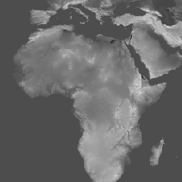
লিথোলজি ডেটাসেটটি ভূপৃষ্ঠের মাটির মূল উপাদানের সাধারণ প্রকারভেদের শ্রেণিবিভাগ প্রদান করে। এটি কোনো ডিইএম (DEM) থেকে উদ্ভূত নয়। কনজারভেশন সায়েন্স পার্টনার্স (সিএসপি)-এর ইকোলজিক্যালি রিলেভেন্ট জিওমরফোলজি (ইআরজিও) ডেটাসেট, ল্যান্ডফর্মস এবং ফিজিওগ্রাফি-তে ভূমিরূপ এবং ভূপ্রাকৃতিক বৈশিষ্ট্যের উপর বিস্তারিত, বহু-স্কেল ডেটা রয়েছে…
CHILI হলো বাষ্পীভবনের উপর সূর্যালোকের প্রভাব এবং ভূ-প্রাকৃতিক ছায়ার প্রভাবের একটি বিকল্প পরিমাপক, যা বিষুব সংক্রান্তির সমতুল্য সূর্য উচ্চতায়, অর্থাৎ পশ্চাদপসরণের শুরুতে সূর্যালোক গণনা করে উপস্থাপন করা হয়। এটি USGS-এর 10m NED DEM-এর উপর ভিত্তি করে তৈরি (যা EE-তে USGS/NED হিসাবে উপলব্ধ)। কনজারভেশন সায়েন্স পার্টনার্স (CSP) পরিবেশগতভাবে…
ALOS ল্যান্ডফর্ম ডেটাসেটটি কন্টিনিউয়াস হিট-ইনসোলেশন লোড ইনডেক্স (CHILI) এবং মাল্টি-স্কেল টপোগ্রাফিক পজিশন ইনডেক্স (mTPI) ডেটাসেট দুটিকে একত্রিত করে তৈরি করা ভূমিরূপ শ্রেণি প্রদান করে। এটি USGS-এর 10m NED DEM-এর উপর ভিত্তি করে তৈরি (যা EE-তে USGS/NED হিসাবে উপলব্ধ)। কনজারভেশন সায়েন্স পার্টনার্স (CSP) ইকোলজিক্যালি রিলেভেন্ট…
ভূ-প্রাকৃতিক বৈচিত্র্য ডেটাসেটটি ভূ-প্রাকৃতিক প্রকারের বৈচিত্র্যের একটি সূচক প্রদান করে। এটি শ্যানন বৈচিত্র্য সূচক ব্যবহার করে একাধিক স্কেলে (কিমি): ১১৫.৮, ৮৯.৯, ৩৫.৫, ১৩.১, ৫.৬, ২.৮, এবং ১.২ গণনা করা হয়েছে। এটি ইউএসজিএস-এর ১০ মিটার এনইডি ডিইএম-এর উপর ভিত্তি করে তৈরি (যা ইই-তে উপলব্ধ…)।
ভূ-প্রাকৃতিক বৈচিত্র্য (D) একটি বিকল্প চলক যা প্রজাতিদের স্থানীয় বাসস্থান হিসেবে উপলব্ধ তাপমাত্রা এবং আর্দ্রতার বিভিন্ন অবস্থাকে উপস্থাপন করে। এটি এই যুক্তি প্রকাশ করে যে, ভূ-জলবায়ুগত পরিবেশের অধিক বৈচিত্র্য উচ্চতর জীববৈচিত্র্যকে (বিশেষত উদ্ভিদের) সমর্থন করবে এবং জলবায়ুগত পরিস্থিতিতে প্রজাতির টিকে থাকাকে সহায়তা করবে…
mTPI শৈলশিরা এবং উপত্যকার আকৃতির মধ্যে পার্থক্য নির্ণয় করে। এটি প্রতিটি অবস্থানের উচ্চতার ডেটা থেকে একটি এলাকার গড় উচ্চতা বিয়োগ করে গণনা করা হয়। mTPI ১১৫.৮, ৮৯.৯, ৩৫.৫, ১৩.১, ৫.৬, ২.৮, এবং ১.২ কিমি ব্যাসার্ধের চলমান উইন্ডো ব্যবহার করে। এটি USGS-এর উপর ভিত্তি করে তৈরি…
ফিজিওগ্রাফি ডেটাসেটটি ভূমিরূপ (EE-তে ERGo/1_0/US/landforms হিসেবে উপলব্ধ) এবং শিলাতত্ত্ব (EE-তে ERGo/1_0/US/lithology হিসেবে উপলব্ধ) ডেটা লেয়ারগুলোর স্থানিক ছেদকে উপস্থাপন করে। এটি সম্ভাব্য ২৭০টির মধ্যে ২৪৭টি অনন্য সমন্বয় প্রদান করে। প্রতিটি প্রকারের মান ভূমিরূপ এবং … সংযুক্ত করে গঠিত হয়।
ইউএসজিএস ৩ডিইপি ১০মি জাতীয় নির্বিঘ্ন মানচিত্র (১/৩ আর্ক-সেকেন্ড)
এটি মার্কিন যুক্তরাষ্ট্রের জন্য একটি নির্বিঘ্ন 3DEP DEM ডেটাসেট, যা ৪৮টি সংলগ্ন রাজ্য, হাওয়াই এবং মার্কিন অঞ্চলসমূহকে সম্পূর্ণরূপে অন্তর্ভুক্ত করে। আলাস্কার কভারেজ এখন আংশিকভাবে উপলব্ধ এবং আলাস্কা ম্যাপিং ইনিশিয়েটিভের অংশ হিসাবে এটিকে রাজ্যব্যাপী কভারেজে সম্প্রসারিত করা হচ্ছে। ভূমির ব্যবধান হলো…
এটি ৩ডি এলিভেশন প্রোগ্রাম (3DEP) থেকে নেওয়া ১ মিটার পিক্সেল আকারের ছবির একটি টাইল করা সংগ্রহ। 3DEP-এর ডেটা ভান্ডার জাতীয় মানচিত্রের উচ্চতা স্তর হিসেবে কাজ করে এবং ভূ-বিজ্ঞান গবেষণা ও ম্যাপিং অ্যাপ্লিকেশনের জন্য মৌলিক উচ্চতার তথ্য সরবরাহ করে।
VJ114IMGTDL_NRT দৈনিক রাস্টার: VIIRS (NOAA-20) ব্যান্ড ৩৭৫মি সক্রিয় অগ্নিকাণ্ড
NOAA-20 (JPSS-1) ভিজিবল ইনফ্রারেড ইমেজিং রেডিওমিটার স্যুট (VIIRS)-এর সক্রিয় অগ্নিকাণ্ড শনাক্তকরণ পণ্যটি যন্ত্রটির ৩৭৫ মিটার নামমাত্র রেজোলিউশনের ডেটার উপর ভিত্তি করে তৈরি। অন্যান্য কম রেজোলিউশনের (≥ ১ কিমি) স্যাটেলাইট অগ্নিকাণ্ড শনাক্তকরণ পণ্যের তুলনায়, উন্নত ৩৭৫ মিটার ডেটা অপেক্ষাকৃত ছোট অগ্নিকাণ্ডের ক্ষেত্রেও অধিকতর সাড়া প্রদান করে…
VNP14IMGTDL_NRT দৈনিক রাস্টার: VIIRS (S-NPP) ব্যান্ড ৩৭৫মি সক্রিয় অগ্নিকাণ্ড
সুওমি এনপিপি ভিজিবল ইনফ্রারেড ইমেজিং রেডিওমিটার স্যুট (VIIRS)-এর সক্রিয় অগ্নিকাণ্ড শনাক্তকরণ পণ্যটি যন্ত্রটির ৩৭৫ মিটার নামমাত্র রেজোলিউশনের ডেটার উপর ভিত্তি করে তৈরি। অন্যান্য কম রেজোলিউশনের (≥ ১ কিমি) স্যাটেলাইট অগ্নিকাণ্ড শনাক্তকরণ পণ্যের তুলনায়, এই উন্নত ৩৭৫ মিটার ডেটা অপেক্ষাকৃত ছোট অগ্নিকাণ্ডের ক্ষেত্রেও অধিকতর সাড়া প্রদান করে…
WHRC প্যানট্রপিক্যাল জাতীয় স্তরের কার্বন মজুত ডেটাসেট
ক্রান্তীয় দেশগুলোর জন্য ৫০০ মিটার উচ্চতায় ভূপৃষ্ঠের উপরের জীবন্ত কাষ্ঠল জৈববস্তুর ঘনত্বের একটি জাতীয় পর্যায়ের মানচিত্র। এই ডেটাসেটটি একই স্থানে করা মাঠপর্যায়ের পরিমাপ, LiDAR পর্যবেক্ষণ এবং মডারেট রেজোলিউশন ইমেজিং স্পেকট্রোরাডিওমিটার (MODIS) থেকে রেকর্ড করা চিত্রাবলীর সমন্বয়ে সংকলিত হয়েছে।
BasinATLAS হলো HydroATLAS ডেটাবেসের একটি অংশ, যা HydroSHEDS-এর একটি অংশ। BasinATLAS উচ্চ স্থানিক রেজোলিউশনে বিশ্বের সমস্ত জলবিভাজিকার জন্য জল-পরিবেশগত বৈশিষ্ট্য তথ্যের একটি প্রমিত সংকলন প্রদান করে। এই ডেটাসেটে ৫৬টি ভেরিয়েবলের ডেটা অন্তর্ভুক্ত রয়েছে, যা ২৮১টি অ্যাট্রিবিউটে বিভক্ত এবং…
BasinATLAS হলো HydroATLAS ডেটাবেসের একটি অংশ, যা HydroSHEDS-এর একটি অংশ। BasinATLAS উচ্চ স্থানিক রেজোলিউশনে বিশ্বের সমস্ত জলবিভাজিকার জন্য জল-পরিবেশগত বৈশিষ্ট্য তথ্যের একটি প্রমিত সংকলন প্রদান করে। এই ডেটাসেটে ৫৬টি ভেরিয়েবলের ডেটা অন্তর্ভুক্ত রয়েছে, যা ২৮১টি অ্যাট্রিবিউটে বিভক্ত এবং…
BasinATLAS হলো HydroATLAS ডেটাবেসের একটি অংশ, যা HydroSHEDS-এর একটি অংশ। BasinATLAS উচ্চ স্থানিক রেজোলিউশনে বিশ্বের সমস্ত জলবিভাজিকার জন্য জল-পরিবেশগত বৈশিষ্ট্য তথ্যের একটি প্রমিত সংকলন প্রদান করে। এই ডেটাসেটে ৫৬টি ভেরিয়েবলের ডেটা অন্তর্ভুক্ত রয়েছে, যা ২৮১টি অ্যাট্রিবিউটে বিভক্ত এবং…
BasinATLAS হলো HydroATLAS ডেটাবেসের একটি অংশ, যা HydroSHEDS-এর একটি অংশ। BasinATLAS উচ্চ স্থানিক রেজোলিউশনে বিশ্বের সমস্ত জলবিভাজিকার জন্য জল-পরিবেশগত বৈশিষ্ট্য তথ্যের একটি প্রমিত সংকলন প্রদান করে। এই ডেটাসেটে ৫৬টি ভেরিয়েবলের ডেটা অন্তর্ভুক্ত রয়েছে, যা ২৮১টি অ্যাট্রিবিউটে বিভক্ত এবং…
BasinATLAS হলো HydroATLAS ডেটাবেসের একটি অংশ, যা HydroSHEDS-এর একটি অংশ। BasinATLAS উচ্চ স্থানিক রেজোলিউশনে বিশ্বের সমস্ত জলবিভাজিকার জন্য জল-পরিবেশগত বৈশিষ্ট্য তথ্যের একটি প্রমিত সংকলন প্রদান করে। এই ডেটাসেটে ৫৬টি ভেরিয়েবলের ডেটা অন্তর্ভুক্ত রয়েছে, যা ২৮১টি অ্যাট্রিবিউটে বিভক্ত এবং…
BasinATLAS হলো HydroATLAS ডেটাবেসের একটি অংশ, যা HydroSHEDS-এর একটি অংশ। BasinATLAS উচ্চ স্থানিক রেজোলিউশনে বিশ্বের সমস্ত জলবিভাজিকার জন্য জল-পরিবেশগত বৈশিষ্ট্য তথ্যের একটি প্রমিত সংকলন প্রদান করে। এই ডেটাসেটে ৫৬টি ভেরিয়েবলের ডেটা অন্তর্ভুক্ত রয়েছে, যা ২৮১টি অ্যাট্রিবিউটে বিভক্ত এবং…
BasinATLAS হলো HydroATLAS ডেটাবেসের একটি অংশ, যা HydroSHEDS-এর একটি অংশ। BasinATLAS উচ্চ স্থানিক রেজোলিউশনে বিশ্বের সমস্ত জলবিভাজিকার জন্য জল-পরিবেশগত বৈশিষ্ট্য তথ্যের একটি প্রমিত সংকলন প্রদান করে। এই ডেটাসেটে ৫৬টি ভেরিয়েবলের ডেটা অন্তর্ভুক্ত রয়েছে, যা ২৮১টি অ্যাট্রিবিউটে বিভক্ত এবং…
BasinATLAS হলো HydroATLAS ডেটাবেসের একটি অংশ, যা HydroSHEDS-এর একটি অংশ। BasinATLAS উচ্চ স্থানিক রেজোলিউশনে বিশ্বের সমস্ত জলবিভাজিকার জন্য জল-পরিবেশগত বৈশিষ্ট্য তথ্যের একটি প্রমিত সংকলন প্রদান করে। এই ডেটাসেটে ৫৬টি ভেরিয়েবলের ডেটা অন্তর্ভুক্ত রয়েছে, যা ২৮১টি অ্যাট্রিবিউটে বিভক্ত এবং…
BasinATLAS হলো HydroATLAS ডেটাবেসের একটি অংশ, যা HydroSHEDS-এর একটি অংশ। BasinATLAS উচ্চ স্থানিক রেজোলিউশনে বিশ্বের সমস্ত জলবিভাজিকার জন্য জল-পরিবেশগত বৈশিষ্ট্য তথ্যের একটি প্রমিত সংকলন প্রদান করে। এই ডেটাসেটে ৫৬টি ভেরিয়েবলের ডেটা অন্তর্ভুক্ত রয়েছে, যা ২৮১টি অ্যাট্রিবিউটে বিভক্ত এবং…
BasinATLAS হলো HydroATLAS ডেটাবেসের একটি অংশ, যা HydroSHEDS-এর একটি অংশ। BasinATLAS উচ্চ স্থানিক রেজোলিউশনে বিশ্বের সমস্ত জলবিভাজিকার জন্য জল-পরিবেশগত বৈশিষ্ট্য তথ্যের একটি প্রমিত সংকলন প্রদান করে। এই ডেটাসেটে ৫৬টি ভেরিয়েবলের ডেটা অন্তর্ভুক্ত রয়েছে, যা ২৮১টি অ্যাট্রিবিউটে বিভক্ত এবং…
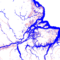
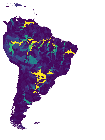
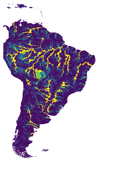
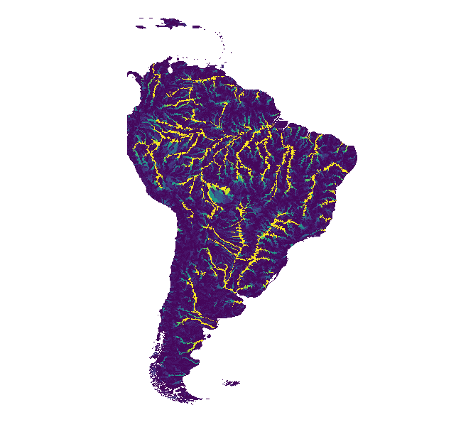
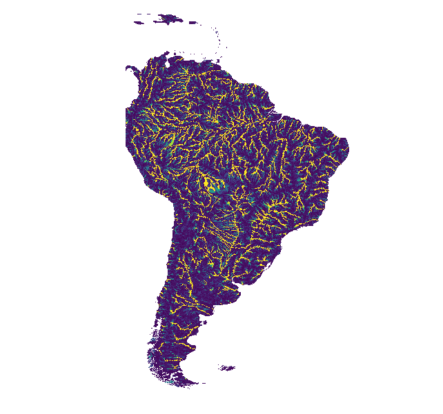
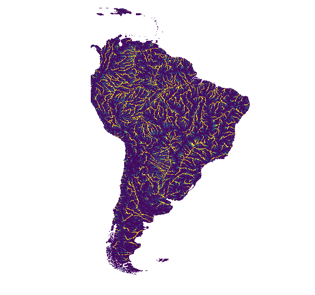
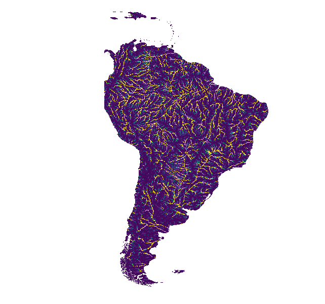
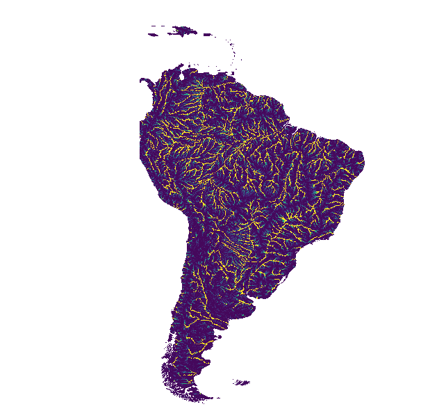
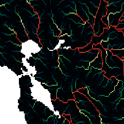
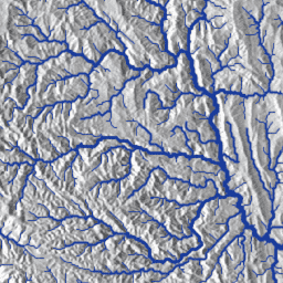
HydroSHEDS হলো একটি ম্যাপিং পণ্য যা আঞ্চলিক এবং বৈশ্বিক-স্তরের অ্যাপ্লিকেশনগুলির জন্য একটি সামঞ্জস্যপূর্ণ বিন্যাসে জললেখচিত্র সংক্রান্ত তথ্য প্রদান করে। এটি বিভিন্ন স্কেলে ভূ-নির্দেশিত ডেটাসেটের (ভেক্টর এবং রাস্টার) একটি সংকলন প্রদান করে, যার মধ্যে রয়েছে নদী নেটওয়ার্ক, জলবিভাজিকার সীমানা, নিষ্কাশনের দিক এবং প্রবাহের সঞ্চয়। HydroSHEDS ভিত্তি করে তৈরি …
HydroSHEDS হলো একটি ম্যাপিং পণ্য যা আঞ্চলিক এবং বৈশ্বিক-স্তরের অ্যাপ্লিকেশনগুলির জন্য একটি সামঞ্জস্যপূর্ণ বিন্যাসে জললেখচিত্র সংক্রান্ত তথ্য প্রদান করে। এটি বিভিন্ন স্কেলে ভূ-নির্দেশিত ডেটাসেটের (ভেক্টর এবং রাস্টার) একটি সংকলন প্রদান করে, যার মধ্যে রয়েছে নদী নেটওয়ার্ক, জলবিভাজিকার সীমানা, নিষ্কাশনের দিক এবং প্রবাহের সঞ্চয়। HydroSHEDS ভিত্তি করে তৈরি …
HydroSHEDS হলো একটি ম্যাপিং পণ্য যা আঞ্চলিক এবং বৈশ্বিক-স্তরের অ্যাপ্লিকেশনগুলির জন্য একটি সামঞ্জস্যপূর্ণ বিন্যাসে জললেখচিত্র সংক্রান্ত তথ্য প্রদান করে। এটি বিভিন্ন স্কেলে ভূ-নির্দেশিত ডেটাসেটের (ভেক্টর এবং রাস্টার) একটি সংকলন প্রদান করে, যার মধ্যে রয়েছে নদী নেটওয়ার্ক, জলবিভাজিকার সীমানা, নিষ্কাশনের দিক এবং প্রবাহের সঞ্চয়। HydroSHEDS ভিত্তি করে তৈরি …
HydroSHEDS হলো একটি ম্যাপিং পণ্য যা আঞ্চলিক এবং বৈশ্বিক-স্তরের অ্যাপ্লিকেশনগুলির জন্য একটি সামঞ্জস্যপূর্ণ বিন্যাসে জললেখচিত্র সংক্রান্ত তথ্য প্রদান করে। এটি বিভিন্ন স্কেলে ভূ-নির্দেশিত ডেটাসেটের (ভেক্টর এবং রাস্টার) একটি সংকলন প্রদান করে, যার মধ্যে রয়েছে নদী নেটওয়ার্ক, জলবিভাজিকার সীমানা, নিষ্কাশনের দিক এবং প্রবাহের সঞ্চয়। HydroSHEDS ভিত্তি করে তৈরি …
HydroSHEDS হলো একটি ম্যাপিং পণ্য যা আঞ্চলিক এবং বৈশ্বিক-স্তরের অ্যাপ্লিকেশনগুলির জন্য একটি সামঞ্জস্যপূর্ণ বিন্যাসে জললেখচিত্র সংক্রান্ত তথ্য প্রদান করে। এটি বিভিন্ন স্কেলে ভূ-নির্দেশিত ডেটাসেটের (ভেক্টর এবং রাস্টার) একটি সংকলন প্রদান করে, যার মধ্যে রয়েছে নদী নেটওয়ার্ক, জলবিভাজিকার সীমানা, নিষ্কাশনের দিক এবং প্রবাহের সঞ্চয়। HydroSHEDS ভিত্তি করে তৈরি …
HydroSHEDS হলো একটি ম্যাপিং পণ্য যা আঞ্চলিক এবং বৈশ্বিক-স্তরের অ্যাপ্লিকেশনগুলির জন্য একটি সামঞ্জস্যপূর্ণ বিন্যাসে জললেখচিত্র সংক্রান্ত তথ্য প্রদান করে। এটি বিভিন্ন স্কেলে ভূ-নির্দেশিত ডেটাসেটের (ভেক্টর এবং রাস্টার) একটি সংকলন প্রদান করে, যার মধ্যে রয়েছে নদী নেটওয়ার্ক, জলবিভাজিকার সীমানা, নিষ্কাশনের দিক এবং প্রবাহের সঞ্চয়। HydroSHEDS ভিত্তি করে তৈরি …
HydroSHEDS হলো একটি ম্যাপিং পণ্য যা আঞ্চলিক এবং বৈশ্বিক-স্তরের অ্যাপ্লিকেশনগুলির জন্য একটি সামঞ্জস্যপূর্ণ বিন্যাসে জললেখচিত্র সংক্রান্ত তথ্য প্রদান করে। এটি বিভিন্ন স্কেলে ভূ-নির্দেশিত ডেটাসেটের (ভেক্টর এবং রাস্টার) একটি সংকলন প্রদান করে, যার মধ্যে রয়েছে নদী নেটওয়ার্ক, জলবিভাজিকার সীমানা, নিষ্কাশনের দিক এবং প্রবাহের সঞ্চয়। HydroSHEDS ভিত্তি করে তৈরি …
HydroSHEDS হলো একটি ম্যাপিং পণ্য যা আঞ্চলিক এবং বৈশ্বিক-স্তরের অ্যাপ্লিকেশনগুলির জন্য একটি সামঞ্জস্যপূর্ণ বিন্যাসে জললেখচিত্র সংক্রান্ত তথ্য প্রদান করে। এটি বিভিন্ন স্কেলে ভূ-নির্দেশিত ডেটাসেটের (ভেক্টর এবং রাস্টার) একটি সংকলন প্রদান করে, যার মধ্যে রয়েছে নদী নেটওয়ার্ক, জলবিভাজিকার সীমানা, নিষ্কাশনের দিক এবং প্রবাহের সঞ্চয়। HydroSHEDS ভিত্তি করে তৈরি …
HydroSHEDS হলো একটি ম্যাপিং পণ্য যা আঞ্চলিক এবং বৈশ্বিক-স্তরের অ্যাপ্লিকেশনগুলির জন্য একটি সামঞ্জস্যপূর্ণ বিন্যাসে জললেখচিত্র সংক্রান্ত তথ্য প্রদান করে। এটি বিভিন্ন স্কেলে ভূ-নির্দেশিত ডেটাসেটের (ভেক্টর এবং রাস্টার) একটি সংকলন প্রদান করে, যার মধ্যে রয়েছে নদী নেটওয়ার্ক, জলবিভাজিকার সীমানা, নিষ্কাশনের দিক এবং প্রবাহের সঞ্চয়। HydroSHEDS ভিত্তি করে তৈরি …
HydroSHEDS হলো একটি ম্যাপিং পণ্য যা আঞ্চলিক এবং বৈশ্বিক-স্তরের অ্যাপ্লিকেশনগুলির জন্য একটি সামঞ্জস্যপূর্ণ বিন্যাসে জললেখচিত্র সংক্রান্ত তথ্য প্রদান করে। এটি বিভিন্ন স্কেলে ভূ-নির্দেশিত ডেটাসেটের (ভেক্টর এবং রাস্টার) একটি সংকলন প্রদান করে, যার মধ্যে রয়েছে নদী নেটওয়ার্ক, জলবিভাজিকার সীমানা, নিষ্কাশনের দিক এবং প্রবাহের সঞ্চয়। HydroSHEDS ভিত্তি করে তৈরি …
HydroSHEDS হলো একটি ম্যাপিং পণ্য যা আঞ্চলিক এবং বৈশ্বিক-স্তরের অ্যাপ্লিকেশনগুলির জন্য একটি সামঞ্জস্যপূর্ণ বিন্যাসে জললেখচিত্র সংক্রান্ত তথ্য প্রদান করে। এটি বিভিন্ন স্কেলে ভূ-নির্দেশিত ডেটাসেটের (ভেক্টর এবং রাস্টার) একটি সংকলন প্রদান করে, যার মধ্যে রয়েছে নদী নেটওয়ার্ক, জলবিভাজিকার সীমানা, নিষ্কাশনের দিক এবং প্রবাহের সঞ্চয়। HydroSHEDS ভিত্তি করে তৈরি …
HydroSHEDS হলো একটি ম্যাপিং পণ্য যা আঞ্চলিক এবং বৈশ্বিক-স্তরের অ্যাপ্লিকেশনগুলির জন্য একটি সামঞ্জস্যপূর্ণ বিন্যাসে জললেখচিত্র সংক্রান্ত তথ্য প্রদান করে। এটি বিভিন্ন স্কেলে ভূ-নির্দেশিত ডেটাসেটের (ভেক্টর এবং রাস্টার) একটি সংকলন প্রদান করে, যার মধ্যে রয়েছে নদী নেটওয়ার্ক, জলবিভাজিকার সীমানা, নিষ্কাশনের দিক এবং প্রবাহের সঞ্চয়। HydroSHEDS ভিত্তি করে তৈরি …
HydroSHEDS হলো একটি ম্যাপিং পণ্য যা আঞ্চলিক এবং বৈশ্বিক-স্তরের অ্যাপ্লিকেশনগুলির জন্য একটি সামঞ্জস্যপূর্ণ বিন্যাসে জললেখচিত্র সংক্রান্ত তথ্য প্রদান করে। এটি বিভিন্ন স্কেলে ভূ-নির্দেশিত ডেটাসেটের (ভেক্টর এবং রাস্টার) একটি সংকলন প্রদান করে, যার মধ্যে রয়েছে নদী নেটওয়ার্ক, জলবিভাজিকার সীমানা, নিষ্কাশনের দিক এবং প্রবাহের সঞ্চয়। HydroSHEDS ভিত্তি করে তৈরি …
HydroSHEDS হলো একটি ম্যাপিং পণ্য যা আঞ্চলিক এবং বৈশ্বিক-স্তরের অ্যাপ্লিকেশনগুলির জন্য একটি সামঞ্জস্যপূর্ণ বিন্যাসে জললেখচিত্র সংক্রান্ত তথ্য প্রদান করে। এটি বিভিন্ন স্কেলে ভূ-নির্দেশিত ডেটাসেটের (ভেক্টর এবং রাস্টার) একটি সংকলন প্রদান করে, যার মধ্যে রয়েছে নদী নেটওয়ার্ক, জলবিভাজিকার সীমানা, নিষ্কাশনের দিক এবং প্রবাহের সঞ্চয়। HydroSHEDS ভিত্তি করে তৈরি …
HydroSHEDS হলো একটি ম্যাপিং পণ্য যা আঞ্চলিক এবং বৈশ্বিক-স্তরের অ্যাপ্লিকেশনগুলির জন্য একটি সামঞ্জস্যপূর্ণ বিন্যাসে জললেখচিত্র সংক্রান্ত তথ্য প্রদান করে। এটি বিভিন্ন স্কেলে ভূ-নির্দেশিত ডেটাসেটের (ভেক্টর এবং রাস্টার) একটি সংকলন প্রদান করে, যার মধ্যে রয়েছে নদী নেটওয়ার্ক, জলবিভাজিকার সীমানা, নিষ্কাশনের দিক এবং প্রবাহের সঞ্চয়। HydroSHEDS ভিত্তি করে তৈরি …
HydroSHEDS হলো একটি ম্যাপিং পণ্য যা আঞ্চলিক এবং বৈশ্বিক-স্তরের অ্যাপ্লিকেশনগুলির জন্য একটি সামঞ্জস্যপূর্ণ বিন্যাসে জললেখচিত্র সংক্রান্ত তথ্য প্রদান করে। এটি বিভিন্ন স্কেলে ভূ-নির্দেশিত ডেটাসেটের (ভেক্টর এবং রাস্টার) একটি সংকলন প্রদান করে, যার মধ্যে রয়েছে নদী নেটওয়ার্ক, জলবিভাজিকার সীমানা, নিষ্কাশনের দিক এবং প্রবাহের সঞ্চয়। HydroSHEDS ভিত্তি করে তৈরি …
HydroSHEDS হলো একটি ম্যাপিং পণ্য যা আঞ্চলিক এবং বৈশ্বিক-স্তরের অ্যাপ্লিকেশনগুলির জন্য একটি সামঞ্জস্যপূর্ণ বিন্যাসে জললেখচিত্র সংক্রান্ত তথ্য প্রদান করে। এটি বিভিন্ন স্কেলে ভূ-নির্দেশিত ডেটাসেটের (ভেক্টর এবং রাস্টার) একটি সংকলন প্রদান করে, যার মধ্যে রয়েছে নদী নেটওয়ার্ক, জলবিভাজিকার সীমানা, নিষ্কাশনের দিক এবং প্রবাহের সঞ্চয়। HydroSHEDS ভিত্তি করে তৈরি …
HydroSHEDS হলো একটি ম্যাপিং পণ্য যা আঞ্চলিক এবং বৈশ্বিক-স্তরের অ্যাপ্লিকেশনগুলির জন্য একটি সামঞ্জস্যপূর্ণ বিন্যাসে জললেখচিত্র সংক্রান্ত তথ্য প্রদান করে। এটি বিভিন্ন স্কেলে ভূ-নির্দেশিত ডেটাসেটের (ভেক্টর এবং রাস্টার) একটি সংকলন প্রদান করে, যার মধ্যে রয়েছে নদী নেটওয়ার্ক, জলবিভাজিকার সীমানা, নিষ্কাশনের দিক এবং প্রবাহের সঞ্চয়। HydroSHEDS ভিত্তি করে তৈরি …
WWF HydroSHEDS হাইড্রোলজিক্যালি কন্ডিশন্ড ডিইএম, ১৫ আর্ক-সেকেন্ড
HydroSHEDS হলো একটি ম্যাপিং পণ্য যা আঞ্চলিক এবং বৈশ্বিক-স্তরের অ্যাপ্লিকেশনগুলির জন্য একটি সামঞ্জস্যপূর্ণ বিন্যাসে জললেখচিত্র সংক্রান্ত তথ্য প্রদান করে। এটি বিভিন্ন স্কেলে ভূ-নির্দেশিত ডেটাসেটের (ভেক্টর এবং রাস্টার) একটি সংকলন প্রদান করে, যার মধ্যে রয়েছে নদী নেটওয়ার্ক, জলবিভাজিকার সীমানা, নিষ্কাশনের দিক এবং প্রবাহের সঞ্চয়। HydroSHEDS ভিত্তি করে তৈরি …
WWF HydroSHEDS হাইড্রোলজিক্যালি কন্ডিশন্ড ডিইএম, ৩ আর্ক-সেকেন্ড
HydroSHEDS হলো একটি ম্যাপিং পণ্য যা আঞ্চলিক এবং বৈশ্বিক-স্তরের অ্যাপ্লিকেশনগুলির জন্য একটি সামঞ্জস্যপূর্ণ বিন্যাসে জললেখচিত্র সংক্রান্ত তথ্য প্রদান করে। এটি বিভিন্ন স্কেলে ভূ-নির্দেশিত ডেটাসেটের (ভেক্টর এবং রাস্টার) একটি সংকলন প্রদান করে, যার মধ্যে রয়েছে নদী নেটওয়ার্ক, জলবিভাজিকার সীমানা, নিষ্কাশনের দিক এবং প্রবাহের সঞ্চয়। HydroSHEDS ভিত্তি করে তৈরি …
WWF HydroSHEDS হাইড্রোলজিক্যালি কন্ডিশন্ড ডিইএম, ৩০ আর্ক-সেকেন্ড
HydroSHEDS হলো একটি ম্যাপিং পণ্য যা আঞ্চলিক এবং বৈশ্বিক-স্তরের অ্যাপ্লিকেশনগুলির জন্য একটি সামঞ্জস্যপূর্ণ বিন্যাসে জললেখচিত্র সংক্রান্ত তথ্য প্রদান করে। এটি বিভিন্ন স্কেলে ভূ-নির্দেশিত ডেটাসেটের (ভেক্টর এবং রাস্টার) একটি সংকলন প্রদান করে, যার মধ্যে রয়েছে নদী নেটওয়ার্ক, জলবিভাজিকার সীমানা, নিষ্কাশনের দিক এবং প্রবাহের সঞ্চয়। HydroSHEDS ভিত্তি করে তৈরি …
WWF HydroSHEDS শূন্যস্থান-পূর্ণ DEM, ৩ আর্ক-সেকেন্ড
HydroSHEDS হলো একটি ম্যাপিং পণ্য যা আঞ্চলিক এবং বৈশ্বিক-স্তরের অ্যাপ্লিকেশনগুলির জন্য একটি সামঞ্জস্যপূর্ণ বিন্যাসে জললেখচিত্র সংক্রান্ত তথ্য প্রদান করে। এটি বিভিন্ন স্কেলে ভূ-নির্দেশিত ডেটাসেটের (ভেক্টর এবং রাস্টার) একটি সংকলন প্রদান করে, যার মধ্যে রয়েছে নদী নেটওয়ার্ক, জলবিভাজিকার সীমানা, নিষ্কাশনের দিক এবং প্রবাহের সঞ্চয়। HydroSHEDS ভিত্তি করে তৈরি …
[[["সহজে বোঝা যায়","easyToUnderstand","thumb-up"],["আমার সমস্যার সমাধান হয়েছে","solvedMyProblem","thumb-up"],["অন্যান্য","otherUp","thumb-up"]],[["এতে আমার প্রয়োজনীয় তথ্য নেই","missingTheInformationINeed","thumb-down"],["খুব জটিল / অনেক ধাপ","tooComplicatedTooManySteps","thumb-down"],["পুরনো","outOfDate","thumb-down"],["অনুবাদ সংক্রান্ত সমস্যা","translationIssue","thumb-down"],["নমুনা / কোড সংক্রান্ত সমস্যা","samplesCodeIssue","thumb-down"],["অন্যান্য","otherDown","thumb-down"]],[],[],[]]