Datasets tagged precipitation in Earth Engine
সেভ করা পৃষ্ঠা গুছিয়ে রাখতে 'সংগ্রহ' ব্যবহার করুন
আপনার পছন্দ অনুযায়ী কন্টেন্ট সেভ করুন ও সঠিক বিভাগে রাখুন।
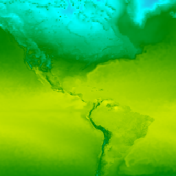
ন্যাশনাল সেন্টারস ফর এনভায়রনমেন্টাল প্রেডিকশন (NCEP)-এর ক্লাইমেট ফোরকাস্ট সিস্টেম রিঅ্যানালাইসিস (CFSR)-কে একটি বৈশ্বিক, উচ্চ-রেজোলিউশনের, সংযুক্ত বায়ুমণ্ডল-মহাসাগর-স্থলভাগ-সমুদ্রের বরফ ব্যবস্থা হিসেবে নকশা ও পরিচালনা করা হয়েছিল, যা জানুয়ারি থেকে শুরু করে ৩২ বছরের নথিভুক্ত সময়কালে এই সংযুক্ত ক্ষেত্রগুলোর অবস্থার সর্বোত্তম অনুমান প্রদান করে…
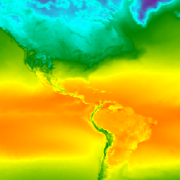
ন্যাশনাল সেন্টারস ফর এনভায়রনমেন্টাল প্রেডিকশন (NCEP) ক্লাইমেট ফোরকাস্ট সিস্টেম (CFS) হলো একটি সম্পূর্ণ সংযুক্ত মডেল যা পৃথিবীর বায়ুমণ্ডল, মহাসাগর, স্থলভাগ এবং সামুদ্রিক বরফের মধ্যকার মিথস্ক্রিয়াকে উপস্থাপন করে। CFS মডেলটি NCEP-এর এনভায়রনমেন্টাল মডেলিং সেন্টার (EMC)-এ তৈরি করা হয়েছিল। কার্যক্ষম CFS-টিকে আপগ্রেড করা হয়েছিল…
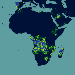
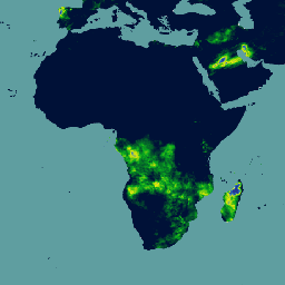
ক্লাইমেট হ্যাজার্ডস সেন্টার ইনফ্রারেড প্রেসিপিটেশন উইথ স্টেশনস (CHIRPS v3) হলো ৪০ বছরেরও বেশি সময় ধরে বিস্তৃত একটি উচ্চ-রেজোলিউশনের প্রায়-বৈশ্বিক বৃষ্টিপাতের ডেটাসেট। এটি ৬০° উত্তর থেকে ৬০° দক্ষিণ অক্ষাংশ পর্যন্ত বিস্তৃত এবং সমস্ত দ্রাঘিমাংশকে অন্তর্ভুক্ত করে, যা ১৯৮১ সাল থেকে প্রায় বর্তমান পর্যন্ত তথ্য সরবরাহ করে। CHIRPS v3 স্যাটেলাইট-ভিত্তিক থার্মাল ইনফ্রারেড বৃষ্টিপাতের অনুমানের সাথে স্টেশনগুলোর নিজস্ব পর্যবেক্ষণকে একত্রিত করে…
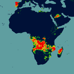
ক্লাইমেট হ্যাজার্ডস সেন্টার ইনফ্রারেড প্রেসিপিটেশন উইথ স্টেশনস (CHIRPS v3) হলো ৪০ বছরেরও বেশি সময় ধরে বিস্তৃত একটি উচ্চ-রেজোলিউশনের প্রায়-বৈশ্বিক বৃষ্টিপাতের ডেটাসেট। এটি ৬০° উত্তর থেকে ৬০° দক্ষিণ অক্ষাংশ পর্যন্ত বিস্তৃত এবং সমস্ত দ্রাঘিমাংশকে অন্তর্ভুক্ত করে, যা ১৯৮১ সাল থেকে প্রায় বর্তমান পর্যন্ত তথ্য সরবরাহ করে। CHIRPS v3 স্যাটেলাইট-ভিত্তিক থার্মাল ইনফ্রারেড বৃষ্টিপাতের অনুমানের সাথে স্টেশনগুলোর নিজস্ব পর্যবেক্ষণকে একত্রিত করে…
ক্লাইমেট হ্যাজার্ডস সেন্টার ইনফ্রারেড প্রেসিপিটেশন উইথ স্টেশন ডেটা (CHIRPS) হলো ৩০ বছরেরও বেশি সময় ধরে সংগৃহীত একটি প্রায়-বৈশ্বিক বৃষ্টিপাতের ডেটাসেট। CHIRPS, প্রবণতা বিশ্লেষণ এবং মৌসুমী খরা পর্যবেক্ষণের জন্য গ্রিডভিত্তিক বৃষ্টিপাতের সময়-শৃঙ্খল তৈরি করতে ০.০৫° রেজোলিউশনের স্যাটেলাইট চিত্রের সাথে স্টেশন থেকে সংগৃহীত ডেটা একত্রিত করে।
ক্লাইমেট হ্যাজার্ডস সেন্টার ইনফ্রারেড প্রেসিপিটেশন উইথ স্টেশন ডেটা (CHIRPS) হলো ৩০ বছরেরও বেশি সময় ধরে সংগৃহীত একটি প্রায়-বৈশ্বিক বৃষ্টিপাতের ডেটাসেট। CHIRPS, প্রবণতা বিশ্লেষণ এবং মৌসুমী খরা পর্যবেক্ষণের জন্য গ্রিডভিত্তিক বৃষ্টিপাতের সময়-শৃঙ্খল তৈরি করতে ০.০৫° রেজোলিউশনের স্যাটেলাইট চিত্রের সাথে স্টেশন থেকে সংগৃহীত ডেটা একত্রিত করে।
ক্লাইমেট হ্যাজার্ডস সেন্টার ইনফ্রারেড প্রেসিপিটেশন উইথ স্টেশনস (CHIRPS v3) হলো ৪০ বছরেরও বেশি সময় ধরে বিস্তৃত একটি উচ্চ-রেজোলিউশনের প্রায়-বৈশ্বিক বৃষ্টিপাতের ডেটাসেট। এটি ৬০° উত্তর থেকে ৬০° দক্ষিণ অক্ষাংশ পর্যন্ত বিস্তৃত এবং সমস্ত দ্রাঘিমাংশকে অন্তর্ভুক্ত করে, যা ১৯৮১ সাল থেকে প্রায় বর্তমান পর্যন্ত তথ্য সরবরাহ করে। CHIRPS v3 স্যাটেলাইট-ভিত্তিক থার্মাল ইনফ্রারেড বৃষ্টিপাতের অনুমানের সাথে স্টেশনগুলোর নিজস্ব পর্যবেক্ষণকে একত্রিত করে…
দৈনিক বৃষ্টিপাতের সিপিসি গ্লোবাল ইউনিফাইড গেজ-ভিত্তিক বিশ্লেষণ
সিপিসি ইউনিফাইড গেজ-বেসড অ্যানালাইসিস অফ গ্লোবাল ডেইলি প্রেসিপিটেশন ডেটাসেটটি ১৯৭৯ সাল থেকে বর্তমান পর্যন্ত স্থলভাগের দৈনিক বৃষ্টিপাতের আনুমানিক হিসাব প্রদান করে। এনওএএ-এর ক্লাইমেট প্রেডিকশন সেন্টার (সিপিসি) দ্বারা তৈরি এই ডেটাসেটটি, বিশ্বব্যাপী বৃষ্টি পরিমাপক যন্ত্রের নেটওয়ার্ক থেকে প্রাপ্ত ডেটা একত্রিত করার জন্য একটি সর্বোত্তম ইন্টারপোলেশন কৌশল ব্যবহার করে, যার সাথে…
এই ডেটাসেটটি বিশ্বের স্থলভাগের দৈনিক ভূপৃষ্ঠের বায়ু তাপমাত্রার একটি গ্রিডভিত্তিক বিশ্লেষণ প্রদান করে, যার মধ্যে দৈনিক সর্বোচ্চ (Tmax) এবং সর্বনিম্ন (Tmin) তাপমাত্রাও অন্তর্ভুক্ত। ১৯৭৯ সাল থেকে বর্তমান পর্যন্ত বিস্তৃত এই ডেটা ০.৫-ডিগ্রি অক্ষাংশ/দ্রাঘিমাংশ গ্রিডে উপস্থাপন করা হয়েছে, যা CPC-এর গেজ-ভিত্তিক বৈশ্বিক দৈনিক ডেটার রেজোলিউশনের সাথে সামঞ্জস্যপূর্ণ।
Daymet V4: দৈনিক ভূপৃষ্ঠের আবহাওয়া ও জলবায়ু সংক্রান্ত সারসংক্ষেপ
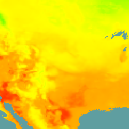
Daymet V4 মহাদেশীয় উত্তর আমেরিকা, হাওয়াই এবং পুয়ের্তো রিকোর জন্য দৈনিক আবহাওয়ার প্যারামিটারগুলির গ্রিডভিত্তিক আনুমানিক হিসাব প্রদান করে (পুয়ের্তো রিকোর ডেটা ১৯৫০ সাল থেকে পাওয়া যায়)। এটি নির্বাচিত আবহাওয়া স্টেশনের ডেটা এবং বিভিন্ন সহায়ক ডেটা উৎস থেকে প্রাপ্ত। পূর্ববর্তী সংস্করণের তুলনায়, Daymet …
এই ডেটাসেটটিতে ECMWF ইন্টিগ্রেটেড ফোরকাস্টিং সিস্টেম (IFS) দ্বারা ০.২৫ ডিগ্রি রেজোলিউশনে তৈরি বায়ুমণ্ডলীয় মডেল ভেরিয়েবলগুলির ১৫-দিনের পূর্বাভাস রয়েছে। আমরা এগুলিকে নিয়ার-রিয়েলটাইম (NRT) বলি, কারণ ECMWF-এর রিয়েলটাইম পূর্বাভাস প্রকাশের পর দিনে দুবার নতুন প্রোডাক্ট প্রকাশ করা হয়…
ERA5 দৈনিক সমষ্টি - ECMWF / কোপারনিকাস ক্লাইমেট চেঞ্জ সার্ভিস দ্বারা প্রস্তুতকৃত সর্বশেষ জলবায়ু পুনর্মূল্যায়ন
ERA5 হলো বৈশ্বিক জলবায়ুর পঞ্চম প্রজন্মের ECMWF বায়ুমণ্ডলীয় পুনঃবিশ্লেষণ। এই পুনঃবিশ্লেষণ মডেলের তথ্যের সাথে বিশ্বজুড়ে প্রাপ্ত পর্যবেক্ষণকে একত্রিত করে একটি বিশ্বব্যাপী সম্পূর্ণ এবং সামঞ্জস্যপূর্ণ ডেটাসেট তৈরি করে। ERA5 তার পূর্বসূরি, ERA-Interim পুনঃবিশ্লেষণকে প্রতিস্থাপন করেছে। ERA5 DAILY প্রতিটি দিনের জন্য সমষ্টিগত মান প্রদান করে…
ERA5 হলো বৈশ্বিক জলবায়ুর পঞ্চম প্রজন্মের ECMWF বায়ুমণ্ডলীয় পুনঃবিশ্লেষণ। এটি ECMWF-এর কোপারনিকাস ক্লাইমেট চেঞ্জ সার্ভিস (C3S) দ্বারা উৎপাদিত হয়। পুনঃবিশ্লেষণ মডেলটির সূত্র ব্যবহার করে বিশ্বজুড়ে প্রাপ্ত পর্যবেক্ষণের সাথে মডেল ডেটাকে একত্রিত করে একটি বিশ্বব্যাপী সম্পূর্ণ এবং সামঞ্জস্যপূর্ণ ডেটাসেট তৈরি করে।
ERA5 হলো বৈশ্বিক জলবায়ুর পঞ্চম প্রজন্মের ECMWF বায়ুমণ্ডলীয় পুনঃবিশ্লেষণ। এই পুনঃবিশ্লেষণ মডেলের তথ্যের সাথে বিশ্বজুড়ে প্রাপ্ত পর্যবেক্ষণকে একত্রিত করে একটি বিশ্বব্যাপী সম্পূর্ণ এবং সামঞ্জস্যপূর্ণ ডেটাসেট তৈরি করে। ERA5 তার পূর্বসূরি, ERA-Interim পুনঃবিশ্লেষণকে প্রতিস্থাপন করেছে। ERA5 MONTHLY প্রতিটি মাসের জন্য সমষ্টিগত মান প্রদান করে…
ERA5-ভূমি দৈনিক সমষ্টিগত - ECMWF জলবায়ু পুনর্মূল্যায়ন
ERA5-Land হলো একটি পুনঃবিশ্লেষণ ডেটাসেট যা ERA5-এর তুলনায় উন্নত রেজোলিউশনে কয়েক দশক ধরে ভূমি চলকগুলোর বিবর্তনের একটি সামঞ্জস্যপূর্ণ চিত্র প্রদান করে। ECMWF ERA5 জলবায়ু পুনঃবিশ্লেষণের ভূমি উপাদানটিকে পুনরায় চালিয়ে ERA5-Land তৈরি করা হয়েছে। পুনঃবিশ্লেষণ মডেল ডেটার সাথে …
ERA5-Land হলো একটি পুনঃবিশ্লেষণ ডেটাসেট যা ERA5-এর তুলনায় উন্নত রেজোলিউশনে কয়েক দশক ধরে ভূমি চলকগুলোর বিবর্তনের একটি সামঞ্জস্যপূর্ণ চিত্র প্রদান করে। ECMWF ERA5 জলবায়ু পুনঃবিশ্লেষণের ভূমি উপাদানটিকে পুনরায় চালিয়ে ERA5-Land তৈরি করা হয়েছে। পুনঃবিশ্লেষণ মডেল ডেটার সাথে …
ERA5-Land হলো একটি পুনঃবিশ্লেষণ ডেটাসেট যা ERA5-এর তুলনায় উন্নত রেজোলিউশনে কয়েক দশক ধরে ভূমি চলকগুলোর বিবর্তনের একটি সামঞ্জস্যপূর্ণ চিত্র প্রদান করে। ECMWF ERA5 জলবায়ু পুনঃবিশ্লেষণের ভূমি উপাদানটিকে পুনরায় চালিয়ে ERA5-Land তৈরি করা হয়েছে। পুনঃবিশ্লেষণ মডেল ডেটার সাথে …
দিনের ঘণ্টা অনুযায়ী ERA5-ভূমির মাসিক গড় - ECMWF জলবায়ু পুনর্মূল্যায়ন
ERA5-Land হলো একটি পুনঃবিশ্লেষণ ডেটাসেট যা ERA5-এর তুলনায় উন্নত রেজোলিউশনে কয়েক দশক ধরে ভূমি চলকগুলোর বিবর্তনের একটি সামঞ্জস্যপূর্ণ চিত্র প্রদান করে। ECMWF ERA5 জলবায়ু পুনঃবিশ্লেষণের ভূমি উপাদানটিকে পুনরায় চালিয়ে ERA5-Land তৈরি করা হয়েছে। পুনঃবিশ্লেষণ মডেল ডেটার সাথে …
ERA5-Land হলো একটি পুনঃবিশ্লেষণ ডেটাসেট যা ERA5-এর তুলনায় উন্নত রেজোলিউশনে কয়েক দশক ধরে ভূমি চলকগুলোর বিবর্তনের একটি সামঞ্জস্যপূর্ণ চিত্র প্রদান করে। ECMWF ERA5 জলবায়ু পুনঃবিশ্লেষণের ভূমি উপাদানটিকে পুনরায় চালিয়ে ERA5-Land তৈরি করা হয়েছে। পুনঃবিশ্লেষণ মডেল ডেটার সাথে …
এফএলডিএএস: দুর্ভিক্ষের আগাম সতর্কীকরণ ব্যবস্থা নেটওয়ার্ক (এফইডব্লিউএস নেট) ভূমি তথ্য আত্তীকরণ ব্যবস্থা
FLDAS ডেটাসেটটি (McNally et al. 2017) ডেটার স্বল্পতাযুক্ত উন্নয়নশীল দেশগুলিতে খাদ্য নিরাপত্তা মূল্যায়নে সহায়তা করার জন্য তৈরি করা হয়েছিল। এতে আর্দ্রতার পরিমাণ, জলীয় বাষ্প, বাষ্পীভবন, গড় মাটির তাপমাত্রা, মোট বৃষ্টিপাতের হার ইত্যাদি সহ জলবায়ু-সম্পর্কিত অনেক চলকের তথ্য অন্তর্ভুক্ত রয়েছে। একাধিক ভিন্ন ভিন্ন FLDAS ডেটাসেট রয়েছে; …
গ্লোবাল ফোরকাস্ট সিস্টেম (GFS) হলো ন্যাশনাল সেন্টারস ফর এনভায়রনমেন্টাল প্রেডিকশন (NCEP) দ্বারা উৎপাদিত একটি আবহাওয়ার পূর্বাভাস মডেল। GFS ডেটাসেটটি গ্রিডেড পূর্বাভাস ভেরিয়েবল হিসেবে নির্বাচিত মডেল আউটপুট (যা নিচে বর্ণনা করা হয়েছে) নিয়ে গঠিত। এর ৩৮৪-ঘণ্টার পূর্বাভাসের সাথে ১-ঘণ্টা (১২০ ঘণ্টা পর্যন্ত) এবং ৩-ঘণ্টার (এরপরে…) পূর্বাভাসও অন্তর্ভুক্ত।
নাসা গ্লোবাল ল্যান্ড ডেটা অ্যাসিমিলেশন সিস্টেম ভার্সন ২ (জিএলডিএএস-২)-এর তিনটি উপাদান রয়েছে: জিএলডিএএস-২.০, জিএলডিএএস-২.১, এবং জিএলডিএএস-২.২। জিএলডিএএস-২.০ সম্পূর্ণরূপে প্রিন্সটন আবহাওয়া সংক্রান্ত ফোর্সিং ইনপুট ডেটা দ্বারা চালিত হয় এবং ১৯৪৮ থেকে ২০১৪ সাল পর্যন্ত একটি সময়গতভাবে সামঞ্জস্যপূর্ণ সিরিজ প্রদান করে। জিএলডিএএস-২.১ বিভিন্ন মডেলের সংমিশ্রণে চালিত হয়…
নাসা গ্লোবাল ল্যান্ড ডেটা অ্যাসিমিলেশন সিস্টেম ভার্সন ২ (জিএলডিএএস-২)-এর তিনটি উপাদান রয়েছে: জিএলডিএএস-২.০, জিএলডিএএস-২.১, এবং জিএলডিএএস-২.২। জিএলডিএএস-২.০ সম্পূর্ণরূপে প্রিন্সটন আবহাওয়া সংক্রান্ত ফোর্সিং ইনপুট ডেটা দ্বারা চালিত হয় এবং ১৯৪৮ থেকে ২০১৪ সাল পর্যন্ত একটি সময়গতভাবে সামঞ্জস্যপূর্ণ সিরিজ প্রদান করে। জিএলডিএএস-২.১ বিভিন্ন মডেলের সংমিশ্রণে চালিত হয়…
গ্লোবাল প্রিসিপিটেশন মেজারমেন্ট (GPM) হলো একটি আন্তর্জাতিক স্যাটেলাইট মিশন, যা প্রতি তিন ঘণ্টা অন্তর বিশ্বব্যাপী বৃষ্টি ও তুষারপাতের পরবর্তী প্রজন্মের পর্যবেক্ষণ প্রদান করে। ইন্টিগ্রেটেড মাল্টি-স্যাটেলাইট রিট্রিভালস ফর GPM (IMERG) হলো একটি সমন্বিত অ্যালগরিদম, যা GPM-এর সমস্ত প্যাসিভ-মাইক্রোওয়েভ যন্ত্র থেকে প্রাপ্ত ডেটা একত্রিত করে বৃষ্টিপাতের আনুমানিক হিসাব প্রদান করে…
আইএমইআরজি-এর চূড়ান্ত সংস্করণ "০৬"-এর উৎপাদন ২০২১ সালের সেপ্টেম্বরে বন্ধ হয়ে গেছে। সংস্করণ "০৭" ২০২২ সালের সেপ্টেম্বরে প্রকাশিত হবে বলে আশা করা হচ্ছে। গ্লোবাল প্রিসিপিটেশন মেজারমেন্ট (জিপিএম) হলো একটি আন্তর্জাতিক স্যাটেলাইট মিশন, যা প্রতি তিন ঘণ্টা অন্তর বিশ্বব্যাপী বৃষ্টি ও তুষারপাতের পরবর্তী প্রজন্মের পর্যবেক্ষণ প্রদান করে। ইন্টিগ্রেটেড মাল্টি-স্যাটেলাইট রিট্রিভালস ফর...
গ্লোবাল প্রিসিপিটেশন মেজারমেন্ট (GPM) হলো একটি আন্তর্জাতিক স্যাটেলাইট মিশন, যা প্রতি তিন ঘণ্টা অন্তর বিশ্বব্যাপী বৃষ্টি ও তুষারপাতের পরবর্তী প্রজন্মের পর্যবেক্ষণ প্রদান করে। ইন্টিগ্রেটেড মাল্টি-স্যাটেলাইট রিট্রিভালস ফর GPM (IMERG) হলো একটি সমন্বিত অ্যালগরিদম, যা GPM-এর সমস্ত প্যাসিভ-মাইক্রোওয়েভ যন্ত্র থেকে প্রাপ্ত ডেটা একত্রিত করে বৃষ্টিপাতের আনুমানিক হিসাব প্রদান করে…
এই ডেটাসেটটিতে ৪-কিমি দৈনিক গ্রিডেড সারফেস মেটিওরোলজিক্যাল (GRIDMET) ডেটাসেট থেকে প্রাপ্ত খরা সূচকসমূহ রয়েছে। প্রদত্ত খরা সূচকগুলোর মধ্যে রয়েছে স্ট্যান্ডার্ডাইজড প্রেসিপিটেশন ইনডেক্স (SPI), ইভাপোরেটিভ ড্রট ডিমান্ড ইনডেক্স (EDDI), স্ট্যান্ডার্ডাইজড প্রেসিপিটেশন ইভাপোট্রান্সপিরেশন ইনডেক্স (SPEI), পামার ড্রট সিভিয়ারিটি ইনডেক্স (PDSI) এবং পামার…
গ্রিডমেট: আইডাহো বিশ্ববিদ্যালয়ের গ্রিডযুক্ত ভূপৃষ্ঠ আবহাওয়া সংক্রান্ত ডেটাসেট
গ্রিডেড সারফেস মেটিওরোলজিক্যাল ডেটাসেটটি ১৯৭৯ সাল থেকে মার্কিন যুক্তরাষ্ট্রের মূল ভূখণ্ড জুড়ে তাপমাত্রা, বৃষ্টিপাত, বায়ুপ্রবাহ, আর্দ্রতা এবং বিকিরণের উচ্চ স্থানিক রেজোলিউশনের (~৪-কিমি) দৈনিক ভূপৃষ্ঠের ক্ষেত্রসমূহ সরবরাহ করে। এই ডেটাসেটটি PRISM থেকে প্রাপ্ত উচ্চ রেজোলিউশনের স্থানিক ডেটার সাথে … থেকে প্রাপ্ত উচ্চ টেম্পোরাল রেজোলিউশনের ডেটা মিশ্রিত করে।
জিএসএমএপি অপারেশনাল: গ্লোবাল স্যাটেলাইট ম্যাপিং অফ প্রেসিপিটেশন - ভি৬
গ্লোবাল স্যাটেলাইট ম্যাপিং অফ প্রেসিপিটেশন (GSMaP) ০.১ x ০.১ ডিগ্রি রেজোলিউশনে বিশ্বব্যাপী প্রতি ঘণ্টার বৃষ্টিপাতের হার সরবরাহ করে। GSMaP হলো গ্লোবাল প্রেসিপিটেশন মেজারমেন্ট (GPM) মিশনের একটি পণ্য, যা প্রতি তিন ঘণ্টা অন্তর বিশ্বব্যাপী বৃষ্টিপাতের পর্যবেক্ষণ প্রদান করে। মাল্টি-ব্যান্ড প্যাসিভ ব্যবহার করে মানগুলি অনুমান করা হয়…
জিএসএমএপি অপারেশনাল: গ্লোবাল স্যাটেলাইট ম্যাপিং অফ প্রেসিপিটেশন - ভি৭
গ্লোবাল স্যাটেলাইট ম্যাপিং অফ প্রেসিপিটেশন (GSMaP) ০.১ x ০.১ ডিগ্রি রেজোলিউশনে বিশ্বব্যাপী প্রতি ঘণ্টার বৃষ্টিপাতের হার সরবরাহ করে। GSMaP হলো গ্লোবাল প্রেসিপিটেশন মেজারমেন্ট (GPM) মিশনের একটি পণ্য, যা প্রতি তিন ঘণ্টা অন্তর বিশ্বব্যাপী বৃষ্টিপাতের পর্যবেক্ষণ প্রদান করে। মাল্টি-ব্যান্ড প্যাসিভ ব্যবহার করে মানগুলি অনুমান করা হয়…
জিএসএমএপি অপারেশনাল: গ্লোবাল স্যাটেলাইট ম্যাপিং অফ প্রেসিপিটেশন - ভি৮
গ্লোবাল স্যাটেলাইট ম্যাপিং অফ প্রেসিপিটেশন (GSMaP) ০.১ x ০.১ ডিগ্রি রেজোলিউশনে বিশ্বব্যাপী প্রতি ঘণ্টার বৃষ্টিপাতের হার সরবরাহ করে। GSMaP হলো গ্লোবাল প্রেসিপিটেশন মেজারমেন্ট (GPM) মিশনের একটি পণ্য, যা প্রতি তিন ঘণ্টা অন্তর বিশ্বব্যাপী বৃষ্টিপাতের পর্যবেক্ষণ প্রদান করে। মাল্টি-ব্যান্ড প্যাসিভ ব্যবহার করে মানগুলি অনুমান করা হয়…
গ্লোবাল স্যাটেলাইট ম্যাপিং অফ প্রেসিপিটেশন (GSMaP) ০.১ x ০.১ ডিগ্রি রেজোলিউশনে বিশ্বব্যাপী প্রতি ঘণ্টার বৃষ্টিপাতের হার সরবরাহ করে। GSMaP হলো গ্লোবাল প্রেসিপিটেশন মেজারমেন্ট (GPM) মিশনের একটি পণ্য, যা প্রতি তিন ঘণ্টা অন্তর বিশ্বব্যাপী বৃষ্টিপাতের পর্যবেক্ষণ প্রদান করে। মাল্টি-ব্যান্ড প্যাসিভ ব্যবহার করে মানগুলি অনুমান করা হয়…
M2T1NXFLX (বা tavg1_2d_flx_Nx) হলো Modern-Era Retrospective analysis for Research and Applications সংস্করণ 2 (MERRA-2)-এর একটি ঘণ্টাভিত্তিক সময়-গড় ডেটা সংগ্রহ। এই সংগ্রহটিতে সমন্বিত ভূপৃষ্ঠ ফ্লাক্স ডায়াগনস্টিকস অন্তর্ভুক্ত রয়েছে, যেমন মোট বৃষ্টিপাত, বায়াস সংশোধিত মোট বৃষ্টিপাত, ভূপৃষ্ঠের বায়ুর তাপমাত্রা, ভূপৃষ্ঠের নির্দিষ্ট আর্দ্রতা, ভূপৃষ্ঠের বাতাসের গতি, …
M2T1NXLND (বা tavg1_2d_lnd_Nx) হলো Modern-Era Retrospective analysis for Research and Applications version 2 (MERRA-2)-এর একটি ঘণ্টাভিত্তিক সময়-গড় ডেটা সংগ্রহ। এই সংগ্রহে ভূমির উপরিভাগের রোগনির্ণয় সংক্রান্ত তথ্য থাকে, যেমন—ভিত্তিপ্রবাহ ফ্লাক্স, রানঅফ, উপরিভাগের মাটির আর্দ্রতা, মূল অঞ্চলের মাটির আর্দ্রতা, উপরিভাগের স্তরে জলের পরিমাণ, ইত্যাদি।
নাসা NEX-DCP30 ডেটাসেটটি সংলগ্ন মার্কিন যুক্তরাষ্ট্রের জন্য ডাউনস্কেল করা জলবায়ু পরিস্থিতি নিয়ে গঠিত, যা কাপলড মডেল ইন্টারকম্প্যারিসন প্রজেক্ট ফেজ ৫ (CMIP5, দেখুন টেলর এট আল. ২০১২)-এর অধীনে পরিচালিত জেনারেল সার্কুলেশন মডেল (GCM) রান থেকে এবং চারটি গ্রিনহাউস গ্যাস পর্যায় জুড়ে উদ্ভূত হয়েছে…
NEX-DCP30: নাসা আর্থ এক্সচেঞ্জের ডাউনস্কেল করা জলবায়ু পূর্বাভাস
নাসা NEX-DCP30 ডেটাসেটটি সংলগ্ন মার্কিন যুক্তরাষ্ট্রের জন্য ডাউনস্কেল করা জলবায়ু পরিস্থিতি নিয়ে গঠিত, যা কাপলড মডেল ইন্টারকম্প্যারিসন প্রজেক্ট ফেজ ৫ (CMIP5, দেখুন টেলর এট আল. ২০১২)-এর অধীনে পরিচালিত জেনারেল সার্কুলেশন মডেল (GCM) রান থেকে এবং চারটি গ্রিনহাউস গ্যাস পর্যায় জুড়ে উদ্ভূত হয়েছে…
NEX-GDDP-CMIP6: নাসা আর্থ এক্সচেঞ্জের বৈশ্বিক দৈনিক ডাউনস্কেল করা জলবায়ু পূর্বাভাস
NEX-GDDP-CMIP6 ডেটাসেটটি কাপলড মডেল ইন্টারকম্প্যারিসন প্রজেক্ট ফেজ ৬ (CMIP6, দেখুন Thrasher et al. 2022)-এর অধীনে পরিচালিত জেনারেল সার্কুলেশন মডেল (GCM) রান থেকে প্রাপ্ত বৈশ্বিক ডাউনস্কেলড জলবায়ু পরিস্থিতি এবং চারটি "টিয়ার ১" গ্রিনহাউস গ্যাস নির্গমন পরিস্থিতির মধ্যে দুটি থেকে উদ্ভূত পরিস্থিতি নিয়ে গঠিত…
নাসা NEX-GDDP ডেটাসেটটি সমগ্র বিশ্বের জন্য ডাউনস্কেল করা জলবায়ু পরিস্থিতি নিয়ে গঠিত, যা কাপলড মডেল ইন্টারকম্প্যারিসন প্রজেক্ট ফেজ ৫ (CMIP5, দেখুন টেলর এট আল. ২০১২)-এর অধীনে পরিচালিত জেনারেল সার্কুলেশন মডেল (GCM) রান থেকে উদ্ভূত এবং চারটি গ্রিনহাউস গ্যাসের মধ্যে দুটির ওপর ভিত্তি করে তৈরি।
NLDAS-2: উত্তর আমেরিকান ভূমি তথ্য আত্তীকরণ সিস্টেম ফোর্সিং ফিল্ড
ল্যান্ড ডেটা অ্যাসিমিলেশন সিস্টেম (LDAS) পৃথিবীর পৃষ্ঠে বা তার কাছাকাছি জলবায়ুগত বৈশিষ্ট্যের অনুমান তৈরি করতে একাধিক পর্যবেক্ষণের উৎস (যেমন বৃষ্টিপাত গেজ ডেটা, স্যাটেলাইট ডেটা এবং রাডার বৃষ্টিপাত পরিমাপ) একত্রিত করে। এই ডেটাসেটটি ফেজ … এর জন্য প্রাথমিক (ডিফল্ট) ফোর্সিং ফাইল (ফাইল A)।
SM2RAIN-ASCAT 2007-2018, IMERG, CHELSA Climate, এবং WorldClim-এর উপর ভিত্তি করে ১ কিমি রেজোলিউশনে মাসিক বৃষ্টিপাত (মিমি-তে)। gdalwarp (কিউবিক স্প্লাইন) এবং WorldClim, CHELSA Climate, ও IMERG-এর মাসিক প্রোডাক্টের গড় ব্যবহার করে এটিকে ১ কিমি রেজোলিউশনে ডাউনস্কেল করা হয়েছে (উদাহরণস্বরূপ, "3B-MO-L.GIS.IMERG.20180601.V05B.tif" দেখুন)। ৩ গুণ বেশি গুরুত্ব দেওয়া হয়েছে…
ওয়া হলো ভূস্থির (GEO) স্যাটেলাইট পর্যবেক্ষণ থেকে প্রাপ্ত একটি প্রায়-বৈশ্বিক, উচ্চ-রেজোলিউশনের বৃষ্টিপাত অনুমানের ডেটাসেট। ওয়া মডেলটি GOES-16/18, Meteosat-9/10, এবং Himawari-8/9 সহ GEO স্যাটেলাইটের একটি নক্ষত্রপুঞ্জ থেকে দৃশ্যমান এবং অবলোহিত (VIS-IR) চ্যানেলের সম্পূর্ণ পরিসর ব্যবহার করে বৃষ্টিপাতের অনুমান তৈরি করে, যা …
PERSIANN-CDR: কৃত্রিম নিউরাল নেটওয়ার্ক ব্যবহার করে দূরসংবেদী তথ্য থেকে বৃষ্টিপাতের অনুমান-জলবায়ু ডেটা রেকর্ড
PERSIANN-CDR হলো একটি দৈনিক প্রায়-বৈশ্বিক বৃষ্টিপাতের ডেটা প্রোডাক্ট যা ১৯৮৩ সালের ১লা জানুয়ারি থেকে বর্তমান পর্যন্ত সময়কালকে অন্তর্ভুক্ত করে। এই ডেটা সাধারণত তিন মাসের ব্যবধানে ত্রৈমাসিকভাবে তৈরি করা হয়। এই প্রোডাক্টটি ক্যালিফোর্নিয়া বিশ্ববিদ্যালয়, আরভাইন-এর সেন্টার ফর হাইড্রোমেটিওরোলজি অ্যান্ড রিমোট সেন্সিং দ্বারা তৈরি করা হয়েছে…
PRISM দৈনিক এবং মাসিক ডেটাসেটগুলি হল মার্কিন যুক্তরাষ্ট্রের সংলগ্ন অঞ্চলের জন্য গ্রিডযুক্ত জলবায়ু ডেটাসেট, যা ওরেগন স্টেট ইউনিভার্সিটির PRISM ক্লাইমেট গ্রুপ দ্বারা তৈরি। এই সংগ্রহটিতে AN81 এবং AN91 উভয় ডেটা রয়েছে, যা 'dataset_type' প্রপার্টি দ্বারা নির্দেশিত। PRISM (প্যারামিটার-এলিভেশন রিগ্রেশনস...) ব্যবহার করে গ্রিডগুলি তৈরি করা হয়।
PRISM দৈনিক এবং মাসিক ডেটাসেটগুলো হলো মার্কিন যুক্তরাষ্ট্রের সংলগ্ন অঞ্চলের জন্য গ্রিডভিত্তিক জলবায়ু ডেটাসেট, যা ওরেগন স্টেট ইউনিভার্সিটির PRISM ক্লাইমেট গ্রুপ দ্বারা প্রস্তুত করা হয়েছে। PRISM (Parameter-elevation Regressions on Independent Slopes Model) ব্যবহার করে গ্রিডগুলো তৈরি করা হয়। PRISM ইন্টারপোলেশন রুটিনগুলো আবহাওয়া এবং জলবায়ু কীভাবে পরিবর্তিত হয় তা অনুকরণ করে…
PRISM দৈনিক এবং মাসিক ডেটাসেটগুলি হল মার্কিন যুক্তরাষ্ট্রের সংলগ্ন অঞ্চলের জন্য গ্রিডযুক্ত জলবায়ু ডেটাসেট, যা ওরেগন স্টেট ইউনিভার্সিটির PRISM ক্লাইমেট গ্রুপ দ্বারা তৈরি। 'dataset_type' প্রপার্টি দ্বারা নির্দেশিত হিসাবে, এই সংগ্রহটিতে AN81 এবং AN91 উভয় ডেটা রয়েছে। PRISM (প্যারামিটার-এলিভেশন …) ব্যবহার করে গ্রিডগুলি তৈরি করা হয়।
রিয়েল-টাইম মেসোস্কেল অ্যানালাইসিস (RTMA) হলো ভূপৃষ্ঠের নিকটবর্তী আবহাওয়ার পরিস্থিতি বিশ্লেষণের জন্য একটি উচ্চ স্থানিক ও কালিক রেজোলিউশনের পদ্ধতি। এই ডেটাসেটে CONUS-এর জন্য ২.৫ কিমি উচ্চতায় ঘণ্টাভিত্তিক বিশ্লেষণ অন্তর্ভুক্ত রয়েছে।
নাসা গ্লোবাল ল্যান্ড ডেটা অ্যাসিমিলেশন সিস্টেম ভার্সন ২ (জিএলডিএএস-২)-এর তিনটি উপাদান রয়েছে: জিএলডিএএস-২.০, জিএলডিএএস-২.১, এবং জিএলডিএএস-২.২। জিএলডিএএস-২.০ সম্পূর্ণরূপে প্রিন্সটন আবহাওয়া সংক্রান্ত ফোর্সিং ইনপুট ডেটা দ্বারা চালিত হয় এবং ১৯৪৮ থেকে ২০১৪ সাল পর্যন্ত একটি সময়গতভাবে সামঞ্জস্যপূর্ণ সিরিজ প্রদান করে। জিএলডিএএস-২.১ বিভিন্ন মডেলের সংমিশ্রণে চালিত হয়…
গ্লোবাল এসপিইআই ডেটাবেস (SPEIbase) ০.৫ ডিগ্রি পিক্সেল সাইজ এবং মাসিক ছন্দে বৈশ্বিক পর্যায়ে খরা পরিস্থিতি সম্পর্কে দীর্ঘমেয়াদী নির্ভরযোগ্য তথ্য প্রদান করে। এটি ১ থেকে ৪৮ মাস পর্যন্ত এসপিইআই সময়সীমা সরবরাহ করে। স্ট্যান্ডার্ডাইজড প্রিসিপিটেশন-ইভাপোট্রান্সপিরেশন ইনডেক্স (SPEI) একটি প্রমিত চলক হিসেবে প্রকাশ করে…
TRMM 3B42: প্রতি ৩ ঘণ্টা অন্তর বৃষ্টিপাতের পূর্বাভাস
ট্রপিক্যাল রেইনফল মেজারিং মিশন (TRMM) হলো নাসা এবং জাপান অ্যারোস্পেস এক্সপ্লোরেশন এজেন্সি (JAXA)-এর একটি যৌথ মিশন, যা ক্রান্তীয় বৃষ্টিপাত পর্যবেক্ষণ ও অধ্যয়নের জন্য ডিজাইন করা হয়েছে। 34B2 প্রোডাক্টটিতে একটি গ্রিডযুক্ত, TRMM-সমন্বিত, একীভূত ইনফ্রারেড বৃষ্টিপাত (মিমি/ঘণ্টা) এবং RMS বৃষ্টিপাত-ত্রুটির অনুমান রয়েছে, যা ৩-ঘণ্টার টেম্পোরাল…
এই সংগ্রহটি আর আপডেট করা হচ্ছে না। IMERG মাসিক দেখুন। এই ডেটাসেটটি SSMI, SSMIS, MHS, AMSU-B এবং AMSR-E সহ একাধিক স্যাটেলাইট থেকে প্রাপ্ত মাইক্রোওয়েভ ডেটা অ্যালগরিদমিকভাবে একত্রিত করে, যার প্রতিটি TRMM কম্বাইন্ড ইন্সট্রুমেন্টের সাথে আন্তঃ-ক্যালিব্রেটেড। অ্যালগরিদম 3B43 প্রতি ক্যালেন্ডার মাসে একবার কার্যকর করা হয় একক ডেটাসেটটি তৈরি করার জন্য, …
টেরাক্লাইমেট: বৈশ্বিক স্থলভাগের মাসিক জলবায়ু ও জলবায়ুগত জল ভারসাম্য, আইডাহো বিশ্ববিদ্যালয়
টেরাক্লাইমেট হলো বৈশ্বিক স্থলভাগের মাসিক জলবায়ু এবং জলবায়ুগত জল ভারসাম্যের একটি ডেটাসেট। এটি জলবায়ু-সহায়ক ইন্টারপোলেশন ব্যবহার করে, যা ওয়ার্ল্ডক্লাইম ডেটাসেট থেকে প্রাপ্ত উচ্চ-স্থানিক রেজোলিউশনের জলবায়ুগত নর্মালের সাথে CRU Ts4.0 এবং জাপানি ৫৫-বছর রিঅ্যানালাইসিস (JRA55) থেকে প্রাপ্ত অপেক্ষাকৃত কম স্থানিক রেজোলিউশন কিন্তু সময়-পরিবর্তনশীল ডেটাকে একত্রিত করে। …
জলবায়ু ঝুঁকি কেন্দ্র (সিএইচসি) সংযুক্ত মডেল আন্তঃতুলনা প্রকল্প পর্যায় ৬ (সিএইচসি-সিএমআইপি৬)
CHC-CMIP6 বিশেষভাবে সাম্প্রতিক অতীত এবং নিকট ভবিষ্যতের জলবায়ু-সম্পর্কিত বিপদের বিশ্লেষণকে সমর্থন করার জন্য তৈরি করা হয়েছিল। এই জলবায়ু প্রক্ষেপণ ডেটাসেটটিতে পর্যবেক্ষণমূলক (১৯৮৩-২০১৬) এবং প্রক্ষেপণ (২০৩০ এবং ২০৫০) সময়কালের জন্য বৈশ্বিক, দৈনিক গ্রিডেড ডেটা রয়েছে যা শনাক্তকরণ এবং…
ইউএস ড্রট মনিটর হলো প্রতি বৃহস্পতিবার প্রকাশিত একটি মানচিত্র, যা মার্কিন যুক্তরাষ্ট্রের খরা কবলিত অঞ্চলগুলো দেখায়। এই মানচিত্রে পাঁচটি শ্রেণিবিভাগ ব্যবহার করা হয়: অস্বাভাবিক শুষ্ক (D0), যা এমন এলাকাগুলোকে দেখায় যেখানে খরা শুরু হতে পারে বা যা খরা থেকে বেরিয়ে আসছে, এবং খরার চারটি স্তর: …
WeatherNext 2 হলো গুগল ডিপমাইন্ডের ফাংশনাল নেটওয়ার্ক জেনারেটিভ ওয়েদার মডেলের একটি অপারেশনাল সংস্করণ দ্বারা উৎপাদিত বৈশ্বিক মধ্যম-পাল্লার এনসেম্বল আবহাওয়ার পূর্বাভাসের একটি পরীক্ষামূলক ডেটাসেট। এই পরীক্ষামূলক ডেটাসেটে রিয়েল-টাইম এবং ঐতিহাসিক ডেটা অন্তর্ভুক্ত রয়েছে। রিয়েল-টাইম ডেটা হলো এমন যেকোনো ডেটা যা একটি নির্দিষ্ট সময়ের সাথে সম্পর্কিত…
WeatherNext 2 Mean হলো গুগল ডিপমাইন্ডের ফাংশনাল নেটওয়ার্ক জেনারেটিভ ওয়েদার মডেলের একটি অপারেশনাল সংস্করণ দ্বারা উৎপাদিত বৈশ্বিক মধ্যম-পাল্লার এনসেম্বল আবহাওয়ার পূর্বাভাসের একটি পরীক্ষামূলক ডেটাসেটের ৬৪টি এনসেম্বলের গড়। সমস্ত এনসেম্বল সদস্য সম্বলিত একটি ডেটাসেটের জন্য, অনুগ্রহ করে (নন-মিন) WeatherNext 2 দেখুন…
WeatherNext 3 (0.05°) ডেটাসেট হলো Google DeepMind এবং Google Research-এর তৈরি বৈশ্বিক মধ্যম-পাল্লার সম্মিলিত আবহাওয়ার পূর্বাভাসের একটি পরীক্ষামূলক ডেটাসেট, যা “WeatherNext 3: Increasing resolution and performance of global weather models with raw observations” শীর্ষক গবেষণাপত্রে বর্ণিত মডেলের একটি কার্যক্ষম সংস্করণ দ্বারা উৎপাদিত। ডেটা অ্যাক্সেস…
WeatherNext 3 (0.1°) ডেটাসেট হলো Google DeepMind এবং Google Research-এর তৈরি বৈশ্বিক মধ্যম-পাল্লার সম্মিলিত আবহাওয়ার পূর্বাভাসের একটি পরীক্ষামূলক ডেটাসেট, যা “WeatherNext 3: Increasing resolution and performance of global weather models with raw observations” শীর্ষক গবেষণাপত্রে বর্ণিত মডেলের একটি কার্যক্ষম সংস্করণ দ্বারা উৎপাদিত। ডেটা অ্যাক্সেস…
WorldClim V1 Bioclim আরও জৈবিকভাবে অর্থবহ মান তৈরি করার জন্য মাসিক তাপমাত্রা এবং বৃষ্টিপাত থেকে প্রাপ্ত জৈব-জলবায়ুগত চলকসমূহ সরবরাহ করে। এই জৈব-জলবায়ুগত চলকগুলো বার্ষিক প্রবণতা (যেমন, গড় বার্ষিক তাপমাত্রা, বার্ষিক বৃষ্টিপাত), ঋতুগত পরিবর্তন (যেমন, তাপমাত্রা ও বৃষ্টিপাতের বার্ষিক পরিসর), এবং চরম অবস্থাকে প্রতিনিধিত্ব করে…
ওয়ার্ল্ডক্লাইম সংস্করণ ১-এ সর্বনিম্ন, গড়, ও সর্বোচ্চ তাপমাত্রা এবং বৃষ্টিপাতের মাসিক গড় বৈশ্বিক জলবায়ু তথ্য রয়েছে। ওয়ার্ল্ডক্লাইম সংস্করণ ১ তৈরি করেছেন রবার্ট জে. হিজম্যানস, সুসান ক্যামেরন, এবং হুয়ান পারা, ক্যালিফোর্নিয়া বিশ্ববিদ্যালয়ের বার্কলে ক্যাম্পাসের মিউজিয়াম অফ ভার্টিব্রেট জুওলজি-তে, …-এর সহযোগিতায়।
ন্যাশনাল সেন্টারস ফর এনভায়রনমেন্টাল প্রেডিকশন (NCEP)-এর ক্লাইমেট ফোরকাস্ট সিস্টেম রিঅ্যানালাইসিস (CFSR)-কে একটি বৈশ্বিক, উচ্চ-রেজোলিউশনের, সংযুক্ত বায়ুমণ্ডল-মহাসাগর-স্থলভাগ-সমুদ্রের বরফ ব্যবস্থা হিসেবে নকশা ও পরিচালনা করা হয়েছিল, যা জানুয়ারি থেকে শুরু করে ৩২ বছরের নথিভুক্ত সময়কালে এই সংযুক্ত ক্ষেত্রগুলোর অবস্থার সর্বোত্তম অনুমান প্রদান করে…
ন্যাশনাল সেন্টারস ফর এনভায়রনমেন্টাল প্রেডিকশন (NCEP) ক্লাইমেট ফোরকাস্ট সিস্টেম (CFS) হলো একটি সম্পূর্ণ সংযুক্ত মডেল যা পৃথিবীর বায়ুমণ্ডল, মহাসাগর, স্থলভাগ এবং সামুদ্রিক বরফের মধ্যকার মিথস্ক্রিয়াকে উপস্থাপন করে। CFS মডেলটি NCEP-এর এনভায়রনমেন্টাল মডেলিং সেন্টার (EMC)-এ তৈরি করা হয়েছিল। কার্যক্ষম CFS-টিকে আপগ্রেড করা হয়েছিল…
ক্লাইমেট হ্যাজার্ডস সেন্টার ইনফ্রারেড প্রেসিপিটেশন উইথ স্টেশনস (CHIRPS v3) হলো ৪০ বছরেরও বেশি সময় ধরে বিস্তৃত একটি উচ্চ-রেজোলিউশনের প্রায়-বৈশ্বিক বৃষ্টিপাতের ডেটাসেট। এটি ৬০° উত্তর থেকে ৬০° দক্ষিণ অক্ষাংশ পর্যন্ত বিস্তৃত এবং সমস্ত দ্রাঘিমাংশকে অন্তর্ভুক্ত করে, যা ১৯৮১ সাল থেকে প্রায় বর্তমান পর্যন্ত তথ্য সরবরাহ করে। CHIRPS v3 স্যাটেলাইট-ভিত্তিক থার্মাল ইনফ্রারেড বৃষ্টিপাতের অনুমানের সাথে স্টেশনগুলোর নিজস্ব পর্যবেক্ষণকে একত্রিত করে…
ক্লাইমেট হ্যাজার্ডস সেন্টার ইনফ্রারেড প্রেসিপিটেশন উইথ স্টেশনস (CHIRPS v3) হলো ৪০ বছরেরও বেশি সময় ধরে বিস্তৃত একটি উচ্চ-রেজোলিউশনের প্রায়-বৈশ্বিক বৃষ্টিপাতের ডেটাসেট। এটি ৬০° উত্তর থেকে ৬০° দক্ষিণ অক্ষাংশ পর্যন্ত বিস্তৃত এবং সমস্ত দ্রাঘিমাংশকে অন্তর্ভুক্ত করে, যা ১৯৮১ সাল থেকে প্রায় বর্তমান পর্যন্ত তথ্য সরবরাহ করে। CHIRPS v3 স্যাটেলাইট-ভিত্তিক থার্মাল ইনফ্রারেড বৃষ্টিপাতের অনুমানের সাথে স্টেশনগুলোর নিজস্ব পর্যবেক্ষণকে একত্রিত করে…
ক্লাইমেট হ্যাজার্ডস সেন্টার ইনফ্রারেড প্রেসিপিটেশন উইথ স্টেশন ডেটা (CHIRPS) হলো ৩০ বছরেরও বেশি সময় ধরে সংগৃহীত একটি প্রায়-বৈশ্বিক বৃষ্টিপাতের ডেটাসেট। CHIRPS, প্রবণতা বিশ্লেষণ এবং মৌসুমী খরা পর্যবেক্ষণের জন্য গ্রিডভিত্তিক বৃষ্টিপাতের সময়-শৃঙ্খল তৈরি করতে ০.০৫° রেজোলিউশনের স্যাটেলাইট চিত্রের সাথে স্টেশন থেকে সংগৃহীত ডেটা একত্রিত করে।
ক্লাইমেট হ্যাজার্ডস সেন্টার ইনফ্রারেড প্রেসিপিটেশন উইথ স্টেশন ডেটা (CHIRPS) হলো ৩০ বছরেরও বেশি সময় ধরে সংগৃহীত একটি প্রায়-বৈশ্বিক বৃষ্টিপাতের ডেটাসেট। CHIRPS, প্রবণতা বিশ্লেষণ এবং মৌসুমী খরা পর্যবেক্ষণের জন্য গ্রিডভিত্তিক বৃষ্টিপাতের সময়-শৃঙ্খল তৈরি করতে ০.০৫° রেজোলিউশনের স্যাটেলাইট চিত্রের সাথে স্টেশন থেকে সংগৃহীত ডেটা একত্রিত করে।
ক্লাইমেট হ্যাজার্ডস সেন্টার ইনফ্রারেড প্রেসিপিটেশন উইথ স্টেশনস (CHIRPS v3) হলো ৪০ বছরেরও বেশি সময় ধরে বিস্তৃত একটি উচ্চ-রেজোলিউশনের প্রায়-বৈশ্বিক বৃষ্টিপাতের ডেটাসেট। এটি ৬০° উত্তর থেকে ৬০° দক্ষিণ অক্ষাংশ পর্যন্ত বিস্তৃত এবং সমস্ত দ্রাঘিমাংশকে অন্তর্ভুক্ত করে, যা ১৯৮১ সাল থেকে প্রায় বর্তমান পর্যন্ত তথ্য সরবরাহ করে। CHIRPS v3 স্যাটেলাইট-ভিত্তিক থার্মাল ইনফ্রারেড বৃষ্টিপাতের অনুমানের সাথে স্টেশনগুলোর নিজস্ব পর্যবেক্ষণকে একত্রিত করে…
দৈনিক বৃষ্টিপাতের সিপিসি গ্লোবাল ইউনিফাইড গেজ-ভিত্তিক বিশ্লেষণ
সিপিসি ইউনিফাইড গেজ-বেসড অ্যানালাইসিস অফ গ্লোবাল ডেইলি প্রেসিপিটেশন ডেটাসেটটি ১৯৭৯ সাল থেকে বর্তমান পর্যন্ত স্থলভাগের দৈনিক বৃষ্টিপাতের আনুমানিক হিসাব প্রদান করে। এনওএএ-এর ক্লাইমেট প্রেডিকশন সেন্টার (সিপিসি) দ্বারা তৈরি এই ডেটাসেটটি, বিশ্বব্যাপী বৃষ্টি পরিমাপক যন্ত্রের নেটওয়ার্ক থেকে প্রাপ্ত ডেটা একত্রিত করার জন্য একটি সর্বোত্তম ইন্টারপোলেশন কৌশল ব্যবহার করে, যার সাথে…
এই ডেটাসেটটি বিশ্বের স্থলভাগের দৈনিক ভূপৃষ্ঠের বায়ু তাপমাত্রার একটি গ্রিডভিত্তিক বিশ্লেষণ প্রদান করে, যার মধ্যে দৈনিক সর্বোচ্চ (Tmax) এবং সর্বনিম্ন (Tmin) তাপমাত্রাও অন্তর্ভুক্ত। ১৯৭৯ সাল থেকে বর্তমান পর্যন্ত বিস্তৃত এই ডেটা ০.৫-ডিগ্রি অক্ষাংশ/দ্রাঘিমাংশ গ্রিডে উপস্থাপন করা হয়েছে, যা CPC-এর গেজ-ভিত্তিক বৈশ্বিক দৈনিক ডেটার রেজোলিউশনের সাথে সামঞ্জস্যপূর্ণ।
Daymet V4: দৈনিক ভূপৃষ্ঠের আবহাওয়া ও জলবায়ু সংক্রান্ত সারসংক্ষেপ
Daymet V4 মহাদেশীয় উত্তর আমেরিকা, হাওয়াই এবং পুয়ের্তো রিকোর জন্য দৈনিক আবহাওয়ার প্যারামিটারগুলির গ্রিডভিত্তিক আনুমানিক হিসাব প্রদান করে (পুয়ের্তো রিকোর ডেটা ১৯৫০ সাল থেকে পাওয়া যায়)। এটি নির্বাচিত আবহাওয়া স্টেশনের ডেটা এবং বিভিন্ন সহায়ক ডেটা উৎস থেকে প্রাপ্ত। পূর্ববর্তী সংস্করণের তুলনায়, Daymet …
এই ডেটাসেটটিতে ECMWF ইন্টিগ্রেটেড ফোরকাস্টিং সিস্টেম (IFS) দ্বারা ০.২৫ ডিগ্রি রেজোলিউশনে তৈরি বায়ুমণ্ডলীয় মডেল ভেরিয়েবলগুলির ১৫-দিনের পূর্বাভাস রয়েছে। আমরা এগুলিকে নিয়ার-রিয়েলটাইম (NRT) বলি, কারণ ECMWF-এর রিয়েলটাইম পূর্বাভাস প্রকাশের পর দিনে দুবার নতুন প্রোডাক্ট প্রকাশ করা হয়…
ERA5 দৈনিক সমষ্টি - ECMWF / কোপারনিকাস ক্লাইমেট চেঞ্জ সার্ভিস দ্বারা প্রস্তুতকৃত সর্বশেষ জলবায়ু পুনর্মূল্যায়ন
ERA5 হলো বৈশ্বিক জলবায়ুর পঞ্চম প্রজন্মের ECMWF বায়ুমণ্ডলীয় পুনঃবিশ্লেষণ। এই পুনঃবিশ্লেষণ মডেলের তথ্যের সাথে বিশ্বজুড়ে প্রাপ্ত পর্যবেক্ষণকে একত্রিত করে একটি বিশ্বব্যাপী সম্পূর্ণ এবং সামঞ্জস্যপূর্ণ ডেটাসেট তৈরি করে। ERA5 তার পূর্বসূরি, ERA-Interim পুনঃবিশ্লেষণকে প্রতিস্থাপন করেছে। ERA5 DAILY প্রতিটি দিনের জন্য সমষ্টিগত মান প্রদান করে…
ERA5 হলো বৈশ্বিক জলবায়ুর পঞ্চম প্রজন্মের ECMWF বায়ুমণ্ডলীয় পুনঃবিশ্লেষণ। এটি ECMWF-এর কোপারনিকাস ক্লাইমেট চেঞ্জ সার্ভিস (C3S) দ্বারা উৎপাদিত হয়। পুনঃবিশ্লেষণ মডেলটির সূত্র ব্যবহার করে বিশ্বজুড়ে প্রাপ্ত পর্যবেক্ষণের সাথে মডেল ডেটাকে একত্রিত করে একটি বিশ্বব্যাপী সম্পূর্ণ এবং সামঞ্জস্যপূর্ণ ডেটাসেট তৈরি করে।
ERA5 হলো বৈশ্বিক জলবায়ুর পঞ্চম প্রজন্মের ECMWF বায়ুমণ্ডলীয় পুনঃবিশ্লেষণ। এই পুনঃবিশ্লেষণ মডেলের তথ্যের সাথে বিশ্বজুড়ে প্রাপ্ত পর্যবেক্ষণকে একত্রিত করে একটি বিশ্বব্যাপী সম্পূর্ণ এবং সামঞ্জস্যপূর্ণ ডেটাসেট তৈরি করে। ERA5 তার পূর্বসূরি, ERA-Interim পুনঃবিশ্লেষণকে প্রতিস্থাপন করেছে। ERA5 MONTHLY প্রতিটি মাসের জন্য সমষ্টিগত মান প্রদান করে…
ERA5-ভূমি দৈনিক সমষ্টিগত - ECMWF জলবায়ু পুনর্মূল্যায়ন
ERA5-Land হলো একটি পুনঃবিশ্লেষণ ডেটাসেট যা ERA5-এর তুলনায় উন্নত রেজোলিউশনে কয়েক দশক ধরে ভূমি চলকগুলোর বিবর্তনের একটি সামঞ্জস্যপূর্ণ চিত্র প্রদান করে। ECMWF ERA5 জলবায়ু পুনঃবিশ্লেষণের ভূমি উপাদানটিকে পুনরায় চালিয়ে ERA5-Land তৈরি করা হয়েছে। পুনঃবিশ্লেষণ মডেল ডেটার সাথে …
ERA5-Land is a reanalysis dataset providing a consistent view of the evolution of land variables over several decades at an enhanced resolution compared to ERA5. ERA5-Land has been produced by replaying the land component of the ECMWF ERA5 climate reanalysis. Reanalysis combines model data with …
ERA5-Land is a reanalysis dataset providing a consistent view of the evolution of land variables over several decades at an enhanced resolution compared to ERA5. ERA5-Land has been produced by replaying the land component of the ECMWF ERA5 climate reanalysis. Reanalysis combines model data with …
ERA5-Land Monthly Averaged by Hour of Day - ECMWF Climate Reanalysis
ERA5-Land is a reanalysis dataset providing a consistent view of the evolution of land variables over several decades at an enhanced resolution compared to ERA5. ERA5-Land has been produced by replaying the land component of the ECMWF ERA5 climate reanalysis. Reanalysis combines model data with …
ERA5-Land is a reanalysis dataset providing a consistent view of the evolution of land variables over several decades at an enhanced resolution compared to ERA5. ERA5-Land has been produced by replaying the land component of the ECMWF ERA5 climate reanalysis. Reanalysis combines model data with …
FLDAS: Famine Early Warning Systems Network (FEWS NET) Land Data Assimilation System
The FLDAS dataset (McNally et al. 2017), was designed to assist with food security assessments in data-sparse, developing country settings. It includes information on many climate-related variables including moisture content, humidity, evapotranspiration, average soil temperature, total precipitation rate, etc. There are multiple different FLDAS datasets; …
The Global Forecast System (GFS) is a weather forecast model produced by the National Centers for Environmental Prediction (NCEP). The GFS dataset consists of selected model outputs (described below) as gridded forecast variables. The 384-hour forecasts, with 1-hour (up to 120 hours) and 3-hour (after …
NASA Global Land Data Assimilation System Version 2 (GLDAS-2) has three components: GLDAS-2.0, GLDAS-2.1, and GLDAS-2.2. GLDAS-2.0 is forced entirely with the Princeton meteorological forcing input data and provides a temporally consistent series from 1948 through 2014. GLDAS-2.1 is forced with a combination of model …
NASA Global Land Data Assimilation System Version 2 (GLDAS-2) has three components: GLDAS-2.0, GLDAS-2.1, and GLDAS-2.2. GLDAS-2.0 is forced entirely with the Princeton meteorological forcing input data and provides a temporally consistent series from 1948 through 2014. GLDAS-2.1 is forced with a combination of model …
GPM: Global Precipitation Measurement (GPM) Release 07
Global Precipitation Measurement (GPM) is an international satellite mission to provide next-generation observations of rain and snow worldwide every three hours. The Integrated Multi-satellitE Retrievals for GPM (IMERG) is the unified algorithm that provides rainfall estimates combining data from all passive-microwave instruments in the GPM …
GPM: Monthly Global Precipitation Measurement (GPM) v6
IMERG-Final version "06" stopped being produced in September, 2021. Version "07" is expected to be released in September 2022 Global Precipitation Measurement (GPM) is an international satellite mission to provide next-generation observations of rain and snow worldwide every three hours. The Integrated Multi-satellitE Retrievals for …
GPM: Monthly Global Precipitation Measurement (GPM) vRelease 07
Global Precipitation Measurement (GPM) is an international satellite mission to provide next-generation observations of rain and snow worldwide every three hours. The Integrated Multi-satellitE Retrievals for GPM (IMERG) is the unified algorithm that provides rainfall estimates combining data from all passive-microwave instruments in the GPM …
This dataset contains drought indices derived from the 4-km daily Gridded Surface Meteorological (GRIDMET) dataset. The drought indices provided include the standardized precipitation index (SPI), the evaporative drought demand index (EDDI), the standardized precipitation evapotranspiration index (SPEI), the Palmer Drought Severity Index (PDSI) and Palmer …
GRIDMET: University of Idaho Gridded Surface Meteorological Dataset
The Gridded Surface Meteorological dataset provides high spatial resolution (~4-km) daily surface fields of temperature, precipitation, winds, humidity and radiation across the contiguous United States from 1979. The dataset blends the high resolution spatial data from PRISM with the high temporal resolution data from the …
জিএসএমএপি অপারেশনাল: গ্লোবাল স্যাটেলাইট ম্যাপিং অফ প্রেসিপিটেশন - ভি৬
Global Satellite Mapping of Precipitation (GSMaP) provides a global hourly rain rate with a 0.1 x 0.1 degree resolution. GSMaP is a product of the Global Precipitation Measurement (GPM) mission, which provides global precipitation observations at three hour intervals. Values are estimated using multi-band passive …
GSMaP Operational: Global Satellite Mapping of Precipitation - V7
Global Satellite Mapping of Precipitation (GSMaP) provides a global hourly rain rate with a 0.1 x 0.1 degree resolution. GSMaP is a product of the Global Precipitation Measurement (GPM) mission, which provides global precipitation observations at three hour intervals. Values are estimated using multi-band passive …
GSMaP Operational: Global Satellite Mapping of Precipitation - V8
Global Satellite Mapping of Precipitation (GSMaP) provides a global hourly rain rate with a 0.1 x 0.1 degree resolution. GSMaP is a product of the Global Precipitation Measurement (GPM) mission, which provides global precipitation observations at three hour intervals. Values are estimated using multi-band passive …
GSMaP Reanalysis: Global Satellite Mapping of Precipitation
Global Satellite Mapping of Precipitation (GSMaP) provides a global hourly rain rate with a 0.1 x 0.1 degree resolution. GSMaP is a product of the Global Precipitation Measurement (GPM) mission, which provides global precipitation observations at three hour intervals. Values are estimated using multi-band passive …
M2T1NXFLX (or tavg1_2d_flx_Nx) is an hourly time-averaged data collection in Modern-Era Retrospective analysis for Research and Applications version 2 (MERRA-2). This collection consists of assimilated surface flux diagnostics, such as total precipitation, bias corrected total precipitation, surface air temperature, surface specific humidity, surface wind speed, …
MERRA-2 M2T1NXLND: Land Surface Diagnostics V5.12.4
M2T1NXLND (or tavg1_2d_lnd_Nx) is an hourly time-averaged data collection in Modern-Era Retrospective analysis for Research and Applications version 2 (MERRA-2). This collection consists of land surface diagnostics, such a baseflow flux, runoff, surface soil wetness, root zone soil wetness, water at surface layer, water at …
NEX-DCP30: Ensemble Stats for NASA Earth Exchange Downscaled Climate Projections
The NASA NEX-DCP30 dataset is comprised of downscaled climate scenarios for the conterminous United States that are derived from the General Circulation Model (GCM) runs conducted under the Coupled Model Intercomparison Project Phase 5 (CMIP5, see Taylor et al. 2012) and across the four greenhouse …
NEX-DCP30: NASA Earth Exchange Downscaled Climate Projections
The NASA NEX-DCP30 dataset is comprised of downscaled climate scenarios for the conterminous United States that are derived from the General Circulation Model (GCM) runs conducted under the Coupled Model Intercomparison Project Phase 5 (CMIP5, see Taylor et al. 2012) and across the four greenhouse …
NEX-GDDP-CMIP6: NASA Earth Exchange Global Daily Downscaled Climate Projections
The NEX-GDDP-CMIP6 dataset is comprised of global downscaled climate scenarios derived from the General Circulation Model (GCM) runs conducted under the Coupled Model Intercomparison Project Phase 6 (CMIP6, see Thrasher et al. 2022) and across two of the four "Tier 1" greenhouse gas emissions scenarios …
NEX-GDDP: NASA Earth Exchange Global Daily Downscaled Climate Projections
The NASA NEX-GDDP dataset is comprised of downscaled climate scenarios for the globe that are derived from the General Circulation Model (GCM) runs conducted under the Coupled Model Intercomparison Project Phase 5 (CMIP5, see Taylor et al. 2012) and across two of the four greenhouse …
NLDAS-2: North American Land Data Assimilation System Forcing Fields
Land Data Assimilation System (LDAS) combines multiple sources of observations (such as precipitation gauge data, satellite data, and radar precipitation measurements) to produce estimates of climatological properties at or near the Earth''s surface. This dataset is the primary (default) forcing file (File A) for Phase …
Monthly precipitation in mm at 1 km resolution based on SM2RAIN-ASCAT 2007-2018, IMERG, CHELSA Climate, and WorldClim. Downscaled to 1 km resolution using gdalwarp (cubic splines) and an average between WorldClim, CHELSA Climate, and IMERG monthly product (see, eg, "3B-MO-L.GIS.IMERG.20180601.V05B.tif"). 3x higher weight is given …
Oya is a quasi-global, high-resolution precipitation estimation dataset derived from geostationary (GEO) satellite observations. The Oya model utilizes the full spectrum of visible and infrared (VIS-IR) channels from a constellation of GEO satellites — including GOES-16/18, Meteosat-9/10, and Himawari-8/9 — to generate precipitation estimates covering …
PERSIANN-CDR: Precipitation Estimation From Remotely Sensed Information Using Artificial Neural Networks-Climate Data Record
PERSIANN-CDR is a daily quasi-global precipitation product that spans the period from 1983-01-01 to present. The data is produced quarterly, with a typical lag of three months. The product is developed by the Center for Hydrometeorology and Remote Sensing at the University of California, Irvine …
The PRISM daily and monthly datasets are gridded climate datasets for the conterminous United States, produced by the PRISM Climate Group at Oregon State University. This collection contains both AN81 and AN91 data, indicated by the 'dataset_type' property. Grids are developed using PRISM (Parameter-elevation Regressions …
The PRISM daily and monthly datasets are gridded climate datasets for the conterminous United States, produced by the PRISM Climate Group at Oregon State University. Grids are developed using PRISM (Parameter-elevation Regressions on Independent Slopes Model). PRISM interpolation routines simulate how weather and climate vary …
The PRISM daily and monthly datasets are gridded climate datasets for the conterminous United States, produced by the PRISM Climate Group at Oregon State University. This collection contains both AN81 and AN91 data, as indicated by the 'dataset_type' property. Grids are developed using PRISM (Parameter-elevation …
The Real-Time Mesoscale Analysis (RTMA) is a high-spatial and temporal resolution analysis for near-surface weather conditions. This dataset includes hourly analyses at 2.5 km for CONUS.
Reprocessed GLDAS-2.0: Global Land Data Assimilation System
NASA Global Land Data Assimilation System Version 2 (GLDAS-2) has three components: GLDAS-2.0, GLDAS-2.1, and GLDAS-2.2. GLDAS-2.0 is forced entirely with the Princeton meteorological forcing input data and provides a temporally consistent series from 1948 through 2014. GLDAS-2.1 is forced with a combination of model …
SPEIbase: Standardised Precipitation-Evapotranspiration Index database, Version 2.11
The Global SPEI database (SPEIbase) offers long-time robust information about drought conditions at the global scale, with a 0.5 degree pixel size and monthly cadence. It provides SPEI time scales from 1 to 48 months. The Standardized Precipitation-Evapotranspiration Index (SPEI) expresses, as a standardized variate …
The Tropical Rainfall Measuring Mission (TRMM) is a joint mission between NASA and the Japan Aerospace Exploration Agency (JAXA) designed to monitor and study tropical rainfall. The 34B2 product contains a gridded, TRMM-adjusted, merged infrared precipitation (mm/hr) and RMS precipitation-error estimate, with a 3-hour temporal …
This collection is no longer being updated. See IMERG monthly This dataset algorithmically merges microwave data from multiple satellites, including SSMI, SSMIS, MHS, AMSU-B and AMSR-E, each inter-calibrated to the TRMM Combined Instrument. Algorithm 3B43 is executed once per calendar month to produce the single, …
TerraClimate: Monthly Climate and Climatic Water Balance for Global Terrestrial Surfaces, University of Idaho
TerraClimate is a dataset of monthly climate and climatic water balance for global terrestrial surfaces. It uses climatically aided interpolation, combining high-spatial resolution climatological normals from the WorldClim dataset, with coarser spatial resolution, but time-varying data from CRU Ts4.0 and the Japanese 55-year Reanalysis (JRA55). …
The Climate Hazards Center (CHC) Coupled Model Intercomparison Project Phase 6 (CHC-CMIP6)
CHC-CMIP6 was explicitly developed to support the analysis of climate-related hazards over the recent past and in the near-future. This climate projection dataset contains global, daily gridded data for the observational (1983-2016) and projection (2030 and 2050) periods to be used in the identification and …
The US Drought Monitor is a map released every Thursday, showing parts of the US that are in drought. The map uses five classifications: abnormally dry (D0), showing areas that may be going into or are coming out of drought, and four levels of drought: …
WeatherNext 2 is an experimental dataset of global medium-range ensemble weather forecasts produced by an operational version of Google DeepMind's Functional Network Generative weather model. The experimental dataset includes real-time and historic data. Real-time data is any data that relates to a time that is …
WeatherNext 2 Mean is the mean of 64 ensembles of an experimental dataset of global medium-range ensemble weather forecasts produced by an operational version of Google DeepMind's Functional Network Generative weather model. For a dataset containing all ensemble members, please see the (non-mean) WeatherNext 2 …
WeatherNext 3 (0.05°) dataset is an experimental dataset of global medium-range ensemble weather forecasts by Google DeepMind and Google Research, produced by an operational version of the model described in: WeatherNext 3: Increasing resolution and performance of global weather models with raw observations. Data Access …
WeatherNext 3 (0.1°) dataset is an experimental dataset of global medium-range ensemble weather forecasts by Google DeepMind and Google Research, produced by an operational version of the model described in: WeatherNext 3: Increasing resolution and performance of global weather models with raw observations. Data Access …
WorldClim V1 Bioclim provides bioclimatic variables that are derived from the monthly temperature and rainfall in order to generate more biologically meaningful values. The bioclimatic variables represent annual trends (eg, mean annual temperature, annual precipitation), seasonality (eg, annual range in temperature and precipitation), and extreme …
WorldClim version 1 has average monthly global climate data for minimum, mean, and maximum temperature and for precipitation. WorldClim version 1 was developed by Robert J. Hijmans, Susan Cameron, and Juan Parra, at the Museum of Vertebrate Zoology, University of California, Berkeley, in collaboration with …
CFSR: Climate Forecast System Reanalysis Harmonized
The National Centers for Environmental Prediction (NCEP) Climate Forecast System Reanalysis (CFSR) was designed and executed as a global, high-resolution, coupled atmosphere-ocean-land surface-sea ice system to provide the best estimate of the state of these coupled domains over the 32-year period of record from January …
CFSV2: NCEP Climate Forecast System Version 2, 6-Hourly Products Harmonized
The National Centers for Environmental Prediction (NCEP) Climate Forecast System (CFS) is a fully coupled model representing the interaction between the Earth's atmosphere, oceans, land, and sea ice. CFS was developed at the Environmental Modeling Center (EMC) at NCEP. The operational CFS was upgraded to …
CHIRPS Precipitation Daily Near-Real-Time: Climate Hazards Center InfraRed Precipitation With Station Data (Version 3.0, IMERG-based)
The Climate Hazards Center Infrared Precipitation with Stations (CHIRPS v3) is a 40+ year, high-resolution quasi-global rainfall dataset. It spans 60°N to 60°S and covers all longitudes, providing data from 1981 to near-present. CHIRPS v3 combines satellite-based thermal infrared rainfall estimates with in-situ station observations …
CHIRPS Precipitation Daily Reanalysis: Climate Hazards Center InfraRed Precipitation With Station Data (Version 3.0, ERA5-based)
The Climate Hazards Center Infrared Precipitation with Stations (CHIRPS v3) is a 40+ year, high-resolution quasi-global rainfall dataset. It spans 60°N to 60°S and covers all longitudes, providing data from 1981 to near-present. CHIRPS v3 combines satellite-based thermal infrared rainfall estimates with in-situ station observations …
CHIRPS Precipitation Daily: Climate Hazards Center InfraRed Precipitation With Station Data (Version 2.0 Final)
ক্লাইমেট হ্যাজার্ডস সেন্টার ইনফ্রারেড প্রেসিপিটেশন উইথ স্টেশন ডেটা (CHIRPS) হলো ৩০ বছরেরও বেশি সময় ধরে সংগৃহীত একটি প্রায়-বৈশ্বিক বৃষ্টিপাতের ডেটাসেট। CHIRPS, প্রবণতা বিশ্লেষণ এবং মৌসুমী খরা পর্যবেক্ষণের জন্য গ্রিডভিত্তিক বৃষ্টিপাতের সময়-শৃঙ্খল তৈরি করতে ০.০৫° রেজোলিউশনের স্যাটেলাইট চিত্রের সাথে স্টেশন থেকে সংগৃহীত ডেটা একত্রিত করে।
CHIRPS Precipitation Pentad: Climate Hazards Center InfraRed Precipitation With Station Data (Version 2.0 Final)
ক্লাইমেট হ্যাজার্ডস সেন্টার ইনফ্রারেড প্রেসিপিটেশন উইথ স্টেশন ডেটা (CHIRPS) হলো ৩০ বছরেরও বেশি সময় ধরে সংগৃহীত একটি প্রায়-বৈশ্বিক বৃষ্টিপাতের ডেটাসেট। CHIRPS, প্রবণতা বিশ্লেষণ এবং মৌসুমী খরা পর্যবেক্ষণের জন্য গ্রিডভিত্তিক বৃষ্টিপাতের সময়-শৃঙ্খল তৈরি করতে ০.০৫° রেজোলিউশনের স্যাটেলাইট চিত্রের সাথে স্টেশন থেকে সংগৃহীত ডেটা একত্রিত করে।
CHIRPS Precipitation Pentad: Climate Hazards Center InfraRed Precipitation With Station Data (Version 3.0)
The Climate Hazards Center Infrared Precipitation with Stations (CHIRPS v3) is a 40+ year, high-resolution quasi-global rainfall dataset. It spans 60°N to 60°S and covers all longitudes, providing data from 1981 to near-present. CHIRPS v3 combines satellite-based thermal infrared rainfall estimates with in-situ station observations …
CPC Global Unified Gauge-Based Analysis of Daily Precipitation
The CPC Unified Gauge-Based Analysis of Global Daily Precipitation dataset offers daily precipitation estimates over land from 1979 to the present. Developed by NOAA's Climate Prediction Center (CPC), it leverages an optimal interpolation technique to combine data from a global network of rain gauges, with …
This dataset provides a gridded analysis of daily surface air temperature over global land areas, including daily maximum (Tmax), minimum (Tmin) temperatures. Spanning from 1979 to the present, the data is presented on 0.5-degree latitude/longitude grids, aligning with the resolution of CPC's gauge-based global daily …
Daymet V4: দৈনিক ভূপৃষ্ঠের আবহাওয়া ও জলবায়ু সংক্রান্ত সারসংক্ষেপ
Daymet V4 provides gridded estimates of daily weather parameters for Continental North America, Hawaii, and Puerto Rico (Data for Puerto Rico is available starting in 1950). It is derived from selected meteorological station data and various supporting data sources. Compared to the previous version, Daymet …
This dataset contains 15-day forecasts of the atmospheric model variables generated by the ECMWF Integrated Forecasting System (IFS) at 0.25 degree resolution. We refer to these as Near-Realtime (NRT) because new products are released twice a day after the release of the ECMWF realtime forecast …
ERA5 Daily Aggregates - Latest Climate Reanalysis Produced by ECMWF / Copernicus Climate Change Service
ERA5 is the fifth generation ECMWF atmospheric reanalysis of the global climate. Reanalysis combines model data with observations from across the world into a globally complete and consistent dataset. ERA5 replaces its predecessor, the ERA-Interim reanalysis. ERA5 DAILY provides aggregated values for each day for …
ERA5 is the fifth generation ECMWF atmospheric reanalysis of the global climate. It is produced by the Copernicus Climate Change Service (C3S) at ECMWF. Reanalysis combines model data with observations from across the world into a globally complete and consistent dataset using the laws of …
ERA5 Monthly Aggregates - Latest Climate Reanalysis Produced by ECMWF / Copernicus Climate Change Service
ERA5 is the fifth generation ECMWF atmospheric reanalysis of the global climate. Reanalysis combines model data with observations from across the world into a globally complete and consistent dataset. ERA5 replaces its predecessor, the ERA-Interim reanalysis. ERA5 MONTHLY provides aggregated values for each month for …
ERA5-Land is a reanalysis dataset providing a consistent view of the evolution of land variables over several decades at an enhanced resolution compared to ERA5. ERA5-Land has been produced by replaying the land component of the ECMWF ERA5 climate reanalysis. Reanalysis combines model data with …
ERA5-Land is a reanalysis dataset providing a consistent view of the evolution of land variables over several decades at an enhanced resolution compared to ERA5. ERA5-Land has been produced by replaying the land component of the ECMWF ERA5 climate reanalysis. Reanalysis combines model data with …
ERA5-Land is a reanalysis dataset providing a consistent view of the evolution of land variables over several decades at an enhanced resolution compared to ERA5. ERA5-Land has been produced by replaying the land component of the ECMWF ERA5 climate reanalysis. Reanalysis combines model data with …
ERA5-Land Monthly Averaged by Hour of Day - ECMWF Climate Reanalysis
ERA5-Land is a reanalysis dataset providing a consistent view of the evolution of land variables over several decades at an enhanced resolution compared to ERA5. ERA5-Land has been produced by replaying the land component of the ECMWF ERA5 climate reanalysis. Reanalysis combines model data with …
ERA5-Land is a reanalysis dataset providing a consistent view of the evolution of land variables over several decades at an enhanced resolution compared to ERA5. ERA5-Land has been produced by replaying the land component of the ECMWF ERA5 climate reanalysis. Reanalysis combines model data with …
FLDAS: Famine Early Warning Systems Network (FEWS NET) Land Data Assimilation System
The FLDAS dataset (McNally et al. 2017), was designed to assist with food security assessments in data-sparse, developing country settings. It includes information on many climate-related variables including moisture content, humidity, evapotranspiration, average soil temperature, total precipitation rate, etc. There are multiple different FLDAS datasets; …
The Global Forecast System (GFS) is a weather forecast model produced by the National Centers for Environmental Prediction (NCEP). The GFS dataset consists of selected model outputs (described below) as gridded forecast variables. The 384-hour forecasts, with 1-hour (up to 120 hours) and 3-hour (after …
NASA Global Land Data Assimilation System Version 2 (GLDAS-2) has three components: GLDAS-2.0, GLDAS-2.1, and GLDAS-2.2. GLDAS-2.0 is forced entirely with the Princeton meteorological forcing input data and provides a temporally consistent series from 1948 through 2014. GLDAS-2.1 is forced with a combination of model …
NASA Global Land Data Assimilation System Version 2 (GLDAS-2) has three components: GLDAS-2.0, GLDAS-2.1, and GLDAS-2.2. GLDAS-2.0 is forced entirely with the Princeton meteorological forcing input data and provides a temporally consistent series from 1948 through 2014. GLDAS-2.1 is forced with a combination of model …
GPM: Global Precipitation Measurement (GPM) Release 07
Global Precipitation Measurement (GPM) is an international satellite mission to provide next-generation observations of rain and snow worldwide every three hours. The Integrated Multi-satellitE Retrievals for GPM (IMERG) is the unified algorithm that provides rainfall estimates combining data from all passive-microwave instruments in the GPM …
GPM: Monthly Global Precipitation Measurement (GPM) v6
IMERG-Final version "06" stopped being produced in September, 2021. Version "07" is expected to be released in September 2022 Global Precipitation Measurement (GPM) is an international satellite mission to provide next-generation observations of rain and snow worldwide every three hours. The Integrated Multi-satellitE Retrievals for …
GPM: Monthly Global Precipitation Measurement (GPM) vRelease 07
Global Precipitation Measurement (GPM) is an international satellite mission to provide next-generation observations of rain and snow worldwide every three hours. The Integrated Multi-satellitE Retrievals for GPM (IMERG) is the unified algorithm that provides rainfall estimates combining data from all passive-microwave instruments in the GPM …
This dataset contains drought indices derived from the 4-km daily Gridded Surface Meteorological (GRIDMET) dataset. The drought indices provided include the standardized precipitation index (SPI), the evaporative drought demand index (EDDI), the standardized precipitation evapotranspiration index (SPEI), the Palmer Drought Severity Index (PDSI) and Palmer …
GRIDMET: University of Idaho Gridded Surface Meteorological Dataset
The Gridded Surface Meteorological dataset provides high spatial resolution (~4-km) daily surface fields of temperature, precipitation, winds, humidity and radiation across the contiguous United States from 1979. The dataset blends the high resolution spatial data from PRISM with the high temporal resolution data from the …
জিএসএমএপি অপারেশনাল: গ্লোবাল স্যাটেলাইট ম্যাপিং অফ প্রেসিপিটেশন - ভি৬
Global Satellite Mapping of Precipitation (GSMaP) provides a global hourly rain rate with a 0.1 x 0.1 degree resolution. GSMaP is a product of the Global Precipitation Measurement (GPM) mission, which provides global precipitation observations at three hour intervals. Values are estimated using multi-band passive …
GSMaP Operational: Global Satellite Mapping of Precipitation - V7
Global Satellite Mapping of Precipitation (GSMaP) provides a global hourly rain rate with a 0.1 x 0.1 degree resolution. GSMaP is a product of the Global Precipitation Measurement (GPM) mission, which provides global precipitation observations at three hour intervals. Values are estimated using multi-band passive …
GSMaP Operational: Global Satellite Mapping of Precipitation - V8
Global Satellite Mapping of Precipitation (GSMaP) provides a global hourly rain rate with a 0.1 x 0.1 degree resolution. GSMaP is a product of the Global Precipitation Measurement (GPM) mission, which provides global precipitation observations at three hour intervals. Values are estimated using multi-band passive …
GSMaP Reanalysis: Global Satellite Mapping of Precipitation
Global Satellite Mapping of Precipitation (GSMaP) provides a global hourly rain rate with a 0.1 x 0.1 degree resolution. GSMaP is a product of the Global Precipitation Measurement (GPM) mission, which provides global precipitation observations at three hour intervals. Values are estimated using multi-band passive …
M2T1NXFLX (or tavg1_2d_flx_Nx) is an hourly time-averaged data collection in Modern-Era Retrospective analysis for Research and Applications version 2 (MERRA-2). This collection consists of assimilated surface flux diagnostics, such as total precipitation, bias corrected total precipitation, surface air temperature, surface specific humidity, surface wind speed, …
MERRA-2 M2T1NXLND: Land Surface Diagnostics V5.12.4
M2T1NXLND (or tavg1_2d_lnd_Nx) is an hourly time-averaged data collection in Modern-Era Retrospective analysis for Research and Applications version 2 (MERRA-2). This collection consists of land surface diagnostics, such a baseflow flux, runoff, surface soil wetness, root zone soil wetness, water at surface layer, water at …
NEX-DCP30: Ensemble Stats for NASA Earth Exchange Downscaled Climate Projections
The NASA NEX-DCP30 dataset is comprised of downscaled climate scenarios for the conterminous United States that are derived from the General Circulation Model (GCM) runs conducted under the Coupled Model Intercomparison Project Phase 5 (CMIP5, see Taylor et al. 2012) and across the four greenhouse …
NEX-DCP30: NASA Earth Exchange Downscaled Climate Projections
The NASA NEX-DCP30 dataset is comprised of downscaled climate scenarios for the conterminous United States that are derived from the General Circulation Model (GCM) runs conducted under the Coupled Model Intercomparison Project Phase 5 (CMIP5, see Taylor et al. 2012) and across the four greenhouse …
NEX-GDDP-CMIP6: NASA Earth Exchange Global Daily Downscaled Climate Projections
The NEX-GDDP-CMIP6 dataset is comprised of global downscaled climate scenarios derived from the General Circulation Model (GCM) runs conducted under the Coupled Model Intercomparison Project Phase 6 (CMIP6, see Thrasher et al. 2022) and across two of the four "Tier 1" greenhouse gas emissions scenarios …
NEX-GDDP: NASA Earth Exchange Global Daily Downscaled Climate Projections
The NASA NEX-GDDP dataset is comprised of downscaled climate scenarios for the globe that are derived from the General Circulation Model (GCM) runs conducted under the Coupled Model Intercomparison Project Phase 5 (CMIP5, see Taylor et al. 2012) and across two of the four greenhouse …
NLDAS-2: North American Land Data Assimilation System Forcing Fields
Land Data Assimilation System (LDAS) combines multiple sources of observations (such as precipitation gauge data, satellite data, and radar precipitation measurements) to produce estimates of climatological properties at or near the Earth''s surface. This dataset is the primary (default) forcing file (File A) for Phase …
Monthly precipitation in mm at 1 km resolution based on SM2RAIN-ASCAT 2007-2018, IMERG, CHELSA Climate, and WorldClim. Downscaled to 1 km resolution using gdalwarp (cubic splines) and an average between WorldClim, CHELSA Climate, and IMERG monthly product (see, eg, "3B-MO-L.GIS.IMERG.20180601.V05B.tif"). 3x higher weight is given …
Oya is a quasi-global, high-resolution precipitation estimation dataset derived from geostationary (GEO) satellite observations. The Oya model utilizes the full spectrum of visible and infrared (VIS-IR) channels from a constellation of GEO satellites — including GOES-16/18, Meteosat-9/10, and Himawari-8/9 — to generate precipitation estimates covering …
PERSIANN-CDR: Precipitation Estimation From Remotely Sensed Information Using Artificial Neural Networks-Climate Data Record
PERSIANN-CDR is a daily quasi-global precipitation product that spans the period from 1983-01-01 to present. The data is produced quarterly, with a typical lag of three months. The product is developed by the Center for Hydrometeorology and Remote Sensing at the University of California, Irvine …
The PRISM daily and monthly datasets are gridded climate datasets for the conterminous United States, produced by the PRISM Climate Group at Oregon State University. This collection contains both AN81 and AN91 data, indicated by the 'dataset_type' property. Grids are developed using PRISM (Parameter-elevation Regressions …
The PRISM daily and monthly datasets are gridded climate datasets for the conterminous United States, produced by the PRISM Climate Group at Oregon State University. Grids are developed using PRISM (Parameter-elevation Regressions on Independent Slopes Model). PRISM interpolation routines simulate how weather and climate vary …
The PRISM daily and monthly datasets are gridded climate datasets for the conterminous United States, produced by the PRISM Climate Group at Oregon State University. This collection contains both AN81 and AN91 data, as indicated by the 'dataset_type' property. Grids are developed using PRISM (Parameter-elevation …
The Real-Time Mesoscale Analysis (RTMA) is a high-spatial and temporal resolution analysis for near-surface weather conditions. This dataset includes hourly analyses at 2.5 km for CONUS.
Reprocessed GLDAS-2.0: Global Land Data Assimilation System
NASA Global Land Data Assimilation System Version 2 (GLDAS-2) has three components: GLDAS-2.0, GLDAS-2.1, and GLDAS-2.2. GLDAS-2.0 is forced entirely with the Princeton meteorological forcing input data and provides a temporally consistent series from 1948 through 2014. GLDAS-2.1 is forced with a combination of model …
SPEIbase: Standardised Precipitation-Evapotranspiration Index database, Version 2.11
The Global SPEI database (SPEIbase) offers long-time robust information about drought conditions at the global scale, with a 0.5 degree pixel size and monthly cadence. It provides SPEI time scales from 1 to 48 months. The Standardized Precipitation-Evapotranspiration Index (SPEI) expresses, as a standardized variate …
The Tropical Rainfall Measuring Mission (TRMM) is a joint mission between NASA and the Japan Aerospace Exploration Agency (JAXA) designed to monitor and study tropical rainfall. The 34B2 product contains a gridded, TRMM-adjusted, merged infrared precipitation (mm/hr) and RMS precipitation-error estimate, with a 3-hour temporal …
This collection is no longer being updated. See IMERG monthly This dataset algorithmically merges microwave data from multiple satellites, including SSMI, SSMIS, MHS, AMSU-B and AMSR-E, each inter-calibrated to the TRMM Combined Instrument. Algorithm 3B43 is executed once per calendar month to produce the single, …
TerraClimate: Monthly Climate and Climatic Water Balance for Global Terrestrial Surfaces, University of Idaho
TerraClimate is a dataset of monthly climate and climatic water balance for global terrestrial surfaces. It uses climatically aided interpolation, combining high-spatial resolution climatological normals from the WorldClim dataset, with coarser spatial resolution, but time-varying data from CRU Ts4.0 and the Japanese 55-year Reanalysis (JRA55). …
The Climate Hazards Center (CHC) Coupled Model Intercomparison Project Phase 6 (CHC-CMIP6)
CHC-CMIP6 was explicitly developed to support the analysis of climate-related hazards over the recent past and in the near-future. This climate projection dataset contains global, daily gridded data for the observational (1983-2016) and projection (2030 and 2050) periods to be used in the identification and …
The US Drought Monitor is a map released every Thursday, showing parts of the US that are in drought. The map uses five classifications: abnormally dry (D0), showing areas that may be going into or are coming out of drought, and four levels of drought: …
WeatherNext 2 is an experimental dataset of global medium-range ensemble weather forecasts produced by an operational version of Google DeepMind's Functional Network Generative weather model. The experimental dataset includes real-time and historic data. Real-time data is any data that relates to a time that is …
WeatherNext 2 Mean is the mean of 64 ensembles of an experimental dataset of global medium-range ensemble weather forecasts produced by an operational version of Google DeepMind's Functional Network Generative weather model. For a dataset containing all ensemble members, please see the (non-mean) WeatherNext 2 …
WeatherNext 3 (0.05°) dataset is an experimental dataset of global medium-range ensemble weather forecasts by Google DeepMind and Google Research, produced by an operational version of the model described in: WeatherNext 3: Increasing resolution and performance of global weather models with raw observations. Data Access …
WeatherNext 3 (0.1°) dataset is an experimental dataset of global medium-range ensemble weather forecasts by Google DeepMind and Google Research, produced by an operational version of the model described in: WeatherNext 3: Increasing resolution and performance of global weather models with raw observations. Data Access …
WorldClim V1 Bioclim provides bioclimatic variables that are derived from the monthly temperature and rainfall in order to generate more biologically meaningful values. The bioclimatic variables represent annual trends (eg, mean annual temperature, annual precipitation), seasonality (eg, annual range in temperature and precipitation), and extreme …
WorldClim version 1 has average monthly global climate data for minimum, mean, and maximum temperature and for precipitation. WorldClim version 1 was developed by Robert J. Hijmans, Susan Cameron, and Juan Parra, at the Museum of Vertebrate Zoology, University of California, Berkeley, in collaboration with …
CFSR: Climate Forecast System Reanalysis Harmonized
The National Centers for Environmental Prediction (NCEP) Climate Forecast System Reanalysis (CFSR) was designed and executed as a global, high-resolution, coupled atmosphere-ocean-land surface-sea ice system to provide the best estimate of the state of these coupled domains over the 32-year period of record from January …
CFSV2: NCEP Climate Forecast System Version 2, 6-Hourly Products Harmonized
The National Centers for Environmental Prediction (NCEP) Climate Forecast System (CFS) is a fully coupled model representing the interaction between the Earth's atmosphere, oceans, land, and sea ice. CFS was developed at the Environmental Modeling Center (EMC) at NCEP. The operational CFS was upgraded to …
CHIRPS Precipitation Daily Near-Real-Time: Climate Hazards Center InfraRed Precipitation With Station Data (Version 3.0, IMERG-based)
The Climate Hazards Center Infrared Precipitation with Stations (CHIRPS v3) is a 40+ year, high-resolution quasi-global rainfall dataset. It spans 60°N to 60°S and covers all longitudes, providing data from 1981 to near-present. CHIRPS v3 combines satellite-based thermal infrared rainfall estimates with in-situ station observations …
CHIRPS Precipitation Daily Reanalysis: Climate Hazards Center InfraRed Precipitation With Station Data (Version 3.0, ERA5-based)
The Climate Hazards Center Infrared Precipitation with Stations (CHIRPS v3) is a 40+ year, high-resolution quasi-global rainfall dataset. It spans 60°N to 60°S and covers all longitudes, providing data from 1981 to near-present. CHIRPS v3 combines satellite-based thermal infrared rainfall estimates with in-situ station observations …
CHIRPS Precipitation Daily: Climate Hazards Center InfraRed Precipitation With Station Data (Version 2.0 Final)
ক্লাইমেট হ্যাজার্ডস সেন্টার ইনফ্রারেড প্রেসিপিটেশন উইথ স্টেশন ডেটা (CHIRPS) হলো ৩০ বছরেরও বেশি সময় ধরে সংগৃহীত একটি প্রায়-বৈশ্বিক বৃষ্টিপাতের ডেটাসেট। CHIRPS, প্রবণতা বিশ্লেষণ এবং মৌসুমী খরা পর্যবেক্ষণের জন্য গ্রিডভিত্তিক বৃষ্টিপাতের সময়-শৃঙ্খল তৈরি করতে ০.০৫° রেজোলিউশনের স্যাটেলাইট চিত্রের সাথে স্টেশন থেকে সংগৃহীত ডেটা একত্রিত করে।
CHIRPS Precipitation Pentad: Climate Hazards Center InfraRed Precipitation With Station Data (Version 2.0 Final)
ক্লাইমেট হ্যাজার্ডস সেন্টার ইনফ্রারেড প্রেসিপিটেশন উইথ স্টেশন ডেটা (CHIRPS) হলো ৩০ বছরেরও বেশি সময় ধরে সংগৃহীত একটি প্রায়-বৈশ্বিক বৃষ্টিপাতের ডেটাসেট। CHIRPS, প্রবণতা বিশ্লেষণ এবং মৌসুমী খরা পর্যবেক্ষণের জন্য গ্রিডভিত্তিক বৃষ্টিপাতের সময়-শৃঙ্খল তৈরি করতে ০.০৫° রেজোলিউশনের স্যাটেলাইট চিত্রের সাথে স্টেশন থেকে সংগৃহীত ডেটা একত্রিত করে।
CHIRPS Precipitation Pentad: Climate Hazards Center InfraRed Precipitation With Station Data (Version 3.0)
The Climate Hazards Center Infrared Precipitation with Stations (CHIRPS v3) is a 40+ year, high-resolution quasi-global rainfall dataset. It spans 60°N to 60°S and covers all longitudes, providing data from 1981 to near-present. CHIRPS v3 combines satellite-based thermal infrared rainfall estimates with in-situ station observations …
CPC Global Unified Gauge-Based Analysis of Daily Precipitation
The CPC Unified Gauge-Based Analysis of Global Daily Precipitation dataset offers daily precipitation estimates over land from 1979 to the present. Developed by NOAA's Climate Prediction Center (CPC), it leverages an optimal interpolation technique to combine data from a global network of rain gauges, with …
This dataset provides a gridded analysis of daily surface air temperature over global land areas, including daily maximum (Tmax), minimum (Tmin) temperatures. Spanning from 1979 to the present, the data is presented on 0.5-degree latitude/longitude grids, aligning with the resolution of CPC's gauge-based global daily …
Daymet V4: দৈনিক ভূপৃষ্ঠের আবহাওয়া ও জলবায়ু সংক্রান্ত সারসংক্ষেপ
Daymet V4 provides gridded estimates of daily weather parameters for Continental North America, Hawaii, and Puerto Rico (Data for Puerto Rico is available starting in 1950). It is derived from selected meteorological station data and various supporting data sources. Compared to the previous version, Daymet …
This dataset contains 15-day forecasts of the atmospheric model variables generated by the ECMWF Integrated Forecasting System (IFS) at 0.25 degree resolution. We refer to these as Near-Realtime (NRT) because new products are released twice a day after the release of the ECMWF realtime forecast …
ERA5 Daily Aggregates - Latest Climate Reanalysis Produced by ECMWF / Copernicus Climate Change Service
ERA5 is the fifth generation ECMWF atmospheric reanalysis of the global climate. Reanalysis combines model data with observations from across the world into a globally complete and consistent dataset. ERA5 replaces its predecessor, the ERA-Interim reanalysis. ERA5 DAILY provides aggregated values for each day for …
ERA5 is the fifth generation ECMWF atmospheric reanalysis of the global climate. It is produced by the Copernicus Climate Change Service (C3S) at ECMWF. Reanalysis combines model data with observations from across the world into a globally complete and consistent dataset using the laws of …
ERA5 Monthly Aggregates - Latest Climate Reanalysis Produced by ECMWF / Copernicus Climate Change Service
ERA5 is the fifth generation ECMWF atmospheric reanalysis of the global climate. Reanalysis combines model data with observations from across the world into a globally complete and consistent dataset. ERA5 replaces its predecessor, the ERA-Interim reanalysis. ERA5 MONTHLY provides aggregated values for each month for …
ERA5-Land is a reanalysis dataset providing a consistent view of the evolution of land variables over several decades at an enhanced resolution compared to ERA5. ERA5-Land has been produced by replaying the land component of the ECMWF ERA5 climate reanalysis. Reanalysis combines model data with …
ERA5-Land is a reanalysis dataset providing a consistent view of the evolution of land variables over several decades at an enhanced resolution compared to ERA5. ERA5-Land has been produced by replaying the land component of the ECMWF ERA5 climate reanalysis. Reanalysis combines model data with …
ERA5-Land is a reanalysis dataset providing a consistent view of the evolution of land variables over several decades at an enhanced resolution compared to ERA5. ERA5-Land has been produced by replaying the land component of the ECMWF ERA5 climate reanalysis. Reanalysis combines model data with …
ERA5-Land Monthly Averaged by Hour of Day - ECMWF Climate Reanalysis
ERA5-Land is a reanalysis dataset providing a consistent view of the evolution of land variables over several decades at an enhanced resolution compared to ERA5. ERA5-Land has been produced by replaying the land component of the ECMWF ERA5 climate reanalysis. Reanalysis combines model data with …
ERA5-Land is a reanalysis dataset providing a consistent view of the evolution of land variables over several decades at an enhanced resolution compared to ERA5. ERA5-Land has been produced by replaying the land component of the ECMWF ERA5 climate reanalysis. Reanalysis combines model data with …
FLDAS: Famine Early Warning Systems Network (FEWS NET) Land Data Assimilation System
The FLDAS dataset (McNally et al. 2017), was designed to assist with food security assessments in data-sparse, developing country settings. It includes information on many climate-related variables including moisture content, humidity, evapotranspiration, average soil temperature, total precipitation rate, etc. There are multiple different FLDAS datasets; …
The Global Forecast System (GFS) is a weather forecast model produced by the National Centers for Environmental Prediction (NCEP). The GFS dataset consists of selected model outputs (described below) as gridded forecast variables. The 384-hour forecasts, with 1-hour (up to 120 hours) and 3-hour (after …
NASA Global Land Data Assimilation System Version 2 (GLDAS-2) has three components: GLDAS-2.0, GLDAS-2.1, and GLDAS-2.2. GLDAS-2.0 is forced entirely with the Princeton meteorological forcing input data and provides a temporally consistent series from 1948 through 2014. GLDAS-2.1 is forced with a combination of model …
NASA Global Land Data Assimilation System Version 2 (GLDAS-2) has three components: GLDAS-2.0, GLDAS-2.1, and GLDAS-2.2. GLDAS-2.0 is forced entirely with the Princeton meteorological forcing input data and provides a temporally consistent series from 1948 through 2014. GLDAS-2.1 is forced with a combination of model …
GPM: Global Precipitation Measurement (GPM) Release 07
Global Precipitation Measurement (GPM) is an international satellite mission to provide next-generation observations of rain and snow worldwide every three hours. The Integrated Multi-satellitE Retrievals for GPM (IMERG) is the unified algorithm that provides rainfall estimates combining data from all passive-microwave instruments in the GPM …
GPM: Monthly Global Precipitation Measurement (GPM) v6
IMERG-Final version "06" stopped being produced in September, 2021. Version "07" is expected to be released in September 2022 Global Precipitation Measurement (GPM) is an international satellite mission to provide next-generation observations of rain and snow worldwide every three hours. The Integrated Multi-satellitE Retrievals for …
GPM: Monthly Global Precipitation Measurement (GPM) vRelease 07
Global Precipitation Measurement (GPM) is an international satellite mission to provide next-generation observations of rain and snow worldwide every three hours. The Integrated Multi-satellitE Retrievals for GPM (IMERG) is the unified algorithm that provides rainfall estimates combining data from all passive-microwave instruments in the GPM …
This dataset contains drought indices derived from the 4-km daily Gridded Surface Meteorological (GRIDMET) dataset. The drought indices provided include the standardized precipitation index (SPI), the evaporative drought demand index (EDDI), the standardized precipitation evapotranspiration index (SPEI), the Palmer Drought Severity Index (PDSI) and Palmer …
GRIDMET: University of Idaho Gridded Surface Meteorological Dataset
The Gridded Surface Meteorological dataset provides high spatial resolution (~4-km) daily surface fields of temperature, precipitation, winds, humidity and radiation across the contiguous United States from 1979. The dataset blends the high resolution spatial data from PRISM with the high temporal resolution data from the …
জিএসএমএপি অপারেশনাল: গ্লোবাল স্যাটেলাইট ম্যাপিং অফ প্রেসিপিটেশন - ভি৬
Global Satellite Mapping of Precipitation (GSMaP) provides a global hourly rain rate with a 0.1 x 0.1 degree resolution. GSMaP is a product of the Global Precipitation Measurement (GPM) mission, which provides global precipitation observations at three hour intervals. Values are estimated using multi-band passive …
GSMaP Operational: Global Satellite Mapping of Precipitation - V7
Global Satellite Mapping of Precipitation (GSMaP) provides a global hourly rain rate with a 0.1 x 0.1 degree resolution. GSMaP is a product of the Global Precipitation Measurement (GPM) mission, which provides global precipitation observations at three hour intervals. Values are estimated using multi-band passive …
GSMaP Operational: Global Satellite Mapping of Precipitation - V8
Global Satellite Mapping of Precipitation (GSMaP) provides a global hourly rain rate with a 0.1 x 0.1 degree resolution. GSMaP is a product of the Global Precipitation Measurement (GPM) mission, which provides global precipitation observations at three hour intervals. Values are estimated using multi-band passive …
GSMaP Reanalysis: Global Satellite Mapping of Precipitation
Global Satellite Mapping of Precipitation (GSMaP) provides a global hourly rain rate with a 0.1 x 0.1 degree resolution. GSMaP is a product of the Global Precipitation Measurement (GPM) mission, which provides global precipitation observations at three hour intervals. Values are estimated using multi-band passive …
M2T1NXFLX (or tavg1_2d_flx_Nx) is an hourly time-averaged data collection in Modern-Era Retrospective analysis for Research and Applications version 2 (MERRA-2). This collection consists of assimilated surface flux diagnostics, such as total precipitation, bias corrected total precipitation, surface air temperature, surface specific humidity, surface wind speed, …
MERRA-2 M2T1NXLND: Land Surface Diagnostics V5.12.4
M2T1NXLND (or tavg1_2d_lnd_Nx) is an hourly time-averaged data collection in Modern-Era Retrospective analysis for Research and Applications version 2 (MERRA-2). This collection consists of land surface diagnostics, such a baseflow flux, runoff, surface soil wetness, root zone soil wetness, water at surface layer, water at …
NEX-DCP30: Ensemble Stats for NASA Earth Exchange Downscaled Climate Projections
The NASA NEX-DCP30 dataset is comprised of downscaled climate scenarios for the conterminous United States that are derived from the General Circulation Model (GCM) runs conducted under the Coupled Model Intercomparison Project Phase 5 (CMIP5, see Taylor et al. 2012) and across the four greenhouse …
NEX-DCP30: NASA Earth Exchange Downscaled Climate Projections
The NASA NEX-DCP30 dataset is comprised of downscaled climate scenarios for the conterminous United States that are derived from the General Circulation Model (GCM) runs conducted under the Coupled Model Intercomparison Project Phase 5 (CMIP5, see Taylor et al. 2012) and across the four greenhouse …
NEX-GDDP-CMIP6: NASA Earth Exchange Global Daily Downscaled Climate Projections
The NEX-GDDP-CMIP6 dataset is comprised of global downscaled climate scenarios derived from the General Circulation Model (GCM) runs conducted under the Coupled Model Intercomparison Project Phase 6 (CMIP6, see Thrasher et al. 2022) and across two of the four "Tier 1" greenhouse gas emissions scenarios …
NEX-GDDP: NASA Earth Exchange Global Daily Downscaled Climate Projections
The NASA NEX-GDDP dataset is comprised of downscaled climate scenarios for the globe that are derived from the General Circulation Model (GCM) runs conducted under the Coupled Model Intercomparison Project Phase 5 (CMIP5, see Taylor et al. 2012) and across two of the four greenhouse …
NLDAS-2: North American Land Data Assimilation System Forcing Fields
Land Data Assimilation System (LDAS) combines multiple sources of observations (such as precipitation gauge data, satellite data, and radar precipitation measurements) to produce estimates of climatological properties at or near the Earth''s surface. This dataset is the primary (default) forcing file (File A) for Phase …
Monthly precipitation in mm at 1 km resolution based on SM2RAIN-ASCAT 2007-2018, IMERG, CHELSA Climate, and WorldClim. Downscaled to 1 km resolution using gdalwarp (cubic splines) and an average between WorldClim, CHELSA Climate, and IMERG monthly product (see, eg, "3B-MO-L.GIS.IMERG.20180601.V05B.tif"). 3x higher weight is given …
Oya is a quasi-global, high-resolution precipitation estimation dataset derived from geostationary (GEO) satellite observations. The Oya model utilizes the full spectrum of visible and infrared (VIS-IR) channels from a constellation of GEO satellites — including GOES-16/18, Meteosat-9/10, and Himawari-8/9 — to generate precipitation estimates covering …
PERSIANN-CDR: Precipitation Estimation From Remotely Sensed Information Using Artificial Neural Networks-Climate Data Record
PERSIANN-CDR is a daily quasi-global precipitation product that spans the period from 1983-01-01 to present. The data is produced quarterly, with a typical lag of three months. The product is developed by the Center for Hydrometeorology and Remote Sensing at the University of California, Irvine …
The PRISM daily and monthly datasets are gridded climate datasets for the conterminous United States, produced by the PRISM Climate Group at Oregon State University. This collection contains both AN81 and AN91 data, indicated by the 'dataset_type' property. Grids are developed using PRISM (Parameter-elevation Regressions …
The PRISM daily and monthly datasets are gridded climate datasets for the conterminous United States, produced by the PRISM Climate Group at Oregon State University. Grids are developed using PRISM (Parameter-elevation Regressions on Independent Slopes Model). PRISM interpolation routines simulate how weather and climate vary …
The PRISM daily and monthly datasets are gridded climate datasets for the conterminous United States, produced by the PRISM Climate Group at Oregon State University. This collection contains both AN81 and AN91 data, as indicated by the 'dataset_type' property. Grids are developed using PRISM (Parameter-elevation …
The Real-Time Mesoscale Analysis (RTMA) is a high-spatial and temporal resolution analysis for near-surface weather conditions. This dataset includes hourly analyses at 2.5 km for CONUS.
Reprocessed GLDAS-2.0: Global Land Data Assimilation System
NASA Global Land Data Assimilation System Version 2 (GLDAS-2) has three components: GLDAS-2.0, GLDAS-2.1, and GLDAS-2.2. GLDAS-2.0 is forced entirely with the Princeton meteorological forcing input data and provides a temporally consistent series from 1948 through 2014. GLDAS-2.1 is forced with a combination of model …
SPEIbase: Standardised Precipitation-Evapotranspiration Index database, Version 2.11
The Global SPEI database (SPEIbase) offers long-time robust information about drought conditions at the global scale, with a 0.5 degree pixel size and monthly cadence. It provides SPEI time scales from 1 to 48 months. The Standardized Precipitation-Evapotranspiration Index (SPEI) expresses, as a standardized variate …
The Tropical Rainfall Measuring Mission (TRMM) is a joint mission between NASA and the Japan Aerospace Exploration Agency (JAXA) designed to monitor and study tropical rainfall. The 34B2 product contains a gridded, TRMM-adjusted, merged infrared precipitation (mm/hr) and RMS precipitation-error estimate, with a 3-hour temporal …
This collection is no longer being updated. See IMERG monthly This dataset algorithmically merges microwave data from multiple satellites, including SSMI, SSMIS, MHS, AMSU-B and AMSR-E, each inter-calibrated to the TRMM Combined Instrument. Algorithm 3B43 is executed once per calendar month to produce the single, …
TerraClimate: Monthly Climate and Climatic Water Balance for Global Terrestrial Surfaces, University of Idaho
TerraClimate is a dataset of monthly climate and climatic water balance for global terrestrial surfaces. It uses climatically aided interpolation, combining high-spatial resolution climatological normals from the WorldClim dataset, with coarser spatial resolution, but time-varying data from CRU Ts4.0 and the Japanese 55-year Reanalysis (JRA55). …
The Climate Hazards Center (CHC) Coupled Model Intercomparison Project Phase 6 (CHC-CMIP6)
CHC-CMIP6 was explicitly developed to support the analysis of climate-related hazards over the recent past and in the near-future. This climate projection dataset contains global, daily gridded data for the observational (1983-2016) and projection (2030 and 2050) periods to be used in the identification and …
The US Drought Monitor is a map released every Thursday, showing parts of the US that are in drought. The map uses five classifications: abnormally dry (D0), showing areas that may be going into or are coming out of drought, and four levels of drought: …
WeatherNext 2 is an experimental dataset of global medium-range ensemble weather forecasts produced by an operational version of Google DeepMind's Functional Network Generative weather model. The experimental dataset includes real-time and historic data. Real-time data is any data that relates to a time that is …
WeatherNext 2 Mean is the mean of 64 ensembles of an experimental dataset of global medium-range ensemble weather forecasts produced by an operational version of Google DeepMind's Functional Network Generative weather model. For a dataset containing all ensemble members, please see the (non-mean) WeatherNext 2 …
WeatherNext 3 (0.05°) dataset is an experimental dataset of global medium-range ensemble weather forecasts by Google DeepMind and Google Research, produced by an operational version of the model described in: WeatherNext 3: Increasing resolution and performance of global weather models with raw observations. Data Access …
WeatherNext 3 (0.1°) dataset is an experimental dataset of global medium-range ensemble weather forecasts by Google DeepMind and Google Research, produced by an operational version of the model described in: WeatherNext 3: Increasing resolution and performance of global weather models with raw observations. Data Access …
WorldClim V1 Bioclim provides bioclimatic variables that are derived from the monthly temperature and rainfall in order to generate more biologically meaningful values. The bioclimatic variables represent annual trends (eg, mean annual temperature, annual precipitation), seasonality (eg, annual range in temperature and precipitation), and extreme …
WorldClim version 1 has average monthly global climate data for minimum, mean, and maximum temperature and for precipitation. WorldClim version 1 was developed by Robert J. Hijmans, Susan Cameron, and Juan Parra, at the Museum of Vertebrate Zoology, University of California, Berkeley, in collaboration with …
[[["সহজে বোঝা যায়","easyToUnderstand","thumb-up"],["আমার সমস্যার সমাধান হয়েছে","solvedMyProblem","thumb-up"],["অন্যান্য","otherUp","thumb-up"]],[["এতে আমার প্রয়োজনীয় তথ্য নেই","missingTheInformationINeed","thumb-down"],["খুব জটিল / অনেক ধাপ","tooComplicatedTooManySteps","thumb-down"],["পুরনো","outOfDate","thumb-down"],["অনুবাদ সংক্রান্ত সমস্যা","translationIssue","thumb-down"],["নমুনা / কোড সংক্রান্ত সমস্যা","samplesCodeIssue","thumb-down"],["অন্যান্য","otherDown","thumb-down"]],[],[],[]]