Datasets tagged precipitation in Earth Engine
با مجموعهها، منظم بمانید
ذخیره و طبقهبندی محتوا براساس اولویتهای شما.
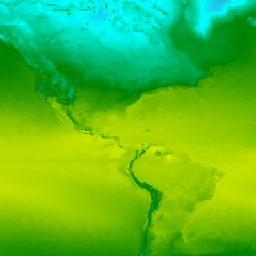
CFSR: بازتحلیل هماهنگشدهی سامانهی پیشبینی آب و هوا
بازتحلیل سامانه پیشبینی اقلیمی (CFSR) مرکز ملی پیشبینیهای زیستمحیطی (NCEP) به عنوان یک سامانه جهانی، با وضوح بالا و جفتشده جو-اقیانوس-خشکی-سطح-یخ دریا طراحی و اجرا شد تا بهترین تخمین از وضعیت این حوزههای جفتشده را در طول دوره ۳۲ ساله ثبت از ژانویه ... ارائه دهد.
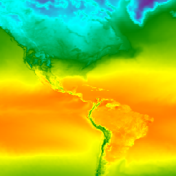
CFSV2: سیستم پیشبینی آب و هوای NCEP نسخه ۲، محصولات ۶ ساعته هماهنگ شدهاند
سیستم پیشبینی آب و هوا (CFS) مرکز ملی پیشبینیهای زیستمحیطی (NCEP) یک مدل کاملاً جفتشده است که نشاندهنده تعامل بین جو زمین، اقیانوسها، خشکی و یخ دریا است. CFS در مرکز مدلسازی زیستمحیطی (EMC) در NCEP توسعه داده شد. CFS عملیاتی به ... ارتقا یافت.
بارش روزانه نزدیک به زمان واقعی CHIRP: مرکز مخاطرات اقلیمی، بارش مادون قرمز با دادههای ایستگاه (نسخه ۳.۰، مبتنی بر IMERG)
مرکز مخاطرات اقلیمی بارش مادون قرمز با ایستگاهها (CHIRPS نسخه ۳) یک مجموعه داده بارش شبه جهانی با وضوح بالا و با دوره زمانی بیش از ۴۰ سال است. این مجموعه داده از ۶۰ درجه شمالی تا ۶۰ درجه جنوبی را پوشش میدهد و تمام طولهای جغرافیایی را پوشش میدهد و دادههایی از سال ۱۹۸۱ تا به امروز ارائه میدهد. CHIRPS نسخه ۳ تخمینهای بارش مادون قرمز حرارتی مبتنی بر ماهواره را با مشاهدات ایستگاههای محلی ترکیب میکند...
تحلیل مجدد روزانه بارش CHIRP: مرکز مخاطرات اقلیمی بارش مادون قرمز با دادههای ایستگاه (نسخه 3.0، مبتنی بر ERA5)
مرکز مخاطرات اقلیمی بارش مادون قرمز با ایستگاهها (CHIRPS نسخه ۳) یک مجموعه داده بارش شبه جهانی با وضوح بالا و با دوره زمانی بیش از ۴۰ سال است. این مجموعه داده از ۶۰ درجه شمالی تا ۶۰ درجه جنوبی را پوشش میدهد و تمام طولهای جغرافیایی را پوشش میدهد و دادههایی از سال ۱۹۸۱ تا به امروز ارائه میدهد. CHIRPS نسخه ۳ تخمینهای بارش مادون قرمز حرارتی مبتنی بر ماهواره را با مشاهدات ایستگاههای محلی ترکیب میکند...
بارش روزانه CHIRP: مرکز مخاطرات اقلیمی، بارش مادون قرمز با دادههای ایستگاه (نسخه ۲.۰ نهایی)
مرکز مخاطرات اقلیمی بارش مادون قرمز با دادههای ایستگاه (CHIRPS) یک مجموعه داده بارش شبه جهانی 30+ ساله است. CHIRPS تصاویر ماهوارهای با وضوح 0.05 درجه را با دادههای ایستگاههای مستقر در محل ترکیب میکند تا سریهای زمانی بارش شبکهای را برای تجزیه و تحلیل روند و پایش خشکسالی فصلی ایجاد کند.
پنجگانه بارش CHIRPS: مرکز مخاطرات اقلیمی، بارش مادون قرمز با دادههای ایستگاه (نسخه ۲.۰ نهایی)
مرکز مخاطرات اقلیمی بارش مادون قرمز با دادههای ایستگاه (CHIRPS) یک مجموعه داده بارش شبه جهانی 30+ ساله است. CHIRPS تصاویر ماهوارهای با وضوح 0.05 درجه را با دادههای ایستگاههای مستقر در محل ترکیب میکند تا سریهای زمانی بارش شبکهای را برای تجزیه و تحلیل روند و پایش خشکسالی فصلی ایجاد کند.
پنجگانه بارش CHIRPS: مرکز مخاطرات اقلیمی، بارش مادون قرمز با دادههای ایستگاه (نسخه ۳.۰)
مرکز مخاطرات اقلیمی بارش مادون قرمز با ایستگاهها (CHIRPS نسخه ۳) یک مجموعه داده بارش شبه جهانی با وضوح بالا و با دوره زمانی بیش از ۴۰ سال است. این مجموعه داده از ۶۰ درجه شمالی تا ۶۰ درجه جنوبی را پوشش میدهد و تمام طولهای جغرافیایی را پوشش میدهد و دادههایی از سال ۱۹۸۱ تا به امروز ارائه میدهد. CHIRPS نسخه ۳ تخمینهای بارش مادون قرمز حرارتی مبتنی بر ماهواره را با مشاهدات ایستگاههای محلی ترکیب میکند...
تحلیل بارش روزانه مبتنی بر دادههای ایستگاههای هواشناسی متحد جهانی CPC
تحلیل یکپارچه مبتنی بر ایستگاههای اندازهگیری بارش جهانی روزانه (CPC) تخمینهای بارش روزانه را از سال ۱۹۷۹ تاکنون در سراسر زمین ارائه میدهد. این ابزار که توسط مرکز پیشبینی آب و هوای NOAA (CPC) توسعه داده شده است، از یک تکنیک درونیابی بهینه برای ترکیب دادهها از یک شبکه جهانی ایستگاههای اندازهگیری باران، با ...
این مجموعه دادهها، تجزیه و تحلیل شبکهای از دمای روزانه هوای سطح زمین در مناطق خشکی جهان، از جمله دمای حداکثر (Tmax) و حداقل (Tmin) روزانه را ارائه میدهد. این دادهها که از سال ۱۹۷۹ تا به امروز را پوشش میدهند، بر روی شبکههای عرض/طول جغرافیایی ۰.۵ درجهای ارائه شدهاند که با وضوح دادههای روزانه جهانی مبتنی بر پیمانه CPC مطابقت دارند...
Daymet V4: خلاصههای روزانه آب و هوای سطحی و اقلیمی
نسخه چهارم نرمافزار Daymet، تخمینهای شبکهای از پارامترهای آب و هوای روزانه برای آمریکای شمالی قارهای، هاوایی و پورتوریکو ارائه میدهد (دادههای پورتوریکو از سال ۱۹۵۰ در دسترس است). این نرمافزار از دادههای ایستگاههای هواشناسی منتخب و منابع داده پشتیبان مختلف استخراج شده است. در مقایسه با نسخه قبلی، Daymet ...
این مجموعه دادهها شامل پیشبینیهای ۱۵ روزه از متغیرهای مدل جوی تولید شده توسط سیستم پیشبینی یکپارچه ECMWF (IFS) با وضوح ۰.۲۵ درجه است. ما به این موارد به عنوان پیشبینیهای نزدیک به زمان واقعی (NRT) اشاره میکنیم زیرا محصولات جدید دو بار در روز پس از انتشار پیشبینی زمان واقعی ECMWF منتشر میشوند...
دادههای روزانه ERA5 - آخرین بازتحلیل اقلیمی تولید شده توسط ECMWF / سرویس تغییرات اقلیمی کوپرنیک
ERA5 نسل پنجم بازتحلیل جوی ECMWF از آب و هوای جهانی است. بازتحلیل، دادههای مدل را با مشاهدات از سراسر جهان در یک مجموعه داده کامل و سازگار جهانی ترکیب میکند. ERA5 جایگزین نسخه قبلی خود، بازتحلیل ERA-Interim، شده است. ERA5 DAILY مقادیر تجمیعی را برای هر روز برای ... ارائه میدهد.
ERA5 نسل پنجم بازتحلیل جوی ECMWF از آب و هوای جهانی است. این بازتحلیل توسط سرویس تغییرات اقلیمی کوپرنیک (C3S) در ECMWF تولید میشود. بازتحلیل، دادههای مدل را با مشاهدات از سراسر جهان در یک مجموعه داده کامل و سازگار جهانی با استفاده از قوانین ... ترکیب میکند.
دادههای ماهانه ERA5 - آخرین تحلیلهای مجدد اقلیمی تهیه شده توسط ECMWF / سرویس تغییرات اقلیمی کوپرنیک
ERA5 نسل پنجم بازتحلیل جوی ECMWF از آب و هوای جهانی است. بازتحلیل، دادههای مدل را با مشاهدات از سراسر جهان در یک مجموعه داده کامل و سازگار جهانی ترکیب میکند. ERA5 جایگزین نسخه قبلی خود، بازتحلیل ERA-Interim، شده است. ERA5 MONTHLY مقادیر تجمیعی را برای هر ماه برای ... ارائه میدهد.
ERA5-Land Daily Aggregated - تحلیل مجدد آب و هوا ECMWF
ERA5-Land یک مجموعه داده بازتحلیل است که دیدگاهی منسجم از تکامل متغیرهای زمین در طول چندین دهه با وضوح بهبود یافته در مقایسه با ERA5 ارائه میدهد. ERA5-Land با بازپخش مؤلفه زمین از بازتحلیل اقلیمی ECMWF ERA5 تولید شده است. بازتحلیل، دادههای مدل را با ... ترکیب میکند.
ERA5-Land یک مجموعه داده بازتحلیل است که دیدگاهی منسجم از تکامل متغیرهای زمین در طول چندین دهه با وضوح بهبود یافته در مقایسه با ERA5 ارائه میدهد. ERA5-Land با بازپخش مؤلفه زمین از بازتحلیل اقلیمی ECMWF ERA5 تولید شده است. بازتحلیل، دادههای مدل را با ... ترکیب میکند.
ERA5-Land ماهانه تجمیع شده - تحلیل مجدد آب و هوا ECMWF
ERA5-Land یک مجموعه داده بازتحلیل است که دیدگاهی منسجم از تکامل متغیرهای زمین در طول چندین دهه با وضوح بهبود یافته در مقایسه با ERA5 ارائه میدهد. ERA5-Land با بازپخش مؤلفه زمین از بازتحلیل اقلیمی ECMWF ERA5 تولید شده است. بازتحلیل، دادههای مدل را با ... ترکیب میکند.
میانگین ماهانه ERA5-Land بر اساس ساعت روز - تحلیل مجدد آب و هوا ECMWF
ERA5-Land یک مجموعه داده بازتحلیل است که دیدگاهی منسجم از تکامل متغیرهای زمین در طول چندین دهه با وضوح بهبود یافته در مقایسه با ERA5 ارائه میدهد. ERA5-Land با بازپخش مؤلفه زمین از بازتحلیل اقلیمی ECMWF ERA5 تولید شده است. بازتحلیل، دادههای مدل را با ... ترکیب میکند.
ERA5-Land یک مجموعه داده بازتحلیل است که دیدگاهی منسجم از تکامل متغیرهای زمین در طول چندین دهه با وضوح بهبود یافته در مقایسه با ERA5 ارائه میدهد. ERA5-Land با بازپخش مؤلفه زمین از بازتحلیل اقلیمی ECMWF ERA5 تولید شده است. بازتحلیل، دادههای مدل را با ... ترکیب میکند.
FLDAS: شبکه سیستمهای هشدار زودهنگام قحطی (FEWS NET) سیستم جذب دادههای زمینی
مجموعه دادههای FLDAS (مکنالی و همکاران، ۲۰۱۷) برای کمک به ارزیابی امنیت غذایی در کشورهای در حال توسعه و کمجمعیت طراحی شده است. این مجموعه شامل اطلاعاتی در مورد بسیاری از متغیرهای مرتبط با آب و هوا از جمله میزان رطوبت، نم، تبخیر و تعرق، میانگین دمای خاک، میزان کل بارندگی و غیره است. چندین مجموعه داده مختلف FLDAS وجود دارد؛ ...
GFS: دادههای پیشبینیشده ۳۸۴ ساعته جو توسط سامانه پیشبینی جهانی
سیستم پیشبینی جهانی (GFS) یک مدل پیشبینی آب و هوا است که توسط مراکز ملی پیشبینی محیطی (NCEP) تولید شده است. مجموعه دادههای GFS شامل خروجیهای مدل انتخاب شده (که در زیر شرح داده شده است) به عنوان متغیرهای پیشبینی شبکهای است. پیشبینیهای ۳۸۴ ساعته، با ۱ ساعت (تا ۱۲۰ ساعت) و ۳ ساعت (بعد از ...
سیستم جذب دادههای جهانی زمین ناسا نسخه ۲ (GLDAS-2) دارای سه جزء است: GLDAS-2.0، GLDAS-2.1 و GLDAS-2.2. GLDAS-2.0 کاملاً با دادههای ورودی نیروی هواشناسی پرینستون ادغام شده و یک سری زمانی سازگار از سال ۱۹۴۸ تا ۲۰۱۴ ارائه میدهد. GLDAS-2.1 با ترکیبی از مدل ... ادغام شده است.
سیستم جذب دادههای جهانی زمین ناسا نسخه ۲ (GLDAS-2) دارای سه جزء است: GLDAS-2.0، GLDAS-2.1 و GLDAS-2.2. GLDAS-2.0 کاملاً با دادههای ورودی نیروی هواشناسی پرینستون ادغام شده و یک سری زمانی سازگار از سال ۱۹۴۸ تا ۲۰۱۴ ارائه میدهد. GLDAS-2.1 با ترکیبی از مدل ... ادغام شده است.
اندازهگیری بارش جهانی (GPM) یک ماموریت ماهوارهای بینالمللی است که هر سه ساعت یکبار مشاهدات نسل بعدی باران و برف را در سراسر جهان ارائه میدهد. بازیابیهای چند ماهوارهای یکپارچه برای GPM (IMERG) الگوریتم یکپارچهای است که تخمینهای بارندگی را با ترکیب دادههای تمام ابزارهای مایکروویو غیرفعال در GPM ارائه میدهد...
تولید نسخه نهایی IMERG با نام "06" در سپتامبر 2021 متوقف شد. انتظار میرود نسخه "07" در سپتامبر 2022 منتشر شود. اندازهگیری بارش جهانی (GPM) یک ماموریت ماهوارهای بینالمللی است که مشاهدات نسل بعدی باران و برف را در سراسر جهان هر سه ساعت یکبار ارائه میدهد. بازیابیهای یکپارچه چند ماهوارهای برای ...
اندازهگیری بارش جهانی (GPM) یک ماموریت ماهوارهای بینالمللی است که هر سه ساعت یکبار مشاهدات نسل بعدی باران و برف را در سراسر جهان ارائه میدهد. بازیابیهای چند ماهوارهای یکپارچه برای GPM (IMERG) الگوریتم یکپارچهای است که تخمینهای بارندگی را با ترکیب دادههای تمام ابزارهای مایکروویو غیرفعال در GPM ارائه میدهد...
این مجموعه دادهها شامل شاخصهای خشکسالی مشتق شده از مجموعه دادههای هواشناسی سطحی شبکهبندی شده روزانه ۴ کیلومتری (GRIDMET) است. شاخصهای خشکسالی ارائه شده شامل شاخص بارش استاندارد (SPI)، شاخص تقاضای خشکسالی تبخیری (EDDI)، شاخص تبخیر و تعرق استاندارد شده بارش (SPEI)، شاخص شدت خشکسالی پالمر (PDSI) و پالمر ...
GRIDMET: مجموعه دادههای هواشناسی سطحی شبکهبندیشده دانشگاه آیداهو
مجموعه دادههای هواشناسی سطح شبکهای، میدانهای سطحی روزانه با وضوح مکانی بالا (حدود ۴ کیلومتر) از دما، بارش، بادها، رطوبت و تابش را در سراسر ایالات متحده از سال ۱۹۷۹ ارائه میدهد. این مجموعه دادهها، دادههای مکانی با وضوح بالای PRISM را با دادههای با وضوح زمانی بالا از ... ترکیب میکند.
GSMaP عملیاتی: نقشهبرداری ماهوارهای جهانی بارش - نسخه ۶
نقشهبرداری ماهوارهای جهانی بارش (GSMaP) نرخ بارش ساعتی جهانی را با وضوح 0.1 در 0.1 درجه ارائه میدهد. GSMaP محصولی از ماموریت اندازهگیری بارش جهانی (GPM) است که مشاهدات بارش جهانی را در فواصل سه ساعته ارائه میدهد. مقادیر با استفاده از دادههای غیرفعال چند باندی تخمین زده میشوند...
GSMaP عملیاتی: نقشهبرداری ماهوارهای جهانی از بارش - نسخه ۷
نقشهبرداری ماهوارهای جهانی بارش (GSMaP) نرخ بارش ساعتی جهانی را با وضوح 0.1 در 0.1 درجه ارائه میدهد. GSMaP محصولی از ماموریت اندازهگیری بارش جهانی (GPM) است که مشاهدات بارش جهانی را در فواصل سه ساعته ارائه میدهد. مقادیر با استفاده از دادههای غیرفعال چند باندی تخمین زده میشوند...
GSMaP عملیاتی: نقشهبرداری ماهوارهای جهانی از بارش - نسخه ۸
نقشهبرداری ماهوارهای جهانی بارش (GSMaP) نرخ بارش ساعتی جهانی را با وضوح 0.1 در 0.1 درجه ارائه میدهد. GSMaP محصولی از ماموریت اندازهگیری بارش جهانی (GPM) است که مشاهدات بارش جهانی را در فواصل سه ساعته ارائه میدهد. مقادیر با استفاده از دادههای غیرفعال چند باندی تخمین زده میشوند...
تحلیل مجدد GSMaP: نقشهبرداری ماهوارهای جهانی از بارش
نقشهبرداری ماهوارهای جهانی بارش (GSMaP) نرخ بارش ساعتی جهانی را با وضوح 0.1 در 0.1 درجه ارائه میدهد. GSMaP محصولی از ماموریت اندازهگیری بارش جهانی (GPM) است که مشاهدات بارش جهانی را در فواصل سه ساعته ارائه میدهد. مقادیر با استفاده از دادههای غیرفعال چند باندی تخمین زده میشوند...
M2T1NXFLX (یا tavg1_2d_flx_Nx) یک مجموعه داده با میانگین زمانی ساعتی در تحلیل گذشتهنگر عصر مدرن برای تحقیق و کاربردها نسخه 2 (MERRA-2) است. این مجموعه شامل تشخیص شار سطحی جذبشده، مانند کل بارش، کل بارش تصحیحشده با بایاس، دمای هوای سطح، رطوبت ویژه سطح، سرعت باد سطح و ... است.
M2T1NXLND (یا tavg1_2d_lnd_Nx) یک مجموعه داده با میانگین زمانی ساعتی در تحلیل گذشتهنگر عصر مدرن برای تحقیق و کاربردها نسخه 2 (MERRA-2) است. این مجموعه شامل تشخیص سطح زمین، مانند شار جریان پایه، رواناب، رطوبت خاک سطحی، رطوبت خاک منطقه ریشه، آب در لایه سطحی، آب در ...
NEX-DCP30: آمار گروهی برای پیشبینیهای اقلیمی کوچکمقیاسشدهی تبادل زمین ناسا
مجموعه دادههای ناسا NEX-DCP30 شامل سناریوهای اقلیمی کوچکمقیاسشده برای ایالات متحده است که از اجرای مدل گردش عمومی (GCM) که تحت فاز 5 پروژه مقایسه متقابل مدلهای جفتشده (CMIP5، به تیلور و همکاران، 2012 مراجعه کنید) و در چهار گلخانه انجام شده است، مشتق شدهاند...
NEX-DCP30: پیشبینیهای اقلیمی کوچکمقیاسشدهی تبادل زمین ناسا
مجموعه دادههای ناسا NEX-DCP30 شامل سناریوهای اقلیمی کوچکمقیاسشده برای ایالات متحده است که از اجرای مدل گردش عمومی (GCM) که تحت فاز 5 پروژه مقایسه متقابل مدلهای جفتشده (CMIP5، به تیلور و همکاران، 2012 مراجعه کنید) و در چهار گلخانه انجام شده است، مشتق شدهاند...
NEX-GDDP-CMIP6: پیشبینیهای اقلیمی روزانه جهانیِ ریزمقیاسشدهی ناسا از تبادل زمین
مجموعه دادههای NEX-GDDP-CMIP6 شامل سناریوهای اقلیمی ریزمقیاسشده جهانی است که از اجرای مدل گردش عمومی جو (GCM) که تحت فاز 6 پروژه مقایسه متقابل مدلهای جفتشده (CMIP6، به Thrasher و همکاران، 2022 مراجعه کنید) و در دو مورد از چهار سناریوی انتشار گازهای گلخانهای «رده 1» انجام شده است، مشتق شدهاند...
NEX-GDDP: پیشبینیهای اقلیمی روزانه جهانی با مقیاس کوچکشده از تبادل زمین ناسا
مجموعه دادههای ناسا NEX-GDDP شامل سناریوهای اقلیمی کوچکمقیاسشده برای کره زمین است که از اجرای مدلهای گردش عمومی جو (GCM) که تحت فاز 5 پروژه مقایسه متقابل مدلهای جفتشده (CMIP5، به تیلور و همکاران، 2012 مراجعه کنید) و در دو تا از چهار گلخانه انجام شده است، مشتق شدهاند...
NLDAS-2: سیستم جذب دادههای زمینی آمریکای شمالی، میدانهای اجباری
سیستم جذب دادههای زمینی (LDAS) منابع متعدد مشاهدات (مانند دادههای ایستگاههای اندازهگیری بارش، دادههای ماهوارهای و اندازهگیریهای بارش راداری) را برای تولید تخمینهایی از ویژگیهای اقلیمی در سطح زمین یا نزدیک آن ترکیب میکند. این مجموعه دادهها، فایل اجباری اولیه (پیشفرض) (فایل A) برای فاز ... است.
بارش ماهانه بر حسب میلیمتر با وضوح ۱ کیلومتر بر اساس دادههای SM2RAIN-ASCAT 2007-2018، IMERG، CHELSA Climate و WorldClim. با استفاده از gdalwarp (خطوط مکعبی) و میانگین بین محصول ماهانه WorldClim، CHELSA Climate و IMERG، به وضوح ۱ کیلومتر کوچکمقیاس شده است (به عنوان مثال، به "3B-MO-L.GIS.IMERG.20180601.V05B.tif" مراجعه کنید). وزن ۳ برابر بیشتر داده شده است ...
اویا یک مجموعه داده تخمین بارش با وضوح بالا و شبهجهانی است که از مشاهدات ماهوارههای زمینآهنگ (GEO) مشتق شده است. مدل اویا از طیف کامل کانالهای مرئی و مادون قرمز (VIS-IR) از مجموعهای از ماهوارههای زمینآهنگ - شامل GOES-16/18، Meteosat-9/10 و Himawari-8/9 - برای تولید تخمینهای بارش استفاده میکند که ...
PERSIANN-CDR: تخمین بارش از اطلاعات سنجش از دور با استفاده از شبکههای عصبی مصنوعی - دادههای اقلیمی ثبت شده
PERSIANN-CDR یک محصول بارش شبه جهانی روزانه است که دوره زمانی از 1983/01/01 تا به امروز را پوشش میدهد. دادهها به صورت فصلی و با تأخیر معمول سه ماه تولید میشوند. این محصول توسط مرکز هیدرومتئورولوژی و سنجش از دور در دانشگاه کالیفرنیا، ایروین توسعه داده شده است...
مجموعه دادههای روزانه و ماهانه PRISM، مجموعه دادههای آب و هوایی شبکهبندی شده برای ایالات متحده هستند که توسط گروه آب و هوایی PRISM در دانشگاه ایالتی اورگان تولید شدهاند. این مجموعه شامل دادههای AN81 و AN91 است که با ویژگی 'dataset_type' مشخص شدهاند. شبکهها با استفاده از PRISM (رگرسیونهای پارامتر-ارتفاع ...) توسعه داده شدهاند.
مجموعه دادههای اقلیمی میانگین بلندمدت PRISM، نرمال۹۱ میلیون
مجموعه دادههای روزانه و ماهانه PRISM، مجموعه دادههای آب و هوایی شبکهبندی شده برای ایالات متحده هستند که توسط گروه آب و هوایی PRISM در دانشگاه ایالتی اورگان تولید شدهاند. شبکهها با استفاده از PRISM (مدل رگرسیون پارامتر-ارتفاع روی شیبهای مستقل) توسعه داده شدهاند. روالهای درونیابی PRISM نحوه تغییر آب و هوا و اقلیم را شبیهسازی میکنند...
مجموعه دادههای روزانه و ماهانه PRISM، مجموعه دادههای آب و هوایی شبکهبندی شده برای ایالات متحده هستند که توسط گروه آب و هوایی PRISM در دانشگاه ایالتی اورگان تولید شدهاند. این مجموعه شامل دادههای AN81 و AN91 است، همانطور که با ویژگی 'dataset_type' مشخص شده است. شبکهها با استفاده از PRISM (پارامتر-ارتفاع ...) توسعه داده شدهاند.
تحلیل مزو-مقیاس بلادرنگ (RTMA) یک تحلیل با وضوح مکانی و زمانی بالا برای شرایط آب و هوایی نزدیک به سطح زمین است. این مجموعه داده شامل تحلیلهای ساعتی در ارتفاع ۲.۵ کیلومتری برای CONUS است.
GLDAS-2.0 پردازششده: سیستم جهانی جذب دادههای زمینی
سیستم جذب دادههای جهانی زمین ناسا نسخه ۲ (GLDAS-2) دارای سه جزء است: GLDAS-2.0، GLDAS-2.1 و GLDAS-2.2. GLDAS-2.0 کاملاً با دادههای ورودی نیروی هواشناسی پرینستون ادغام شده و یک سری زمانی سازگار از سال ۱۹۴۸ تا ۲۰۱۴ ارائه میدهد. GLDAS-2.1 با ترکیبی از مدل ... ادغام شده است.
SPEIbase: پایگاه داده شاخص بارش-تبخیر و تعرق استاندارد، نسخه ۲.۱۱
پایگاه داده جهانی SPEI (SPEIbase) اطلاعات قوی و بلندمدتی در مورد شرایط خشکسالی در مقیاس جهانی، با اندازه پیکسل 0.5 درجه و ریتم ماهانه ارائه میدهد. این پایگاه داده، مقیاسهای زمانی SPEI را از 1 تا 48 ماه ارائه میدهد. شاخص بارش-تبخیر و تعرق استاندارد شده (SPEI)، به عنوان یک متغیر استاندارد بیان میکند ...
ماموریت اندازهگیری بارش گرمسیری (TRMM) یک ماموریت مشترک بین ناسا و آژانس اکتشافات هوافضای ژاپن (JAXA) است که برای نظارت و مطالعه بارشهای گرمسیری طراحی شده است. محصول 34B2 شامل یک تخمین بارش مادون قرمز ادغام شده، تنظیم شده توسط TRMM و شبکهبندی شده (میلیمتر بر ساعت) و خطای بارش RMS با یک بازه زمانی 3 ساعته است...
این مجموعه دیگر بهروزرسانی نمیشود. به صورت ماهانه به IMERG مراجعه کنید. این مجموعه داده به صورت الگوریتمی دادههای مایکروویو را از چندین ماهواره، از جمله SSMI، SSMIS، MHS، AMSU-B و AMSR-E، که هر کدام با ابزار ترکیبی TRMM کالیبره شدهاند، ادغام میکند. الگوریتم 3B43 هر ماه تقویمی یک بار اجرا میشود تا دادههای واحد، ... را تولید کند.
TerraClimate: آب و هوای ماهانه و تعادل آب و هوایی برای سطوح خشکی جهانی، دانشگاه آیداهو
TerraClimate مجموعهای از دادههای ماهانه آب و هوا و تعادل آب و هوایی برای سطوح زمینی جهان است. این مجموعه از درونیابی به کمک اقلیم استفاده میکند و دادههای نرمالهای اقلیمی با وضوح مکانی بالا از مجموعه دادههای WorldClim را با دادههای با وضوح مکانی درشتتر اما متغیر با زمان از CRU Ts4.0 و بازتحلیل ۵۵ ساله ژاپنی (JRA55) ترکیب میکند. ...
فاز 6 پروژه مقایسه متقابل مدل جفتشده مرکز مخاطرات اقلیمی (CHC) (CHC-CMIP6)
CHC-CMIP6 به طور خاص برای پشتیبانی از تجزیه و تحلیل خطرات مرتبط با آب و هوا در گذشته نزدیک و آینده نزدیک توسعه داده شده است. این مجموعه داده پیشبینی آب و هوا شامل دادههای شبکهای روزانه و جهانی برای دورههای مشاهدهای (1983-2016) و پیشبینی (2030 و 2050) است که در شناسایی و ... مورد استفاده قرار میگیرند.
«پایش خشکسالی ایالات متحده» نقشهای است که هر پنجشنبه منتشر میشود و بخشهایی از ایالات متحده را که در خشکسالی هستند نشان میدهد. این نقشه از پنج طبقهبندی استفاده میکند: خشکی غیرطبیعی (D0)، مناطقی را نشان میدهد که ممکن است وارد خشکسالی شوند یا از آن خارج شوند، و چهار سطح خشکسالی: ...
WeatherNext 2 یک مجموعه داده آزمایشی از پیشبینیهای آب و هوایی گروهی میانبرد جهانی است که توسط یک نسخه عملیاتی از مدل آب و هوایی مولد شبکه عملکردی گوگل دیپمایند تولید شده است. این مجموعه داده آزمایشی شامل دادههای بلادرنگ و دادههای تاریخی است. دادههای بلادرنگ هر دادهای است که مربوط به زمانی است که ...
میانگین WeatherNext 2 میانگین 64 گروه از یک مجموعه داده آزمایشی از پیشبینیهای آب و هوایی گروهی میانبرد جهانی است که توسط یک نسخه عملیاتی از مدل آب و هوایی مولد شبکه عملکردی گوگل دیپمایند تولید شده است. برای مجموعه دادهای که شامل همه اعضای گروه است، لطفاً به WeatherNext 2 (غیر میانگین) مراجعه کنید...
مجموعه داده WeatherNext 3 (0.05°) یک مجموعه داده آزمایشی از پیشبینیهای آب و هوایی گروهی میانبرد جهانی توسط Google DeepMind و Google Research است که توسط یک نسخه عملیاتی از مدل شرح داده شده در: WeatherNext 3: افزایش وضوح و عملکرد مدلهای آب و هوایی جهانی با مشاهدات خام تولید شده است. دسترسی به دادهها ...
مجموعه داده WeatherNext 3 (0.1°) یک مجموعه داده آزمایشی از پیشبینیهای آب و هوایی گروهی میانبرد جهانی توسط Google DeepMind و Google Research است که توسط یک نسخه عملیاتی از مدل شرح داده شده در: WeatherNext 3: افزایش وضوح و عملکرد مدلهای آب و هوایی جهانی با مشاهدات خام تولید شده است. دسترسی به دادهها ...
WorldClim V1 Bioclim متغیرهای زیستاقلیمی را ارائه میدهد که از دما و بارندگی ماهانه مشتق شدهاند تا مقادیر بیولوژیکی معنادارتری تولید کنند. متغیرهای زیستاقلیمی نشاندهنده روندهای سالانه (مثلاً میانگین دمای سالانه، بارندگی سالانه)، فصلی بودن (مثلاً دامنه سالانه دما و بارندگی) و شدتهای شدید ...
نسخه ۱ نرمافزار WorldClim شامل دادههای میانگین ماهانه آب و هوای جهانی برای حداقل، میانگین و حداکثر دما و همچنین برای بارندگی است. نسخه ۱ نرمافزار WorldClim توسط رابرت جی. هایجمنز، سوزان کامرون و خوان پارا در موزه جانورشناسی مهرهداران، دانشگاه کالیفرنیا، برکلی، با همکاری ... توسعه داده شده است.
CFSR: بازتحلیل هماهنگشدهی سامانهی پیشبینی آب و هوا
بازتحلیل سامانه پیشبینی اقلیمی (CFSR) مرکز ملی پیشبینیهای زیستمحیطی (NCEP) به عنوان یک سامانه جهانی، با وضوح بالا و جفتشده جو-اقیانوس-خشکی-سطح-یخ دریا طراحی و اجرا شد تا بهترین تخمین از وضعیت این حوزههای جفتشده را در طول دوره ۳۲ ساله ثبت از ژانویه ... ارائه دهد.
CFSV2: سیستم پیشبینی آب و هوای NCEP نسخه ۲، محصولات ۶ ساعته هماهنگ شدهاند
سیستم پیشبینی آب و هوا (CFS) مرکز ملی پیشبینیهای زیستمحیطی (NCEP) یک مدل کاملاً جفتشده است که نشاندهنده تعامل بین جو زمین، اقیانوسها، خشکی و یخ دریا است. CFS در مرکز مدلسازی زیستمحیطی (EMC) در NCEP توسعه داده شد. CFS عملیاتی به ... ارتقا یافت.
بارش روزانه نزدیک به زمان واقعی CHIRP: مرکز مخاطرات اقلیمی، بارش مادون قرمز با دادههای ایستگاه (نسخه ۳.۰، مبتنی بر IMERG)
مرکز مخاطرات اقلیمی بارش مادون قرمز با ایستگاهها (CHIRPS نسخه ۳) یک مجموعه داده بارش شبه جهانی با وضوح بالا و با دوره زمانی بیش از ۴۰ سال است. این مجموعه داده از ۶۰ درجه شمالی تا ۶۰ درجه جنوبی را پوشش میدهد و تمام طولهای جغرافیایی را پوشش میدهد و دادههایی از سال ۱۹۸۱ تا به امروز ارائه میدهد. CHIRPS نسخه ۳ تخمینهای بارش مادون قرمز حرارتی مبتنی بر ماهواره را با مشاهدات ایستگاههای محلی ترکیب میکند...
تحلیل مجدد روزانه بارش CHIRP: مرکز مخاطرات اقلیمی بارش مادون قرمز با دادههای ایستگاه (نسخه 3.0، مبتنی بر ERA5)
مرکز مخاطرات اقلیمی بارش مادون قرمز با ایستگاهها (CHIRPS نسخه ۳) یک مجموعه داده بارش شبه جهانی با وضوح بالا و با دوره زمانی بیش از ۴۰ سال است. این مجموعه داده از ۶۰ درجه شمالی تا ۶۰ درجه جنوبی را پوشش میدهد و تمام طولهای جغرافیایی را پوشش میدهد و دادههایی از سال ۱۹۸۱ تا به امروز ارائه میدهد. CHIRPS نسخه ۳ تخمینهای بارش مادون قرمز حرارتی مبتنی بر ماهواره را با مشاهدات ایستگاههای محلی ترکیب میکند...
بارش روزانه CHIRP: مرکز مخاطرات اقلیمی، بارش مادون قرمز با دادههای ایستگاه (نسخه ۲.۰ نهایی)
مرکز مخاطرات اقلیمی بارش مادون قرمز با دادههای ایستگاه (CHIRPS) یک مجموعه داده بارش شبه جهانی 30+ ساله است. CHIRPS تصاویر ماهوارهای با وضوح 0.05 درجه را با دادههای ایستگاههای مستقر در محل ترکیب میکند تا سریهای زمانی بارش شبکهای را برای تجزیه و تحلیل روند و پایش خشکسالی فصلی ایجاد کند.
پنجگانه بارش CHIRPS: مرکز مخاطرات اقلیمی، بارش مادون قرمز با دادههای ایستگاه (نسخه ۲.۰ نهایی)
مرکز مخاطرات اقلیمی بارش مادون قرمز با دادههای ایستگاه (CHIRPS) یک مجموعه داده بارش شبه جهانی 30+ ساله است. CHIRPS تصاویر ماهوارهای با وضوح 0.05 درجه را با دادههای ایستگاههای مستقر در محل ترکیب میکند تا سریهای زمانی بارش شبکهای را برای تجزیه و تحلیل روند و پایش خشکسالی فصلی ایجاد کند.
پنجگانه بارش CHIRPS: مرکز مخاطرات اقلیمی، بارش مادون قرمز با دادههای ایستگاه (نسخه ۳.۰)
مرکز مخاطرات اقلیمی بارش مادون قرمز با ایستگاهها (CHIRPS نسخه ۳) یک مجموعه داده بارش شبه جهانی با وضوح بالا و با دوره زمانی بیش از ۴۰ سال است. این مجموعه داده از ۶۰ درجه شمالی تا ۶۰ درجه جنوبی را پوشش میدهد و تمام طولهای جغرافیایی را پوشش میدهد و دادههایی از سال ۱۹۸۱ تا به امروز ارائه میدهد. CHIRPS نسخه ۳ تخمینهای بارش مادون قرمز حرارتی مبتنی بر ماهواره را با مشاهدات ایستگاههای محلی ترکیب میکند...
تحلیل بارش روزانه مبتنی بر دادههای ایستگاههای هواشناسی متحد جهانی CPC
تحلیل یکپارچه مبتنی بر ایستگاههای اندازهگیری بارش جهانی روزانه (CPC) تخمینهای بارش روزانه را از سال ۱۹۷۹ تاکنون در سراسر زمین ارائه میدهد. این ابزار که توسط مرکز پیشبینی آب و هوای NOAA (CPC) توسعه داده شده است، از یک تکنیک درونیابی بهینه برای ترکیب دادهها از یک شبکه جهانی ایستگاههای اندازهگیری باران، با ...
این مجموعه دادهها، تجزیه و تحلیل شبکهای از دمای روزانه هوای سطح زمین در مناطق خشکی جهان، از جمله دمای حداکثر (Tmax) و حداقل (Tmin) روزانه را ارائه میدهد. این دادهها که از سال ۱۹۷۹ تا به امروز را پوشش میدهند، بر روی شبکههای عرض/طول جغرافیایی ۰.۵ درجهای ارائه شدهاند که با وضوح دادههای روزانه جهانی مبتنی بر پیمانه CPC مطابقت دارند...
Daymet V4: خلاصههای روزانه آب و هوای سطحی و اقلیمی
نسخه چهارم نرمافزار Daymet، تخمینهای شبکهای از پارامترهای آب و هوای روزانه برای آمریکای شمالی قارهای، هاوایی و پورتوریکو ارائه میدهد (دادههای پورتوریکو از سال ۱۹۵۰ در دسترس است). این نرمافزار از دادههای ایستگاههای هواشناسی منتخب و منابع داده پشتیبان مختلف استخراج شده است. در مقایسه با نسخه قبلی، Daymet ...
این مجموعه دادهها شامل پیشبینیهای ۱۵ روزه از متغیرهای مدل جوی تولید شده توسط سیستم پیشبینی یکپارچه ECMWF (IFS) با وضوح ۰.۲۵ درجه است. ما به این موارد به عنوان پیشبینیهای نزدیک به زمان واقعی (NRT) اشاره میکنیم زیرا محصولات جدید دو بار در روز پس از انتشار پیشبینی زمان واقعی ECMWF منتشر میشوند...
دادههای روزانه ERA5 - آخرین بازتحلیل اقلیمی تولید شده توسط ECMWF / سرویس تغییرات اقلیمی کوپرنیک
ERA5 نسل پنجم بازتحلیل جوی ECMWF از آب و هوای جهانی است. بازتحلیل، دادههای مدل را با مشاهدات از سراسر جهان در یک مجموعه داده کامل و سازگار جهانی ترکیب میکند. ERA5 جایگزین نسخه قبلی خود، بازتحلیل ERA-Interim، شده است. ERA5 DAILY مقادیر تجمیعی را برای هر روز برای ... ارائه میدهد.
ERA5 نسل پنجم بازتحلیل جوی ECMWF از آب و هوای جهانی است. این بازتحلیل توسط سرویس تغییرات اقلیمی کوپرنیک (C3S) در ECMWF تولید میشود. بازتحلیل، دادههای مدل را با مشاهدات از سراسر جهان در یک مجموعه داده کامل و سازگار جهانی با استفاده از قوانین ... ترکیب میکند.
دادههای ماهانه ERA5 - آخرین تحلیلهای مجدد اقلیمی تهیه شده توسط ECMWF / سرویس تغییرات اقلیمی کوپرنیک
ERA5 نسل پنجم بازتحلیل جوی ECMWF از آب و هوای جهانی است. بازتحلیل، دادههای مدل را با مشاهدات از سراسر جهان در یک مجموعه داده کامل و سازگار جهانی ترکیب میکند. ERA5 جایگزین نسخه قبلی خود، بازتحلیل ERA-Interim، شده است. ERA5 MONTHLY مقادیر تجمیعی را برای هر ماه برای ... ارائه میدهد.
ERA5-Land Daily Aggregated - تحلیل مجدد آب و هوا ECMWF
ERA5-Land یک مجموعه داده بازتحلیل است که دیدگاهی منسجم از تکامل متغیرهای زمین در طول چندین دهه با وضوح بهبود یافته در مقایسه با ERA5 ارائه میدهد. ERA5-Land با بازپخش مؤلفه زمین از بازتحلیل اقلیمی ECMWF ERA5 تولید شده است. بازتحلیل، دادههای مدل را با ... ترکیب میکند.
ERA5-Land یک مجموعه داده بازتحلیل است که دیدگاهی منسجم از تکامل متغیرهای زمین در طول چندین دهه با وضوح بهبود یافته در مقایسه با ERA5 ارائه میدهد. ERA5-Land با بازپخش مؤلفه زمین از بازتحلیل اقلیمی ECMWF ERA5 تولید شده است. بازتحلیل، دادههای مدل را با ... ترکیب میکند.
ERA5-Land ماهانه تجمیع شده - تحلیل مجدد آب و هوا ECMWF
ERA5-Land is a reanalysis dataset providing a consistent view of the evolution of land variables over several decades at an enhanced resolution compared to ERA5. ERA5-Land has been produced by replaying the land component of the ECMWF ERA5 climate reanalysis. Reanalysis combines model data with …
ERA5-Land Monthly Averaged by Hour of Day - ECMWF Climate Reanalysis
ERA5-Land is a reanalysis dataset providing a consistent view of the evolution of land variables over several decades at an enhanced resolution compared to ERA5. ERA5-Land has been produced by replaying the land component of the ECMWF ERA5 climate reanalysis. Reanalysis combines model data with …
ERA5-Land is a reanalysis dataset providing a consistent view of the evolution of land variables over several decades at an enhanced resolution compared to ERA5. ERA5-Land has been produced by replaying the land component of the ECMWF ERA5 climate reanalysis. Reanalysis combines model data with …
FLDAS: Famine Early Warning Systems Network (FEWS NET) Land Data Assimilation System
The FLDAS dataset (McNally et al. 2017), was designed to assist with food security assessments in data-sparse, developing country settings. It includes information on many climate-related variables including moisture content, humidity, evapotranspiration, average soil temperature, total precipitation rate, etc. There are multiple different FLDAS datasets; …
GFS: Global Forecast System 384-Hour Predicted Atmosphere Data
The Global Forecast System (GFS) is a weather forecast model produced by the National Centers for Environmental Prediction (NCEP). The GFS dataset consists of selected model outputs (described below) as gridded forecast variables. The 384-hour forecasts, with 1-hour (up to 120 hours) and 3-hour (after …
NASA Global Land Data Assimilation System Version 2 (GLDAS-2) has three components: GLDAS-2.0, GLDAS-2.1, and GLDAS-2.2. GLDAS-2.0 is forced entirely with the Princeton meteorological forcing input data and provides a temporally consistent series from 1948 through 2014. GLDAS-2.1 is forced with a combination of model …
NASA Global Land Data Assimilation System Version 2 (GLDAS-2) has three components: GLDAS-2.0, GLDAS-2.1, and GLDAS-2.2. GLDAS-2.0 is forced entirely with the Princeton meteorological forcing input data and provides a temporally consistent series from 1948 through 2014. GLDAS-2.1 is forced with a combination of model …
GPM: Global Precipitation Measurement (GPM) Release 07
Global Precipitation Measurement (GPM) is an international satellite mission to provide next-generation observations of rain and snow worldwide every three hours. The Integrated Multi-satellitE Retrievals for GPM (IMERG) is the unified algorithm that provides rainfall estimates combining data from all passive-microwave instruments in the GPM …
GPM: Monthly Global Precipitation Measurement (GPM) v6
IMERG-Final version "06" stopped being produced in September, 2021. Version "07" is expected to be released in September 2022 Global Precipitation Measurement (GPM) is an international satellite mission to provide next-generation observations of rain and snow worldwide every three hours. The Integrated Multi-satellitE Retrievals for …
GPM: Monthly Global Precipitation Measurement (GPM) vRelease 07
Global Precipitation Measurement (GPM) is an international satellite mission to provide next-generation observations of rain and snow worldwide every three hours. The Integrated Multi-satellitE Retrievals for GPM (IMERG) is the unified algorithm that provides rainfall estimates combining data from all passive-microwave instruments in the GPM …
This dataset contains drought indices derived from the 4-km daily Gridded Surface Meteorological (GRIDMET) dataset. The drought indices provided include the standardized precipitation index (SPI), the evaporative drought demand index (EDDI), the standardized precipitation evapotranspiration index (SPEI), the Palmer Drought Severity Index (PDSI) and Palmer …
GRIDMET: University of Idaho Gridded Surface Meteorological Dataset
The Gridded Surface Meteorological dataset provides high spatial resolution (~4-km) daily surface fields of temperature, precipitation, winds, humidity and radiation across the contiguous United States from 1979. The dataset blends the high resolution spatial data from PRISM with the high temporal resolution data from the …
GSMaP Operational: Global Satellite Mapping of Precipitation - V6
Global Satellite Mapping of Precipitation (GSMaP) provides a global hourly rain rate with a 0.1 x 0.1 degree resolution. GSMaP is a product of the Global Precipitation Measurement (GPM) mission, which provides global precipitation observations at three hour intervals. Values are estimated using multi-band passive …
GSMaP Operational: Global Satellite Mapping of Precipitation - V7
Global Satellite Mapping of Precipitation (GSMaP) provides a global hourly rain rate with a 0.1 x 0.1 degree resolution. GSMaP is a product of the Global Precipitation Measurement (GPM) mission, which provides global precipitation observations at three hour intervals. Values are estimated using multi-band passive …
GSMaP Operational: Global Satellite Mapping of Precipitation - V8
Global Satellite Mapping of Precipitation (GSMaP) provides a global hourly rain rate with a 0.1 x 0.1 degree resolution. GSMaP is a product of the Global Precipitation Measurement (GPM) mission, which provides global precipitation observations at three hour intervals. Values are estimated using multi-band passive …
GSMaP Reanalysis: Global Satellite Mapping of Precipitation
Global Satellite Mapping of Precipitation (GSMaP) provides a global hourly rain rate with a 0.1 x 0.1 degree resolution. GSMaP is a product of the Global Precipitation Measurement (GPM) mission, which provides global precipitation observations at three hour intervals. Values are estimated using multi-band passive …
M2T1NXFLX (or tavg1_2d_flx_Nx) is an hourly time-averaged data collection in Modern-Era Retrospective analysis for Research and Applications version 2 (MERRA-2). This collection consists of assimilated surface flux diagnostics, such as total precipitation, bias corrected total precipitation, surface air temperature, surface specific humidity, surface wind speed, …
MERRA-2 M2T1NXLND: Land Surface Diagnostics V5.12.4
M2T1NXLND (or tavg1_2d_lnd_Nx) is an hourly time-averaged data collection in Modern-Era Retrospective analysis for Research and Applications version 2 (MERRA-2). This collection consists of land surface diagnostics, such a baseflow flux, runoff, surface soil wetness, root zone soil wetness, water at surface layer, water at …
NEX-DCP30: Ensemble Stats for NASA Earth Exchange Downscaled Climate Projections
The NASA NEX-DCP30 dataset is comprised of downscaled climate scenarios for the conterminous United States that are derived from the General Circulation Model (GCM) runs conducted under the Coupled Model Intercomparison Project Phase 5 (CMIP5, see Taylor et al. 2012) and across the four greenhouse …
NEX-DCP30: NASA Earth Exchange Downscaled Climate Projections
The NASA NEX-DCP30 dataset is comprised of downscaled climate scenarios for the conterminous United States that are derived from the General Circulation Model (GCM) runs conducted under the Coupled Model Intercomparison Project Phase 5 (CMIP5, see Taylor et al. 2012) and across the four greenhouse …
NEX-GDDP-CMIP6: NASA Earth Exchange Global Daily Downscaled Climate Projections
The NEX-GDDP-CMIP6 dataset is comprised of global downscaled climate scenarios derived from the General Circulation Model (GCM) runs conducted under the Coupled Model Intercomparison Project Phase 6 (CMIP6, see Thrasher et al. 2022) and across two of the four "Tier 1" greenhouse gas emissions scenarios …
NEX-GDDP: NASA Earth Exchange Global Daily Downscaled Climate Projections
The NASA NEX-GDDP dataset is comprised of downscaled climate scenarios for the globe that are derived from the General Circulation Model (GCM) runs conducted under the Coupled Model Intercomparison Project Phase 5 (CMIP5, see Taylor et al. 2012) and across two of the four greenhouse …
NLDAS-2: North American Land Data Assimilation System Forcing Fields
Land Data Assimilation System (LDAS) combines multiple sources of observations (such as precipitation gauge data, satellite data, and radar precipitation measurements) to produce estimates of climatological properties at or near the Earth''s surface. This dataset is the primary (default) forcing file (File A) for Phase …
Monthly precipitation in mm at 1 km resolution based on SM2RAIN-ASCAT 2007-2018, IMERG, CHELSA Climate, and WorldClim. Downscaled to 1 km resolution using gdalwarp (cubic splines) and an average between WorldClim, CHELSA Climate, and IMERG monthly product (see, eg, "3B-MO-L.GIS.IMERG.20180601.V05B.tif"). 3x higher weight is given …
Oya is a quasi-global, high-resolution precipitation estimation dataset derived from geostationary (GEO) satellite observations. The Oya model utilizes the full spectrum of visible and infrared (VIS-IR) channels from a constellation of GEO satellites — including GOES-16/18, Meteosat-9/10, and Himawari-8/9 — to generate precipitation estimates covering …
PERSIANN-CDR: Precipitation Estimation From Remotely Sensed Information Using Artificial Neural Networks-Climate Data Record
PERSIANN-CDR is a daily quasi-global precipitation product that spans the period from 1983-01-01 to present. The data is produced quarterly, with a typical lag of three months. The product is developed by the Center for Hydrometeorology and Remote Sensing at the University of California, Irvine …
The PRISM daily and monthly datasets are gridded climate datasets for the conterminous United States, produced by the PRISM Climate Group at Oregon State University. This collection contains both AN81 and AN91 data, indicated by the 'dataset_type' property. Grids are developed using PRISM (Parameter-elevation Regressions …
The PRISM daily and monthly datasets are gridded climate datasets for the conterminous United States, produced by the PRISM Climate Group at Oregon State University. Grids are developed using PRISM (Parameter-elevation Regressions on Independent Slopes Model). PRISM interpolation routines simulate how weather and climate vary …
The PRISM daily and monthly datasets are gridded climate datasets for the conterminous United States, produced by the PRISM Climate Group at Oregon State University. This collection contains both AN81 and AN91 data, as indicated by the 'dataset_type' property. Grids are developed using PRISM (Parameter-elevation …
تحلیل مزو-مقیاس بلادرنگ (RTMA) یک تحلیل با وضوح مکانی و زمانی بالا برای شرایط آب و هوایی نزدیک به سطح زمین است. این مجموعه داده شامل تحلیلهای ساعتی در ارتفاع ۲.۵ کیلومتری برای CONUS است.
Reprocessed GLDAS-2.0: Global Land Data Assimilation System
NASA Global Land Data Assimilation System Version 2 (GLDAS-2) has three components: GLDAS-2.0, GLDAS-2.1, and GLDAS-2.2. GLDAS-2.0 is forced entirely with the Princeton meteorological forcing input data and provides a temporally consistent series from 1948 through 2014. GLDAS-2.1 is forced with a combination of model …
SPEIbase: Standardised Precipitation-Evapotranspiration Index database, Version 2.11
The Global SPEI database (SPEIbase) offers long-time robust information about drought conditions at the global scale, with a 0.5 degree pixel size and monthly cadence. It provides SPEI time scales from 1 to 48 months. The Standardized Precipitation-Evapotranspiration Index (SPEI) expresses, as a standardized variate …
The Tropical Rainfall Measuring Mission (TRMM) is a joint mission between NASA and the Japan Aerospace Exploration Agency (JAXA) designed to monitor and study tropical rainfall. The 34B2 product contains a gridded, TRMM-adjusted, merged infrared precipitation (mm/hr) and RMS precipitation-error estimate, with a 3-hour temporal …
This collection is no longer being updated. See IMERG monthly This dataset algorithmically merges microwave data from multiple satellites, including SSMI, SSMIS, MHS, AMSU-B and AMSR-E, each inter-calibrated to the TRMM Combined Instrument. Algorithm 3B43 is executed once per calendar month to produce the single, …
TerraClimate: Monthly Climate and Climatic Water Balance for Global Terrestrial Surfaces, University of Idaho
TerraClimate is a dataset of monthly climate and climatic water balance for global terrestrial surfaces. It uses climatically aided interpolation, combining high-spatial resolution climatological normals from the WorldClim dataset, with coarser spatial resolution, but time-varying data from CRU Ts4.0 and the Japanese 55-year Reanalysis (JRA55). …
The Climate Hazards Center (CHC) Coupled Model Intercomparison Project Phase 6 (CHC-CMIP6)
CHC-CMIP6 was explicitly developed to support the analysis of climate-related hazards over the recent past and in the near-future. This climate projection dataset contains global, daily gridded data for the observational (1983-2016) and projection (2030 and 2050) periods to be used in the identification and …
The US Drought Monitor is a map released every Thursday, showing parts of the US that are in drought. The map uses five classifications: abnormally dry (D0), showing areas that may be going into or are coming out of drought, and four levels of drought: …
WeatherNext 2 is an experimental dataset of global medium-range ensemble weather forecasts produced by an operational version of Google DeepMind's Functional Network Generative weather model. The experimental dataset includes real-time and historic data. Real-time data is any data that relates to a time that is …
WeatherNext 2 Mean is the mean of 64 ensembles of an experimental dataset of global medium-range ensemble weather forecasts produced by an operational version of Google DeepMind's Functional Network Generative weather model. For a dataset containing all ensemble members, please see the (non-mean) WeatherNext 2 …
WeatherNext 3 (0.05°) dataset is an experimental dataset of global medium-range ensemble weather forecasts by Google DeepMind and Google Research, produced by an operational version of the model described in: WeatherNext 3: Increasing resolution and performance of global weather models with raw observations. Data Access …
WeatherNext 3 (0.1°) dataset is an experimental dataset of global medium-range ensemble weather forecasts by Google DeepMind and Google Research, produced by an operational version of the model described in: WeatherNext 3: Increasing resolution and performance of global weather models with raw observations. Data Access …
WorldClim V1 Bioclim provides bioclimatic variables that are derived from the monthly temperature and rainfall in order to generate more biologically meaningful values. The bioclimatic variables represent annual trends (eg, mean annual temperature, annual precipitation), seasonality (eg, annual range in temperature and precipitation), and extreme …
WorldClim version 1 has average monthly global climate data for minimum, mean, and maximum temperature and for precipitation. WorldClim version 1 was developed by Robert J. Hijmans, Susan Cameron, and Juan Parra, at the Museum of Vertebrate Zoology, University of California, Berkeley, in collaboration with …
CFSR: بازتحلیل هماهنگشدهی سامانهی پیشبینی آب و هوا
The National Centers for Environmental Prediction (NCEP) Climate Forecast System Reanalysis (CFSR) was designed and executed as a global, high-resolution, coupled atmosphere-ocean-land surface-sea ice system to provide the best estimate of the state of these coupled domains over the 32-year period of record from January …
CFSV2: NCEP Climate Forecast System Version 2, 6-Hourly Products Harmonized
The National Centers for Environmental Prediction (NCEP) Climate Forecast System (CFS) is a fully coupled model representing the interaction between the Earth's atmosphere, oceans, land, and sea ice. CFS was developed at the Environmental Modeling Center (EMC) at NCEP. The operational CFS was upgraded to …
CHIRPS Precipitation Daily Near-Real-Time: Climate Hazards Center InfraRed Precipitation With Station Data (Version 3.0, IMERG-based)
The Climate Hazards Center Infrared Precipitation with Stations (CHIRPS v3) is a 40+ year, high-resolution quasi-global rainfall dataset. It spans 60°N to 60°S and covers all longitudes, providing data from 1981 to near-present. CHIRPS v3 combines satellite-based thermal infrared rainfall estimates with in-situ station observations …
CHIRPS Precipitation Daily Reanalysis: Climate Hazards Center InfraRed Precipitation With Station Data (Version 3.0, ERA5-based)
The Climate Hazards Center Infrared Precipitation with Stations (CHIRPS v3) is a 40+ year, high-resolution quasi-global rainfall dataset. It spans 60°N to 60°S and covers all longitudes, providing data from 1981 to near-present. CHIRPS v3 combines satellite-based thermal infrared rainfall estimates with in-situ station observations …
CHIRPS Precipitation Daily: Climate Hazards Center InfraRed Precipitation With Station Data (Version 2.0 Final)
مرکز مخاطرات اقلیمی بارش مادون قرمز با دادههای ایستگاه (CHIRPS) یک مجموعه داده بارش شبه جهانی 30+ ساله است. CHIRPS تصاویر ماهوارهای با وضوح 0.05 درجه را با دادههای ایستگاههای مستقر در محل ترکیب میکند تا سریهای زمانی بارش شبکهای را برای تجزیه و تحلیل روند و پایش خشکسالی فصلی ایجاد کند.
CHIRPS Precipitation Pentad: Climate Hazards Center InfraRed Precipitation With Station Data (Version 2.0 Final)
مرکز مخاطرات اقلیمی بارش مادون قرمز با دادههای ایستگاه (CHIRPS) یک مجموعه داده بارش شبه جهانی 30+ ساله است. CHIRPS تصاویر ماهوارهای با وضوح 0.05 درجه را با دادههای ایستگاههای مستقر در محل ترکیب میکند تا سریهای زمانی بارش شبکهای را برای تجزیه و تحلیل روند و پایش خشکسالی فصلی ایجاد کند.
CHIRPS Precipitation Pentad: Climate Hazards Center InfraRed Precipitation With Station Data (Version 3.0)
The Climate Hazards Center Infrared Precipitation with Stations (CHIRPS v3) is a 40+ year, high-resolution quasi-global rainfall dataset. It spans 60°N to 60°S and covers all longitudes, providing data from 1981 to near-present. CHIRPS v3 combines satellite-based thermal infrared rainfall estimates with in-situ station observations …
تحلیل بارش روزانه مبتنی بر دادههای ایستگاههای هواشناسی متحد جهانی CPC
The CPC Unified Gauge-Based Analysis of Global Daily Precipitation dataset offers daily precipitation estimates over land from 1979 to the present. Developed by NOAA's Climate Prediction Center (CPC), it leverages an optimal interpolation technique to combine data from a global network of rain gauges, with …
This dataset provides a gridded analysis of daily surface air temperature over global land areas, including daily maximum (Tmax), minimum (Tmin) temperatures. Spanning from 1979 to the present, the data is presented on 0.5-degree latitude/longitude grids, aligning with the resolution of CPC's gauge-based global daily …
Daymet V4: خلاصههای روزانه آب و هوای سطحی و اقلیمی
Daymet V4 provides gridded estimates of daily weather parameters for Continental North America, Hawaii, and Puerto Rico (Data for Puerto Rico is available starting in 1950). It is derived from selected meteorological station data and various supporting data sources. Compared to the previous version, Daymet …
This dataset contains 15-day forecasts of the atmospheric model variables generated by the ECMWF Integrated Forecasting System (IFS) at 0.25 degree resolution. We refer to these as Near-Realtime (NRT) because new products are released twice a day after the release of the ECMWF realtime forecast …
ERA5 Daily Aggregates - Latest Climate Reanalysis Produced by ECMWF / Copernicus Climate Change Service
ERA5 is the fifth generation ECMWF atmospheric reanalysis of the global climate. Reanalysis combines model data with observations from across the world into a globally complete and consistent dataset. ERA5 replaces its predecessor, the ERA-Interim reanalysis. ERA5 DAILY provides aggregated values for each day for …
ERA5 is the fifth generation ECMWF atmospheric reanalysis of the global climate. It is produced by the Copernicus Climate Change Service (C3S) at ECMWF. Reanalysis combines model data with observations from across the world into a globally complete and consistent dataset using the laws of …
ERA5 Monthly Aggregates - Latest Climate Reanalysis Produced by ECMWF / Copernicus Climate Change Service
ERA5 is the fifth generation ECMWF atmospheric reanalysis of the global climate. Reanalysis combines model data with observations from across the world into a globally complete and consistent dataset. ERA5 replaces its predecessor, the ERA-Interim reanalysis. ERA5 MONTHLY provides aggregated values for each month for …
ERA5-Land is a reanalysis dataset providing a consistent view of the evolution of land variables over several decades at an enhanced resolution compared to ERA5. ERA5-Land has been produced by replaying the land component of the ECMWF ERA5 climate reanalysis. Reanalysis combines model data with …
ERA5-Land is a reanalysis dataset providing a consistent view of the evolution of land variables over several decades at an enhanced resolution compared to ERA5. ERA5-Land has been produced by replaying the land component of the ECMWF ERA5 climate reanalysis. Reanalysis combines model data with …
ERA5-Land is a reanalysis dataset providing a consistent view of the evolution of land variables over several decades at an enhanced resolution compared to ERA5. ERA5-Land has been produced by replaying the land component of the ECMWF ERA5 climate reanalysis. Reanalysis combines model data with …
ERA5-Land Monthly Averaged by Hour of Day - ECMWF Climate Reanalysis
ERA5-Land is a reanalysis dataset providing a consistent view of the evolution of land variables over several decades at an enhanced resolution compared to ERA5. ERA5-Land has been produced by replaying the land component of the ECMWF ERA5 climate reanalysis. Reanalysis combines model data with …
ERA5-Land is a reanalysis dataset providing a consistent view of the evolution of land variables over several decades at an enhanced resolution compared to ERA5. ERA5-Land has been produced by replaying the land component of the ECMWF ERA5 climate reanalysis. Reanalysis combines model data with …
FLDAS: Famine Early Warning Systems Network (FEWS NET) Land Data Assimilation System
The FLDAS dataset (McNally et al. 2017), was designed to assist with food security assessments in data-sparse, developing country settings. It includes information on many climate-related variables including moisture content, humidity, evapotranspiration, average soil temperature, total precipitation rate, etc. There are multiple different FLDAS datasets; …
GFS: Global Forecast System 384-Hour Predicted Atmosphere Data
The Global Forecast System (GFS) is a weather forecast model produced by the National Centers for Environmental Prediction (NCEP). The GFS dataset consists of selected model outputs (described below) as gridded forecast variables. The 384-hour forecasts, with 1-hour (up to 120 hours) and 3-hour (after …
NASA Global Land Data Assimilation System Version 2 (GLDAS-2) has three components: GLDAS-2.0, GLDAS-2.1, and GLDAS-2.2. GLDAS-2.0 is forced entirely with the Princeton meteorological forcing input data and provides a temporally consistent series from 1948 through 2014. GLDAS-2.1 is forced with a combination of model …
NASA Global Land Data Assimilation System Version 2 (GLDAS-2) has three components: GLDAS-2.0, GLDAS-2.1, and GLDAS-2.2. GLDAS-2.0 is forced entirely with the Princeton meteorological forcing input data and provides a temporally consistent series from 1948 through 2014. GLDAS-2.1 is forced with a combination of model …
GPM: Global Precipitation Measurement (GPM) Release 07
Global Precipitation Measurement (GPM) is an international satellite mission to provide next-generation observations of rain and snow worldwide every three hours. The Integrated Multi-satellitE Retrievals for GPM (IMERG) is the unified algorithm that provides rainfall estimates combining data from all passive-microwave instruments in the GPM …
GPM: Monthly Global Precipitation Measurement (GPM) v6
IMERG-Final version "06" stopped being produced in September, 2021. Version "07" is expected to be released in September 2022 Global Precipitation Measurement (GPM) is an international satellite mission to provide next-generation observations of rain and snow worldwide every three hours. The Integrated Multi-satellitE Retrievals for …
GPM: Monthly Global Precipitation Measurement (GPM) vRelease 07
Global Precipitation Measurement (GPM) is an international satellite mission to provide next-generation observations of rain and snow worldwide every three hours. The Integrated Multi-satellitE Retrievals for GPM (IMERG) is the unified algorithm that provides rainfall estimates combining data from all passive-microwave instruments in the GPM …
This dataset contains drought indices derived from the 4-km daily Gridded Surface Meteorological (GRIDMET) dataset. The drought indices provided include the standardized precipitation index (SPI), the evaporative drought demand index (EDDI), the standardized precipitation evapotranspiration index (SPEI), the Palmer Drought Severity Index (PDSI) and Palmer …
GRIDMET: University of Idaho Gridded Surface Meteorological Dataset
The Gridded Surface Meteorological dataset provides high spatial resolution (~4-km) daily surface fields of temperature, precipitation, winds, humidity and radiation across the contiguous United States from 1979. The dataset blends the high resolution spatial data from PRISM with the high temporal resolution data from the …
GSMaP Operational: Global Satellite Mapping of Precipitation - V6
Global Satellite Mapping of Precipitation (GSMaP) provides a global hourly rain rate with a 0.1 x 0.1 degree resolution. GSMaP is a product of the Global Precipitation Measurement (GPM) mission, which provides global precipitation observations at three hour intervals. Values are estimated using multi-band passive …
GSMaP Operational: Global Satellite Mapping of Precipitation - V7
Global Satellite Mapping of Precipitation (GSMaP) provides a global hourly rain rate with a 0.1 x 0.1 degree resolution. GSMaP is a product of the Global Precipitation Measurement (GPM) mission, which provides global precipitation observations at three hour intervals. Values are estimated using multi-band passive …
GSMaP Operational: Global Satellite Mapping of Precipitation - V8
Global Satellite Mapping of Precipitation (GSMaP) provides a global hourly rain rate with a 0.1 x 0.1 degree resolution. GSMaP is a product of the Global Precipitation Measurement (GPM) mission, which provides global precipitation observations at three hour intervals. Values are estimated using multi-band passive …
GSMaP Reanalysis: Global Satellite Mapping of Precipitation
Global Satellite Mapping of Precipitation (GSMaP) provides a global hourly rain rate with a 0.1 x 0.1 degree resolution. GSMaP is a product of the Global Precipitation Measurement (GPM) mission, which provides global precipitation observations at three hour intervals. Values are estimated using multi-band passive …
M2T1NXFLX (or tavg1_2d_flx_Nx) is an hourly time-averaged data collection in Modern-Era Retrospective analysis for Research and Applications version 2 (MERRA-2). This collection consists of assimilated surface flux diagnostics, such as total precipitation, bias corrected total precipitation, surface air temperature, surface specific humidity, surface wind speed, …
MERRA-2 M2T1NXLND: Land Surface Diagnostics V5.12.4
M2T1NXLND (or tavg1_2d_lnd_Nx) is an hourly time-averaged data collection in Modern-Era Retrospective analysis for Research and Applications version 2 (MERRA-2). This collection consists of land surface diagnostics, such a baseflow flux, runoff, surface soil wetness, root zone soil wetness, water at surface layer, water at …
NEX-DCP30: Ensemble Stats for NASA Earth Exchange Downscaled Climate Projections
The NASA NEX-DCP30 dataset is comprised of downscaled climate scenarios for the conterminous United States that are derived from the General Circulation Model (GCM) runs conducted under the Coupled Model Intercomparison Project Phase 5 (CMIP5, see Taylor et al. 2012) and across the four greenhouse …
NEX-DCP30: NASA Earth Exchange Downscaled Climate Projections
The NASA NEX-DCP30 dataset is comprised of downscaled climate scenarios for the conterminous United States that are derived from the General Circulation Model (GCM) runs conducted under the Coupled Model Intercomparison Project Phase 5 (CMIP5, see Taylor et al. 2012) and across the four greenhouse …
NEX-GDDP-CMIP6: NASA Earth Exchange Global Daily Downscaled Climate Projections
The NEX-GDDP-CMIP6 dataset is comprised of global downscaled climate scenarios derived from the General Circulation Model (GCM) runs conducted under the Coupled Model Intercomparison Project Phase 6 (CMIP6, see Thrasher et al. 2022) and across two of the four "Tier 1" greenhouse gas emissions scenarios …
NEX-GDDP: NASA Earth Exchange Global Daily Downscaled Climate Projections
The NASA NEX-GDDP dataset is comprised of downscaled climate scenarios for the globe that are derived from the General Circulation Model (GCM) runs conducted under the Coupled Model Intercomparison Project Phase 5 (CMIP5, see Taylor et al. 2012) and across two of the four greenhouse …
NLDAS-2: North American Land Data Assimilation System Forcing Fields
Land Data Assimilation System (LDAS) combines multiple sources of observations (such as precipitation gauge data, satellite data, and radar precipitation measurements) to produce estimates of climatological properties at or near the Earth''s surface. This dataset is the primary (default) forcing file (File A) for Phase …
Monthly precipitation in mm at 1 km resolution based on SM2RAIN-ASCAT 2007-2018, IMERG, CHELSA Climate, and WorldClim. Downscaled to 1 km resolution using gdalwarp (cubic splines) and an average between WorldClim, CHELSA Climate, and IMERG monthly product (see, eg, "3B-MO-L.GIS.IMERG.20180601.V05B.tif"). 3x higher weight is given …
Oya is a quasi-global, high-resolution precipitation estimation dataset derived from geostationary (GEO) satellite observations. The Oya model utilizes the full spectrum of visible and infrared (VIS-IR) channels from a constellation of GEO satellites — including GOES-16/18, Meteosat-9/10, and Himawari-8/9 — to generate precipitation estimates covering …
PERSIANN-CDR: Precipitation Estimation From Remotely Sensed Information Using Artificial Neural Networks-Climate Data Record
PERSIANN-CDR is a daily quasi-global precipitation product that spans the period from 1983-01-01 to present. The data is produced quarterly, with a typical lag of three months. The product is developed by the Center for Hydrometeorology and Remote Sensing at the University of California, Irvine …
The PRISM daily and monthly datasets are gridded climate datasets for the conterminous United States, produced by the PRISM Climate Group at Oregon State University. This collection contains both AN81 and AN91 data, indicated by the 'dataset_type' property. Grids are developed using PRISM (Parameter-elevation Regressions …
The PRISM daily and monthly datasets are gridded climate datasets for the conterminous United States, produced by the PRISM Climate Group at Oregon State University. Grids are developed using PRISM (Parameter-elevation Regressions on Independent Slopes Model). PRISM interpolation routines simulate how weather and climate vary …
The PRISM daily and monthly datasets are gridded climate datasets for the conterminous United States, produced by the PRISM Climate Group at Oregon State University. This collection contains both AN81 and AN91 data, as indicated by the 'dataset_type' property. Grids are developed using PRISM (Parameter-elevation …
تحلیل مزو-مقیاس بلادرنگ (RTMA) یک تحلیل با وضوح مکانی و زمانی بالا برای شرایط آب و هوایی نزدیک به سطح زمین است. این مجموعه داده شامل تحلیلهای ساعتی در ارتفاع ۲.۵ کیلومتری برای CONUS است.
Reprocessed GLDAS-2.0: Global Land Data Assimilation System
NASA Global Land Data Assimilation System Version 2 (GLDAS-2) has three components: GLDAS-2.0, GLDAS-2.1, and GLDAS-2.2. GLDAS-2.0 is forced entirely with the Princeton meteorological forcing input data and provides a temporally consistent series from 1948 through 2014. GLDAS-2.1 is forced with a combination of model …
SPEIbase: Standardised Precipitation-Evapotranspiration Index database, Version 2.11
The Global SPEI database (SPEIbase) offers long-time robust information about drought conditions at the global scale, with a 0.5 degree pixel size and monthly cadence. It provides SPEI time scales from 1 to 48 months. The Standardized Precipitation-Evapotranspiration Index (SPEI) expresses, as a standardized variate …
The Tropical Rainfall Measuring Mission (TRMM) is a joint mission between NASA and the Japan Aerospace Exploration Agency (JAXA) designed to monitor and study tropical rainfall. The 34B2 product contains a gridded, TRMM-adjusted, merged infrared precipitation (mm/hr) and RMS precipitation-error estimate, with a 3-hour temporal …
This collection is no longer being updated. See IMERG monthly This dataset algorithmically merges microwave data from multiple satellites, including SSMI, SSMIS, MHS, AMSU-B and AMSR-E, each inter-calibrated to the TRMM Combined Instrument. Algorithm 3B43 is executed once per calendar month to produce the single, …
TerraClimate: Monthly Climate and Climatic Water Balance for Global Terrestrial Surfaces, University of Idaho
TerraClimate is a dataset of monthly climate and climatic water balance for global terrestrial surfaces. It uses climatically aided interpolation, combining high-spatial resolution climatological normals from the WorldClim dataset, with coarser spatial resolution, but time-varying data from CRU Ts4.0 and the Japanese 55-year Reanalysis (JRA55). …
The Climate Hazards Center (CHC) Coupled Model Intercomparison Project Phase 6 (CHC-CMIP6)
CHC-CMIP6 was explicitly developed to support the analysis of climate-related hazards over the recent past and in the near-future. This climate projection dataset contains global, daily gridded data for the observational (1983-2016) and projection (2030 and 2050) periods to be used in the identification and …
The US Drought Monitor is a map released every Thursday, showing parts of the US that are in drought. The map uses five classifications: abnormally dry (D0), showing areas that may be going into or are coming out of drought, and four levels of drought: …
WeatherNext 2 is an experimental dataset of global medium-range ensemble weather forecasts produced by an operational version of Google DeepMind's Functional Network Generative weather model. The experimental dataset includes real-time and historic data. Real-time data is any data that relates to a time that is …
WeatherNext 2 Mean is the mean of 64 ensembles of an experimental dataset of global medium-range ensemble weather forecasts produced by an operational version of Google DeepMind's Functional Network Generative weather model. For a dataset containing all ensemble members, please see the (non-mean) WeatherNext 2 …
WeatherNext 3 (0.05°) dataset is an experimental dataset of global medium-range ensemble weather forecasts by Google DeepMind and Google Research, produced by an operational version of the model described in: WeatherNext 3: Increasing resolution and performance of global weather models with raw observations. Data Access …
WeatherNext 3 (0.1°) dataset is an experimental dataset of global medium-range ensemble weather forecasts by Google DeepMind and Google Research, produced by an operational version of the model described in: WeatherNext 3: Increasing resolution and performance of global weather models with raw observations. Data Access …
WorldClim V1 Bioclim provides bioclimatic variables that are derived from the monthly temperature and rainfall in order to generate more biologically meaningful values. The bioclimatic variables represent annual trends (eg, mean annual temperature, annual precipitation), seasonality (eg, annual range in temperature and precipitation), and extreme …
WorldClim version 1 has average monthly global climate data for minimum, mean, and maximum temperature and for precipitation. WorldClim version 1 was developed by Robert J. Hijmans, Susan Cameron, and Juan Parra, at the Museum of Vertebrate Zoology, University of California, Berkeley, in collaboration with …
CFSR: بازتحلیل هماهنگشدهی سامانهی پیشبینی آب و هوا
The National Centers for Environmental Prediction (NCEP) Climate Forecast System Reanalysis (CFSR) was designed and executed as a global, high-resolution, coupled atmosphere-ocean-land surface-sea ice system to provide the best estimate of the state of these coupled domains over the 32-year period of record from January …
CFSV2: NCEP Climate Forecast System Version 2, 6-Hourly Products Harmonized
The National Centers for Environmental Prediction (NCEP) Climate Forecast System (CFS) is a fully coupled model representing the interaction between the Earth's atmosphere, oceans, land, and sea ice. CFS was developed at the Environmental Modeling Center (EMC) at NCEP. The operational CFS was upgraded to …
CHIRPS Precipitation Daily Near-Real-Time: Climate Hazards Center InfraRed Precipitation With Station Data (Version 3.0, IMERG-based)
The Climate Hazards Center Infrared Precipitation with Stations (CHIRPS v3) is a 40+ year, high-resolution quasi-global rainfall dataset. It spans 60°N to 60°S and covers all longitudes, providing data from 1981 to near-present. CHIRPS v3 combines satellite-based thermal infrared rainfall estimates with in-situ station observations …
CHIRPS Precipitation Daily Reanalysis: Climate Hazards Center InfraRed Precipitation With Station Data (Version 3.0, ERA5-based)
The Climate Hazards Center Infrared Precipitation with Stations (CHIRPS v3) is a 40+ year, high-resolution quasi-global rainfall dataset. It spans 60°N to 60°S and covers all longitudes, providing data from 1981 to near-present. CHIRPS v3 combines satellite-based thermal infrared rainfall estimates with in-situ station observations …
CHIRPS Precipitation Daily: Climate Hazards Center InfraRed Precipitation With Station Data (Version 2.0 Final)
مرکز مخاطرات اقلیمی بارش مادون قرمز با دادههای ایستگاه (CHIRPS) یک مجموعه داده بارش شبه جهانی 30+ ساله است. CHIRPS تصاویر ماهوارهای با وضوح 0.05 درجه را با دادههای ایستگاههای مستقر در محل ترکیب میکند تا سریهای زمانی بارش شبکهای را برای تجزیه و تحلیل روند و پایش خشکسالی فصلی ایجاد کند.
CHIRPS Precipitation Pentad: Climate Hazards Center InfraRed Precipitation With Station Data (Version 2.0 Final)
مرکز مخاطرات اقلیمی بارش مادون قرمز با دادههای ایستگاه (CHIRPS) یک مجموعه داده بارش شبه جهانی 30+ ساله است. CHIRPS تصاویر ماهوارهای با وضوح 0.05 درجه را با دادههای ایستگاههای مستقر در محل ترکیب میکند تا سریهای زمانی بارش شبکهای را برای تجزیه و تحلیل روند و پایش خشکسالی فصلی ایجاد کند.
CHIRPS Precipitation Pentad: Climate Hazards Center InfraRed Precipitation With Station Data (Version 3.0)
The Climate Hazards Center Infrared Precipitation with Stations (CHIRPS v3) is a 40+ year, high-resolution quasi-global rainfall dataset. It spans 60°N to 60°S and covers all longitudes, providing data from 1981 to near-present. CHIRPS v3 combines satellite-based thermal infrared rainfall estimates with in-situ station observations …
تحلیل بارش روزانه مبتنی بر دادههای ایستگاههای هواشناسی متحد جهانی CPC
The CPC Unified Gauge-Based Analysis of Global Daily Precipitation dataset offers daily precipitation estimates over land from 1979 to the present. Developed by NOAA's Climate Prediction Center (CPC), it leverages an optimal interpolation technique to combine data from a global network of rain gauges, with …
This dataset provides a gridded analysis of daily surface air temperature over global land areas, including daily maximum (Tmax), minimum (Tmin) temperatures. Spanning from 1979 to the present, the data is presented on 0.5-degree latitude/longitude grids, aligning with the resolution of CPC's gauge-based global daily …
Daymet V4: خلاصههای روزانه آب و هوای سطحی و اقلیمی
Daymet V4 provides gridded estimates of daily weather parameters for Continental North America, Hawaii, and Puerto Rico (Data for Puerto Rico is available starting in 1950). It is derived from selected meteorological station data and various supporting data sources. Compared to the previous version, Daymet …
This dataset contains 15-day forecasts of the atmospheric model variables generated by the ECMWF Integrated Forecasting System (IFS) at 0.25 degree resolution. We refer to these as Near-Realtime (NRT) because new products are released twice a day after the release of the ECMWF realtime forecast …
ERA5 Daily Aggregates - Latest Climate Reanalysis Produced by ECMWF / Copernicus Climate Change Service
ERA5 is the fifth generation ECMWF atmospheric reanalysis of the global climate. Reanalysis combines model data with observations from across the world into a globally complete and consistent dataset. ERA5 replaces its predecessor, the ERA-Interim reanalysis. ERA5 DAILY provides aggregated values for each day for …
ERA5 is the fifth generation ECMWF atmospheric reanalysis of the global climate. It is produced by the Copernicus Climate Change Service (C3S) at ECMWF. Reanalysis combines model data with observations from across the world into a globally complete and consistent dataset using the laws of …
ERA5 Monthly Aggregates - Latest Climate Reanalysis Produced by ECMWF / Copernicus Climate Change Service
ERA5 is the fifth generation ECMWF atmospheric reanalysis of the global climate. Reanalysis combines model data with observations from across the world into a globally complete and consistent dataset. ERA5 replaces its predecessor, the ERA-Interim reanalysis. ERA5 MONTHLY provides aggregated values for each month for …
ERA5-Land is a reanalysis dataset providing a consistent view of the evolution of land variables over several decades at an enhanced resolution compared to ERA5. ERA5-Land has been produced by replaying the land component of the ECMWF ERA5 climate reanalysis. Reanalysis combines model data with …
ERA5-Land is a reanalysis dataset providing a consistent view of the evolution of land variables over several decades at an enhanced resolution compared to ERA5. ERA5-Land has been produced by replaying the land component of the ECMWF ERA5 climate reanalysis. Reanalysis combines model data with …
ERA5-Land is a reanalysis dataset providing a consistent view of the evolution of land variables over several decades at an enhanced resolution compared to ERA5. ERA5-Land has been produced by replaying the land component of the ECMWF ERA5 climate reanalysis. Reanalysis combines model data with …
ERA5-Land Monthly Averaged by Hour of Day - ECMWF Climate Reanalysis
ERA5-Land is a reanalysis dataset providing a consistent view of the evolution of land variables over several decades at an enhanced resolution compared to ERA5. ERA5-Land has been produced by replaying the land component of the ECMWF ERA5 climate reanalysis. Reanalysis combines model data with …
ERA5-Land is a reanalysis dataset providing a consistent view of the evolution of land variables over several decades at an enhanced resolution compared to ERA5. ERA5-Land has been produced by replaying the land component of the ECMWF ERA5 climate reanalysis. Reanalysis combines model data with …
FLDAS: Famine Early Warning Systems Network (FEWS NET) Land Data Assimilation System
The FLDAS dataset (McNally et al. 2017), was designed to assist with food security assessments in data-sparse, developing country settings. It includes information on many climate-related variables including moisture content, humidity, evapotranspiration, average soil temperature, total precipitation rate, etc. There are multiple different FLDAS datasets; …
GFS: Global Forecast System 384-Hour Predicted Atmosphere Data
The Global Forecast System (GFS) is a weather forecast model produced by the National Centers for Environmental Prediction (NCEP). The GFS dataset consists of selected model outputs (described below) as gridded forecast variables. The 384-hour forecasts, with 1-hour (up to 120 hours) and 3-hour (after …
NASA Global Land Data Assimilation System Version 2 (GLDAS-2) has three components: GLDAS-2.0, GLDAS-2.1, and GLDAS-2.2. GLDAS-2.0 is forced entirely with the Princeton meteorological forcing input data and provides a temporally consistent series from 1948 through 2014. GLDAS-2.1 is forced with a combination of model …
NASA Global Land Data Assimilation System Version 2 (GLDAS-2) has three components: GLDAS-2.0, GLDAS-2.1, and GLDAS-2.2. GLDAS-2.0 is forced entirely with the Princeton meteorological forcing input data and provides a temporally consistent series from 1948 through 2014. GLDAS-2.1 is forced with a combination of model …
GPM: Global Precipitation Measurement (GPM) Release 07
Global Precipitation Measurement (GPM) is an international satellite mission to provide next-generation observations of rain and snow worldwide every three hours. The Integrated Multi-satellitE Retrievals for GPM (IMERG) is the unified algorithm that provides rainfall estimates combining data from all passive-microwave instruments in the GPM …
GPM: Monthly Global Precipitation Measurement (GPM) v6
IMERG-Final version "06" stopped being produced in September, 2021. Version "07" is expected to be released in September 2022 Global Precipitation Measurement (GPM) is an international satellite mission to provide next-generation observations of rain and snow worldwide every three hours. The Integrated Multi-satellitE Retrievals for …
GPM: Monthly Global Precipitation Measurement (GPM) vRelease 07
Global Precipitation Measurement (GPM) is an international satellite mission to provide next-generation observations of rain and snow worldwide every three hours. The Integrated Multi-satellitE Retrievals for GPM (IMERG) is the unified algorithm that provides rainfall estimates combining data from all passive-microwave instruments in the GPM …
This dataset contains drought indices derived from the 4-km daily Gridded Surface Meteorological (GRIDMET) dataset. The drought indices provided include the standardized precipitation index (SPI), the evaporative drought demand index (EDDI), the standardized precipitation evapotranspiration index (SPEI), the Palmer Drought Severity Index (PDSI) and Palmer …
GRIDMET: University of Idaho Gridded Surface Meteorological Dataset
The Gridded Surface Meteorological dataset provides high spatial resolution (~4-km) daily surface fields of temperature, precipitation, winds, humidity and radiation across the contiguous United States from 1979. The dataset blends the high resolution spatial data from PRISM with the high temporal resolution data from the …
GSMaP Operational: Global Satellite Mapping of Precipitation - V6
Global Satellite Mapping of Precipitation (GSMaP) provides a global hourly rain rate with a 0.1 x 0.1 degree resolution. GSMaP is a product of the Global Precipitation Measurement (GPM) mission, which provides global precipitation observations at three hour intervals. Values are estimated using multi-band passive …
GSMaP Operational: Global Satellite Mapping of Precipitation - V7
Global Satellite Mapping of Precipitation (GSMaP) provides a global hourly rain rate with a 0.1 x 0.1 degree resolution. GSMaP is a product of the Global Precipitation Measurement (GPM) mission, which provides global precipitation observations at three hour intervals. Values are estimated using multi-band passive …
GSMaP Operational: Global Satellite Mapping of Precipitation - V8
Global Satellite Mapping of Precipitation (GSMaP) provides a global hourly rain rate with a 0.1 x 0.1 degree resolution. GSMaP is a product of the Global Precipitation Measurement (GPM) mission, which provides global precipitation observations at three hour intervals. Values are estimated using multi-band passive …
GSMaP Reanalysis: Global Satellite Mapping of Precipitation
Global Satellite Mapping of Precipitation (GSMaP) provides a global hourly rain rate with a 0.1 x 0.1 degree resolution. GSMaP is a product of the Global Precipitation Measurement (GPM) mission, which provides global precipitation observations at three hour intervals. Values are estimated using multi-band passive …
M2T1NXFLX (or tavg1_2d_flx_Nx) is an hourly time-averaged data collection in Modern-Era Retrospective analysis for Research and Applications version 2 (MERRA-2). This collection consists of assimilated surface flux diagnostics, such as total precipitation, bias corrected total precipitation, surface air temperature, surface specific humidity, surface wind speed, …
MERRA-2 M2T1NXLND: Land Surface Diagnostics V5.12.4
M2T1NXLND (or tavg1_2d_lnd_Nx) is an hourly time-averaged data collection in Modern-Era Retrospective analysis for Research and Applications version 2 (MERRA-2). This collection consists of land surface diagnostics, such a baseflow flux, runoff, surface soil wetness, root zone soil wetness, water at surface layer, water at …
NEX-DCP30: Ensemble Stats for NASA Earth Exchange Downscaled Climate Projections
The NASA NEX-DCP30 dataset is comprised of downscaled climate scenarios for the conterminous United States that are derived from the General Circulation Model (GCM) runs conducted under the Coupled Model Intercomparison Project Phase 5 (CMIP5, see Taylor et al. 2012) and across the four greenhouse …
NEX-DCP30: NASA Earth Exchange Downscaled Climate Projections
The NASA NEX-DCP30 dataset is comprised of downscaled climate scenarios for the conterminous United States that are derived from the General Circulation Model (GCM) runs conducted under the Coupled Model Intercomparison Project Phase 5 (CMIP5, see Taylor et al. 2012) and across the four greenhouse …
NEX-GDDP-CMIP6: NASA Earth Exchange Global Daily Downscaled Climate Projections
The NEX-GDDP-CMIP6 dataset is comprised of global downscaled climate scenarios derived from the General Circulation Model (GCM) runs conducted under the Coupled Model Intercomparison Project Phase 6 (CMIP6, see Thrasher et al. 2022) and across two of the four "Tier 1" greenhouse gas emissions scenarios …
NEX-GDDP: NASA Earth Exchange Global Daily Downscaled Climate Projections
The NASA NEX-GDDP dataset is comprised of downscaled climate scenarios for the globe that are derived from the General Circulation Model (GCM) runs conducted under the Coupled Model Intercomparison Project Phase 5 (CMIP5, see Taylor et al. 2012) and across two of the four greenhouse …
NLDAS-2: North American Land Data Assimilation System Forcing Fields
Land Data Assimilation System (LDAS) combines multiple sources of observations (such as precipitation gauge data, satellite data, and radar precipitation measurements) to produce estimates of climatological properties at or near the Earth''s surface. This dataset is the primary (default) forcing file (File A) for Phase …
Monthly precipitation in mm at 1 km resolution based on SM2RAIN-ASCAT 2007-2018, IMERG, CHELSA Climate, and WorldClim. Downscaled to 1 km resolution using gdalwarp (cubic splines) and an average between WorldClim, CHELSA Climate, and IMERG monthly product (see, eg, "3B-MO-L.GIS.IMERG.20180601.V05B.tif"). 3x higher weight is given …
Oya is a quasi-global, high-resolution precipitation estimation dataset derived from geostationary (GEO) satellite observations. The Oya model utilizes the full spectrum of visible and infrared (VIS-IR) channels from a constellation of GEO satellites — including GOES-16/18, Meteosat-9/10, and Himawari-8/9 — to generate precipitation estimates covering …
PERSIANN-CDR: Precipitation Estimation From Remotely Sensed Information Using Artificial Neural Networks-Climate Data Record
PERSIANN-CDR is a daily quasi-global precipitation product that spans the period from 1983-01-01 to present. The data is produced quarterly, with a typical lag of three months. The product is developed by the Center for Hydrometeorology and Remote Sensing at the University of California, Irvine …
The PRISM daily and monthly datasets are gridded climate datasets for the conterminous United States, produced by the PRISM Climate Group at Oregon State University. This collection contains both AN81 and AN91 data, indicated by the 'dataset_type' property. Grids are developed using PRISM (Parameter-elevation Regressions …
The PRISM daily and monthly datasets are gridded climate datasets for the conterminous United States, produced by the PRISM Climate Group at Oregon State University. Grids are developed using PRISM (Parameter-elevation Regressions on Independent Slopes Model). PRISM interpolation routines simulate how weather and climate vary …
The PRISM daily and monthly datasets are gridded climate datasets for the conterminous United States, produced by the PRISM Climate Group at Oregon State University. This collection contains both AN81 and AN91 data, as indicated by the 'dataset_type' property. Grids are developed using PRISM (Parameter-elevation …
تحلیل مزو-مقیاس بلادرنگ (RTMA) یک تحلیل با وضوح مکانی و زمانی بالا برای شرایط آب و هوایی نزدیک به سطح زمین است. این مجموعه داده شامل تحلیلهای ساعتی در ارتفاع ۲.۵ کیلومتری برای CONUS است.
Reprocessed GLDAS-2.0: Global Land Data Assimilation System
NASA Global Land Data Assimilation System Version 2 (GLDAS-2) has three components: GLDAS-2.0, GLDAS-2.1, and GLDAS-2.2. GLDAS-2.0 is forced entirely with the Princeton meteorological forcing input data and provides a temporally consistent series from 1948 through 2014. GLDAS-2.1 is forced with a combination of model …
SPEIbase: Standardised Precipitation-Evapotranspiration Index database, Version 2.11
The Global SPEI database (SPEIbase) offers long-time robust information about drought conditions at the global scale, with a 0.5 degree pixel size and monthly cadence. It provides SPEI time scales from 1 to 48 months. The Standardized Precipitation-Evapotranspiration Index (SPEI) expresses, as a standardized variate …
The Tropical Rainfall Measuring Mission (TRMM) is a joint mission between NASA and the Japan Aerospace Exploration Agency (JAXA) designed to monitor and study tropical rainfall. The 34B2 product contains a gridded, TRMM-adjusted, merged infrared precipitation (mm/hr) and RMS precipitation-error estimate, with a 3-hour temporal …
This collection is no longer being updated. See IMERG monthly This dataset algorithmically merges microwave data from multiple satellites, including SSMI, SSMIS, MHS, AMSU-B and AMSR-E, each inter-calibrated to the TRMM Combined Instrument. Algorithm 3B43 is executed once per calendar month to produce the single, …
TerraClimate: Monthly Climate and Climatic Water Balance for Global Terrestrial Surfaces, University of Idaho
TerraClimate is a dataset of monthly climate and climatic water balance for global terrestrial surfaces. It uses climatically aided interpolation, combining high-spatial resolution climatological normals from the WorldClim dataset, with coarser spatial resolution, but time-varying data from CRU Ts4.0 and the Japanese 55-year Reanalysis (JRA55). …
The Climate Hazards Center (CHC) Coupled Model Intercomparison Project Phase 6 (CHC-CMIP6)
CHC-CMIP6 was explicitly developed to support the analysis of climate-related hazards over the recent past and in the near-future. This climate projection dataset contains global, daily gridded data for the observational (1983-2016) and projection (2030 and 2050) periods to be used in the identification and …
The US Drought Monitor is a map released every Thursday, showing parts of the US that are in drought. The map uses five classifications: abnormally dry (D0), showing areas that may be going into or are coming out of drought, and four levels of drought: …
WeatherNext 2 is an experimental dataset of global medium-range ensemble weather forecasts produced by an operational version of Google DeepMind's Functional Network Generative weather model. The experimental dataset includes real-time and historic data. Real-time data is any data that relates to a time that is …
WeatherNext 2 Mean is the mean of 64 ensembles of an experimental dataset of global medium-range ensemble weather forecasts produced by an operational version of Google DeepMind's Functional Network Generative weather model. For a dataset containing all ensemble members, please see the (non-mean) WeatherNext 2 …
WeatherNext 3 (0.05°) dataset is an experimental dataset of global medium-range ensemble weather forecasts by Google DeepMind and Google Research, produced by an operational version of the model described in: WeatherNext 3: Increasing resolution and performance of global weather models with raw observations. Data Access …
WeatherNext 3 (0.1°) dataset is an experimental dataset of global medium-range ensemble weather forecasts by Google DeepMind and Google Research, produced by an operational version of the model described in: WeatherNext 3: Increasing resolution and performance of global weather models with raw observations. Data Access …
WorldClim V1 Bioclim provides bioclimatic variables that are derived from the monthly temperature and rainfall in order to generate more biologically meaningful values. The bioclimatic variables represent annual trends (eg, mean annual temperature, annual precipitation), seasonality (eg, annual range in temperature and precipitation), and extreme …
WorldClim version 1 has average monthly global climate data for minimum, mean, and maximum temperature and for precipitation. WorldClim version 1 was developed by Robert J. Hijmans, Susan Cameron, and Juan Parra, at the Museum of Vertebrate Zoology, University of California, Berkeley, in collaboration with …
[[["درک آسان","easyToUnderstand","thumb-up"],["مشکلم را برطرف کرد","solvedMyProblem","thumb-up"],["غیره","otherUp","thumb-up"]],[["اطلاعاتی که نیاز دارم وجود ندارد","missingTheInformationINeed","thumb-down"],["بیشازحد پیچیده/ مراحل بسیار زیاد","tooComplicatedTooManySteps","thumb-down"],["قدیمی","outOfDate","thumb-down"],["مشکل ترجمه","translationIssue","thumb-down"],["مشکل کد / نمونهها","samplesCodeIssue","thumb-down"],["غیره","otherDown","thumb-down"]],[],[],[]]