
概要
ローカルまたはリモートのソースから GeoJSON データをインポートし、地図に表示する方法を説明します。このチュートリアルでは、以下の地図を使用して、データを地図にインポートするさまざまな方法を説明します。
以下のセクションに、このチュートリアルでマップを作成するために必要なコード全体を載せています。
TypeScript
let map: google.maps.Map; function initMap(): void { map = new google.maps.Map(document.getElementById("map") as HTMLElement, { zoom: 2, center: new google.maps.LatLng(2.8, -187.3), mapTypeId: "terrain", }); // Create a <script> tag and set the USGS URL as the source. const script = document.createElement("script"); // This example uses a local copy of the GeoJSON stored at // http://earthquake.usgs.gov/earthquakes/feed/v1.0/summary/2.5_week.geojsonp script.src = "https://developers.google.com/maps/documentation/javascript/examples/json/earthquake_GeoJSONP.js"; document.getElementsByTagName("head")[0].appendChild(script); } // Loop through the results array and place a marker for each // set of coordinates. const eqfeed_callback = function (results: any) { for (let i = 0; i < results.features.length; i++) { const coords = results.features[i].geometry.coordinates; const latLng = new google.maps.LatLng(coords[1], coords[0]); new google.maps.Marker({ position: latLng, map: map, }); } }; declare global { interface Window { initMap: () => void; eqfeed_callback: (results: any) => void; } } window.initMap = initMap; window.eqfeed_callback = eqfeed_callback;
JavaScript
let map; function initMap() { map = new google.maps.Map(document.getElementById("map"), { zoom: 2, center: new google.maps.LatLng(2.8, -187.3), mapTypeId: "terrain", }); // Create a <script> tag and set the USGS URL as the source. const script = document.createElement("script"); // This example uses a local copy of the GeoJSON stored at // http://earthquake.usgs.gov/earthquakes/feed/v1.0/summary/2.5_week.geojsonp script.src = "https://developers.google.com/maps/documentation/javascript/examples/json/earthquake_GeoJSONP.js"; document.getElementsByTagName("head")[0].appendChild(script); } // Loop through the results array and place a marker for each // set of coordinates. const eqfeed_callback = function (results) { for (let i = 0; i < results.features.length; i++) { const coords = results.features[i].geometry.coordinates; const latLng = new google.maps.LatLng(coords[1], coords[0]); new google.maps.Marker({ position: latLng, map: map, }); } }; window.initMap = initMap; window.eqfeed_callback = eqfeed_callback;
CSS
/* * Always set the map height explicitly to define the size of the div element * that contains the map. */ #map { height: 100%; } /* * Optional: Makes the sample page fill the window. */ html, body { height: 100%; margin: 0; padding: 0; }
HTML
<html>
<head>
<title>Earthquake Markers</title>
<link rel="stylesheet" type="text/css" href="./style.css" />
<script type="module" src="./index.js"></script>
</head>
<body>
<div id="map"></div>
<!--
The `defer` attribute causes the script to execute after the full HTML
document has been parsed. For non-blocking uses, avoiding race conditions,
and consistent behavior across browsers, consider loading using Promises. See
https://developers.google.com/maps/documentation/javascript/load-maps-js-api
for more information.
-->
<script
src="https://maps.googleapis.com/maps/api/js?key=AIzaSyB41DRUbKWJHPxaFjMAwdrzWzbVKartNGg&callback=initMap&v=weekly"
defer
></script>
</body>
</html>サンプルを試す
データの読み込み
このセクションでは、Maps JavaScript API アプリケーションと同じドメインから、または別のドメインからデータを読み込む方法について説明します。
同じドメインからデータを読み込む
Google マップのデータレイヤは、任意の地理空間データ(GeoJSON を含む)のコンテナを提供します。Maps JavaScript API アプリケーションと同じドメインにホストしているファイルにデータが存在する場合は、map.data.loadGeoJson() メソッドを使用してデータを読み込むことができます。このファイルは同じドメインに存在する必要がありますが、別のサブドメインでホストできます。たとえば、www.example.com から files.example.com にリクエストを送信できます。
map.data.loadGeoJson('data.json');
ドメインをまたいでデータを読み込む
ドメインの設定で許可されていれば、自己所有のドメイン以外のドメインに対してデータをリクエストすることもできます。こうした権限の標準は、クロスオリジン リソース シェアリング(CORS)と呼ばれます。ドメインでクロスドメイン リクエストを許可している場合は、レスポンス ヘッダーに次の宣言を含める必要があります。
Access-Control-Allow-Origin: *
ドメインで CORS が有効になっているかどうかを確認するには、Chrome デベロッパー ツール(DevTools)を使用します。

このようなドメインからのデータの読み込みは、同じドメインから JSON を読み込む場合と同じです。
map.data.loadGeoJson('http://www.CORS-ENABLED-SITE.com/data.json');
JSONP のリクエスト
この手法を使用するには、対象のドメインで JSONP のリクエストがサポートされている必要があります。
JSONP をリクエストする場合は、createElement() を使用して、ドキュメントのヘッダーに script タグを追加します。
var script = document.createElement('script');
script.src = 'http://earthquake.usgs.gov/earthquakes/feed/v1.0/summary/2.5_week.geojsonp';
document.getElementsByTagName('head')[0].appendChild(script);
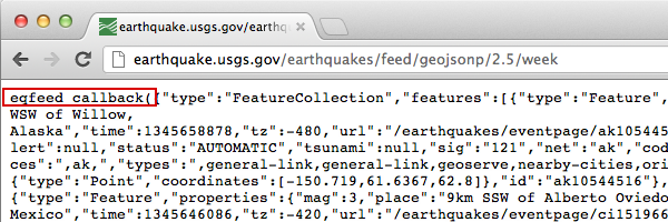
スクリプトを実行すると、対象のドメインはそのデータを引数として別のスクリプト(通常は callback() という名前)に渡します。対象のドメインは、コールバック スクリプトの名前を定義します。これは、ブラウザで対象の URL を読み込むと、最初にページに表示される名前です。
たとえば、ブラウザのウィンドウで http://earthquake.usgs.gov/earthquakes/feed/v1.0/summary/2.5_week.geojsonp を読み込むと、コールバックの名前が eqfeed_callback であることがわかります。
コールバック スクリプトをコード内で定義する必要があります。
function eqfeed_callback(response) {
  map.data.addGeoJson(response);
}
addGeoJson() メソッドを使用して、解析された GeoJSON データを地図に配置します。
データのスタイル設定
データの外観を変更するには、GeoJSON データを Map オブジェクトに追加します。データのスタイル設定について詳しくは、デベロッパー ガイドをご覧ください。
詳細
- GeoJSON は、JSON(JavaScript Object Notation)を基にしたオープンなフォーマットで、地理情報データのエンコードに幅広く使用されています。JSON データ用に設計された JavaScript のツールやメソッドも GeoJSON に使用できます。詳しくは、デベロッパー ガイドをご覧ください。
- JSONP は padded JSON の略です。これは、別のドメインにあるサーバーにデータをリクエストするための通信メソッドで、ウェブブラウザで実行する JavaScript プログラムで使用されます。