
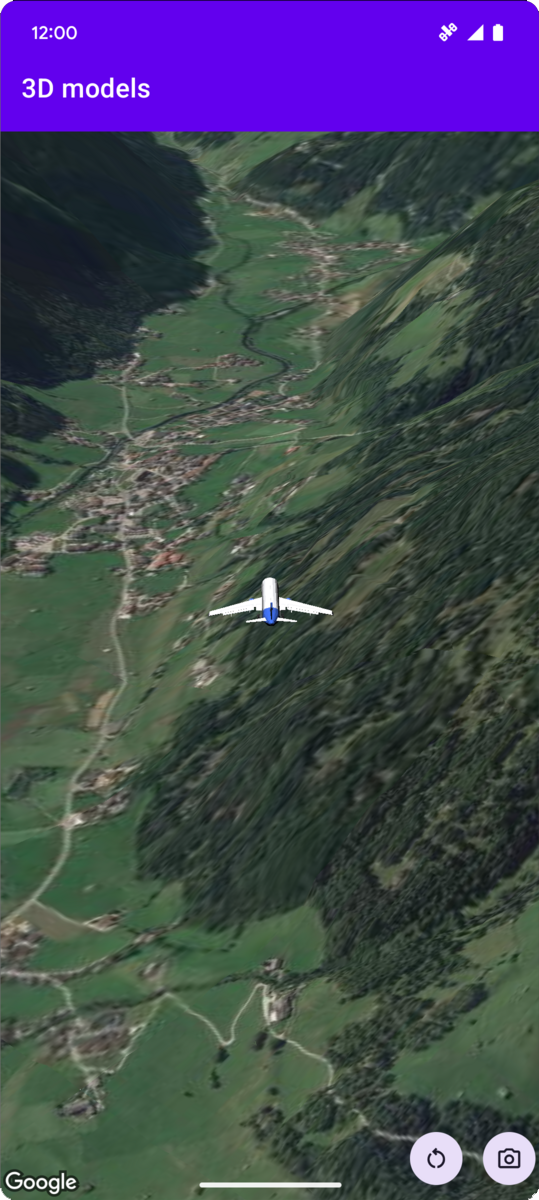
Poniższy przykładowy kod pokazuje, jak dodać model 3D i umieścić go
w przestrzeni 3D, wywołując metodę
addModel. Aby użyć tego przykładowego kodu, postępuj zgodnie z instrukcjami w
Konfigurowanie i dodawanie mapy 3D do
aplikacji, aby skonfigurować projekt
Android Studio z podstawową mapą 3D. Następnie dodaj ten kod do pliku MainActivity.kt:
// Add imports and define constants
import com.google.android.gms.maps3d.model.latLngAltitude
val PLANE_URL = "https://storage.googleapis.com/gmp-maps-demos/p3d-map/assets/Airplane.glb"
val PLANE_SCALE = 0.05

// Add to the onMap3DViewReady method, after the googleMap3D object has been initialized
googleMap3D.setCamera(
   camera {
        center = latLngAltitude {
            latitude = 47.133971
            longitude = 11.333161
            altitude = 2200.0
        }
        heading = 221.0
        tilt = 65.0
        range = 1_200.0
    }
)

googleMap3D.addModel(
    modelOptions {
        id = "plane_model"
        position = latLngAltitude {
            latitude = 47.133971
            longitude = 11.333161
            altitude = 2200.0
        }
        altitudeMode = AltitudeMode.ABSOLUTE
        orientation = orientation {
            heading = 41.5
            tilt = -90.0
            roll = 0.0
        }
        url = PLANE_URL
        scale = vector3D {
            x = PLANE_SCALE
            y = PLANE_SCALE
            z = PLANE_SCALE
        }
    }
)
Nasłuchiwanie zdarzeń kliknięcia modelu 3D
Aby nasłuchiwać zdarzeń kliknięcia modelu 3D, wywołaj metodę setClickListener na obiekcie modelu. Poniższy przykład pokazuje, jak ustawić detektor kliknięć na modelu 3D:
model.setClickListener {
    lifecycleScope.launch(Dispatchers.Main) {
        Toast.makeText(this@ModelsActivity, "Model clicked", Toast.LENGTH_SHORT).show()
    }
}
Pamiętaj, że moduł obsługi kliknięć nie jest uruchamiany w wątku głównym (ani interfejsu użytkownika). Jeśli chcesz wprowadzić zmiany w interfejsie użytkownika (np. wyświetlić komunikat Toast), musisz przełączyć się na wątek główny. W Kotlinie możesz to zrobić za pomocą lifecycleScope.launch(Dispatchers.Main).