
境界線ポリゴンの塗りつぶしとストロークをスタイル設定するには、GMSPlaceFeature を受け取り、GMSFeatureStyle を返すスタイル設定クロージャを使用して、スタイル属性を定義します。次に、スタイル プロパティを、スタイル設定ロジックを含むスタイル設定クロージャに設定します。
Swift
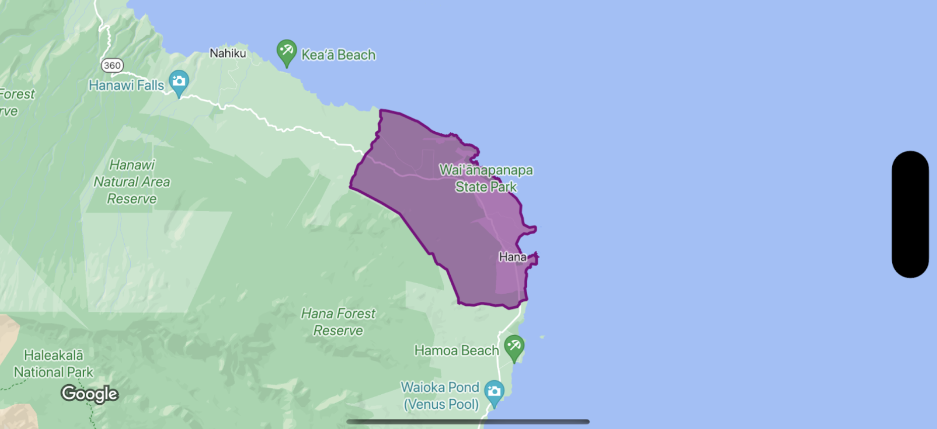
let mapView = GMSMapView(frame: .zero, mapID: GMSMapID(identifier: "YOUR_MAP_ID"), camera: GMSCameraPosition(latitude: 20.773, longitude: -156.01, zoom: 12))

let layer = mapView.featureLayer(of: .locality)

// Define a style with purple
let style = FeatureStyle(fill: .purple.withAlphaComponent(0.5), stroke: .purple, strokeWidth: 3.0)

// Apply the style to a single boundary.
layer.style = { ($0.placeID == "ChIJ0zQtYiWsVHkRk8lRoB1RNPo"/* Hana, HI */) ? style : nil }
Objective-C
GMSMapView *mapView = [GMSMapView mapWithFrame:CGRectZero mapID:[GMSMapID mapIDWithIdentifier:@"MAP_ID"] camera:[GMSCameraPosition cameraWithLatitude: 20.773 longitude: -156.01 zoom:12]];

GMSFeatureLayer<GMSPlaceFeature *> *layer = [mapView featureLayerOfFeatureType:GMSFeatureTypeLocality];

// Define a style with purple fill and border.
GMSFeatureStyle *style = [GMSFeatureStyle styleWithFillColor:[[UIColor purpleColor] colorWithAlphaComponent:0.5] strokeColor:[UIColor purpleColor] strokeWidth:3.0];

// Apply the style to a single boundary.
layer.style = ^(GMSPlaceFeature *feature) {
  return [feature.placeID isEqual:@"ChIJ0zQtYiWsVHkRk8lRoB1RNPo"/* Hana, HI */] ? style : nil;
};