Page Summary
-
The webpage describes various climate and weather datasets, primarily focusing on precipitation, temperature, atmospheric conditions, and tropical cyclones.
-
Datasets originate from institutions such as NOAA, NCEP, ECMWF, UCSB-CHG, NASA, JAXA, and Oregon State University, offering data at different spatial and temporal resolutions.
-
Examples of specific datasets include CHC-CMIP6 for climate hazard analysis, WeatherNext Gen and Graph Forecasts for medium-range ensemble forecasts, and WorldClim BIO and Climatology for bioclimatic and average monthly climate data.
-
CFSR: Climate Forecast System Reanalysis
The National Centers for Environmental Prediction (NCEP) Climate Forecast System Reanalysis (CFSR) was designed and executed as a global, high-resolution, coupled atmosphere-ocean-land surface-sea ice system to provide the best estimate of the state of these coupled domains over the 32-year period of record from January … climate daylight flux forecast geophysical ncep -
CFSV2: NCEP Climate Forecast System Version 2, 6-Hourly Products Harmonized
The National Centers for Environmental Prediction (NCEP) Climate Forecast System (CFS) is a fully coupled model representing the interaction between the Earth's atmosphere, oceans, land, and sea ice. CFS was developed at the Environmental Modeling Center (EMC) at NCEP. The operational CFS was upgraded to … climate daylight flux forecast geophysical ncep -
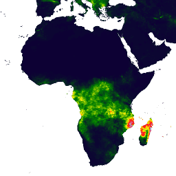
CHIRPS Precipitation Daily Near-Real-Time: Climate Hazards Center InfraRed Precipitation With Station Data (Version 3.0, IMERG-based)
The Climate Hazards Center Infrared Precipitation with Stations (CHIRPS v3) is a 40+ year, high-resolution quasi-global rainfall dataset. It spans 60°N to 60°S and covers all longitudes, providing data from 1981 to near-present. CHIRPS v3 combines satellite-based thermal infrared rainfall estimates with in-situ station observations … chc climate geophysical precipitation ucsb weather -
CHIRPS Precipitation Daily Reanalysis: Climate Hazards Center InfraRed Precipitation With Station Data (Version 3.0, ERA5-based)
The Climate Hazards Center Infrared Precipitation with Stations (CHIRPS v3) is a 40+ year, high-resolution quasi-global rainfall dataset. It spans 60°N to 60°S and covers all longitudes, providing data from 1981 to near-present. CHIRPS v3 combines satellite-based thermal infrared rainfall estimates with in-situ station observations … chc climate geophysical precipitation ucsb weather -
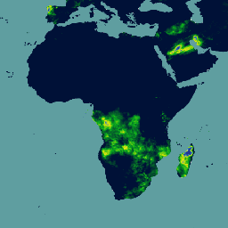
CHIRPS Precipitation Daily: Climate Hazards Center InfraRed Precipitation With Station Data (Version 2.0 Final)

Climate Hazards Center InfraRed Precipitation with Station data (CHIRPS) is a 30+ year quasi-global rainfall dataset. CHIRPS incorporates 0.05° resolution satellite imagery with in-situ station data to create gridded rainfall time series for trend analysis and seasonal drought monitoring. chg climate geophysical precipitation ucsb weather -
CHIRPS Precipitation Pentad: Climate Hazards Center InfraRed Precipitation With Station Data (Version 2.0 Final)
Climate Hazards Center InfraRed Precipitation with Station data (CHIRPS) is a 30+ year quasi-global rainfall dataset. CHIRPS incorporates 0.05° resolution satellite imagery with in-situ station data to create gridded rainfall time series for trend analysis and seasonal drought monitoring. chg climate geophysical precipitation ucsb weather -
CHIRPS Precipitation Pentad: Climate Hazards Center InfraRed Precipitation With Station Data (Version 3.0)
The Climate Hazards Center Infrared Precipitation with Stations (CHIRPS v3) is a 40+ year, high-resolution quasi-global rainfall dataset. It spans 60°N to 60°S and covers all longitudes, providing data from 1981 to near-present. CHIRPS v3 combines satellite-based thermal infrared rainfall estimates with in-situ station observations … chc chg climate geophysical precipitation ucsb -
CPC Global Unified Gauge-Based Analysis of Daily Precipitation
The CPC Unified Gauge-Based Analysis of Global Daily Precipitation dataset offers daily precipitation estimates over land from 1979 to the present. Developed by NOAA's Climate Prediction Center (CPC), it leverages an optimal interpolation technique to combine data from a global network of rain gauges, with … daily noaa precipitation weather -
CPC Global Unified Temperature

This dataset provides a gridded analysis of daily surface air temperature over global land areas, including daily maximum (Tmax), minimum (Tmin) temperatures. Spanning from 1979 to the present, the data is presented on 0.5-degree latitude/longitude grids, aligning with the resolution of CPC's gauge-based global daily … climate daily noaa precipitation weather -
Daymet V4: Daily Surface Weather and Climatological Summaries
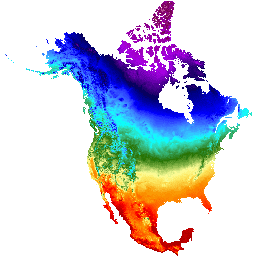
Daymet V4 provides gridded estimates of daily weather parameters for Continental North America, Hawaii, and Puerto Rico (Data for Puerto Rico is available starting in 1950). It is derived from selected meteorological station data and various supporting data sources. Compared to the previous version, Daymet … climate daily daylight flux geophysical nasa -
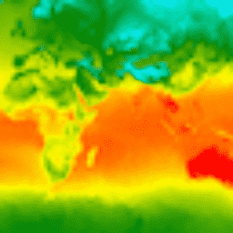
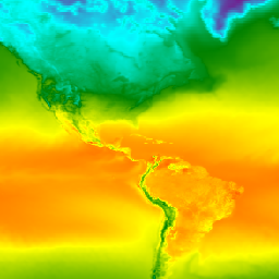
ERA5 Hourly - ECMWF Climate Reanalysis
ERA5 is the fifth generation ECMWF atmospheric reanalysis of the global climate. It is produced by the Copernicus Climate Change Service (C3S) at ECMWF. Reanalysis combines model data with observations from across the world into a globally complete and consistent dataset using the laws of … atmosphere climate copernicus ecmwf era5 hourly -
ERA5 Hourly Pressure Levels - ECMWF Climate Reanalysis
ERA5 is the fifth generation ECMWF atmospheric reanalysis of the global climate. Reanalysis combines model data with observations from across the world into a globally complete and consistent dataset. ERA5 replaces its predecessor, the ERA-Interim reanalysis. This dataset contains 3D parameters at 37 pressure levels. atmosphere climate copernicus ecmwf era5 hourly -
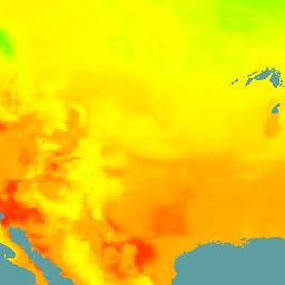
GFS: Global Forecast System 384-Hour Predicted Atmosphere Data
The Global Forecast System (GFS) is a weather forecast model produced by the National Centers for Environmental Prediction (NCEP). The GFS dataset consists of selected model outputs (described below) as gridded forecast variables. The 384-hour forecasts, with 1-hour (up to 120 hours) and 3-hour (after … climate cloud flux forecast geophysical humidity -
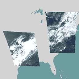
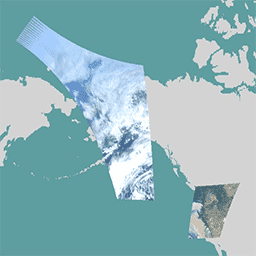
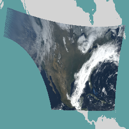
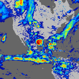
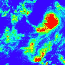
GOES-16 MCMIPC Series ABI Level 2 Cloud and Moisture Imagery CONUS
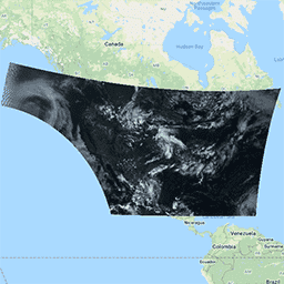
The Cloud and Moisture Imagery products are all at 2km resolution. Bands 1-6 are reflective. The dimensionless "reflectance factor" quantity is normalized by the solar zenith angle. These bands support the characterization of clouds, vegetation, snow/ice, and aerosols. Bands 7-16 are emissive. The brightness temperature … abi atmosphere goes goes-16 goes-east goes-r -
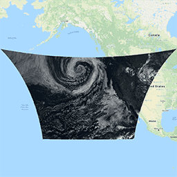
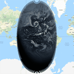
GOES-16 MCMIPF Series ABI Level 2 Cloud and Moisture Imagery Full Disk
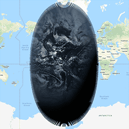
The Cloud and Moisture Imagery products are all at 2km resolution. Bands 1-6 are reflective. The dimensionless "reflectance factor" quantity is normalized by the solar zenith angle. These bands support the characterization of clouds, vegetation, snow/ice, and aerosols. Bands 7-16 are emissive. The brightness temperature … abi atmosphere goes goes-16 goes-east goes-r -
GOES-16 MCMIPM Series ABI Level 2 Cloud and Moisture Imagery Mesoscale
The Cloud and Moisture Imagery products are all at 2km resolution. Bands 1-6 are reflective. The dimensionless "reflectance factor" quantity is normalized by the solar zenith angle. These bands support the characterization of clouds, vegetation, snow/ice, and aerosols. Bands 7-16 are emissive. The brightness temperature … abi atmosphere goes goes-16 goes-east goes-r -
GOES-17 MCMIPC Series ABI Level 2 Cloud and Moisture Imagery CONUS

The Cloud and Moisture Imagery products are all at 2km resolution. Bands 1-6 are reflective. The dimensionless "reflectance factor" quantity is normalized by the solar zenith angle. These bands support the characterization of clouds, vegetation, snow/ice, and aerosols. Bands 7-16 are emissive. The brightness temperature … abi atmosphere goes goes-17 goes-s mcmip -
GOES-17 MCMIPF Series ABI Level 2 Cloud and Moisture Imagery Full Disk

The Cloud and Moisture Imagery products are all at 2km resolution. Bands 1-6 are reflective. The dimensionless "reflectance factor" quantity is normalized by the solar zenith angle. These bands support the characterization of clouds, vegetation, snow/ice, and aerosols. Bands 7-16 are emissive. The brightness temperature … abi atmosphere goes goes-17 goes-s mcmip -
GOES-17 MCMIPM Series ABI Level 2 Cloud and Moisture Imagery Mesoscale

The Cloud and Moisture Imagery products are all at 2km resolution. Bands 1-6 are reflective. The dimensionless "reflectance factor" quantity is normalized by the solar zenith angle. These bands support the characterization of clouds, vegetation, snow/ice, and aerosols. Bands 7-16 are emissive. The brightness temperature … abi atmosphere goes goes-17 goes-s mcmip -
GOES-18 MCMIPC Series ABI Level 2 Cloud and Moisture Imagery CONUS
The Cloud and Moisture Imagery products are all at 2km resolution. Bands 1-6 are reflective. The dimensionless "reflectance factor" quantity is normalized by the solar zenith angle. These bands support the characterization of clouds, vegetation, snow/ice, and aerosols. Bands 7-16 are emissive. The brightness temperature … abi atmosphere goes goes-18 goes-t goes-west -
GOES-18 MCMIPF Series ABI Level 2 Cloud and Moisture Imagery Full Disk
The Cloud and Moisture Imagery products are all at 2km resolution. Bands 1-6 are reflective. The dimensionless "reflectance factor" quantity is normalized by the solar zenith angle. These bands support the characterization of clouds, vegetation, snow/ice, and aerosols. Bands 7-16 are emissive. The brightness temperature … abi atmosphere goes goes-18 goes-t goes-west -
GOES-18 MCMIPM Series ABI Level 2 Cloud and Moisture Imagery Mesoscale
The Cloud and Moisture Imagery products are all at 2km resolution. Bands 1-6 are reflective. The dimensionless "reflectance factor" quantity is normalized by the solar zenith angle. These bands support the characterization of clouds, vegetation, snow/ice, and aerosols. Bands 7-16 are emissive. The brightness temperature … abi atmosphere goes goes-18 goes-t goes-west -
GOES-19 MCMIPC Series ABI Level 2 Cloud and Moisture Imagery CONUS
The Cloud and Moisture Imagery products are all at 2km resolution. Bands 1-6 are reflective. The dimensionless "reflectance factor" quantity is normalized by the solar zenith angle. These bands support the characterization of clouds, vegetation, snow/ice, and aerosols. Bands 7-16 are emissive. The brightness temperature … abi atmosphere goes goes-19 goes-east goes-u -
GOES-19 MCMIPF Series ABI Level 2 Cloud and Moisture Imagery Full Disk

The Cloud and Moisture Imagery products are all at 2km resolution. Bands 1-6 are reflective. The dimensionless "reflectance factor" quantity is normalized by the solar zenith angle. These bands support the characterization of clouds, vegetation, snow/ice, and aerosols. Bands 7-16 are emissive. The brightness temperature … abi atmosphere goes goes-19 goes-east goes-u -
GOES-19 MCMIPM Series ABI Level 2 Cloud and Moisture Imagery Mesoscale

The Cloud and Moisture Imagery products are all at 2km resolution. Bands 1-6 are reflective. The dimensionless "reflectance factor" quantity is normalized by the solar zenith angle. These bands support the characterization of clouds, vegetation, snow/ice, and aerosols. Bands 7-16 are emissive. The brightness temperature … abi atmosphere goes goes-19 goes-east goes-u -
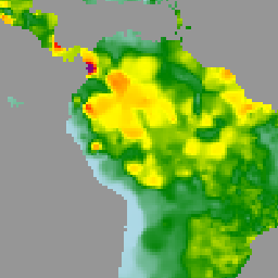
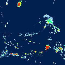
GPM: Global Precipitation Measurement (GPM) Release 07
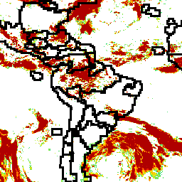
Global Precipitation Measurement (GPM) is an international satellite mission to provide next-generation observations of rain and snow worldwide every three hours. The Integrated Multi-satellitE Retrievals for GPM (IMERG) is the unified algorithm that provides rainfall estimates combining data from all passive-microwave instruments in the GPM … climate geophysical gpm imerg jaxa nasa -
GPM: Monthly Global Precipitation Measurement (GPM) v6
IMERG-Final version "06" stopped being produced in September, 2021. Version "07" is expected to be released in September 2022 Global Precipitation Measurement (GPM) is an international satellite mission to provide next-generation observations of rain and snow worldwide every three hours. The Integrated Multi-satellitE Retrievals for … climate geophysical gpm imerg jaxa monthly -
GPM: Monthly Global Precipitation Measurement (GPM) vRelease 07

Global Precipitation Measurement (GPM) is an international satellite mission to provide next-generation observations of rain and snow worldwide every three hours. The Integrated Multi-satellitE Retrievals for GPM (IMERG) is the unified algorithm that provides rainfall estimates combining data from all passive-microwave instruments in the GPM … climate geophysical gpm imerg jaxa monthly -
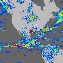
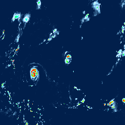
GSMaP Operational: Global Satellite Mapping of Precipitation - V6

Global Satellite Mapping of Precipitation (GSMaP) provides a global hourly rain rate with a 0.1 x 0.1 degree resolution. GSMaP is a product of the Global Precipitation Measurement (GPM) mission, which provides global precipitation observations at three hour intervals. Values are estimated using multi-band passive … climate geophysical gpm hourly jaxa precipitation -
GSMaP Operational: Global Satellite Mapping of Precipitation - V7
Global Satellite Mapping of Precipitation (GSMaP) provides a global hourly rain rate with a 0.1 x 0.1 degree resolution. GSMaP is a product of the Global Precipitation Measurement (GPM) mission, which provides global precipitation observations at three hour intervals. Values are estimated using multi-band passive … climate geophysical gpm hourly jaxa precipitation -
GSMaP Operational: Global Satellite Mapping of Precipitation - V8
Global Satellite Mapping of Precipitation (GSMaP) provides a global hourly rain rate with a 0.1 x 0.1 degree resolution. GSMaP is a product of the Global Precipitation Measurement (GPM) mission, which provides global precipitation observations at three hour intervals. Values are estimated using multi-band passive … climate geophysical gpm hourly jaxa precipitation -
GSMaP Reanalysis: Global Satellite Mapping of Precipitation
Global Satellite Mapping of Precipitation (GSMaP) provides a global hourly rain rate with a 0.1 x 0.1 degree resolution. GSMaP is a product of the Global Precipitation Measurement (GPM) mission, which provides global precipitation observations at three hour intervals. Values are estimated using multi-band passive … climate geophysical gpm hourly jaxa precipitation -
International Best Track Archive for Climate Stewardship Project

The International Best Track Archive for Climate Stewardship (IBTrACS) provides location and intensity for global tropical cyclones. The data span from the 1840s to present, generally providing data at 3-hour intervals. While the best track data is focused on position and intensity (maximum sustained wind … climate hurricane noaa table weather -
NOAA NHC HURDAT2 Atlantic Hurricane Catalog
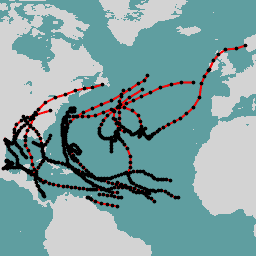
Hurricane best track database (HURDAT2). Atlantic basin 1851-2018. climate hurricane nhc noaa table weather -
NOAA NHC HURDAT2 Pacific Hurricane Catalog
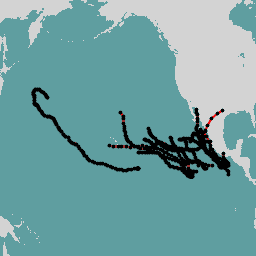
Hurricane best track database (HURDAT2). Pacific basin 1949-2018. climate hurricane nhc noaa table weather -
Ocean Color SMI: Standard Mapped Image MODIS Aqua Data

This level 3 product includes ocean color and satellite ocean biology data produced or collected under EOSDIS. This dataset may be used for studying the biology and hydrology of coastal zones, changes in the diversity and geographical distribution of coastal marine habitats, biogeochemical fluxes and … biology chlorophyll modis nasa oceandata oceans -
Ocean Color SMI: Standard Mapped Image MODIS Terra Data
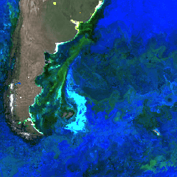
This level 3 product includes ocean color and satellite ocean biology data produced or collected under EOSDIS. This dataset may be used for studying the biology and hydrology of coastal zones, changes in the diversity and geographical distribution of coastal marine habitats, biogeochemical fluxes and … biology chlorophyll modis nasa oceandata oceans -
Ocean Color SMI: Standard Mapped Image SeaWiFS Data

This level 3 product includes ocean color and satellite ocean biology data produced or collected under EOSDIS. This dataset may be used for studying the biology and hydrology of coastal zones, changes in the diversity and geographical distribution of coastal marine habitats, biogeochemical fluxes and … biology chlorophyll nasa oceandata oceans reflectance -
Oya: 5km Quasi-Global Precipitation Estimates
Oya is a quasi-global, high-resolution precipitation estimation dataset derived from geostationary (GEO) satellite observations. The Oya model utilizes the full spectrum of visible and infrared (VIS-IR) channels from a constellation of GEO satellites — including GOES-16/18, Meteosat-9/10, and Himawari-8/9 — to generate precipitation estimates covering … climate geophysical gpm precipitation publisher-dataset weather -
PERSIANN-CDR: Precipitation Estimation From Remotely Sensed Information Using Artificial Neural Networks-Climate Data Record
PERSIANN-CDR is a daily quasi-global precipitation product that spans the period from 1983-01-01 to present. The data is produced quarterly, with a typical lag of three months. The product is developed by the Center for Hydrometeorology and Remote Sensing at the University of California, Irvine … cdr climate geophysical noaa precipitation weather -
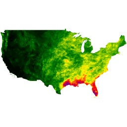
PRISM Daily Spatial Climate Dataset ANd

The PRISM daily and monthly datasets are gridded climate datasets for the conterminous United States, produced by the PRISM Climate Group at Oregon State University. This collection contains both AN81 and AN91 data, indicated by the 'dataset_type' property. Grids are developed using PRISM (Parameter-elevation Regressions … climate daily geophysical oregonstate precipitation pressure -
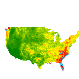
PRISM Long-Term Average Climate Dataset Norm91m
The PRISM daily and monthly datasets are gridded climate datasets for the conterminous United States, produced by the PRISM Climate Group at Oregon State University. Grids are developed using PRISM (Parameter-elevation Regressions on Independent Slopes Model). PRISM interpolation routines simulate how weather and climate vary … climate geophysical oregonstate precipitation pressure prism -
PRISM Monthly Spatial Climate Dataset ANm
The PRISM daily and monthly datasets are gridded climate datasets for the conterminous United States, produced by the PRISM Climate Group at Oregon State University. This collection contains both AN81 and AN91 data, as indicated by the 'dataset_type' property. Grids are developed using PRISM (Parameter-elevation … climate geophysical monthly oregonstate precipitation pressure -
RTMA: Real-Time Mesoscale Analysis
The Real-Time Mesoscale Analysis (RTMA) is a high-spatial and temporal resolution analysis for near-surface weather conditions. This dataset includes hourly analyses at 2.5 km for CONUS. atmosphere climate cloud geophysical humidity noaa -
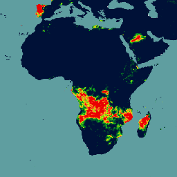
SPL3SMP_E.005 SMAP L3 Radiometer Global Daily 9 km Soil Moisture

Data starting from 2023-12-04 are available in the NASA/SMAP/SPL3SMP_E/006 collection. This Level-3 (L3) soil moisture product provides a daily composite of global land surface conditions retrieved by the Soil Moisture Active Passive (SMAP) L-Band radiometer. The daily data here were collected from the descending (local … drought nasa smap soil soil-moisture surface -
SPL3SMP_E.006 SMAP L3 Radiometer Global Daily 9 km Soil Moisture
Data prior from 2023-12-04 are available in the older NASA/SMAP/SPL3SMP_E/005 collection. They will eventually be reprocessed and added to this collection. This Level-3 (L3) soil moisture product provides a daily composite of global land surface conditions retrieved by the Soil Moisture Active Passive (SMAP) L-Band … drought nasa smap soil soil-moisture surface -
SPL4SMGP.008 SMAP L4 Global 3-hourly 9-km Surface and Root Zone Soil Moisture
The SMAP Level-4 (L4) Soil Moisture product includes surface soil moisture (0-5 cm vertical average), root-zone soil moisture (0-100 cm vertical average), and additional research products (not validated), including surface meteorological forcing variables, soil temperature, evapotranspiration, and net radiation. This dataset, formally known as the … drought nasa smap soil soil-moisture surface -
TRMM 3B42: 3-Hourly Precipitation Estimates
The Tropical Rainfall Measuring Mission (TRMM) is a joint mission between NASA and the Japan Aerospace Exploration Agency (JAXA) designed to monitor and study tropical rainfall. The 34B2 product contains a gridded, TRMM-adjusted, merged infrared precipitation (mm/hr) and RMS precipitation-error estimate, with a 3-hour temporal … 3-hourly climate geophysical jaxa nasa precipitation -
TRMM 3B43: Monthly Precipitation Estimates
This collection is no longer being updated. See IMERG monthly This dataset algorithmically merges microwave data from multiple satellites, including SSMI, SSMIS, MHS, AMSU-B and AMSR-E, each inter-calibrated to the TRMM Combined Instrument. Algorithm 3B43 is executed once per calendar month to produce the single, … climate geophysical jaxa nasa precipitation rainfall -
The Climate Hazards Center (CHC) Coupled Model Intercomparison Project Phase 6 (CHC-CMIP6)

CHC-CMIP6 was explicitly developed to support the analysis of climate-related hazards over the recent past and in the near-future. This climate projection dataset contains global, daily gridded data for the observational (1983-2016) and projection (2030 and 2050) periods to be used in the identification and … climate geophysical precipitation ucsb weather -
WeatherNext 2
WeatherNext 2 is an experimental dataset of global medium-range ensemble weather forecasts produced by an operational version of Google DeepMind's Functional Network Generative weather model. The experimental dataset includes real-time and historic data. Real-time data is any data that relates to a time that is … climate forecast gcp-public-data-weathernext precipitation publisher-dataset temperature -
WeatherNext 2 Mean
WeatherNext 2 Mean is the mean of 64 ensembles of an experimental dataset of global medium-range ensemble weather forecasts produced by an operational version of Google DeepMind's Functional Network Generative weather model. For a dataset containing all ensemble members, please see the (non-mean) WeatherNext 2 … climate forecast gcp-public-data-weathernext precipitation publisher-dataset temperature -
WeatherNext Gen Forecasts

DEPRECATION NOTICE: This dataset is scheduled for deprecation on July 15, 2026. To ensure service continuity, users must migrate all active workflows to WeatherNext 2. For more details, see our deprecation page. WeatherNext Gen is an experimental dataset of global medium-range ensemble weather forecasts produced … climate forecast gcp-public-data-weathernext precipitation publisher-dataset temperature -
WeatherNext Graph Forecasts

DEPRECATION NOTICE: This dataset is scheduled for deprecation on July 15, 2026. To ensure service continuity, users must migrate all active workflows to WeatherNext 2. For more details, see our deprecation page. WeatherNext Graph is an experimental dataset of global medium-range weather forecasts produced by … climate forecast gcp-public-data-weathernext precipitation publisher-dataset temperature -
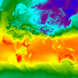
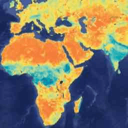
WorldClim BIO Variables V1
WorldClim V1 Bioclim provides bioclimatic variables that are derived from the monthly temperature and rainfall in order to generate more biologically meaningful values. The bioclimatic variables represent annual trends (e.g., mean annual temperature, annual precipitation), seasonality (e.g., annual range in temperature and precipitation), and extreme … berkeley climate monthly precipitation temperature weather -
WorldClim Climatology V1

WorldClim version 1 has average monthly global climate data for minimum, mean, and maximum temperature and for precipitation. WorldClim version 1 was developed by Robert J. Hijmans, Susan Cameron, and Juan Parra, at the Museum of Vertebrate Zoology, University of California, Berkeley, in collaboration with … berkeley climate monthly precipitation temperature weather