Earth Engine은 공유 컴퓨팅 리소스를 보호하고 모든 사용자에게 안정적인 성능을 보장하기 위해 비상업적 할당량 등급을 도입합니다. 모든 비상업용 프로젝트는 2026년 4월 27일까지 할당량 등급을 선택해야 하며, 선택하지 않으면 커뮤니티 등급이 기본적으로 사용됩니다. 등급 할당량은 등급 선택 날짜와 관계없이 2026년 4월 27일에 모든 프로젝트에 적용됩니다. 자세히 알아보기
Google uses AI technology to translate content into your preferred language. AI translations can contain errors.
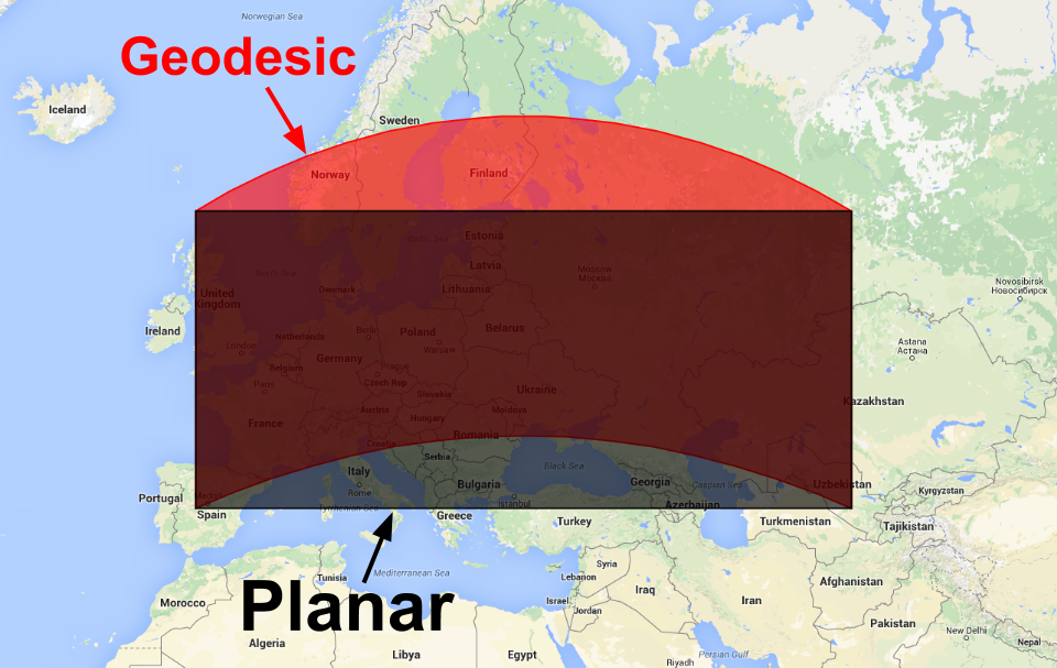
지오데식 도형과 평면 도형 비교
컬렉션을 사용해 정리하기
내 환경설정을 기준으로 콘텐츠를 저장하고 분류하세요.
Earth Engine에서 생성된 도형은 지오데시컬 (즉, 가장자리가 구 표면에서 가장 짧은 경로)이거나 평면 (즉, 가장자리가 2D 데카르트 평면에서 가장 짧은 경로)입니다. 전 세계 지형지물 모음에 적합한 평면 좌표계는 없으므로 Earth Engine의 도형 생성자는 기본적으로 지오데시 기하학을 빌드합니다. 평면 도형을 만들기 위해 생성자에는 false로 설정할 수 있는 geodesic 매개변수가 있습니다.
[[["이해하기 쉬움","easyToUnderstand","thumb-up"],["문제가 해결됨","solvedMyProblem","thumb-up"],["기타","otherUp","thumb-up"]],[["필요한 정보가 없음","missingTheInformationINeed","thumb-down"],["너무 복잡함/단계 수가 너무 많음","tooComplicatedTooManySteps","thumb-down"],["오래됨","outOfDate","thumb-down"],["번역 문제","translationIssue","thumb-down"],["샘플/코드 문제","samplesCodeIssue","thumb-down"],["기타","otherDown","thumb-down"]],["최종 업데이트: 2025-07-25(UTC)"],[],["Earth Engine geometry can be geodesic (shortest path on a sphere) or planar (shortest path on a 2D plane). Geodesic is the default for global collections. To create a planar geometry, set the `geodesic` parameter to `false` in the `ee.Geometry` constructor, as shown in the code example: `var planarPolygon = ee.Geometry(polygon, null, false);`. Conversion between these types is possible using the same constructor. Figure 1 illustrates the visual difference between geodesic (red) and planar (black) polygons.\n"]]