-
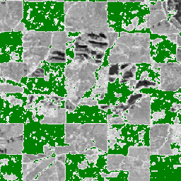
カカオの確率モデル 2025a
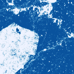
**注: このデータセットはまだピアレビューされていません。詳細については、GitHub の README をご覧ください。** この画像コレクションは、基盤となる領域が商品で占有されているピクセル単位の推定確率を提供します。確率の推定値は 10 メートル解像度で提供され、… によって生成されています。 農業 生物多様性 カカオ 保全 作物 eudr -
カカオの確率モデル 2025b
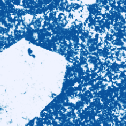
このデータセットの技術ドキュメントについては、GitHub の README をご覧ください。この画像コレクションは、基盤となる領域が商品で占有されているピクセル単位の推定確率を提供します。確率推定値は 10 メートル解像度で提供され、機械学習モデルによって生成されています。… 農業 生物多様性 カカオ 保全 作物 eudr -
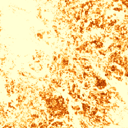
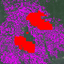
Coffee Probability モデル 2025a

**注: このデータセットはまだピアレビューされていません。詳細については、GitHub の README をご覧ください。** この画像コレクションは、基盤となる領域が商品で占有されているピクセル単位の推定確率を提供します。確率の推定値は 10 メートル解像度で提供され、… によって生成されています。 農業 生物多様性 コーヒー 保全 作物 eudr -
Coffee 確率モデル 2025b
このデータセットの技術ドキュメントについては、GitHub の README をご覧ください。この画像コレクションは、基盤となる領域が商品で占有されているピクセル単位の推定確率を提供します。確率推定値は 10 メートル解像度で提供され、機械学習モデルによって生成されています。… 農業 生物多様性 コーヒー 保全 作物 eudr -
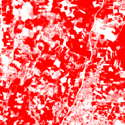
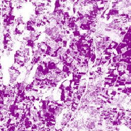
Farmscapes 2020
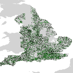
Farmscapes 2020 データセットは、イングランドの農業景観内の 3 つの主要な半自然の地物(生垣、森林、石垣)の高解像度(25 cm)の確率マップを提供します。このデータセットは、オックスフォード レバーハルム自然回復センターと共同で開発され、次のようなアプリケーションのベースラインとして使用されます。 biodiversity climate conservation forest landuse-landcover nature-trace -
Forest Persistence v0
注: このデータセットはまだピアレビューされていません。詳細については、このモデルに関連付けられている GitHub の README をご覧ください。この画像は、2020 年にピクセル領域が手つかずの森林で占められているかどうかを示すピクセル単位のスコア([0, 1])を提供します。これらのスコアは… biodiversity conservation deforestation eudr forest-biomass forestdatapartnership -
アブラヤシ農園の世界地図
このデータセットは、2019 年の 10 m グローバル産業および小規模農家のパーム油マップです。アブラヤシ農園が検出された地域を対象としています。分類された画像は、Sentinel-1 と Sentinel-2 の半年間の合成画像に基づく畳み込みニューラル ネットワークの出力です。詳しくは、記事をご覧ください。 農業 生物多様性 保全 作物 グローバル 土地利用 -
世界の天然林 2020

Natural Forests of the World 2020 は、2020 年の全球天然林の確率マップを 10 m の解像度で提供します。このレイヤは、欧州連合の森林破壊防止規制(EUDR)などの取り組みや、森林の環境保護とモニタリングに向けたその他の取り組みをサポートするために開発されました。地図 … biodiversity climate conservation deforestation eudr forest -
Palm 確率モデル 2025a
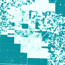
**注: このデータセットはまだピアレビューされていません。詳細については、GitHub の README をご覧ください。** この画像コレクションは、基盤となる領域が商品で占有されているピクセル単位の推定確率を提供します。確率の推定値は 10 メートル解像度で提供され、… によって生成されています。 agriculture biodiversity conservation crop eudr forestdatapartnership -
Palm 確率モデル 2025b
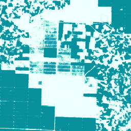
このデータセットの技術ドキュメントについては、GitHub の README をご覧ください。この画像コレクションは、基盤となる領域が商品で占有されているピクセル単位の推定確率を提供します。確率推定値は 10 メートル解像度で提供され、機械学習モデルによって生成されています。… agriculture biodiversity conservation crop eudr forestdatapartnership -
RESOLVE Ecoregions 2017
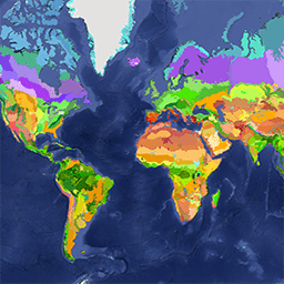
2017 年に更新された RESOLVE Ecoregions データセットは、地球上の 846 の陸上生態地域を表しています。スタイル設定された地図は、https://ecoregions2017.appspot.com/ または Earth Engine で確認できます。生態地域は、最も単純な定義では、地域規模の生態系です。具体的には、エコリージョンは明確な集合体を表します。 biodiversity conservation ecoregions ecosystems global table -
ゴムの確率モデル 2025b
このデータセットの技術ドキュメントについては、GitHub の README をご覧ください。この画像コレクションは、基盤となる領域が商品で占有されているピクセル単位の推定確率を提供します。確率推定値は 10 メートル解像度で提供され、機械学習モデルによって生成されています。… agriculture biodiversity conservation crop eudr forestdatapartnership -
Rubber Tree Probability モデル 2025a
**注: このデータセットはまだピアレビューされていません。詳細については、GitHub の README をご覧ください。** この画像コレクションは、基盤となる領域が商品で占有されているピクセル単位の推定確率を提供します。確率の推定値は 10 メートル解像度で提供され、… によって生成されています。 agriculture biodiversity conservation crop eudr forestdatapartnership -
Species Distribution, Australia Mammals(オーストラリアの哺乳類の分布)
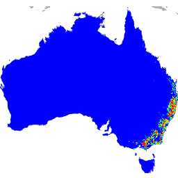
Google が QCIF および EcoCommons と共同で開発したこれらの種の分布モデルの出力は、種の相対的な発生確率の推定値を表しています(つまり、値が高いほど、特定の調査方法と特定の調査で、その場所で種が検出される可能性が高いことを示します)。 biodiversity conservation ecosystems nature-trace publisher-dataset species