-
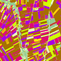
カナダ AAFC 年次作物在庫

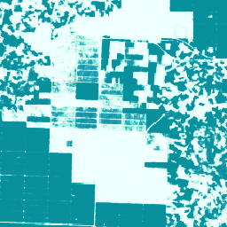
2009 年から、カナダ農業・農産食品省(AAFC)の科学技術部門(STB)の地球観測チームは、年間の作物タイプのデジタル地図を作成するプロセスを開始しました。2009 年と 2010 年のプレーリー州に焦点を当て、決定木(DT)に基づく方法論… agriculture canada crop landcover -
カカオ確率モデル 2025a
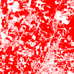
この画像コレクションは、基盤となる領域が商品で占有されているピクセル単位の推定確率を提供します。確率推定値は 10 メートル四方単位で提供され、機械学習モデルによって生成されています。詳しくは、Forest Data Partnership の技術ドキュメントをご覧ください。 農業 生物多様性 カカオ 保全 作物 eudr -
カカオの確率モデル 2025b
この画像コレクションは、基盤となる領域が商品で占有されているピクセル単位の推定確率を提供します。確率推定値は 10 メートル四方単位で提供され、機械学習モデルによって生成されています。詳しくは、Forest Data Partnership の技術ドキュメントをご覧ください。 agriculture alphaearth-derived biodiversity cocoa conservation crop -
Coffee Probability モデル 2025a

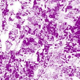
この画像コレクションは、基盤となる領域が商品で占有されているピクセル単位の推定確率を提供します。確率推定値は 10 メートル四方単位で提供され、機械学習モデルによって生成されています。詳しくは、Forest Data Partnership の技術ドキュメントをご覧ください。 農業 生物多様性 コーヒー 保全 作物 eudr -
Coffee 確率モデル 2025b
この画像コレクションは、基盤となる領域が商品で占有されているピクセル単位の推定確率を提供します。確率推定値は 10 メートル四方単位で提供され、機械学習モデルによって生成されています。詳しくは、Forest Data Partnership の技術ドキュメントをご覧ください。 agriculture alphaearth-derived biodiversity coffee conservation crop -
ESA WorldCereal 10 m v100

欧州宇宙機関(ESA)の WorldCereal 10 m 2021 プロダクト スイートは、グローバル スケールの年間および季節の作物マップと、それに関連する信頼度で構成されています。これらは、ESA-WorldCereal プロジェクトの一環として生成されました。これらのプロダクトの内容と、…に使用される方法の詳細 農業 Copernicus 作物 ESA グローバル 土地被覆 -
ESA WorldCereal AEZ v100
欧州宇宙機関(ESA)の WorldCereal 分類システムは、特定の生育期の終了後 1 か月以内のプロダクト生成を目標としています。世界各地の生育期は動的に変化するため、… に基づいて、農業生態学的ゾーン(AEZ)へのグローバルな階層化が行われました。 agriculture boundaries crop esa global table -
ESA WorldCereal Active Cropland 10 m v100

欧州宇宙機関(ESA)の WorldCereal Active Cropland 10 m 2021 プロダクト スイートには、グローバル スケールの季節的な耕作地マーカーが含まれています。これらは、ESA-WorldCereal プロジェクトの一環として生成されました。アクティブな農地プロダクトは、一時的な作物として識別されたピクセルがアクティブに… 農業 Copernicus 作物 ESA グローバル 土地被覆 -
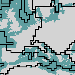
EUCROPMAP
Sentinel-1 と LUCAS Copernicus 2018 の現地観測データ(2018 年)および Sentinel-1、Sentinel-2、補助データと LUCAS Copernicus 2022 の観測データ(2022 年)を組み合わせて作成された、ヨーロッパの作物タイプマップ。このデータセットは、独自の LUCAS 2018 Copernicus 現地調査に基づいており、… agriculture crop eu jrc lucas sentinel1-derived -
GFSAD1000: Cropland Extent 1km Multi-Study Crop Mask, Global Food-Support Analysis Data
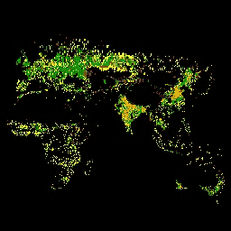
GFSAD は、21 世紀のグローバルな食料安全保障に貢献する高解像度のグローバル農地データとその水使用量を提供する NASA の資金援助プロジェクトです。GFSAD プロダクトは、マルチセンサー リモート センシング データ(Landsat、MODIS、AVHRR など)、二次データ、フィールド プロット データから派生しています。 agriculture crop landcover usgs -
GRIDMET 干ばつ: CONUS 干ばつ指数

このデータセットには、4 km の日次グリッド化された地表気象(GRIDMET)データセットから導出された干ばつ指数が含まれています。提供される干ばつ指数には、標準化降水指数(SPI)、蒸発散干ばつ需要指数(EDDI)、標準化降水蒸発散指数(SPEI)、パーマー干ばつ深刻度指数(PDSI)、パーマー… climate conus crop drought evapotranspiration geophysical -
アブラヤシ農園の世界地図
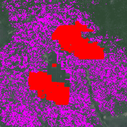
このデータセットは、2019 年の 10 m グローバル産業および小規模農家のパーム油マップです。アブラヤシ農園が検出された地域を対象としています。分類された画像は、Sentinel-1 と Sentinel-2 の半年間の合成画像に基づく畳み込みニューラル ネットワークの出力です。詳しくは、記事をご覧ください。 農業 生物多様性 保全 作物 グローバル 土地利用 -
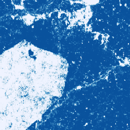
Palm 確率モデル 2025a
この画像コレクションは、基盤となる領域が商品で占有されているピクセル単位の推定確率を提供します。確率推定値は 10 メートル四方単位で提供され、機械学習モデルによって生成されています。詳しくは、Forest Data Partnership の技術ドキュメントをご覧ください。 agriculture biodiversity conservation crop eudr forestdatapartnership -
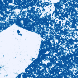
Palm 確率モデル 2025b
この画像コレクションは、基盤となる領域が商品で占有されているピクセル単位の推定確率を提供します。確率推定値は 10 メートル四方単位で提供され、機械学習モデルによって生成されています。詳しくは、Forest Data Partnership の技術ドキュメントをご覧ください。 agriculture alphaearth-derived biodiversity conservation crop eudr -
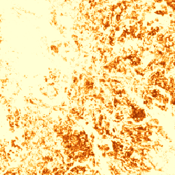
Rubber Probability モデル 2025b
この画像コレクションは、基盤となる領域が商品で占有されているピクセル単位の推定確率を提供します。確率推定値は 10 メートル四方単位で提供され、機械学習モデルによって生成されています。詳しくは、Forest Data Partnership の技術ドキュメントをご覧ください。 agriculture alphaearth-derived biodiversity conservation crop eudr -
Rubber Tree Probability モデル 2025a
この画像コレクションは、基盤となる領域が商品で占有されているピクセル単位の推定確率を提供します。確率推定値は 10 メートル四方単位で提供され、機械学習モデルによって生成されています。詳しくは、Forest Data Partnership の技術ドキュメントをご覧ください。 agriculture biodiversity conservation crop eudr forestdatapartnership -
USDA NASS の Cropland データレイヤ
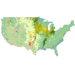
Cropland Data Layer(CDL)は、中程度の解像度の衛星画像と広範な農業のグラウンド トゥルースを使用して、米国本土向けに毎年作成される作物固有の土地被覆データレイヤです。CDL は、米国農務省(USDA)の国立農業統計局(NASS)の研究開発部門によって作成されます。 agriculture crop landcover usda