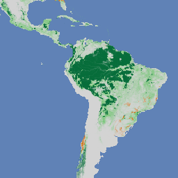
Natural Forests of the World 2020 は、2020 年の全球天然林の確率マップを 10 m の解像度で提供します。このレイヤは、欧州連合の森林破壊防止規制(EUDR)などの取り組みや、森林の保全とモニタリングに向けたその他の取り組みをサポートするために開発されました。地図…
[[["わかりやすい","easyToUnderstand","thumb-up"],["問題の解決に役立った","solvedMyProblem","thumb-up"],["その他","otherUp","thumb-up"]],[["必要な情報がない","missingTheInformationINeed","thumb-down"],["複雑すぎる / 手順が多すぎる","tooComplicatedTooManySteps","thumb-down"],["最新ではない","outOfDate","thumb-down"],["翻訳に関する問題","translationIssue","thumb-down"],["サンプル / コードに問題がある","samplesCodeIssue","thumb-down"],["その他","otherDown","thumb-down"]],[],[],["Multiple datasets offer 10m resolution spatial data. Two datasets map global forest cover and types for 2020, distinguishing between primary, naturally regenerating, and planted forests. Three other datasets provide per-pixel probability estimates for cocoa, palm, and rubber tree presence. Finally, one dataset quantifies the likelihood of undisturbed forest in 2020. These probability models are marked as pre-peer review. All of them are made for the regulation from the European Union.\n"]]