
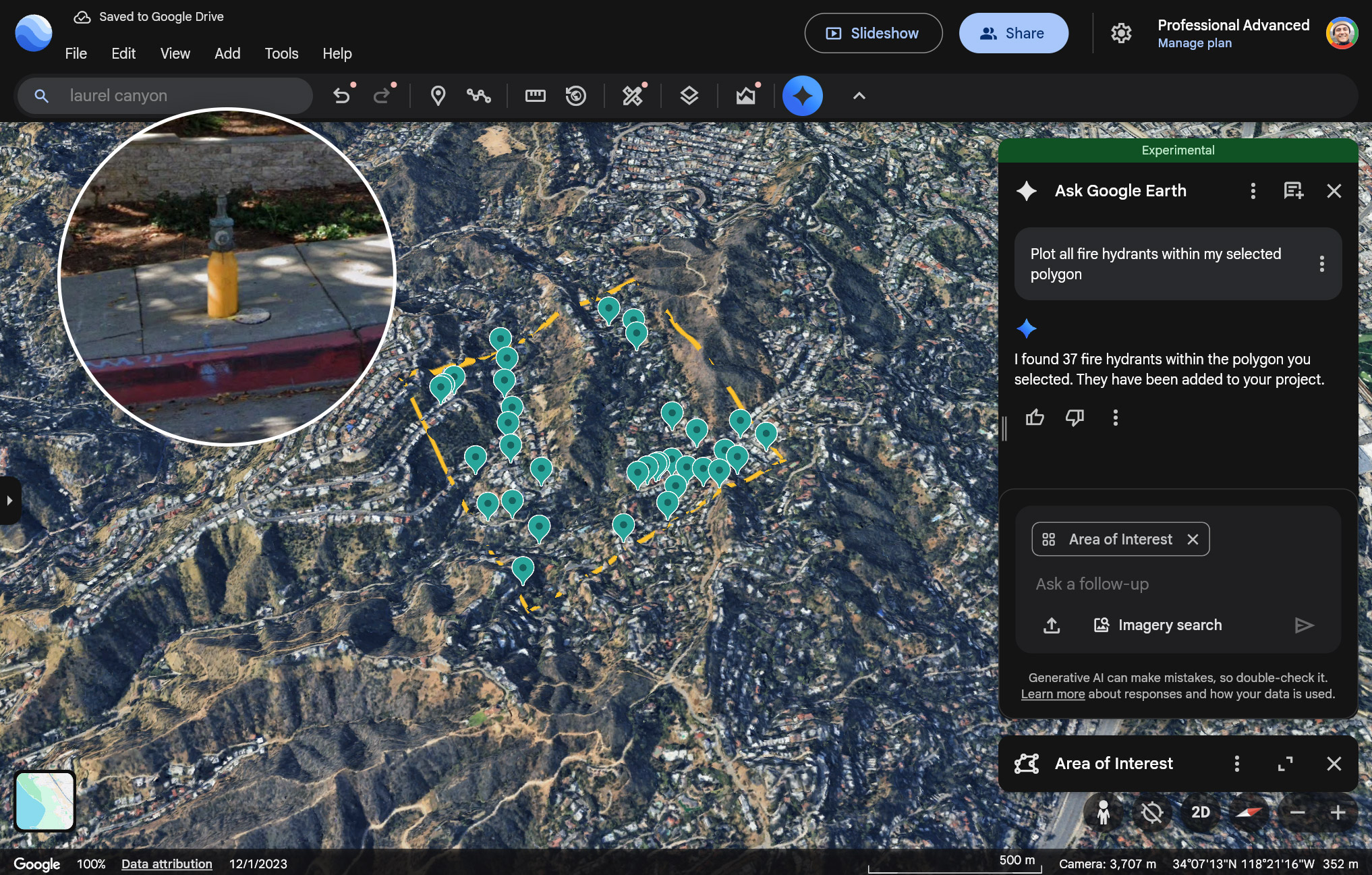
With Ask Google Earth, you can now access one of our latest datasets derived from Google Street View, which provides a rich overview of infrastructure assets in the real world. This feature lets you identify and locate specific types of infrastructure within a defined area, streamlining workflows for urban planning, maintenance, and analysis.
Explore infrastructure data in Google Earth
Supported infrastructure data
You can ask about the following types of infrastructure data (in the US only):
| Infrastructure data | Description |
|---|---|
| Fire hydrants | A standalone structure or connection point by which firefighters can tap into a water supply |
| Speed limit signs |
Regulatory signs that display the maximum or minimum speed of travel permitted on a roadway |
| Stop signs | Regulatory signs that instruct drivers to come to a complete stop before proceeding into an intersection or roadway |
| Street lights | Light sources mounted on poles intended to illuminate public roads, sidewalks, or other public areas for safety and navigation |
| Traffic lights | Signaling devices positioned at road intersections, pedestrian crossings, and other locations to control the flow of traffic using a standard color sequence (red, yellow, green) |
| Utility poles | Posts that support overhead power lines, telephone lines, and other public utilities |
| Storm drains | Includes typical round or rectangular drains and curb inlet drains |
| Maintenance covers | A lid covering a hole or entrance leading to an underground system (for example, for utilities), large enough for a person to access |