-
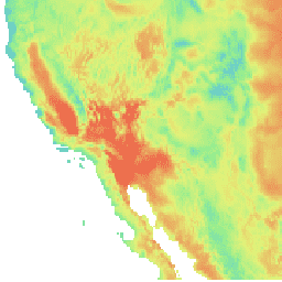
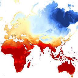
อุณหภูมิ CHIRTS รายวัน: ผลิตภัณฑ์ข้อมูลรายวันของอุณหภูมิอินฟราเรดของศูนย์อันตรายจากสภาพอากาศที่มีสถานี
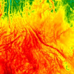
ผลิตภัณฑ์ข้อมูลอุณหภูมิรายวันของศูนย์อันตรายจากสภาพอากาศ (Climate Hazards Center) ที่วัดด้วยอุณหภูมิอินฟราเรดพร้อมสถานี (CHIRTS-daily; Verdin et al. 2020) เป็นชุดข้อมูลแบบกริดความละเอียดสูงระดับกึ่งโลก (ความละเอียด 0.05° × 0.05°, 60°S - 70°N) ซึ่งให้ข้อมูลอุณหภูมิต่ำสุด (Tmin) และสูงสุด (Tmax) ที่ระดับ 2 เมตรในแต่ละวัน รวมถึงตัวแปรที่ได้มา 4 ตัว ได้แก่ แรงดันไอน้ำอิ่มตัว … chg climate daily era5 geophysical reanalysis -
การพยากรณ์ชั้นบรรยากาศ IFS แบบแทบจะเรียลไทม์ของ ECMWF
ชุดข้อมูลนี้ประกอบด้วยการคาดการณ์ 15 วันของตัวแปรโมเดลชั้นบรรยากาศที่สร้างขึ้นโดยระบบการคาดการณ์แบบบูรณาการ (IFS) ของ ECMWF ที่ความละเอียด 0.25 องศา เราเรียกข้อมูลเหล่านี้ว่าข้อมูลแบบเรียลไทม์เกือบ (NRT) เนื่องจากมีการเปิดตัวผลิตภัณฑ์ใหม่วันละ 2 ครั้งหลังจากเปิดตัวการพยากรณ์แบบเรียลไทม์ของ ECMWF … สภาพอากาศ จุดน้ำค้าง ecmwf พยากรณ์ ทั่วโลก ความชื้น -
การรวบรวมข้อมูลรายวันของ ERA5 - การวิเคราะห์สภาพภูมิอากาศล่าสุดที่ผลิตโดย ECMWF / Copernicus Climate Change Service
ERA5 คือการวิเคราะห์ซ้ำของชั้นบรรยากาศ ECMWF รุ่นที่ 5 เกี่ยวกับสภาพภูมิอากาศทั่วโลก การวิเคราะห์ซ้ำจะรวมข้อมูลโมเดลเข้ากับการสังเกตการณ์จากทั่วโลกเป็นชุดข้อมูลที่สมบูรณ์และสอดคล้องกันทั่วโลก ERA5 จะมาแทนที่ ERA-Interim reanalysis ซึ่งเป็นรุ่นก่อนหน้า ERA5 DAILY ให้ค่ารวมสำหรับแต่ละวันสำหรับ … สภาพอากาศ copernicus จุดน้ำค้าง ecmwf era5 หยาดน้ำฟ้า -
รายชั่วโมง ERA5 - การวิเคราะห์สภาพภูมิอากาศซ้ำของ ECMWF
ERA5 คือการวิเคราะห์ซ้ำของชั้นบรรยากาศ ECMWF รุ่นที่ 5 เกี่ยวกับสภาพภูมิอากาศทั่วโลก โดยจัดทำขึ้นโดย Copernicus Climate Change Service (C3S) ที่ ECMWF การวิเคราะห์ซ้ำจะรวมข้อมูลโมเดลเข้ากับการสังเกตการณ์จากทั่วโลกเป็นชุดข้อมูลที่สมบูรณ์และสอดคล้องกันทั่วโลกโดยใช้กฎของ … ชั้นบรรยากาศ สภาพอากาศ copernicus ecmwf era5 รายชั่วโมง -
การรวมข้อมูลรายเดือนของ ERA5 - การวิเคราะห์สภาพอากาศย้อนหลังล่าสุดที่ผลิตโดย ECMWF / Copernicus Climate Change Service

ERA5 คือการวิเคราะห์ซ้ำของชั้นบรรยากาศ ECMWF รุ่นที่ 5 เกี่ยวกับสภาพภูมิอากาศทั่วโลก การวิเคราะห์ซ้ำจะรวมข้อมูลโมเดลเข้ากับการสังเกตการณ์จากทั่วโลกเป็นชุดข้อมูลที่สมบูรณ์และสอดคล้องกันทั่วโลก ERA5 จะมาแทนที่ ERA-Interim reanalysis ซึ่งเป็นรุ่นก่อนหน้า ERA5 MONTHLY ให้ค่ารวมสําหรับแต่ละเดือนสําหรับ … สภาพอากาศ copernicus จุดน้ำค้าง ecmwf era5 หยาดน้ำฟ้า -
ERA5-Land Daily Aggregated - ECMWF Climate Reanalysis
ERA5-Land เป็นชุดข้อมูลการวิเคราะห์ซ้ำที่ให้มุมมองที่สอดคล้องกันเกี่ยวกับการเปลี่ยนแปลงของตัวแปรบนบกในช่วงหลายทศวรรษที่ผ่านมา โดยมีความละเอียดที่ปรับปรุงแล้วเมื่อเทียบกับ ERA5 ERA5-Land สร้างขึ้นโดยการเล่นซ้ำองค์ประกอบภาคพื้นดินของการวิเคราะห์สภาพอากาศย้อนหลัง ERA5 ของ ECMWF การวิเคราะห์ซ้ำจะรวมข้อมูลโมเดลเข้ากับ … cds climate copernicus ecmwf era5-land evaporation -
รายชั่วโมงของ ERA5-Land - การวิเคราะห์สภาพภูมิอากาศซ้ำของ ECMWF
ERA5-Land เป็นชุดข้อมูลการวิเคราะห์ซ้ำที่ให้มุมมองที่สอดคล้องกันเกี่ยวกับการเปลี่ยนแปลงของตัวแปรบนบกในช่วงหลายทศวรรษที่ผ่านมา โดยมีความละเอียดที่ปรับปรุงแล้วเมื่อเทียบกับ ERA5 ERA5-Land สร้างขึ้นโดยการเล่นซ้ำองค์ประกอบภาคพื้นดินของการวิเคราะห์สภาพอากาศย้อนหลัง ERA5 ของ ECMWF การวิเคราะห์ซ้ำจะรวมข้อมูลโมเดลเข้ากับ … cds climate copernicus ecmwf era5-land evaporation -
ERA5-Land Monthly Aggregated - ECMWF Climate Reanalysis

ERA5-Land เป็นชุดข้อมูลการวิเคราะห์ซ้ำที่ให้มุมมองที่สอดคล้องกันเกี่ยวกับการเปลี่ยนแปลงของตัวแปรบนบกในช่วงหลายทศวรรษที่ผ่านมา โดยมีความละเอียดที่ปรับปรุงแล้วเมื่อเทียบกับ ERA5 ERA5-Land สร้างขึ้นโดยการเล่นซ้ำองค์ประกอบภาคพื้นดินของการวิเคราะห์สภาพอากาศย้อนหลัง ERA5 ของ ECMWF การวิเคราะห์ซ้ำจะรวมข้อมูลโมเดลเข้ากับ … cds climate copernicus ecmwf era5-land evaporation -
ค่าเฉลี่ยรายเดือนของ ERA5-Land ตามชั่วโมงของวัน - การวิเคราะห์สภาพอากาศย้อนหลังของ ECMWF

ERA5-Land เป็นชุดข้อมูลการวิเคราะห์ซ้ำที่ให้มุมมองที่สอดคล้องกันเกี่ยวกับการเปลี่ยนแปลงของตัวแปรบนบกในช่วงหลายทศวรรษที่ผ่านมา โดยมีความละเอียดที่ปรับปรุงแล้วเมื่อเทียบกับ ERA5 ERA5-Land สร้างขึ้นโดยการเล่นซ้ำองค์ประกอบภาคพื้นดินของการวิเคราะห์สภาพอากาศย้อนหลัง ERA5 ของ ECMWF การวิเคราะห์ซ้ำจะรวมข้อมูลโมเดลเข้ากับ … cds climate copernicus ecmwf era5-land evaporation -
FLDAS: Famine Early Warning Systems Network (FEWS NET) Land Data Assimilation System

ชุดข้อมูล FLDAS (McNally et al. 2017) ออกแบบมาเพื่อช่วยในการประเมินความมั่นคงทางอาหารในประเทศกำลังพัฒนาที่มีข้อมูลเบาบาง ซึ่งรวมถึงข้อมูลเกี่ยวกับตัวแปรที่เกี่ยวข้องกับสภาพอากาศหลายอย่าง เช่น ปริมาณความชื้น ความชื้น การคายระเหย อุณหภูมิเฉลี่ยของดิน อัตราการเกิดฝนรวม เป็นต้น มีชุดข้อมูล FLDAS หลายชุดที่แตกต่างกัน … สภาพอากาศ ชั้นน้ำแข็ง การคายระเหย ความชื้น ldas รายเดือน -
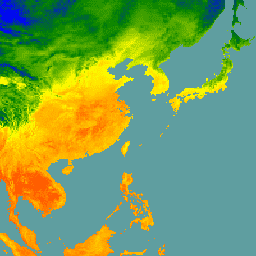
GFS: ข้อมูลชั้นบรรยากาศที่คาดการณ์ไว้ 384 ชั่วโมงของระบบพยากรณ์อากาศทั่วโลก
ระบบพยากรณ์อากาศทั่วโลก (Global Forecast System หรือ GFS) เป็นโมเดลพยากรณ์อากาศที่ผลิตโดยศูนย์พยากรณ์สิ่งแวดล้อมแห่งชาติ (National Centers for Environmental Prediction หรือ NCEP) ชุดข้อมูล GFS ประกอบด้วยเอาต์พุตของโมเดลที่เลือก (อธิบายไว้ด้านล่าง) เป็นตัวแปรพยากรณ์ที่จัดเรียงเป็นตารางกริด การพยากรณ์ 384 ชั่วโมงที่มีความละเอียด 1 ชั่วโมง (สูงสุด 120 ชั่วโมง) และ 3 ชั่วโมง (หลังจาก … สภาพอากาศ เมฆ ฟลักซ์ พยากรณ์ ธรณีฟิสิกส์ ความชื้น -
GLDAS-2.1: ระบบการปรับข้อมูลที่ดินทั่วโลก

ระบบการปรับข้อมูลที่ดินทั่วโลกของ NASA เวอร์ชัน 2 (GLDAS-2) มี 3 องค์ประกอบ ได้แก่ GLDAS-2.0, GLDAS-2.1 และ GLDAS-2.2 GLDAS-2.0 ใช้ข้อมูลอินพุตการบังคับทางอุตุนิยมวิทยาของ Princeton ทั้งหมด และให้ชุดข้อมูลที่สอดคล้องกันตามเวลาตั้งแต่ปี 1948 ถึง 2014 GLDAS-2.1 ถูกบังคับให้ใช้ร่วมกับโมเดล … ทุก 3 ชั่วโมง สภาพอากาศ cryosphere การระเหย forcing geophysical -
GLDAS-2.2: ระบบการปรับข้อมูลที่ดินทั่วโลก

ระบบการปรับข้อมูลที่ดินทั่วโลกของ NASA เวอร์ชัน 2 (GLDAS-2) มี 3 องค์ประกอบ ได้แก่ GLDAS-2.0, GLDAS-2.1 และ GLDAS-2.2 GLDAS-2.0 ใช้ข้อมูลอินพุตการบังคับทางอุตุนิยมวิทยาของ Princeton ทั้งหมด และให้ชุดข้อมูลที่สอดคล้องกันตามเวลาตั้งแต่ปี 1948 ถึง 2014 GLDAS-2.1 ถูกบังคับให้ใช้ร่วมกับโมเดล … ทุก 3 ชั่วโมง สภาพอากาศ cryosphere การระเหย forcing geophysical -
GRIDMET: ชุดข้อมูลอุตุนิยมวิทยาพื้นผิวแบบกริดของมหาวิทยาลัยไอดาโฮ

ชุดข้อมูลอุตุนิยมวิทยาพื้นผิวแบบกริดให้ฟิลด์พื้นผิวรายวันที่มีความละเอียดเชิงพื้นที่สูง (~4 กม.) ของอุณหภูมิ ปริมาณน้ำฝน ลม ความชื้น และรังสีทั่วสหรัฐอเมริกาที่อยู่ติดกันตั้งแต่ปี 1979 ชุดข้อมูลนี้ผสมผสานข้อมูลเชิงพื้นที่ความละเอียดสูงจาก PRISM กับข้อมูลความละเอียดเชิงเวลาสูงจาก … climate gridmet humidity merced metdata precipitation -
MERRA-2 M2T1NXSLV: การวินิจฉัยระดับเดียว V5.12.4
M2T1NXSLV (หรือ tavg1_2d_slv_Nx) คือการรวบรวมข้อมูล 2 มิติที่หาค่าเฉลี่ยตามเวลาเป็นรายชั่วโมงในการวิเคราะห์ย้อนหลังยุคใหม่สำหรับการวิจัยและการประยุกต์ใช้เวอร์ชัน 2 (MERRA-2) คอลเล็กชันนี้ประกอบด้วยการวินิจฉัยอุตุนิยมวิทยาที่ระดับความสูงที่ใช้กันโดยทั่วไป เช่น อุณหภูมิอากาศที่ 2 เมตร (หรือที่ 10 เมตร, 850hPa, 500 hPa, 250hPa) … ชั้นบรรยากาศ สภาพอากาศ ความชื้น merra nasa ความดัน -
NLDAS-2: ฟิลด์บังคับของระบบการดูดซับข้อมูลภาคพื้นทวีปอเมริกาเหนือ
ระบบการปรับข้อมูลที่ดิน (LDAS) จะรวมแหล่งข้อมูลการสังเกตหลายแหล่ง (เช่น ข้อมูลเกจวัดปริมาณน้ำฝน ข้อมูลดาวเทียม และการวัดปริมาณน้ำฝนจากเรดาร์) เพื่อสร้างค่าประมาณคุณสมบัติทางภูมิอากาศที่หรือใกล้พื้นผิวโลก ชุดข้อมูลนี้เป็นไฟล์บังคับหลัก (ค่าเริ่มต้น) (ไฟล์ ก.) สำหรับระยะที่ … สภาพอากาศ การระเหย การบังคับ ธรณีฟิสิกส์ รายชั่วโมง ความชื้น -
อุณหภูมิผิวน้ำทะเลทั่วโลกที่ 4 กม. ที่รวบรวมจาก NOAA AVHRR Pathfinder เวอร์ชัน 5.3
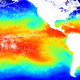
ชุดข้อมูลอุณหภูมิผิวน้ำทะเล AVHRR Pathfinder เวอร์ชัน 5.3 (PFV53) เป็นชุดข้อมูลอุณหภูมิผิวน้ำทะเลทั่วโลกขนาด 4 กม. ที่ได้ 2 ครั้งต่อวัน ซึ่งผลิตขึ้นโดยความร่วมมือระหว่างศูนย์ข้อมูลสมุทรศาสตร์แห่งชาติของ NOAA และโรงเรียนวิทยาศาสตร์ทางทะเลและบรรยากาศ Rosenstiel ของมหาวิทยาลัยไมอามี PFV53 … avhrr noaa oceans sst temperature wind -
NOAA CDR: Ocean Near-Surface Atmospheric Properties, Version 2
ชุดข้อมูลคุณสมบัติของชั้นบรรยากาศใกล้พื้นผิวทะเลเป็นส่วนหนึ่งของชุดข้อมูลพื้นผิวทะเล (OSB) ของ NOAA และให้บันทึกข้อมูลสภาพอากาศ (CDR) คุณภาพสูงเกี่ยวกับอุณหภูมิอากาศ ความเร็วลม และความชื้นจำเพาะเหนือพื้นผิวทะเลที่ไม่มีน้ำแข็ง ระบบจะคำนวณคุณสมบัติของชั้นบรรยากาศเหล่านี้ตามอุณหภูมิความสว่าง … ชั้นบรรยากาศ cdr รายชั่วโมง ความชื้น noaa มหาสมุทร -
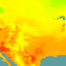
RTMA: การวิเคราะห์แบบเมโซสเกลแบบเรียลไทม์
การวิเคราะห์เมโซสเกลแบบเรียลไทม์ (RTMA) คือการวิเคราะห์สภาพอากาศใกล้พื้นผิวที่มีความละเอียดเชิงพื้นที่และเวลาสูง ชุดข้อมูลนี้ประกอบด้วยการวิเคราะห์รายชั่วโมงที่ 2.5 กม. สำหรับ CONUS ชั้นบรรยากาศ สภาพอากาศ เมฆ ธรณีฟิสิกส์ ความชื้น noaa -
GLDAS-2.0 ที่ประมวลผลใหม่: ระบบการปรับข้อมูลที่ดินทั่วโลก

ระบบการปรับข้อมูลที่ดินทั่วโลกของ NASA เวอร์ชัน 2 (GLDAS-2) มี 3 องค์ประกอบ ได้แก่ GLDAS-2.0, GLDAS-2.1 และ GLDAS-2.2 GLDAS-2.0 ใช้ข้อมูลอินพุตการบังคับทางอุตุนิยมวิทยาของ Princeton ทั้งหมด และให้ชุดข้อมูลที่สอดคล้องกันตามเวลาตั้งแต่ปี 1948 ถึง 2014 GLDAS-2.1 ถูกบังคับให้ใช้ร่วมกับโมเดล … ทุก 3 ชั่วโมง สภาพอากาศ cryosphere การระเหย forcing geophysical -
TerraClimate: Monthly Climate and Climatic Water Balance for Global Terrestrial Surfaces, University of Idaho
TerraClimate เป็นชุดข้อมูลเกี่ยวกับสภาพอากาศรายเดือนและสมดุลน้ำในสภาพอากาศสำหรับพื้นผิวโลกทั่วโลก โดยใช้การประมาณค่าที่ช่วยด้วยสภาพอากาศ ซึ่งรวมค่าปกติทางภูมิอากาศที่มีความละเอียดเชิงพื้นที่สูงจากชุดข้อมูล WorldClim เข้ากับข้อมูลที่มีความละเอียดเชิงพื้นที่หยาบกว่า แต่มีการเปลี่ยนแปลงตามเวลาจาก CRU Ts4.0 และการวิเคราะห์ซ้ำ 55 ปีของญี่ปุ่น (JRA55) … สภาพอากาศ ภัยแล้ง การคายระเหย ธรณีฟิสิกส์ ทั่วโลก merced -
WeatherNext 2

WeatherNext 2 เป็นชุดข้อมูลทดลองของการพยากรณ์อากาศแบบกลุ่มระยะปานกลางทั่วโลก ซึ่งสร้างขึ้นโดยโมเดลพยากรณ์อากาศแบบ Generative ของ Functional Network เวอร์ชันที่ใช้งานได้ของ Google DeepMind ชุดข้อมูลทดลองประกอบด้วยข้อมูลแบบเรียลไทม์และข้อมูลย้อนหลัง ข้อมูลเรียลไทม์คือข้อมูลใดก็ตามที่เกี่ยวข้องกับเวลาที่ … สภาพอากาศ พยากรณ์ gcp-public-data-weathernext หยาดน้ำฟ้า ชุดข้อมูลของผู้เผยแพร่ อุณหภูมิ -
WeatherNext 2 Mean
WeatherNext 2 Mean คือค่าเฉลี่ยของกลุ่มการพยากรณ์อากาศแบบกลุ่มระยะปานกลางทั่วโลก 64 กลุ่มจากชุดข้อมูลทดลอง ซึ่งสร้างขึ้นโดยโมเดลพยากรณ์อากาศเชิงสร้างสรรค์แบบเครือข่ายฟังก์ชันของ Google DeepMind เวอร์ชันที่ใช้งานได้ สำหรับชุดข้อมูลที่มีสมาชิกทั้งหมดของกลุ่ม โปรดดู WeatherNext 2 (ไม่ใช่ค่าเฉลี่ย) … สภาพอากาศ พยากรณ์ gcp-public-data-weathernext หยาดน้ำฟ้า ชุดข้อมูลของผู้เผยแพร่ อุณหภูมิ -
พยากรณ์อากาศรุ่นถัดไป

ประกาศการเลิกใช้งาน: เรามีกำหนดการที่จะเลิกใช้งานชุดข้อมูลนี้ในวันที่ 15 กรกฎาคม 2026 ผู้ใช้ต้องย้ายข้อมูลเวิร์กโฟลว์ที่ใช้งานอยู่ทั้งหมดไปยัง WeatherNext 2 เพื่อให้มั่นใจว่าบริการจะทำงานได้อย่างต่อเนื่อง ดูรายละเอียดเพิ่มเติมได้ที่หน้าการเลิกใช้งาน WeatherNext Gen เป็นชุดข้อมูลทดลองของการพยากรณ์อากาศแบบรวมระยะปานกลางทั่วโลกที่ผลิตโดย … สภาพอากาศ พยากรณ์ gcp-public-data-weathernext หยาดน้ำฟ้า ชุดข้อมูลของผู้เผยแพร่ อุณหภูมิ -
การพยากรณ์กราฟ WeatherNext

ประกาศการเลิกใช้งาน: เรามีกำหนดการที่จะเลิกใช้งานชุดข้อมูลนี้ในวันที่ 15 กรกฎาคม 2026 ผู้ใช้ต้องย้ายข้อมูลเวิร์กโฟลว์ที่ใช้งานอยู่ทั้งหมดไปยัง WeatherNext 2 เพื่อให้มั่นใจว่าบริการจะทำงานได้อย่างต่อเนื่อง ดูรายละเอียดเพิ่มเติมได้ที่หน้าการเลิกใช้งาน กราฟ WeatherNext เป็นชุดข้อมูลทดลองของพยากรณ์อากาศระยะปานกลางทั่วโลกที่ผลิตโดย … สภาพอากาศ พยากรณ์ gcp-public-data-weathernext หยาดน้ำฟ้า ชุดข้อมูลของผู้เผยแพร่ อุณหภูมิ