Page Summary
-
Numerous climate-related datasets are available, covering various aspects of Earth's systems including atmosphere, land surface, ocean, and cryosphere.
-
Datasets include both historical reanalysis products and near-real-time and projected forecast data.
-
High-resolution data is available for specific variables such as temperature, precipitation, radiation, land surface temperature, and methane concentrations.
-
Various temporal resolutions are offered, ranging from hourly and daily to 3-hourly, 8-daily, pentad, monthly, and annual data.
-
The datasets are sourced from multiple organizations including ECMWF, NASA, NOAA, JAXA, and Copernicus, and are primarily available through Google Earth Engine.
-
Breathing Earth System Simulator (BESS) Radiation v1
Breathing Earth System Simulator (BESS) is a simplified process-based model that couples atmosphere and canopy radiative transfers, canopy photosynthesis, transpiration, and energy balance. It couples an atmospheric radiative transfer model and artificial neural network with forcings from MODIS atmospheric products to generate 5-km daily products. … climate evapotranspiration gpp modis-derived par radiation -
CFSR: Climate Forecast System Reanalysis
The National Centers for Environmental Prediction (NCEP) Climate Forecast System Reanalysis (CFSR) was designed and executed as a global, high-resolution, coupled atmosphere-ocean-land surface-sea ice system to provide the best estimate of the state of these coupled domains over the 32-year period of record from January … climate daylight flux forecast geophysical ncep -
CFSV2: NCEP Climate Forecast System Version 2, 6-Hourly Products Harmonized
The National Centers for Environmental Prediction (NCEP) Climate Forecast System (CFS) is a fully coupled model representing the interaction between the Earth's atmosphere, oceans, land, and sea ice. CFS was developed at the Environmental Modeling Center (EMC) at NCEP. The operational CFS was upgraded to … climate daylight flux forecast geophysical ncep -
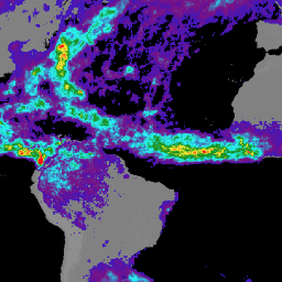
CHIRPS Precipitation Daily Near-Real-Time: Climate Hazards Center InfraRed Precipitation With Station Data (Version 3.0, IMERG-based)
The Climate Hazards Center Infrared Precipitation with Stations (CHIRPS v3) is a 40+ year, high-resolution quasi-global rainfall dataset. It spans 60°N to 60°S and covers all longitudes, providing data from 1981 to near-present. CHIRPS v3 combines satellite-based thermal infrared rainfall estimates with in-situ station observations … chc climate geophysical precipitation ucsb weather -
CHIRPS Precipitation Daily Reanalysis: Climate Hazards Center InfraRed Precipitation With Station Data (Version 3.0, ERA5-based)
The Climate Hazards Center Infrared Precipitation with Stations (CHIRPS v3) is a 40+ year, high-resolution quasi-global rainfall dataset. It spans 60°N to 60°S and covers all longitudes, providing data from 1981 to near-present. CHIRPS v3 combines satellite-based thermal infrared rainfall estimates with in-situ station observations … chc climate geophysical precipitation ucsb weather -
CHIRPS Precipitation Daily: Climate Hazards Center InfraRed Precipitation With Station Data (Version 2.0 Final)

Climate Hazards Center InfraRed Precipitation with Station data (CHIRPS) is a 30+ year quasi-global rainfall dataset. CHIRPS incorporates 0.05° resolution satellite imagery with in-situ station data to create gridded rainfall time series for trend analysis and seasonal drought monitoring. chg climate geophysical precipitation ucsb weather -
CHIRPS Precipitation Pentad: Climate Hazards Center InfraRed Precipitation With Station Data (Version 2.0 Final)
Climate Hazards Center InfraRed Precipitation with Station data (CHIRPS) is a 30+ year quasi-global rainfall dataset. CHIRPS incorporates 0.05° resolution satellite imagery with in-situ station data to create gridded rainfall time series for trend analysis and seasonal drought monitoring. chg climate geophysical precipitation ucsb weather -
CHIRPS Precipitation Pentad: Climate Hazards Center InfraRed Precipitation With Station Data (Version 3.0)
The Climate Hazards Center Infrared Precipitation with Stations (CHIRPS v3) is a 40+ year, high-resolution quasi-global rainfall dataset. It spans 60°N to 60°S and covers all longitudes, providing data from 1981 to near-present. CHIRPS v3 combines satellite-based thermal infrared rainfall estimates with in-situ station observations … chc chg climate geophysical precipitation ucsb -
CHIRTS Temperature Daily: Climate Hazards Center InfraRed Temperature with Stations daily data product

The Climate Hazards Center InfraRed Temperature with Stations daily temperature data product (CHIRTS-daily; Verdin et al. 2020) is a quasi global, high-resolution gridded dataset (0.05° × 0.05° resolution, 60°S - 70°N) that provides daily minimum (Tmin) and maximum 2-meter temperatures (Tmax) and four derived variables: saturation vapor … chg climate daily era5 geophysical reanalysis -
CPC Global Unified Temperature

This dataset provides a gridded analysis of daily surface air temperature over global land areas, including daily maximum (Tmax), minimum (Tmin) temperatures. Spanning from 1979 to the present, the data is presented on 0.5-degree latitude/longitude grids, aligning with the resolution of CPC's gauge-based global daily … climate daily noaa precipitation weather -
Copernicus Atmosphere Monitoring Service (CAMS) Global Near-Real-Time
The Copernicus Atmosphere Monitoring Service provides the capacity to continuously monitor the composition of the Earth's atmosphere at global and regional scales. The main global near-real-time production system is a data assimilation and forecasting suite providing two 5-day forecasts per day for aerosols and chemical … aerosol atmosphere climate copernicus ecmwf forecast -
Daymet V4: Daily Surface Weather and Climatological Summaries
Daymet V4 provides gridded estimates of daily weather parameters for Continental North America, Hawaii, and Puerto Rico (Data for Puerto Rico is available starting in 1950). It is derived from selected meteorological station data and various supporting data sources. Compared to the previous version, Daymet … climate daily daylight flux geophysical nasa -
Drained Organic Soils Emissions (Annual) 1.0
The two related FAO datasets on Drained Organic Soils provide estimates of: DROSA-A: area of Organic Soils (in hectares) drained for agricultural activities (cropland and grazed grassland) DROSE-A: carbon (C) and nitrous oxide (N2O) estimates (in gigagrams) from the agricultural drainage of organic soils under … agriculture climate climate-change emissions fao ghg -
ECMWF Near-Realtime IFS Atmospheric Forecasts

This dataset contains 15-day forecasts of the atmospheric model variables generated by the ECMWF Integrated Forecasting System (IFS) at 0.25 degree resolution. We refer to these as Near-Realtime (NRT) because new products are released twice a day after the release of the ECMWF realtime forecast … climate dewpoint ecmwf forecast global humidity -
ECMWF Near-Realtime IFS Wave (Short-Cutoff) Forecasts

This dataset contains 6-day forecasts of the wave model fields generated by the ECMWF Integrated Forecasting System (IFS) at 0.25 degree resolution. We refer to these as Near-Realtime (NRT) because new products are released twice a day after the release of the ECMWF realtime forecast … climate ecmwf forecast global oceans -
ECMWF Near-Realtime IFS Wave Forecasts

This dataset contains 15-day forecasts of the wave model fields generated by the ECMWF Integrated Forecasting System (IFS) at 0.25 degree resolution. We refer to these as Near-Realtime (NRT) because new products are released twice a day after the release of the ECMWF realtime forecast … climate ecmwf forecast global oceans -
ERA5 Daily Aggregates - Latest Climate Reanalysis Produced by ECMWF / Copernicus Climate Change Service

ERA5 is the fifth generation ECMWF atmospheric reanalysis of the global climate. Reanalysis combines model data with observations from across the world into a globally complete and consistent dataset. ERA5 replaces its predecessor, the ERA-Interim reanalysis. ERA5 DAILY provides aggregated values for each day for … climate copernicus dewpoint ecmwf era5 precipitation -
ERA5 Hourly - ECMWF Climate Reanalysis
ERA5 is the fifth generation ECMWF atmospheric reanalysis of the global climate. It is produced by the Copernicus Climate Change Service (C3S) at ECMWF. Reanalysis combines model data with observations from across the world into a globally complete and consistent dataset using the laws of … atmosphere climate copernicus ecmwf era5 hourly -
ERA5 Monthly Aggregates - Latest Climate Reanalysis Produced by ECMWF / Copernicus Climate Change Service
ERA5 is the fifth generation ECMWF atmospheric reanalysis of the global climate. Reanalysis combines model data with observations from across the world into a globally complete and consistent dataset. ERA5 replaces its predecessor, the ERA-Interim reanalysis. ERA5 MONTHLY provides aggregated values for each month for … climate copernicus dewpoint ecmwf era5 precipitation -
ERA5-Land Daily Aggregated - ECMWF Climate Reanalysis
ERA5-Land is a reanalysis dataset providing a consistent view of the evolution of land variables over several decades at an enhanced resolution compared to ERA5. ERA5-Land has been produced by replaying the land component of the ECMWF ERA5 climate reanalysis. Reanalysis combines model data with … cds climate copernicus ecmwf era5-land evaporation -
ERA5-Land Hourly - ECMWF Climate Reanalysis
ERA5-Land is a reanalysis dataset providing a consistent view of the evolution of land variables over several decades at an enhanced resolution compared to ERA5. ERA5-Land has been produced by replaying the land component of the ECMWF ERA5 climate reanalysis. Reanalysis combines model data with … cds climate copernicus ecmwf era5-land evaporation -
ERA5-Land Monthly Aggregated - ECMWF Climate Reanalysis
ERA5-Land is a reanalysis dataset providing a consistent view of the evolution of land variables over several decades at an enhanced resolution compared to ERA5. ERA5-Land has been produced by replaying the land component of the ECMWF ERA5 climate reanalysis. Reanalysis combines model data with … cds climate copernicus ecmwf era5-land evaporation -
ERA5-Land Monthly Averaged by Hour of Day - ECMWF Climate Reanalysis

ERA5-Land is a reanalysis dataset providing a consistent view of the evolution of land variables over several decades at an enhanced resolution compared to ERA5. ERA5-Land has been produced by replaying the land component of the ECMWF ERA5 climate reanalysis. Reanalysis combines model data with … cds climate copernicus ecmwf era5-land evaporation -
ERA5-Land Static - ECMWF Climate Reanalysis

ERA5-Land is a reanalysis dataset providing a consistent view of the evolution of land variables over several decades at an enhanced resolution compared to ERA5. ERA5-Land has been produced by replaying the land component of the ECMWF ERA5 climate reanalysis. Reanalysis combines model data with … cds climate copernicus ecmwf era5-land evaporation -
FLDAS: Famine Early Warning Systems Network (FEWS NET) Land Data Assimilation System
The FLDAS dataset (McNally et al. 2017), was designed to assist with food security assessments in data-sparse, developing country settings. It includes information on many climate-related variables including moisture content, humidity, evapotranspiration, average soil temperature, total precipitation rate, etc. There are multiple different FLDAS datasets; … climate cryosphere evapotranspiration humidity ldas monthly -
Farmscapes 2020
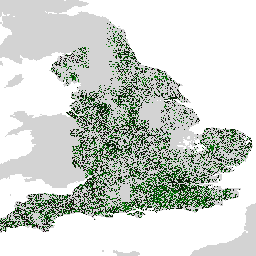
The Farmscapes 2020 dataset provides high-resolution (25cm) probability maps for three key semi-natural features within England's agricultural landscapes: hedgerows, woodland, and stone walls. This dataset was developed in collaboration with the Leverhulme Centre for Nature Recovery at Oxford to serve as a baseline for applications … biodiversity climate conservation ecological-connectivity forest landuse-landcover -
Farmscapes 2020 Vectorised
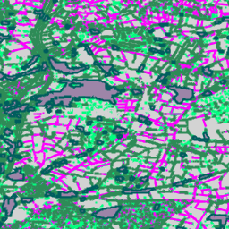
This is the vectorised version of the Farmscapes 2020 raster dataset. It provides polygon geometries representing fine-scale semi-natural landscape features (specifically hedgerows, woodland, and stone walls) across England's agricultural landscapes. This dataset was developed in collaboration with the Oxford Leverhulme Centre for Nature Recovery to … biodiversity climate conservation ecological-connectivity forest landuse-landcover -
Forest Typology (ForTy) 2020 v1.0

The Forest Typology (ForTy) v1 dataset consists of a global per-class probability map at 10 m resolution covering all land areas between 65°S and 84°N latitude for the year 2020. The six-class typology is aligned with FAO and EU Deforestation Regulation (EUDR) definitions: Class 1 … alphaearth-derived biodiversity climate conservation deforestation eudr -
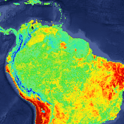
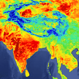
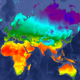
GCOM-C/SGLI L3 Land Surface Temperature (V1)
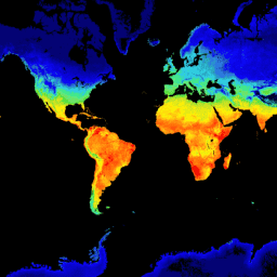
This product is the temperature of terrestrial land surface. A newer version JAXA/GCOM-C/L3/LAND/LST/V3 is also available for this dataset which uses this algorithm for processing. GCOM-C conducts long-term and continuous global observation and data collection to elucidate the mechanism behind fluctuations in radiation budget and … climate g-portal gcom gcom-c jaxa land -
GCOM-C/SGLI L3 Land Surface Temperature (V2)

This product is the temperature of terrestrial land surface. For data after 2021-11-28, see the V3 dataset. GCOM-C conducts long-term and continuous global observation and data collection to elucidate the mechanism behind fluctuations in radiation budget and carbon cycle needed to make accurate projections regarding … climate g-portal gcom gcom-c jaxa land -
GCOM-C/SGLI L3 Land Surface Temperature (V3)

This product is the temperature of terrestrial land surface. This is an ongoing dataset with a latency of 3-4 days. GCOM-C conducts long-term and continuous global observation and data collection to elucidate the mechanism behind fluctuations in radiation budget and carbon cycle needed to make … climate g-portal gcom gcom-c jaxa land -
GCOM-C/SGLI L3 Sea Surface Temperature (V1)
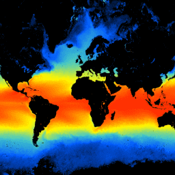
This product is the temperature of sea surface. A newer version JAXA/GCOM-C/L3/OCEAN/SST/V3 is also available for this dataset which uses this algorithm for processing. GCOM-C conducts long-term and continuous global observation and data collection to elucidate the mechanism behind fluctuations in radiation budget and carbon … climate g-portal gcom gcom-c jaxa oceans -
GCOM-C/SGLI L3 Sea Surface Temperature (V2)

This product is the temperature of sea surface. For data after 2021-11-28, see the V3 dataset. GCOM-C conducts long-term and continuous global observation and data collection to elucidate the mechanism behind fluctuations in radiation budget and carbon cycle needed to make accurate projections regarding future … climate g-portal gcom gcom-c jaxa oceans -
GCOM-C/SGLI L3 Sea Surface Temperature (V3)

This product is the temperature of sea surface. This is an ongoing dataset with a latency of 3-4 days. GCOM-C conducts long-term and continuous global observation and data collection to elucidate the mechanism behind fluctuations in radiation budget and carbon cycle needed to make accurate … climate g-portal gcom gcom-c jaxa oceans -
GFS: Global Forecast System 384-Hour Predicted Atmosphere Data
The Global Forecast System (GFS) is a weather forecast model produced by the National Centers for Environmental Prediction (NCEP). The GFS dataset consists of selected model outputs (described below) as gridded forecast variables. The 384-hour forecasts, with 1-hour (up to 120 hours) and 3-hour (after … climate cloud flux forecast geophysical humidity -
GLDAS-2.1: Global Land Data Assimilation System

NASA Global Land Data Assimilation System Version 2 (GLDAS-2) has three components: GLDAS-2.0, GLDAS-2.1, and GLDAS-2.2. GLDAS-2.0 is forced entirely with the Princeton meteorological forcing input data and provides a temporally consistent series from 1948 through 2014. GLDAS-2.1 is forced with a combination of model … 3-hourly climate cryosphere evaporation forcing geophysical -
GLDAS-2.2: Global Land Data Assimilation System
NASA Global Land Data Assimilation System Version 2 (GLDAS-2) has three components: GLDAS-2.0, GLDAS-2.1, and GLDAS-2.2. GLDAS-2.0 is forced entirely with the Princeton meteorological forcing input data and provides a temporally consistent series from 1948 through 2014. GLDAS-2.1 is forced with a combination of model … 3-hourly climate cryosphere evaporation forcing geophysical -
GPM: Global Precipitation Measurement (GPM) Release 07

Global Precipitation Measurement (GPM) is an international satellite mission to provide next-generation observations of rain and snow worldwide every three hours. The Integrated Multi-satellitE Retrievals for GPM (IMERG) is the unified algorithm that provides rainfall estimates combining data from all passive-microwave instruments in the GPM … climate geophysical gpm imerg jaxa nasa -
GPM: Monthly Global Precipitation Measurement (GPM) v6
IMERG-Final version "06" stopped being produced in September, 2021. Version "07" is expected to be released in September 2022 Global Precipitation Measurement (GPM) is an international satellite mission to provide next-generation observations of rain and snow worldwide every three hours. The Integrated Multi-satellitE Retrievals for … climate geophysical gpm imerg jaxa monthly -
GPM: Monthly Global Precipitation Measurement (GPM) vRelease 07

Global Precipitation Measurement (GPM) is an international satellite mission to provide next-generation observations of rain and snow worldwide every three hours. The Integrated Multi-satellitE Retrievals for GPM (IMERG) is the unified algorithm that provides rainfall estimates combining data from all passive-microwave instruments in the GPM … climate geophysical gpm imerg jaxa monthly -
GRIDMET DROUGHT: CONUS Drought Indices
This dataset contains drought indices derived from the 4-km daily Gridded Surface Meteorological (GRIDMET) dataset. The drought indices provided include the standardized precipitation index (SPI), the evaporative drought demand index (EDDI), the standardized precipitation evapotranspiration index (SPEI), the Palmer Drought Severity Index (PDSI) and Palmer … climate conus crop drought evapotranspiration geophysical -
GRIDMET: University of Idaho Gridded Surface Meteorological Dataset
The Gridded Surface Meteorological dataset provides high spatial resolution (~4-km) daily surface fields of temperature, precipitation, winds, humidity and radiation across the contiguous United States from 1979. The dataset blends the high resolution spatial data from PRISM with the high temporal resolution data from the … climate gridmet humidity merced metdata precipitation -
GSMaP Operational: Global Satellite Mapping of Precipitation - V6

Global Satellite Mapping of Precipitation (GSMaP) provides a global hourly rain rate with a 0.1 x 0.1 degree resolution. GSMaP is a product of the Global Precipitation Measurement (GPM) mission, which provides global precipitation observations at three hour intervals. Values are estimated using multi-band passive … climate geophysical gpm hourly jaxa precipitation -
GSMaP Operational: Global Satellite Mapping of Precipitation - V7
Global Satellite Mapping of Precipitation (GSMaP) provides a global hourly rain rate with a 0.1 x 0.1 degree resolution. GSMaP is a product of the Global Precipitation Measurement (GPM) mission, which provides global precipitation observations at three hour intervals. Values are estimated using multi-band passive … climate geophysical gpm hourly jaxa precipitation -
GSMaP Operational: Global Satellite Mapping of Precipitation - V8
Global Satellite Mapping of Precipitation (GSMaP) provides a global hourly rain rate with a 0.1 x 0.1 degree resolution. GSMaP is a product of the Global Precipitation Measurement (GPM) mission, which provides global precipitation observations at three hour intervals. Values are estimated using multi-band passive … climate geophysical gpm hourly jaxa precipitation -
GSMaP Reanalysis: Global Satellite Mapping of Precipitation
Global Satellite Mapping of Precipitation (GSMaP) provides a global hourly rain rate with a 0.1 x 0.1 degree resolution. GSMaP is a product of the Global Precipitation Measurement (GPM) mission, which provides global precipitation observations at three hour intervals. Values are estimated using multi-band passive … climate geophysical gpm hourly jaxa precipitation -
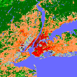
Global map of Local Climate Zones, latest version
Since their introduction in 2012, Local Climate Zones (LCZs) emerged as a new standard for characterizing urban landscapes, providing a holistic classification approach that takes into account micro-scale land-cover and associated physical properties. This global map of Local Climate Zones, at 100m pixel size and … climate landcover landuse-landcover urban -
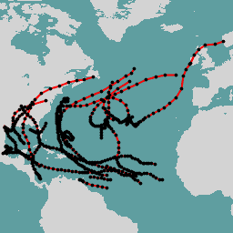
International Best Track Archive for Climate Stewardship Project

The International Best Track Archive for Climate Stewardship (IBTrACS) provides location and intensity for global tropical cyclones. The data span from the 1840s to present, generally providing data at 3-hour intervals. While the best track data is focused on position and intensity (maximum sustained wind … climate hurricane noaa table weather -
LST Day: Malaria Atlas Project Gap-Filled Daytime Land Surface Temperature (8-Daily 1km)

Daytime Land Surface Temperature (LST) are derived from the ~1km MODIS MOD11A2 v6.1 products. The 8-daily composites are converted to degrees Celsius and then gap-filled using the approach outlined in Weiss et al (2014) to eliminate missing data caused by factors such as cloud cover. … climate lst malariaatlasproject map publisher-dataset surface-temperature -
LST Day: Malaria Atlas Project Gap-Filled Daytime Land Surface Temperature (Annual 1km)

Daytime Land Surface Temperature (LST) are derived from the ~1km MODIS MOD11A2 v6.1 products. The 8-daily composites are converted to degrees Celsius and then gap-filled using the approach outlined in Weiss et al (2014) to eliminate missing data caused by factors such as cloud cover. … climate lst malariaatlasproject map publisher-dataset surface-temperature -
LST Day: Malaria Atlas Project Gap-Filled Daytime Land Surface Temperature (Monthly 1km)

Daytime Land Surface Temperature (LST) are derived from the ~1km MODIS MOD11A2 v6.1 products. The 8-daily composites are converted to degrees Celsius and then gap-filled using the approach outlined in Weiss et al (2014) to eliminate missing data caused by factors such as cloud cover. … climate lst malariaatlasproject map publisher-dataset surface-temperature -
LST Night: Malaria Atlas Project Gap-Filled Nighttime Land Surface Temperature (8-Daily 1km)

Nighttime Land Surface Temperature (LST) are derived from the ~1km MODIS MOD11A2 v6.1 products. The 8-daily composites are converted to degrees Celsius and then gap-filled using the approach outlined in Weiss et al (2014) to eliminate missing data caused by factors such as cloud cover. … climate lst malariaatlasproject map publisher-dataset surface-temperature -
LST Night: Malaria Atlas Project Gap-Filled Nighttime Land Surface Temperature (Annual 1km)

Nighttime Land Surface Temperature (LST) are derived from the ~1km MODIS MOD11A2 v6.1 products. The 8-daily composites are converted to degrees Celsius and then gap-filled using the approach outlined in Weiss et al (2014) to eliminate missing data caused by factors such as cloud cover. … climate lst malariaatlasproject map publisher-dataset surface-temperature -
LST Night: Malaria Atlas Project Gap-Filled Nighttime Land Surface Temperature (Monthly 1km)

Nighttime Land Surface Temperature (LST) are derived from the ~1km MODIS MOD11A2 v6.1 products. The 8-daily composites are converted to degrees Celsius and then gap-filled using the approach outlined in Weiss et al (2014) to eliminate missing data caused by factors such as cloud cover. … climate lst malariaatlasproject map publisher-dataset surface-temperature -
MACAv2-METDATA Monthly Summaries: University of Idaho, Multivariate Adaptive Constructed Analogs Applied to Global Climate Models
The MACAv2-METDATA dataset is a collection of 20 global climate models covering the conterminous USA. The Multivariate Adaptive Constructed Analogs (MACA) method is a statistical downscaling method which utilizes a training dataset (i.e. a meteorological observation dataset) to remove historical biases and match spatial patterns … climate conus geophysical idaho maca monthly -
MACAv2-METDATA: University of Idaho, Multivariate Adaptive Constructed Analogs Applied to Global Climate Models
The MACAv2-METDATA dataset is a collection of 20 global climate models covering the conterminous USA. The Multivariate Adaptive Constructed Analogs (MACA) method is a statistical downscaling method which utilizes a training dataset (i.e. a meteorological observation dataset) to remove historical biases and match spatial patterns … climate conus geophysical idaho maca monthly -
MCD18A1.062 Surface Radiation Daily/3-Hour

The MCD18A1 Version 6.2 is a Moderate Resolution Imaging Spectroradiometer (MODIS) Terra and Aqua combined Downward Shortwave Radiation (DSR) gridded Level 3 product produced daily at 1 kilometer pixel resolution with estimates of DSR every 3 hours. DSR is incident solar radiation over land surfaces … climate par radiation -
MCD18C2.062 Photosynthetically Active Radiation Daily 3-Hour

The MCD18C2 Version 6.2 is a Moderate Resolution Imaging Spectroradiometer (MODIS) Terra and Aqua combined Photosynthetically Active Radiation (PAR) gridded Level 3 product produced daily at 0.05 degree (5,600 meters at the equator) resolution with estimates of PAR every 3 hours. PAR is incident solar … climate par radiation -
MERRA-2 M2T1NXFLX: Surface Flux Diagnostics V5.12.4
M2T1NXFLX (or tavg1_2d_flx_Nx) is an hourly time-averaged data collection in Modern-Era Retrospective analysis for Research and Applications version 2 (MERRA-2). This collection consists of assimilated surface flux diagnostics, such as total precipitation, bias corrected total precipitation, surface air temperature, surface specific humidity, surface wind speed, … climate merra precipitation sea-salt so2 so4 -
MERRA-2 M2T1NXLND: Land Surface Diagnostics V5.12.4
M2T1NXLND (or tavg1_2d_lnd_Nx) is an hourly time-averaged data collection in Modern-Era Retrospective analysis for Research and Applications version 2 (MERRA-2). This collection consists of land surface diagnostics, such a baseflow flux, runoff, surface soil wetness, root zone soil wetness, water at surface layer, water at … climate cryosphere evaporation ice merra precipitation -
MERRA-2 M2T1NXRAD: Radiation Diagnostics V5.12.4
M2T1NXRAD (or tavg1_2d_rad_Nx) is an hourly time-averaged data collection in Modern-Era Retrospective analysis for Research and Applications version 2 (MERRA-2). This collection consists of radiation diagnostics, such as surface albedo, cloud area fraction, in cloud optical thickness, surface incoming shortwave flux (i.e. solar radiation), surface … albedo atmosphere climate emissivity merra shortwave -
MERRA-2 M2T1NXSLV: Single-Level Diagnostics V5.12.4
M2T1NXSLV (or tavg1_2d_slv_Nx) is an hourly time-averaged 2-dimensional data collection in Modern-Era Retrospective analysis for Research and Applications version 2 (MERRA-2). This collection consists of meteorology diagnostics at popularly used vertical levels, such as air temperature at 2-meter (or at 10-meter, 850hPa, 500 hPa, 250hPa), … atmosphere climate humidity merra nasa pressure -
MOD08_M3.061 Terra Atmosphere Monthly Global Product
MOD08_M3 V6.1 is an atmosphere global product that contains monthly 1 x 1 degree grid average values of atmospheric parameters. These parameters are related to atmospheric aerosol particle properties, total ozone burden, atmospheric water vapor, cloud optical and physical properties, and atmospheric stability indices. The … atmosphere climate geophysical global modis monthly -
MOD11A1.061 Terra Land Surface Temperature and Emissivity Daily Global 1km

The MOD11A1 V6.1 product provides daily land surface temperature (LST) and emissivity values in a 1200 x 1200 kilometer grid. The temperature value is derived from the MOD11_L2 swath product. Above 30 degrees latitude, some pixels may have multiple observations where the criteria for clear-sky … climate daily emissivity global lst modis -
MOD11A2.061 Terra Land Surface Temperature and Emissivity 8-Day Global 1km
The MOD11A2 V6.1 product provides an average 8-day land surface temperature (LST) in a 1200 x 1200 kilometer grid. Each pixel value in MOD11A2 is a simple average of all the corresponding MOD11A1 LST pixels collected within that 8 day period. The MOD11A2 does a … 8-day climate emissivity global lst mod11a2 -
MOD21A1D.061 Terra Land Surface Temperature and 3-Band Emissivity Daily Global 1km

The MOD21A1D dataset is produced daily from daytime Level 2 Gridded (L2G) intermediate LST products at a spatial resolution of 1,000 meters. The L2G process maps the daily MOD21 swath granules onto a sinusoidal MODIS grid and stores all observations falling over a gridded cell … climate daily emissivity global lst nasa -
MOD21A1N.061 Terra Land Surface Temperature and 3-Band Emissivity Daily Global 1km

The MOD21A1N dataset is produced daily from nighttime Level 2 Gridded (L2G) intermediate LST products at a spatial resolution of 1,000 meters. The L2G process maps the daily MOD21 swath granules onto a sinusoidal MODIS grid and stores all observations falling over a gridded cell … climate daily emissivity global lst nasa -
MOD21C1.061 Terra Land Surface Temperature and 3-Band Emissivity Daily L3 Global 0.05 Deg CMG
The MOD21C1 dataset is produced daily in a 0.05 degree (5,600 meters at the equator) Climate Modeling Grid (CMG) from daytime Level 2 Gridded (L2G) intermediate LST products. The L2G process maps the daily MOD21 swath granules onto a sinusoidal MODIS grid and stores all … climate daily emissivity global lst nasa -
MOD21C2.061 Terra Land Surface Temperature and 3-Band Emissivity 8-Day L3 Global 0.05 Deg CMG

The MOD21C2 dataset is an 8-day composite LST product that uses an algorithm based on a simple averaging method. The algorithm calculates the average from all the cloud free MOD21A1D and MOD21A1N daily acquisitions from the 8-day period. Unlike the MOD21A1 data sets where the … climate emissivity global lst nasa surface-temperature -
MOD21C3.061 Terra Land Surface Temperature and 3-Band Emissivity Monthly L3 Global 0.05 Deg CMG

The MOD21C3 dataset is a monthly composite LST product that uses an algorithm based on a simple averaging method. The algorithm calculates the average from all the cloud free MOD21A1D and MOD21A1N daily acquisitions from the 8-day period. Unlike the MOD21A1 data sets where the … climate emissivity global lst monthly nasa -
MYD08_M3.061 Aqua Atmosphere Monthly Global Product

MYD08_M3 V6.1 is an atmosphere global product that contains monthly 1 x 1 degree grid average values of atmospheric parameters. These parameters are related to atmospheric aerosol particle properties, total ozone burden, atmospheric water vapor, cloud optical and physical properties, and atmospheric stability indices. The … aqua atmosphere climate geophysical global modis -
MYD11A1.061 Aqua Land Surface Temperature and Emissivity Daily Global 1km

The MYD11A1 V6.1 product provides daily land surface temperature (LST) and emissivity values in a 1200 x 1200 kilometer grid. The temperature value is derived from the MYD11_L2 swath product. Above 30 degrees latitude, some pixels may have multiple observations where the criteria for clear-sky … aqua climate daily emissivity global lst -
MYD11A2.061 Aqua Land Surface Temperature and Emissivity 8-Day Global 1km

The MYD11A2 V6.1 product provides an average 8-day land surface temperature (LST) in a 1200 x 1200 kilometer grid. Each pixel value in MYD11A2 is a simple average of all the corresponding MYD11A1 LST pixels collected within that 8 day period. The MYD11A2 does a … 8-day aqua climate emissivity global lst -
MYD21A1D.061 Aqua Land Surface Temperature and 3-Band Emissivity Daily Global 1km

The MYD21A1D dataset is produced daily from daytime Level 2 Gridded (L2G) intermediate LST products at a spatial resolution of 1,000 meters. The L2G process maps the daily MOD21 swath granules onto a sinusoidal MODIS grid and stores all observations falling over a gridded cell … aqua climate daily emissivity global lst -
MYD21A1N.061 Aqua Land Surface Temperature and 3-Band Emissivity Daily Global 1km

The MYD21A1N dataset is produced daily from nighttime Level 2 Gridded (L2G) intermediate LST products at a spatial resolution of 1,000 meters. The L2G process maps the daily MOD21 swath granules onto a sinusoidal MODIS grid and stores all observations falling over a gridded cell … aqua climate daily emissivity global lst -
MYD21C1.061 Aqua Land Surface Temperature and 3-Band Emissivity Daily L3 Global 0.05 Deg CMG

The MYD21C1 dataset is produced daily in a 0.05 degree (5,600 meters at the equator) Climate Modeling Grid (CMG) from daytime Level 2 Gridded (L2G) intermediate LST products. The L2G process maps the daily MYD21 swath granules onto a sinusoidal MODIS grid and stores all … aqua climate daily emissivity global lst -
MYD21C2.061 Aqua Land Surface Temperature and 3-Band Emissivity 8-Day L3 Global 0.05 Deg CMG

The MYD21C2 dataset is an 8-day composite LST product that uses an algorithm based on a simple averaging method. The algorithm calculates the average from all the cloud free MYD21A1D and MYD21A1N daily acquisitions from the 8-day period. Unlike the MYD21A1 data sets where the … aqua climate emissivity global lst nasa -
MYD21C3.061 Aqua Land Surface Temperature and 3-Band Emissivity Monthly L3 Global 0.05 Deg CMG

The MYD21C3 dataset is a monthly composite LST product that uses an algorithm based on a simple averaging method. The algorithm calculates the average from all the cloud free MYD21A1D and MYD21A1N daily acquisitions from the 8-day period. Unlike the MYD21A1 data sets where the … aqua climate emissivity global lst monthly -
MethaneAIR L3 Concentration V1.1.0
This dataset provides geospatial data for the total column dry air mole fraction of methane in the atmosphere, "XCH4", as observed by the MethaneAIR imaging spectrometer. XCH4 is defined as the total column amount (number of molecules) of methane ("CH4") divided by the total amount … atmosphere climate edf edf-methanesat-ee emissions ghg -
MethaneAIR L3 Concentration v1

This dataset provides geospatial data for the total column dry air mole fraction of methane in the atmosphere, "XCH4", as observed by the MethaneAIR imaging spectrometer. XCH4 is defined as the total column amount (number of molecules) of methane ("CH4") divided by the total amount … atmosphere climate edf emissions ghg methane -
MethaneAIR L4 Area Sources v1

The area emissions model is still in development and not representative of a final product. This dataset provides spatially disaggregated methane emission fluxes (kg/hr) using measurements from MethaneAIR flights focused on oil and gas producing regions throughout the United States. Total emissions for the survey … atmosphere climate edf emissions ghg methane -
MethaneAIR L4 Point Sources V1.1.0

This dataset provides data for high-emitting methane point source detections (kg/hr) over 13 oil and gas or coal extraction areas from Colorado, New Mexico, and Texas in the west to Pennsylvania, Ohio, and West Virginia in the east, plus three urban areas (New York City, … atmosphere climate edf edf-methanesat-ee emissions ghg -
MethaneAIR L4 Point Sources v1

This dataset provides data for high-emitting methane point source detections (kg/hr) over 13 oil and gas or coal extraction areas from Colorado, New Mexico, and Texas in the west to Pennsylvania, Ohio, and West Virginia in the east, plus three urban areas (New York City, … atmosphere climate edf emissions ghg methane -
MethaneSAT L3 Concentration Public Preview V1.0.0

This early "Public Preview" dataset provides geospatial data for the column-averaged dry-air mole fraction of methane in the atmosphere, "XCH4", retrieved from measurements by the MethaneSAT imaging spectrometer. XCH4 is defined as the total column amount (number of molecules above a unit surface area) of … atmosphere climate edf edf-methanesat-ee emissions ghg -
MethaneSAT L4 Area Sources Public Preview V1.0.0

The dispersed area emissions model is still in development and not representative of a final product. This early "Public Preview" dataset provides high precision data for methane emissions from dispersed area sources. These emissions data come from the Appalachian, Permian, and Uinta basins in the … atmosphere climate edf edf-methanesat-ee emissions ghg -
MethaneSAT L4 Area Sources Public Preview V2.0.0

The dispersed area emissions model is still in development and not representative of a final product. This early "Public Preview" dataset provides high precision data for methane emissions from dispersed area sources. These novel measurements demonstrate the importance of quantifying total methane emissions with high … atmosphere climate edf edf-methanesat-ee emissions ghg -
MethaneSAT L4 Point Sources Public Preview V1.0.0

This early "Public Preview" dataset provides high precision data for methane emissions from discrete point sources. These methane emission fluxes were produced using a point source detection and emissions quantification framework specialized to exploit the high spatial resolution, wide spatial coverage, and high precision of … atmosphere climate edf edf-methanesat-ee emissions ghg -
NCEP-DOE Reanalysis 2 (Gaussian Grid), Total Cloud Coverage
This collection is no longer being updated. The Model is no longer being updated at the source. NCEP-DOE Reanalysis 2 project is using a state-of-the-art analysis/forecast system to perform data assimilation using past data from 1979 through the previous year. atmosphere climate cloud geophysical ncep noaa -
NCEP/NCAR Reanalysis Data, Sea-Level Pressure [deprecated]
The NCEP/NCAR Reanalysis Project is a joint project between the National Centers for Environmental Prediction (NCEP, formerly "NMC") and the National Center for Atmospheric Research (NCAR). The goal of this joint effort is to produce new atmospheric analyses using historical data as well as to … atmosphere climate geophysical ncep noaa pressure -
NCEP/NCAR Reanalysis Data, Surface Temperature [deprecated]
The NCEP/NCAR Reanalysis Project is a joint project between the National Centers for Environmental Prediction (NCEP, formerly "NMC") and the National Center for Atmospheric Research (NCAR). The goal of this joint effort is to produce new atmospheric analyses using historical data as well as to … atmosphere climate geophysical ncep noaa reanalysis -
NCEP/NCAR Reanalysis Data, Water Vapor [deprecated]

The NCEP/NCAR Reanalysis Project is a joint project between the National Centers for Environmental Prediction (NCEP, formerly "NMC") and the National Center for Atmospheric Research (NCAR). The goal of this joint effort is to produce new atmospheric analyses using historical data as well as to … atmosphere climate geophysical ncep noaa reanalysis -
NEX-DCP30: Ensemble Stats for NASA Earth Exchange Downscaled Climate Projections

The NASA NEX-DCP30 dataset is comprised of downscaled climate scenarios for the conterminous United States that are derived from the General Circulation Model (GCM) runs conducted under the Coupled Model Intercomparison Project Phase 5 (CMIP5, see Taylor et al. 2012) and across the four greenhouse … cag climate cmip5 geophysical ipcc nasa -
NEX-DCP30: NASA Earth Exchange Downscaled Climate Projections
The NASA NEX-DCP30 dataset is comprised of downscaled climate scenarios for the conterminous United States that are derived from the General Circulation Model (GCM) runs conducted under the Coupled Model Intercomparison Project Phase 5 (CMIP5, see Taylor et al. 2012) and across the four greenhouse … cag climate cmip5 geophysical ipcc nasa -
NEX-GDDP-CMIP6: NASA Earth Exchange Global Daily Downscaled Climate Projections
The NEX-GDDP-CMIP6 dataset is comprised of global downscaled climate scenarios derived from the General Circulation Model (GCM) runs conducted under the Coupled Model Intercomparison Project Phase 6 (CMIP6, see Thrasher et al. 2022) and across two of the four "Tier 1" greenhouse gas emissions scenarios … cag climate gddp geophysical ipcc nasa -
NEX-GDDP: NASA Earth Exchange Global Daily Downscaled Climate Projections
The NASA NEX-GDDP dataset is comprised of downscaled climate scenarios for the globe that are derived from the General Circulation Model (GCM) runs conducted under the Coupled Model Intercomparison Project Phase 5 (CMIP5, see Taylor et al. 2012) and across two of the four greenhouse … cag climate cmip5 gddp geophysical ipcc -
NLDAS-2: North American Land Data Assimilation System Forcing Fields
Land Data Assimilation System (LDAS) combines multiple sources of observations (such as precipitation gauge data, satellite data, and radar precipitation measurements) to produce estimates of climatological properties at or near the Earth''s surface. This dataset is the primary (default) forcing file (File A) for Phase … climate evaporation forcing geophysical hourly humidity -
NOAA CDR GRIDSAT-B1: Geostationary IR Channel Brightness Temperature
Note: This dataset has not been updated by the provider since 2024-03-31 due to ongoing infrastructure updates. There is no current timeline for when dataset updates will resume. This dataset provides a high quality Climate Data Record (CDR) of global infrared measurements from geostationary satellites. … brightness cdr climate infrared noaa reflectance -
NOAA CDR PATMOSX: Cloud Properties, Reflectance, and Brightness Temperatures, Version 5.3
This dataset provides high quality Climate Data Record (CDR) of multiple cloud properties along with Advanced Very High Resolution Radiometer (AVHRR) Pathfinder Atmospheres Extended (PATMOS-x) brightness temperatures and reflectances. These data have been fitted to a 0.1 x 0.1 equal angle-grid with both ascending and … atmospheric avhrr brightness cdr climate cloud -
NOAA NHC HURDAT2 Atlantic Hurricane Catalog
Hurricane best track database (HURDAT2). Atlantic basin 1851-2018. climate hurricane nhc noaa table weather -
NOAA NHC HURDAT2 Pacific Hurricane Catalog
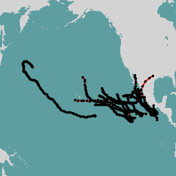
Hurricane best track database (HURDAT2). Pacific basin 1949-2018. climate hurricane nhc noaa table weather -
Natural Forests of the World 2020
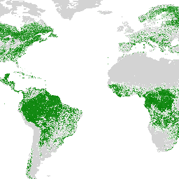
Natural Forests of the World 2020, provides a global map of natural forest probability for the year 2020 at a 10-meter resolution. It was developed to support initiatives like the European Union's Deforestation Regulation (EUDR) and other efforts for forest conservation and monitoring. The map … biodiversity climate conservation deforestation eudr forest -
OpenLandMap Long-term Land Surface Temperature Daytime Monthly Median
Land Surface Temperature daytime monthly mean value 2000-2017. Derived using the data.table package and quantile function in R. For more info about the MODIS LST product see this page. Antarctica is not included. To access and visualize maps outside of Earth Engine, use this page. … climate envirometrix lst mod11a2 modis monthly -
OpenLandMap Long-term Land Surface Temperature Daytime Monthly Standard Deviation

Long-term MODIS LST day-time and night-time temperatures standard deviation at 1 km based on the 2000-2017 time series. Derived using the data.table package and quantile function in R. For more info about the MODIS LST product see this page. Antarctica is not included. To access … climate envirometrix lst mod11a2 modis monthly -
OpenLandMap Long-term Land Surface Temperature Monthly Day-Night Difference
Long-term MODIS LST day-time and night-time differences at 1 km based on the 2000-2017 time series Derived using the data.table package and quantile function in R. For more info about the MODIS LST product see this page. Antarctica is not included. To access and visualize … climate day envirometrix lst mod11a2 modis -
Oya: 5km Quasi-Global Precipitation Estimates
Oya is a quasi-global, high-resolution precipitation estimation dataset derived from geostationary (GEO) satellite observations. The Oya model utilizes the full spectrum of visible and infrared (VIS-IR) channels from a constellation of GEO satellites — including GOES-16/18, Meteosat-9/10, and Himawari-8/9 — to generate precipitation estimates covering … climate geophysical gpm precipitation publisher-dataset weather -
PERSIANN-CDR: Precipitation Estimation From Remotely Sensed Information Using Artificial Neural Networks-Climate Data Record
PERSIANN-CDR is a daily quasi-global precipitation product that spans the period from 1983-01-01 to present. The data is produced quarterly, with a typical lag of three months. The product is developed by the Center for Hydrometeorology and Remote Sensing at the University of California, Irvine … cdr climate geophysical noaa precipitation weather -
PRISM Daily Spatial Climate Dataset ANd
The PRISM daily and monthly datasets are gridded climate datasets for the conterminous United States, produced by the PRISM Climate Group at Oregon State University. This collection contains both AN81 and AN91 data, indicated by the 'dataset_type' property. Grids are developed using PRISM (Parameter-elevation Regressions … climate daily geophysical oregonstate precipitation pressure -
PRISM Long-Term Average Climate Dataset Norm91m
The PRISM daily and monthly datasets are gridded climate datasets for the conterminous United States, produced by the PRISM Climate Group at Oregon State University. Grids are developed using PRISM (Parameter-elevation Regressions on Independent Slopes Model). PRISM interpolation routines simulate how weather and climate vary … climate geophysical oregonstate precipitation pressure prism -
PRISM Monthly Spatial Climate Dataset ANm
The PRISM daily and monthly datasets are gridded climate datasets for the conterminous United States, produced by the PRISM Climate Group at Oregon State University. This collection contains both AN81 and AN91 data, as indicated by the 'dataset_type' property. Grids are developed using PRISM (Parameter-elevation … climate geophysical monthly oregonstate precipitation pressure -
RTMA: Real-Time Mesoscale Analysis

The Real-Time Mesoscale Analysis (RTMA) is a high-spatial and temporal resolution analysis for near-surface weather conditions. This dataset includes hourly analyses at 2.5 km for CONUS. atmosphere climate cloud geophysical humidity noaa -
Reprocessed GLDAS-2.0: Global Land Data Assimilation System

NASA Global Land Data Assimilation System Version 2 (GLDAS-2) has three components: GLDAS-2.0, GLDAS-2.1, and GLDAS-2.2. GLDAS-2.0 is forced entirely with the Princeton meteorological forcing input data and provides a temporally consistent series from 1948 through 2014. GLDAS-2.1 is forced with a combination of model … 3-hourly climate cryosphere evaporation forcing geophysical -
SPEIbase: Standardised Precipitation-Evapotranspiration Index database, Version 2.11
The Global SPEI database (SPEIbase) offers long-time robust information about drought conditions at the global scale, with a 0.5 degree pixel size and monthly cadence. It provides SPEI time scales from 1 to 48 months. The Standardized Precipitation-Evapotranspiration Index (SPEI) expresses, as a standardized variate … climate climate-change drought evapotranspiration global monthly -
Sentinel-5P OFFL CH4: Offline Methane

OFFL/L3_CH4 This dataset provides offline high-resolution imagery of methane concentrations. Methane (CH4) is, after carbon dioxide (CO2), the most important contributor to the anthropogenically enhanced greenhouse effect. Roughly three-quarters of methane emissions are anthropogenic and as such, it is important to continue the record of … atmosphere climate copernicus esa eu knmi -
TOMS and OMI Merged Ozone Data v4
The Total Ozone Mapping Spectrometer (TOMS) data represent the primary long-term, continuous record of satellite-based observations available for use in monitoring global and regional trends in total ozone over the past 25 years. The data are produced by the Laboratory for Atmospheres at NASA's Goddard … atmosphere climate geophysical nasa ozone -
TRMM 3B42: 3-Hourly Precipitation Estimates

The Tropical Rainfall Measuring Mission (TRMM) is a joint mission between NASA and the Japan Aerospace Exploration Agency (JAXA) designed to monitor and study tropical rainfall. The 34B2 product contains a gridded, TRMM-adjusted, merged infrared precipitation (mm/hr) and RMS precipitation-error estimate, with a 3-hour temporal … 3-hourly climate geophysical jaxa nasa precipitation -
TRMM 3B43: Monthly Precipitation Estimates
This collection is no longer being updated. See IMERG monthly This dataset algorithmically merges microwave data from multiple satellites, including SSMI, SSMIS, MHS, AMSU-B and AMSR-E, each inter-calibrated to the TRMM Combined Instrument. Algorithm 3B43 is executed once per calendar month to produce the single, … climate geophysical jaxa nasa precipitation rainfall -
TerraClimate: Monthly Climate and Climatic Water Balance for Global Terrestrial Surfaces, University of Idaho
TerraClimate is a dataset of monthly climate and climatic water balance for global terrestrial surfaces. It uses climatically aided interpolation, combining high-spatial resolution climatological normals from the WorldClim dataset, with coarser spatial resolution, but time-varying data from CRU Ts4.0 and the Japanese 55-year Reanalysis (JRA55). … climate drought evapotranspiration geophysical global merced -
The Climate Hazards Center (CHC) Coupled Model Intercomparison Project Phase 6 (CHC-CMIP6)

CHC-CMIP6 was explicitly developed to support the analysis of climate-related hazards over the recent past and in the near-future. This climate projection dataset contains global, daily gridded data for the observational (1983-2016) and projection (2030 and 2050) periods to be used in the identification and … climate geophysical precipitation ucsb weather -
UN FAO Drained Organic Soils Area (Annual) 1.0

The two related FAO datasets on Drained Organic Soils provide estimates of: DROSA-A: area of Organic Soils (in hectares) drained for agricultural activities (cropland and grazed grassland) DROSE-A: carbon (C) and nitrous oxide (N2O) estimates (in gigagrams) from the agricultural drainage of organic soils under … agriculture climate climate-change emissions fao ghg -
VNP21A1D.002: Day Land Surface Temperature and Emissivity Daily 1km

The NASA Suomi National Polar-Orbiting Partnership (Suomi NPP) Visible Infrared Imaging Radiometer Suite (VIIRS) Land Surface Temperature and Emissivity (LST&E) Day Version 1 product (VNP21A1D) is compiled daily from daytime Level 2 Gridded (L2G) intermediate products. The L2G process maps the daily VNP21 swath granules … climate daily day land nasa noaa -
VNP21A1N.002: Night Land Surface Temperature and Emissivity Daily 1km

The NASA Suomi National Polar-Orbiting Partnership (Suomi NPP) Visible Infrared Imaging Radiometer Suite (VIIRS) Land Surface Temperature and Emissivity (LST&E) Night Version 1 product (VNP21A1N) is compiled daily from nighttime Level 2 Gridded (L2G) intermediate products. The L2G process maps the daily VNP21 swath granules … climate daily land nasa night noaa -
WeatherNext 2
WeatherNext 2 is an experimental dataset of global medium-range ensemble weather forecasts produced by an operational version of Google DeepMind's Functional Network Generative weather model. The experimental dataset includes real-time and historic data. Real-time data is any data that relates to a time that is … climate forecast gcp-public-data-weathernext precipitation publisher-dataset temperature -
WeatherNext 2 Mean
WeatherNext 2 Mean is the mean of 64 ensembles of an experimental dataset of global medium-range ensemble weather forecasts produced by an operational version of Google DeepMind's Functional Network Generative weather model. For a dataset containing all ensemble members, please see the (non-mean) WeatherNext 2 … climate forecast gcp-public-data-weathernext precipitation publisher-dataset temperature -
WeatherNext Gen Forecasts

DEPRECATION NOTICE: This dataset is scheduled for deprecation on July 15, 2026. To ensure service continuity, users must migrate all active workflows to WeatherNext 2. For more details, see our deprecation page. WeatherNext Gen is an experimental dataset of global medium-range ensemble weather forecasts produced … climate forecast gcp-public-data-weathernext precipitation publisher-dataset temperature -
WeatherNext Graph Forecasts

DEPRECATION NOTICE: This dataset is scheduled for deprecation on July 15, 2026. To ensure service continuity, users must migrate all active workflows to WeatherNext 2. For more details, see our deprecation page. WeatherNext Graph is an experimental dataset of global medium-range weather forecasts produced by … climate forecast gcp-public-data-weathernext precipitation publisher-dataset temperature -
WorldClim BIO Variables V1
WorldClim V1 Bioclim provides bioclimatic variables that are derived from the monthly temperature and rainfall in order to generate more biologically meaningful values. The bioclimatic variables represent annual trends (e.g., mean annual temperature, annual precipitation), seasonality (e.g., annual range in temperature and precipitation), and extreme … berkeley climate monthly precipitation temperature weather -
WorldClim Climatology V1

WorldClim version 1 has average monthly global climate data for minimum, mean, and maximum temperature and for precipitation. WorldClim version 1 was developed by Robert J. Hijmans, Susan Cameron, and Juan Parra, at the Museum of Vertebrate Zoology, University of California, Berkeley, in collaboration with … berkeley climate monthly precipitation temperature weather -
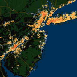
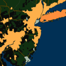
YCEO Surface Urban Heat Islands: Pixel-Level Annual Daytime and Nighttime Intensity

This dataset contains annual, summertime, and wintertime surface urban heat island (SUHI) intensities for day and night for over 10,000 urban clusters throughout the world. The dataset was created using the MODIS 8-day TERRA and AQUA land surface temperature (LST) products, the Landscan urban extent … climate uhi urban yale -
YCEO Surface Urban Heat Islands: Pixel-Level Composites of Yearly Summertime Daytime and Nighttime Intensity

This dataset contains annual, summertime, and wintertime surface urban heat island (SUHI) intensities for day and night for over 10,000 urban clusters throughout the world. The dataset was created using the MODIS 8-day TERRA and AQUA land surface temperature (LST) products, the Landscan urban extent … climate uhi urban yale -
YCEO Surface Urban Heat Islands: Pixel-Level Yearly Composites of Wintertime Daytime and Nighttime Intensity
This dataset contains annual, summertime, and wintertime surface urban heat island (SUHI) intensities for day and night for over 10,000 urban clusters throughout the world. The dataset was created using the MODIS 8-day TERRA and AQUA land surface temperature (LST) products, the Landscan urban extent … climate uhi urban yale -
YCEO Surface Urban Heat Islands: Spatially-Averaged Daytime and Nighttime Intensity for Annual, Summer, and Winter

This dataset contains annual, summertime, and wintertime surface urban heat island (SUHI) intensities for day and night for over 10,000 urban clusters throughout the world. The dataset was created using the MODIS 8-day TERRA and AQUA land surface temperature (LST) products, the Landscan urban extent … climate uhi urban yale -
YCEO Surface Urban Heat Islands: Spatially-Averaged Monthly Composites of Daytime and Nighttime Intensity
This dataset contains annual, summertime, and wintertime surface urban heat island (SUHI) intensities for day and night for over 10,000 urban clusters throughout the world. The dataset was created using the MODIS 8-day TERRA and AQUA land surface temperature (LST) products, the Landscan urban extent … climate uhi urban yale -
YCEO Surface Urban Heat Islands: Spatially-Averaged Yearly Composites of Annual Daytime and Nighttime Intensity

This dataset contains annual, summertime, and wintertime surface urban heat island (SUHI) intensities for day and night for over 10,000 urban clusters throughout the world. The dataset was created using the MODIS 8-day TERRA and AQUA land surface temperature (LST) products, the Landscan urban extent … climate uhi urban yale