Page Summary
-
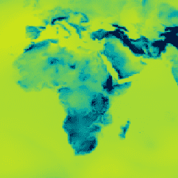
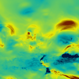
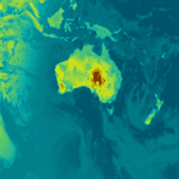
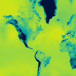
Multiple datasets offer continuous monitoring of Earth's atmospheric composition and air quality at various scales.
-
Diverse sensors and reanalysis projects provide data on aerosols, trace gases like methane, ozone, NO2, CO, and HCHO, as well as cloud properties and meteorological parameters.
-
Several sources focus on high-resolution mapping and detection of specific pollutants, including methane plumes and urban air quality.
-
Datasets are available in near-real-time and offline processing levels, with varying spatial and temporal resolutions.
-
Key providers include Copernicus (Sentinel-5P, CAMS), ECMWF (ERA5), NASA (EMIT, MERRA-2, MODIS, TOMS/OMI), NOAA (GOES-R, NCEP), and EDF (MethaneAIR, MethaneSAT).
-
Copernicus Atmosphere Monitoring Service (CAMS) Global Near-Real-Time
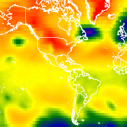
The Copernicus Atmosphere Monitoring Service provides the capacity to continuously monitor the composition of the Earth's atmosphere at global and regional scales. The main global near-real-time production system is a data assimilation and forecasting suite providing two 5-day forecasts per day for aerosols and chemical … aerosol atmosphere climate copernicus ecmwf forecast -
ERA5 Hourly - ECMWF Climate Reanalysis
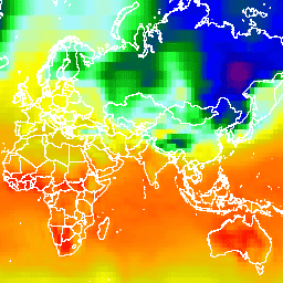
ERA5 is the fifth generation ECMWF atmospheric reanalysis of the global climate. It is produced by the Copernicus Climate Change Service (C3S) at ECMWF. Reanalysis combines model data with observations from across the world into a globally complete and consistent dataset using the laws of … atmosphere climate copernicus ecmwf era5 hourly -
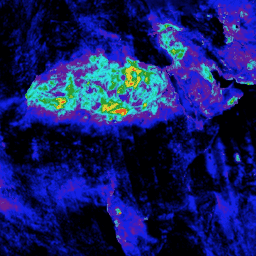
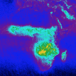
Earth Surface Mineral Dust Source Investigation- Methane Enhancement

The EMIT Project is part of the Earth Venture-Instrument (EV-I) Program directed by the Program Director of the NASA Earth Science Division (ESD). EMIT is comprised of a VSWIR Infrared Dyson imaging spectrometer adapted for installation on the International Space Station (ISS). EMIT measures radiance … atmosphere daily emit methane nasa -
Earth Surface Mineral Dust Source Investigation- Methane Plume Complexes
The EMIT Project is part of the Earth Venture-Instrument (EV-I) Program directed by the Program Director of the NASA Earth Science Division (ESD). EMIT is comprised of a VSWIR Infrared Dyson imaging spectrometer adapted for installation on the International Space Station (ISS). EMIT measures radiance … atmosphere daily emit methane nasa -
GEOS-CF Ana htf v2: Goddard Earth Observing System Composition Forecast
This dataset contains analysis (ana) of high-temporal frequency data (htf) at 15 minute intervals. It is created from the original GEOS-CF collection htf_inst_15mn_glo_L1440x721_slv. The Goddard Earth Observing System Composition Forecast (GEOS-CF) system is a global constituent prediction system from NASA's Global Modeling and Assimilation Office(GMAO). … atmosphere composition forecast geos geos-cf gmao -
GEOS-CF ana tavg1hr v2: Goddard Earth Observing System Composition Forecast
This dataset contains meteorological analysis (ana) of time-average one hour data (tavg1hr). It is built by merging the original GEOS-CF collections chm_tavg_1hr_glo_L1440x721_slv, met_tavg_1hr_glo_L1440x721_slv, and xgc_tavg_1hr_glo_L1440x721_slv. The Goddard Earth Observing System Composition Forecast (GEOS-CF) system is a global constituent prediction system from NASA's Global Modeling and … atmosphere composition forecast geos geos-cf gmao -
GEOS-CF fcst htf v1: Goddard Earth Observing System Composition Forecast
This dataset contains meteorological forecast (fcst) of high-temporal frequency data (htf). Use the 'creation_time' and 'forecast_time' properties to select data of interest. The Goddard Earth Observing System Composition Forecast (GEOS-CF) system is a global constituent prediction system from NASA's Global Modeling and Assimilation Office (GMAO). … atmosphere composition forecast geos gmao nasa -
GEOS-CF fcst htf v2: Goddard Earth Observing System Composition Forecast
This dataset contains forecast (fcst) of high-temporal frequency data (htf) at 15 minute intervals. It is created from the original GEOS-CF collection htf_inst_15mn_glo_L1440x721_slv. Use the 'creation_time' and 'forecast_time' properties to select data of interest. The Goddard Earth Observing System Composition Forecast (GEOS-CF) system is a … atmosphere composition forecast geos geos-cf gmao -
GEOS-CF fcst tavg1hr v1: Goddard Earth Observing System Composition Forecast

This dataset contains meteorological forecast (fcst) of time-averaged frequency data (tavg1hr). Use the 'creation_time' and 'forecast_time' properties to select data of interest. The Goddard Earth Observing System Composition Forecast (GEOS-CF) system is a global constituent prediction system from NASA's Global Modeling and Assimilation Office (GMAO). … atmosphere composition forecast geos gmao nasa -
GEOS-CF fcst tavg1hr v2: Goddard Earth Observing System Composition Forecast

This dataset contains forecast (fcst) of time-averaged frequency data (tavg1hr). It is built by merging the original GEOS-CF collections chm_tavg_1hr_glo_L1440x721_slv, met_tavg_1hr_glo_L1440x721_slv, and xgc_tavg_1hr_glo_L1440x721_slv. Use the 'creation_time' and 'forecast_time' properties to select data of interest. The Goddard Earth Observing System Composition Forecast (GEOS-CF) system is a … atmosphere composition forecast geos geos-cf gmao -
GEOS-CF rpl htf v1: Goddard Earth Observing System Composition Forecast

This dataset contains meteorological replay (rpl) of high-temporal frequency data (htf). The Goddard Earth Observing System Composition Forecast (GEOS-CF) system is a global constituent prediction system from NASA's Global Modeling and Assimilation Office (GMAO). GEOS-CF offers a new tool for atmospheric chemistry research, with the … atmosphere composition forecast geos gmao nasa -
GEOS-CF rpl tavg1hr v1: Goddard Earth Observing System Composition Forecast
This dataset contains meteorological replay (rpl) of time-average one hour data (tavg1hr). It is built by merging the original GEOS-CF collections chm_tavg_1hr_g1440x721_v1, met_tavg_1hr_g1440x721_x1, and xgc_tavg_1hr_g1440x721_x1. The Goddard Earth Observing System Composition Forecast (GEOS-CF) system is a global constituent prediction system from NASA's Global Modeling and … atmosphere composition forecast geos gmao nasa -
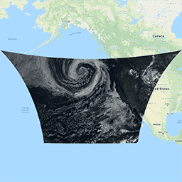
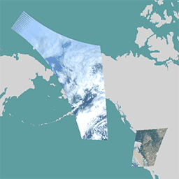
GOES-16 MCMIPC Series ABI Level 2 Cloud and Moisture Imagery CONUS
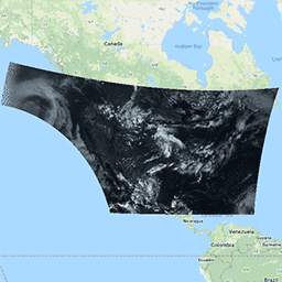
The Cloud and Moisture Imagery products are all at 2km resolution. Bands 1-6 are reflective. The dimensionless "reflectance factor" quantity is normalized by the solar zenith angle. These bands support the characterization of clouds, vegetation, snow/ice, and aerosols. Bands 7-16 are emissive. The brightness temperature … abi atmosphere goes goes-16 goes-east goes-r -
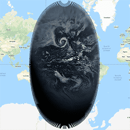
GOES-16 MCMIPF Series ABI Level 2 Cloud and Moisture Imagery Full Disk
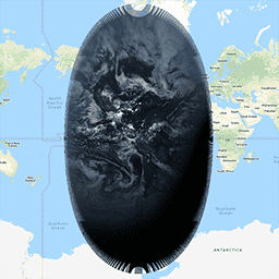
The Cloud and Moisture Imagery products are all at 2km resolution. Bands 1-6 are reflective. The dimensionless "reflectance factor" quantity is normalized by the solar zenith angle. These bands support the characterization of clouds, vegetation, snow/ice, and aerosols. Bands 7-16 are emissive. The brightness temperature … abi atmosphere goes goes-16 goes-east goes-r -
GOES-16 MCMIPM Series ABI Level 2 Cloud and Moisture Imagery Mesoscale
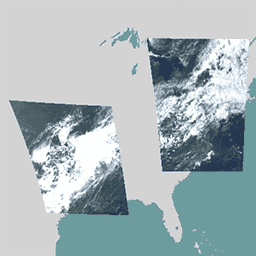
The Cloud and Moisture Imagery products are all at 2km resolution. Bands 1-6 are reflective. The dimensionless "reflectance factor" quantity is normalized by the solar zenith angle. These bands support the characterization of clouds, vegetation, snow/ice, and aerosols. Bands 7-16 are emissive. The brightness temperature … abi atmosphere goes goes-16 goes-east goes-r -
GOES-17 MCMIPC Series ABI Level 2 Cloud and Moisture Imagery CONUS
The Cloud and Moisture Imagery products are all at 2km resolution. Bands 1-6 are reflective. The dimensionless "reflectance factor" quantity is normalized by the solar zenith angle. These bands support the characterization of clouds, vegetation, snow/ice, and aerosols. Bands 7-16 are emissive. The brightness temperature … abi atmosphere goes goes-17 goes-s mcmip -
GOES-17 MCMIPF Series ABI Level 2 Cloud and Moisture Imagery Full Disk
The Cloud and Moisture Imagery products are all at 2km resolution. Bands 1-6 are reflective. The dimensionless "reflectance factor" quantity is normalized by the solar zenith angle. These bands support the characterization of clouds, vegetation, snow/ice, and aerosols. Bands 7-16 are emissive. The brightness temperature … abi atmosphere goes goes-17 goes-s mcmip -
GOES-17 MCMIPM Series ABI Level 2 Cloud and Moisture Imagery Mesoscale
The Cloud and Moisture Imagery products are all at 2km resolution. Bands 1-6 are reflective. The dimensionless "reflectance factor" quantity is normalized by the solar zenith angle. These bands support the characterization of clouds, vegetation, snow/ice, and aerosols. Bands 7-16 are emissive. The brightness temperature … abi atmosphere goes goes-17 goes-s mcmip -
GOES-18 MCMIPC Series ABI Level 2 Cloud and Moisture Imagery CONUS

The Cloud and Moisture Imagery products are all at 2km resolution. Bands 1-6 are reflective. The dimensionless "reflectance factor" quantity is normalized by the solar zenith angle. These bands support the characterization of clouds, vegetation, snow/ice, and aerosols. Bands 7-16 are emissive. The brightness temperature … abi atmosphere goes goes-18 goes-t goes-west -
GOES-18 MCMIPF Series ABI Level 2 Cloud and Moisture Imagery Full Disk

The Cloud and Moisture Imagery products are all at 2km resolution. Bands 1-6 are reflective. The dimensionless "reflectance factor" quantity is normalized by the solar zenith angle. These bands support the characterization of clouds, vegetation, snow/ice, and aerosols. Bands 7-16 are emissive. The brightness temperature … abi atmosphere goes goes-18 goes-t goes-west -
GOES-18 MCMIPM Series ABI Level 2 Cloud and Moisture Imagery Mesoscale

The Cloud and Moisture Imagery products are all at 2km resolution. Bands 1-6 are reflective. The dimensionless "reflectance factor" quantity is normalized by the solar zenith angle. These bands support the characterization of clouds, vegetation, snow/ice, and aerosols. Bands 7-16 are emissive. The brightness temperature … abi atmosphere goes goes-18 goes-t goes-west -
GOES-19 MCMIPC Series ABI Level 2 Cloud and Moisture Imagery CONUS

The Cloud and Moisture Imagery products are all at 2km resolution. Bands 1-6 are reflective. The dimensionless "reflectance factor" quantity is normalized by the solar zenith angle. These bands support the characterization of clouds, vegetation, snow/ice, and aerosols. Bands 7-16 are emissive. The brightness temperature … abi atmosphere goes goes-19 goes-east goes-u -
GOES-19 MCMIPF Series ABI Level 2 Cloud and Moisture Imagery Full Disk

The Cloud and Moisture Imagery products are all at 2km resolution. Bands 1-6 are reflective. The dimensionless "reflectance factor" quantity is normalized by the solar zenith angle. These bands support the characterization of clouds, vegetation, snow/ice, and aerosols. Bands 7-16 are emissive. The brightness temperature … abi atmosphere goes goes-19 goes-east goes-u -
GOES-19 MCMIPM Series ABI Level 2 Cloud and Moisture Imagery Mesoscale

The Cloud and Moisture Imagery products are all at 2km resolution. Bands 1-6 are reflective. The dimensionless "reflectance factor" quantity is normalized by the solar zenith angle. These bands support the characterization of clouds, vegetation, snow/ice, and aerosols. Bands 7-16 are emissive. The brightness temperature … abi atmosphere goes goes-19 goes-east goes-u -
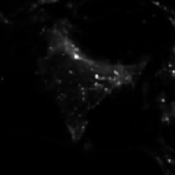
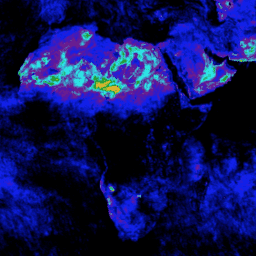
Google Street View Air Quality: High Resolution Air Pollution Mapping in California
This large vector dataset contains high resolution air pollution mapping of NO, NO2, O3, CH4, CO2, BC, PN2.5, and UFP concentrations in California between June 2015 and June 2019. The dataset consists of measurements collected using four Google Street View vehicles equipped with the Aclima … air-quality atmosphere nitrogen-dioxide pollution table -
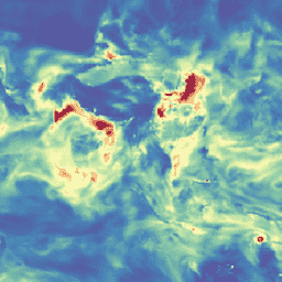
MCD19A2.061: Terra & Aqua MAIAC Land Aerosol Optical Depth Daily 1km
The MCD19A2 V6.1 data product is a MODIS Terra and Aqua combined Multi-angle Implementation of Atmospheric Correction (MAIAC) Land Aerosol Optical Depth (AOD) gridded Level 2 product produced daily at 1 km resolution. For more information see the MAIAC user guide. NOTE: This product has … aerosol aod aqua atmosphere daily global -
MERRA-2 M2I3NVAER: Aerosol Mixing Ratio V5.12.4
M2I3NVAER (or inst3_3d_aer_Nv) is an instantaneous 3-dimensional 3-hourly data collection in Modern-Era Retrospective analysis for Research and Applications version 2 (MERRA-2). This collection consists of assimilations of aerosol mixing ratio parameters at 72 model layers, such as dust, sulphur dioxide, sea salt, black carbon, and … aerosol atmosphere dust mass merra nasa -
MERRA-2 M2T1NXAER: Aerosol Diagnostics V5.12.4
M2T1NXAER (or tavg1_2d_aer_Nx) is an hourly time-averaged 2-dimensional data collection in Modern-Era Retrospective analysis for Research and Applications version 2 (MERRA-2). This collection consists of assimilated aerosol diagnostics, such as column mass density of aerosol components (black carbon, dust, sea-salt, sulfate, and organic carbon), surface … aerosol atmosphere carbon dust mass merra -
MERRA-2 M2T1NXRAD: Radiation Diagnostics V5.12.4
M2T1NXRAD (or tavg1_2d_rad_Nx) is an hourly time-averaged data collection in Modern-Era Retrospective analysis for Research and Applications version 2 (MERRA-2). This collection consists of radiation diagnostics, such as surface albedo, cloud area fraction, in cloud optical thickness, surface incoming shortwave flux (i.e. solar radiation), surface … albedo atmosphere climate emissivity merra shortwave -
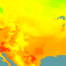
MERRA-2 M2T1NXSLV: Single-Level Diagnostics V5.12.4
M2T1NXSLV (or tavg1_2d_slv_Nx) is an hourly time-averaged 2-dimensional data collection in Modern-Era Retrospective analysis for Research and Applications version 2 (MERRA-2). This collection consists of meteorology diagnostics at popularly used vertical levels, such as air temperature at 2-meter (or at 10-meter, 850hPa, 500 hPa, 250hPa), … atmosphere climate humidity merra nasa pressure -
MOD08_M3.061 Terra Atmosphere Monthly Global Product
MOD08_M3 V6.1 is an atmosphere global product that contains monthly 1 x 1 degree grid average values of atmospheric parameters. These parameters are related to atmospheric aerosol particle properties, total ozone burden, atmospheric water vapor, cloud optical and physical properties, and atmospheric stability indices. The … atmosphere climate geophysical global modis monthly -
MYD08_M3.061 Aqua Atmosphere Monthly Global Product

MYD08_M3 V6.1 is an atmosphere global product that contains monthly 1 x 1 degree grid average values of atmospheric parameters. These parameters are related to atmospheric aerosol particle properties, total ozone burden, atmospheric water vapor, cloud optical and physical properties, and atmospheric stability indices. The … aqua atmosphere climate geophysical global modis -
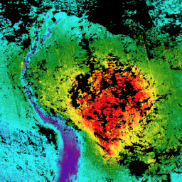
MethaneAIR L3 Concentration V1.1.0
This dataset provides geospatial data for the total column dry air mole fraction of methane in the atmosphere, "XCH4", as observed by the MethaneAIR imaging spectrometer. XCH4 is defined as the total column amount (number of molecules) of methane ("CH4") divided by the total amount … atmosphere climate edf edf-methanesat-ee emissions ghg -
MethaneAIR L3 Concentration v1

This dataset provides geospatial data for the total column dry air mole fraction of methane in the atmosphere, "XCH4", as observed by the MethaneAIR imaging spectrometer. XCH4 is defined as the total column amount (number of molecules) of methane ("CH4") divided by the total amount … atmosphere climate edf emissions ghg methane -
MethaneAIR L4 Area Sources v1

The area emissions model is still in development and not representative of a final product. This dataset provides spatially disaggregated methane emission fluxes (kg/hr) using measurements from MethaneAIR flights focused on oil and gas producing regions throughout the United States. Total emissions for the survey … atmosphere climate edf emissions ghg methane -
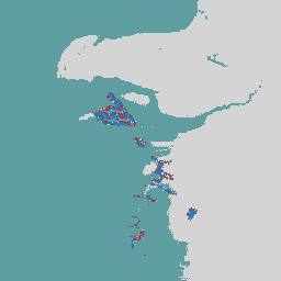
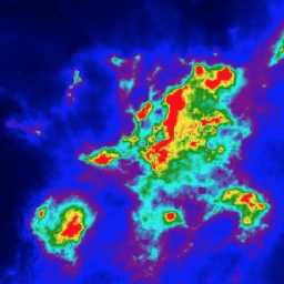
MethaneAIR L4 Point Sources V1.1.0
This dataset provides data for high-emitting methane point source detections (kg/hr) over 13 oil and gas or coal extraction areas from Colorado, New Mexico, and Texas in the west to Pennsylvania, Ohio, and West Virginia in the east, plus three urban areas (New York City, … atmosphere climate edf edf-methanesat-ee emissions ghg -
MethaneAIR L4 Point Sources v1

This dataset provides data for high-emitting methane point source detections (kg/hr) over 13 oil and gas or coal extraction areas from Colorado, New Mexico, and Texas in the west to Pennsylvania, Ohio, and West Virginia in the east, plus three urban areas (New York City, … atmosphere climate edf emissions ghg methane -
MethaneSAT L3 Concentration Public Preview V1.0.0

This early "Public Preview" dataset provides geospatial data for the column-averaged dry-air mole fraction of methane in the atmosphere, "XCH4", retrieved from measurements by the MethaneSAT imaging spectrometer. XCH4 is defined as the total column amount (number of molecules above a unit surface area) of … atmosphere climate edf edf-methanesat-ee emissions ghg -
MethaneSAT L4 Area Sources Public Preview V1.0.0

The dispersed area emissions model is still in development and not representative of a final product. This early "Public Preview" dataset provides high precision data for methane emissions from dispersed area sources. These emissions data come from the Appalachian, Permian, and Uinta basins in the … atmosphere climate edf edf-methanesat-ee emissions ghg -
MethaneSAT L4 Area Sources Public Preview V2.0.0

The dispersed area emissions model is still in development and not representative of a final product. This early "Public Preview" dataset provides high precision data for methane emissions from dispersed area sources. These novel measurements demonstrate the importance of quantifying total methane emissions with high … atmosphere climate edf edf-methanesat-ee emissions ghg -
MethaneSAT L4 Point Sources Public Preview V1.0.0

This early "Public Preview" dataset provides high precision data for methane emissions from discrete point sources. These methane emission fluxes were produced using a point source detection and emissions quantification framework specialized to exploit the high spatial resolution, wide spatial coverage, and high precision of … atmosphere climate edf edf-methanesat-ee emissions ghg -
NCEP-DOE Reanalysis 2 (Gaussian Grid), Total Cloud Coverage
This collection is no longer being updated. The Model is no longer being updated at the source. NCEP-DOE Reanalysis 2 project is using a state-of-the-art analysis/forecast system to perform data assimilation using past data from 1979 through the previous year. atmosphere climate cloud geophysical ncep noaa -
NCEP/NCAR Reanalysis Data, Sea-Level Pressure [deprecated]
The NCEP/NCAR Reanalysis Project is a joint project between the National Centers for Environmental Prediction (NCEP, formerly "NMC") and the National Center for Atmospheric Research (NCAR). The goal of this joint effort is to produce new atmospheric analyses using historical data as well as to … atmosphere climate geophysical ncep noaa pressure -
NCEP/NCAR Reanalysis Data, Surface Temperature [deprecated]
The NCEP/NCAR Reanalysis Project is a joint project between the National Centers for Environmental Prediction (NCEP, formerly "NMC") and the National Center for Atmospheric Research (NCAR). The goal of this joint effort is to produce new atmospheric analyses using historical data as well as to … atmosphere climate geophysical ncep noaa reanalysis -
NCEP/NCAR Reanalysis Data, Water Vapor [deprecated]

The NCEP/NCAR Reanalysis Project is a joint project between the National Centers for Environmental Prediction (NCEP, formerly "NMC") and the National Center for Atmospheric Research (NCAR). The goal of this joint effort is to produce new atmospheric analyses using historical data as well as to … atmosphere climate geophysical ncep noaa reanalysis -
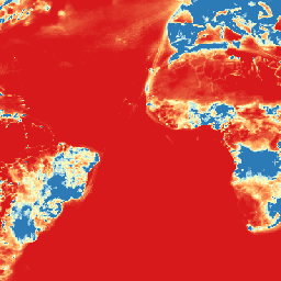
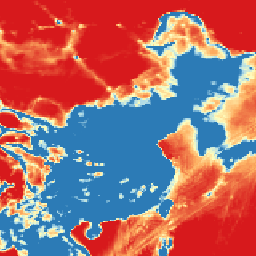
NOAA CDR AVHRR AOT: Daily Aerosol Optical Thickness Over Global Oceans, v04
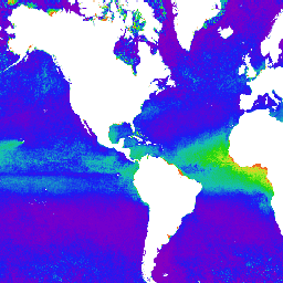
The NOAA Climate Data Record (CDR) of Aerosol Optical Thickness (AOT) is a collection of global daily 0.1 degree derived data from the PATMOS-x AVHRR level-2b channel 1 (0.63 micron) orbital clear-sky radiance. The aerosol product is generated from AVHRR imagery in cloud-free conditions during … aerosol atmosphere atmospheric avhrr cdr daily -
RTMA: Real-Time Mesoscale Analysis

The Real-Time Mesoscale Analysis (RTMA) is a high-spatial and temporal resolution analysis for near-surface weather conditions. This dataset includes hourly analyses at 2.5 km for CONUS. atmosphere climate cloud geophysical humidity noaa -
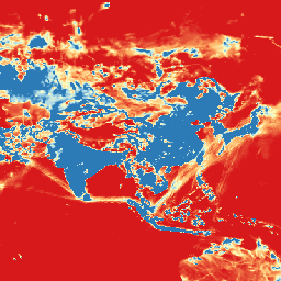
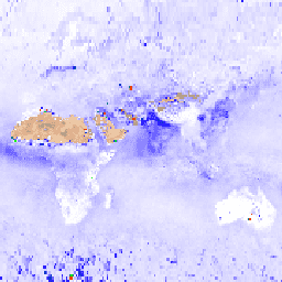
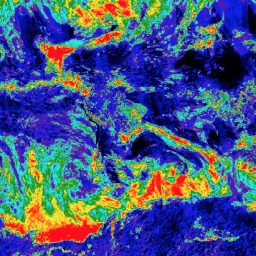
Sentinel-5P NRTI AER AI: Near Real-Time UV Aerosol Index
NRTI/L3_AER_AI This dataset provides near real-time high-resolution imagery of the UV Aerosol Index (UVAI), also called the Absorbing Aerosol Index (AAI). The AAI is based on wavelength-dependent changes in Rayleigh scattering in the UV spectral range for a pair of wavelengths. The difference between observed … aai aerosol air-quality atmosphere copernicus esa -
Sentinel-5P NRTI AER LH: Near Real-Time UV Aerosol Layer Height
NRTI/L3_AER_LH This dataset provides offline high-resolution imagery of the UV Aerosol Index (UVAI), also called the Absorbing Layer Height (ALH). The ALH is very sensitive to cloud contamination. However, aerosols and clouds can be difficult to distinguish, and ALH is computed for all FRESCO effective … aerosol air-quality alh atmosphere copernicus esa -
Sentinel-5P NRTI CLOUD: Near Real-Time Cloud Properties

NRTI/L3_CLOUD This dataset provides near real-time high-resolution imagery of cloud parameters. The TROPOMI/S5P cloud properties retrieval is based on the OCRA and ROCINN algorithms currently being used in the operational GOME and GOME-2 products. OCRA retrieves the cloud fraction using measurements in the UV/VIS spectral … atmosphere cloud copernicus dlr esa eu -
Sentinel-5P NRTI CO: Near Real-Time Carbon Monoxide
NRTI/L3_CO This dataset provides near real-time high-resolution imagery of CO concentrations. Carbon monoxide (CO) is an important atmospheric trace gas for understanding tropospheric chemistry. In certain urban areas, it is a major atmospheric pollutant. Main sources of CO are combustion of fossil fuels, biomass burning, … air-quality atmosphere carbon-monoxide copernicus esa eu -
Sentinel-5P NRTI HCHO: Near Real-Time Formaldehyde

NRTI/L3_HCHO This dataset provides near real-time high-resolution imagery of atmospheric formaldehyde (HCHO) concentrations. Formaldehyde is an intermediate gas in almost all oxidation chains of non-methane volatile organic compounds (NMVOC), leading eventually to CO2. Non-Methane Volatile Organic Compounds (NMVOCs) are, together with NOx, CO and CH4, … air-quality atmosphere bira copernicus dlr esa -
Sentinel-5P NRTI NO2: Near Real-Time Nitrogen Dioxide

NRTI/L3_NO2 This dataset provides near real-time high-resolution imagery of NO2 concentrations. Nitrogen oxides (NO2 and NO) are important trace gases in the Earth's atmosphere, present in both the troposphere and the stratosphere. They enter the atmosphere as a result of anthropogenic activities (notably fossil fuel … air-quality atmosphere copernicus esa eu knmi -
Sentinel-5P NRTI O3: Near Real-Time Ozone
NRTI/L3_O3 This dataset provides near-real-time high-resolution imagery of total column ozone concentrations. See also COPERNICUS/S5P/OFFL/L3_O3_TCL for the tropospheric column data. In the stratosphere, the ozone layer shields the biosphere from dangerous solar ultraviolet radiation. In the troposphere, it acts as an efficient cleansing agent, but … air-quality atmosphere copernicus esa eu o3 -
Sentinel-5P NRTI SO2: Near Real-Time Sulfur Dioxide
NRTI/L3_SO2 This dataset provides near real-time high-resolution imagery of atmospheric sulfur dioxide (SO2) concentrations. Sulfur dioxide (SO2) enters the Earth's atmosphere through both natural and anthropogenic processes. It plays a role in chemistry on a local and global scale and its impact ranges from short-term … air-quality atmosphere bira copernicus dlr esa -
Sentinel-5P OFFL AER AI: Offline UV Aerosol Index
OFFL/L3_AER_AI This dataset provides offline high-resolution imagery of the UV Aerosol Index (UVAI), also called the Absorbing Aerosol Index (AAI). The AAI is based on wavelength-dependent changes in Rayleigh scattering in the UV spectral range for a pair of wavelengths. The difference between observed and … aai aerosol air-quality atmosphere copernicus esa -
Sentinel-5P OFFL AER LH: Offline UV Aerosol Layer Height
OFFL/L3_AER_LH This dataset provides offline high-resolution imagery of the UV Aerosol Index (UVAI), also called the Absorbing Layer Height (ALH). The ALH is very sensitive to cloud contamination. However, aerosols and clouds can be difficult to distinguish, and ALH is computed for all FRESCO effective … aerosol air-quality alh atmosphere copernicus esa -
Sentinel-5P OFFL CH4: Offline Methane

OFFL/L3_CH4 This dataset provides offline high-resolution imagery of methane concentrations. Methane (CH4) is, after carbon dioxide (CO2), the most important contributor to the anthropogenically enhanced greenhouse effect. Roughly three-quarters of methane emissions are anthropogenic and as such, it is important to continue the record of … atmosphere climate copernicus esa eu knmi -
Sentinel-5P OFFL CLOUD: Offline Cloud Properties
OFFL/L3_CLOUD This dataset provides offline high-resolution imagery of cloud parameters. The TROPOMI/S5P cloud properties retrieval is based on the OCRA and ROCINN algorithms currently being used in the operational GOME and GOME-2 products. OCRA retrieves the cloud fraction using measurements in the UV/VIS spectral regions … atmosphere cloud copernicus dlr esa eu -
Sentinel-5P OFFL CO: Offline Carbon Monoxide
OFFL/L3_CO This dataset provides offline high-resolution imagery of CO concentrations. Carbon monoxide (CO) is an important atmospheric trace gas for understanding tropospheric chemistry. In certain urban areas, it is a major atmospheric pollutant. Main sources of CO are combustion of fossil fuels, biomass burning, and … air-quality atmosphere carbon-monoxide copernicus esa eu -
Sentinel-5P OFFL HCHO: Offline Formaldehyde
OFFL/L3_HCHO This dataset provides offline high-resolution imagery of atmospheric formaldehyde (HCHO) concentrations. Formaldehyde is an intermediate gas in almost all oxidation chains of non-methane volatile organic compounds (NMVOC), leading eventually to CO2. Non-Methane Volatile Organic Compounds (NMVOCs) are, together with NOx, CO and CH4, among … air-quality atmosphere bira copernicus dlr esa -
Sentinel-5P OFFL NO2: Offline Nitrogen Dioxide
OFFL/L3_NO2 This dataset provides offline high-resolution imagery of NO2 concentrations. Nitrogen oxides (NO2 and NO) are important trace gases in the Earth's atmosphere, present in both the troposphere and the stratosphere. They enter the atmosphere as a result of anthropogenic activities (notably fossil fuel combustion … air-quality atmosphere copernicus esa eu knmi -
Sentinel-5P OFFL O3 TCL: Offline Tropospheric Ozone

OFFL/L3_O3_TCL This dataset provides offline tropospheric high-resolution imagery of ozone concentrations between 20N and 20S. See also COPERNICUS/S5P/OFFL/L3_O3 and COPERNICUS/S5P/NRTI/L3_O3 for the total column data. In the stratosphere, the ozone layer shields the biosphere from dangerous solar ultraviolet radiation. In the troposphere, it acts as … air-quality atmosphere copernicus esa eu o3 -
Sentinel-5P OFFL O3: Offline Ozone
OFFL/L3_O3 This dataset provides offline high-resolution imagery of total column ozone concentrations. See also COPERNICUS/S5P/OFFL/L3_O3_TCL for the tropospheric column data. In the stratosphere, the ozone layer shields the biosphere from dangerous solar ultraviolet radiation. In the troposphere, it acts as an efficient cleansing agent, but … air-quality atmosphere copernicus esa eu o3 -
Sentinel-5P OFFL SO2: Offline Sulfur Dioxide
OFFL/L3_SO2 This dataset provides offline high-resolution imagery of atmospheric sulfur dioxide (SO2) concentrations. Sulfur dioxide (SO2) enters the Earth's atmosphere through both natural and anthropogenic processes. It plays a role in chemistry on a local and global scale and its impact ranges from short-term pollution … air-quality atmosphere bira copernicus dlr esa -
TOMS and OMI Merged Ozone Data v4
The Total Ozone Mapping Spectrometer (TOMS) data represent the primary long-term, continuous record of satellite-based observations available for use in monitoring global and regional trends in total ozone over the past 25 years. The data are produced by the Laboratory for Atmospheres at NASA's Goddard … atmosphere climate geophysical nasa ozone -
VIIRS Aerosol Optical Depth and Aerosol Particle Size EDRs V3
The VIIRS Aerosol Optical Depth (AOD) and Aerosol Particle Size (APS) Environmental Data Records (EDRs) product provides aerosol properties retrieved from the Visible Infrared Imaging Radiometer Suite (VIIRS) sensor. The primary product is the AOD at 550 nm, with additional retrievals at other sensor channels … aerosol aod atmosphere noaa viirs