Geländefliesen
Mit Sammlungen den Überblick behalten
Sie können Inhalte basierend auf Ihren Einstellungen speichern und kategorisieren.
Entwickler im Europäischen Wirtschaftsraum (EWR)
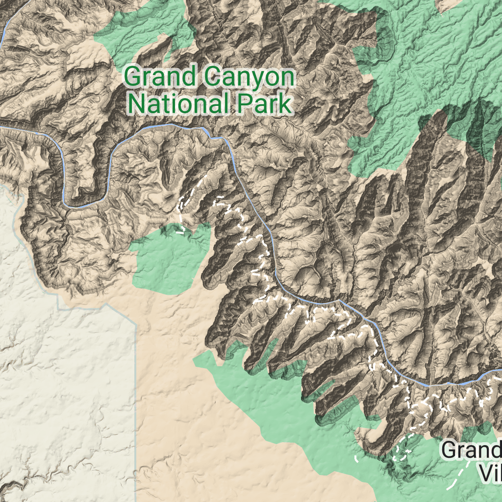
Geländekacheln sind Bildkacheln, die eine Schattierungskarte
und Höhenlinien enthalten. Sie umfassen natürliche Merkmale wie Vegetation.
Geländekacheln abrufen
Sie können Anfragen für Geländekacheln stellen, nachdem Sie ein Sitzungstoken erhalten haben.
Da ein Sitzungstoken für die gesamte Sitzung gilt, müssen Sie die Kartenoptionen nicht in Ihren Kachelanfragen angeben.
Das folgende Codebeispiel zeigt eine typische Sitzungstokenanfrage für Geländekacheln.
[[["Leicht verständlich","easyToUnderstand","thumb-up"],["Mein Problem wurde gelöst","solvedMyProblem","thumb-up"],["Sonstiges","otherUp","thumb-up"]],[["Benötigte Informationen nicht gefunden","missingTheInformationINeed","thumb-down"],["Zu umständlich/zu viele Schritte","tooComplicatedTooManySteps","thumb-down"],["Nicht mehr aktuell","outOfDate","thumb-down"],["Problem mit der Übersetzung","translationIssue","thumb-down"],["Problem mit Beispielen/Code","samplesCodeIssue","thumb-down"],["Sonstiges","otherDown","thumb-down"]],["Zuletzt aktualisiert: 2026-07-04 (UTC)."],[],["Terrain tiles, which include hillshade mapping, contour lines, and natural features, are accessed by first obtaining a session token via a POST request specifying the map type, language, region, and layer types. Subsequently, tiles are retrieved with HTTPS GET requests, providing the zoom level (z), x and y coordinates, and the session token. An example demonstrates requesting a tile at zoom level 10, with coordinates (192, 401). The tile data downloads to a local file, without a server response message.\n"]]

 Geländekacheln sind Bildkacheln, die eine Schattierungskarte
und Höhenlinien enthalten. Sie umfassen natürliche Merkmale wie Vegetation.
Geländekacheln sind Bildkacheln, die eine Schattierungskarte
und Höhenlinien enthalten. Sie umfassen natürliche Merkmale wie Vegetation.