Datasets tagged usgs in Earth Engine
با مجموعهها، منظم بمانید
ذخیره و طبقهبندی محتوا براساس اولویتهای شما.
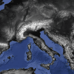
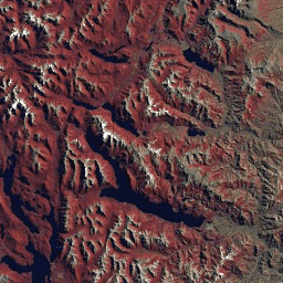
رادیانس ASTER L1T
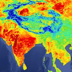
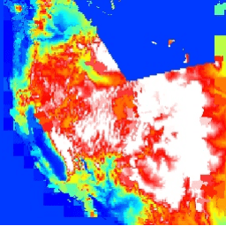
توجه: به دلیل مشکلات فنی دستگاه ASTER، بین ۲۸ نوامبر ۲۰۲۴ و ۱۶ ژانویه ۲۰۲۵، فاصلهای در جمعآوری دادهها وجود دارد. برای اطلاعات بیشتر به اطلاعیه USGS مراجعه کنید. رادیومتر پیشرفته فضابرد انتشار و بازتاب حرارتی (ASTER) یک تصویرگر چندطیفی است که...
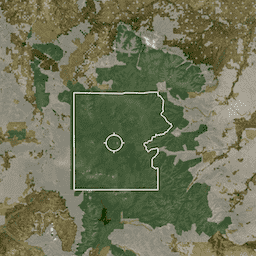
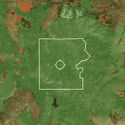
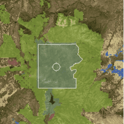
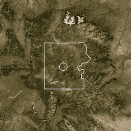
PAD-US فهرست ملی رسمی آمریکا از مناطق حفاظتشده زمینی و دریایی ایالات متحده است که به حفظ تنوع زیستی و سایر کاربردهای طبیعی، تفریحی و فرهنگی اختصاص داده شده و از طریق روشهای قانونی یا سایر روشهای مؤثر برای این اهداف مدیریت میشوند. این پایگاه داده به بخشهای ... تفکیک شده است.
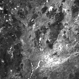
هایپریون یک تصویربردار فراطیفی با وضوح بالا است که ۲۲۰ کانال طیفی منحصر به فرد از ۰.۳۵۷ تا ۲.۵۷۶ میکرومتر با پهنای باند ۱۰ نانومتر تولید میکند. این ابزار به روش جاروب فشاری، با وضوح مکانی ۳۰ متر برای همه باندها و عرض صحنه استاندارد ... عمل میکند.
PAD-US فهرست ملی رسمی آمریکا از مناطق حفاظتشده زمینی و دریایی ایالات متحده است که به حفظ تنوع زیستی و سایر کاربردهای طبیعی، تفریحی و فرهنگی اختصاص داده شده و از طریق روشهای قانونی یا سایر روشهای مؤثر برای این اهداف مدیریت میشوند. این پایگاه داده به بخشهای ... تفکیک شده است.
PAD-US فهرست ملی رسمی آمریکا از مناطق حفاظتشده زمینی و دریایی ایالات متحده است که به حفظ تنوع زیستی و سایر کاربردهای طبیعی، تفریحی و فرهنگی اختصاص داده شده و از طریق روشهای قانونی یا سایر روشهای مؤثر برای این اهداف مدیریت میشوند. این پایگاه داده به بخشهای ... تفکیک شده است.
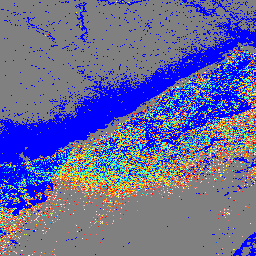
محصول معیارهای ارتفاع و ارتفاع جغرافیایی سطح 2A GEDI (GEDI02_A) در درجه اول از 100 معیار ارتفاع نسبی (RH) تشکیل شده است که در مجموع شکل موج جمعآوری شده توسط GEDI را توصیف میکنند. محصول اصلی GEDI02_A یک جدول نقطهای با وضوح مکانی (میانگین ردپا) 25 متر است. ...
محصول معیارهای ارتفاع و ارتفاع جغرافیایی سطح 2A GEDI (GEDI02_A) در درجه اول از 100 معیار ارتفاع نسبی (RH) تشکیل شده است که در مجموع شکل موج جمعآوری شده توسط GEDI را توصیف میکنند. محصول اصلی GEDI02_A یک جدول نقطهای با وضوح مکانی (میانگین ردپا) 25 متر است. ...
این یک مجموعه ویژگی است که از هندسه جداول L2A در LARSE/GEDI/GEDI02_A_002 ایجاد شده است. هر ویژگی، ردپای چندضلعی از یک جدول منبع به همراه شناسه دارایی و مهرهای زمانی شروع/پایان آن است. لطفاً برای اطلاعات بیشتر به راهنمای کاربر مراجعه کنید. ماموریت GEDI بررسی دینامیک اکوسیستم جهانی ...
محصول معیارهای پوشش تاجی و پروفیل عمودی سطح 2B از GEDI (GEDI02_B) معیارهای بیوفیزیکی را از هر شکل موج GEDI استخراج میکند. این معیارها بر اساس پروفیل احتمال شکاف جهتدار مشتق شده از شکل موج L1B هستند. گام عمودی بین اندازهگیریهای پروفیل شاخ و برگ (که در GEDI با dZ شناخته میشود...)
محصول معیارهای پوشش تاجی و پروفیل عمودی سطح 2B از GEDI (GEDI02_B) معیارهای بیوفیزیکی را از هر شکل موج GEDI استخراج میکند. این معیارها بر اساس پروفیل احتمال شکاف جهتدار مشتق شده از شکل موج L1B هستند. گام عمودی بین اندازهگیریهای پروفیل شاخ و برگ (که در GEDI با dZ شناخته میشود...)
این یک مجموعه ویژگی است که از هندسه جداول L2B در LARSE/GEDI/GEDI02_B_002 ایجاد شده است. هر ویژگی، یک ردپای چندضلعی از یک جدول منبع به همراه شناسه دارایی و مهرهای زمانی شروع/پایان آن است. لطفاً برای اطلاعات بیشتر به راهنمای کاربر مراجعه کنید. ماموریت GEDI بررسی دینامیک اکوسیستم جهانی ...
این مجموعه دادهها شامل پیشبینیهای نسخه ۲ سطح ۴A (L4A) از بررسی دینامیک اکوسیستم جهانی (GEDI) از تراکم زیستتوده روی زمین (AGBD؛ بر حسب Mg/ha) و تخمین خطای استاندارد پیشبینی در هر ردپای لیزری جغرافیایی نمونهبرداری شده است. در این نسخه، گرانولها در زیرمدارها قرار دارند. معیارهای ارتفاع ...
این مجموعه دادهها شامل پیشبینیهای نسخه ۲ سطح ۴A (L4A) از بررسی دینامیک اکوسیستم جهانی (GEDI) از تراکم زیستتوده روی زمین (AGBD؛ بر حسب Mg/ha) و تخمین خطای استاندارد پیشبینی در هر ردپای لیزری جغرافیایی نمونهبرداری شده است. در این نسخه، گرانولها در زیرمدارها قرار دارند. معیارهای ارتفاع ...
این یک مجموعه ویژگی است که از هندسه جداول L4A در LARSE/GEDI/GEDI04_A_002 ایجاد شده است. هر ویژگی، ردپای چندضلعی از یک جدول منبع به همراه شناسه دارایی و مهرهای زمانی شروع/پایان آن است. لطفاً برای اطلاعات بیشتر به راهنمای کاربر مراجعه کنید. ماموریت GEDI بررسی دینامیک اکوسیستم جهانی ...
چگالی زیست توده روی زمین شبکه بندی شده GEDI L4B (نسخه 2)
این محصول L4B از پروژه بررسی دینامیک اکوسیستم جهانی (GEDI) تخمینهایی به ابعاد ۱ کیلومتر در ۱ کیلومتر از میانگین تراکم زیستتوده روی زمین (AGBD) را بر اساس مشاهدات از هفته ۱۹ ماموریت که از تاریخ ۲۰۱۹-۰۴-۱۸ آغاز شده تا هفته ۱۳۸ ماموریت که در تاریخ ۲۰۲۱-۰۸-۰۴ به پایان میرسد، ارائه میدهد. محصول ردپای زیستتوده GEDI L4A ...
GFSAD1000: پوشش گیاهی چند مطالعهای به وسعت ۱ کیلومتر مربع، دادههای تحلیل حمایت غذایی جهانی
GFSAD یک پروژه با بودجه ناسا است که دادههای جهانی با وضوح بالا از زمینهای کشاورزی و میزان مصرف آب آنها را ارائه میدهد که به امنیت غذایی جهانی در قرن بیست و یکم کمک میکند. محصولات GFSAD از طریق دادههای سنجش از دور چند حسگری (مانند Landsat، MODIS، AVHRR)، دادههای ثانویه و دادههای نقشههای میدانی استخراج میشوند...
GMTED2010: دادههای ارتفاعی چند رزولوشنی جهانی زمین در سال ۲۰۱۰
مجموعه دادههای ارتفاعی زمین با وضوح چندگانه جهانی ۲۰۱۰ (GMTED2010) شامل دادههای ارتفاعی برای کره زمین است که از منابع مختلف با وضوح ۷.۵ ثانیه قوسی جمعآوری شدهاند. جزئیات بیشتر در گزارش مجموعه دادهها موجود است. مجموعه دادههای منبع اصلی برای GMTED2010، دادههای ارتفاعی زمین دیجیتال SRTM (DTED®) NGA است...
GTOPO30 یک مدل ارتفاعی رقومی جهانی (DEM) با فاصله شبکه افقی 30 ثانیه قوسی (تقریباً 1 کیلومتر) است. این DEM از چندین منبع رستری و برداری اطلاعات توپوگرافی استخراج شده است. GTOPO30 که در اواخر سال 1996 تکمیل شد، طی یک دوره سه ساله از طریق ... توسعه داده شد.
این پایگاه داده با استفاده از دادههای ماهواره لندست از سال ۲۰۰۰ تهیه شده است. بیش از ۱۰۰۰ صحنه لندست که از مرکز رصد و علوم منابع زمین (EROS) سازمان زمینشناسی ایالات متحده (USGS) به دست آمده است، با استفاده از تکنیکهای طبقهبندی تصاویر دیجیتال ترکیبی نظارتشده و نظارتنشده طبقهبندی شدهاند. این پایگاه داده اولین و پرکاربردترین ...
HLSL30: بازتاب سطحی و روشنایی TOA تصویرگر عملیاتی زمین HLS-2 لندست، روزانه جهانی 30 متر
پروژه هماهنگشده لندست سنتینل-۲ (HLS) دادههای بازتاب سطحی (SR) و روشنایی بالای جو (TOA) ثابتی را از یک مجموعه مجازی از حسگرهای ماهوارهای ارائه میدهد. تصویربردار عملیاتی زمین (OLI) بر روی ماهوارههای مشترک ناسا/USGS لندست ۸ و لندست ۹ قرار دارد، در حالی که تصویربردار چندطیفی...
HLSS30: ابزار چند طیفی HLS Sentinel-2، بازتاب سطحی روزانه جهانی 30 متر
پروژه هماهنگشده لندست سنتینل-۲ (HLS) دادههای بازتاب سطحی ثابتی را از تصویرگر عملیاتی زمین (OLI) در ماهواره مشترک ناسا/USGS لندست ۸ و ابزار چندطیفی (MSI) در ماهوارههای کوپرنیک سنتینل-۲A اروپا ارائه میدهد. اندازهگیری ترکیبی، مشاهدات جهانی از زمین را هر ۲-۳ ...
HUC02: مجموعه دادههای مرز حوزه آبخیز USGS از مناطق
مجموعه دادههای مرز حوضه آبخیز (WBD) مجموعهای جامع و تجمیعشده از دادههای واحد هیدرولوژیکی (HU) است که با معیارهای ملی برای تعیین و تفکیکپذیری مطابقت دارد. این مجموعه، وسعت منطقهای زهکشی آبهای سطحی را تا یک نقطه مشخص، به جز در مناطق ساحلی یا کنار دریاچه که ...
HUC04: مجموعه دادههای مرز حوزه آبخیز USGS از زیرمنطقهها
مجموعه دادههای مرز حوضه آبخیز (WBD) مجموعهای جامع و تجمیعشده از دادههای واحد هیدرولوژیکی (HU) است که با معیارهای ملی برای تعیین و تفکیکپذیری مطابقت دارد. این مجموعه، وسعت منطقهای زهکشی آبهای سطحی را تا یک نقطه مشخص، به جز در مناطق ساحلی یا کنار دریاچه که ...
مجموعه دادههای مرز حوضه آبخیز (WBD) مجموعهای جامع و تجمیعشده از دادههای واحد هیدرولوژیکی (HU) است که با معیارهای ملی برای تعیین و تفکیکپذیری مطابقت دارد. این مجموعه، وسعت منطقهای زهکشی آبهای سطحی را تا یک نقطه مشخص، به جز در مناطق ساحلی یا کنار دریاچه که ...
HUC08: مجموعه دادههای مرز حوضه آبخیز USGS از زیرحوضهها
مجموعه دادههای مرز حوضه آبخیز (WBD) مجموعهای جامع و تجمیعشده از دادههای واحد هیدرولوژیکی (HU) است که با معیارهای ملی برای تعیین و تفکیکپذیری مطابقت دارد. این مجموعه، وسعت منطقهای زهکشی آبهای سطحی را تا یک نقطه مشخص، به جز در مناطق ساحلی یا کنار دریاچه که ...
HUC10: مجموعه دادههای مرز حوزههای آبخیز سازمان زمینشناسی آمریکا (USGS)
مجموعه دادههای مرز حوضه آبخیز (WBD) مجموعهای جامع و تجمیعشده از دادههای واحد هیدرولوژیکی (HU) است که با معیارهای ملی برای تعیین و تفکیکپذیری مطابقت دارد. این مجموعه، وسعت منطقهای زهکشی آبهای سطحی را تا یک نقطه مشخص، به جز در مناطق ساحلی یا کنار دریاچه که ...
HUC12: مجموعه دادههای مرز حوزه آبخیز USGS از زیرحوزههای آبخیز
مجموعه دادههای مرز حوضه آبخیز (WBD) مجموعهای جامع و تجمیعشده از دادههای واحد هیدرولوژیکی (HU) است که با معیارهای ملی برای تعیین و تفکیکپذیری مطابقت دارد. این مجموعه، وسعت منطقهای زهکشی آبهای سطحی را تا یک نقطه مشخص، به جز در مناطق ساحلی یا کنار دریاچه که ...
LANDFIRE (LF)، ابزارهای برنامهریزی آتشسوزی چشمانداز و مدیریت منابع، یک برنامه مشترک بین برنامههای مدیریت آتشسوزی در مناطق وحشی خدمات جنگلداری وزارت کشاورزی ایالات متحده، سازمان زمینشناسی وزارت کشور ایالات متحده و سازمان حفاظت از طبیعت است. لایههای LANDFIRE (LF) با استفاده از پیشبینی ... ایجاد میشوند.
LANDFIRE (LF)، ابزارهای برنامهریزی آتشسوزی چشمانداز و مدیریت منابع، یک برنامه مشترک بین برنامههای مدیریت آتشسوزی در مناطق وحشی خدمات جنگلداری وزارت کشاورزی ایالات متحده، سازمان زمینشناسی وزارت کشور ایالات متحده و سازمان حفاظت از طبیعت است. لایههای LANDFIRE (LF) با استفاده از پیشبینی ... ایجاد میشوند.
LANDFIRE (LF)، ابزارهای برنامهریزی آتشسوزی چشمانداز و مدیریت منابع، یک برنامه مشترک بین برنامههای مدیریت آتشسوزی در مناطق وحشی خدمات جنگلداری وزارت کشاورزی ایالات متحده، سازمان زمینشناسی وزارت کشور ایالات متحده و سازمان حفاظت از طبیعت است. لایههای LANDFIRE (LF) با استفاده از پیشبینی ... ایجاد میشوند.
LANDFIRE (LF)، ابزارهای برنامهریزی آتشسوزی چشمانداز و مدیریت منابع، یک برنامه مشترک بین برنامههای مدیریت آتشسوزی در مناطق وحشی خدمات جنگلداری وزارت کشاورزی ایالات متحده، سازمان زمینشناسی وزارت کشور ایالات متحده و سازمان حفاظت از طبیعت است. لایههای LANDFIRE (LF) با استفاده از پیشبینی ... ایجاد میشوند.
LANDFIRE (LF)، ابزارهای برنامهریزی آتشسوزی چشمانداز و مدیریت منابع، یک برنامه مشترک بین برنامههای مدیریت آتشسوزی در مناطق وحشی خدمات جنگلداری وزارت کشاورزی ایالات متحده، سازمان زمینشناسی وزارت کشور ایالات متحده و سازمان حفاظت از طبیعت است. لایههای LANDFIRE (LF) با استفاده از پیشبینی ... ایجاد میشوند.
LANDFIRE (LF)، ابزارهای برنامهریزی آتشسوزی چشمانداز و مدیریت منابع، یک برنامه مشترک بین برنامههای مدیریت آتشسوزی در مناطق وحشی خدمات جنگلداری وزارت کشاورزی ایالات متحده، سازمان زمینشناسی وزارت کشور ایالات متحده و سازمان حفاظت از طبیعت است. لایههای LANDFIRE (LF) با استفاده از پیشبینی ... ایجاد میشوند.
LANDFIRE (LF)، ابزارهای برنامهریزی آتشسوزی چشمانداز و مدیریت منابع، یک برنامه مشترک بین برنامههای مدیریت آتشسوزی در مناطق وحشی خدمات جنگلداری وزارت کشاورزی ایالات متحده، سازمان زمینشناسی وزارت کشور ایالات متحده و سازمان حفاظت از طبیعت است. لایههای LANDFIRE (LF) با استفاده از پیشبینی ... ایجاد میشوند.
آتشسوزی زمین (LF)، ابزارهای برنامهریزی آتشسوزی چشمانداز و مدیریت منابع، یک برنامه مشترک بین برنامههای مدیریت آتشسوزی در مناطق بکر خدمات جنگلداری وزارت کشاورزی ایالات متحده، سازمان زمینشناسی وزارت کشور ایالات متحده و سازمان حفاظت از طبیعت است. آتشسوزی زمین (LF) رژیمهای آتشسوزی تاریخی، فواصل زمانی و ...
آتشسوزی زمین (LF)، ابزارهای برنامهریزی آتشسوزی چشمانداز و مدیریت منابع، یک برنامه مشترک بین برنامههای مدیریت آتشسوزی در مناطق بکر خدمات جنگلداری وزارت کشاورزی ایالات متحده، سازمان زمینشناسی وزارت کشور ایالات متحده و سازمان حفاظت از طبیعت است. آتشسوزی زمین (LF) رژیمهای آتشسوزی تاریخی، فواصل زمانی و ...
آتشسوزی زمین (LF)، ابزارهای برنامهریزی آتشسوزی چشمانداز و مدیریت منابع، یک برنامه مشترک بین برنامههای مدیریت آتشسوزی در مناطق بکر خدمات جنگلداری وزارت کشاورزی ایالات متحده، سازمان زمینشناسی وزارت کشور ایالات متحده و سازمان حفاظت از طبیعت است. آتشسوزی زمین (LF) رژیمهای آتشسوزی تاریخی، فواصل زمانی و ...
PMS آتشسوزی زمینی (درصد آتشسوزی با شدت مختلط) نسخه ۱.۲.۰
آتشسوزی زمین (LF)، ابزارهای برنامهریزی آتشسوزی چشمانداز و مدیریت منابع، یک برنامه مشترک بین برنامههای مدیریت آتشسوزی در مناطق بکر خدمات جنگلداری وزارت کشاورزی ایالات متحده، سازمان زمینشناسی وزارت کشور ایالات متحده و سازمان حفاظت از طبیعت است. آتشسوزی زمین (LF) رژیمهای آتشسوزی تاریخی، فواصل زمانی و ...
LANDFIRE PRS (درصد آتشسوزی با شدت جایگزینی) نسخه ۱.۲.۰
آتشسوزی زمین (LF)، ابزارهای برنامهریزی آتشسوزی چشمانداز و مدیریت منابع، یک برنامه مشترک بین برنامههای مدیریت آتشسوزی در مناطق بکر خدمات جنگلداری وزارت کشاورزی ایالات متحده، سازمان زمینشناسی وزارت کشور ایالات متحده و سازمان حفاظت از طبیعت است. آتشسوزی زمین (LF) رژیمهای آتشسوزی تاریخی، فواصل زمانی و ...
آتشسوزی زمین (LF)، ابزارهای برنامهریزی آتشسوزی چشمانداز و مدیریت منابع، یک برنامه مشترک بین برنامههای مدیریت آتشسوزی در مناطق بکر خدمات جنگلداری وزارت کشاورزی ایالات متحده، سازمان زمینشناسی وزارت کشور ایالات متحده و سازمان حفاظت از طبیعت است. آتشسوزی زمین (LF) رژیمهای آتشسوزی تاریخی، فواصل زمانی و ...
آتشسوزی زمین (LF)، ابزارهای برنامهریزی آتشسوزی چشمانداز و مدیریت منابع، یک برنامه مشترک بین برنامههای مدیریت آتشسوزی در مناطق بکر خدمات جنگلداری وزارت کشاورزی ایالات متحده، سازمان زمینشناسی وزارت کشور ایالات متحده و سازمان حفاظت از طبیعت است. آتشسوزی زمین (LF) رژیمهای آتشسوزی تاریخی، فواصل زمانی و ...
آتشسوزی زمین (LF)، ابزارهای برنامهریزی آتشسوزی چشمانداز و مدیریت منابع، یک برنامه مشترک بین برنامههای مدیریت آتشسوزی در مناطق بکر خدمات جنگلداری وزارت کشاورزی ایالات متحده، سازمان زمینشناسی وزارت کشور ایالات متحده و سازمان حفاظت از طبیعت است. آتشسوزی زمین (LF) رژیمهای آتشسوزی تاریخی، فواصل زمانی و ...
این تصاویر ترکیبی لندست کالکشن ۲ رده ۱ سطح ۲ از صحنههای تصحیحشده قائم رده ۱ سطح ۲ ساخته شدهاند. شاخص مساحت سوختگی (BAI) از باندهای قرمز و فروسرخ نزدیک تولید میشود و فاصله طیفی هر پیکسل را از یک نقطه طیفی مرجع (...) اندازهگیری میکند.
این تصاویر ترکیبی لندست کالکشن ۲ رده ۱ سطح ۲ از صحنههای تصحیحشده قائم رده ۱ سطح ۲ ساخته شدهاند و شامل باندهای SR: آبی، سبز، قرمز، nir، swir1، swir2 و حرارتی هستند. این تصاویر ترکیبی از تمام صحنهها در هر دوره ۳۲ روزه با شروع از ... ایجاد شدهاند.
این تصاویر ترکیبی لندست کالکشن ۲ رده ۱ سطح ۲ از صحنههای تصحیحشده قائم رده ۱ سطح ۲ ساخته شدهاند. شاخص نسبت سوختگی نرمالشده حرارتی (NBRT) از باندهای Near-IR، Mid-IR (۲۲۱۵ نانومتر) و Thermal تولید میشود و دامنهای از ۱.۰- تا ۱.۰ دارد. ببینید ...
این تصاویر ترکیبی لندست کالکشن ۲ رده ۱ سطح ۲ از صحنههای تصحیحشده ارتو در رده ۱ سطح ۲ ساخته شدهاند. شاخص پوشش گیاهی تفاضلی نرمالشده از باندهای فروسرخ نزدیک و قرمز هر صحنه به صورت (NIR - قرمز) / (NIR + قرمز) تولید میشود و در محدوده ... قرار دارد.
این تصاویر ترکیبی لندست کالکشن ۲ رده ۱ سطح ۲ از صحنههای تصحیحشده قائم رده ۱ سطح ۲ ساخته شدهاند. شاخص نرمالشده تفاضلی آب (NDWI) برای مشخص کردن ویژگیهای آبهای آزاد و افزایش حضور آنها در تصاویر و در عین حال حذف ویژگیهای خاک و پوشش گیاهی زمینی طراحی شده است. این ...
این تصاویر ترکیبی لندست کالکشن ۲ رده ۱ سطح ۲ از صحنههای تصحیحشده قائم رده ۱ سطح ۲ ساخته شدهاند. شاخص مساحت سوختگی (BAI) از باندهای قرمز و فروسرخ نزدیک تولید میشود و فاصله طیفی هر پیکسل را از یک نقطه طیفی مرجع (...) اندازهگیری میکند.
این تصاویر ترکیبی لندست کالکشن ۲ رده ۱ سطح ۲ از صحنههای تصحیحشده قائم رده ۱ سطح ۲ ساخته شدهاند و شامل باندهای SR: آبی، سبز، قرمز، nir، swir1، swir2 و حرارتی هستند. این تصاویر ترکیبی از تمام صحنهها در هر دوره ۸ روزه با شروع از ... ایجاد شدهاند.
این تصاویر ترکیبی لندست کالکشن ۲ رده ۱ سطح ۲ از صحنههای تصحیحشده قائم رده ۱ سطح ۲ ساخته شدهاند. شاخص پوشش گیاهی بهبودیافته (EVI) از باندهای فروسرخ نزدیک، قرمز و آبی هر صحنه تولید میشود و مقدار آن از ۱.۰- تا ۱.۰ متغیر است. به Huete مراجعه کنید…
مجموعه لندست ۲، ردیف ۱، سطح ۲، کامپوزیت NBR هشت روزه
این تصاویر ترکیبی لندست کالکشن ۲ رده ۱ سطح ۲ از صحنههای تصحیحشده قائم رده ۱ سطح ۲ ساخته شدهاند. شاخص نسبت سوختگی نرمالشده حرارتی (NBRT) از باندهای Near-IR، Mid-IR (۲۲۱۵ نانومتر) و Thermal تولید میشود و دامنهای از ۱.۰- تا ۱.۰ دارد. ببینید ...
این تصاویر ترکیبی لندست کالکشن ۲ رده ۱ سطح ۲ از صحنههای تصحیحشده ارتو در رده ۱ سطح ۲ ساخته شدهاند. شاخص پوشش گیاهی تفاضلی نرمالشده از باندهای فروسرخ نزدیک و قرمز هر صحنه به صورت (NIR - قرمز) / (NIR + قرمز) تولید میشود و در محدوده ... قرار دارد.
این تصاویر ترکیبی لندست کالکشن ۲ رده ۱ سطح ۲ از صحنههای تصحیحشده قائم رده ۱ سطح ۲ ساخته شدهاند. شاخص نرمالشده تفاضلی آب (NDWI) برای مشخص کردن ویژگیهای آبهای آزاد و افزایش حضور آنها در تصاویر و در عین حال حذف ویژگیهای خاک و پوشش گیاهی زمینی طراحی شده است. این ...
این تصاویر ترکیبی لندست کالکشن ۲ رده ۱ سطح ۲ از صحنههای تصحیحشده قائم رده ۱ سطح ۲ ساخته شدهاند. شاخص مساحت سوختگی (BAI) از باندهای قرمز و فروسرخ نزدیک تولید میشود و فاصله طیفی هر پیکسل را از یک نقطه طیفی مرجع (...) اندازهگیری میکند.
این تصاویر ترکیبی لندست کالکشن ۲ رده ۱ سطح ۲ از صحنههای تصحیحشده قائم رده ۱ سطح ۲ ساخته شدهاند و شامل باندهای SR: آبی، سبز، قرمز، nir، swir1، swir2 و حرارتی هستند. این تصاویر ترکیبی از تمام صحنهها در هر دوره سالانه با شروع از ... ایجاد شدهاند.
مجموعه لندست ۲، سطح ۱، سطح ۲، گزارش ترکیبی سالانه EVI
این تصاویر ترکیبی لندست کالکشن ۲ رده ۱ سطح ۲ از صحنههای تصحیحشده قائم رده ۱ سطح ۲ ساخته شدهاند. شاخص پوشش گیاهی بهبودیافته (EVI) از باندهای فروسرخ نزدیک، قرمز و آبی هر صحنه تولید میشود و مقدار آن از ۱.۰- تا ۱.۰ متغیر است. به Huete مراجعه کنید…
مجموعه لندست ۲، ردیف ۱، سطح ۲، گزارش ترکیبی سالانه NBR
این تصاویر ترکیبی لندست کالکشن ۲ رده ۱ سطح ۲ از صحنههای تصحیحشده قائم رده ۱ سطح ۲ ساخته شدهاند. شاخص نسبت سوختگی نرمالشده حرارتی (NBRT) از باندهای Near-IR، Mid-IR (۲۲۱۵ نانومتر) و Thermal تولید میشود و دامنهای از ۱.۰- تا ۱.۰ دارد. ببینید ...
این تصاویر ترکیبی لندست کالکشن ۲ رده ۱ سطح ۲ از صحنههای تصحیحشده ارتو در رده ۱ سطح ۲ ساخته شدهاند. شاخص پوشش گیاهی تفاضلی نرمالشده از باندهای فروسرخ نزدیک و قرمز هر صحنه به صورت (NIR - قرمز) / (NIR + قرمز) تولید میشود و در محدوده ... قرار دارد.
این تصاویر ترکیبی لندست کالکشن ۲ رده ۱ سطح ۲ از صحنههای تصحیحشده قائم رده ۱ سطح ۲ ساخته شدهاند. شاخص نرمالشده تفاضلی آب (NDWI) برای مشخص کردن ویژگیهای آبهای آزاد و افزایش حضور آنها در تصاویر و در عین حال حذف ویژگیهای خاک و پوشش گیاهی زمینی طراحی شده است. این ...
نقشهبرداری جهانی زمین (GLS) 1975 مجموعهای جهانی از تصاویر اسکنر چندطیفی لندست (MSS) است. اکثر صحنهها توسط لندست 1-3 در سالهای 1972-1983 گرفته شدهاند. چند جای خالی در دادههای لندست 1-3 با صحنههای گرفته شده توسط لندست 4-5 در طول ... پر شده است.
نقشهبرداری جهانی زمین لندست ۲۰۰۵، صحنههایی از لندست ۵
مجموعه دادههای GLS2005 مجموعهای از ۹۵۰۰ تصویر ماهوارهای با وضوح متوسط و تصحیحشده قائم است که بین سالهای ۲۰۰۴ تا ۲۰۰۷ جمعآوری شده و خشکیهای زمین را پوشش میدهد. GLS2005 عمدتاً از دادههای لندست ۵ و دادههای لندست ۷ که جای خالی دارند، به همراه دادههای EO-1 ALI و Terra ASTER که هر جای خالی را پر میکنند، استفاده میکند...
نقشهبرداری جهانی زمین لندست ۲۰۰۵، صحنههای لندست ۵+۷
مجموعه دادههای GLS2005 مجموعهای از ۹۵۰۰ تصویر ماهوارهای با وضوح متوسط و تصحیحشده قائم است که بین سالهای ۲۰۰۴ تا ۲۰۰۷ جمعآوری شده و خشکیهای زمین را پوشش میدهد. GLS2005 عمدتاً از دادههای لندست ۵ و دادههای لندست ۷ که جای خالی دارند، به همراه دادههای EO-1 ALI و Terra ASTER که هر جای خالی را پر میکنند، استفاده میکند...
نقشهبرداری جهانی زمین لندست ۲۰۰۵، صحنههایی از لندست ۷
مجموعه دادههای GLS2005 مجموعهای از ۹۵۰۰ تصویر ماهوارهای با وضوح متوسط و تصحیحشده قائم است که بین سالهای ۲۰۰۴ تا ۲۰۰۷ جمعآوری شده و خشکیهای زمین را پوشش میدهد. GLS2005 عمدتاً از دادههای لندست ۵ و دادههای لندست ۷ که جای خالی دارند، به همراه دادههای EO-1 ALI و Terra ASTER که هر جای خالی را پر میکنند، استفاده میکند...
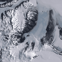
موزاییک تصویر لندست از قطب جنوب (LIMA) - صحنههای پردازششده لندست (۱۶ بیتی)
تصویر موزاییکی لندست از قطب جنوب (LIMA) یک تصویر موزاییکی یکپارچه و تقریباً بدون ابر است که از صحنههای پردازششدهی لندست ۷ ETM+ ایجاد شده است. صحنههای پردازششدهی لندست (۱۶ بیتی) صحنههای NLAPS سطح ۱Gt هستند که به ۱۶ بیتی تبدیل شدهاند، با تصحیح زاویه خورشید پردازش شدهاند و به مقادیر بازتاب (Bindschadler ...) تبدیل شدهاند.
تصویر موزاییکی لندست از قطب جنوب (LIMA) - صحنههای پردازششده لندست (۱۶ بیتی) فراداده
تصویر موزاییکی لندست از قطب جنوب (LIMA) یک تصویر موزاییکی یکپارچه و تقریباً بدون ابر است که از صحنههای پردازششدهی لندست ۷ ETM+ ایجاد شده است. صحنههای پردازششدهی لندست (۱۶ بیتی) صحنههای NLAPS سطح ۱Gt هستند که به ۱۶ بیتی تبدیل شدهاند، با تصحیح زاویه خورشید پردازش شدهاند و به مقادیر بازتاب (Bindschadler ...) تبدیل شدهاند.
تصویر موزاییکی لندست از قطب جنوب (LIMA) موزاییک ۱۶ بیتی با وضوح بالا
تصویر موزاییکی لندست از قطب جنوب (LIMA) یک تصویر موزاییکی یکپارچه و تقریباً بدون ابر است که از صحنههای پردازششدهی لندست ۷ ETM+ ایجاد شده است. این مجموعه دادهی LIMA، LIMA میانی ۱۶ بیتی است. این موزاییک شامل صحنههای بازتاب سطحی نرمالشدهی تیز شده (باندهای ۱، ۲، ۳ و ... لندست ETM+) است.
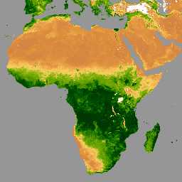
MCD12C1.061 MODIS نوع پوشش اراضی سالانه جهانی 0.05 درجه سانتیگراد
محصول دادههای ترکیبی Terra و Aqua با استفاده از طیفسنج تصویربرداری با وضوح متوسط (MODIS) و شبکه مدلسازی آب و هوای پوشش زمین (CMG) (MCD12C1) نسخه 6.1، یک نسخه تجمیعشده مکانی و بازتصویر شده از محصول دادههای کاشیکاری شده MCD12Q1 نسخه 6.1 را ارائه میدهد. نقشههای برنامه بینالمللی ژئوسفر-زیستکره (IGBP)، دانشگاه ...
MCD12Q1.061 MODIS نوع پوشش اراضی سالانه جهانی ۵۰۰ متر
محصول دادههای ترکیبی طیفسنجی تصویربرداری با وضوح متوسط (MODIS) و نوع پوشش زمین (MCD12Q1) نسخه 6.1 از سنجندههای Terra و Aqua، انواع پوشش زمین جهانی را در فواصل سالانه ارائه میدهد. محصول دادههای MCD12Q1 نسخه 6.1 با استفاده از طبقهبندیهای نظارتشده دادههای بازتاب MODIS از سنجندههای Terra و Aqua استخراج شده است. Land…
MCD12Q2.006 دینامیک پوشش زمین سالانه جهانی ۵۰۰ میلیون
محصول دادههای ترکیبی طیفسنج تصویربرداری با وضوح متوسط (MODIS) و دینامیک پوشش زمین (MCD12Q2) نسخه 6.1 از سنجندههای Terra و Aqua، معیارهای فنولوژی سطح زمین را در فواصل سالانه ارائه میدهد. محصول دادههای MCD12Q2 نسخه 6.1 از سری زمانی شاخص پوشش گیاهی بهبود یافته 2 باندی (EVI2) مشتق شده است...
MCD15A3H.061 شاخص سطح برگ MODIS/FPAR 4 روزه جهانی 500 متر
محصول MCD15A3H نسخه 6.1 طیفسنج تصویربرداری با وضوح متوسط (MODIS) سطح 4، کسر ترکیبی تابش فعال فتوسنتزی (FPAR) و شاخص سطح برگ (LAI) یک مجموعه داده ترکیبی 4 روزه با اندازه پیکسل 500 متر است. این الگوریتم بهترین پیکسل موجود را از بین تمام ... انتخاب میکند.
MCD19A1.061: سطح زمین BRF روزانه L2G جهانی ۵۰۰ متر و ۱ کیلومتر
محصول داده MCD19A1 نسخه 6.1 یک محصول شبکهبندی شده سطح 2 با استفاده از طیفسنج تصویربرداری با وضوح متوسط (MODIS) از دادههای ترکیبی Terra و Aqua با ضریب بازتاب دوجهته سطح زمین (BRF) است که روزانه با وضوح 500 متر و 1 کیلومتر تولید میشود. برای اطلاعات بیشتر به راهنمای کاربر MAIAC مراجعه کنید.
MCD19A2.061: عمق نوری آئروسل زمینی Terra & Aqua MAIAC روزانه ۱ کیلومتر
محصول داده MCD19A2 V6.1 ترکیبی از MODIS Terra و Aqua با پیادهسازی چند زاویهای تصحیح جوی (MAIAC) و عمق نوری آئروسل زمین (AOD) با شبکهبندی سطح 2 است که روزانه با وضوح 1 کیلومتر تولید میشود. برای اطلاعات بیشتر به راهنمای کاربر MAIAC مراجعه کنید. توجه: این محصول دارای ...
پارامترهای مدل MODIS BRDF-Albedo با استفاده از MCD43A1.061، روزانه ۵۰۰ متر
مجموعه دادههای پارامترهای مدل تابع توزیع بازتاب دوطرفه و آلبدو (BRDF/Albedo) مدل MCD43A1 V6.1، یک حاصلضرب ۱۶ روزه روزانه ۵۰۰ متری است. تاریخ جولیان نشان دهنده نهمین روز از دوره بازیابی ۱۶ روزه است و در نتیجه مشاهدات برای تخمین BRDF/Albedo برای آن روز وزندهی میشوند. …
MCD43A2.061 MODIS BRDF- کیفیت آلبدو روزانه ۵۰۰ متر
مجموعه دادههای کیفیت تابع توزیع بازتاب دوطرفه و آلبدو (BRDF/Albedo) مدل MCD43A2 V6.1، یک محصول ۱۶ روزه با دامنه ۵۰۰ متر است. این مجموعه شامل تمام اطلاعات کیفی برای محصولات ۱۶ روزه متناظر MCD43A3 Albedo و MCD43A4 Nadir-BRDF (NBAR) است. MCD43A2 شامل کیفیت باندهای جداگانه و دادههای مشاهدهای است...
مجموعه داده مدل آلبدو MCD43A3 V6.1 یک محصول روزانه ۱۶ روزه است. این مجموعه، هم بازتاب نیمکره جهتدار (آلبدو آسمان سیاه) و هم بازتاب دو نیمکرهای (آلبدو آسمان سفید) را برای هر یک از باندهای بازتاب سطحی MODIS (باند ۱ تا باند ۷) و همچنین ۳ طیف گسترده ... ارائه میدهد.
بازتاب تعدیلشده BRDF با استفاده از MODIS Nadir، MCD43A4.061، روزانه ۵۰۰ متر
محصول MCD43A4 V6.1 با تابع توزیع بازتاب دو جهته نادیر (NBAR) دادههای بازتاب ۵۰۰ متری از باندهای ۱ تا ۷ "خشکی" MODIS را ارائه میدهد. این دادهها با استفاده از یک تابع توزیع بازتاب دو جهته تنظیم میشوند تا مقادیر را طوری مدلسازی کنند که گویی از نمای نادیر جمعآوری شدهاند. ...
مجموعه دادههای آلبدو و تابع توزیع بازتاب دوطرفه (BRDF/Albedo) مربوط به MCD43C3 نسخه 6.1، روزانه با استفاده از دادههای 16 روزه Terra و Aqua MODIS در یک شبکه مدلسازی اقلیمی (CMG) با زاویه 0.05 درجه (5600 متر در خط استوا) تولید میشوند. دادهها به صورت زمانی تا نهم وزندهی میشوند...
MCD64A1.061 MODIS منطقه سوخته ماهانه جهانی ۵۰۰ میلیون
محصول دادههای ترکیبی MCD64A1 نسخه 6.1 از دادههای مناطق سوخته Terra و Aqua، یک محصول ماهانه، سراسری و شبکهبندی شده 500 متری است که شامل اطلاعات مربوط به مساحت سوخته شده در هر پیکسل و اطلاعات کیفی است. رویکرد نقشهبرداری از مناطق سوخته MCD64A1 از تصاویر بازتاب سطحی 500 متری MODIS به همراه مشاهدات آتشسوزی فعال 1 کیلومتری MODIS استفاده میکند. الگوریتم ...
MOD08_M3 V6.1 یک محصول جهانی جو است که شامل مقادیر میانگین شبکهای ماهانه 1 در 1 درجه از پارامترهای جوی است. این پارامترها مربوط به خواص ذرات آئروسل جوی، بار کل ازن، بخار آب جوی، خواص نوری و فیزیکی ابر و شاخصهای پایداری جوی هستند. ...
MOD09A1.061 بازتاب سطحی Terra، 8 روز جهانی، 500 متر
محصول MOD09A1 V6.1 تخمینی از بازتاب طیفی سطحی باندهای 1 تا 7 سنجنده Terra MODIS با وضوح 500 متر و اصلاح شده برای شرایط جوی مانند گازها، آئروسلها و پراکندگی ریلی ارائه میدهد. در کنار هفت باند بازتاب، یک لایه کیفی و چهار لایه مشاهدهای وجود دارد...
MOD09GA.061 بازتاب سطحی Terra روزانه جهانی ۱ کیلومتر و ۵۰۰ متر
محصولات بازتاب سطحی MODIS تخمینی از بازتاب طیفی سطح ارائه میدهند، همانطور که در سطح زمین و در غیاب پراکندگی یا جذب جوی اندازهگیری میشود. دادههای سطح پایین برای گازهای جوی و آئروسلها اصلاح میشوند. MOD09GA نسخه 6.1 باندهای 1 تا 7 را در ... ارائه میدهد.
MOD09GQ.061 بازتاب سطحی Terra روزانه جهانی 250 متر
محصولات بازتاب سطحی MODIS تخمینی از بازتاب طیفی سطح ارائه میدهند، همانطور که در سطح زمین و در غیاب پراکندگی یا جذب جوی اندازهگیری میشود. دادههای سطح پایین برای گازهای جوی و آئروسلها تصحیح میشوند. MOD09GQ نسخه 6.1 باندهای 1 و ... را ارائه میدهد.
MOD09Q1.061 بازتاب سطحی Terra، 8 روزه جهانی، 250 متر
The MOD09Q1 product provides an estimate of the surface spectral reflectance of bands 1 and 2 at 250m resolution and corrected for atmospheric conditions such as gasses, aerosols, and Rayleigh scattering. Along with the two reflectance bands, a quality layer is also included. For each …
MOD11A1.061 دمای سطح زمین و ضریب انتشار روزانه جهانی 1 کیلومتر
محصول MOD11A1 V6.1 مقادیر روزانه دمای سطح زمین (LST) و ضریب گسیلندگی را در یک شبکه 1200 در 1200 کیلومتری ارائه میدهد. مقدار دما از محصول نوار MOD11_L2 مشتق شده است. در عرضهای جغرافیایی بالاتر از 30 درجه، برخی از پیکسلها ممکن است چندین مشاهده داشته باشند که در آنها معیارهای آسمان صاف ...
MOD11A2.061 Terra Land Surface Temperature and Emissivity 8-Day Global 1km
محصول MOD11A2 V6.1 میانگین دمای سطح زمین (LST) 8 روزه را در یک شبکه 1200 در 1200 کیلومتری ارائه میدهد. مقدار هر پیکسل در MOD11A2 میانگین سادهای از تمام پیکسلهای LST مربوط به MOD11A1 است که در آن دوره 8 روزه جمعآوری شدهاند. MOD11A2 ...
MOD13A1.061 Terra Vegetation Indices 16-Day Global 500m
The MOD13A1 V6.1 product provides a Vegetation Index (VI) value at a per pixel basis. There are two primary vegetation layers. The first is the Normalized Difference Vegetation Index (NDVI) which is referred to as the continuity index to the existing National Oceanic and Atmospheric …
MOD13A2.061 Terra Vegetation Indices 16-Day Global 1km
The MOD13A2 V6.1 product provides two Vegetation Indices (VI): the Normalized Difference Vegetation Index (NDVI) and the Enhanced Vegetation Index (EVI). The NDVI is referred to as the continuity index to the existing National Oceanic and Atmospheric Administration-Advanced Very High Resolution Radiometer (NOAA-AVHRR) derived NDVI. …
MOD13A3.061 Vegetation Indices Monthly L3 Global 1 km SIN Grid
The MOD13A3 V6.1 product data is provided monthly at 1 kilometer (km) spatial resolution. In generating this monthly product, the algorithm ingests all the MOD13A2 products that overlap the month and employs a weighted temporal average. Vegetation indices are used for global monitoring of vegetation …
MOD13C1.061: Terra Vegetation Indices 16-Day L3 Global 0.05 Deg Climate Modeling Grid
The Terra Moderate Resolution Imaging Spectroradiometer (MODIS) Vegetation Indices 16-Day (MOD13C1) Version 6.1 product provides a Vegetation Index (VI) value at a per pixel basis. There are two primary vegetation layers. The first is the Normalized Difference Vegetation Index (NDVI), which maintains continuity with the …
MOD13Q1.061 Terra Vegetation Indices 16-Day Global 250m
The MOD13Q1 V6.1 product provides a Vegetation Index (VI) value at a per pixel basis. There are two primary vegetation layers. The first is the Normalized Difference Vegetation Index (NDVI) which is referred to as the continuity index to the existing National Oceanic and Atmospheric …
MOD14A1.061: Terra Thermal Anomalies & Fire Daily Global 1km
The MOD14A1 V6.1 dataset provides daily fire mask composites at 1km resolution derived from the MODIS 4- and 11-micrometer radiances. The fire detection strategy is based on absolute detection of a fire (when the fire strength is sufficient to detect), and on detection relative to …
MOD14A2.061: Terra Thermal Anomalies & Fire 8-Day Global 1km
The MOD14A2 V6.1 dataset provides 8-day fire mask composites at 1km resolution. It contains the maximum value of the individual pixel classes over the compositing period. Along with the fire mask, an associated quality information layer is also provided. Documentation: User's Guide Algorithm Theoretical Basis …
MOD15A2H.061: Terra Leaf Area Index/FPAR 8-Day Global 500m
The MOD15A2H V6.1 MODIS combined Leaf Area Index (LAI) and Fraction of Photosynthetically Active Radiation (FPAR) product is an 8-day composite dataset at 500m resolution. The algorithm chooses the "best" pixel available from all the acquisitions of the Terra sensor from within the 8-day period. …
MOD17A2H.061: Terra Gross Primary Productivity 8-Day Global 500m
The MOD17A2H V6.1 Gross Primary Productivity (GPP) product is a cumulative 8-day composite with a 500m pixel size. The product is based on the radiation-use efficiency concept and can be potentially used as inputs to data models to calculate terrestrial energy, carbon, water cycle processes, …
MOD17A2HGF.061: Terra Gross Primary Productivity 8-Day Global 500m
The MOD17A2HGF Version 6.1 Gross Primary Productivity (GPP) product is a cumulative 8-day composite of values with 500 meter (m) pixel size based on the radiation use efficiency concept that can be potentially used as inputs to data models to calculate terrestrial energy, carbon, water …
MOD17A3HGF.061: Terra Net Primary Production Gap-Filled Yearly Global 500m
The MOD17A3HGF V6.1 product provides information about annual Gross and Net Primary Productivity (GPP and NPP) at 500m pixel resolution. Annual NPP is derived from the sum of all 8-day Net Photosynthesis(PSN) products (MOD17A2H) from the given year. The PSN value is the difference of …
MOD21A1D.061 دمای سطح زمین Terra و ضریب انتشار سه باند روزانه جهانی 1 کیلومتر
مجموعه دادههای MOD21A1D به صورت روزانه از محصولات LST میانی سطح ۲ شبکهبندی شده (L2G) در طول روز با وضوح مکانی ۱۰۰۰ متر تولید میشود. فرآیند L2G، دانههای نواری روزانه MOD21 را بر روی یک شبکه سینوسی MODIS نگاشت کرده و تمام مشاهداتی را که بر روی یک سلول شبکهبندی شده قرار میگیرند، ذخیره میکند...
MOD21A1N.061 دمای سطح زمین Terra و ضریب انتشار سه باند روزانه جهانی 1 کیلومتر
مجموعه دادههای MOD21A1N به صورت روزانه از محصولات LST سطح ۲ شبکهبندی شده (L2G) با وضوح مکانی ۱۰۰۰ متر تولید میشود. فرآیند L2G، دانههای نواری روزانه MOD21 را بر روی یک شبکه سینوسی MODIS نگاشت کرده و تمام مشاهداتی را که بر روی یک سلول شبکهبندی شده قرار میگیرند، ذخیره میکند...
MOD21C1.061 دمای سطح زمین Terra و ضریب انتشار سه باند روزانه L3 جهانی 0.05 درجه CMG
مجموعه دادههای MOD21C1 به صورت روزانه در یک شبکه مدلسازی اقلیمی (CMG) با زاویه 0.05 درجه (5600 متر در خط استوا) از محصولات LST میانی شبکهبندی شده سطح 2 (L2G) در طول روز تولید میشود. فرآیند L2G، دانههای نواری روزانه MOD21 را بر روی یک شبکه سینوسی MODIS نگاشت کرده و همه ... را ذخیره میکند.
MOD21C2.061 دمای سطح زمین Terra و ضریب انتشار سه بانده 8 روزه L3 Global 0.05 Deg CMG
مجموعه داده MOD21C2 یک محصول LST ترکیبی 8 روزه است که از الگوریتمی مبتنی بر روش میانگینگیری ساده استفاده میکند. این الگوریتم میانگین را از تمام دادههای روزانه MOD21A1D و MOD21A1N بدون ابر از دوره 8 روزه محاسبه میکند. برخلاف مجموعه دادههای MOD21A1 که در آن ...
MOD21C3.061 دمای سطح زمین Terra و ضریب انتشار سه باند ماهانه L3 جهانی 0.05 درجه CMG
مجموعه داده MOD21C3 یک محصول LST ترکیبی ماهانه است که از الگوریتمی مبتنی بر روش میانگینگیری ساده استفاده میکند. این الگوریتم میانگین را از تمام دادههای روزانه MOD21A1D و MOD21A1N بدون ابر از دوره 8 روزه محاسبه میکند. برخلاف مجموعه دادههای MOD21A1 که در آن ...
MOD44W.006 Terra Land Water Mask Derived From MODIS and SRTM Yearly Global 250m
The MOD44W V6 land/water mask 250m product is derived using a decision tree classifier trained with MODIS data and validated with the MOD44W V5 product. A series of masks are applied to address known issues caused by terrain shadow, burn scars, cloudiness, or ice cover …
MODOCGA.006 Terra Ocean Reflectance Daily Global 1km
The MODOCGA V6 ocean reflectance product consists of 1 kilometer reflectance data from Terra MODIS bands 8-16. The product is referred to as ocean reflectance, because bands 8-16 are used primarily to produce ocean products, but this is not an ocean product as the tiles …
مجموعه دادههای مرزهای مناطق سوخته «روندهای پایش شدت سوختگی» (MTBS) شامل چندضلعیهای وسعت مناطق سوخته شده در تمام آتشسوزیهای MTBS که در حال حاضر برای ایالات متحده، آلاسکا، هاوایی و پورتوریکو تکمیل شدهاند، میباشد. در زیر NBR مخفف «نسبت سوختگی نرمالشده» است، در حالی که dNBR مخفف ...
MYD08_M3.061 Aqua Atmosphere Monthly Global Product
MYD08_M3 V6.1 is an atmosphere global product that contains monthly 1 x 1 degree grid average values of atmospheric parameters. These parameters are related to atmospheric aerosol particle properties, total ozone burden, atmospheric water vapor, cloud optical and physical properties, and atmospheric stability indices. The …
MYD09A1.061 Aqua Surface Reflectance 8-Day Global 500m
The MYD09A1 V6.1 product provides an estimate of the surface spectral reflectance of Aqua MODIS bands 1-7 at 500m resolution and corrected for atmospheric conditions such as gasses, aerosols, and Rayleigh scattering. Along with the seven reflectance bands is a quality layer and four observation …
MYD09GA.061 بازتاب سطح آب دریا، روزانه جهانی، ۱ کیلومتر و ۵۰۰ متر
The MODIS Surface Reflectance products provide an estimate of the surface spectral reflectance as it would be measured at ground level in the absence of atmospheric scattering or absorption. Low-level data are corrected for atmospheric gases and aerosols. MYD09GA version 6.1 provides bands 1-7 in …
MYD09GQ.061 Aqua Surface Reflectance Daily Global 250m
The MODIS Surface Reflectance products provide an estimate of the surface spectral reflectance as it would be measured at ground level in the absence of atmospheric scattering or absorption. Low-level data are corrected for atmospheric gases and aerosols. MYD09GQ version 6.1 provides bands 1 and …
MYD09Q1.061 Aqua Surface Reflectance 8-Day Global 250m
The MYD09Q1 product provides an estimate of the surface spectral reflectance of bands 1 and 2 at 250m resolution and corrected for atmospheric conditions such as gasses, aerosols, and Rayleigh scattering. Along with the two reflectance bands, a quality layer is also included. For each …
MYD11A1.061 دمای سطح زمین و ضریب انتشار روزانه جهانی 1 کیلومتر در آکوا
محصول MYD11A1 V6.1 مقادیر روزانه دمای سطح زمین (LST) و ضریب گسیلندگی را در یک شبکه 1200 در 1200 کیلومتری ارائه میدهد. مقدار دما از محصول نوار MYD11_L2 مشتق شده است. در عرضهای جغرافیایی بالاتر از 30 درجه، برخی از پیکسلها ممکن است چندین مشاهده داشته باشند که در آنها معیارهای آسمان صاف ...
MYD11A2.061 دمای سطح زمین و ضریب انتشار Aqua، دادههای جهانی ۸ روزه از ۱ کیلومتر
محصول MYD11A2 V6.1 میانگین دمای سطح زمین (LST) 8 روزه را در یک شبکه 1200 در 1200 کیلومتری ارائه میدهد. مقدار هر پیکسل در MYD11A2 میانگین سادهای از تمام پیکسلهای LST مربوط به MYD11A1 است که در آن دوره 8 روزه جمعآوری شدهاند. MYD11A2 ...
MYD13A1.061 Aqua Vegetation Indices 16-Day Global 500m
The MYD13A1 V6.1 product provides a Vegetation Index (VI) value at a per pixel basis. There are two primary vegetation layers. The first is the Normalized Difference Vegetation Index (NDVI) which is referred to as the continuity index to the existing National Oceanic and Atmospheric …
MYD13A2.061 Aqua Vegetation Indices 16-Day Global 1km
The MYD13A2 V6.1 product provides two Vegetation Indices (VI): the Normalized Difference Vegetation Index (NDVI) and the Enhanced Vegetation Index (EVI). The NDVI is referred to as the continuity index to the existing National Oceanic and Atmospheric Administration-Advanced Very High Resolution Radiometer (NOAA-AVHRR) derived NDVI. …
MYD13A3.061 Aqua Vegetation Indices Monthly L3 Global 1 km SIN Grid
The Aqua Moderate Resolution Imaging Spectroradiometer (MODIS) Vegetation Indices (MYD13A3) Version 6.1 data are provided monthly at 1 kilometer (km) spatial resolution as a gridded Level 3 product in the sinusoidal projection. In generating this monthly product, the algorithm ingests all the MYD13A2 products that …
MYD13C1.061: Aqua Vegetation Indices 16-Day L3 Global 0.05 Deg CMG
The Aqua Moderate Resolution Imaging Spectroradiometer (MODIS) Vegetation Indices 16-Day (MYD13C1) Version 6.1 product provides a Vegetation Index (VI) value at a per pixel basis. There are two primary vegetation layers. The first is the Normalized Difference Vegetation Index (NDVI), which maintains continuity with the …
MYD13Q1.061 Aqua Vegetation Indices 16-Day Global 250m
The MYD13Q1 V6.1 product provides a Vegetation Index (VI) value at a per pixel basis. There are two primary vegetation layers. The first is the Normalized Difference Vegetation Index (NDVI) which is referred to as the continuity index to the existing National Oceanic and Atmospheric …
MYD14A1.061: Aqua Thermal Anomalies & Fire Daily Global 1km
The MYD14A1 V6.1 dataset provides daily fire mask composites at 1km resolution derived from the MODIS 4- and 11-micrometer radiances. The fire detection strategy is based on absolute detection of a fire (when the fire strength is sufficient to detect), and on detection relative to …
MYD14A2.061: Aqua Thermal Anomalies & Fire 8-Day Global 1km
The MYD14A2 V6.1 dataset provides 8-day fire mask composites at 1km resolution. It contains the maximum value of the individual pixel classes over the compositing period. Along with the fire mask, an associated quality information layer is also provided. Documentation: User's Guide Algorithm Theoretical Basis …
MYD15A2H.061: Aqua Leaf Area Index/FPAR 8-Day Global 500m
The MYD15A2H V6.1 MODIS combined Leaf Area Index (LAI) and Fraction of Photosynthetically Active Radiation (FPAR) product is an 8-day composite dataset at 500m resolution. The algorithm chooses the "best" pixel available from all the acquisitions of the Aqua sensor from within the 8-day period. …
MYD17A2H.061: Aqua Gross Primary Productivity 8-Day Global 500m
The MYD17A2H V6.1 Gross Primary Productivity (GPP) product is a cumulative 8-day composite with a 500m resolution. The product is based on the radiation-use efficiency concept and can be potentially used as inputs to data models to calculate terrestrial energy, carbon, water cycle processes, and …
MYD17A3HGF.061: Aqua Net Primary Production Gap-Filled Yearly Global 500m
The MYD17A3HGF V6.1 product provides information about annual Gross and Net Primary Productivity (GPP and NPP) at 500m pixel resolution. Annual NPP is derived from the sum of all 8-day Net Photosynthesis(PSN) products (MYD17A2H) from the given year. The PSN value is the difference of …
MYD21A1D.061 دمای سطح زمین آکوا و ضریب انتشار سه باندی روزانه جهانی ۱ کیلومتر
مجموعه دادههای MYD21A1D به صورت روزانه از محصولات LST میانی سطح ۲ شبکهبندی شده (L2G) در طول روز با وضوح مکانی ۱۰۰۰ متر تولید میشود. فرآیند L2G، دانههای نواری روزانه MOD21 را بر روی یک شبکه سینوسی MODIS نگاشت کرده و تمام مشاهداتی را که بر روی یک سلول شبکهبندی شده قرار میگیرند، ذخیره میکند...
MYD21A1N.061 دمای سطح زمین آکوا و ضریب انتشار سه باندی روزانه جهانی ۱ کیلومتر
مجموعه داده MYD21A1N به صورت روزانه از محصولات LST سطح ۲ شبکهبندی شده (L2G) با وضوح مکانی ۱۰۰۰ متر تولید میشود. فرآیند L2G، دانههای نواری روزانه MOD21 را بر روی یک شبکه سینوسی MODIS نگاشت کرده و تمام مشاهداتی را که بر روی یک سلول شبکهبندی شده قرار میگیرند، ذخیره میکند...
MYD21C1.061 Aqua Land Surface Temperature and 3-Band Emissivity Daily L3 Global 0.05 Deg CMG
مجموعه دادههای MYD21C1 به صورت روزانه در یک شبکه مدلسازی اقلیمی (CMG) با زاویه 0.05 درجه (5600 متر در خط استوا) از محصولات LST میانی شبکهبندی شده سطح 2 (L2G) در طول روز تولید میشود. فرآیند L2G، دانههای نواری روزانه MYD21 را بر روی یک شبکه سینوسی MODIS نگاشت کرده و همه ... را ذخیره میکند.
MYD21C2.061 دمای سطح زمین Aqua و ضریب انتشار سه بانده 8 روزه L3 Global 0.05 Deg CMG
مجموعه داده MYD21C2 یک محصول LST ترکیبی ۸ روزه است که از الگوریتمی مبتنی بر روش میانگینگیری ساده استفاده میکند. این الگوریتم میانگین را از تمام دادههای روزانه MYD21A1D و MYD21A1N بدون ابر از دوره ۸ روزه محاسبه میکند. برخلاف مجموعه دادههای MYD21A1 که در آن ...
MYD21C3.061 دمای سطح زمین Aqua و ضریب انتشار سه باند ماهانه L3 جهانی 0.05 درجه CMG
مجموعه داده MYD21C3 یک محصول LST ترکیبی ماهانه است که از الگوریتمی مبتنی بر روش میانگینگیری ساده استفاده میکند. این الگوریتم میانگین را از تمام دادههای روزانه MYD21A1D و MYD21A1N که بدون نیاز به فضای ابری و در بازه زمانی ۸ روزه جمعآوری شدهاند، محاسبه میکند. برخلاف مجموعه دادههای MYD21A1 که در آن ...
MYDOCGA.006 Aqua Ocean Reflectance Daily Global 1km
The MYDOCGA V6 ocean reflectance product consists of 1 kilometer reflectance data from Aqua MODIS bands 8-16. The product is referred to as ocean reflectance, because bands 8-16 are used primarily to produce ocean products, but this is not an ocean product as the tiles …
روندهای نظارت بر شدت سوختگی (MTBS) تصاویر شدت سوختگی
موزاییکهای شدت سوختگی شامل تصاویر رستری موضوعی از کلاسهای شدت سوختگی MTBS برای همه آتشسوزیهای MTBS که در حال حاضر برای ایالات متحده، آلاسکا، هاوایی و پورتوریکو تکمیل شدهاند، میباشد. تصاویر شدت سوختگی موزاییکی شده سالانه توسط ایالت متحده و ... گردآوری میشوند.
The Shuttle Radar Topography Mission (SRTM, see Farr et al. 2007) digital elevation data is an international research effort that obtained digital elevation models on a near-global scale. This SRTM V3 product (SRTM Plus) is provided by NASA JPL at a resolution of 1 arc-second …
NASADEM is a reprocessing of SRTM data, with improved accuracy by incorporating auxiliary data from ASTER GDEM, ICESat GLAS, and PRISM datasets. The most significant processing improvements involve void reduction through improved phase unwrapping and using ICESat GLAS data for control. Documentation: User's Guide
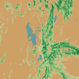
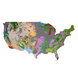
NLCD 2019: پایگاه داده ملی پوشش اراضی USGS، نسخه 2019
NLCD (پایگاه داده ملی پوشش اراضی) یک پایگاه داده پوشش اراضی مبتنی بر لندست 30 متری است که 8 دوره (2001، 2004، 2006، 2008، 2011، 2013، 2016 و 2019) را در بر میگیرد. دوره نهم برای سال 2021 نیز در اینجا موجود است. تصاویر بر اساس لایه داده نفوذناپذیری برای مناطق شهری ...
NLCD 2021: پایگاه داده ملی پوشش اراضی USGS، نسخه 2021
سازمان زمینشناسی ایالات متحده (USGS)، با همکاری چندین آژانس فدرال، اکنون هفت محصول پایگاه داده ملی پوشش اراضی (NLCD) را توسعه داده و منتشر کرده است: NLCD 1992، 2001، 2006، 2011، 2016، 2019 و 2021. از زمان انتشار در سال 2016، محصولات پوشش اراضی برای فواصل دو تا سه ساله ایجاد شدند ...
PAD-US is America's official national inventory of US terrestrial and marine protected areas that are dedicated to the preservation of biological diversity and to other natural, recreation and cultural uses, managed for these purposes through legal or other effective means. This database is separated into …
پوشش سایبان درختی USFS نسخه 2025-6 (CONUS و OCONUS)
مجموعه دادههای پوشش تاج درختان (TCC)، که توسط وزارت کشاورزی ایالات متحده، خدمات جنگلداری (USFS) تولید شده است، خروجیهای نقشه سالانه مبتنی بر سنجش از دور هستند که از سال ۱۹۸۵ تا ۲۰۲۵ را در بر میگیرند. این دادهها از پروژه پایگاه داده ملی پوشش اراضی (NLCD) که توسط سازمان زمینشناسی ایالات متحده مدیریت میشود، پشتیبانی میکنند...
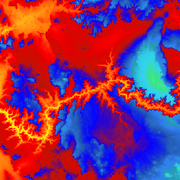
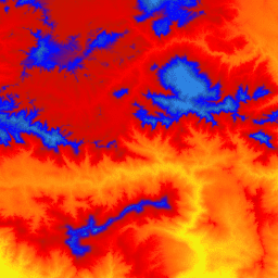
USGS 3DEP 10m National Map Seamless (1/3 Arc-Second)
This is the seamless 3DEP DEM dataset for the US with full coverage of the 48 conterminous states, Hawaii, and US territories. Alaska coverage is partially available now and is being expanded to statewide coverage as part of the Alaska Mapping Initiative. Ground spacing is …
This is a tiled collection of images with 1m pixel size from the 3D Elevation Program (3DEP). The 3DEP data holdings serve as the elevation layer of The National Map and provide foundational elevation information for earth science studies and mapping applications in the United …
USGS 3DEP National Map Spatial Metadata 1/3 Arc-Second (10m)
This is a table with metadata for the 3DEP 10m DEM asset. The Work unit Extent Spatial Metadata (WESM) contains current lidar data availability and basic information about lidar projects, including lidar quality level, data acquisition dates, and links to project-level metadata. See more details …
The GAP/LANDFIRE National Terrestrial Ecosystems data represents a detailed vegetation and land cover classification for the Conterminous US, Alaska, Hawaii, and Puerto Rico.GAP/LF 2011 Ecosystems for the Conterminous US is an update of the National Gap Analysis Program Land Cover Data - Version 2.2. Alaska …
The GAP/LANDFIRE National Terrestrial Ecosystems data represents a detailed vegetation and land cover classification for the Conterminous US, Alaska, Hawaii, and Puerto Rico.GAP/LF 2011 Ecosystems for the Conterminous US is an update of the National Gap Analysis Program Land Cover Data - Version 2.2. Alaska …
The GAP/LANDFIRE National Terrestrial Ecosystems data represents a detailed vegetation and land cover classification for the Conterminous US, Alaska, Hawaii, and Puerto Rico.GAP/LF 2011 Ecosystems for the Conterminous US is an update of the National Gap Analysis Program Land Cover Data - Version 2.2. Alaska …
The GAP/LANDFIRE National Terrestrial Ecosystems data represents a detailed vegetation and land cover classification for the Conterminous US, Alaska, Hawaii, and Puerto Rico.GAP/LF 2011 Ecosystems for the Conterminous US is an update of the National Gap Analysis Program Land Cover Data - Version 2.2. Alaska …
Landsat 1 MSS Collection 2 Tier 1 DN values, representing scaled, calibrated at-sensor radiance. Landsat scenes with the highest available data quality are placed into Tier 1 and are considered suitable for time-series processing analysis. Tier 1 includes Level-1 Precision Terrain (L1TP) processed data that …
Landsat 1 MSS Collection 2 Tier 2 DN values, representing scaled, calibrated at-sensor radiance. Scenes not meeting Tier 1 criteria during processing are assigned to Tier 2. This includes Systematic terrain (L1GT) and Systematic (L1GS) processed scenes, as well as any L1TP scenes that do …
Landsat 2 MSS Collection 2 Tier 1 DN values, representing scaled, calibrated at-sensor radiance. Landsat scenes with the highest available data quality are placed into Tier 1 and are considered suitable for time-series processing analysis. Tier 1 includes Level-1 Precision Terrain (L1TP) processed data that …
Landsat 2 MSS Collection 2 Tier 2 DN values, representing scaled, calibrated at-sensor radiance. Scenes not meeting Tier 1 criteria during processing are assigned to Tier 2. This includes Systematic terrain (L1GT) and Systematic (L1GS) processed scenes, as well as any L1TP scenes that do …
Landsat 3 MSS Collection 2 Tier 1 DN values, representing scaled, calibrated at-sensor radiance. Landsat scenes with the highest available data quality are placed into Tier 1 and are considered suitable for time-series processing analysis. Tier 1 includes Level-1 Precision Terrain (L1TP) processed data that …
Landsat 3 MSS Collection 2 Tier 2 DN values, representing scaled, calibrated at-sensor radiance. Scenes not meeting Tier 1 criteria during processing are assigned to Tier 2. This includes Systematic terrain (L1GT) and Systematic (L1GS) processed scenes, as well as any L1TP scenes that do …
This dataset contains atmospherically corrected surface reflectance and land surface temperature derived from the data produced by the Landsat TM sensor. These images contain 4 visible and near-infrared (VNIR) bands and 2 short-wave infrared (SWIR) bands processed to orthorectified surface reflectance, and one thermal infrared …
This dataset contains atmospherically corrected surface reflectance and land surface temperature derived from the data produced by the Landsat TM sensor. These images contain 4 visible and near-infrared (VNIR) bands and 2 short-wave infrared (SWIR) bands processed to orthorectified surface reflectance, and one thermal infrared …
Landsat 4 MSS Collection 2 Tier 1 DN values, representing scaled, calibrated at-sensor radiance. Landsat scenes with the highest available data quality are placed into Tier 1 and are considered suitable for time-series processing analysis. Tier 1 includes Level-1 Precision Terrain (L1TP) processed data that …
Landsat 4 MSS Collection 2 Tier 2 DN values, representing scaled, calibrated at-sensor radiance. Scenes not meeting Tier 1 criteria during processing are assigned to Tier 2. This includes Systematic terrain (L1GT) and Systematic (L1GS) processed scenes, as well as any L1TP scenes that do …
Landsat 4 TM Collection 2 Tier 1 DN values, representing scaled, calibrated at-sensor radiance. Landsat scenes with the highest available data quality are placed into Tier 1 and are considered suitable for time-series processing analysis. Tier 1 includes Level-1 Precision Terrain (L1TP) processed data that …
USGS Landsat 4 TM Collection 2 Tier 1 TOA Reflectance
Landsat 4 TM Collection 2 Tier 1 calibrated top-of-atmosphere (TOA) reflectance. Calibration coefficients are extracted from the image metadata. See Chander et al. (2009) for details on the TOA computation.
Landsat 4 TM Collection 2 Tier 2 DN values, representing scaled, calibrated at-sensor radiance. Scenes not meeting Tier 1 criteria during processing are assigned to Tier 2. This includes Systematic terrain (L1GT) and Systematic (L1GS) processed scenes, as well as any L1TP scenes that do …
USGS Landsat 4 TM Collection 2 Tier 2 TOA Reflectance
Landsat 4 TM Collection 2 Tier 2 calibrated top-of-atmosphere (TOA) reflectance. Calibration coefficients are extracted from the image metadata. See Chander et al. (2009) for details on the TOA computation.
This dataset contains atmospherically corrected surface reflectance and land surface temperature derived from the data produced by the Landsat TM sensor. These images contain 4 visible and near-infrared (VNIR) bands and 2 short-wave infrared (SWIR) bands processed to orthorectified surface reflectance, and one thermal infrared …
This dataset contains atmospherically corrected surface reflectance and land surface temperature derived from the data produced by the Landsat TM sensor. These images contain 4 visible and near-infrared (VNIR) bands and 2 short-wave infrared (SWIR) bands processed to orthorectified surface reflectance, and one thermal infrared …
Landsat 5 MSS Collection 2 Tier 1 DN values, representing scaled, calibrated at-sensor radiance. Landsat scenes with the highest available data quality are placed into Tier 1 and are considered suitable for time-series processing analysis. Tier 1 includes Level-1 Precision Terrain (L1TP) processed data that …
Landsat 5 MSS Collection 2 Tier 2 DN values, representing scaled, calibrated at-sensor radiance. Scenes not meeting Tier 1 criteria during processing are assigned to Tier 2. This includes Systematic terrain (L1GT) and Systematic (L1GS) processed scenes, as well as any L1TP scenes that do …
Landsat 5 TM Collection 2 Tier 1 DN values, representing scaled, calibrated at-sensor radiance. Landsat scenes with the highest available data quality are placed into Tier 1 and are considered suitable for time-series processing analysis. Tier 1 includes Level-1 Precision Terrain (L1TP) processed data that …
USGS Landsat 5 TM Collection 2 Tier 1 TOA Reflectance
Landsat 5 TM Collection 2 Tier 1 calibrated top-of-atmosphere (TOA) reflectance. Calibration coefficients are extracted from the image metadata. See Chander et al. (2009) for details on the TOA computation.
Landsat 5 TM Collection 2 Tier 2 DN values, representing scaled, calibrated at-sensor radiance. Scenes not meeting Tier 1 criteria during processing are assigned to Tier 2. This includes Systematic terrain (L1GT) and Systematic (L1GS) processed scenes, as well as any L1TP scenes that do …
USGS Landsat 5 TM Collection 2 Tier 2 TOA Reflectance
Landsat 5 TM Collection 2 Tier 2 calibrated top-of-atmosphere (TOA) reflectance. Calibration coefficients are extracted from the image metadata. See Chander et al. (2009) for details on the TOA computation.
Landsat 7 Collection 2 Tier 1 DN values, representing scaled, calibrated at-sensor radiance. Landsat scenes with the highest available data quality are placed into Tier 1 and are considered suitable for time-series processing analysis. Tier 1 includes Level-1 Precision Terrain (L1TP) processed data that have …
USGS Landsat 7 Collection 2 Tier 1 TOA Reflectance
Landsat 7 Collection 2 Tier 1 calibrated top-of-atmosphere (TOA) reflectance. Calibration coefficients are extracted from the image metadata. See Chander et al. (2009) for details on the TOA computation. Note that Landsat 7's orbit has been drifting to an earlier acquisition time since 2017.
USGS Landsat 7 Collection 2 Tier 1 and Real-Time data Raw Scenes
Landsat 7 Collection 2 Tier 1 and Real-Time data DN values, representing scaled, calibrated at-sensor radiance. Landsat scenes with the highest available data quality are placed into Tier 1 and are considered suitable for time-series processing analysis. Tier 1 includes Level-1 Precision Terrain (L1TP) processed …
USGS Landsat 7 Collection 2 Tier 1 and Real-Time data TOA Reflectance
Landsat 7 Collection 2 Tier 1 and Real-Time data calibrated top-of-atmosphere (TOA) reflectance. Calibration coefficients are extracted from the image metadata. See Chander et al. (2009) for details on the TOA computation. Note that Landsat 7's orbit has been drifting to an earlier acquisition time …
Landsat 7 Collection 2 Tier 2 DN values, representing scaled, calibrated at-sensor radiance. Scenes not meeting Tier 1 criteria during processing are assigned to Tier 2. This includes Systematic terrain (L1GT) and Systematic (L1GS) processed scenes, as well as any L1TP scenes that do not …
USGS Landsat 7 Collection 2 Tier 2 TOA Reflectance
Landsat 7 Collection 2 Tier 2 calibrated top-of-atmosphere (TOA) reflectance. Calibration coefficients are extracted from the image metadata. See Chander et al. (2009) for details on the TOA computation. Note that Landsat 7's orbit has been drifting to an earlier acquisition time since 2017.
This dataset contains atmospherically corrected surface reflectance and land surface temperature derived from the data produced by the Landsat 7 ETM+ sensor. These images contain 4 visible and near-infrared (VNIR) bands and 2 short-wave infrared (SWIR) bands processed to orthorectified surface reflectance, and one thermal …
This dataset contains atmospherically corrected surface reflectance and land surface temperature derived from the data produced by the Landsat 7 ETM+ sensor. These images contain 4 visible and near-infrared (VNIR) bands and 2 short-wave infrared (SWIR) bands processed to orthorectified surface reflectance, and one thermal …
Landsat 8 Collection 2 Tier 1 DN values, representing scaled, calibrated at-sensor radiance. Landsat scenes with the highest available data quality are placed into Tier 1 and are considered suitable for time-series processing analysis. Tier 1 includes Level-1 Precision Terrain (L1TP) processed data that have …
USGS Landsat 8 Collection 2 Tier 1 TOA Reflectance
Landsat 8 Collection 2 Tier 1 calibrated top-of-atmosphere (TOA) reflectance. Calibration coefficients are extracted from the image metadata. See Chander et al. (2009) for details on the TOA computation. Landsat scenes with the highest available data quality are placed into Tier 1 and are considered …
USGS Landsat 8 Collection 2 Tier 1 and Real-Time data Raw Scenes
Landsat 8 Collection 2 Tier 1 and Real-Time data DN values, representing scaled, calibrated at-sensor radiance. Landsat scenes with the highest available data quality are placed into Tier 1 and are considered suitable for time-series processing analysis. Tier 1 includes Level-1 Precision Terrain (L1TP) processed …
دادههای TOA از مجموعه دوم لندست ۸ سازمان زمینشناسی ایالات متحده (رده ۱) و دادههای بلادرنگ
Landsat 8 Collection 2 Tier 1 and Real-Time data calibrated top-of-atmosphere (TOA) reflectance. Calibration coefficients are extracted from the image metadata. See Chander et al. (2009) for details on the TOA computation. Landsat scenes with the highest available data quality are placed into Tier 1 …
صحنههای خام رده دوم از مجموعه لندست ۸ سازمان زمینشناسی آمریکا
Landsat 8 Collection 2 Tier 2 DN values, representing scaled, calibrated at-sensor radiance. Scenes not meeting Tier 1 criteria during processing are assigned to Tier 2. This includes Systematic terrain (L1GT) and Systematic (L1GS) processed scenes, as well as any L1TP scenes that do not …
USGS Landsat 8 Collection 2 Tier 2 TOA Reflectance
Landsat 8 Collection 2 Tier 2 calibrated top-of-atmosphere (TOA) reflectance. Calibration coefficients are extracted from the image metadata. See Chander et al. (2009) for details on the TOA computation. Scenes not meeting Tier 1 criteria during processing are assigned to Tier 2. This includes Systematic …
This dataset contains atmospherically corrected surface reflectance and land surface temperature derived from the data produced by the Landsat 8 OLI/TIRS sensors. These images contain 5 visible and near-infrared (VNIR) bands and 2 short-wave infrared (SWIR) bands processed to orthorectified surface reflectance, and one thermal …
This dataset contains atmospherically corrected surface reflectance and land surface temperature derived from the data produced by the Landsat 8 OLI/TIRS sensors. These images contain 5 visible and near-infrared (VNIR) bands and 2 short-wave infrared (SWIR) bands processed to orthorectified surface reflectance, and one thermal …
Landsat 9 Collection 2 Tier 1 DN values, representing scaled, calibrated at-sensor radiance. Landsat scenes with the highest available data quality are placed into Tier 1 and are considered suitable for time-series processing analysis. Tier 1 includes Level-1 Precision Terrain (L1TP) processed data that have …
بازتاب TOA رده ۱ از مجموعه ۲ ماهواره لندست ۹ سازمان زمینشناسی آمریکا
Landsat 9 Collection 2 Tier 1 calibrated top-of-atmosphere (TOA) reflectance. Calibration coefficients are extracted from the image metadata. See Chander et al. (2009) for details on the TOA computation. Landsat scenes with the highest available data quality are placed into Tier 1 and are considered …
Landsat 9 Collection 2 Tier 2 DN values, representing scaled, calibrated at-sensor radiance. Scenes not meeting Tier 1 criteria during processing are assigned to Tier 2. This includes Systematic terrain (L1GT) and Systematic (L1GS) processed scenes, as well as any L1TP scenes that do not …
USGS Landsat 9 Collection 2 Tier 2 TOA Reflectance
Landsat 9 Collection 2 Tier 2 calibrated top-of-atmosphere (TOA) reflectance. Calibration coefficients are extracted from the image metadata. See Chander et al. (2009) for details on the TOA computation. Scenes not meeting Tier 1 criteria during processing are assigned to Tier 2. This includes Systematic …
ماهواره لندست ۹ سازمان زمینشناسی آمریکا، سطح ۲، مجموعه ۲، ردیف ۱
This dataset contains atmospherically corrected surface reflectance and land surface temperature derived from the data produced by the Landsat 9 OLI/TIRS sensors. These images contain 5 visible and near-infrared (VNIR) bands and 2 short-wave infrared (SWIR) bands processed to orthorectified surface reflectance, and one thermal …
ماهواره لندست ۹ سازمان زمینشناسی آمریکا (USGS) سطح ۲، مجموعه ۲، ردیف ۲
This dataset contains atmospherically corrected surface reflectance and land surface temperature derived from the data produced by the Landsat 9 OLI/TIRS sensors. These images contain 5 visible and near-infrared (VNIR) bands and 2 short-wave infrared (SWIR) bands processed to orthorectified surface reflectance, and one thermal …
[[["درک آسان","easyToUnderstand","thumb-up"],["مشکلم را برطرف کرد","solvedMyProblem","thumb-up"],["غیره","otherUp","thumb-up"]],[["اطلاعاتی که نیاز دارم وجود ندارد","missingTheInformationINeed","thumb-down"],["بیشازحد پیچیده/ مراحل بسیار زیاد","tooComplicatedTooManySteps","thumb-down"],["قدیمی","outOfDate","thumb-down"],["مشکل ترجمه","translationIssue","thumb-down"],["مشکل کد / نمونهها","samplesCodeIssue","thumb-down"],["غیره","otherDown","thumb-down"]],[],[],[]]