-
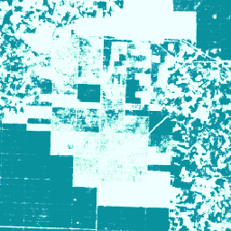
カカオ確率モデル 2025a
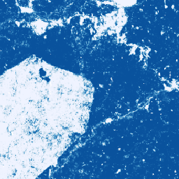
**注: このデータセットはまだピアレビューされていません。詳細については、こちらの GitHub README をご覧ください。** この画像コレクションは、基盤となるエリアが商品で占められている確率をピクセル単位で推定したものです。確率の推定値は 10 メートル解像度で提供され、… によって生成されています。 agriculture biodiversity cocoa conservation crop eudr -
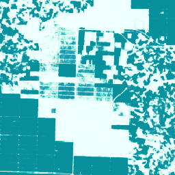
カカオ確率モデル 2025b
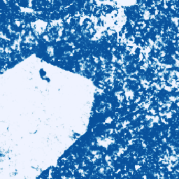
このデータセットの技術ドキュメントについては、こちらの GitHub README をご覧ください。この画像コレクションは、基盤となるエリアが商品で占められている確率をピクセル単位で推定したものです。確率の推定値は 10 メートル四方の解像度で提供され、機械学習モデルによって生成されています。… agriculture biodiversity cocoa conservation crop eudr -
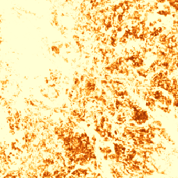
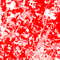
コーヒー確率モデル 2025a

**注: このデータセットはまだピアレビューされていません。詳細については、こちらの GitHub README をご覧ください。** この画像コレクションは、基盤となるエリアが商品で占められている確率をピクセル単位で推定したものです。確率の推定値は 10 メートル解像度で提供され、… によって生成されています。 agriculture biodiversity coffee conservation crop eudr -
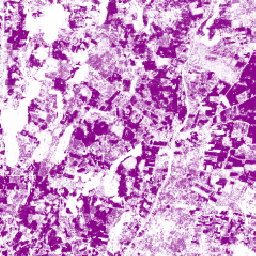
コーヒー確率モデル 2025b
このデータセットの技術ドキュメントについては、こちらの GitHub README をご覧ください。この画像コレクションは、基盤となるエリアが商品で占められている確率をピクセル単位で推定したものです。確率の推定値は 10 メートル四方の解像度で提供され、機械学習モデルによって生成されています。… agriculture biodiversity coffee conservation crop eudr -
アブラヤシ農園のグローバル マップ
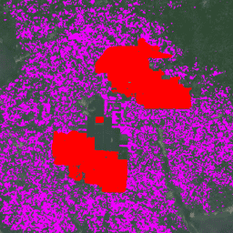
このデータセットは、2019 年の 10 メートル四方単位のグローバルな工業用および小規模なアブラヤシ農園のマップです。アブラヤシ農園が検出されたエリアをカバーしています。分類された画像は、Sentinel-1 と Sentinel-2 の半年ごとの合成画像に基づく畳み込みニューラル ネットワークの出力です。詳細については、こちらの記事をご覧ください。 agriculture biodiversity conservation crop global landuse -
アブラヤシ確率モデル 2025a
**注: このデータセットはまだピアレビューされていません。詳細については、こちらの GitHub README をご覧ください。** この画像コレクションは、基盤となるエリアが商品で占められている確率をピクセル単位で推定したものです。確率の推定値は 10 メートル解像度で提供され、… によって生成されています。 agriculture biodiversity conservation crop eudr forestdatapartnership -
アブラヤシ確率モデル 2025b
このデータセットの技術ドキュメントについては、こちらの GitHub README をご覧ください。この画像コレクションは、基盤となるエリアが商品で占められている確率をピクセル単位で推定したものです。確率の推定値は 10 メートル四方の解像度で提供され、機械学習モデルによって生成されています。… agriculture biodiversity conservation crop eudr forestdatapartnership -
ゴム確率モデル 2025b
このデータセットの技術ドキュメントについては、こちらの GitHub README をご覧ください。この画像コレクションは、基盤となるエリアが商品で占められている確率をピクセル単位で推定したものです。確率の推定値は 10 メートル四方の解像度で提供され、機械学習モデルによって生成されています。… agriculture biodiversity conservation crop eudr forestdatapartnership -
ゴムの木確率モデル 2025a
**注: このデータセットはまだピアレビューされていません。詳細については、こちらの GitHub README をご覧ください。** この画像コレクションは、基盤となるエリアが商品で占められている確率をピクセル単位で推定したものです。確率の推定値は 10 メートル解像度で提供され、… によって生成されています。 agriculture biodiversity conservation crop eudr forestdatapartnership