Page Summary
-
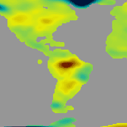
Several datasets provide Land Surface Temperature data, including multiple versions from GCOM-C/SGLI.
-
Multiple datasets offer Leaf Area Index and Fraction of Absorbed Photosynthetically Active Radiation data for evaluating vegetation and forecasting yields.
-
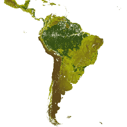
Global Pasture Watch provides datasets on grassland classification, probabilities, vegetation height, and gross primary productivity at a 30m resolution.
-
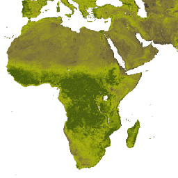
NOAA and NASA provide various land-related datasets from AVHRR and VIIRS sensors, including NDVI, surface reflectance, thermal anomalies, and burned area.
-
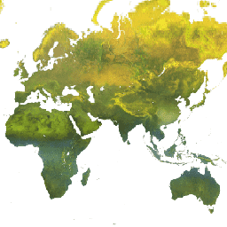
Data types available include land surface temperature, NDVI, albedo, leaf area index, burned area, grassland classification, vegetation height, and gross primary productivity.
-
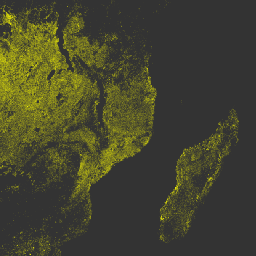
ECOSTRESS Tiled Ancillary NDVI and Albedo L2 Global 70 m V002
The ECOSTRESS Tiled Ancillary NDVI and Albedo (ECO_L2T_STARS) V002 dataset provides Normalized Difference Vegetation Index (NDVI) and albedo data at a 70m spatial resolution. This ancillary product, essential for understanding plant water needs and stress, is created through a data fusion process that combines Visible … albedo land ndvi plant-productivity -
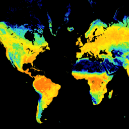
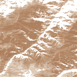
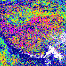
GCOM-C/SGLI L3 Land Surface Temperature (V1)

This product is the temperature of terrestrial land surface. A newer version JAXA/GCOM-C/L3/LAND/LST/V3 is also available for this dataset which uses this algorithm for processing. GCOM-C conducts long-term and continuous global observation and data collection to elucidate the mechanism behind fluctuations in radiation budget and … climate g-portal gcom gcom-c jaxa land -
GCOM-C/SGLI L3 Land Surface Temperature (V2)
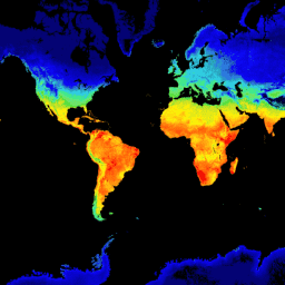
This product is the temperature of terrestrial land surface. For data after 2021-11-28, see the V3 dataset. GCOM-C conducts long-term and continuous global observation and data collection to elucidate the mechanism behind fluctuations in radiation budget and carbon cycle needed to make accurate projections regarding … climate g-portal gcom gcom-c jaxa land -
GCOM-C/SGLI L3 Land Surface Temperature (V3)

This product is the temperature of terrestrial land surface. This is an ongoing dataset with a latency of 3-4 days. GCOM-C conducts long-term and continuous global observation and data collection to elucidate the mechanism behind fluctuations in radiation budget and carbon cycle needed to make … climate g-portal gcom gcom-c jaxa land -
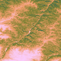
GCOM-C/SGLI L3 Leaf Area Index (V1)
This product is the sum of the one-sided green leaf area per unit ground area. A newer version JAXA/GCOM-C/L3/LAND/LAI/V3 is also available for this dataset which uses this algorithm for processing. GCOM-C conducts long-term and continuous global observation and data collection to elucidate the mechanism … g-portal gcom gcom-c jaxa lai land -
GCOM-C/SGLI L3 Leaf Area Index (V2)

This product is the sum of the one-sided green leaf area per unit ground area. For data after 2021-11-28, see the V3 dataset. GCOM-C conducts long-term and continuous global observation and data collection to elucidate the mechanism behind fluctuations in radiation budget and carbon cycle … g-portal gcom gcom-c jaxa lai land -
GCOM-C/SGLI L3 Leaf Area Index (V3)

This product is the sum of the one-sided green leaf area per unit ground area. This is an ongoing dataset with a latency of 3-4 days. GCOM-C conducts long-term and continuous global observation and data collection to elucidate the mechanism behind fluctuations in radiation budget … g-portal gcom gcom-c jaxa lai land -
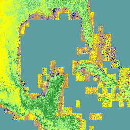
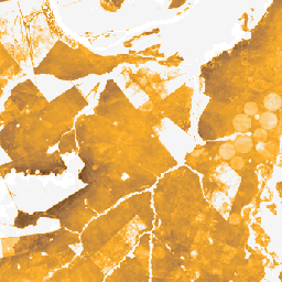
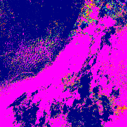
GPW Annual Dominant Class of Grasslands v1
This dataset provides global annual dominant class maps of grasslands (cultivated and natural/semi-natural) from 2000 to 2022 at 30-m spatial resolution. Produced by the Land & Carbon Lab Global Pasture Watch initiative, the mapped grassland extent includes any land cover type, which contains at least … global global-pasture-watch land landcover landuse landuse-landcover -
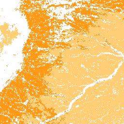
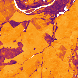
GPW Annual Probabilities of Cultivated Grasslands v1
This dataset provides global annual probability maps of cultivated grassland from 2000 to 2022 at 30-m spatial resolution. Produced by the Land & Carbon Lab Global Pasture Watch initiative, the mapped grassland extent includes any land cover type, which contains at least 30% of dry … global global-pasture-watch land landcover landuse landuse-landcover -
GPW Annual Probabilities of Natural/Semi-natural Grasslands v1
This dataset provides global annual probability maps of natural/semi-natural grassland from 2000 to 2022 at 30-m spatial resolution. Produced by the Land & Carbon Lab Global Pasture Watch initiative, the mapped grassland extent includes any land cover type, which contains at least 30% of dry … global global-pasture-watch land landcover landuse landuse-landcover -
GPW Annual short vegetation height v1
This dataset provides global median vegetation height from 2000 at 30-m spatial resolution. Produced by the Land & Carbon Lab’s Global Pasture Watch initiative, this dataset provides median vegetation height values (50th percentile) globally at 30-m spatial resolution from 2000 onwards. The dataset is based … canopy global global-pasture-watch land landcover plant-productivity -
GPW Annual uncalibrated Gross Primary Productivity (uGPP) v1
This dataset provides global uncalibrated EO-based Gross Primary Productivity from 2000 at 30-m spatial resolution. Produced by the Land & Carbon Lab Global Pasture Watch initiative, the current dataset provides Gross Primary Productivity (GPP) values globally at 30-m spatial resolution from 2000 onwards. GPP values … global global-pasture-watch land landcover landuse plant-productivity -
GRACE Monthly Mass Grids Release 06 Version 04 - Land
The monthly land mass grids contain water mass anomalies given as equivalent water thickness derived from GRACE & GRACE-FO time-variable gravity observations during the specified timespan, and relative to the specified time-mean reference period. The equivalent water thickness represents the total terrestrial water storage anomalies … crs gfz grace gravity jpl land -
NOAA CDR AVHRR LAI FAPAR: Leaf Area Index and Fraction of Absorbed Photosynthetically Active Radiation, Version 5
The NOAA Climate Data Record (CDR) of AVHRR Leaf Area Index (LAI) and Fraction of Absorbed Photosynthetically Active Radiation (FAPAR) dataset contains derived values that characterize the canopy and photosynthetic activity of plants. This dataset is derived from the NOAA AVHRR Surface Reflectance product and … avhrr cdr daily fapar lai land -
NOAA CDR AVHRR NDVI: Normalized Difference Vegetation Index, Version 5
The NOAA Climate Data Record (CDR) of AVHRR Normalized Difference Vegetation Index (NDVI) contains gridded daily NDVI derived from the NOAA AVHRR Surface Reflectance product. It provides a measurement of surface vegetation coverage activity, gridded at a resolution of 0.05° and computed globally over land … avhrr cdr daily land ndvi noaa -
NOAA CDR AVHRR: Surface Reflectance, Version 5
The NOAA Climate Data Record (CDR) of AVHRR Surface Reflectance contains gridded daily surface reflectance and brightness temperatures derived from the Advanced Very High Resolution Radiometer (AVHRR) sensors onboard seven NOAA polar orbiting satellites. The data are gridded at a resolution of 0.05° and computed … avhrr cdr daily land noaa reflectance -
NOAA CDR VIIRS LAI FAPAR: Leaf Area Index and Fraction of Absorbed Photosynthetically Active Radiation, Version 1

This Climate Data Record (CDR) combines datasets for Leaf Area Index (LAI) and Fraction of Absorbed Photosynthetically Active Radiation (FAPAR), two biophysical variables that can be used to evaluate vegetation stress, forecast agricultural yields, and other modeling and resource management applications. LAI tracks the one-sided … cdr daily fapar lai land noaa -
NOAA CDR VIIRS NDVI: Normalized Difference Vegetation Index, Version 1

This dataset contains gridded daily Normalized Difference Vegetation Index (NDVI) derived from the NOAA Climate Data Record (CDR) of Visible Infrared Imaging Radiometer Suite (VIIRS) Surface Reflectance. The data record spans from 2014 onward using data from NOAA polar orbiting satellites. The data are projected … cdr daily land ndvi noaa vegetation-indices -
VNP14A1.002: Thermal Anomalies/Fire Daily L3 Global 1km SIN Grid
The daily Suomi National Polar-Orbiting Partnership NASA Visible Infrared Imaging Radiometer Suite (VIIRS) Thermal Anomalies/Fire (VNP14A1) Version 1 data product provides daily information about active fires and other thermal anomalies. The VNP14A1 data product is a global, 1km gridded composite of fire pixels detected from … fire land nasa noaa surface viirs -
VNP15A2H: LAI/FPAR 8-Day L4 Global 500m SIN Grid
The Visible Infrared Imaging Radiometer Suite (VIIRS) Leaf Area Index (LAI) and Fraction of Photosynthetically Active Radiation (FPAR) Version 1 data product provides information about the vegetative canopy layer at 500 meter resolution (VNP15A2H). The VIIRS sensor is located onboard the NOAA/NASA joint Suomi National … land nasa noaa surface vegetation-indices viirs -
VNP21A1D.002: Day Land Surface Temperature and Emissivity Daily 1km
The NASA Suomi National Polar-Orbiting Partnership (Suomi NPP) Visible Infrared Imaging Radiometer Suite (VIIRS) Land Surface Temperature and Emissivity (LST&E) Day Version 1 product (VNP21A1D) is compiled daily from daytime Level 2 Gridded (L2G) intermediate products. The L2G process maps the daily VNP21 swath granules … climate daily day land nasa noaa -
VNP21A1N.002: Night Land Surface Temperature and Emissivity Daily 1km

The NASA Suomi National Polar-Orbiting Partnership (Suomi NPP) Visible Infrared Imaging Radiometer Suite (VIIRS) Land Surface Temperature and Emissivity (LST&E) Night Version 1 product (VNP21A1N) is compiled daily from nighttime Level 2 Gridded (L2G) intermediate products. The L2G process maps the daily VNP21 swath granules … climate daily land nasa night noaa -
VNP22Q2: Land Surface Phenology Yearly L3 Global 500m SIN Grid
The Suomi National Polar-Orbiting Partnership (Suomi NPP) NASA Visible Infrared Imaging Radiometer Suite (VIIRS) Land Cover Dynamics data product provides global land surface phenology (GLSP) metrics at yearly intervals. The VNP22Q2 data product is derived from time series of the two-band Enhanced Vegetation Index (EVI2) … land landuse-landcover nasa ndvi noaa npp -
VNP43IA1: BRDF/Albedo Model Parameters Daily L3 Global 500m SIN Grid
The Suomi National Polar-Orbiting Partnership (Suomi NPP) NASA Visible Infrared Imaging Radiometer Suite (VIIRS) Bidirectional Reflectance Distribution Function (BRDF) and Albedo Model Parameters (VNP43IA1) Version 1 product provides kernel weights (parameters) at 500 resolution. The VNP43IA1 product is produced daily using 16 days of VIIRS … land nasa noaa satellite-imagery surface viirs -
VNP43IA2: BRDF/Albedo Quality Daily L3 Global 500m SIN Grid
The Suomi National Polar-Orbiting Partnership (Suomi NPP) NASA Visible Infrared Imaging Radiometer Suite (VIIRS) Bidirectional Reflectance Distribution Function (BRDF) and Albedo Quality (VNP43IA2) Version 1 product provides BRDF and Albedo quality at 500m resolution. The VNP43IA2 product is produced daily using 16 days of VIIRS … land nasa noaa satellite-imagery surface viirs -
VNP43IA4: BRDF/Albedo Quality Daily L3 Global 500m SIN Grid

The NASA/NOAA Suomi National Polar-orbiting Partnership (Suomi NPP) Visible Infrared Imaging Radiometer Suite (VIIRS) Nadir Bidirectional Reflectance Distribution Function (BRDF) Adjusted Reflectance (NBAR) Version 2 product provides NBAR estimates at 500 meter resolution. The VNP43IA4 product is produced daily using 16 days of VIIRS data … brdf land nasa noaa satellite-imagery surface -
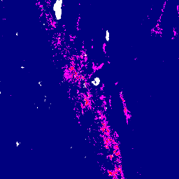
VNP64A1.002: Burned Area Monthly L4 Global 500m SIN Grid
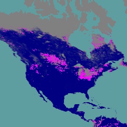
The daily Suomi National Polar-Orbiting Partnership (Suomi NPP) NASA Visible Infrared Imaging Radiometer Suite (VIIRS) Burned Area (VNP64A1) Version 2 data product is a monthly, global gridded 500m product containing per-pixel burned area and quality information. The VNP64 burned area mapping approach employs 750m VIIRS … burn change-detection fire land nasa surface -
VNP64A1: Burned Area Monthly L4 Global 500m SIN Grid
The daily Suomi National Polar-Orbiting Partnership (Suomi NPP) NASA Visible Infrared Imaging Radiometer Suite (VIIRS) Burned Area (VNP64A1) Version 1 data product is a monthly, global gridded 500m product containing per-pixel burned area and quality information. The VNP64 burned area mapping approach employs 750m VIIRS … burn change-detection fire land nasa noaa