-
世界の年間マングローブ分布(1984 ~ 2023 年)
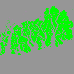
CGMD-Extent30(Continuous Global Mangrove Dynamics-Annual Mangrove Extent at 30-m resolution)データセットは、1984 年から 2023 年までの世界の年間マングローブ分布を提供します。このデータセットは、単一の Earth Engine FeatureCollection として配布されます。各フィーチャーは、特定の年のマングローブ ポリゴンをマッピングしたものです。このデータセットは… annual coastal forest-biomass global landsat-derived landuse-landcover -
世界の年間マングローブ樹冠被覆率(1984 ~ 2023 年)
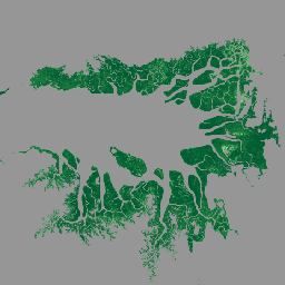
このデータセットは、1984 年から 2023 年までの世界の年間マングローブ樹冠被覆率(FCC)を 30 m の空間解像度で提供し、樹冠の劣化と回復、ブルーカーボン評価、沿岸生態系のモニタリングなど、長期的なマングローブの動態の大規模な分析をサポートします。FCC は、各 Landsat の割合を定量化します。 annual coastal forest-biomass global landsat-derived mangrove -
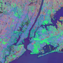
世界のマンローブ林分布、v1(2000 年)
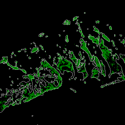
このデータベースは、2000 年の Landsat 衛星データを使用して作成されました。米国地質調査所(USGS)の地球資源観測科学センター(EROS)から取得した 1,000 以上の Landsat シーンは、教師ありと教師なしのハイブリッド デジタル画像分類手法を使用して分類されました。このデータベースは、最も… annual ciesin forest-biomass global landsat-derived mangrove -
JRC 年間水分類履歴、v1.4

このデータセットには、1984 年から 2021 年までの地表水の場所と時間分布の地図が含まれており、水面の範囲と変化に関する統計情報が提供されています。詳細については、関連する学術論文「High-resolution mapping of global surface water and its …」をご覧ください。 annual geophysical google history jrc landsat-derived -
MOD44B.061 Terra Vegetation Continuous Fields Yearly Global 250m

Terra MODIS Vegetation Continuous Fields(VCF)プロダクトは、世界の地表植生被覆率の推定値をサブピクセル レベルで表したものです。地球の陸地表面を基本的な植生特性の割合として継続的に表すように設計されており、樹木エリア、… annual geophysical global landuse-landcover modis nasa -
Open Buildings Temporal V1
Open Buildings 2.5D Temporal Dataset には、2016 年から 2023 年までの年次で、4 m の実効空間解像度(0.5 m 解像度のラスターが提供されます)での建物の存在、建物の割合、建物の高さに関するデータが含まれています。これは、… africa annual asia built-up height open-buildings -
Satellite Embedding V1
Google Satellite Embedding データセットは、学習済みの地理空間埋め込みのグローバルな分析対応コレクションです。このデータセットの各 10 メートル ピクセルは、64 次元の表現(埋め込みベクトル)です。これは、さまざまな地球観測… annual global google landsat-derived satellite-imagery sentinel1-derived -
VIIRS Nighttime Day/Night Annual Band Composites V2.1
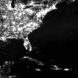
年間のグローバル VIIRS 夜間照明データセットは、2013 年から 2021 年までの月ごとの雲のない平均放射輝度グリッドから生成された時系列です。2022 年のデータは NOAA/VIIRS/DNB/ANNUAL_V22 データセットで入手できます。最初のフィルタリング ステップで、日光、月光、雲のピクセルが削除され、… annual dnb eog lights nighttime noaa -
VIIRS Nighttime Day/Night Annual Band Composites V2.2

年間のグローバル VIIRS 夜間照明データセットは、2022 年の月ごとの雲のない平均放射輝度グリッドから生成された時系列です。過去のデータは NOAA/VIIRS/DNB/ANNUAL_V21 データセットで入手できます。最初のフィルタリング ステップで、日光、月光、雲のピクセルが削除され、… annual dnb eog lights nighttime noaa