
- Catalog Owner
- Earth Timelapse
- Dataset Availability
- 1984-01-01T00:00:00Z–2022-12-31T23:59:59Z
- Dataset Producer
- Google Earth Outreach
- Cadence
- 1 Year
- Tags
Description
The Earth Timelapse dataset provides a four-decade visual record of planetary change spanning from 1984 to 2022. Synthesized by Google from petabytes of spaceborne observations acquired by NASA/USGS Landsat missions (Landsat 4, 5, 7, 8, and 9) and ESA's Copernicus Sentinel-2 constellation, the dataset is offered as annual mosaics for visual interpretation.
The annual mosaics are globally complete, gap-filled, and water-masked visual basemaps that power the public Google Earth Timelapse interactive viewer. Pre-1999 observation voids are smoothly reconstructed using pixel-wise temporal linear regression interpolation across adjacent valid observation years. Open ocean waters are replaced with styled NOAA ETOPO1 shaded-relief bathymetry and global water masking (using Hansen GFC and MOD44W datasets). These data are suitable for: visual interpretation, educational storytelling, base mapping, or custom video exports.
See the Timelapse developer documentation for more details on data characteristics, processing, and limitations.
Bands
Bands
Pixel size: 30 meters (all bands)
| Name | Min | Max | Pixel Size | Description |
|---|---|---|---|---|
red |
0 | 255 | 30 meters | Visually normalized 8-bit red value derived from TOA reflectance (min 0.02, max 0.50, gamma 1.7, matched to MODIS BRDF; not surface reflectance). |
green |
0 | 255 | 30 meters | Visually normalized 8-bit green value derived from TOA reflectance (min 0.02, max 0.50, gamma 1.7, matched to MODIS BRDF; not surface reflectance). |
blue |
0 | 255 | 30 meters | Visually normalized 8-bit blue value derived from TOA reflectance (min 0.02, max 0.50, gamma 1.7, matched to MODIS BRDF; not surface reflectance). |
Image Properties
Image Properties
| Name | Type | Description |
|---|---|---|
| year | INT | Observation year of the annual mosaic. |
Terms of Use
Terms of Use
This dataset is licensed under CC-BY 4.0 and requires the following attribution: "Google Earth Timelapse (Google, Landsat, Copernicus)" Contains modified Copernicus Sentinel data [2015-present]. See the Sentinel Data Legal Notice.
Citations
Google Earth Timelapse (Google, Landsat, Copernicus). Online
Explore with Earth Engine
Code Editor (JavaScript)
// Timelapse

// Import the collection.
var timelapse = ee.ImageCollection('projects/ee-earth-timelapse/assets/annual');

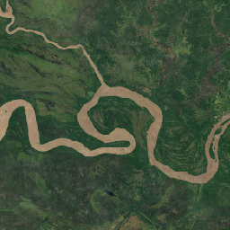
// Point to center (Papua river meandering).
var lon = 139.4081;
var lat = -7.169;

// Center the map.
Map.setCenter(lon, lat, 10);

// Filter the collection to the 2022 mosaic.
var timelapse2022 =
    timelapse.filter(ee.Filter.calendarRange(2022, 2022, 'year')).first();

// No visualization parameters needed.
Map.addLayer(timelapse2022);

// Thumbnail video params.
var pixels = 512;
var delta = 0.2;
var areaOfInterest = ee.Geometry.Rectangle(
    [lon - delta, lat - delta, lon + delta, lat + delta], null, false);

var parameters = {
  dimensions: [pixels, pixels],
  region: areaOfInterest,
  crs: 'EPSG:3857',
  framesPerSecond: 5
};

print(ui.Thumbnail(timelapse, parameters));