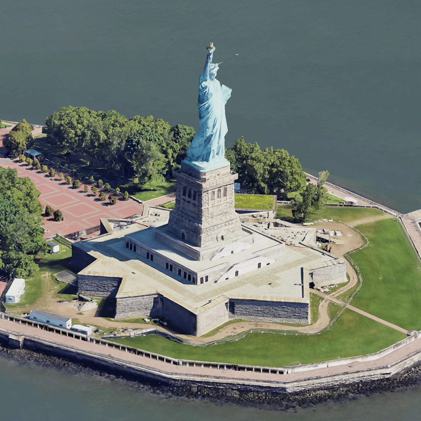
 ชิ้นส่วนแผนที่ 3 มิติแบบสมจริงคือชิ้นส่วนแผนที่ที่มีข้อมูลทางภูมิศาสตร์ 3 มิติของ Google
ในรูปแบบชิ้นส่วนแผนที่ 3 มิติของ OGC
คุณสามารถแสดงผลแผนที่ 3 มิติของ Google ด้วยโปรแกรมแสดงผล 3D Tiles ของคุณเอง หรือจะใช้
ไลบรารีโอเพนซอร์สสำหรับการแสดงภาพเชิงพื้นที่ 3 มิติก็ได้
เหตุผลที่ควรใช้ 3D Tiles
Google มี 3D Tiles สำหรับ Use Case การแสดงภาพรุ่นถัดไป คุณใช้ ชิ้นส่วนแผนที่ 3 มิติเพื่อสร้างมุมมองเปอร์สเปคทีฟ 3 มิติที่น่าทึ่งได้เช่นเดียวกับใน Google Earth มุมมองเหล่านี้ช่วยให้ผู้ใช้เข้าใจบริบททางภูมิศาสตร์ได้ดียิ่งขึ้น ปรับปรุง วิธีไปยังส่วนต่างๆ และแสดงสถานที่เพื่อเล่าเรื่องได้ นอกจากนี้ คุณยังใช้ โปรแกรมแสดงผลที่ต้องการเพื่อบังคับกล้องผ่าน ฉากได้อย่างราบรื่นเพื่อดูจากมุมต่างๆ
พื้นที่ให้บริการ
ตรวจสอบความครอบคลุมของ Map Tiles API Google จะอัปเดตและ เพิ่มภาพเป็นประจำ
โซลูชัน 3 มิติ
ศูนย์สถาปัตยกรรม Google Maps Platform มีตัวอย่างโซลูชัน 3 มิติที่คุณสามารถตรวจสอบเพื่อเริ่มต้นใช้งานแอป ได้
เครื่องมือสำรวจพื้นที่ 3 มิติ: ช่วยให้คุณสำรวจย่านและพื้นที่ต่างๆ แบบเสมือนจริงและในรูปแบบ 3 มิติ พร้อมรายละเอียดภาพที่สูง
การเล่าเรื่องแบบ 3 มิติ เชื่อมโยงการเล่าเรื่องและการทำแผนที่ ช่วยให้ครีเอเตอร์สร้างเรื่องราวที่สมจริงและ โต้ตอบได้โดยใช้ชิ้นส่วนแผนที่ 3 มิติแบบสมจริง
